

DanLarsen34
-
Posts
514 -
Joined
-
Last visited
Content Type
Profiles
Blogs
Forums
American Weather
Media Demo
Store
Gallery
Posts posted by DanLarsen34
-
-
-
Just now, hlcater said:
The debris scattering and fallout downshear of this tornado is by far and away the most expansive I have EVER seen. Wow.
oh my god.
-
I'd call this a tornado emergency for Prentiss and Bassfield. Trailing storm now has a well-defined debris ball.
-
That's the strongest wording for a watch that I've seen since May 20 last year. Numerous tornadoes expected, and the discussion portion mentions strong/violent tornadoes.
-
You've got to think if these storms maintain themselves that we'll see a potential upgrade to high risk in the day's final update, not that it really matters at this point.
-
 2
2
-
-
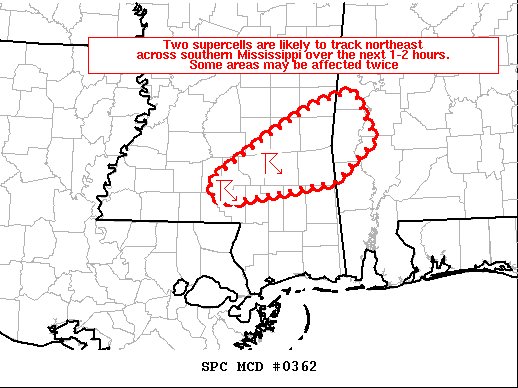
SPC just issued a PDS watch for the southern areas of MS and southern/Central AL.
-
1
-
-
The second cell has a rapidly increasing velocity couplet too. Looks like we're about to see another strong/violent tornado on the heels of the lead one.
-
I just hope the people in the path of this monster have an underground shelter or a safe room.
-
1
-
-
Just now, SmokeEater said:
Couplet behind the monster is ramping up fast also....
Sent from my SM-G973U using Tapatalk
Was just about to say that. It's really getting its act together as well.
-
MD from the SPC says EF-4/EF-5 likely in progress. Shit...
-
Just now, ICEHOCEY77 said:
Cantore said 35k ft debris loft
If I’m remembering correctly, that’s clearly EF-4-5 range for debris being lofted. Yikes.
-
Hate to say the obvious here, but that lead cell has nothing impeding it. Unless other storms fire, it’s going to have room to run for a LONG time.
-
Officially a tornado emergency for the storm heading towards Bassfield.
-
Storm behind it near MaComb is really ramping up too.
-
Just now, Bob's Burgers said:
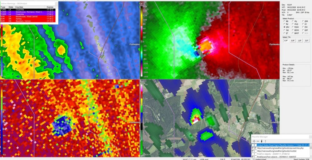
Debris ball (60+ dbz) on the jackson radar. Vrot around 70 knots now.
Major debris ball. I’d call this a tornado emergency.
-
1 minute ago, LithiaWx said:
Does that mean the threat increased farther east towards AL and west GA or just less tornadoes from this system in general?
This was just a comment on the threat in Mississippi right now. Alabama and Georgia are still facing a potentially significant threat a few hours from now. Don’t let your guard down.
-
 1
1
-
-
I’m beginning to wonder if we even end up with 5-10 tornadoes in the PDS watch across Mississippi at this point. Line has advanced pretty far across the watch area. The embedded cell might have been the only shot we have to get there. (Key word is might).
-
3 minutes ago, SnowGoose69 said:
That was more or less a clear air bust wasn’t it? My memory is there was a massive burst of AM convection that killed instability but even though it totally cleared out for hours after nothing ever happenedNot really. We had a bunch of storms try to fire across the warm sector, but none of them were ever able to take off. They were a lot like the WAA storms we’re seeing right now. Any time it looked like one had a shot, it crashed over the surging front and died too.
-
-
1 minute ago, Quincy said:
Today is a good example of why STP is not always helpful. Sure, it’s maxed out near the warm front, but lapse rates are sub-marginal.
We had a high risk bust in Oklahoma last year that was largely due to junky lapse rates. 6 C/km is a good benchmark. 6.5 C/km is the mean for most tornado environments.
I’m curious to see what happens down in LA/southern MS. Can the convection remain sustained? If so, does it evolve into a broken line? There’s good 0-3km CAPE, steeper lapse rates and strong low-level flow there.
Today reminds me of that day a lot, at least at the moment.
-
1
-
-
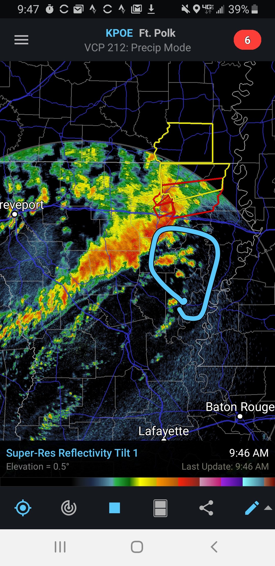
Initiation appears to be underway ahead of the main line just south of Jackson, MS.
-
1
-
-
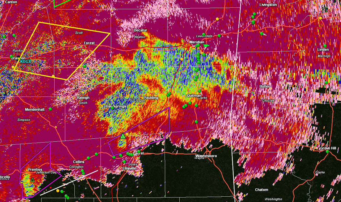
That's one of the most violent signatures I've ever seen for a storm embedded within a line.
-
Just now, Bob's Burgers said:
Gate to Gate shear near 200 knots
Holy S***.
-
Just now, jpeters3 said:
trying to fire ahead of main line

Immediate issue I see for these storms is that they're tracking right into the complex. They're going to have to fire a bit further ahead of the line, or begin to take on more of an easterly direction to avoid getting absorbed by the main line.

April 12 Severe Event
in Southeastern States
Posted
Hate to point this out, but we might have additional cells firing to the southwest of these two...