

DanLarsen34
-
Posts
514 -
Joined
-
Last visited
Content Type
Profiles
Blogs
Forums
American Weather
Media Demo
Store
Gallery
Posts posted by DanLarsen34
-
-
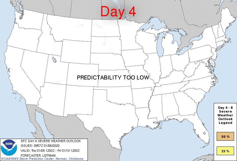
As mentioned above, SPC has added a 30% contour for Friday for the Arklatex region. Discussion shows they’re quite bold on the warm sector that will be in place that day. Instability/shear combo will be quite impressive
Saturday stays at 15%, but the risk area has been expanded a bit with SPC hinting at a possible upgrade in the next outlook.
-
Thought I’d get a thread going for January 10-11. SPC already has 15% threat areas for next Friday and Saturday, January 10-11, for much of the gulf coast. Threat starts in the Texas, Arkansas, and Louisiana area on Friday, then shifts to Mississippi and Alabama on Saturday. Could this be our first severe weather event of the decade?
-
 1
1
-
 1
1
-
-
Will be fascinated to see what the storm surveys find in the coming days. Yesterday performed much more along the lines of what we thought a median outcome for 5-20 would be. This cell, in particular, may have had an extremely long-tracking tornado.
-
Storm to the north of the Columbia cell heading towards Mount Olive has a hell of a velocity signature, and has had one for several scans. Radar reflectivity has that classic look too. Very good chance there’s a strong tornado in progress with that cell.
-
Today has been really active. We’ve had several discrete/semi-discrete cells producing tornadoes for several hours now. One of the most active days of the year.
-
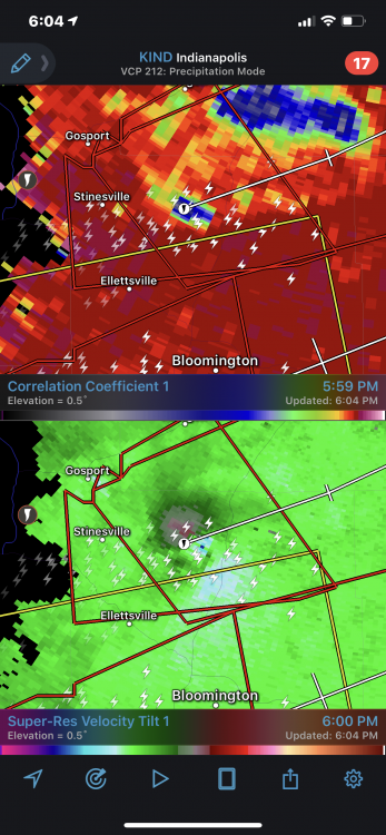
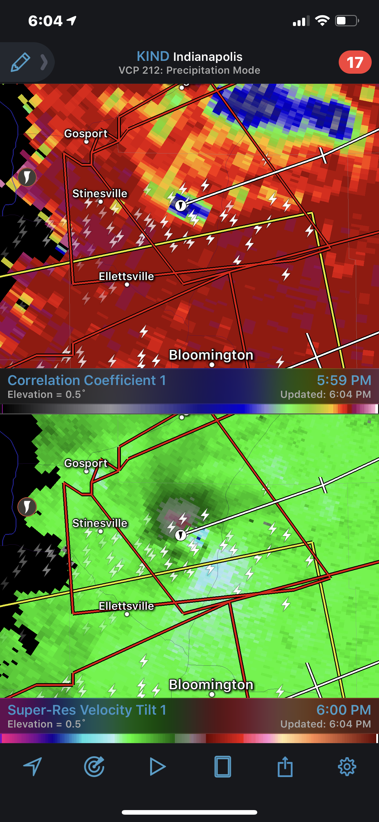
CC drop isn’t as pronounced as before, but it’s still there on the loop. Tornado might not have been as intense when it tracked into the city, but it was definitely still there.
-
BWER and intense couplet developing on the more discrete cell to the SE of the Alexandria storm.
-
I would call this a tornado emergency for Alexandria, Pineville, and Ball. Radar signature very clearly indicates an intense tornado in progress (EF3+).
-
17 hours ago, SchaumburgStormer said:
Have they completed the storm surveys yet for these tornadoes from yesterday?
CC maxed out at 24,000 feet with this and there was a debris fallout evident on radar as well. That’s highly suggestive of an high-end EF3 to EF4 tornado.
-
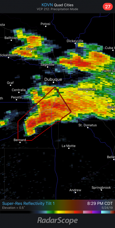
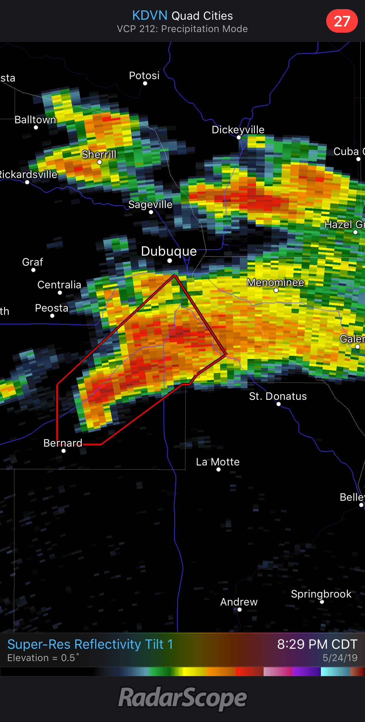
This cell near Dubuque is really beginning to look dangerous at the moment.
-
I’m a little surprised this forum has been quiet. The long-range models are suggesting we could be looking at the most active stretch of severe weather we’ve had since 2011.
Right now, the models are depicting several days of favorable flow across the plains from May 19-26 with ample moisture and instability.
Obviously, there’s still a ways to go, but I’ve seen some of the most reserved meteorologists I know starting to highlight this period as potentially being a May 2003 or May 2008 sequence if everything comes together.
-
1
-
January 10-11 Severe Weather Threat
in Central/Western States
Posted
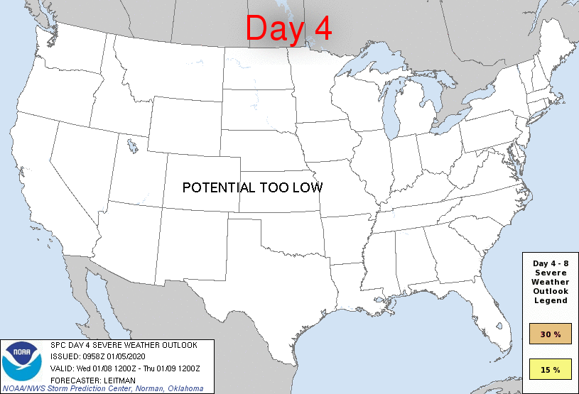
Pretty sizable risk area at that.
Friday’s outlook has shifted west towards the Dallas/Fort Worth area and I-35.