

Wetbulbs88
-
Posts
1,503 -
Joined
-
Last visited
Content Type
Profiles
Blogs
Forums
American Weather
Media Demo
Store
Gallery
Everything posted by Wetbulbs88
-
Outta gas and Outta Time: Early March Winter Storm finale
Wetbulbs88 replied to Ji's topic in Mid Atlantic
Does anyone have a decent radar these days? I have the Nexlab/COD which is solid, but I want something zoomed out a little more. The old school all-green Accuweather radar was perfect. Simple shaded greens and yellows for heavier returns. Now all I find is nonsense. -
Outta gas and Outta Time: Early March Winter Storm finale
Wetbulbs88 replied to Ji's topic in Mid Atlantic
Not bad so far. Too bad we're now in the classic DC snow hole. Probably half an inch to an inch. -
More specifically where you can select regions for this. I’ve been looking for this classic radar for years and can’t find it on Accu.
-
I would be infinitely grateful if you shared where this radar is.
-
Feb 22nd/23rd "There's no way..." Obs Thread
Wetbulbs88 replied to Maestrobjwa's topic in Mid Atlantic
The consolation prize continues under this Norlun, IVT, or whatever the fuck we're calling it these days.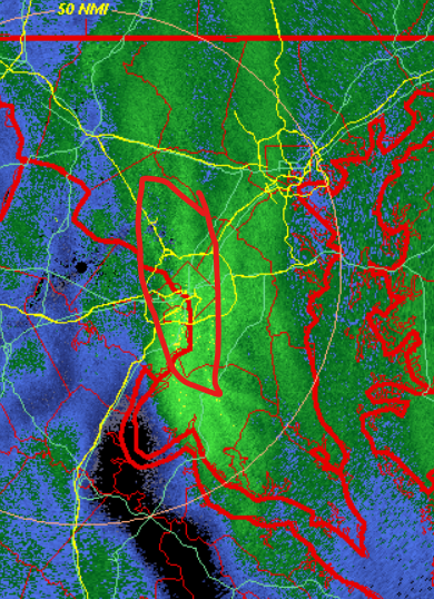
-
Feb 22nd/23rd "There's no way..." Obs Thread
Wetbulbs88 replied to Maestrobjwa's topic in Mid Atlantic
Miller Bs aren't judged by their explosiveness. 96 was a B. The lack of Low over the Ohio Valley is the main argument going for an A. -
Feb 22nd/23rd "There's no way..." Obs Thread
Wetbulbs88 replied to Maestrobjwa's topic in Mid Atlantic
IVT totally saved this from being a total bust. Still moderate snow with about an inch on pavement now. -
The February 22-23 Late Season Miracle: JV Disco/Banter Thread
Wetbulbs88 replied to bncho's topic in Mid Atlantic
I'll take the lack of objection as confirmation. All I needed to sleep like a baby. Bad people deserve bad lives. -
Feb 22nd/23rd "There's no way..." Obs Thread
Wetbulbs88 replied to Maestrobjwa's topic in Mid Atlantic
I agree with the sentiment but factually speaking there were many runs that looked beyond amazing. -
Feb 22nd/23rd "There's no way..." Obs Thread
Wetbulbs88 replied to Maestrobjwa's topic in Mid Atlantic
Given the many suggestions I've received to ignore you like an angry gnat, clearly you have nothing in your life outside making irrational ad hominem attacks against internet strangers. And given that this means you have no one in your life--because why else would someone behave this way, and who would want to associate with someone who provides zero value in any situation whatsoever--I'm completely satisfied. Oh and look. It's still snowing. You have a good one now! -
Feb 22nd/23rd "There's no way..." Obs Thread
Wetbulbs88 replied to Maestrobjwa's topic in Mid Atlantic
How does me not following ever one of 200 members' exact plans have anything to do with being interested or not? Go ahead and list for me exactly what everyone is doing and where they are. Utter clown. Zero logical ability. -
Feb 22nd/23rd "There's no way..." Obs Thread
Wetbulbs88 replied to Maestrobjwa's topic in Mid Atlantic
Okay will do. I didn't realize they were willfully spiteful. -
Feb 22nd/23rd "There's no way..." Obs Thread
Wetbulbs88 replied to Maestrobjwa's topic in Mid Atlantic
Lol so you're actually small enough to expect that people track everyone's comings and goings across this entire forum? You're making this worse for yourself in public. -
Feb 22nd/23rd "There's no way..." Obs Thread
Wetbulbs88 replied to Maestrobjwa's topic in Mid Atlantic
We're talking about Philly and NYC. -
Feb 22nd/23rd "There's no way..." Obs Thread
Wetbulbs88 replied to Maestrobjwa's topic in Mid Atlantic
Yeah for sure. But NWS has stuck to their guns on the higher totals. Interested to see how it plays out. -
Feb 22nd/23rd "There's no way..." Obs Thread
Wetbulbs88 replied to Maestrobjwa's topic in Mid Atlantic
His location reads Crofton. You desperately need medication. Deal with not having snow better. -
Feb 22nd/23rd "There's no way..." Obs Thread
Wetbulbs88 replied to Maestrobjwa's topic in Mid Atlantic
Ah took his Crofton locale at face value. Thanks. -
Feb 22nd/23rd "There's no way..." Obs Thread
Wetbulbs88 replied to Maestrobjwa's topic in Mid Atlantic
Rates are solid right now. Definitely a nice consolation prize even though we won't even get close to verifying. -
Feb 22nd/23rd "There's no way..." Obs Thread
Wetbulbs88 replied to Maestrobjwa's topic in Mid Atlantic
Amazing how much more snow you have just a few miles NE. Nuts. -
Feb 22nd/23rd "There's no way..." Obs Thread
Wetbulbs88 replied to Maestrobjwa's topic in Mid Atlantic
He's in complete denial. -
Feb 22nd/23rd "There's no way..." Obs Thread
Wetbulbs88 replied to Maestrobjwa's topic in Mid Atlantic
Why do you say that? I wouldn't be surprised given how modeling trended near the end. But I haven't been keeping up with things up there. -
Feb 22nd/23rd "There's no way..." Obs Thread
Wetbulbs88 replied to Maestrobjwa's topic in Mid Atlantic
Just took the pup out for a jeb and some frolicking. Decent rates. Not even close to an inch an hour though. Hard to imagine that this is the norlun but maybe we're not really in it. -
Feb 22nd/23rd "There's no way..." Obs Thread
Wetbulbs88 replied to Maestrobjwa's topic in Mid Atlantic
I feel attacked. -
Feb 22nd/23rd "There's no way..." Obs Thread
Wetbulbs88 replied to Maestrobjwa's topic in Mid Atlantic
But it's an observation of my sadness. -
Feb 22nd/23rd "There's no way..." Obs Thread
Wetbulbs88 replied to Maestrobjwa's topic in Mid Atlantic
Yeah for sure. GFS definitely led the way. The others were completely off. Climo climo climo!


