

WesternFringe
-
Posts
848 -
Joined
-
Last visited
Content Type
Profiles
Blogs
Forums
American Weather
Media Demo
Store
Gallery
Posts posted by WesternFringe
-
-
4 minutes ago, Ji said:11 minutes ago, Bob Chill said:Cmc looks just like the gfs. Lol
2 of the worst models agree...one model hasn't been fed data since dec 27 haha
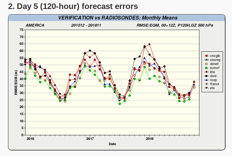
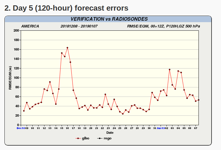
Sometimes they are 2 of the worst, sometimes they are 2 of the best. Question is, which will they be this time? The second graph shows that in the last 30 days, the CMC is getting back in the range of performing as well as it is capable of performing.
-
5 minutes ago, BristowWx said:
Well this 0z run or maybe 6z is when things should start to fall apart if they are going to so maybe 18z was a warning shot. Euro is rarely denied.
It was denied even 36 hours out as recently as the 12/9/18 storm for the southern half of the subforum. Only the Canadian had it sniffed out at that range.
-
 2
2
-
 1
1
-
-
CMC is on board now with the general evolution of the storm. Track of the low is further south than the GFS
-
1
-
-
1 minute ago, BaltimoreWxGuy said:
So when does the FV3 take over again? I mean I know it can still be accurate and have wins but how much stock do we even put into the “old” GFS at this point?
Many, many pages back in this thread someone who appeared to be in the know said late 2019 or early 2020.
edit: Ninja'd by Bob Chill
-
2 minutes ago, PCT_ATC said:
just not enough of a bump north for most of us. I ended up with an inch and half in Opal, VA (Just south of Warrenton) and I'm about 55 miles north of CHO
Right, but it was a 150 mile north bump in the last 36 hours, so it ended up helping the southern half of the subforum very much. Very tight gradient, though, you are correct on that.
-
30 minutes ago, NorthArlington101 said:
Last storm had a major north jump. Charlottesville went from 2-4” to a 1’.That must have been 2 storms ago, at least. Last storm, Charlottesville went from forecast of 1-2" a day before only to end up getting 8-12". (12/9/18)
-
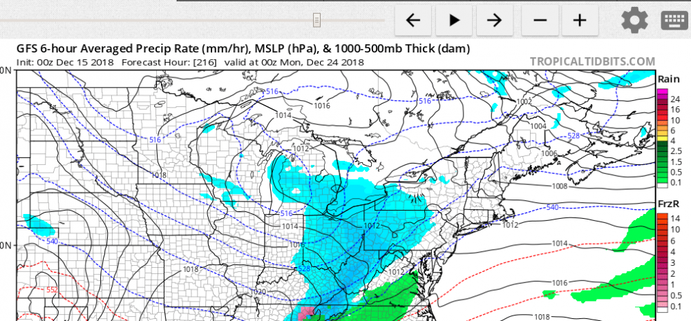
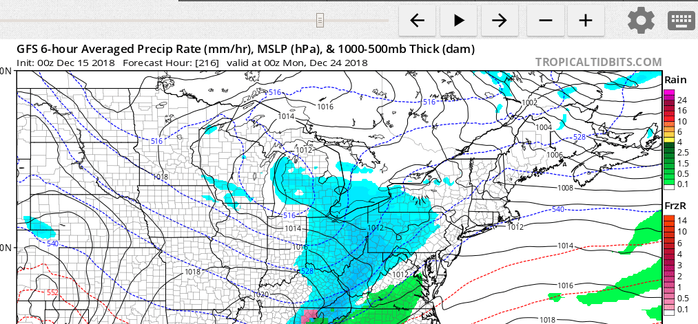
I know it is an op run from range and the old GFS, but still, this would be frustrating for most of us if it happened to verify on almost Christmas Eve:
-
8 hours ago, EastCoast NPZ said:
I remember it showing a MECS for us after all the other models settled on NC SWVA hit and cirrus for us. At least, that is memory....
"cirrus for us"
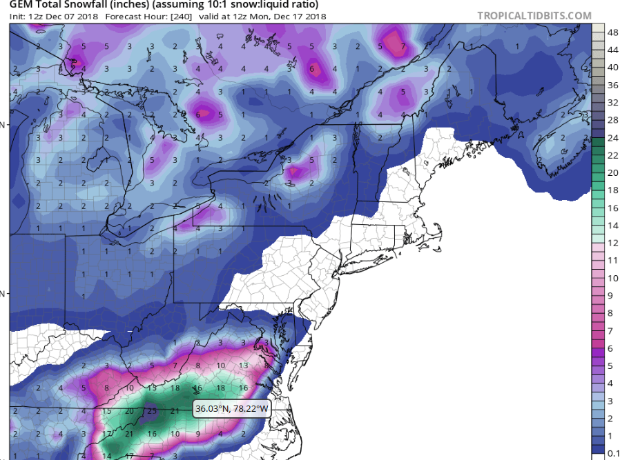
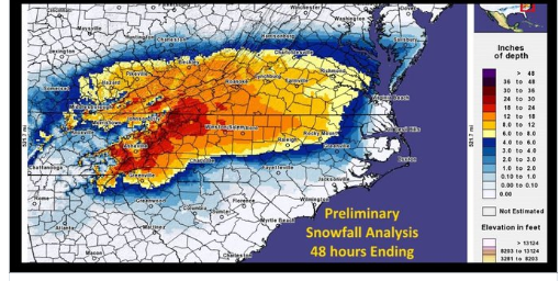
I guess perspective is everything and it matters where you live. The GEM may have been wrong for where you live, but it WAS a MECS for most of VA (southern locations in Augusta County where I live got 15", and I received 8") when the rest of the globals (GFS, FV3, Euro) were showing the storm barely reaching southern VA. It was far closer to reality 48 hours out for the southern half of the subforum than the other models were.
Which was closer to reality 48 hrs out for most of VA? GEM at ~50 hours out from the storm...
versus the GFS at about ~44 hours out? (The FV3 and Euro showed about the same as the GFS last Friday)...
versus reality...
-
2
-
-
58 minutes ago, H2O said:
When has the GEM been right about anything?
A week ago when it was the first global to shift back to showing accumulating snow in most of Virginia rather than just southern Virginia for the 12/9/18 storm?
-
2
-
-
About 6" here. Reports of 9" from a co-worker over the mountain in Albemarle County
-
8
-
1
-
-
2 minutes ago, wxdude64 said:
WOW! Man, you and I aren't 40 miles apart as the crow flies. I am at work, just off Low Moor exit on I-64 and although NOT scientific, stuck tape measure in 4 different spots and got 10-11 inches each time. about 5 minutes ago.
You have elevation on me, are further south, and had an earlier onset time. Of course you have more and congrats. About 4" now and falling quickly here!
-
UVa hospital cam in Cville (courtesy of another poster earlier)
-
1
-
-
About 2" and still rippin'
-
1
-
-
2 minutes ago, DDweatherman said:
Thoughts on where to take the Jeep down to later this afternoon? Closer to CHO or RIC?
CHO. Better Kuchera ratios = better snow
-
Just now, BristowWx said:
Add a beverage to that and it’s a pick from heaven.
Done. Voodoo Ranger Double IPA
-
3
-
-
Current situation
-
3
-
-
3" per my buddy in Schuyler, 20 miles south of CHO. Over an inch here and rippin'!
-
27.9 and snowing like crazy here near Staunton
-
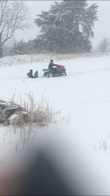
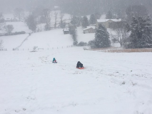
This is happening. Perspective is everything. I am wary of subforum-wide ultimatum posts. I anticipate snow by 18Z
-
-
1 hour ago, Ji said:1 hour ago, yoda said:00z RGEM 0.07" QPF at DCA
South trend continues
What south trend? Back it up with something...Looking good here, despite what some might say. 30.7/23
-
30.7 / 24
expecting snow by 17Z- we shall see if it verifies
-
33 minutes ago, mattie g said:
OK...10%?
Let’s be honest...most of the major contributors and year-round folks are from the Baltimore and DC metro areas. Not sure how anyone can argue against that.
But don’t mind me...I’m just being a wiseacre, not a curmudgeon as @WxWatcher007 claims. He’s just bitter he had to move away, so now he’s telling lies and trying to badmouth the rest of us.
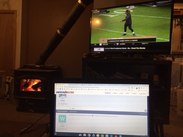
I don't know what the percent is, just wondering how you arrived at your figure. In the meantime, I'll enjoy my wood stove and my snow tomorrow. I didn't see you casting a tear or being worried about for those of us in the southern tier during the 11/15 storm!
-
13 minutes ago, mattie g said:
I’m going to follow this thread all day because 5% of the subforum’s posters will be getting snow tomorrow.
#luvuguys
I wonder how you arrive at the 5% figure...
January 12-14, 2019 Storm Threat
in Mid Atlantic
Posted
18Z GFS IR inbound at 84 hrs is a beautiful sight to behold.