

klw
-
Posts
4,981 -
Joined
-
Last visited
Content Type
Profiles
Blogs
Forums
American Weather
Media Demo
Store
Gallery
Everything posted by klw
-
Live free or die. Worst I have ever had it was the summer of 03. We were living in W. Warwick RI at the time. The neighborhood sounded almost like a warzone on July 4. The dogs were manic. Making it hard to understand was that we lived about 4 blocks from the Station Nightclub and the fire had just been about 4 months earlier. Only having one neighbor within a half a mile has lessened this issue.
-

May 8-9 mid-spring rain, snow, cold, wind obs
klw replied to CT Valley Snowman's topic in New England
Good to hear they were okay. I am just shocked that there are trees left in Tolland to fall down. I would have thought they all would have come down the past 5 years based on the number of downed trees and power lines we have seen over the years. -
May 8-9 mid-spring rain, snow, cold, wind obs
klw replied to CT Valley Snowman's topic in New England
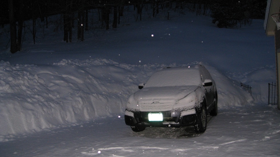
Meltwater is pouring off the roof now. I'll be out working in the yard soon this afternoon at this rate. -
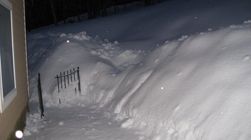
May 8-9 mid-spring rain, snow, cold, wind obs
klw replied to CT Valley Snowman's topic in New England
Another picture: -
May 8-9 mid-spring rain, snow, cold, wind obs
klw replied to CT Valley Snowman's topic in New England
Sun is coming out more frequently and we are up to 34 now so the melting has begun. Last measurement gives us 2.6". -
May 8-9 mid-spring rain, snow, cold, wind obs
klw replied to CT Valley Snowman's topic in New England
2 inches on the outside table, clumpy on the ground depending on where there is grass, wet ground, etc. That poor birch above the wheelbarrow has been bent over since a storm in January? when we had snow then ice then snow and it then didn't melt off the trees for over a week. 30f and light snow at the moment. -
Funny but I was thinking about that everytime I hit a rock yesterday. Yup this is why they all moved to Ohio.
-
I spent the weekend building stone steps up the embankment of the backyard. Our property has a large number of rocks everywhere and whenever I have done any digging, I inevitably hit a large stone somewhere. When I was digging the raised beds I ended up lining the outsides with stones from the beds instead of wood. I frequently had to resort to using a prybar to get the biggest ones out of the earth. So yesterday and today I took about 25 of the biggest flat stones and built a staircase. Hardest parts were when I would hit stones where I was trying to dig out to put the steps in. The other aggravating factor is that the lower part is very wet this time of year so the area I would dig would fill with water and muck. It was pretty fun yesterday with the COC day haowever. In terms of mulch, our town has a shed outside the transfer station. In the winter there is salted grit any resident can go and get. The other 4 months there is free mulch- mostly pine. I just go with about twenty containers and fill away. I did that a week or so ago on a day the dump was closed so it was quiet. It is a nice perk the town does.
-
but wait there's more... another 1.1 overnight 18.7 for the event now.
-
Looked like a little under 1.5 inches during the day today, 17.6 for the event
-
17.2 here after getting another 3.5 since 10:30 last night. Still snowing.
-
been ripping 4" since 7:30, 13.7 so far on the day
-
We caught enough of the 91 band that we are up to 5.5 inches in the 05055
-
WPAC, Indian Ocean, and Southern Hemisphere Tropical Cyclones
klw replied to 1900hurricane's topic in Tropical Headquarters
this would seem to be an interesting run of the GFS -
I just figured Mrs. Cold Miser finally saw his avatar history.
-
Alaska/Western Canada obs and discussion
klw replied to patrick7032's topic in Central/Western States
Ran into this article from an Anchorage paper about the storm. http://www.adn.com/2...at-western.html

