

tunafish
-
Posts
2,043 -
Joined
-
Last visited
Content Type
Profiles
Blogs
Forums
American Weather
Media Demo
Store
Gallery
Posts posted by tunafish
-
-
9 minutes ago, Lava Rock said:
Nice. Surprised you pulled off over 9". It was pretty pedestrian here. Most fell by noon and grabbed maybe 1/2" last night for 6" total.
Sent from my SM-S921U using Tapatalk
Coastal front for the win I guess.
-
 2
2
-
-
13 hours ago, alex said:
This is an absolutely incredible start to school vacation week. Best ski season in years. Can’t remember the last time we went 2 months without any rain
The "no rainer" is the big differentiatior this winter, even here in PWM where the season didn't really start until 1/11. Continuous cold, pack, and events have made this an amazing stretch.
-
45 minutes ago, TheSnowman said:
Do you ever START Understanding that I had arguably the Worst Day in my Weather Life and almost 100% of the Rest of you had an Overperforming day and I have to Sit Here and Read everyone else playing in the Snow? And Every Facet of this storm, EVERY One, is Positive for you guys, and negative for me? And the Real Hell starts Tomorrow when everything is going to cut everyone's tires since no one could shovel?
Do you also understand I haven't seen 12" of snow here in 6 Years?? Stop Bit*hing at my Bi*ching. I have not even seen a 6" Storm in 3 freaking years.
Move.
-
 1
1
-
 1
1
-
-
PWM 05z -
2.8"/0.30" new
Total - 9.4"/1.41" - depth 21"
-SN 21.3°
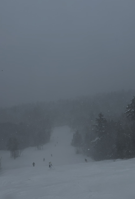
Overperformer here, deep winter. Deepest at the stake in (my) 4 seasons for PWM.
-
15 minutes ago, dryslot said:
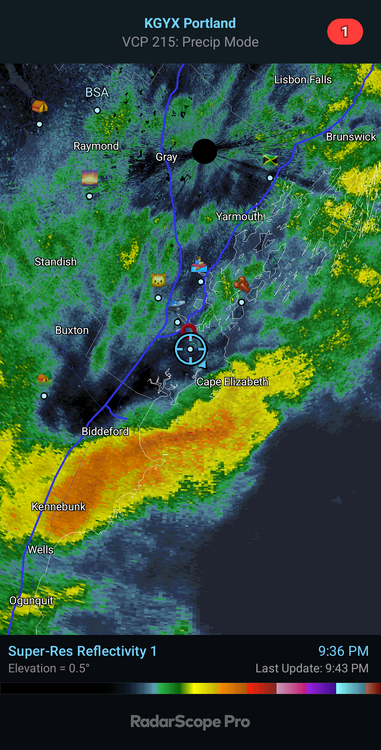
Special Weather Statement
National Weather Service Gray ME
1038 PM EST Sun Feb 16 2025

MEZ014-018>028-NHZ006-010-170545-
Southern Somerset-Interior York-Central Interior Cumberland-
Androscoggin-Kennebec-Interior Waldo-Coastal York-
Coastal Cumberland-Sagadahoc-Lincoln-Knox-Coastal Waldo-
Southern Carroll-Strafford-
Including the cities of Athens, Cornville, Skowhegan, Palmyra,
Pittsfield, Embden, Madison, Hollis, Alfred, Lebanon, Sanford,
Goodwins Mills, Buxton, Limington, Berwick, New Gloucester, Gray,
North Windham, Gorham, Greene, Lewiston, Sabattus, Wales, Minot,
Turner, Auburn, Livermore Falls, Augusta, Sidney, Windsor,
Vassalboro, Waterville, China, Palermo, Brooks, Jackson, Knox,
Liberty, Montville, Morrill, Waldo, Winterport, Unity, Biddeford,
Saco, Old Orchard Beach, Kittery, Portland, Cape Elizabeth,
South Portland, Westbrook, Yarmouth, Brunswick, Arrowsic, Bath,
Phippsburg, Bowdoinham, Topsham, Bowdoin, Whitefield, Dresden,
Alna, Bremen, Bristol, Damariscotta, Newcastle, Boothbay Harbor,
Wiscasset, Waldoboro, Owls Head, Rockland, Appleton, Camden,
Hope, Rockport, Thomaston, Belfast, Northport, Searsmont,
Lincolnville, Wakefield, Bridgewater, Brookfield, Ossipee,
Tuftonboro, Wolfeboro, Moultonborough, Barrington, Rochester,
Dover, Rollinsford, Somersworth, Durham, and Madbury
1038 PM EST Sun Feb 16 2025

A heavy burst of snow is moving through southeast New Hampshire
and southwest Maine. Sleet will continue to transition to a heavy
burst of snow along the I-95 and I-295 corridor. Visibilities
less than 1/4 mile, and heavy snowfall rates of 1 to 2 inches per
hour can be expected. Snow comes to an end across the Seacoast
around midnight, and a few hours later through the MidCoast and
central Maine.

$$
Rocking here. 9" within reach.
-
3
-
-
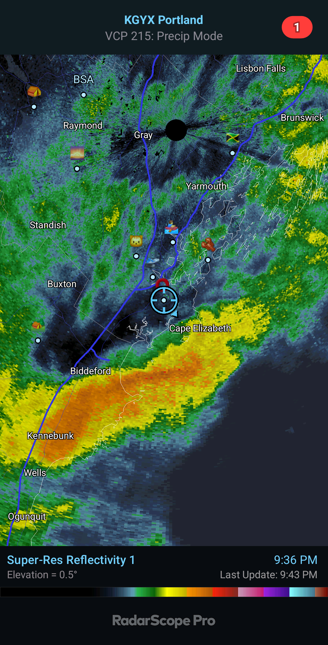
Radar looks good for another inch, maybe two.
-
2
-
-
Just now, tunafish said:
Holy Mackerel.
Guess I'll wait to do the driveway.
-
Holy Mackerel.
-
3
-
-
PWM 00z -
1.5"/0.41" new
6.6"/1.11" Total - depth 18"
19.9° and and a few flakes while we await that last batch. Been nonstop all day with the CF.
-
1
-
 1
1
-
-
16 minutes ago, dendrite said:
That’s got to be low level snow aided by salt nuclei and the CF. The mid level warmth is way north of you.
Neat. Appreciate the explanation.
Funny, pope said he just didn't know how we'd hang on to the cold here with winds out of the east.
-
Over 6" now, still snowing - I don't think anything showed snow after noon.
-
4
-
-
PWM 18z -
3.1"/0.50" new
5.1"/0.70" total - depth 18"
IP, 24.4°
-
We had sleet mixing in for about 30 minutes around 9AM this morning here in PWM, but it's been back to all snow since then. Loose estimate based on the stake is between 4-5" total.
-
1
-
-
PWM 12z -
0.8"/0.11" new
2.0"/0.20" total - depth 15"
SN, 23.2°
-
2
-
-
PWM 05z -
1.1"/0.09" new
1.2" total - depth 14"
SN- 24.1°
-
25 minutes ago, moneypitmike said:
when did it start snowing down there? Still nothing here.
Around 615ish
-
1
-
-
PWM 00z -
0.1"/T new - depth 13"
SN-, 25.9°
-
1
-
-
Regardless of storm outcome, these threads are better when people like Ginx and JC are posting.
-
3
-
 2
2
-
1
-
-
06z Euro would work just fine up here.
-
2
-
-
19 minutes ago, Go Kart Mozart said:
The uncle oh so close to a capture..
just an FYI - Ginx started a threader
-
11 minutes ago, Damage In Tolland said:
You have any pics from that ?
I found one.
-
1
-
8
-
1
-
-
3 minutes ago, ma blizzard said:
1.3" before the rain in PWM
-
41 minutes ago, PowderBeard said:
Just went from pounding baking soda to big flakes in the past few minutes. Radar looks good for @tunafish
Same thing happened here right around that time. back to baking soda now though. Had 0.4" at 12z, probably somewhere between 1.0" -1.5" now
-
53 minutes ago, Lava Rock said:
Garbage. A dusting. Models had 1-3" overnight.
Sent from my SM-S921U using Tapatalk
Yeah looks like shit. Schools canceled too
-
1
-
PD Holiday Weekend Mess DISCO
in New England
Posted
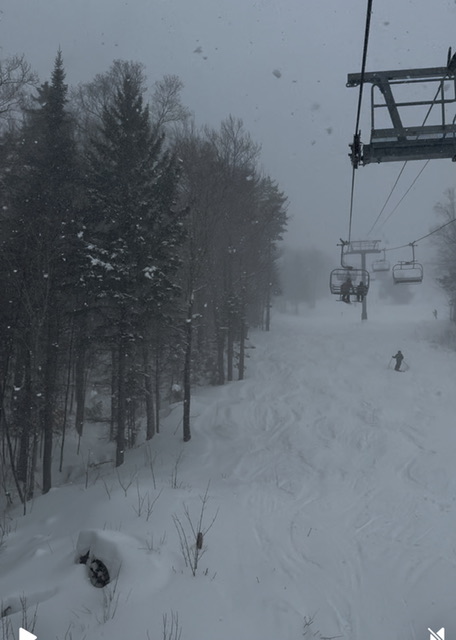
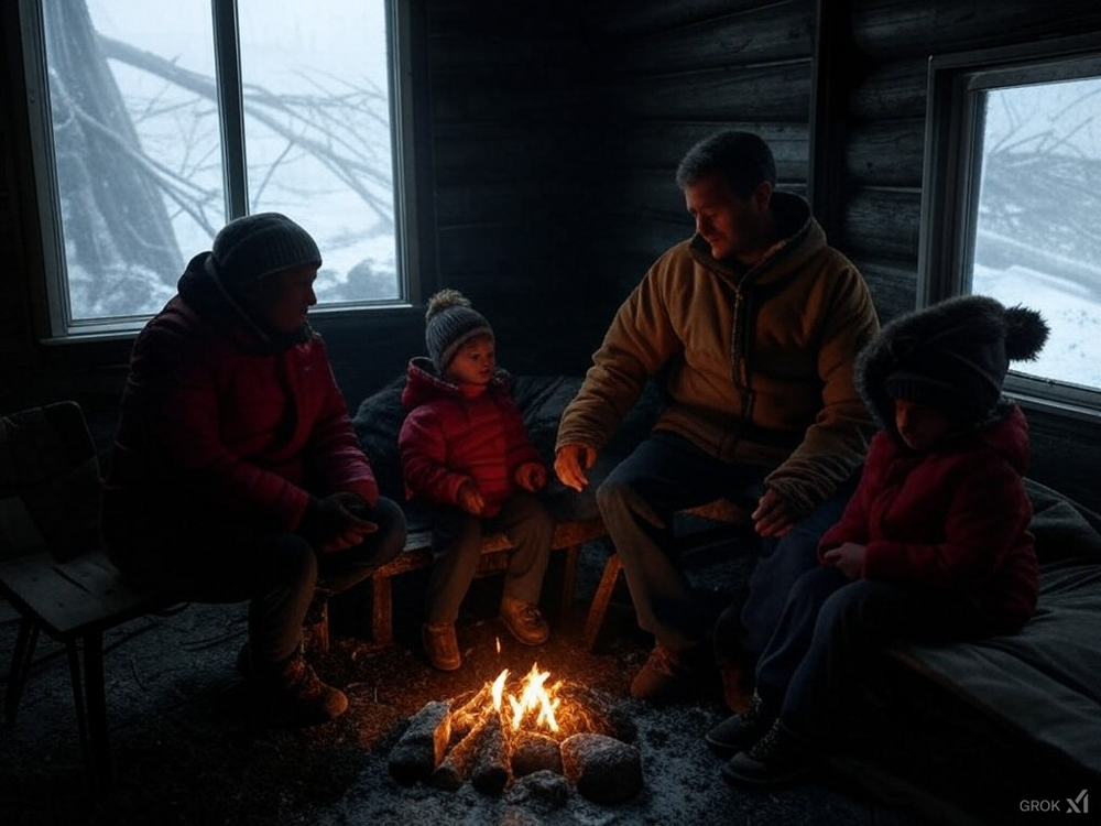
Deep winter.