snowmagnet
-
Posts
962 -
Joined
-
Last visited
Content Type
Profiles
Blogs
Forums
American Weather
Media Demo
Store
Gallery
Posts posted by snowmagnet
-
-
So if I'm looking for snow the first week of April, should I opt for Vermont or Montreal/ Quebec area?
-
2 hours ago, psuhoffman said:
What is going on. For the last 3 months I’ve been taking abuse for being a deb because I wasn’t interested in day 10 fantasy and was saying nope sorry that’s not gonna happen.
Now I’m optimistic we might have a chance and those same people are being huge debs. WTF.
I’m very excited about your optimism! You’ve been right all winter, unfortunately. So there is only one way to go from here!
-
19 minutes ago, Ji said:
So you guys aren’t going to be giving this new pattern a chance even though it’s different from the current pattern?
Chuck is all in, and PSU is interested. That’s quite a change from the past 3 months.
-
 1
1
-
-
23 minutes ago, NorthArlington101 said:
thread?
")
We could re-open the rockin’ February thread for Saturday and the 28th!
-
17 minutes ago, Weather Will said:
WB 6Z GFS….snows for 24 hours starting next Friday afternoon.

Of course it’s the weekend. We’ve got snow days to use up and can’t get any mid-week storms.
-
February 28th is 9 days away. There is still time.
-
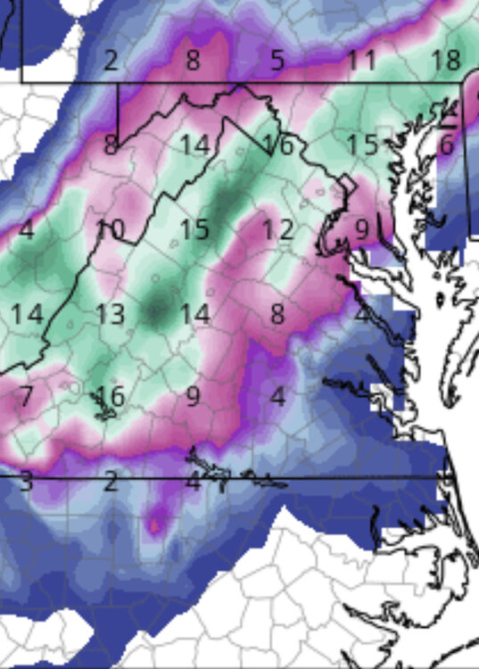
5 hours ago, MD Snow said:
CMC is pretty close as well. Major winter storm verbatim for the northern crew. I’ve been watching this window for a couple days now. GFS has been close a few times. Nice to see gfs and cmc move in the right direction tonight.
What is this window?
-
I walked out in the deck this morning and realized it was sleeting, while the weather channel radar showed snow. There was definitely no snow, but sleet for a bit at 41 degrees.
-
3 minutes ago, Buddy1987 said:
I will believe this sh*t when I see it down this way falling and on the ground. Anything to do with 850s and having to wet bulb just screams don't get invested.
It’s all part of the game. We win rarely and lose usually, but that’s risk in tracking. For me the most frustrating ones are when the tracking goes well for days and days leading up to the event, only to end up as too warm, too dry, or too far south. Some of the most interesting storms are those that thread the needle or rely on deformation.
-
21 minutes ago, NorthArlington101 said:
largely noise - highlights are probably more snow SWVA, more snow central VA/along I-81, less members that are bringing snow further north out of our subforum.

probability maps for just an 1" (hey, low bar) show non-zero improvement from 06z. Generally 0-10% better


That’s 30-40% than I had 2 days ago.
-
1 hour ago, Jersey Andrew said:
Would be absolutely stunned if snowstorm happens. Then again Veterans Day 1987.
I was in Charles county where we got unexpectedly hammered with about 13” that day.
-
Just now, TowsonTownT said:
May I suggest no storm thread either. A new LR thread can be created just as easily.
I say we need to keep this thread. It’s actually the late February thread, so maybe we can fake out whatever is trying to keep us from getting snow.
-
9 minutes ago, Weather Will said:
WB 12Z EURO…. no comment.


It’s moving in the right direction, right??
-
1
-
-
45 minutes ago, Ji said:
The only reason it’s even snow is because it’s so dynamic. Of course it’s rate dependent. Shades of Jan 2011 lol?
.I was just thinking of Jan 2011 too. We can do deform well around here if it threads the needle.
-
16 minutes ago, Siberian-Snowcover-Myth said:
I love seeing clown maps…. Especially this winter season.
Please!!!!!!!
-
36 minutes ago, WinterWxLuvr said:
12z gfs looks great!!
I’m so confused. One person says it’s gone, then you say it looks great. ???
-
2
-
-
29 minutes ago, MDScienceTeacher said:
BTW...
this happened: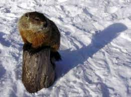
and this happened:
Phil called it, so it’s happening. I believe we can salvage this winter.
-
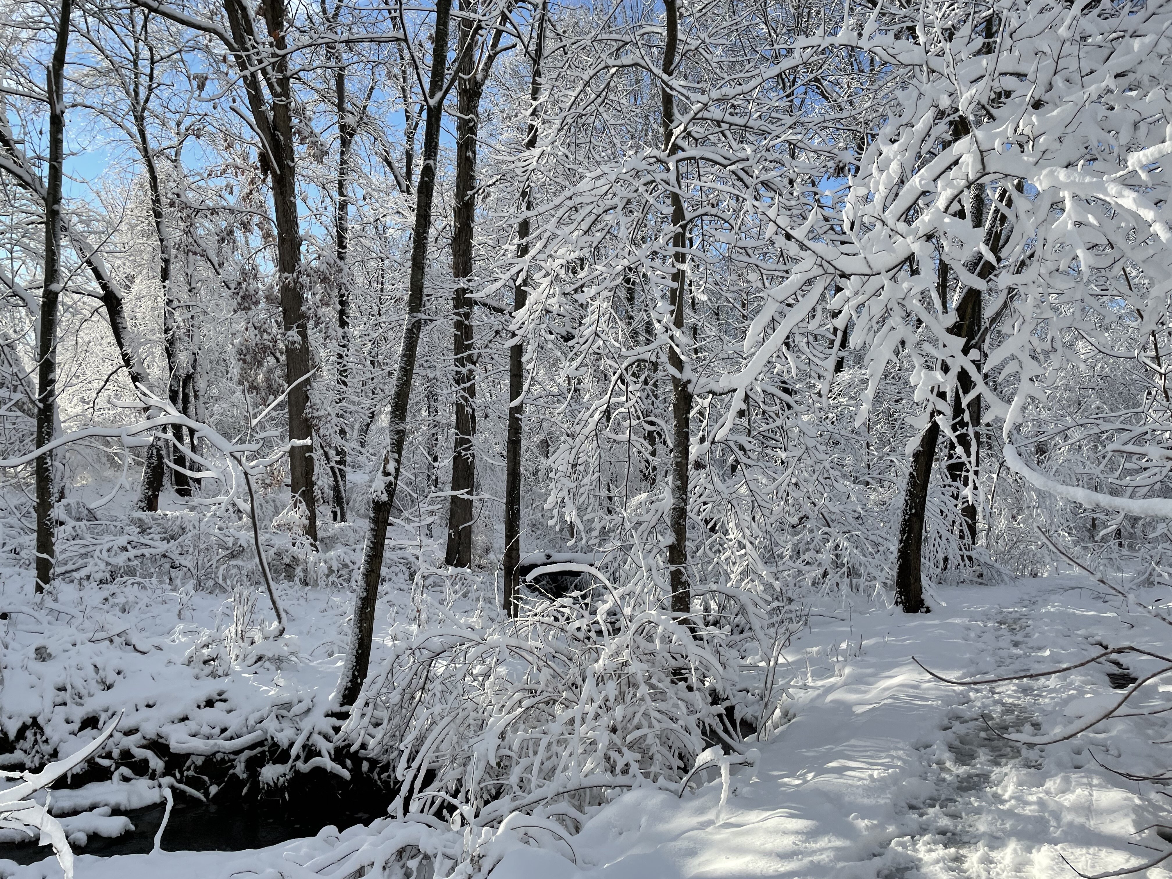
So much for February rockin’. More like “doom and gloom for the next decade”.
I’ll take Jebman’s optimism and hope our .5 “ is a precursor for a better end of winter.
-
2
-
-
5 minutes ago, 87storms said:
Blurb from LWX on that one...
Come Saturday, the trough/vortex will move into Maritime Canada with
height rises locally. As an incoming trough moves through the Ohio
Valley, the interaction of the northern and southern stream energy
will be key to see if there is any precipitation/storm threat Sunday
into Monday. Have maintained low end chance POPs for most with some
wintry potential.
Most positive post so far today!
-
3
-
-
15 hours ago, anotherman said:
Uh, yeah. Also, has the Canadian ever been right?
Jan 6, 2018.
-
21 minutes ago, Prestige Worldwide said:
Take it fwiw
Has the control ever been right?
-
23 minutes ago, Bob Chill said:
Too early for that. Next 10 days look absolutely abysmal at first but moderates towards just run of the mill God awful. Trend is our friend. Maybe we can move firmly into the not terrible enough to not snow arena before it's still light after 7pm

I appreciate when you pop on here to keep people from jumping off the ledge. I don't think the models can handle things in the long run, especially when the Pac is throwing a wrench in things. We have seen this all winter. This current pattern can't last, so something has to give. Or maybe it will and California will be under water much earlier than predicted.
-
12 minutes ago, CAPE said:
It does happen. Last Jan was an example, but the main difference is the cold coming in was legit and sharp. Even though temps were 60 leading in, it started off as snow and much of it fell with temps in the low to mid 20s. The way this pattern seems to be evolving on the means, it looks like more of a gradual transition to somewhat colder. That doesn't mean we can't get a similar result.
At least there is something to track. I think that's what everyone here needs most of all. I'm hopeful that we will luck out with something by mid-January!
-
1
-
-
1 hour ago, Ralph Wiggum said:
Who wouldn't take this fantasy look in early January? If we didn't know it was going to push mid 60s a few days prior we would be more inclined to believe it:
We often get good storms within a couple of days of really warm temperatures. Most recently that happened last January, but it is pretty common around here. I'm always hearing people say, "its too warm to snow", or "it won't stick" when we are predicting a coastal storm 2 days after it hits 60 or 70. I could be wrong, but I seem to recall it was pretty warm just a couple days before Jan '16 too.


March Medium/Long Range Thread: The Empire Strikes Back
in Mid Atlantic
Posted
This works quite well. It also fits in the timeframe that you and Chuck said would be prime.