MAG5035
-
Posts
6,078 -
Joined
-
Last visited
Content Type
Profiles
Blogs
Forums
American Weather
Media Demo
Store
Gallery
Everything posted by MAG5035
-
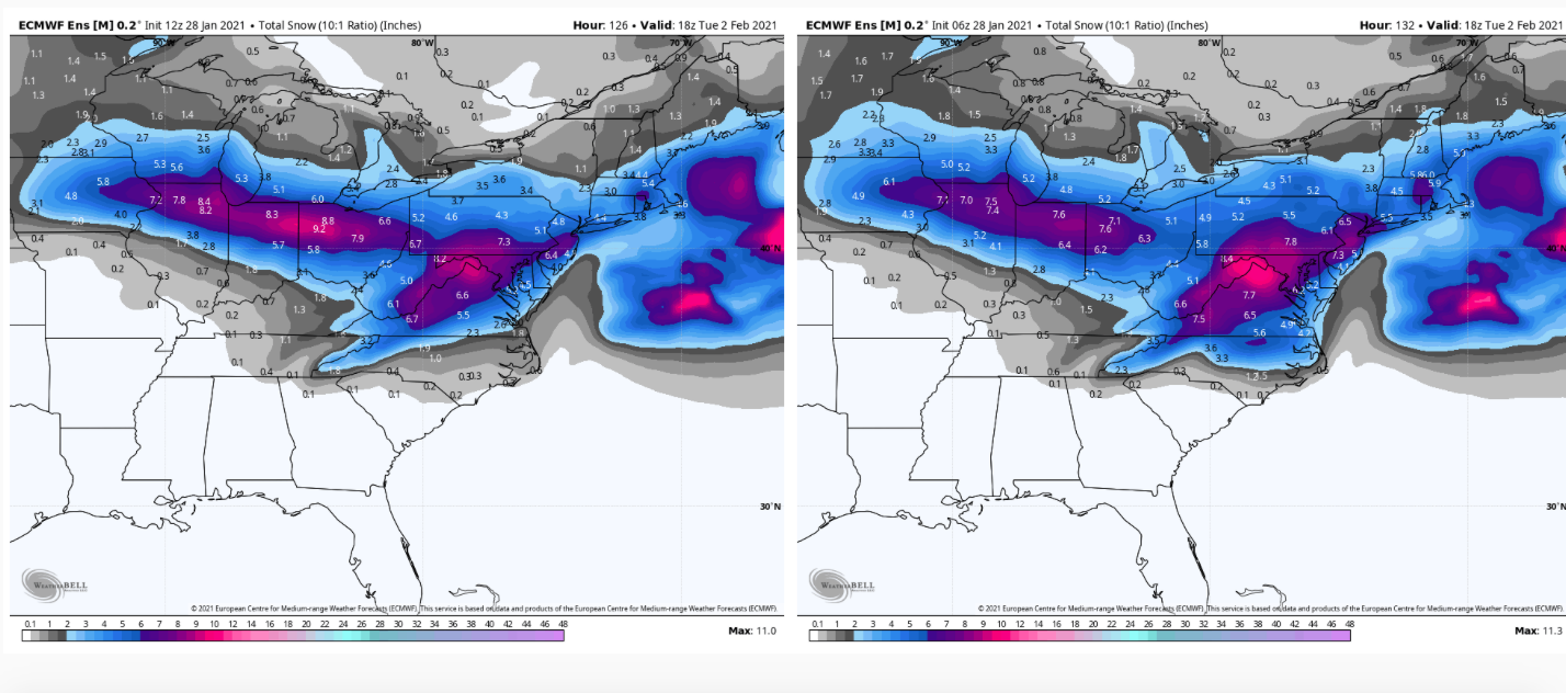
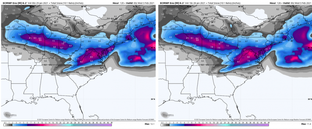
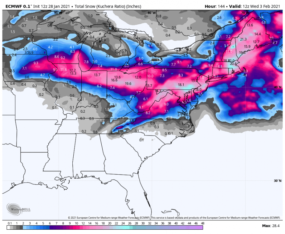
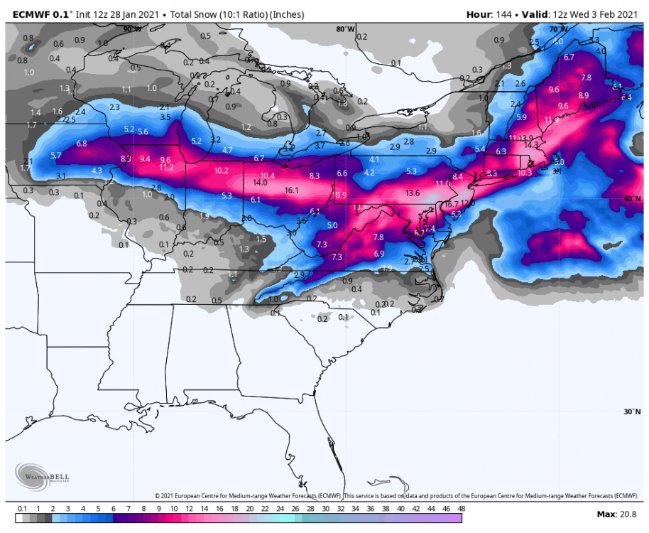
0z Euro ensemble vs 18z, essentially the same. It's still the furthest south of the ensemble guidance but more in the ballpark of the other stuff. The Canadian ensemble mean (posted earlier) definitely didn't show any reflection of the crazy op run that had.
-
I'm not sure, this was a huge shift from 12z. Like I said, this was what the Euro had been doing before it's big run last night at 0z, while the GFS was punching the primary almost to Cleveland and having all kinds of mixing problems. The GFS has shifted more toward a Canadian like primary track, but still looks like the model with the most mixing issues. Should note the Euro map i posted wasn't done in New England as eastern Mass gets crushed. But the heavy swath even ducks Philly and NYC. Pretty much gonna have to blend the ensembles tonight, these ops are all over the place with their snow swath. Figured we'd be starting to center this up but not tonight lol. Euro's probably too suppressed this run, and Canadian/Icon are probably too amped north. Almost looks like the GFS/GEFS/UKMET represents some kind of middle ground. Nothing else shaves off that precip shield in eastern PA like the Euro did... I don't buy that extreme of an erosion.
-
Lol what a clunker on the Euro, ouch. It's reverting to what it was mostly doing a couple days ago before the huge run last night at 0z, killing the primary precip in PA and ducking the coastal swath. Probably the furthest these ops have diverged from each other in the last few days. 0z vs 12z
-
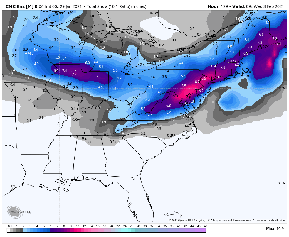
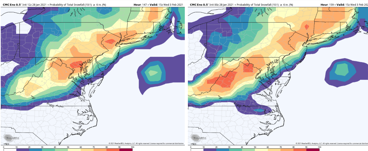
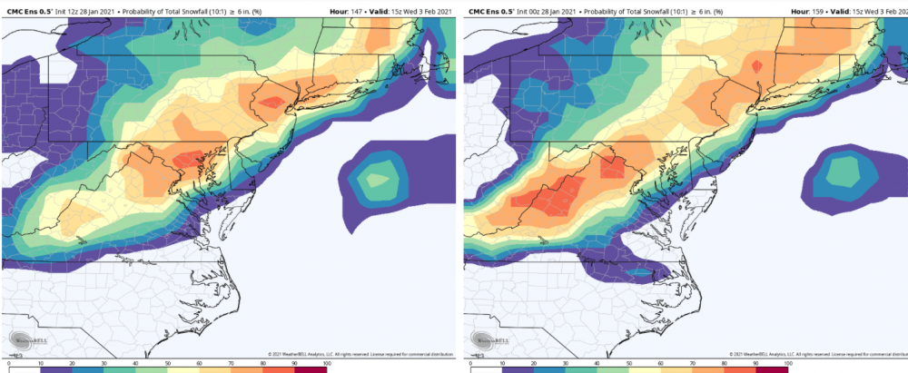
Back to reality though, the CMC ensemble is a bit more in line with the other stuff. Really a Mid-Atlantic/LSV/I-95 corridor focused heavy swath. Splits the primary and coastal 6+ swaths however.

-
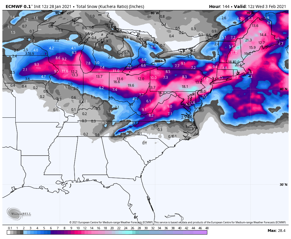
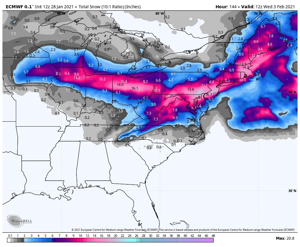
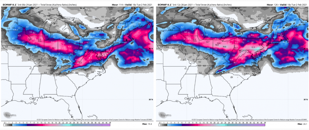
Lol i just realized the Canadian gave Williamsport almost 28" via Kuchera.
-
Well GFS certainly isn't giving up much, there's some mixing southern tier and def SW PA but it's winding up that deform band with the coastal up through 96 in southern PA.
-
Lol that really is an Atomixwx bullseye this time.
-
Well, it's looking quite likely we face the prospect of a couple day warmup and cutter at the end of next week as trough and cold settle back into the west again. PNA temporarily neutralizes with the upcoming storm before diving again. -NAO/AO blocking remains firm, EPO/WPO look generally negative-ish. So after we have this probable cutter next week we look to settle into a cool but not cold pattern for the time being with storm chances but some vulnerablity to cutters. MJO has been back in the picture near the Phase 6/7 line, and guidance generally gets it slowly into 7 at a pretty decent amplitude... which reflects the previous sentence pretty decently. A warmish phase but not quite the dead ringer torch phase 4-6 is. What would really be nice is eventually progressing the MJO pulse toward 8-1-2... which would likely put some of the really cold air in play on this side of the country. Either way, I don't currently see any major detrimental things that would prevent us from having our chances getting into the first half of next month.
-
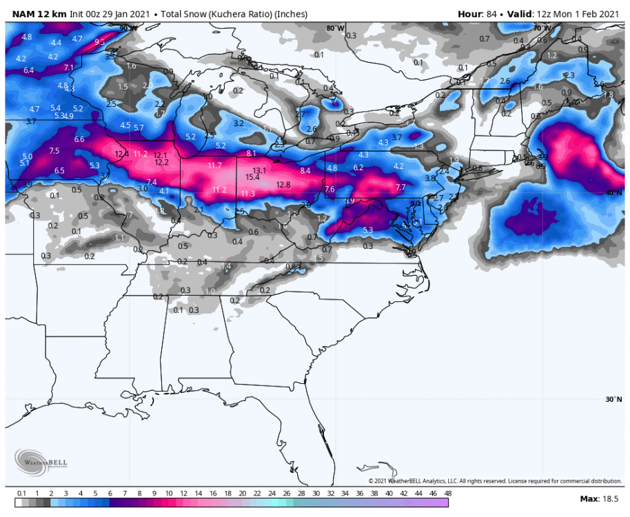
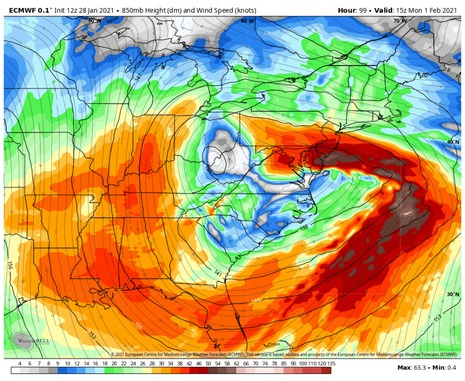
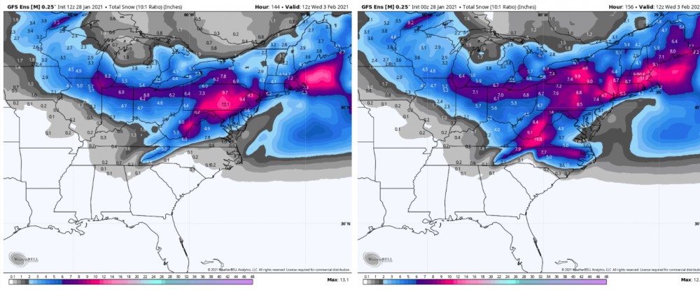
I'm not sweating some stuff shifting around some right now. We have probably almost half the storm to go still out of NAM range and this thing's arriving roughly in D3 range. Mentioned this earlier today but look at the snow swath out in the midwest. Chicago getting clobbered with a snowstorm is typically from an event that is trying to cut and would give us p-type issues. We have blocking/confluence and such but I just don't think it's overwhelming enough that this thing get's completely stuffed or something like that. How many storm examples are out there of a Chicago - DC heavy snow axis? Or even a Chicago-NYC. Not very many. It's def a unique setup.
-
At any rate the 0z NAM brought the swath north a bit and some mixing up to the mason-dixon. Pretty much the NAM is looking a bit more NAM-y than it did 18z. Through 84hr with precip shield still on a majority of PA.
-
Some of them definitely get snippy pretty easily lol geesh. Probably don't realize at least half of the regular posters in here are in the part of the LSV that's pretty much an extension of the northern part of that subforum climo-wise.
-
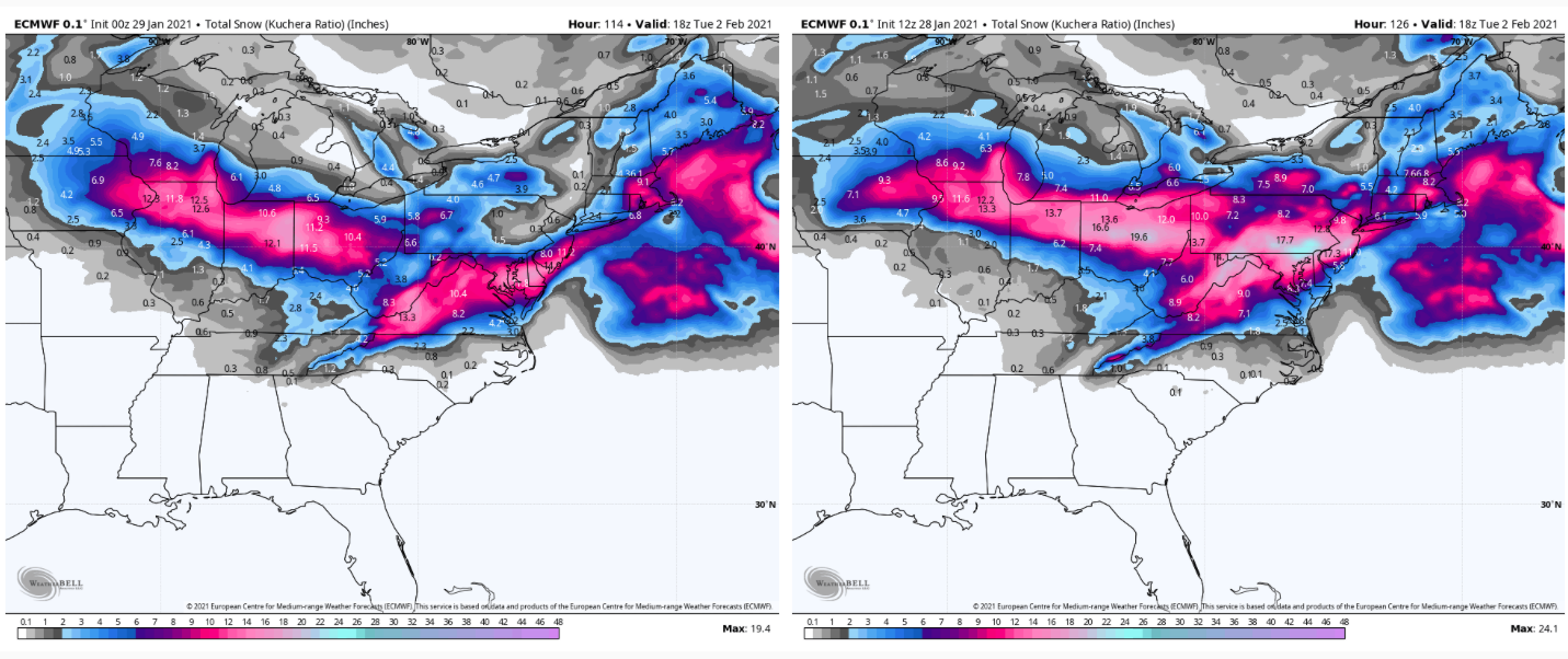
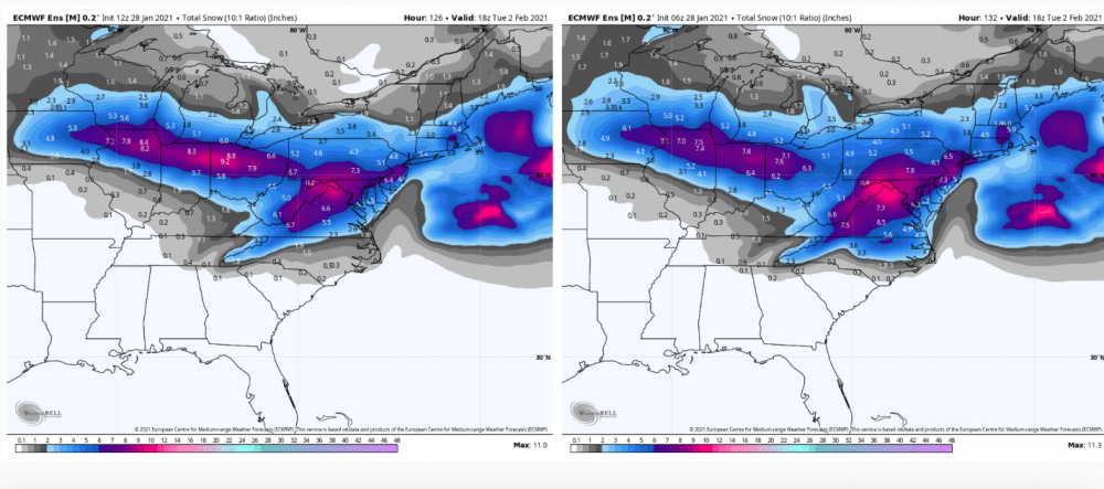
It looked like the Euro was heading for a somewhat further south heavy snow swath than it's 12z run, especially in eastern PA associated with the coastal low taking over. Looked like it was going to try to squeeze NE PA to some degree and stuff the heavy axis more toward the mason-dixon into northern MD and DC. Western PA is still seeing 6+ amounts through 90 with it still snowing. 18z Euro ensemble mean is south of 12z some overall with the heavy swath.
-
Der IKON is about 15-20 miles or so north of having a Wormleysburg bullseye of 24"+. I know that's all the briefing you need to hear haha. Most guidance remains very solid on 6"+ for C-PA below I-80. GFS tracks the primary more closely to the Euro now, starting to minimize mixing in the LSV last couple runs. The Euro was better getting precip from the primary into PA, which is a key part of elevating the totals where the precip shield pivots as the lows transfer.
-
4-6" is all IPT needs to get there haha.
-
Yup we can get C-Pa’s new snowtown to average for the whole season by next week with a decent snow. Lol
-
NAM's tighter with the precip shield but generally looks like the Euro with positioning of features. High a bit stronger on the NAM. Not really much to gather from it at this point, it's still just getting the coastal started at 84 hours.
-
Western Pa / Pittsburgh area Winter Discussion ❄️☃️
MAG5035 replied to north pgh's topic in Upstate New York/Pennsylvania
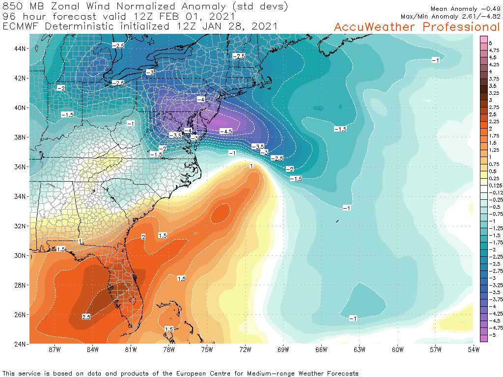
I think as long as the primary low and 850mb low don't go too far north and stays just below Pittsburgh's latitude while its transferring to the coastal.. this is actually a pretty good setup for a decent snow event for Pittsburgh and surrounding. The west-east trajectory of the primary and transfer plus the overall blocking pattern maintain the nose of that anomalous easterly 850mb fetch pretty far inland... which is a pretty good sign for maintaining a nice precip shield between the two lows as they transfer. -4 standard deviations is quite significant.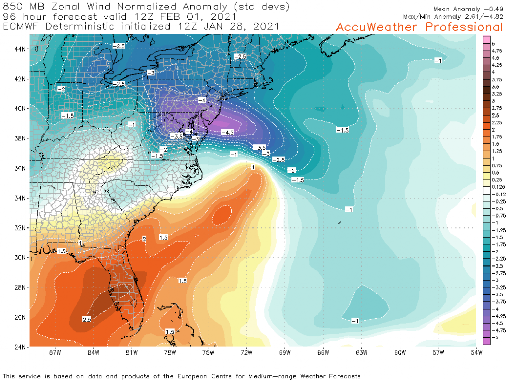
-
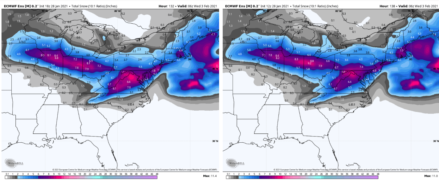
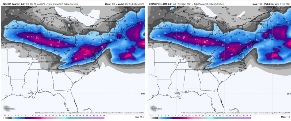
Euro ensemble, 12z v. 6z. Trend between that and esp comparing 12z to the 0z ensemble is tightening the 6" mean on the northern extent.
-
Yea, look at the swath in the Mid-west.
-
It's the primary low. I've been saying over and over (and over) for the last couple days.. that low has to track close enough to put the precip shield over PA and transfer to pivot it over PA. The Euro had been ducking it and popping the coastal, narrowing the heavy snow swath. It's starting to finally put the precip shield from the primary solidly into PA like the GFS has been doing while transferring in time to keep things mostly snow.
-
The 12z Euro doesn't stall the low over Delmarva like the 0z did, does so farther east. The biggest thing I'm seeing is it's finally starting to fill in the precip shield related to the primary low. And trajectory of that and the handoff is good to hang the shield over PA. The western PA gang will like this run, it keeps Pittsburgh mostly or all snow. We have to remember this storm is coming on a straight west-east trajectory, not directly up from the Gulf. Typically, storms that slam Chicago with a foot plus of snow are ones that are cutting and giving us rain or p-type issues. Not with this block though. This is still a great run for a big snowfall, pretty much everyone gets a warning snow and Sus Valley still gets clobbered. The big thing with this setup is where the coastal low stalls, if it's east or it doesn't stall for long we see this result. If it stalls over the Delmarva like last night's 0z run did, then the excessive totals become more in play (the 18-24+ type stuff).
-
It's all good, just trying to keep comparisons straight. A lot of times shared info from the Mid-Atlantic thread is stuff that's being analyzed through the Mid-Atlantic lense. Here's GEFS means 12z vs 0z, ramped up pretty good in our region and some of the northern MD folks. 6z means are fairly close to 12z. Again, starting to focus more than shift.. imo.
-
Compared to what, the 0z run? 12z looks better in central PA probs wise. I see some solidifying of better probs but not a significant shift. Biggest difference I see is in western VA and eastern WV. 12z left, 0z right.
-
I haven't really been watching what the UKMET's been doing, I just looked at it today since it was commented on being way south. But yea lol, that's not an outcome I'm anticipating out of this.
-
Yea I know that's been a unofficial indicator of the Euro in the past. I recall the UKMET being south on the lead-up to December's storm, or at least that they weren't showing that connection. I'm sure there's a couple comments on it buried many pages ago in this thread somewhere since this thread started at the beginning of December.