HKY1894
-
Posts
190 -
Joined
-
Last visited
Content Type
Profiles
Blogs
Forums
American Weather
Media Demo
Store
Gallery
Everything posted by HKY1894
-
Euro dropping massive amount of ZR .
-
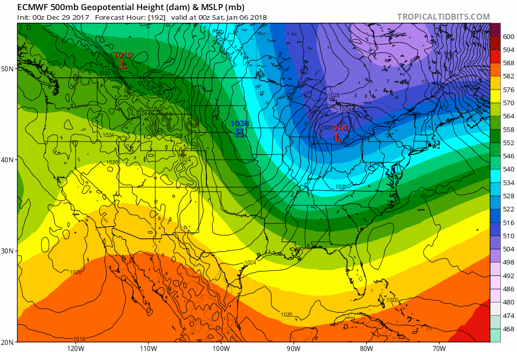
Euro is an absolute monster. 32 degree line well south.. night and day from any other model in evolution .
-
Definite trend from all 00z op runs so far for a miller b. Still not sold one way or another personally. One positive trend from both gfs runs was quicker ejection of shorthwave .
-
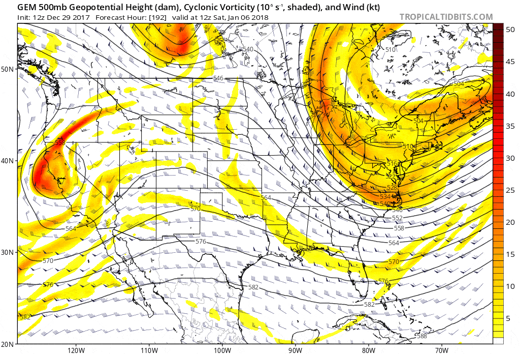
FV3 at 138 isn’t as sharp with energy in Southwest compared to 18z more broad like euro not gonna guess on outcome but it’s not a bad trend .
-
Was just about to post this mean snowfall ranging from 5-8 inches across all of WNC. Pretty big increase in overall amount of snowfall too
-
Even with the miller B the gfs is a huge hit for NW NC and SW VA. Front end snow then either sleet or ZR lots of QPF .
-
Both 12z gefs and eps had a big increase in snowfall. Looks like it’s an all or nothing situation, on eps members that have snowfall are big for WNC. Other members appear to be big rainers. .
-
Very notable increase in snowfall on 6z gefs compared to prior runs nearly double it appears. South/Central Va looking pretty good at this lead time. Farther south still questionable due to temps. Pure southern stream waves are much more predictable than chance of no storm is very slim right now. Similar to 09-10 in that regard.
-
0z euro is a huge hit for western part of NC 32 degree line is just west of CLT when heavy precip moves in. Not looking at soundings this far out but Weatherbell snow map is drool worthy for my area. Looks like classic miller A El Niño storm .
-
It appears the confluence in the north begins to move out as shortwave moves eastward. The speed of the s/w will be key to low track it appears. If the low is inland over GA this will be a mid-Atlantic storm. No way any model will get timing right this far out....... .
-
looking like 12z euro lots o cold rain .
-
Gonna be much more intense system on 00z gfs than 18z looks warm we will see if HP over Midwest can move east for CAD .
-
Interested to see how this plays out, FV3 has consistently migrated towards more of a cutter or Miller b in last 4 model cycles. But eps and gefs look more like a classic Miller a type storm. Feel like early December climo favors WNC if we get Miller A look. Timing of the high pressure vs the storm will be key as well. We are far from final solution no matter what the outcome. Many more opportunities later in December and early January when forcing becomes more favorable for Aleutian low/+PNA pattern + more favorable climo .
-
12z euro also has the energy in the southwest in the long range, looks like a big midwestern storm forming though unfortunately, something other than suppression though.

-
Not gonna over analyze it because the gfs has nothing even close to this but that “ridge”you’re seeing is actually the flow backing and that causes overrunning, the surface maps have sleet and ZR in the cad regions with a dammning high in NNE. Basically we want to see the isobars pointed in a north to south orientation rather than the flat east to west orientation we are seeing now. The NAO being neutral to positive isn’t great either but I don’t think it’s physically possible in this decade for that indice to be anything but positive.
-
Way out in fantasy land on the CMC is a much better look for a storm, could possibly cut or be a miller b but much better movement of the energy way out on the west coast early on, in the southeast we can’t rely on energy dropping into the northwest and digging through the Midwest, Gotta be into Cali and through the southwest. December 8th-9th was more similar to this look than what we’ve seen recently

-
COLD AND DRYI LOVE IT
-
The December to Remember 7th-8th blue turd winter threat thread.
HKY1894 replied to lilj4425's topic in Southeastern States
QPF totals from gfs? I’m too busy to look at work -
The December to Remember 7th-8th blue turd winter threat thread.
HKY1894 replied to lilj4425's topic in Southeastern States
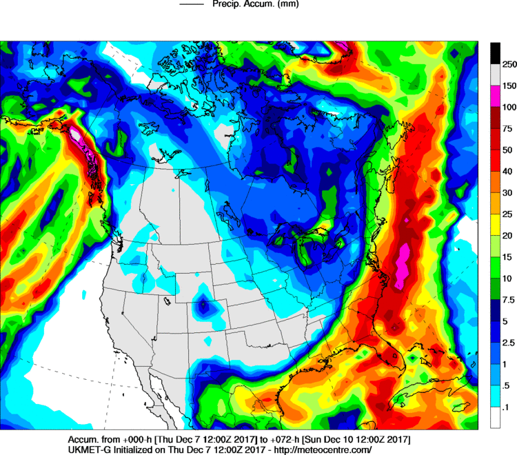
Big increase in QPF from 12z ukie compared last nights 00z run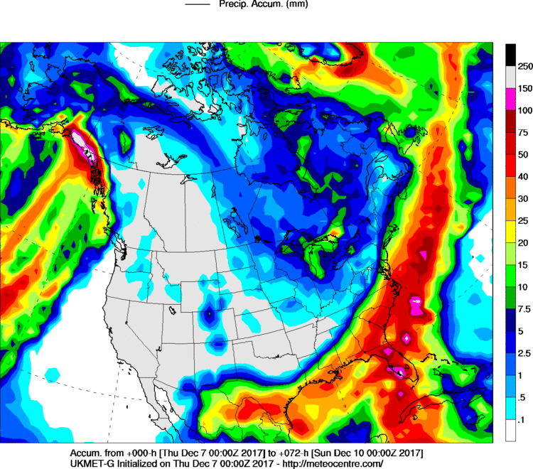
-
The December to Remember 7th-8th blue turd winter threat thread.
HKY1894 replied to lilj4425's topic in Southeastern States
This model has been so consistent for at least 3 days now -
The December to Remember 7th-8th blue turd winter threat thread.
HKY1894 replied to lilj4425's topic in Southeastern States
Ukie not quite as good as 12z yesterday. But much better than 0z. Trending back towards a good storm for WNC possible up into VA -
The December to Remember 7th-8th blue turd winter threat thread.
HKY1894 replied to lilj4425's topic in Southeastern States
It’s so odd how the NAVGEM is so amped up and has been for days. It’s notoriously a progressive model