AMZ8990
-
Posts
1,270 -
Joined
-
Last visited
Content Type
Profiles
Blogs
Forums
American Weather
Media Demo
Store
Gallery
Everything posted by AMZ8990
-

TN valley heavy rain/flooding week of whenever
AMZ8990 replied to janetjanet998's topic in Tennessee Valley
I used to work in a lot of power plants doing switchgear Maintenance on the circuit breaks throughout the plant. All the turbine floors are usually on the 3rd or 4th floor of the plants. First floor is usually a huge open area that runs just about the whole floor with a large crane running in the rafters to move large items down and up from the other floors, and you’ll have a few other non essential things on the first floor. I share all this to say that most power plants can handle a serious flood better than most would think due to the way they are layed out. They also have tons of extra drainage valves through your the plant that are there to help in the unlikely event that a fire happens and the fire suppression system cuts on. Those drains could also help if you had flooding from the river the plant was on as well. -
That’s about 10 miles north of me.
-
I’m under a tornado warning as we speak. It’s pretty ominous outside
-
TN valley heavy rain/flooding week of whenever
AMZ8990 replied to janetjanet998's topic in Tennessee Valley
I’m under a tornado warning until 6:15 in Hardeman County. Apparently one has touched down in the northeastern part of the county. -
TN valley heavy rain/flooding week of whenever
AMZ8990 replied to janetjanet998's topic in Tennessee Valley
Have you broke your February rainfall record John? -
Something to keep an eye on for sure
-
What are you thinking about the cells coming into Memphis now Jax?
-
TN valley heavy rain/flooding week of whenever
AMZ8990 replied to janetjanet998's topic in Tennessee Valley
I’m under a tornado watch in west tn. The line about to cross the Mississippi River in Memphis looks particularly nasty. Flash flood warnings popping up along the path of the cells in about a 5 county long line from Arkansas into north Mississippi/south west tn. -
TN valley heavy rain/flooding week of whenever
AMZ8990 replied to janetjanet998's topic in Tennessee Valley
This one gives you a little bit better understanding as you can see the levee in the backdrop and how high the water is up onto the levee.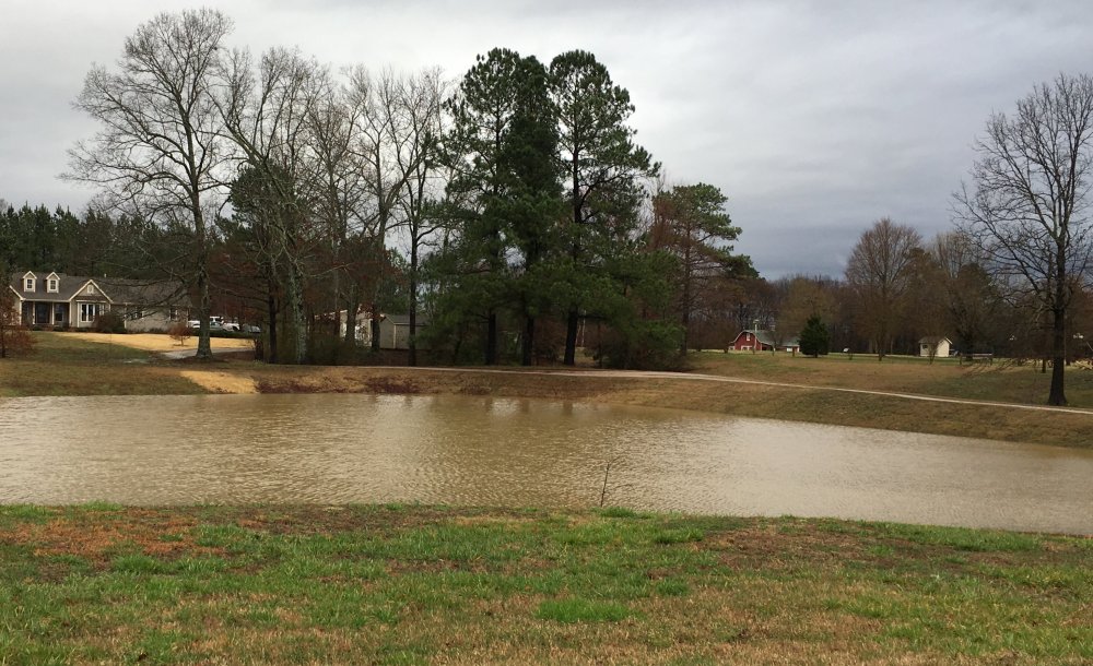
-
TN valley heavy rain/flooding week of whenever
AMZ8990 replied to janetjanet998's topic in Tennessee Valley
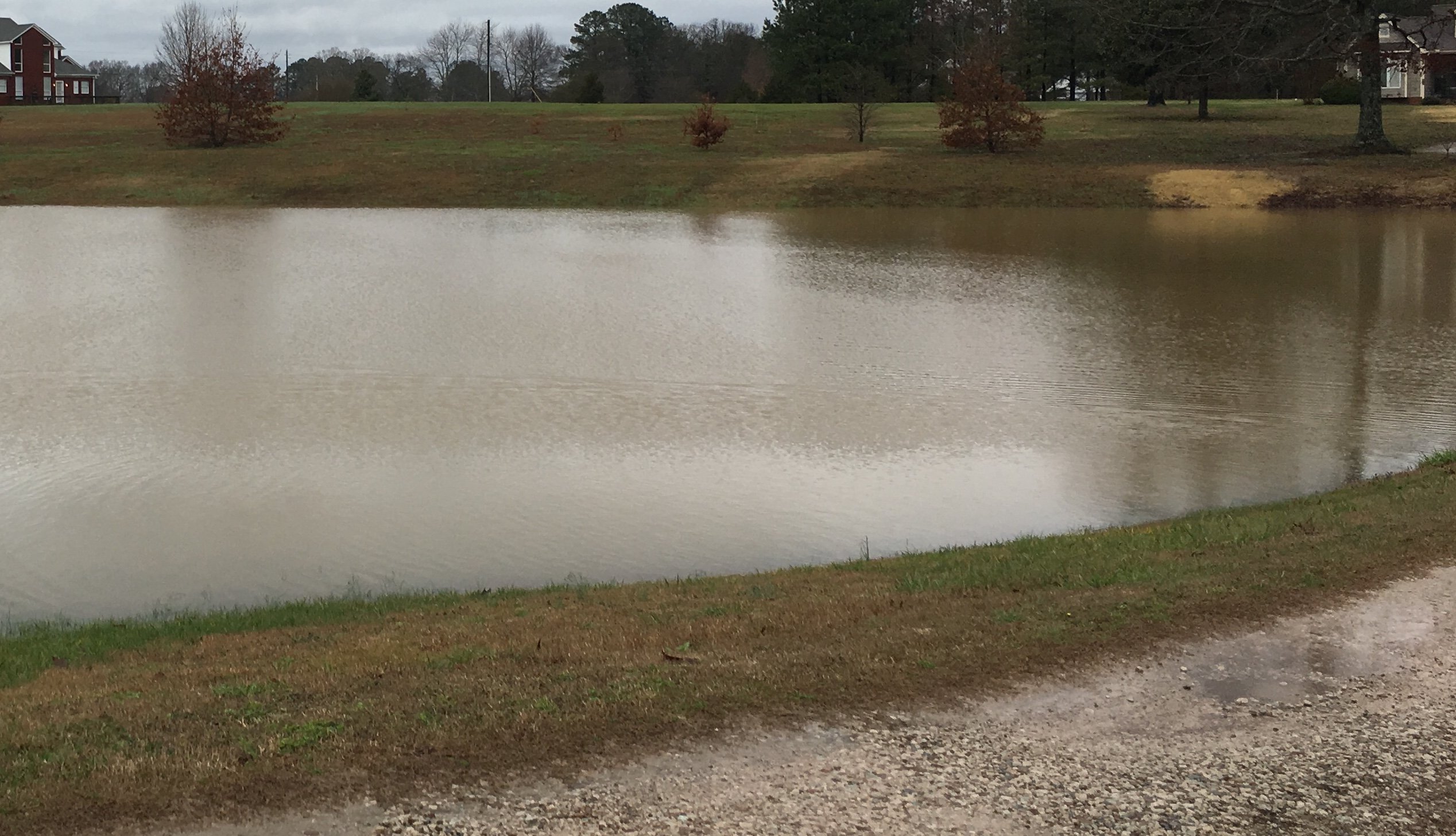
Here is a partial picture of what my front yard looks like this morning. The pond does not hold water anymore and is empty 10 months a year so that gives you an idea of how much rain we have received here in west tn.
-
TN valley heavy rain/flooding week of whenever
AMZ8990 replied to janetjanet998's topic in Tennessee Valley
Hatchie river in my neck off the woods is scheduled to be at 18.5 by Sunday morning. At 19ft the river starts to flood houses along river road in hardeman county. If we get to 19ft it could get ugly for a lot of people on or along the Hatchie River. Stay safe this weekend guys/gals. -
61 pages,, wow. I’d say you guys earned that one then. Lol
-
I understand that, we definitely don’t lose our severe wx chances during any season of the year which is fun if your into tracking those kinds of threats. You guys getting lots of snow up there this year??
-
@CheeselandSkies I didn’t mean anything bad about my comment saying I don’t know why you care about our thread. I hadn’t seen you in our thread before and thought you might of been a lurker trying to stir the pot like so many others around here try to do to get a rise out of people. My apologies if I offended you.
-
Sounds good to me. I don’t know why the guy from Wisconsin cares about our thread but whatever. And for the record- I had some pretty good cells come through my house the past 2 days. The snow wasn’t far behind the thunder either which was kinda cool.
-
Pretty stout cell moving over my house at the moment. Winds gusting up to 50.
-
Had some serious thunder and heavy rain come through last night from about midnight to 3am. The pond in my yard has now gone from half full to 85% full. Roughly a 4 foot rise in the level to give you a better idea. Easily an inch of rain has already fallen, probably closer to 1.5 though. Hopefully the old addage about thunder during winter holds true because we had quite the thunderstorm last night.
-
Noticed that that as well, definitely gives one hope we can have a good winter. Where do we stand with the Modoki look? Is there any cold water creeping off the coast of South America??
-
Looks like the Euro try’s to cool off significantly towards the end of its ten day run, potential flooding look for Chattanooga over to Atlanta around the 4th of August. Still a ways out but North GA was showing 7.5 inches of rain for that timeframe, 2.5 for chatt!
-
I’m 60 miles east of Memphis and we’ve had thunderstorms every night this week. I work in Collierville which is technically south east Memphis but when I got to the golf course this morning the course was a mess. We had standing water in a lot of areas, and limbs down everywhere. It’s been pretty cool to watch these storms unfold and develop every night this week.
-
Had a pretty intense storm Last night, came in around 2:30am this morning. picked up around .65 in the rain gauge and some epic lighting strikes. Had several that shook the house and I haven’t got that all year so far. It was the strongest cell of the summer so far in my opinion. Anyone else get anything this morning??
-
Got a good thunder storm last night around 11. Rained steady for about an hour and we had some serious lighting going on. Few limbs down but nothing substantial. Might translate into a few storms for you guys across the east side of the state today. Tomorrow looks like it’s gonna be wet in West Tennessee. I haven’t looked at the severe outlook yet though for tomorrow.
-
Yeah. I with ya on the power getting knocked out, that’s never a good thing. Especially in those rural areas where people don’t have access to help like you would in a city environment. Have you been keeping up with the ice pack up north any Jax??
-
Yeah we did, it came in late though. Right around 11:30 the wind picked up out of no where and the rain blew in. It wasn’t a gully washer but we got a steady rain for about 2 hours. Not too much lightning but the wind was was enough to bring some Limbs down. No trees came down to my knowledge though.
-
Here’s to hoping you get a good one sooner rather than later. With this heat it wouldn’t take much to get a good storm!