

STILL N OF PIKE
-
Posts
14,848 -
Joined
-
Last visited
Content Type
Profiles
Blogs
Forums
American Weather
Media Demo
Store
Gallery
Posts posted by STILL N OF PIKE
-
-
1 minute ago, ORH_wxman said:
Go up 31 to Paxton. You could go up to Princeton too but you’d prob need to go to WaWa lodge to find food in that town.
Does this thump slide by to the east at this latitude next hour
do you think it hangs on at least moderate for a while
-
2 minutes ago, ORH_wxman said:
Paxton is around 1200 feet downtown near 31/56/122 intersection. Prob one of the best spot for this storm.
Paxton house of pizza used to have decent pizza and subs but haven’t tried it in eons.
Haha I edited post. I’m in Holden
but I’m damn hungry and may swing to Paxton , roads messy
My app says I’m at 800’
-
In Holden , Ma . Took a drive . Probably going sit down somewhere for lunch
Heavy snow , approximately an inch on everything
-
 2
2
-
-
You can see SW part of 495 and even inside has cooled with heaviest banding
-
Sleet flips to fatties on 290 in Marlboro
-
3 minutes ago, HoarfrostHubb said:
Yeah. I wasn’t expecting much if anything before noon or so
He basically didn’t even mention Worcester county elevations . (Berks and S VT )ORH airport to you looks good for a few 10-2pm
-
16 minutes ago, HoarfrostHubb said:
I mentioned that yesterday. Gene Simmons
Good call
-
6 minutes ago, 512high said:
yup, not feeling this one either.....
Temple to mason and west looks good lol
-
Awesome ice covering trees at Crotched mountain all evening into 11pm. Trails were spring like but interesting the trees above 1800’ were solid shimmering ice . Somewhere over 1/4 inch as many branches hung down .
Was there for midnite madness
-
3
-
-
Went skiing tonite at Crotched mtn . Was surprised to see the trees shimmering w branches hanging heavy in decent ice
The ice line was approx 1800’ at 2k it looked awesome
-
3
-
-
1 minute ago, tamarack said:
Forecast has been edging things north over the past 2 days. GYX' POP from the most recent 3 forecast periods here went from 30% to 50%, now 70%.
They trend looks done since 12z
-
Just now, Sey-Mour Snow said:
That’s an unreal push of WAA rain for southern Ct 1.0” rain in 6 hours then it’s pretty much done
Gonna be close in the hills down there
-
Reggie better S of Pike and worse N of route 2
same trend
CT/RI do well (away from immediate coast )
-
1
-
-
3 minutes ago, WinterWolf said:
How much if that 1” is frozen…I wonder?
I think that’s a good question lol
Head to Norfolk
-
9 minutes ago, CoastalWx said:
18z nam is better Monday morning in central and eastern areas.
Nam is 1” QPF pike south
.5 QPF line rides NH/Ma border
-
11 minutes ago, weathafella said:
The elephant in the room: temperatures are well above normal in NNE to the Canadian border. Not what sne wants to see the day before a storm.
I think That was modeled well . We needed rates for first 1/2 of tubs anyway . This thing just never seems to organize well anymore . Many runs had a 6 hour period of .5+ QPF after 0z for areas N of pike into SNH . That appears gone as does the CCB so lol ..we take em down and see if this reverses
-
Euro is flaccid outside of isothermal WAA thump for S and SW areas of SNE
tracked for days and it craps out on QPF couple days and is basically shreddy and weak over 18 hrs for Ne mass to Ash . Was solid inch for a while now it’s like .7 with no 3 hour period above .20
them are the breaks It appears
Im hoping folks in CT and RI score on WAA thump
-
1
-
 1
1
-
-
I will be impressed if any map remotely gets this correct
-
2
-
-
12z HREF mean has 6”+ for the watch areas
And 4-6” from Fenway and a few miles south all the way back to nearly parallel MA/CT border
-
12z HREF mean and max show the difference for most if Part 1 blows or blows up
The mean is weak sauce and 1-2 for N CT and 2-4 for Berks and 1-2 N of pike with exception of SE NH as at this point run only goes to 0z Monday
the max shows a big 4-6 stripe for Central CT across center RI and then a bit less north to you get N of Ma pike and basically hits Berks and ORH and W Middlesex hard 6-8 thru late Sunday eve
-
2 minutes ago, WinterWolf said:
This reminds me of last March 13th(I mean nobody is getting 30” like Dave and Ineedsnow did then, with this POS) but that one was just rain, and then white rain here when it transitioned. Same crap airmass idea is what is bringing that one to mind.
And Just like that one from last March, a coating to a half inch perhaps here would be what I think happens. Unless the NAM has a clue, and we go isothermal, but that’s a long shot imo.
Pray for a big ole WAA thump or bust
I think you have a decent shot for one
-
1
-
-
Just now, ineedsnow said:
that map looks exactly like this one for a different storm pick and choose lol
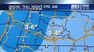
So they have a few accumulation templates lol
-
 1
1
-
-
6 minutes ago, CoastalWx said:
Gfs is a nice Blue Hill to Foxboro look.
Gfs blows 3-5” on kuchie region wide 6” in berks
but i do realize this is war as far as backyard weather
-
1 minute ago, ineedsnow said:
there out of edibles
Looks like they finished them off making that map
-
1
-
Monitoring the 29th/30th for significant impact coastal redevelopment - confidence only medium for now but is trending favorably.
in New England
Posted
You can see Johnston RI has flipped to snow on RI cams