TullyHeel
-
Posts
12,875 -
Joined
-
Last visited
Content Type
Profiles
Blogs
Forums
American Weather
Media Demo
Store
Gallery
Everything posted by TullyHeel
-
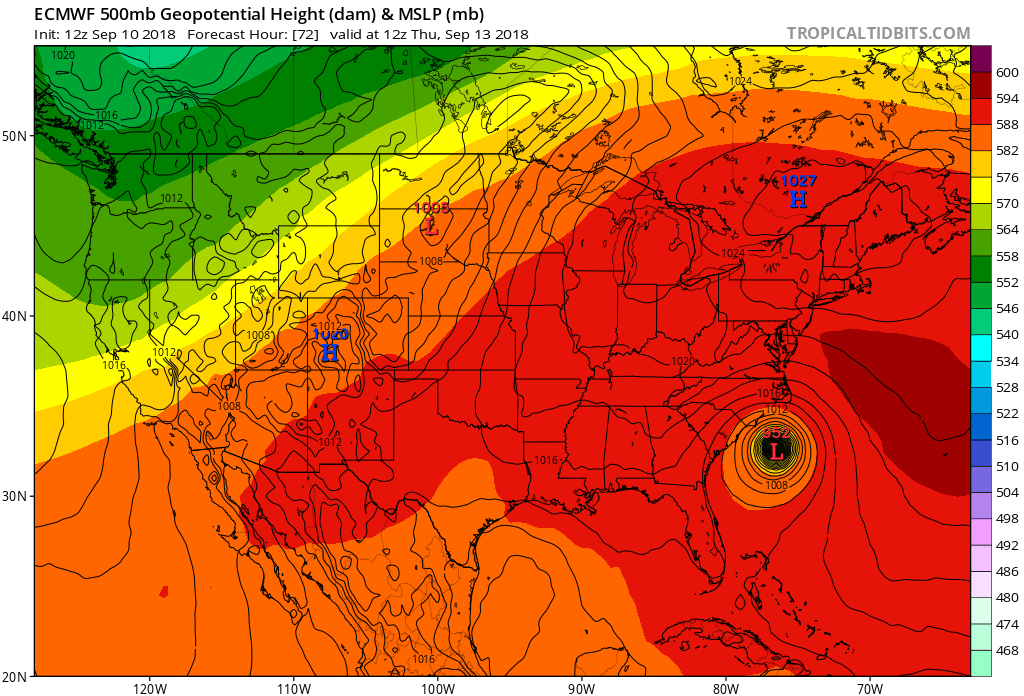
We got control runs, ensembles, means all showing a big storm. Really exciting.
-
Who is ready for Carolina Crusher 2: Snow Boogaloo?!?!
-
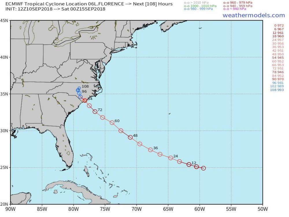
Allan Huffman has landfall still between Cape Fear and Cape Lookout, but move the inland track further south. https://twitter.com/RaleighWx/status/1039497772590878720
-
Personally, I was hoping the last Euro run was on to something with it being farther south and into SC, and Flo wouldn't track over the Triangle. But now this has pretty much crushed that hope.
-
Well, the Euro sure threw a wrench in things. Looked like we were getting a consensus focused on Wilmington to Morehead City, and then the Euro goes south into Myrtle Beach. Madness. God thing is it looks like Flo should take longer to get here, so there is more time to figure out where she will go.
-
Well, I guess coming in at Morehead City instead of Wilmington would be a little better for the Triangle folks. Also looks to be coming in 6 hours later.
-
SC is already closing schools tomorrow. I guess better safe than sorry, but that seems a bit extreme.
-
-
-
I know, but they were both labeled 2 pm Friday. The last update had it as a hurricane then, and this one is back to a tropical storm. I guess they are back to thinking it will downgrade faster once it comes inland.
-
GFS is wandering around drunk this run.
-
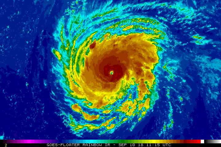
I don't get the back and forth with it having tropical storm force winds or hurricane force winds farther inland. The last update had hurricane forcewinds inland, and now it is back to tropical storm force. Everything I have seen today has said Flo is getting stronger, and could be a cat 4 or 5 at landfall. That to me says the hurricane force winds should be farther inland once it comes in. Very confusing.
-
Yes it is a pretty good spread. But the tightest clusters appear to be between the SC/NC border and Morehead City. Right now that looks like the are to bet on for landfall. Of course, where and what direction she goes after hitting land has a big implication on how bad things will be inland.
-
Stall just west of the triangle.
-
Looks like it stalls inland.
-
Euro coming in at Wilmington.
-
I think somewhere between Cape Fear and Morehead City is a good bet for landfall.
-
-
UK a little NE of the last Euro run. Maybe end up somewhere in the middle of those.
-
Looks like hurricane force based on the latest track from the NHC.
-
Pray the GFS is on to something. Maybe the stronger Flo gets, the better chance it turns out to sea.
-
Looks like Flo is starting to hulk up.
-
Worst possible scenario for the Triangle.
-
They have it as a hurricane farther inland now.
-
I know UNC-Wilmington has canceled class for the week and told the students to go home. I hope the colleges in the mountains like App State, UNC-Ashville, and Western Carolina are going to do the same.