

SENC
-
Posts
892 -
Joined
-
Last visited
Content Type
Profiles
Blogs
Forums
American Weather
Media Demo
Store
Gallery
Posts posted by SENC
-
-
3 minutes ago, NCWX said:
41.7 and moderate rain. Not very windy here,yet.
Your just over the CFMB from Me! Hello partner!
-
Not much change here on the Coast..
Here on the Coast Folks.. (ILM-Carolina Beach)
LIGHT Rain..
Temp(s) 43F Dew of 42F
Humidity 87%
Wind(s) East @ 6mph..
Rainfall (Less than) one inch..
-
Light Rain here on the Coast thus far, EPIC QPF "forecast" is FAILING to "materialize" thus far..
Temp(s) have fallen 2F to 44F with a Dew of 42F..
Humidity 85%Rainfall so far is 0.15"Winds NNE at 11MPH -
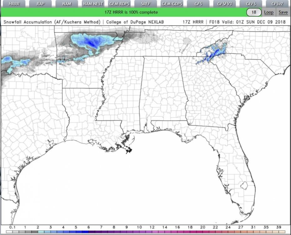
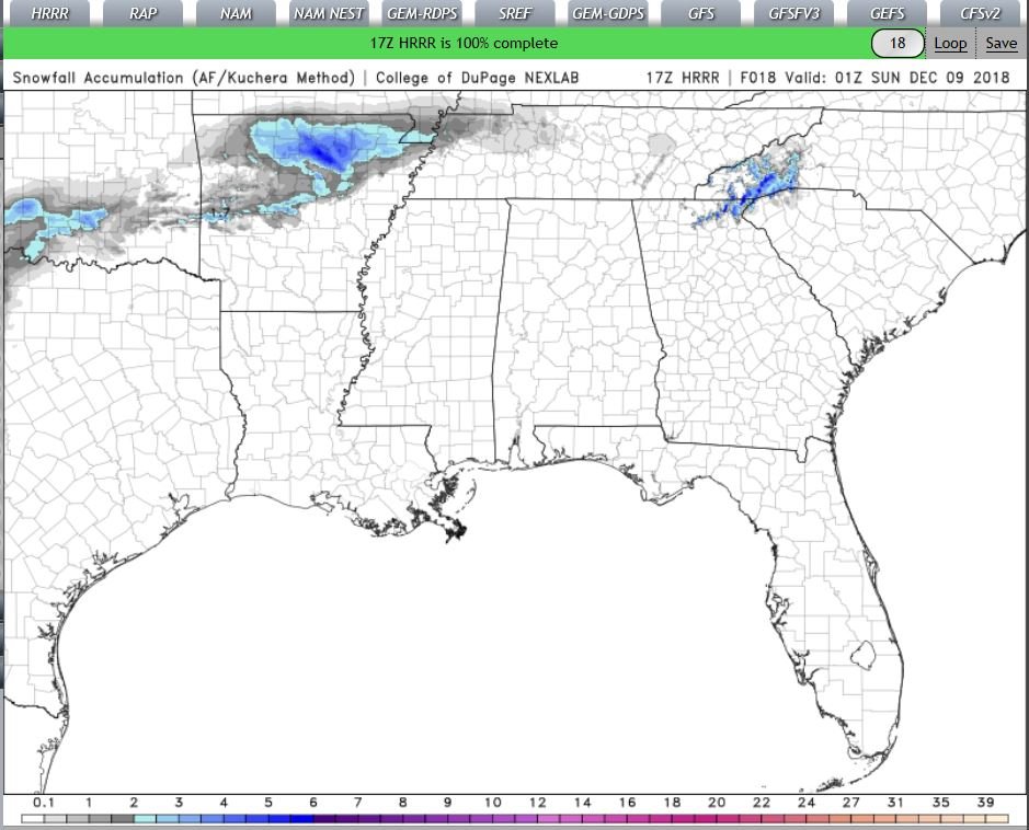
HRRR total snow accumulation is NOT good, 10-1 (Kuch) It just finished..
-
 1
1
-
 1
1
-
-
-
out to 10

-
4 minutes ago, Disc said:
Just something that would make it so we don't have to scroll through a bunch of images, COD allows a GIF to be made so you can post the whole run in one post.
ok like this? trying to figure out the timing part
-
Just now, Disc said:
Just something that would make it so we don't have to scroll through a bunch of images, COD allows a GIF to be made so you can post the whole run in one post.
ok I'll give it a shot..
-
Grit & Mods skip panel 8 and wait a few frames?
-
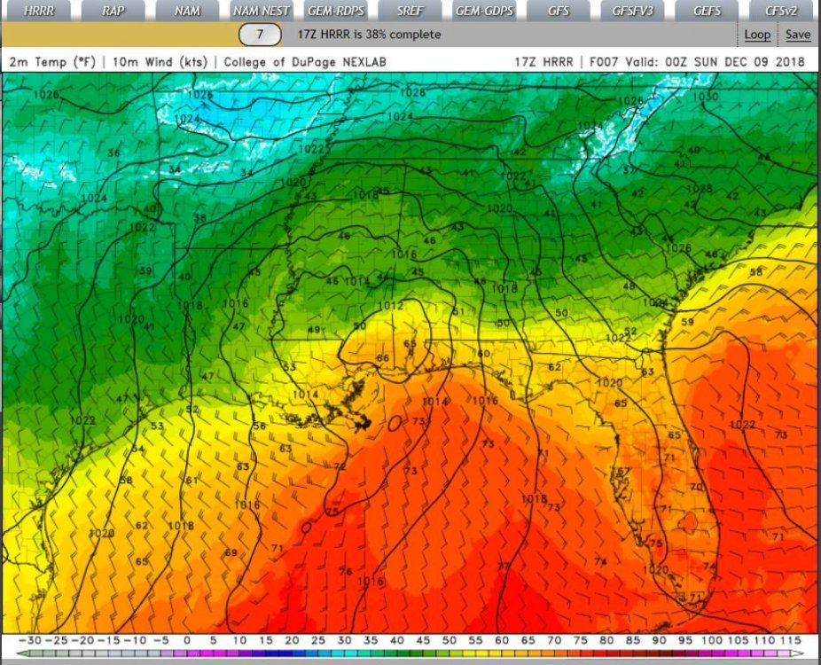
2M temps & Precip panels(next frame)
-
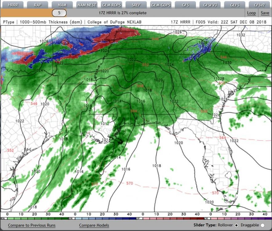
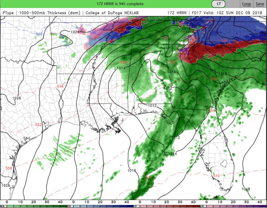
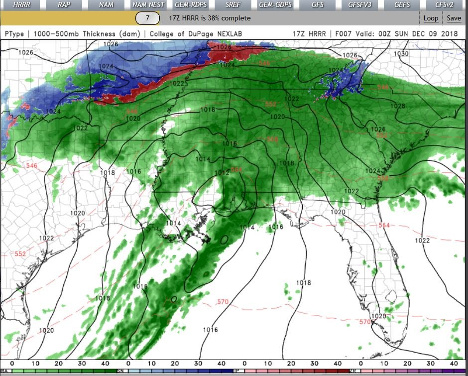
17Z hour 5?
-
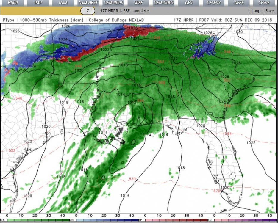
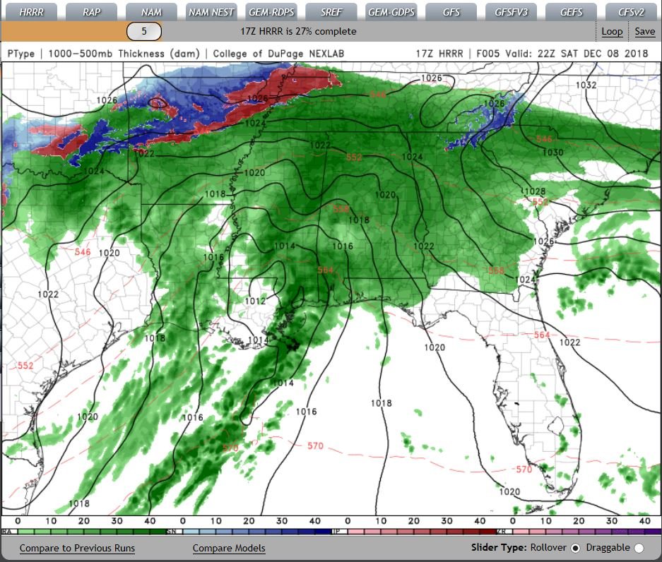
17Z HRRR running.. I'll post as it comes in.. (If it's ok with the crew)..
-
 1
1
-
-
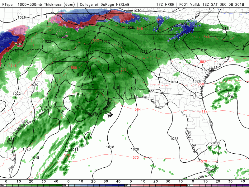
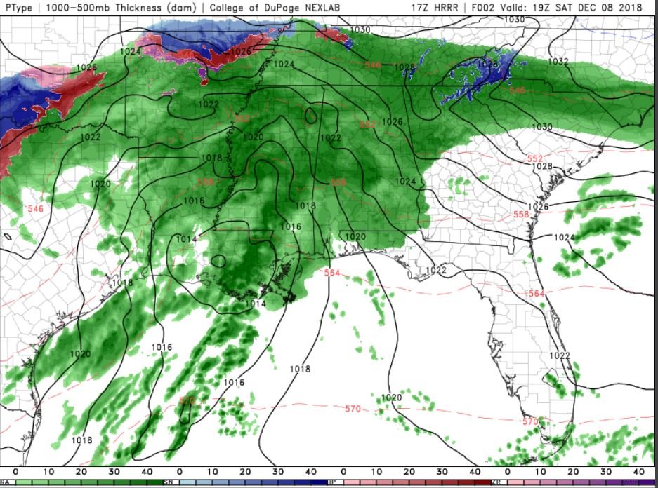
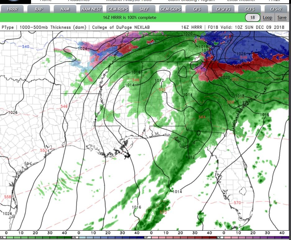
16Z HRRR

-
From the Coast, (ILM) Forecasted High Today was to be 50F,
Light rain, 4 degrees below forecast, setting @ 46F currently, Dew point of 41, Winds barely out of the East @ 2mph.
-
KILM Local AFD finally updated after 3 Days of nothing..
Short term /Saturday night through Sunday night/...
as of 300 PM Friday...wet weather expected through this period
as storm system tracks up and off the southeast coast. While
the NAM was the cooler of the models, still holding to an all
rain event for our local forecast area with wintry mix remaining
just west and north of US through this period.
The column will basically remain saturated through this period
with a significant amount of rainfall expected. The track of the
sfc low will remain off shore as it parallels the Carolina
coast through Sunday reaching offshore of the Cape Fear coast
sun evening. This will maintain stiff cool north-NE winds at the sfc
while a moist onshore flow increases above the sfc, with a more
SW flow in the mid to upper levels as shortwave digs down into
the southern states. Overall expect increasing isentropic lift
to drive widespread rain across the area. The best dynamic
cooling will come Sun morning as low tracks across northern FL,
but still looks like local area will remain in all rain. The
overall thermal profile points to all rain throughout our local
forecast area at this time, but the coolest NAM forecast points
to possibility of some mixed pcp Sun morning. The NAM sounding
for lbt Sun morning shows a decent shallow cool layer below 2k
ft and warm nose drops toward 0c for a few hours, but the
grounds will be wet and warmer and do not expect any impacts at
this time. The best chc of seeing any mixed pcp will be in the
far western reaches of Marlboro and Robeson counties.
Expect periods of moderate to heavy rain at times with rainfall
total 2 to 3 inches with possibly greater amounts, especially
along the coast. The main impacts of this storm will be
widespread rainfall, coastal flooding, river levels rising, and
marine hazards. The coastal flooding should occur during Sunday
morning's high tide, with potential for minor to moderate tide
levels. Rivers will rise during this period, with potential for
minor river flooding into early next week. Not expecting any
flash flood problems at this time as rainfall should be steady
and ground is not saturated from any previous rainfall.
Although we are not expecting any wintry mix impacts in our
local area, the temps will be running between 35 and 45 for much
of our area through this period, producing a cold rain. The
brisk northerly winds will make it feel even cooler.
&&
Long term /Monday through Friday/...
as of 300 PM Friday...as low pressure lifts off to the
northeast Monday, shortwave energy will dig down around the base
of mid to upper level trough over the southeast. The models are
hinting at low pressure developing off the southeast coast Mon
night which should hold onto clouds and pcp a bit longer, as it
wraps around the back end of the low. This will coincide with
decent cold air advection. Therefore some flurries or snow showers are not out
of the question Mon. Temps will not rise past the 40s most
places on Mon in cold air advection with temps remaining cool through mid week
as high pressure builds in on the back end of the low. …..Post a lot of Pictures Our upstate Folks! My Step=Daughter is in Pinelevel (just southEast of Raleigh), With Her GF currently, I told Her expect a "pastebomb"..
-
@Orangeburgwx& I are all set I think..

-
1 hour ago, Orangeburgwx said:
My current DP is dead freezing... Right at 32
My current Dew point is @ 31F..
-
7 minutes ago, Jonathan said:
We'll bathe in your NC tears come Monday.
 Enjoy your sleet.
 ")
that's just,, cruel, frozen sweat, I mean sleet, Sweating frozen sleet & Swearing,,, I mean sleet, (YOU know what I mean!).. While crying ice cubes!
 Lets have another one..
-
13 minutes ago, beanskip said:
Very strange run. Almost like somebody jostled the map of the US and everything got shifted south. Temps looked good until the end when 850s pooped out at 72 hours. I don’t know — odd.
Even I got snow that run..

-
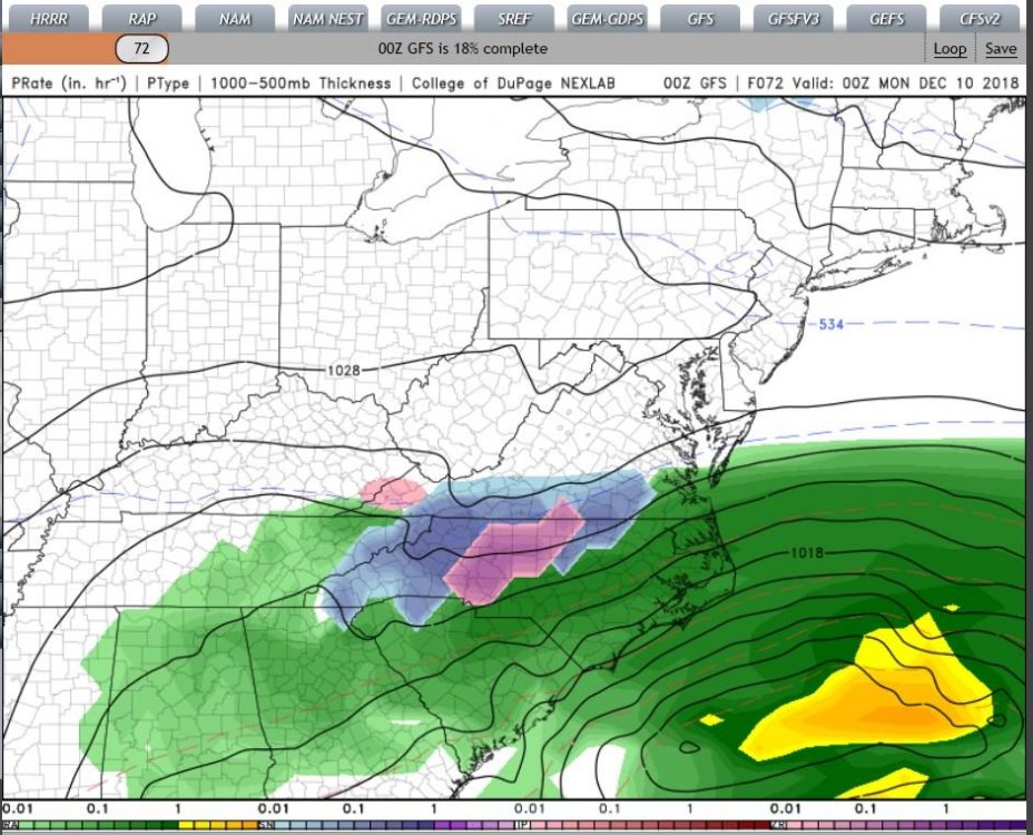
GFS out too 72
-
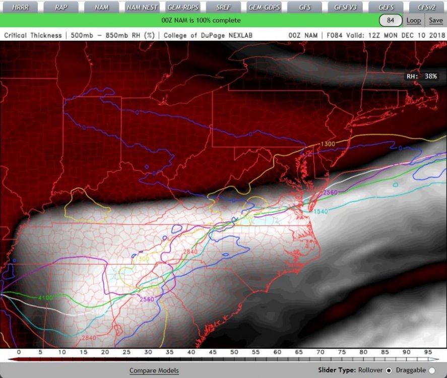
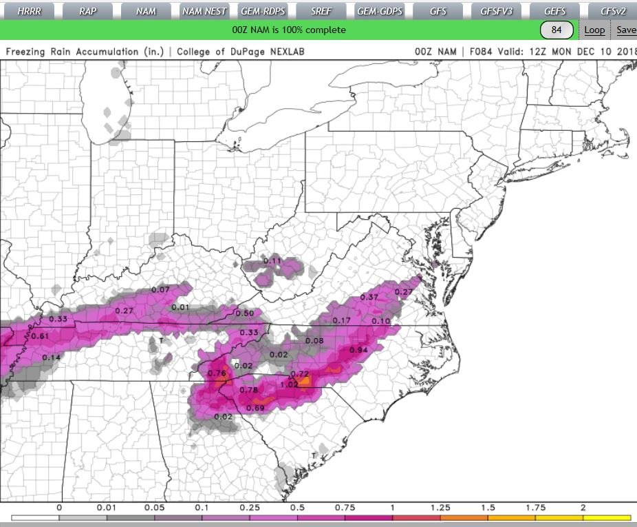
Critical thickness out to Hour 84..
-
NAM (freezing precip).. Out to hour 84

-
2
-
-
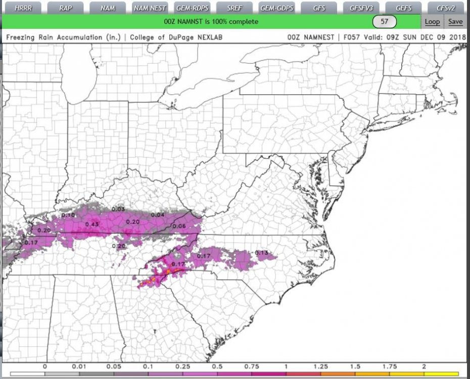
freezing rain profile.. out to 57, ,, I'm just trying help ya'll folks out here.. Honestly.. use these in addition to the Maps posted above..
-
 1
1
-
-
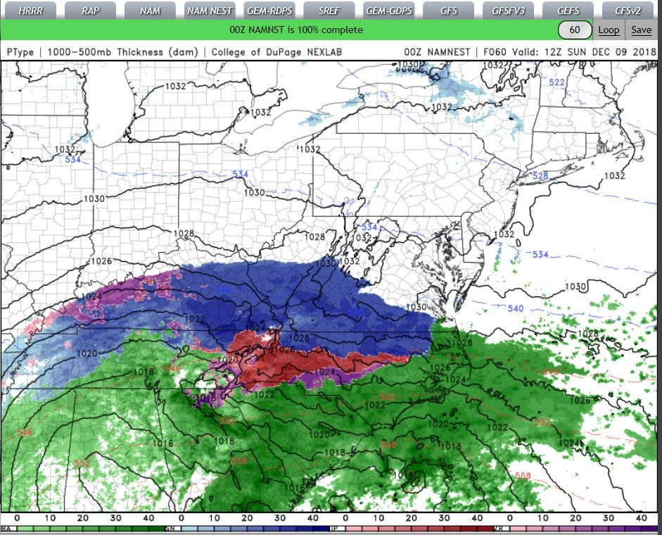
Namnest out to 12Z (60hours)..

-
1
-


December 8-10 Winter Storm Obs
in Southeastern States
Posted
30+ years here,, again hello, Maybe we can meet up for coffee & biscuits(s) one Day? (Or a beerski)..