
TriPol
-
Posts
1,472 -
Joined
-
Last visited
Content Type
Profiles
Blogs
Forums
American Weather
Media Demo
Store
Gallery
Posts posted by TriPol
-
-
56 minutes ago, bdgwx said:
The winters of 12/13 and 13/14 were La Nada.
Is it me, or are there more El Niños and La Nina’s than La Nadas?
-
On 7/24/2024 at 12:08 PM, Stormchaserchuck1 said:
Since 1998, we have had 14 La Nina events, and 8 El Nino events. This heavy skew with La Nina conditions may even be keeping the global temperature down some over the past 20 years..

When was the last time we had 2 or more years straight of La Nada?
-
7 hours ago, Stormchaserchuck1 said:
That 60W/20N is a big climo spot. Storms that pass NE re-curve >90% of the time. CV Storms that pass SW of it re-curve vs hit land 60/40.
Models do have a -EPO developing when the storm is getting close to the EC, and that favors more of a troughy pattern, so I would right now probably favor a turn out to sea, but if it tracks so far south as to the Caribbean first, it could stay clear of the EC trough, but I don't see the pattern as favorable for SE US or NE, US hits.
Maybe a new found land special?
-
 1
1
-
-
If a La Nina is scheduled to develop, we might have a late tropical season. Should be interesting to follow.
-
Just got woken up by some LOUD thunder near Morristown, NJ!
-
She's finally lost major hurricane status. FINALLY.
-
165 mph winds. WOW.
-
 1
1
-
-
-
Who ordered the tropical storm??
-
2 minutes ago, Allsnow said:
Last year it rained 1.5 inches every other weekend. It’s ok to be dry for a while.
-
 1
1
-
 1
1
-
 1
1
-
-
This feels like the coolest spring we’ve had in a while. Sure, we’ve had a handful of 70s and 80s, but most of it has been 50s.
-
1
-
-
When does the warm spring air come in again? Sick and tired of hovering around 40 each night.
-
1
-
1
-
-
How much rain are we supposed to get yet again??
-
On 4/8/2024 at 1:24 PM, MJO812 said:
The last few days with the earthquake and now the eclipse have been more exciting than the last 2 winters combined.
NYC hasn't had a good winter since 2015 - 2016.
-
The next time a solar eclipse will be visible in New Jersey or NYC will be 2079. Get out there and enjoy it!
-
Nature tends to balance itself. For years we were dry and in a drought. That drought has ended and we have a surplus of rain, but little snow. Soon we will have a surplus of snow and we will have to wait until May for it all to finally melt.
-
1
-
 3
3
-
2
-
-
Man am I glad we're getting these rains to beat the drought that was here in the Autumn/Winter...
-
2
-
-
I'd rather have a warm spring and a cool Summer than a cold spring and a hot summer.
-
1
-
-
Could hit 70 on March 1 next week in NYC.
-
1
-
-
2 hours ago, LibertyBell said:
if the SSTs are the reason for it, it's not a cycle, because we are in completely uncharted territory with SST this warm.
In the years we have major snowstorms, the Mets always go to the playoffs. I'm not looking forward to this season.
-
2
-
-
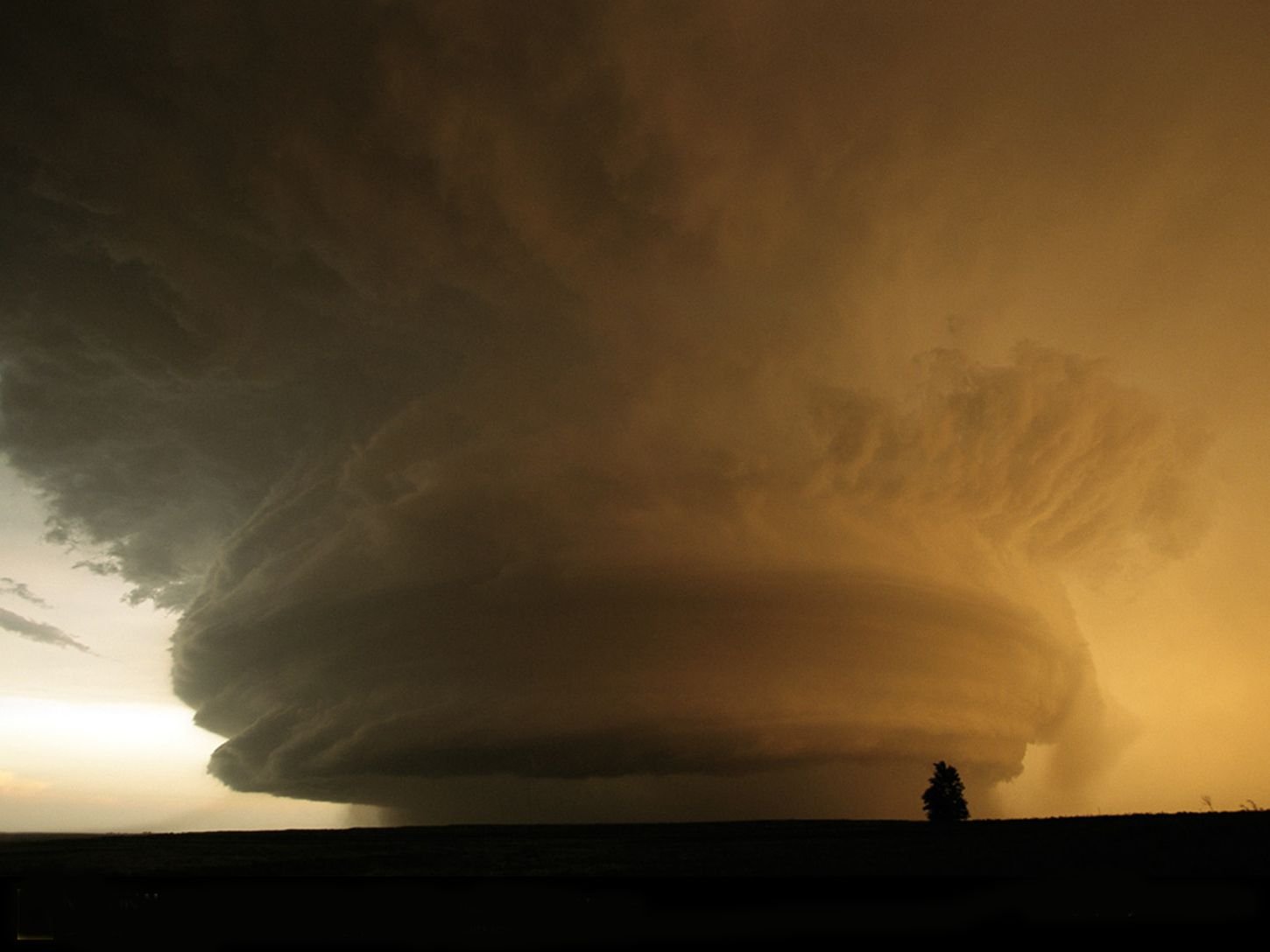
I'm interested to learn when the El Nino will transition to a La Nina -- what kind of impact will that have on tornadoes this season?
-
3 hours ago, snowman19 said:
The fat lady is standing at the mic and she’s warming up her vocal cords…..
There's ALWAYS a storm to chase toward the end of February/Beginning of March. ALWAYS. Every year.
-
1
-
1
-
-
As long as it's not this wet slushy crap we just got.
-
Winter Storm Warning NYC
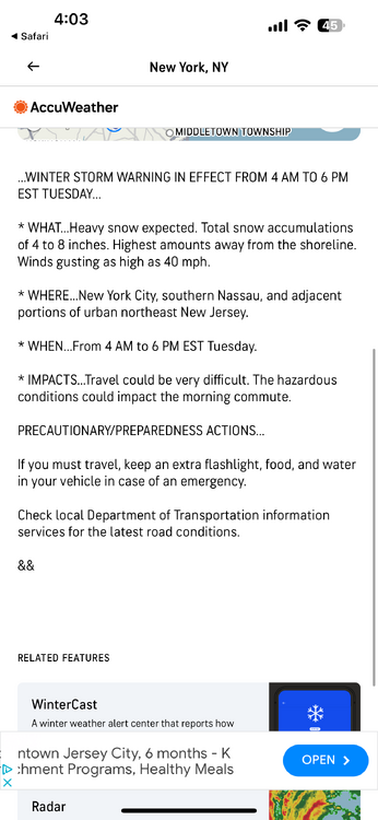

August 2024
in New York City Metro
Posted
Looking good for NE NJ!