
TriPol
-
Posts
1,370 -
Joined
-
Last visited
Content Type
Profiles
Blogs
Forums
American Weather
Media Demo
Store
Gallery
Posts posted by TriPol
-
-
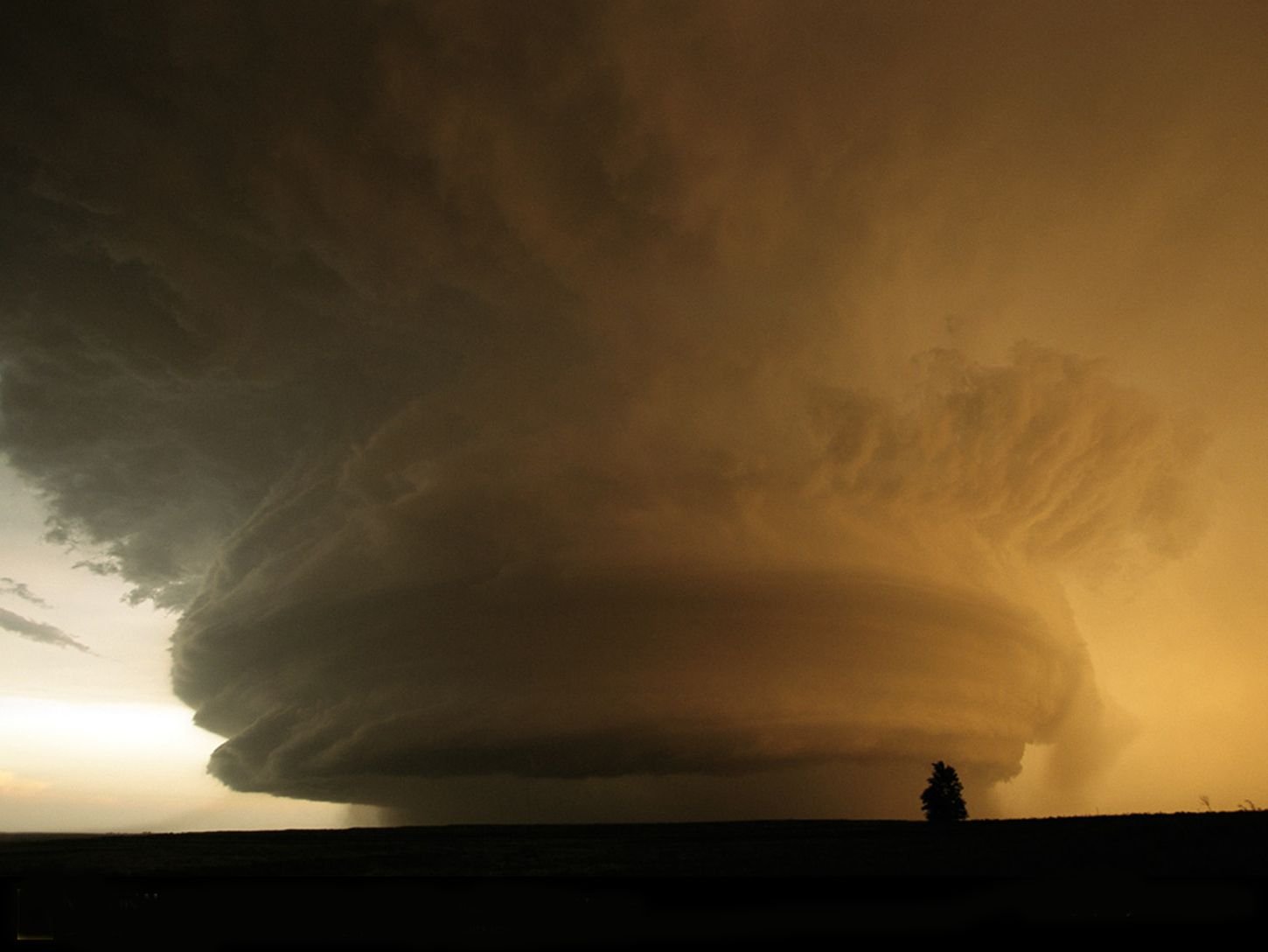
Holy hell those winds are something out of a movie.
-
I just don't understand where alll this rain is going to go go to. We've had 2-4 inch rainstorms almost every week since September. I cannot imagine getting yet another storm like this. Yes, the winds are going to be bad and there will be Hurricane Gloria level power outages on LI, but I'm extremely concerned about the flooding potential with this, especially since it's going to melt all of the snowfall from the past week. I just don't understand how this isn't a bigger story.
-
Heavy wet snow here at the Giants game. Nothing accumulating on the ground.
-
29 minutes ago, North and West said:
I drove past 287 yesterday.
.Mazal tov.
-
 1
1
-
-
The GFS is warm and weak. The EURO is colder and stronger. Oh no, the GFS is colder the EURO is warmer. Ah, they’re both too warm. The low is too far east, so it’s suppressed, now it’s too far west and I87 isn’t safe. 4 days out it’s nowcasting time. In a way, I didn’t miss not having something to chase, because of the model chaos. Everything was going fine until someone invoked March 2001. That storm should be banned from ever being mentioned.
-
 2
2
-
-
I don’t think nyc sees its first inch of snow yet. Too warm.
-
1
-
-
If we can push off this storm for 12 hours, we could get a helluva Giants game.
-
3 hours ago, NittanyWx said:
As discussed, the 6th-7th window is the one opportunity I dont totally dismiss regarding snow chances. Still need a few things to go right to make it happen, but some HP in east Can is helpful. You need to amp this some, but a deep bombing coastal low probably overwhelms marginal HP help for most in the area.
Weekend rule in effect…
-
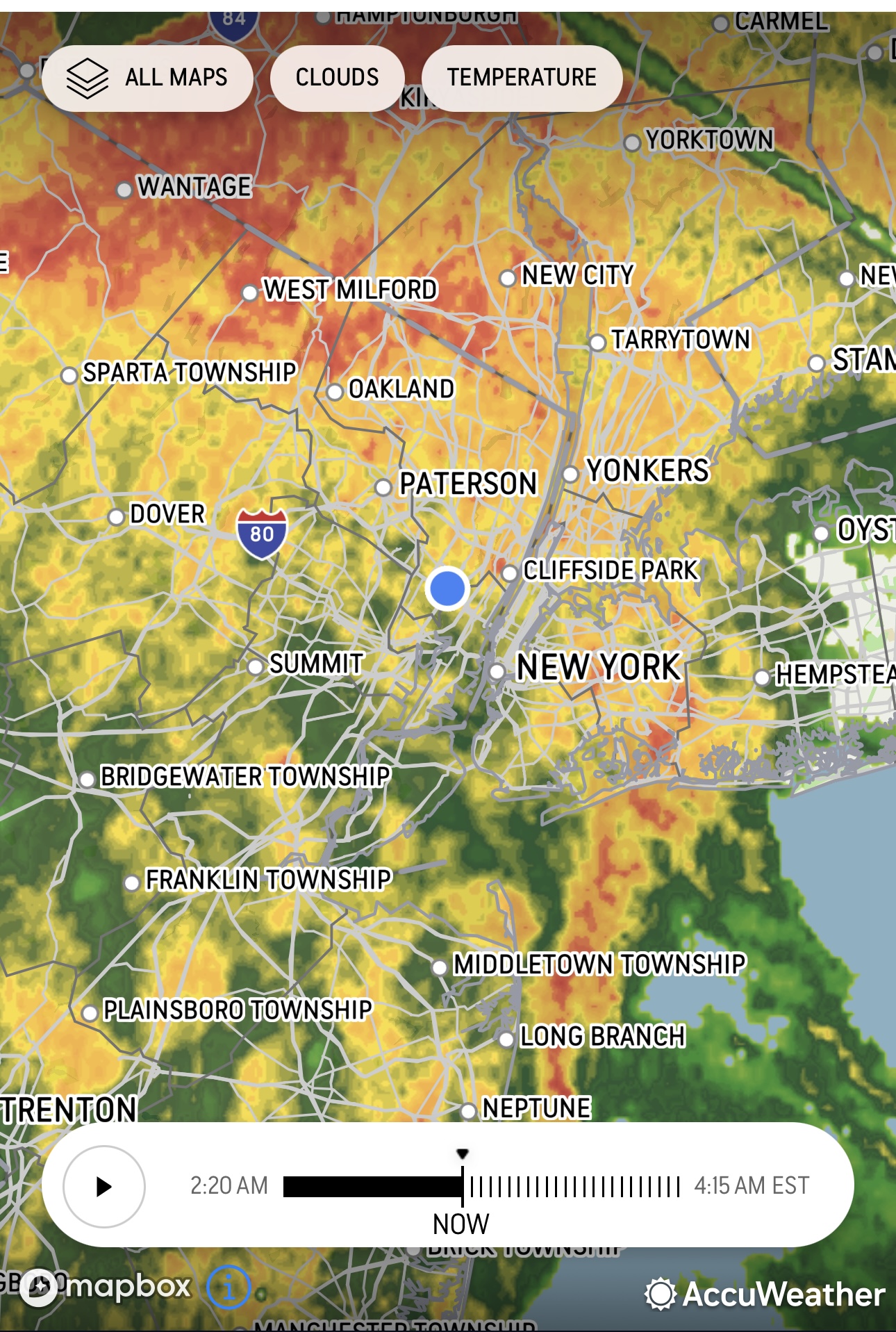
The northern part of the area is covered in reds and yellows.

-
2 hours ago, Wxoutlooksblog said:
Here is the problem as I see it. While we've experienced lots of precipitation due to the almost tropical moisture accompanying storms which have hooked to our west our cold or modified cold outbreaks have been extremely transient and very short-lived. And when it's cold, it's dry. Storms are major super-moist lots of intensity with high winds and flooding and occur about every 7-10 days. Even though precip amounts are way above normal, it is NOT a stormy pattern historically for late December going into January. A stormy pattern over this time is an event every 3 days. When was the last time we got significant precipitation from a storm sliding under us with a cold HP to the north or n/w?? There are some red flags waving for the likelihood of the cold snowy winter forecasts most outlets have come up with. Even today's better looking maps which tend to be over 300 hours away do not show a ridge out west. Yes there's the split flow, but there's never cold HP locked in place when a low moves into the Plains and towards the east. Rather HP slides east of New England the low pressure curves northward and we are doused with heavy rain. I think this pattern of cold/dry alternating with warmer/wet will probably last into mid January at least and maybe longer. Then you look back at late starting winters here. Which ones are memorable? 1978 is the most notable. But I gotta say, there was fierce cold air pouring into the northeastern U.S. that year from November 1977 into December 1977 with several nights dropping well into the teens. We are struggling to get temperatures into the 20s this year. I'm just uncertain that what we'd like to see is going to happen this time.
WX/PT
The 20s in this climate are worth as much as the teens were in the 1970s. NYC just can’t get that cold anymore.
-
1
-
-
4 hours ago, Allsnow said:
The snowbirds will be cold in Florida

Rolling blackouts in Tampa!
-
1
-
-
Want there that Norlurn over LI back around this time in 1988?
-
Wait… is it not going to rain this weekend? It rains every weekend. Since September. It’s not raining this weekend??
-
1
-
 2
2
-
-
As afraid as we all were for the wind and rain, the area bore the brunt of the storm well. Mass transit was a mess, but besides that, no major issues.
-
Just now, steve392 said:
A lot of the heavy precip seen further west. Has it trended further west?
Ah, yes. The obligatory "It's further north, east, south, west than originally modeled" post.
-
1
-
-
1 minute ago, the_other_guy said:
The first circle is you in Hoboken.
The second circle is the storm 400 miles away.

Good thing Hoboken never floods.
-
4
-
-
3 minutes ago, BoulderWX said:
Already seeing 4-5” areas in SC under training 40/50 Dbz Bands. Wouldn’t be surprised if someone sees a foot from this storm
But upton said only 2-3 inches!
-
1
-
-
Already raining hours earlier than expected. Coming down nicely.
-
7 minutes ago, the_other_guy said:
I just flew through the storm into Orlando. In terms of big storms, really not too bad. Some light turbulence. No moderate.
A constant, steady, wind swept rain in Orlando currently. But nothing down here is flooded in terms of roads or airports.
Well it’s a good thing the storm isn’t forecasted to strengthen or anything!
-
1
-
1
-
-
Flash flood watch, high wind warnings everywhere according to the GFS. This is going to be a storm to remember.
-
13 minutes ago, Stormlover74 said:
This is not Ida
Not saying it is. I'm saying Upton is consistently conservative and it comes back to haunt them.
-
4 hours ago, uofmiami said:
The NWS did this to us once. They said "Oh, no big deal. just a couple inches of rain." Then Manhattan got obliterated with 6 inches of rain in 2 hours. We are going to get hit hard and Upton, as per usual, is going on the conservative side.
-
I don’t care about the warm weather right now. There are… 1… no 2…. hurricane strength storms about to hit us? Up to 10” of rain in a week from them both? That’s some MAJOR flooding!
-
1
-
-
1 hour ago, North and West said:
Exactly. Mild, boring, and tranquil doesn’t get it done.
.Tranquil? The city is about to get drenched with 2-3 inches of rain. I believe someone mentioned that it would be dry in December last month because we already received 40 inches of rain.


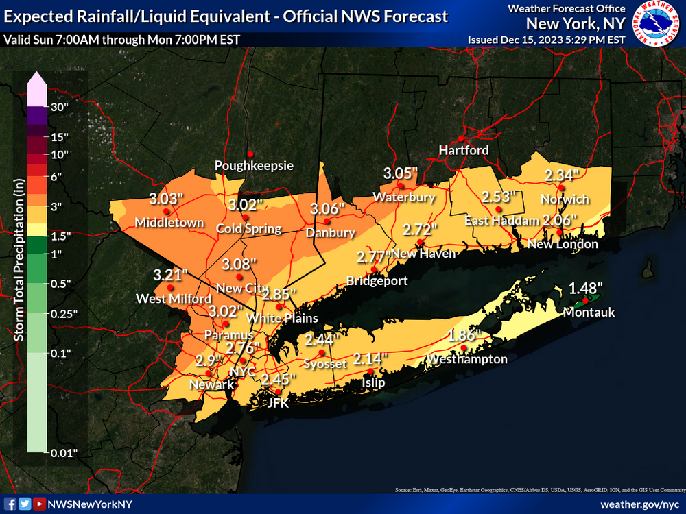
Two Mdt to high impact events NYC subforum; wknd Jan 6-7 Incl OBS, and mid week Jan 9-10 (incl OBS). Total water equiv by 00z/11 general 2", possibly 6" includes snow-ice mainly interior. RVR flood potential increases Jan 10 and beyond. Damaging wind.
in New York City Metro
Posted
This would be an incredible squall line in July. For January, it’s unbelievable.