
TriPol
-
Posts
1,892 -
Joined
-
Last visited
Content Type
Profiles
Blogs
Forums
American Weather
Media Demo
Store
Gallery
Posts posted by TriPol
-
-
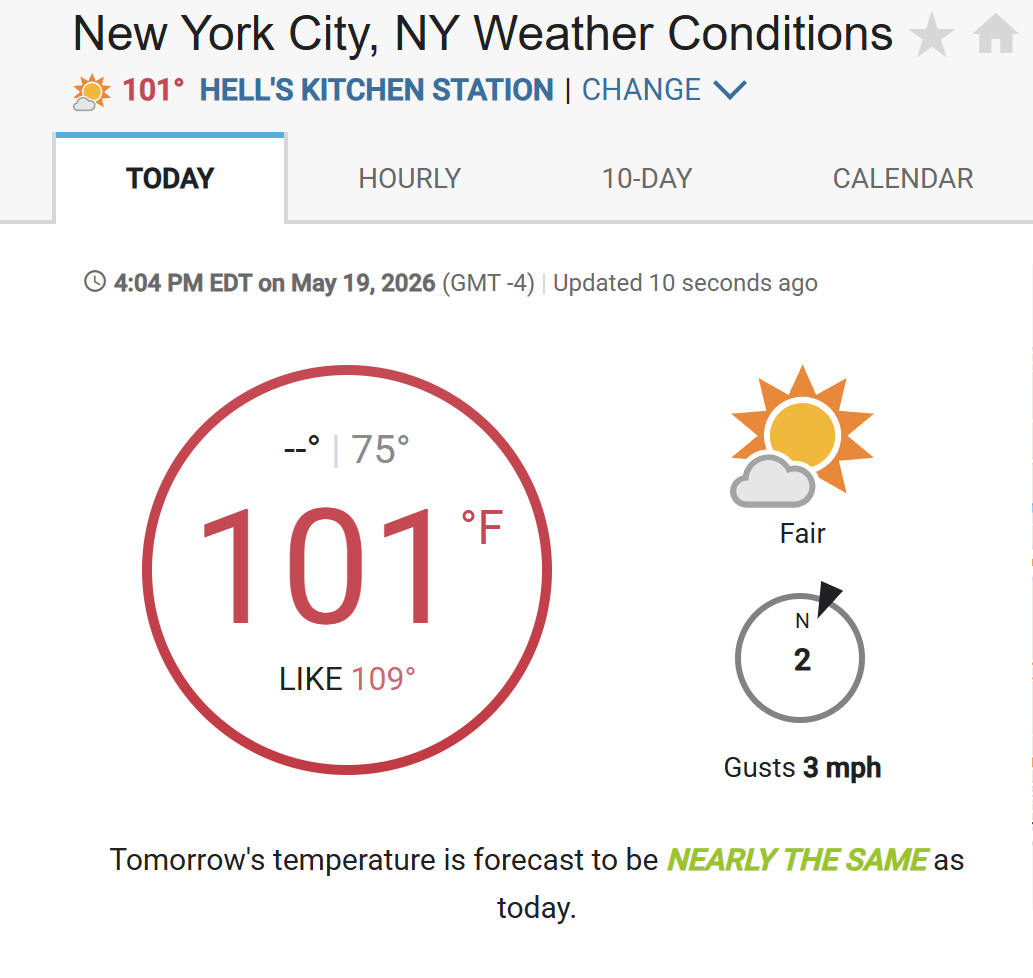
What's this talk about NYC hitting over 100 degrees by Friday??
-
 1
1
-
 1
1
-
 1
1
-
-
NYC is really hyping storms for tomorrow.
-
16 hours ago, Stormchaserchuck1 said:
Models continue building a Strong Aleutian ridge in the long range
Save it for October!
-
7 hours ago, WeatherGeek2025 said:
18 more days and days start getting shorter @MJO812
If we get a Super, record breaking El Nino for autumn 2026... we could have an amazing fall foliage year.
-
1
-
-
Can we please keep this weather for the rest of the..... century? Highs in the low to mid 70s. Lows in the low to mid 50s. It's just perfect.
-
5
-
-
I for one am ready for lows in the 40s and highs in the 60s with perfect sunshine
-
1
-
-
I love living in Arizona.

-
Yikes. Hope this doesn't pan out.
-
 2
2
-
-
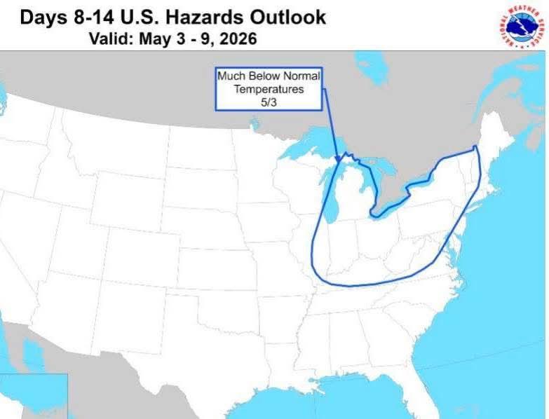
Is there a potential frost on tap next weekend? Can't think of a worse time for farmers who have been hit hard this spring.

-
1
-
-
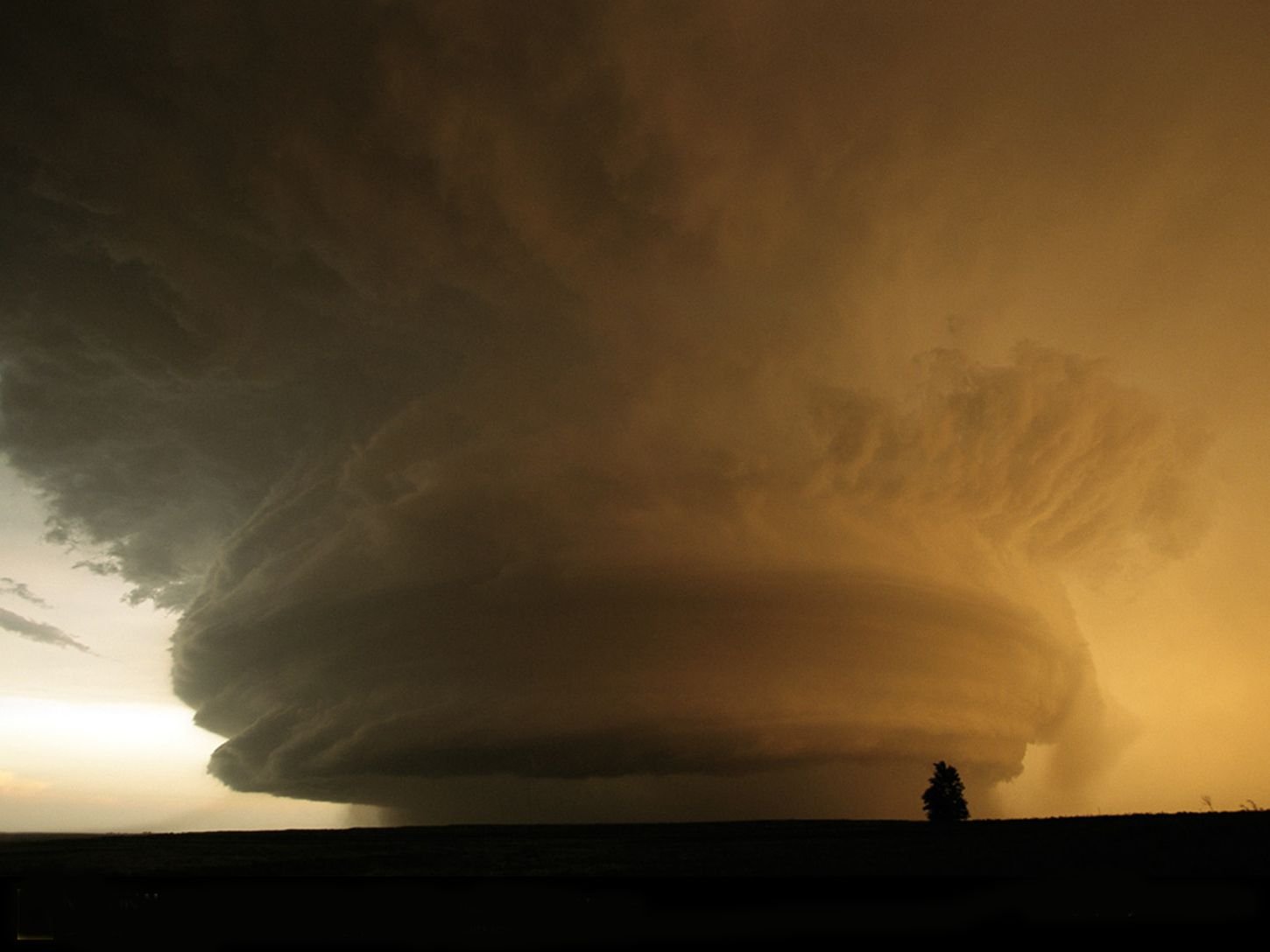
Not NYC related, but holy crap... Oklahoma got destroyed. Haven't seen a tornado that scary in a while.
-
Well, it looks like the Hudson River isn't frozen over anymore.
-
 1
1
-
-
43 degrees. Chilly.
-
10 hours ago, WeatherGeek2025 said:
today's weather sucks. If it's not going to snow, can we get some warm weather man
I never thought I'd see the day where YOU of all people cheer on warmth.
-
1
-
-
Looks like we're gonna get some rain this week. April showers bring May flowers and all that.
-
1
-
-
70 degrees on Thursday! Can't wait!
-
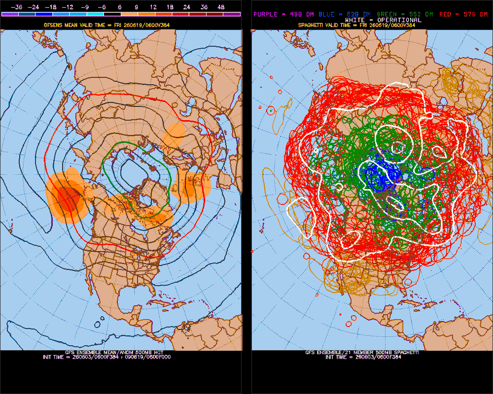
18z 384 hr. GFS says winter uncanceled! 4 feet of snow possible for NYC just in time for tax day!
-
 3
3
-
1
-
-
If NYC can catch the beginning of a transition from ENSO neutral to a developing Super El Nino when it's cold... boy that winter would rock and roll for us. Constant threats of KU storms. It would be a winter Weenie's dream come true.

-
1
-
-
Who ordered the hurricane in March?
-
1
-
-
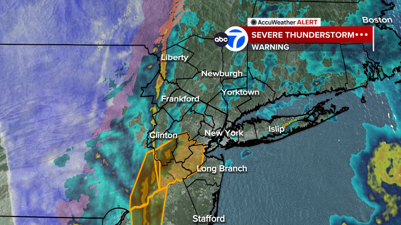
Cool radar shot from Channel 7
-
4 hours ago, Santa Claus said:
just not enough CAPE Monday but i bet there’s at least one NJ tornado
Oh please. Spare me another EF-0 or EF-1 little whirlwind.
-
7 hours ago, WeatherGeek2025 said:
big thunderstorms and lighting sounds like the end of the world!
Interestingly enough, the end of the world won't happen with thunderstorms. It will happen when this planet is too warm to sustain life due the sun's increase in size.
-
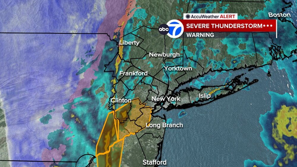
Is that... a severe thunderstorm warning less than 24 hours until it snows? I love Spring!
-
New York City B+
I would have really liked for that blizzard to make a move even 25 miles north and west. NYC would've gotten some amazing, record snow.
-
Enjoy the warm weather guys. May we reach 80 degrees quickly!
June 2026
in New York City Metro
Posted
Definitely hear the hail