-
Posts
2,639 -
Joined
-
Last visited
Content Type
Profiles
Blogs
Forums
American Weather
Media Demo
Store
Gallery
Posts posted by hlcater
-
-
47 minutes ago, Windspeed said:
Michael had sub 940 mb pressure readings for nearly 8 hours prior to landfall. Think about that. Before anyone should have to defend the official intensity statements, it would seem to me someone would need to explain their hypothesis against the meteorological fact above as to how in the hell maximum sustained winds never exceeded C2 at landfall. I don't care that we've yet to have an official or unofficial anemometer reading analyzed. There are way more logical explanations for the latter.
What’s interesting is that there’s 2 camps to the argument here. 1 camp is arguing that a C5 was justifiable based on the recon data just prior to landfall and the other is saying Michael was only a C2. The only plausible reason I can think of that would allow these ideas to coexist can only be summed up as “humanity.”
-
 1
1
-
-
Let us remember this excerpt from then Subtropical Storm Leslie Adv 1 all the way back on September 23rd:
QuoteADVISORY #1 ...SUBTROPICAL STORM LESLIE FORMS IN THE NORTH ATLANTIC... ...FORECAST TO BE A SHORT-LIVED CYCLONE..."
Yea that didn't really pan out well. To make things worse, Leslie has had like 25 aces up her sleeve since then, the NHC just cant pin her down. GFS proceeds to keep Leslie alive through FH240 on the 00z.
-
 3
3
-
 1
1
-
-
-
I’d be okay with this active pattern running into December/January to be honest. However, didn’t someone say that wet falls tend to lead to drier winters? Maybe it was cold falls lead to warmer winters. It was some sort of inverse correlation like that.
-
Solid sounding at 18z near Williamsburg with exactly 0 means for initiation. Nice.

-
 1
1
-
-
1 hour ago, cyclone77 said:
Very nice! Was thinking about heading up to Wisconsin in about 3 weeks when I'm on vacation to shoot some foliage pics. Looks like it may be too late by then as things appear a bit ahead of schedule. May have to slum it and find some place in this area lol.
The Driftless Area in NE IA and SW WI might be a good bet. Plenty of deep cuts and valleys with very picturesque streams its very heavily forested as well.
-
 1
1
-
-
-
Our rivers are still flooded at several gauges. We can't handle another deluge.
-
 1
1
-
-
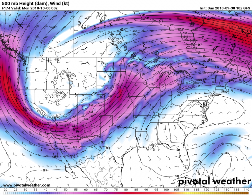
I like the look of next weekend, particularly the look the GFS is advertising. Both the GFS and the Euro have a seasonably strong trough coming into the west with a 60-70kt 500mb jet over mid/upper 60s dews across much of the plains. Sunday looks to be the biggest day as of right now, but things are going to change. Even then, going off the pattern alone, some sort of severe weather looks probable.
-
Sounds like the EC is gonna get off hour cycles coming up here soon. Awesome!
-
 1
1
-
 1
1
-
-
57 minutes ago, nwohweather said:
Sun for the last few hours just south of Toledo. I really am quite concerned with how this is unfolding that we’re going to have a serious situation this evening. The way that shortwave is moving in, combined with CAPE at the surface of 2000 j/kg this has all the makings of a mini outbreak this evening
Better preemptively seek shelter now before it’s too late.
-
 2
2
-
-
1 hour ago, hawkeye_wx said:
My garden really took a beating. One of my big hummer plants was partially broken and another was snapped off near the base. There may be more damage once I more closely examine the garden. Little bits of tree debris are strewn across the yard, with a few bigger pieces mixed in. A neighbor lost a 4.5" limb off one of his trees. I was expecting the severe wind to come from the west, but it oddly came more from the south, which was bad for my garden.
This might be(and probably is) totally wrong, but the little mesovortex that tracked over Cedar Rapids might have changed the wind direction to southerly(towards it), especially for the area immediately to the south and east of where it tracked, you’d fall into that pool. Down in Iowa City, it was northwesterly, as expected. Probably about 50mph in magnitude here.
-
The Caribbean as a whole has been pretty unfavorable this year. Not holding my breath.
-
 1
1
-
-
-
Just now, mempho said:
The flow at the surface would get stalled but that would not stop the fresh supply of warm waters at deeper layers which will get mixed out via upwelling.
Sent from my SM-G950U using Tapatalk
But the point I was trying to make is I don't think that happens at a fast enough rate such that it outpaces the speed of upwelling, especially for a storm the size of Florence.
-
 1
1
-
-
2 minutes ago, NJwx85 said:
Would stalling over the gulf stream like Florence seemingly has reduce the risk for upwelling since there should be a constant NE flow of fresh warm water?
Probably not. I don't think the NE flow of water is fast enough/deep enough to counteract upwelling. But I agree that the inner core has actually gotten its act together rather well. I doubt it intensifies much, but it'll probably at least hold serve
-
13 minutes ago, StormChaser4Life said:
Curious to see an updated microwave image. To see if an EWRC is occurring with those concentric eyewalls present
Given the large size and Levi’s most recent video, it probably won’t consolidate a single true eyewall anymore. It’s essentially a bariatric hurricane. Too large and overweight to the point it’s causing detrimental effects to the health of the storm.
-
Looks like things got pretty spicy in here.

-
 1
1
-
 2
2
-
-
15 minutes ago, csnavywx said:
That last recon pass - wow. There's like 3 cocentric eyewalls and a big stripe of hurricane force surface winds like 80-100 miles away from the center. Still obviously a decaying inner eyewall too. The center "calm" area has grown to 60-70 miles wide. The wind field has grown too big to strengthen quickly unless that big second eyewall can consolidate a bit and rob the rest of the wind maxima. Bottom line, the size is likely to continue growing, even if the max winds really don't.
I dont think the eye is 60-70 miles wide. It may look like it is, but recon did a little loop inside the eyewall. Unless that wasn't what you were using to judge size. Does anyone have a vortex message?
-
1 minute ago, jpeters3 said:
Looks like 15-20 kt. Look at the top plot, which shows the 200-850 hPa wind difference averaged an area centered on the vortex.That looks like an old analysis as it hasnt updated thru 9/13 00z. Looks like from midday or so.
-
-
There has to be some poorly analyzed shear impacting florence, it's had problems getting anything going to the SW of the core all evening. Until this is fixed, florence should struggle to intensify much.

-
 1
1
-
-
1 minute ago, hawkeye_wx said:
The SFMR data during the first pass was not very impressive. Even the ne quad only showed 105 kts.
I wonder why this is? Satellite presentation(after taking a dump late this afternoon) has been improving this evening. Even the morning recon when the storm was still in an EWRC and the sat. presentation was worse still had more robust winds. I'm very confused to say the least.
-
1 minute ago, friedmators said:
Typical ERC progression no? Pressure first then winds
I think this has less to do with the ERC and more to do with the fact the SW quad has been pretty beat up the past 4-6 hours.


Michael Banter Thread
in Tropical Headquarters
Posted
I’m talking in the grand scheme of things. There’s definitely 2 camps on Twitter.