BGM Blizzard
-
Posts
1,676 -
Joined
-
Last visited
Content Type
Profiles
Blogs
Forums
American Weather
Media Demo
Store
Gallery
Everything posted by BGM Blizzard
-
 Shifted south a decent bit from 12z but plenty of room to spare on that front. Keeps the mix line south of NYPA line.
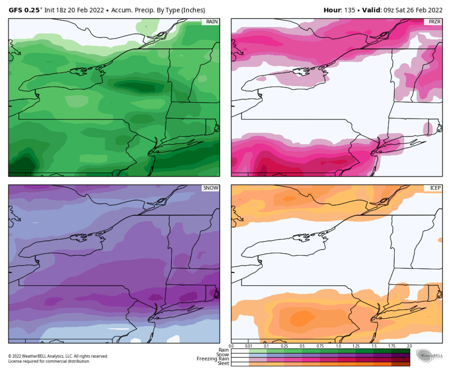
-
Yeah start time Thur evening, so 4-4.25 days. Thought they'd add this storm to the HWO with the afternoon update, but they left it out. Think they are focusing on the mid week storm moreso for now.
-
12/18z NBM
.thumb.png.1dff7e5ade9aba2063254358b1dff005.png)
-
BGM
-
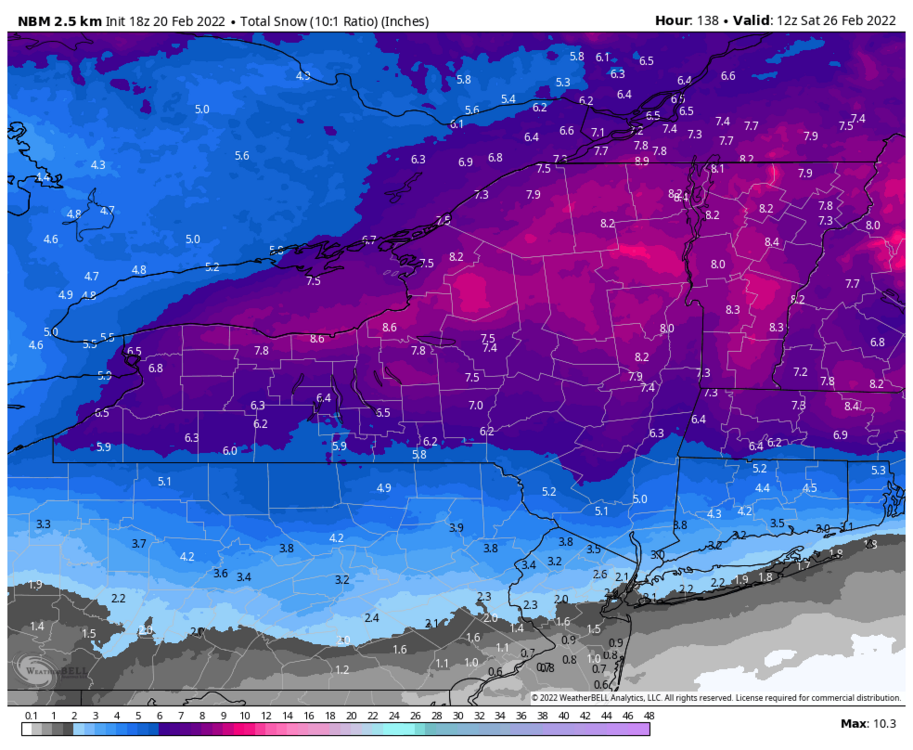
Indeed. Thruway, Capital District, southern ADK, eastern Catskills look like the consensus sweet spot right now.
-
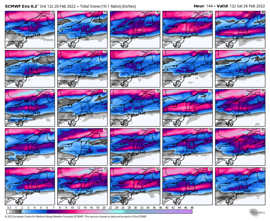
12z ensembles

-
Euro maps
-
12z Geps and Gefs shifted a little north but not a lot. Still solid from the northern tier of PA north. I wouldnt worry about north central NY too much. The thruway corridor might be the jackpot for this one.

-
Yeah just for a short time in the central southern tier. The 12z gfs did as well but both are mainly snow and around 6 along the PA border.
-
6z eps was even better than 0z. This is trending the right way folks. Widespread 6+ becoming more and more likely. Hopefully no more big shifts the rest of the way.

-
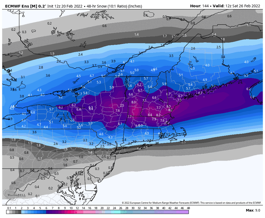
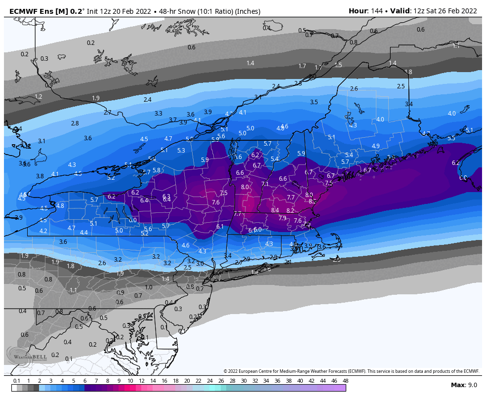
Big improvement in the Eps mean. Start locking it in.
.thumb.png.4bfbc157209b66a49e283368e14700de.png)
.thumb.png.a7d3137f240ca78a2d4be639f8cce2d0.png)
.thumb.png.58c2a190f7c4a2145e7afc1a22ecdd47.png)
.thumb.png.387fdb2f6bb4032a940b77451aa8a66e.png)
-
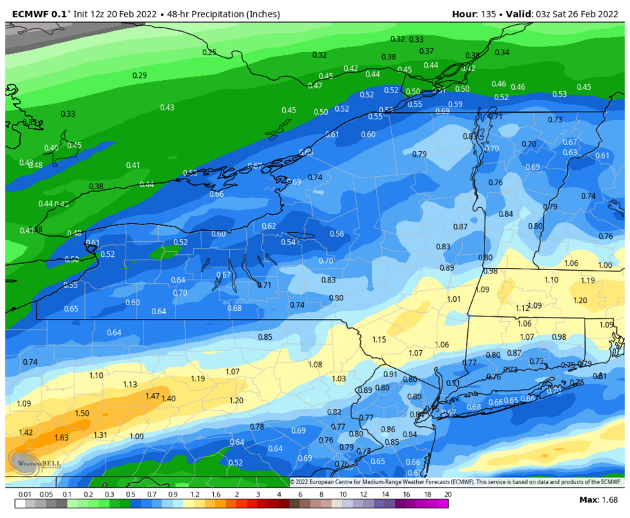
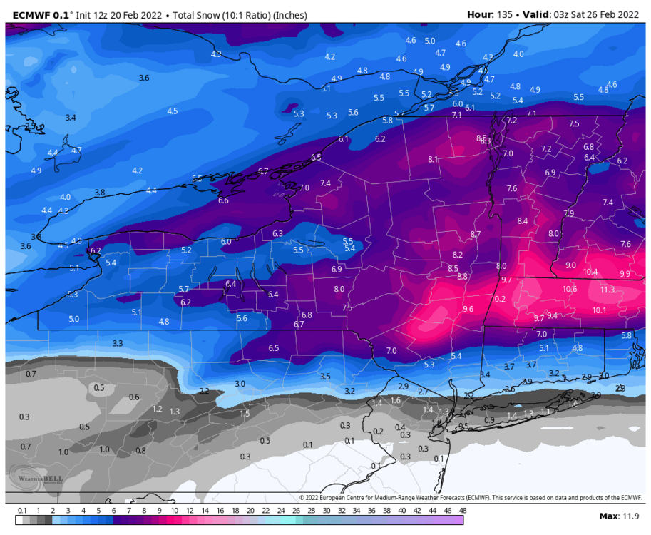
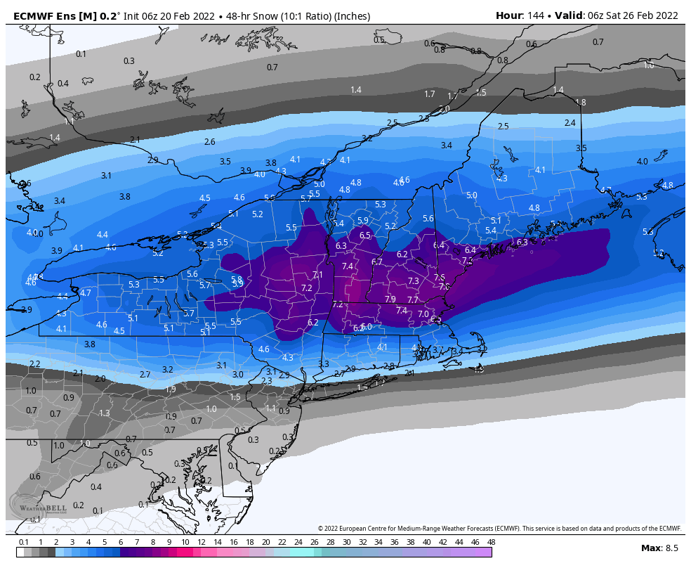
Thats a sizeable SE shift by the Euro. Mix line stays south of i90 except for Capital District area. Less dry slotting too.
-
UK still a widespread hit
.thumb.png.71e4dc760b28abf2f76edc1bb9e03bb9.png)
-
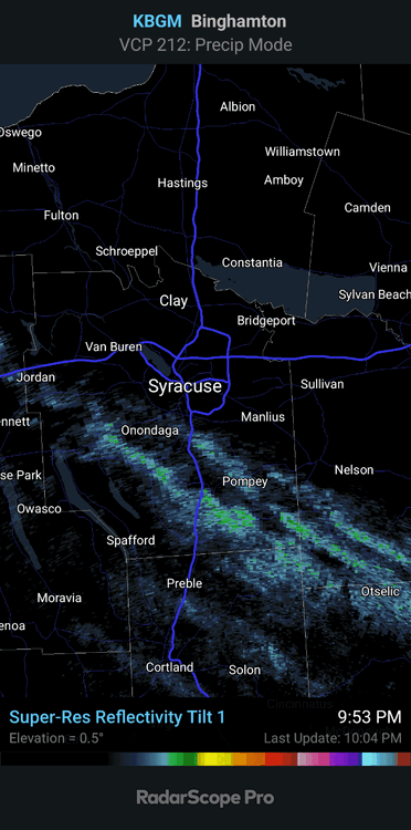
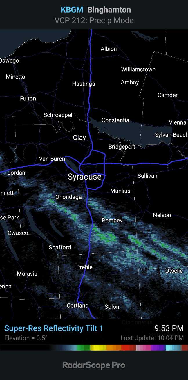
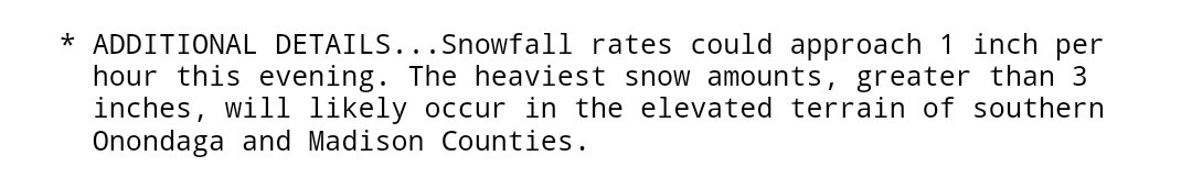
Yeah, the WWA will probably still verify over the hills of S Onondaga and Madison. Kbgm radar probably overshooting some of the bands.

-
18z Gefs was another nice run. Now if can just get Euro/Eps trending better.
.thumb.png.beaf5374f2e0f63fa548826d4e61471e.png)
-
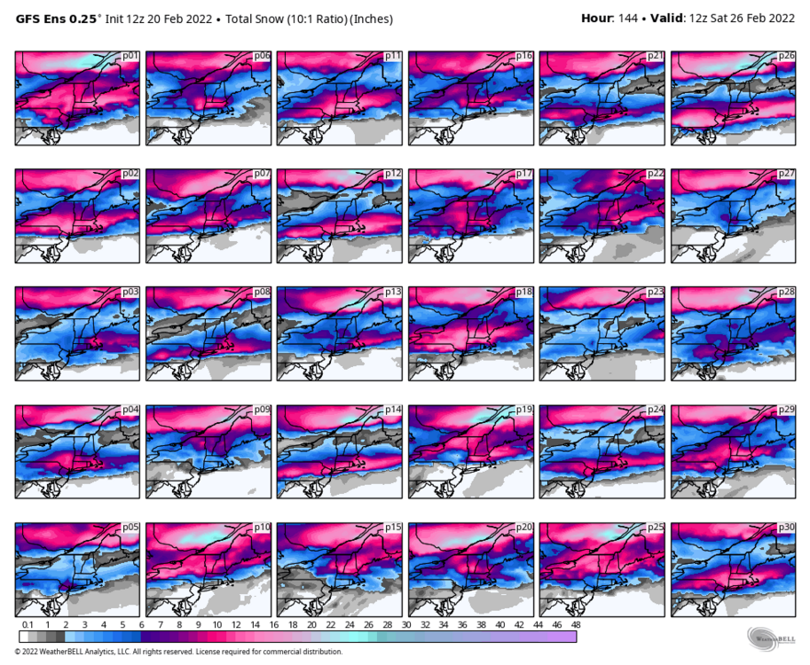
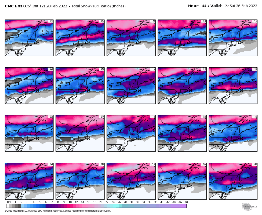
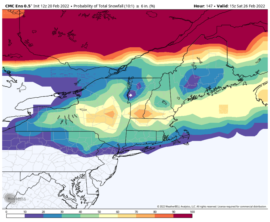
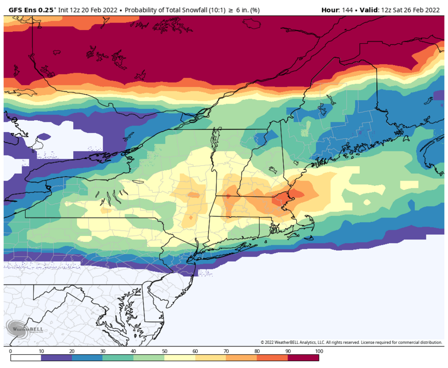
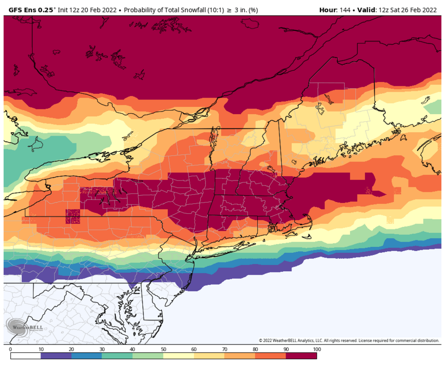
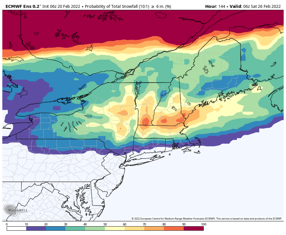
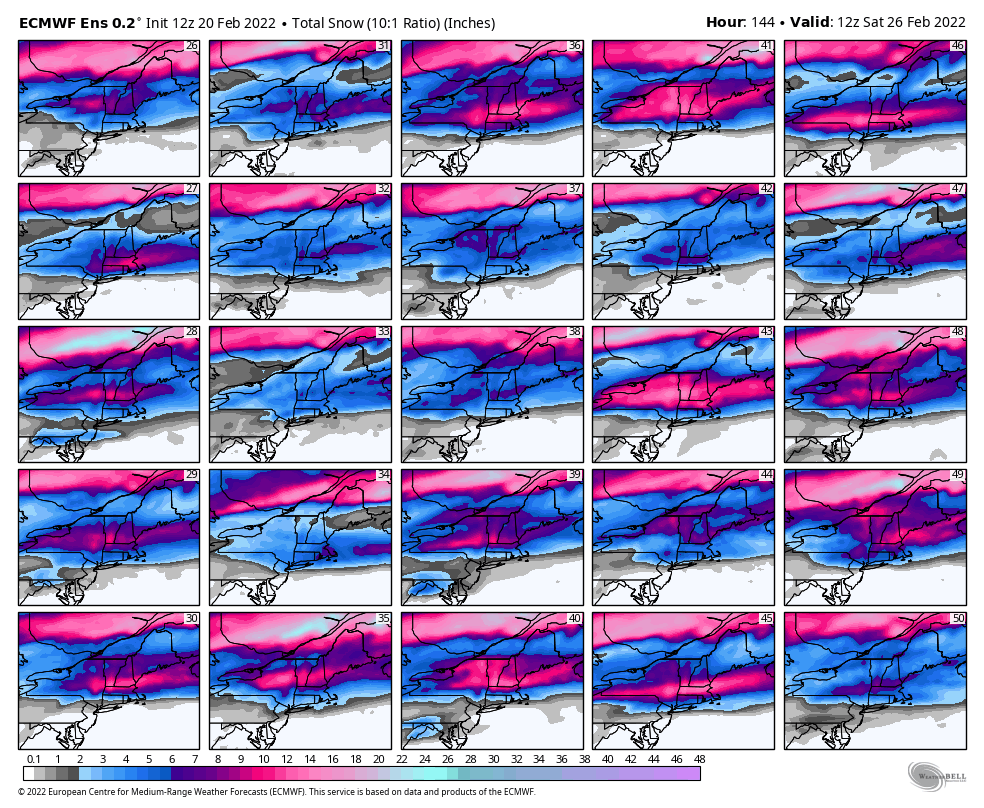
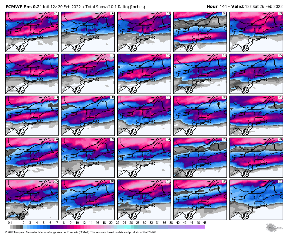
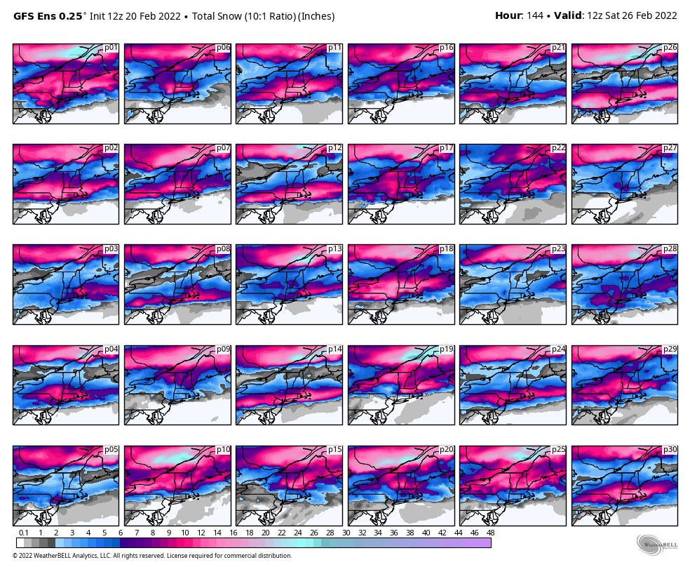
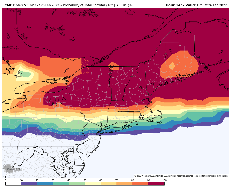
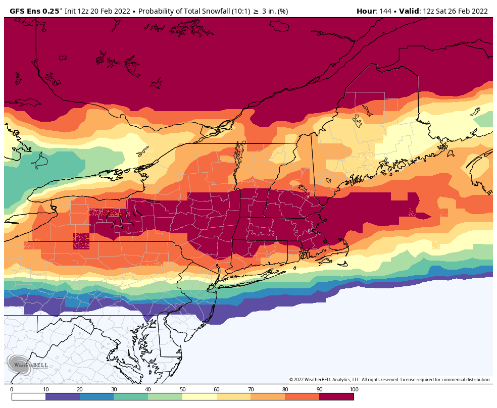
Euro/Eps continue to be a stubborn pos for late week. Until they get on board, cautious optimism only. Pretty good look on most other models. 10:1 mean (Eps, Gefs, Geps) Eps members Gefs members Geps members
.thumb.gif.d75a32e58636efebf7c6bda35fa131c6.gif)
.thumb.png.00bd12c5d63d1874ec8cb05ab041fcb9.png)
.thumb.png.c117428223418d0ec057d71b2379396e.png)
.thumb.png.0534c3b6695c156347065402ae13ee2f.png)
.thumb.png.6909715e15a04f156a3e2345c1b0da33.png)
-
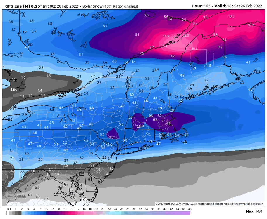
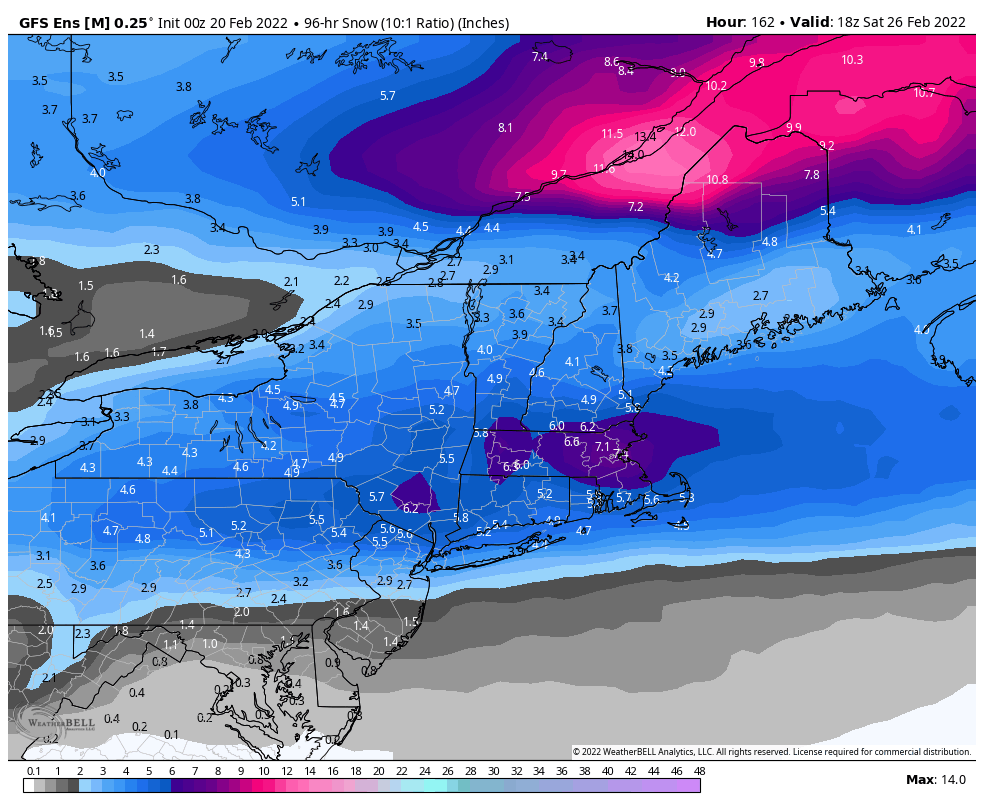
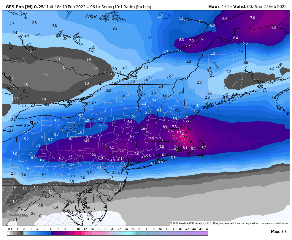
0z ensemble 10:1 mean from mid week to 18z Saturday 2/26. That's a pretty strong signal for a widespread heavy snowfall event at this range. Just need the Euro/Eps to spread the love.
-
0z ensemble members Eps Gefs Geps
-
Eps def has a North of 90 look for late next week. Would expect widespread mixing issues unless theres an early transfer to the coast before this gets to Jamestown.
-
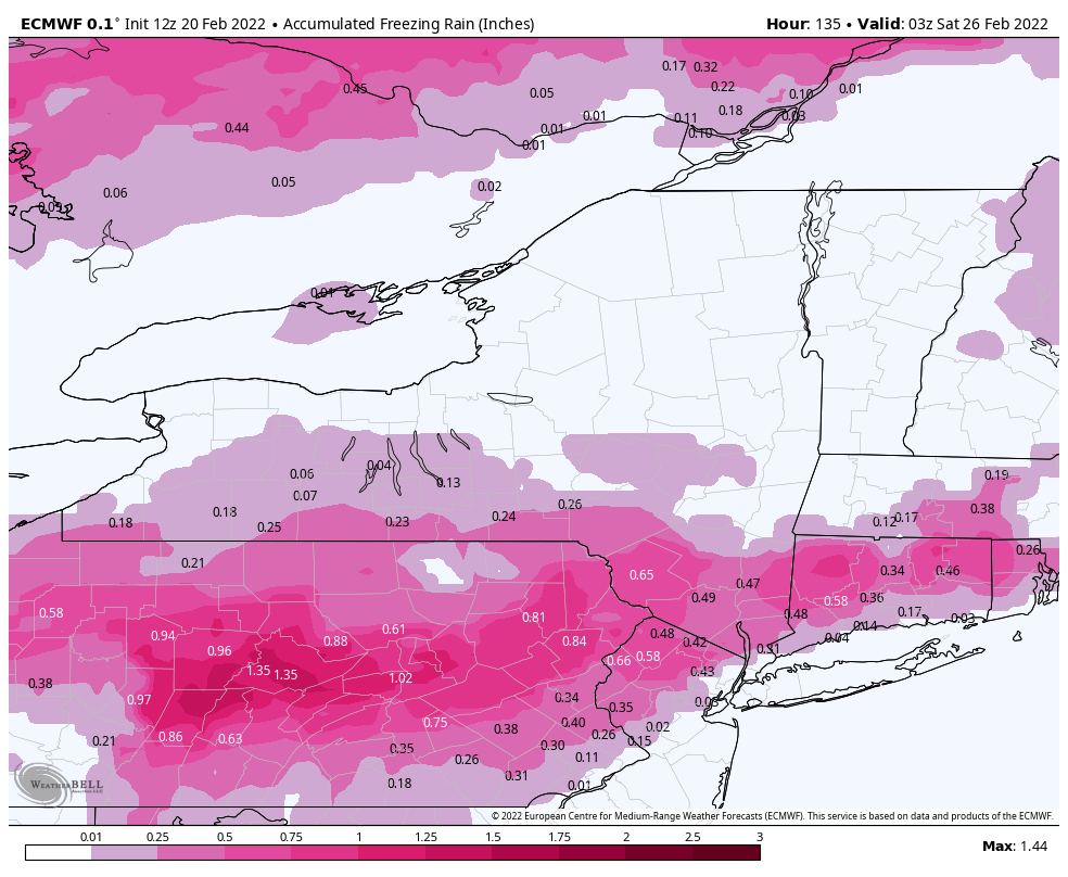
Somehow held onto about 2" of snowpack in most spots. Total of 0.89" of rainfall. Wasn't even that icy this morning either. Think the winds help dry things out a bit. Reached a high of 54.9° at 2:19am and dropped to 32.0° at 3:59am.


.png.37434e04a7650234d880884463624bb3.png)


.png.d08d1547e69b59f9caa7b2b29b9ed864.png)
.png.556d4d9e2f74e00020fa27c1978a05b8.png)
.png.82bac7cfb81edb695c398494e259a5db.png)
.png.da37b52780a99d5200e039bc116cfad3.png)
.png.34015a86d44ec571958fa1dc01742e94.png)
.png.96e7e933c8770e547a7ed8ad09c8fc70.png)
.gif.8f34779e0cea93a690006737124cffdb.gif)
.png.09abeae2019f9c53f3eae6c74466d31a.png)
.png.d822a641206f3e0402df5447a302a757.png)
.png.2fd7c3e18452bc7c690fc20dd1d1b85f.png)
.png.9793a2db2685637cb8a993bf4c8a71b3.png)