BGM Blizzard
-
Posts
1,676 -
Joined
-
Last visited
Content Type
Profiles
Blogs
Forums
American Weather
Media Demo
Store
Gallery
Everything posted by BGM Blizzard
-
 Lol yeah probably working on it as we speak along with the AFD update. The grids update every hour on Wxbell.
 -
Lol yeah that was the default. This site has 10-90%. The 50% version looks like the 18z NBM
-
Latest nws grids
.thumb.png.527794cef57727324d2eaa0c7f20ae57.png)
-
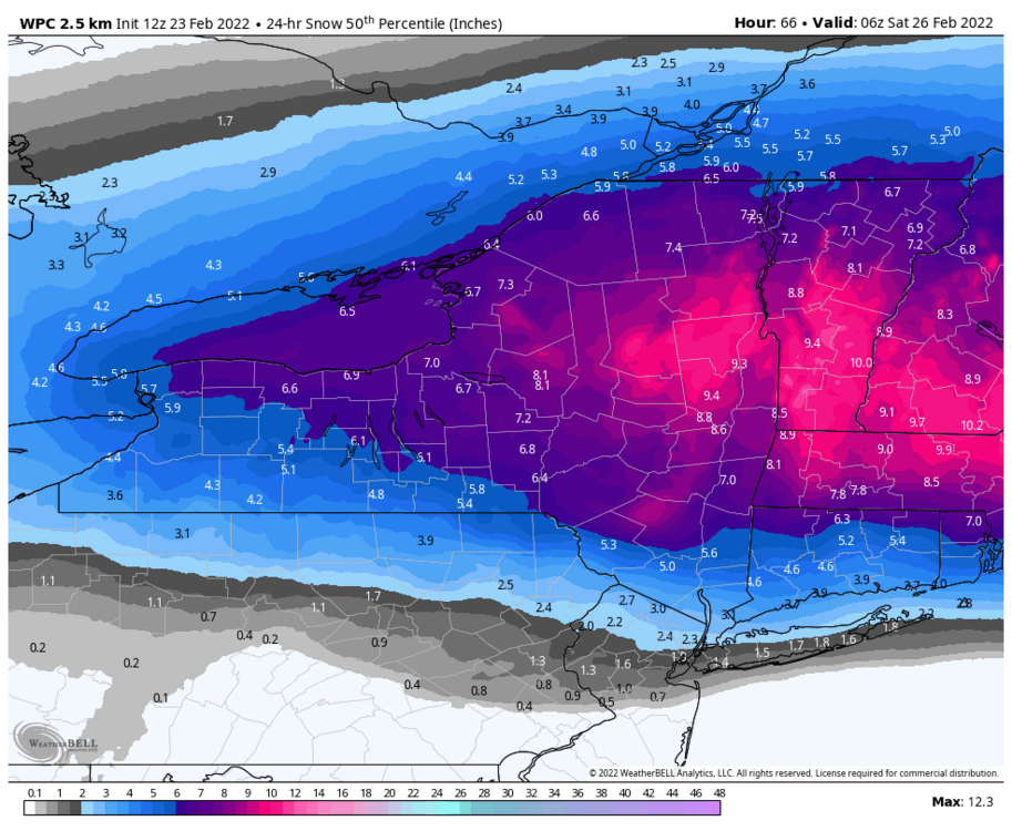
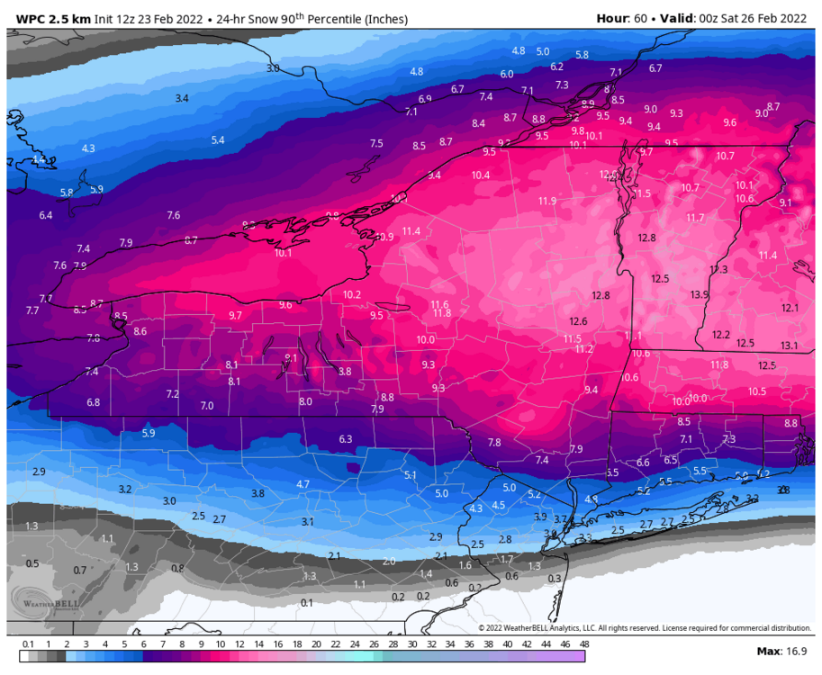
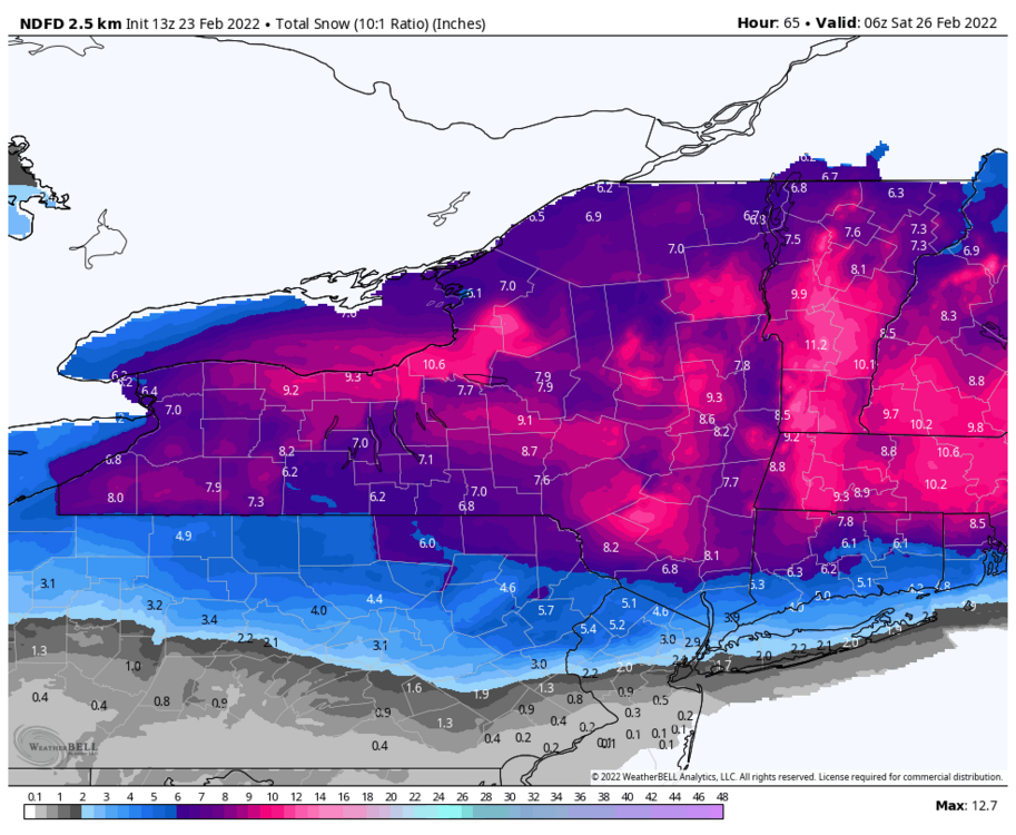
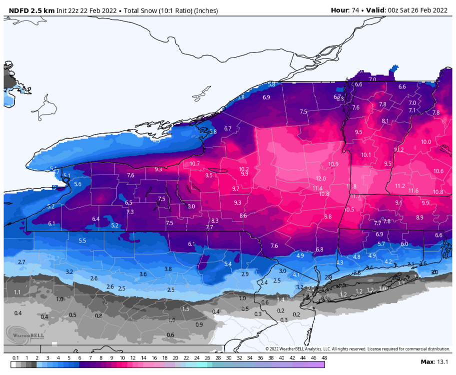
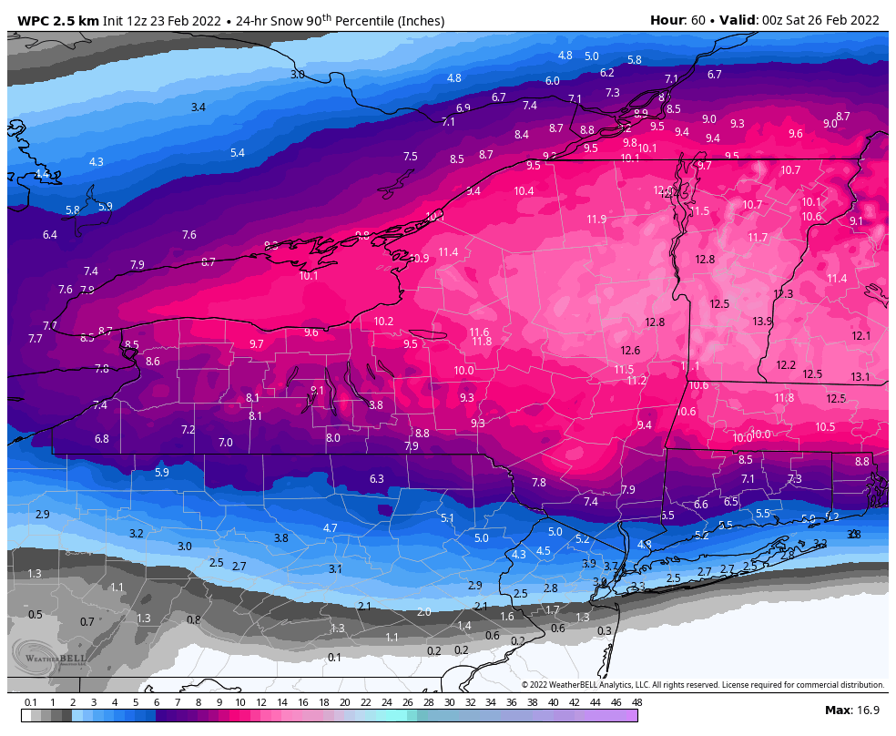
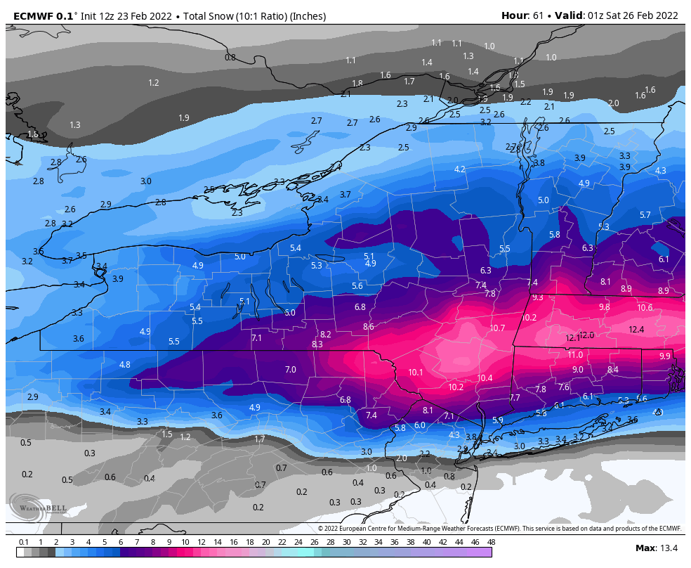
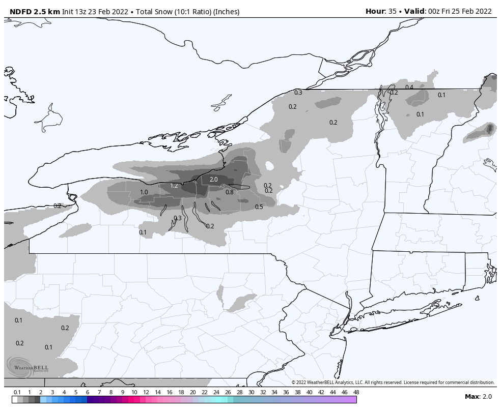
Wpc 24 hour snowfall thru 0z Sat
-
18z nbm Can def tell it has some NAM blended in.
.thumb.png.464c6257dd20d3c62bb210f649c1abaa.png)
-
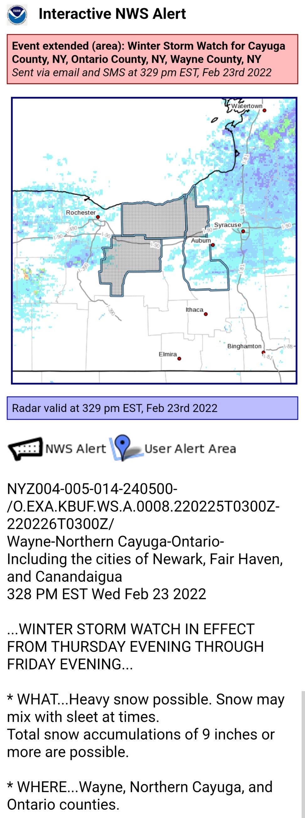
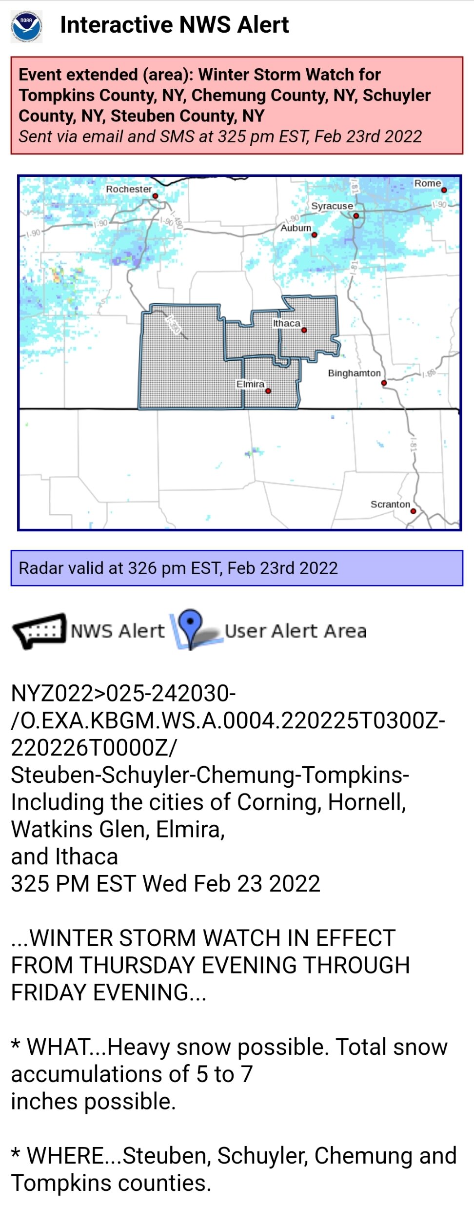
Buf expanded WSW a bit west to line up with Bgm
-
Bgm expanded the WSW to the rest of the cwa west of 81
-
Nam should be atleast a little south of 12z. H5 @ H36... More confluence up north and lower heights out in front. Vort looks a little weaker too.
-
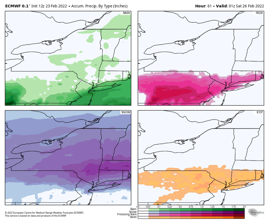
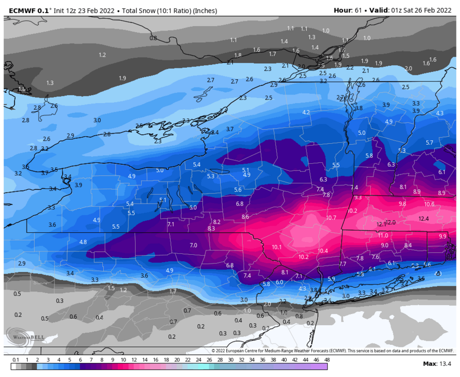
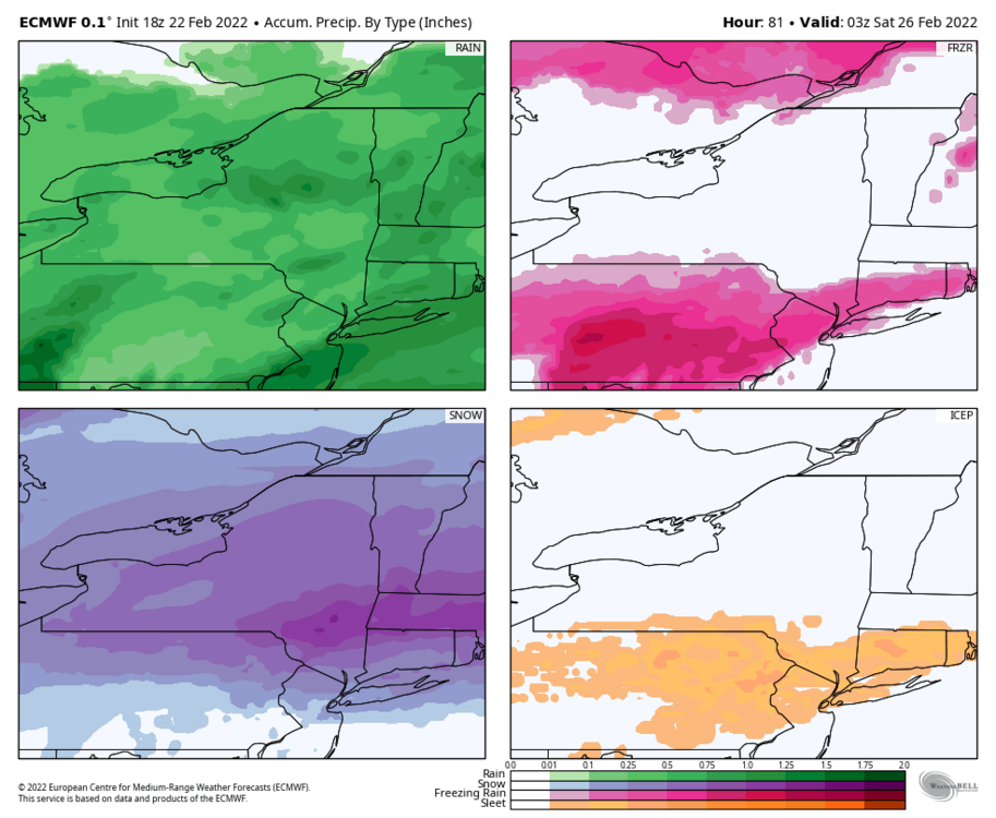
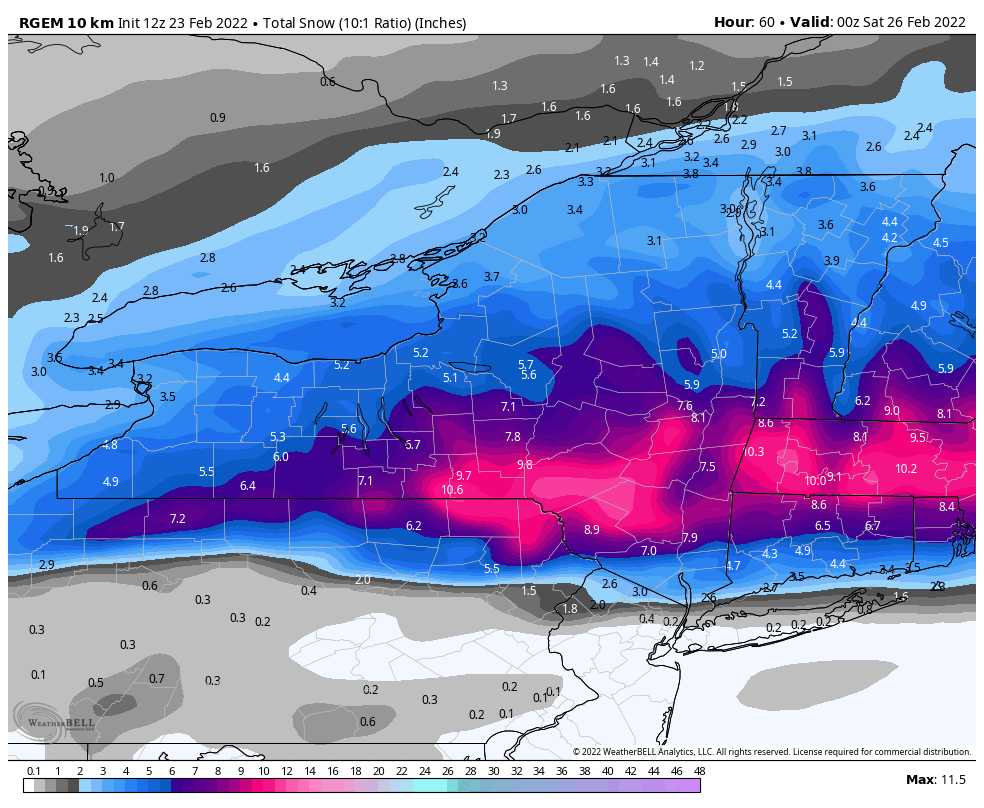
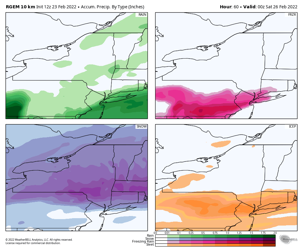
Euro shifted back south like the gfs. Even further south than the Rgem with the axis of heaviest snow.
-
I'm guessing that's why NOAA developed the NBM model. Literally just melt and blend it all down and see what the average of the average is and hope it's close to the final solution or close enough such that major adjustments aren't required.
-
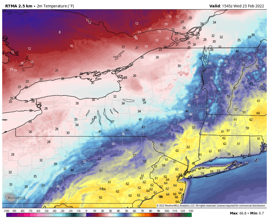
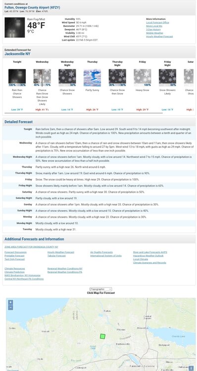
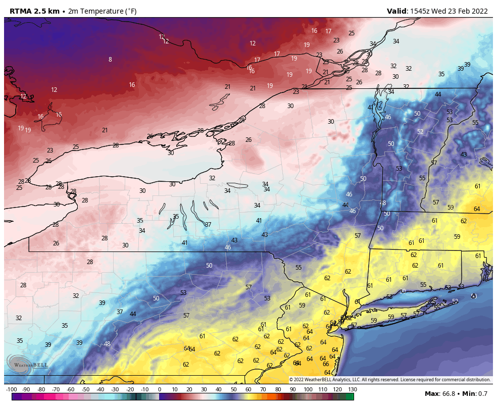
1045am surface temp map shows where the front is located
-
It's actually been very consistent but it's a bit of an (southern) outlier. Keeps mix line near and south of state line. Likely not going to happen as much I hate saying that. A solution somewhere between the NAM and RGEM is probably most realistic.


-
Less than 48 hours from start time. NAM going even further north is def a cause for concern. If it's still hell bent on that on the 0z run tonight that's a major red flag. See what the other models do today.
-
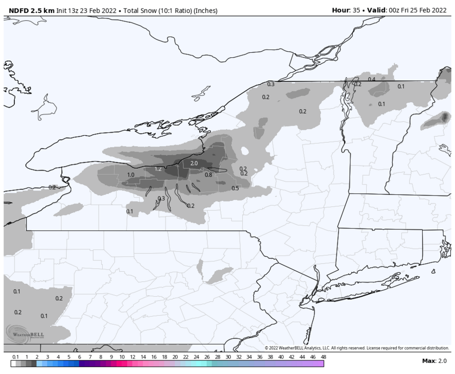
See my updated post. I forgot about the minor accums for later today. They'll look about same probably after today.
-
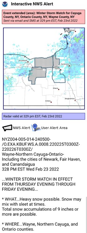
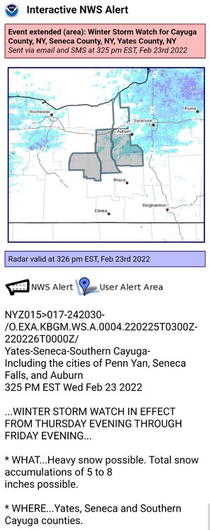
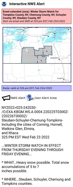
Nws grids for snowfall. Albany scaled way back to blend better with surrounding offices. Buf and Bgm still > Ctp along state line. Buf > than Bgm along the Lake Plain. Edit: forgot Buf is forecasting some minor accum later today that's also included. Here the pre-storm grid forecast.
-
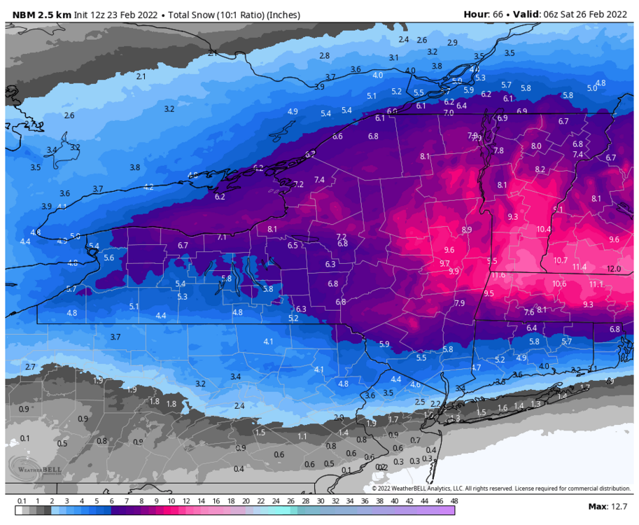
12z nbm
-
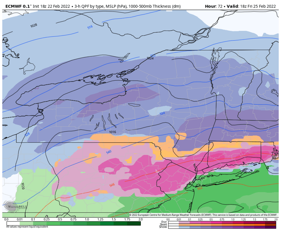
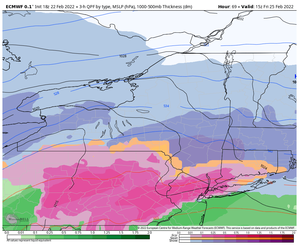
6z Euro nudged north
.thumb.png.88d1a2bdfefb07ddc4943431d71ea016.png)
.thumb.png.a0fa4ca7b96bcc8458556c7536a64c87.png)
.thumb.png.205d7dc0e3c70b02479e88bd4d0666ae.png)
-
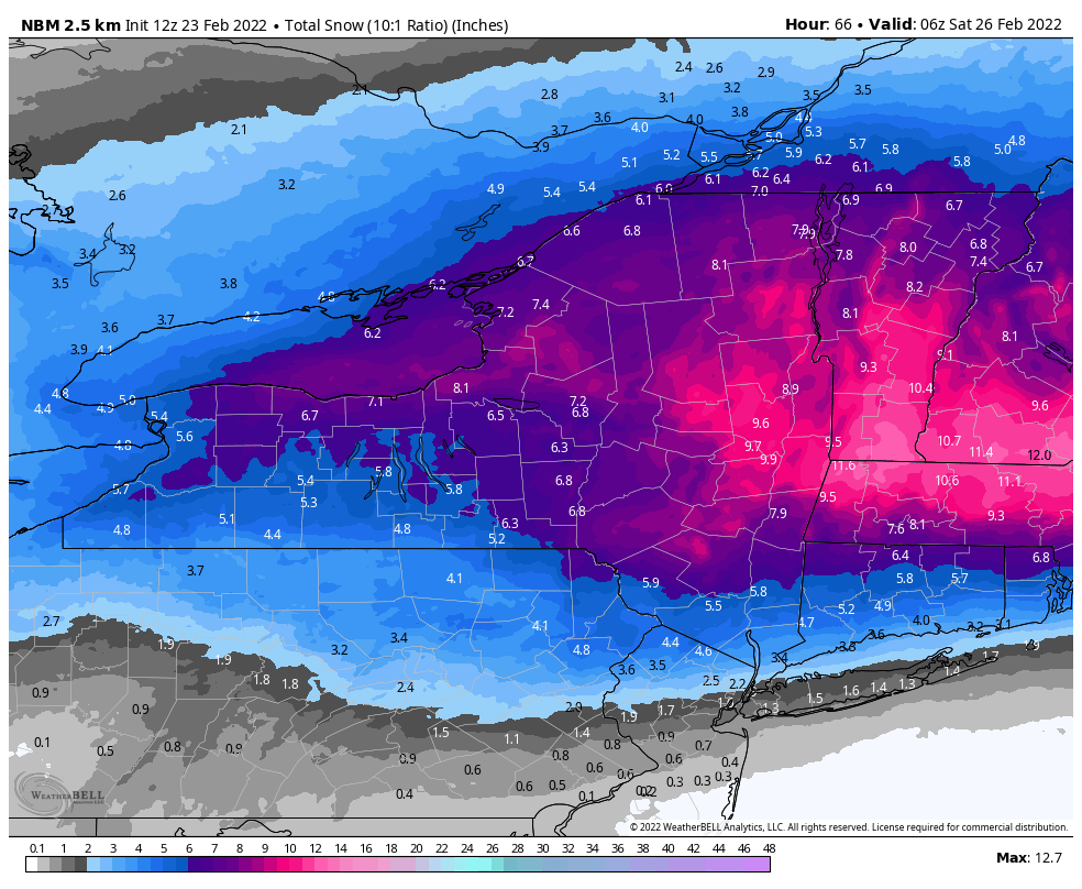
0z nbm
.thumb.png.15f66ffec1ca931288a322f3f64d29ec.png)
-
Kuchera avg is 17.5:1 at buf so that's almost certainly too high. Maybe somewhere in the middle but probably closer to 10:1 like LEK said.
.thumb.png.7ee863614480d8081b9647c8ac0406a5.png)
-
18z eps mean is near identical to 12z
.thumb.png.8659f2c8c8c146e22d60aeb457bf4eb6.png)
.thumb.png.f33893e790f058a1ba1c869b0ccb976a.png)
.thumb.png.4d7eac72b2e7b1e25359f06a58f43289.png)
.thumb.png.aa464cedfa79c7a7e2b8a879971fb061.png)
-
Not sure if that minima is gonna be legit or not. Could see a dry slot develop somewhere in the forum depending on how the primary behaves/tracks. Hopefully not before thumping anyway.

-
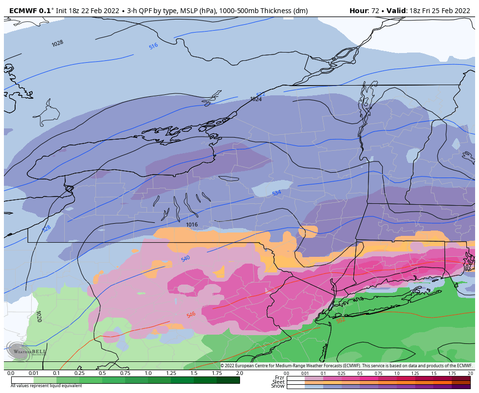
18z Euro a smidge north of 12z.
.thumb.png.07b9bbe0e4ac3f363e928e0102a40540.png)
.thumb.png.70e101cfdec0810a99184ac9fd39718f.png)
-
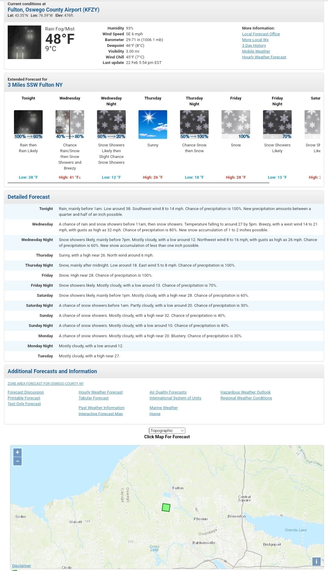
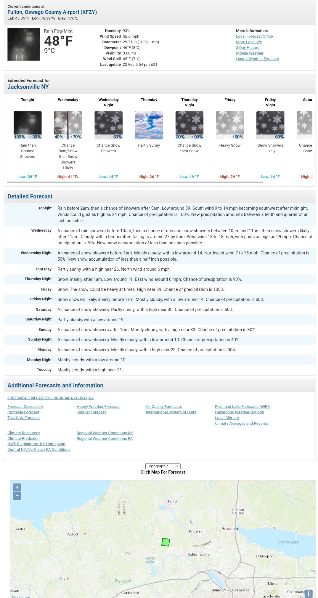
The point n click shows the difference in the grids between sw Oswego (buf) and nw Onondaga (bgm)
.thumb.png.03fcc108b4d36b66778d818d9d5d87a7.png)
-
Wxbell pretty awesome site. Looks like there little bit in the grids for late tomorrow afternoon/evening ahead of the main storm. Buffalo forecasting more than Bgm.
-
Nws grids thru 0z Saturday Always interesting to see how the individual offices are thinking. The sharp drop offs at various county lines is kinda funny. Albany much more bullish than Buf, Bgm, and Btv.


.png.6d857bfb203ef0db8268ab1df9dcd786.png)

.png.a98be7f7522f3cc572f81e38ffeaf64d.png)


.png.409e1b7f4366448b8d6b69a386963302.png)
.png.d1c284d09c269a0c7448c73905a6d971.png)
.png.b13954b929c4e222d5d4ed484a5d969e.png)
.png.c50d83e3384490d678c19c9cf1d24b0f.png)
.png.448b806fb1ff30b2537ef70b013fd1c5.png)
.png.1cd671ce4d80267d54dd24cda3fa30b8.png)
.png.caa2c557aa1101d782f1a6a0e4c71c0e.png)
.png.ce7f964d4c76478f50804348963df7dd.png)
.png.7e0caa0f08f27224e6ca78e0f3e6333b.png)
.png.8a345ad95c7ebaedb4c810c00e6e3670.png)

.png.17e83883b310cd16af60b5855209a807.png)
.png.af24e549cf07015f836411680711682f.png)