BGM Blizzard
-
Posts
1,676 -
Joined
-
Last visited
Content Type
Profiles
Blogs
Forums
American Weather
Media Demo
Store
Gallery
Everything posted by BGM Blizzard
-

Feb 24-25th Snowstorm- Observation Thread
BGM Blizzard replied to BuffaloWeather's topic in Upstate New York/Pennsylvania
Primary low is nearing Jamestown as of 6am/11z.gif.2c93b0d44eed369b6f80ca5081298225.gif)
-
Feb 24-25th Snowstorm- Observation Thread
BGM Blizzard replied to BuffaloWeather's topic in Upstate New York/Pennsylvania
Must have flipped back and forth between sleet and snow as heavier precip rates came thru earlier this morning. Currently sleet and 22.3°. Have about 2.5" of snow/sleet mix on the ground. -
Feb 24-25th Snowstorm- Observation Thread
BGM Blizzard replied to BuffaloWeather's topic in Upstate New York/Pennsylvania
All sleet here now. Didn't even get an inch before the changeover. LOL! This radar is comical. Once again way off on the mix line. If we're lucky maybe we flip back to snow when that heavy band gets here but not counting on it..gif.d921797c946e262e266def8d1d1bedae.gif)
-
Feb 24-25th Snowstorm- Observation Thread
BGM Blizzard replied to BuffaloWeather's topic in Upstate New York/Pennsylvania
Mixing in Elmira already. Wouldn't think a weak primary in eastern KY would be able to get to Jamestown and beyond with this look but who knows.
-
Feb 24-25th Snowstorm- Observation Thread
BGM Blizzard replied to BuffaloWeather's topic in Upstate New York/Pennsylvania
Will be surprised if Bgm keeps the WSW going with the overnight update save maybe Oneida County. Atleast with radar being down they can blame the bust on that and not being able to follow the mix line movement on the coefficient. -
Feb 24-25th Snowstorm- Observation Thread
BGM Blizzard replied to BuffaloWeather's topic in Upstate New York/Pennsylvania
Weak sauce and yet still shoving a warm layer up our arse. -
Feb 24-25th Snowstorm- Observation Thread
BGM Blizzard replied to BuffaloWeather's topic in Upstate New York/Pennsylvania
0z NAM is shit-tastic. But if I drew a forecast map, the 0z NAM is pretty damn close to how I see this storm playing out unfortunately..thumb.png.ee9085ead4f0633423cb08343bd055de.png)
-
Feb 24-25th Snowstorm- Observation Thread
BGM Blizzard replied to BuffaloWeather's topic in Upstate New York/Pennsylvania
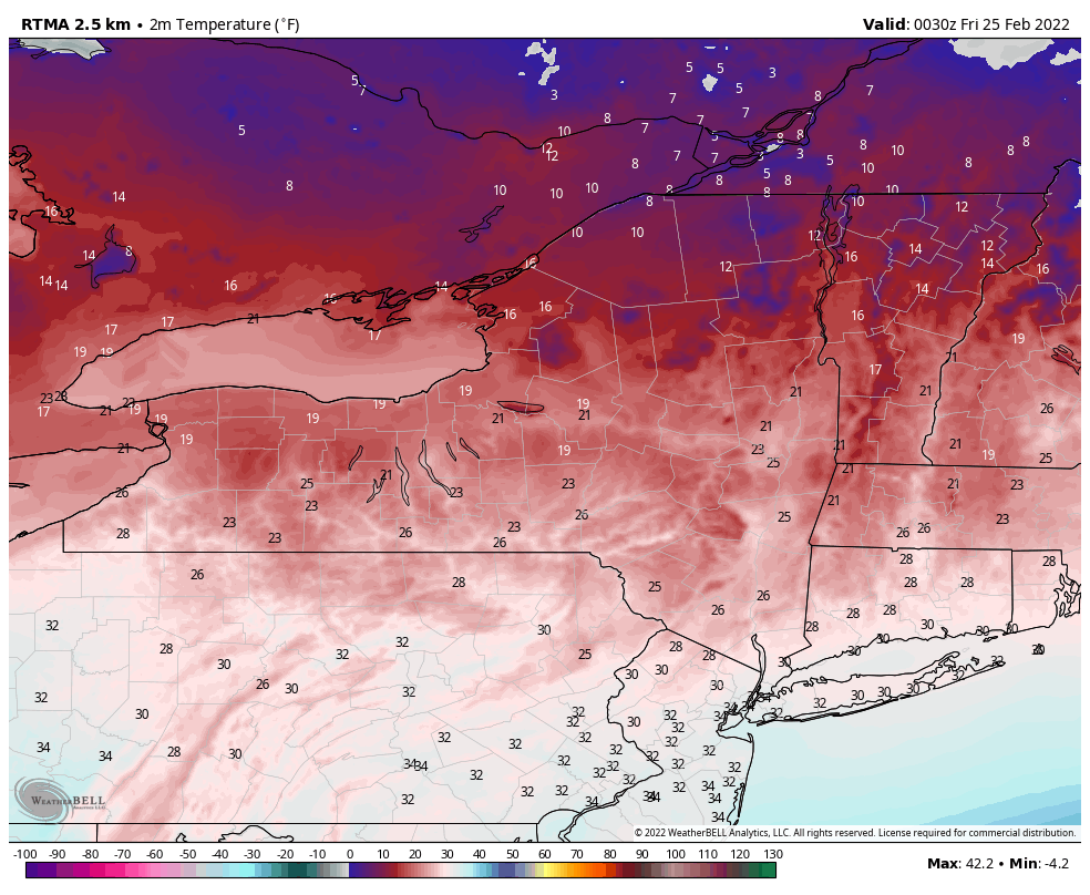
7:30 temps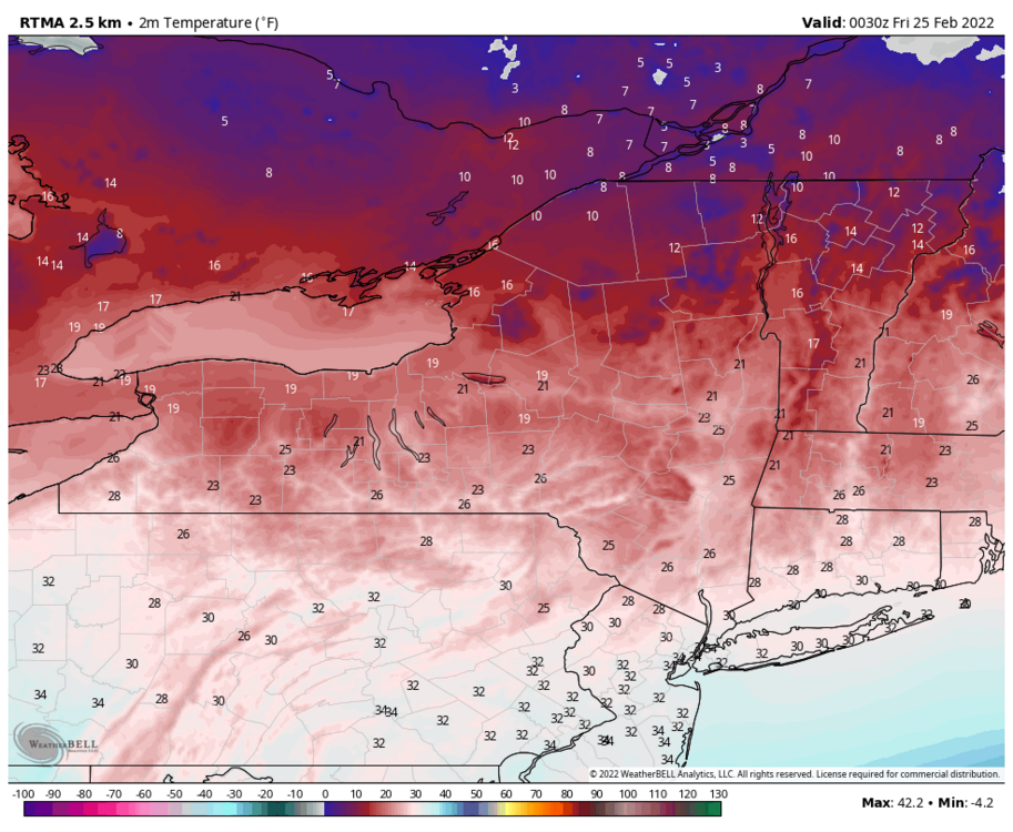
-
Feb 24-25th Snowstorm- Observation Thread
BGM Blizzard replied to BuffaloWeather's topic in Upstate New York/Pennsylvania
Bgm radar just went down with no estimated time for restoration. Great time to be flying blind. -
Feb 24-25th Snowstorm- Observation Thread
BGM Blizzard replied to BuffaloWeather's topic in Upstate New York/Pennsylvania
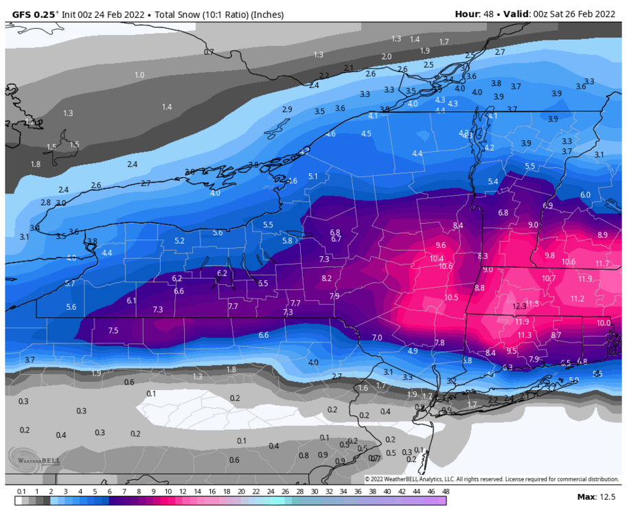
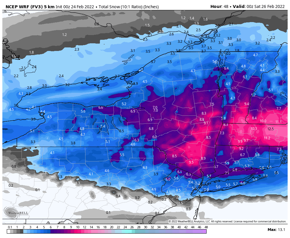
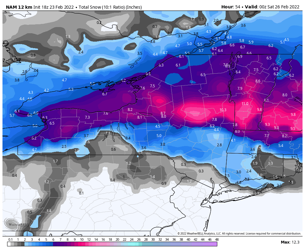
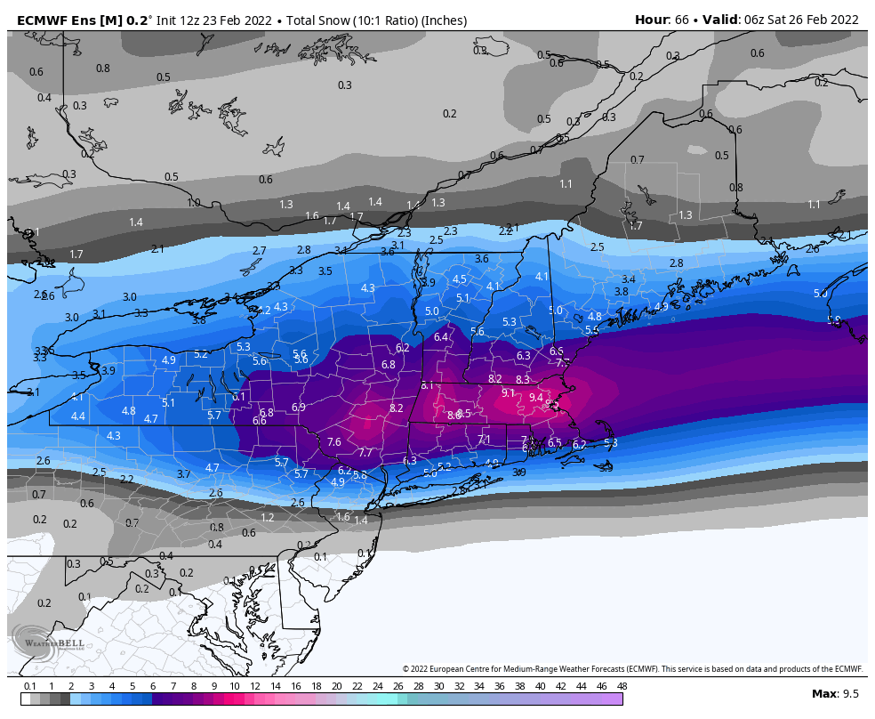
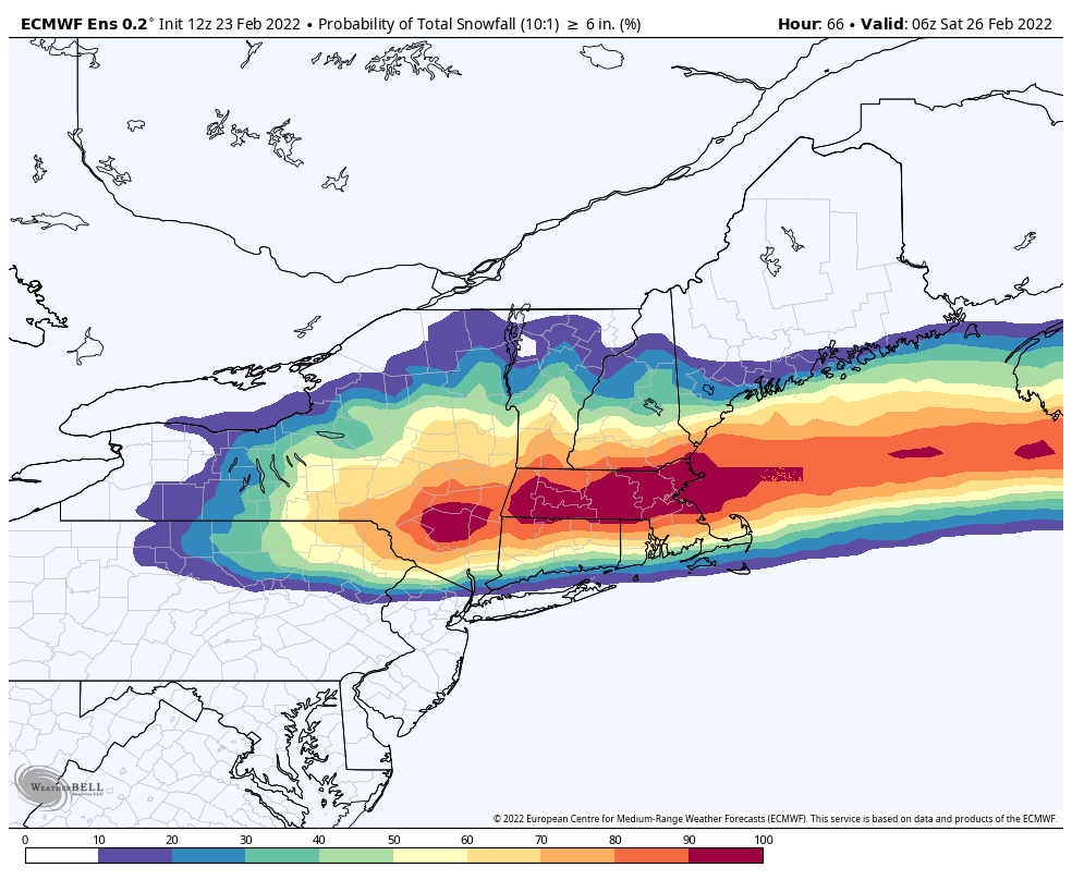
Mix lines and dry slots always seem to move in faster than expected. I think this is gonna be primarily a waa thump of 4-6 across most of WNY and CNY then mix and/or slot with backend snow showers. ENY will probably benefit from coastal re-development and end up with widespread 8-12. That's my guess. -
Latest nws grids Bit of a disconnect between buf and bgm on the western border... the southern tier zones especially.
.thumb.png.594c253da8f59898bf36d90249367759.png)
-
Euro been trending north since bottoming out south at 18z yesterday.
-
The Rapper is going batshit around these parts. Hard sell.
.thumb.png.0be228575ca9b9580d8e620e3461e6dc.png)
-
GFS has been rock steady for at least 5 straight runs. Very little change on 0z run.
-
Solid shift for sure

-
0z nam/H18.... Confluence pushing little more south and heights a little lower out front vs 18z run. It's early but probably going to shift south some again this run.
-
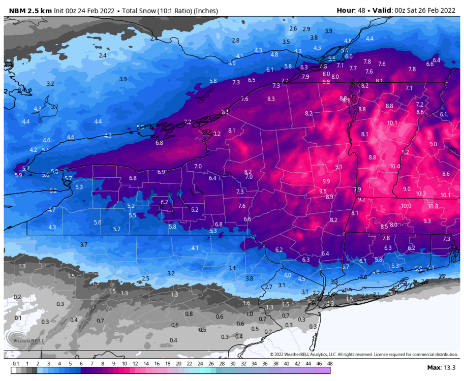
0z nbm
-
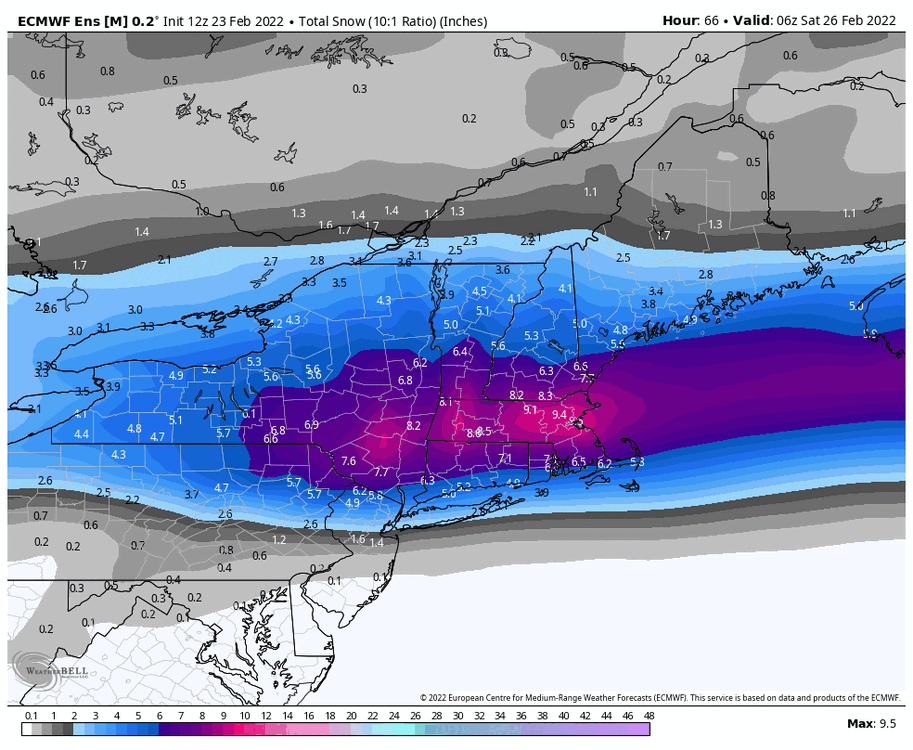
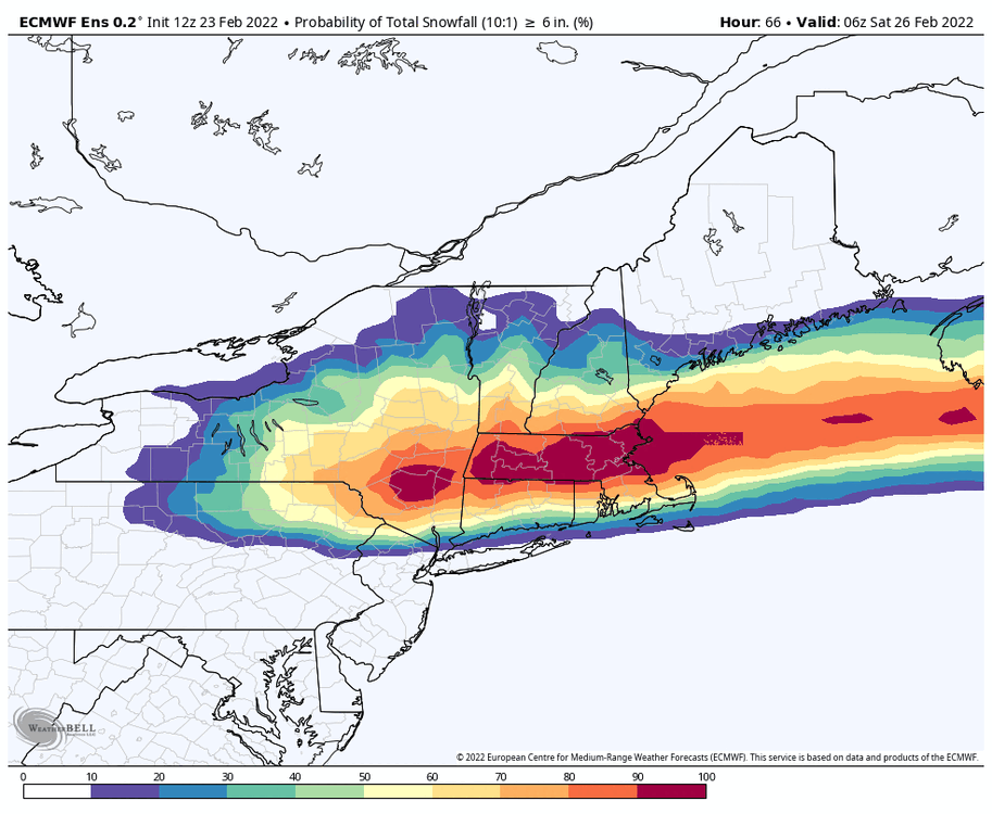
Eps 12z vs 18z. Could def see those axis shifting atleast 25mi north.
-
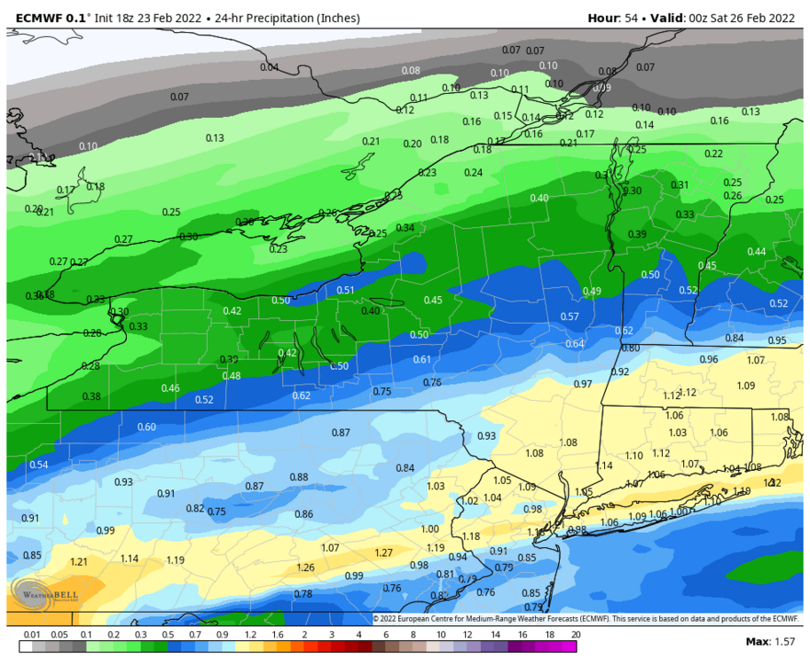
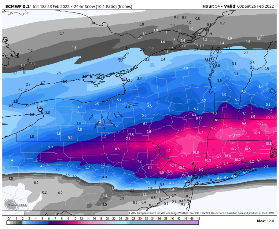
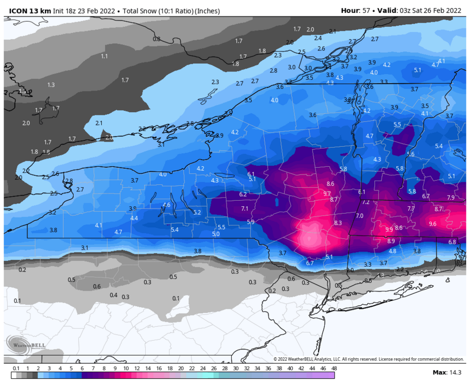
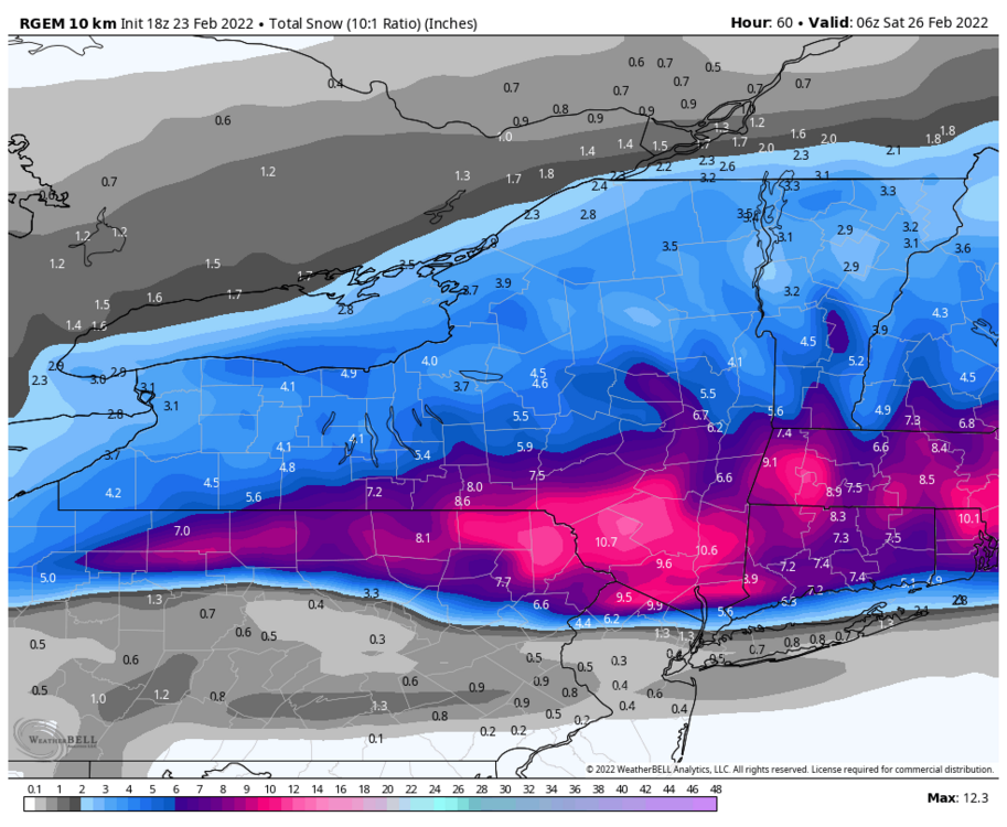
I find it interesting the nam and rgem are on complete opposite sides of the spectrum right now and both have been quite consistent in their north and south solutions. The rgem did the best with the last one of these storms as I recall... atleast when it came to pinpointing the axis of heaviest snow. The nam wasn't too far off either with that one. Both were nw of the globals for most part esp the Euro.
-
Euro was too far south on the last one of these storms. Consistently had southern tier within the axis of heaviest snow but ended up busting a good 40 miles too far south. Gotta start to weigh the meso models more heavily starting with tonight's runs.
-
Euro made another shift south at 18z

-
Icon dropped south and/or colder.
-
Buf, Bgm, and Btv updated the grids. Now Albany sticks out like sore thumb lol.
.thumb.png.ed09c5acf81dc30c3ab58aef93c2e6f2.png)
-
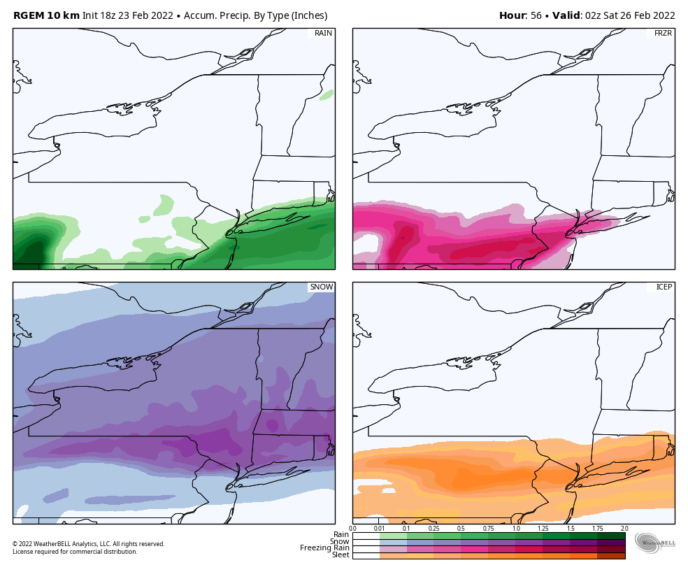
Rgem went even further south than 12z and jacks Scranton.


.png.70f9573051827fe5fd08b8cb907f66d8.png)

.png.2a444b3970fe53bdf16f612974fd56a4.png)

.png.fbdce229ef9d507aa5208805a500e727.png)


.png.c79a879f383239da0c951cc439816db9.png)