Jmister
-
Posts
575 -
Joined
-
Last visited
Content Type
Profiles
Blogs
Forums
American Weather
Media Demo
Store
Gallery
Everything posted by Jmister
-
Jan 24-26 Weekend Snow and Sleetfest Model Thread Part Tres
Jmister replied to H2O's topic in Mid Atlantic
First time I've ever seen my tool used in the wild! Thanks NPCJoey <happy tear> -
Jan 24-26 Weekend Snow and Sleetfest Model Thread Part Tres
Jmister replied to H2O's topic in Mid Atlantic
Not sure it's worth much, but now-cast HRRR is missing precip breaking out in cold sector. Just something to watch moving forward.
-
Yep, looks like it's missing some lighter precip to the north of the main batch too. Something to keep watching as the storm takes shape. Thanks! Yep, I was at PSU from 2007-2017 and in doing so I missed some of Philly's best snowstorms haha. I think they had four storms of 20+ inches while State College's best was 14"...go figure Congrats Mid Atlantic crew, this looks to be a solid storm for you!
-
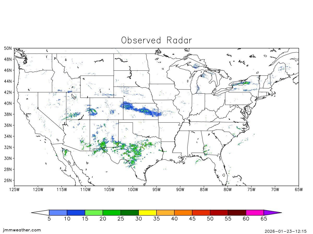
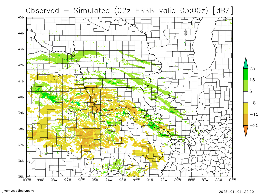
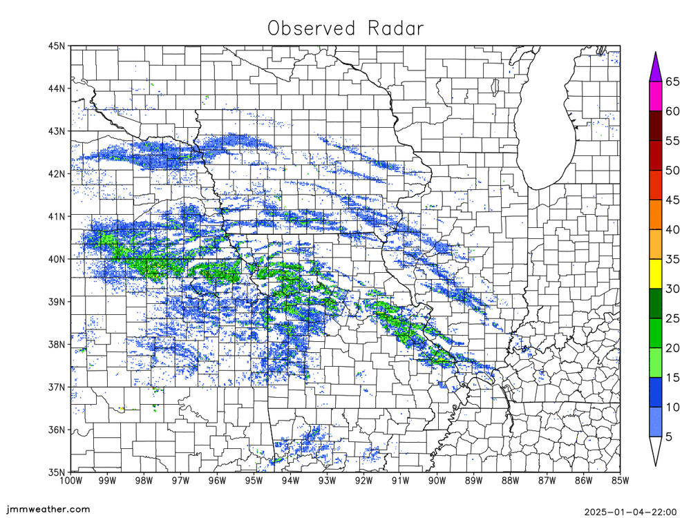
As we get closer to the event, tracking observations becomes more crucial to see how models are performing. This tool compares HRRR sim radar to the observed radar. As you can see, there are some noticible differences already in placement and intensity of precip. http://www.jmmweather.com/radar_comparison.html Please message me with any suggestions as this is a work in progress.
-
Have you looked into OpenGrADS at all? It's a versatile visual tool for all things grib. http://opengrads.org/
-
FYI, https://weather.cod.edu/forecast/ is getting GFS data just fine.
-
Jan 31st - 33rd Storm Obs and Disco like it's 1979
Jmister replied to Bob Chill's topic in Mid Atlantic
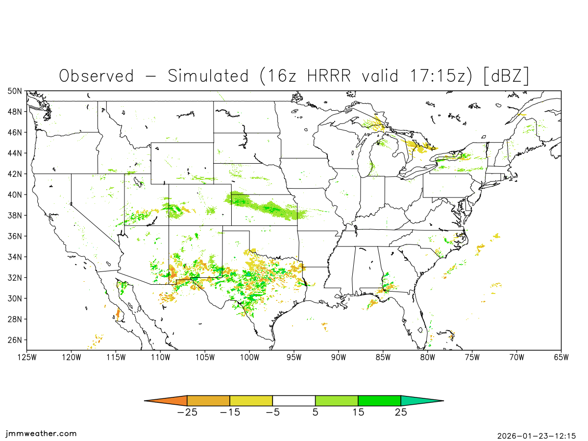
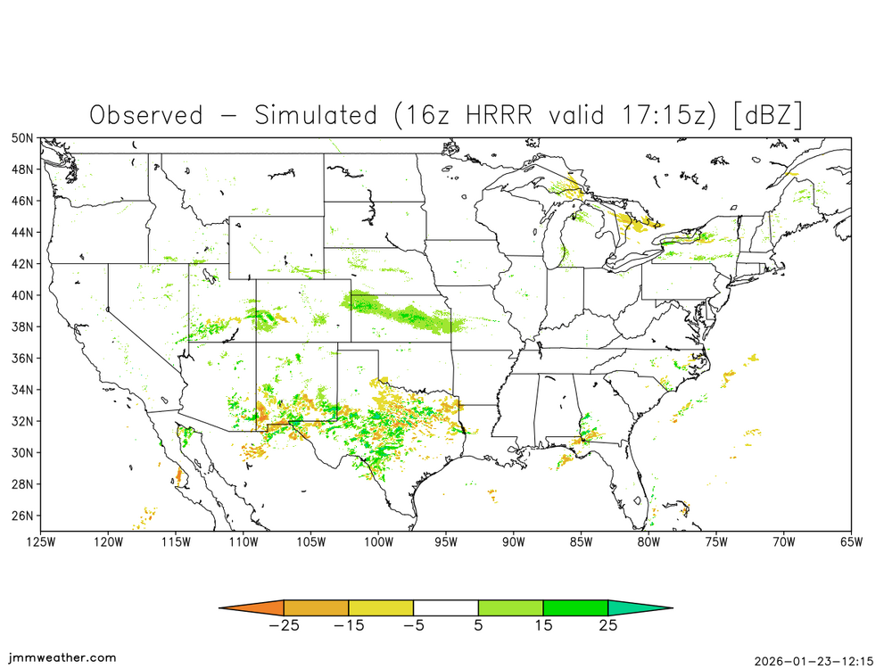
I think some of the fringes differ because the actual radar may show very light returns (virga) that the model doesn't have. It's more useful to look at the difference in heavier returns. I may filter the images to only show 15 dbZ or higher instead of 5 to eliminate non-precipitation. -
Jan 31st - 33rd Storm Obs and Disco like it's 1979
Jmister replied to Bob Chill's topic in Mid Atlantic
As the storm begins to approach the area, here's a shameless plug for my tool to help ease your radar hallucinations. Specifically for the HRRR simulated radar. jmmweather.com/hrrr The green regions in KY, NC, WV show that it's under-doing the precipitation extent there right now. Good luck to you all down here! -
Since it's crunch time and we're using a lot of insight from the HRRR, my tool may come in handy to determine radar hallucination from reality: And a quantitative difference: I have this updating every 15 minutes at jmmweather.com/hrrr
-
Hoping so! I keep following this sub-forum closest because if the models are good for you guys, it's good news for me in the PHL area haha. Lots of good entertainment here too.