

BornAgain13
-
Posts
2,879 -
Joined
-
Last visited
Content Type
Profiles
Blogs
Forums
American Weather
Media Demo
Store
Gallery
Posts posted by BornAgain13
-
-
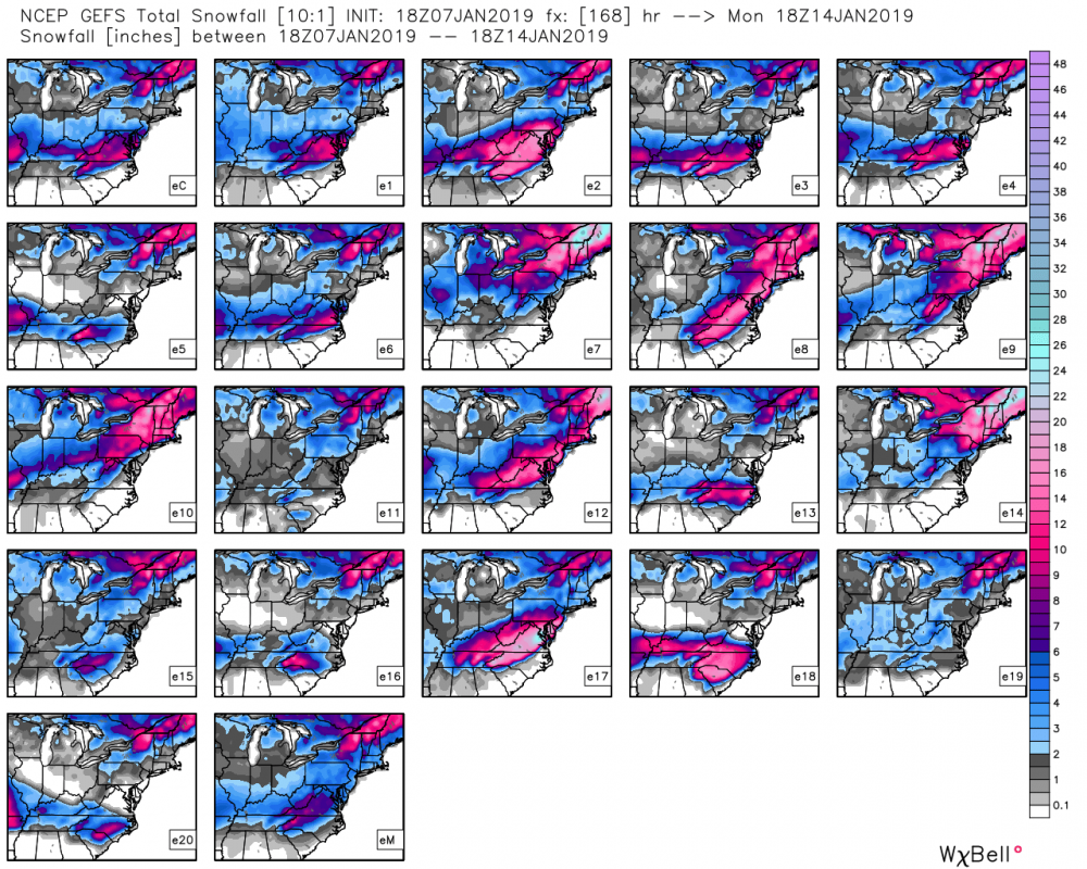
12z GEFS had a little jump in QPF compared to 6z
-
2 minutes ago, griteater said:
12z UKMet has the parent low way up in N MS, but the endpoint is still a low moving off the NC coast (with damming in between). GFS/CMC/UKMet from 12z are fairly similar. The damming high yields a fairly high chance for an impactful, mixed precip winter storm over the favored CAD areas IMO. I would be surprised if this moves to a more snowy solution over the coming days, and a way north, low impact event with mostly rain seems unlikely as well
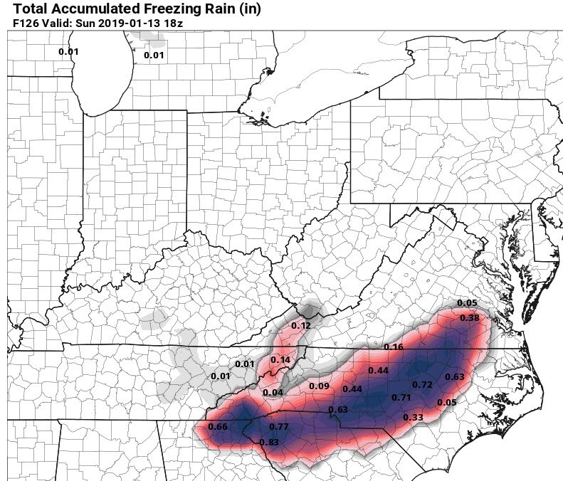
UK seem to show Snow to ICE for southern VA?
-
5 minutes ago, FallsLake said:
Are you sure you want to reel this in (12z CMC):
Except the CMC!!! lol
-
Let's reel it in!!
-
12z GFS looks like it will be a little further north from 6z ... looks stronger.
-
12z ICON looks like it's coming in with the goods!
-
ICON looks like a strung out mess....
-
-
18z GEFS really upped Snow means!
-
 1
1
-
-
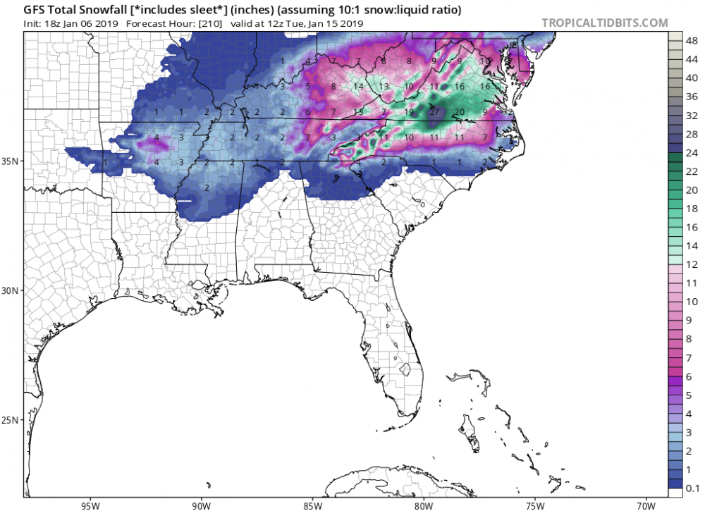
18z GFS Actually gives MBY a solid 4-7" of snow before the change to ICE. A better run for sure.
-
Does EPS agree with the OP? Minor-moderate type of event?
-
1 minute ago, griteater said:
For the GFS and Euro, this fits well with their common biases nowadays IMO. It was opposite in the old days
Just curious, what's making the Euro and Icon stay more Snow/Ice, while others are Ice/Rain
-
So the GFS/ICON/CMC seem to be more Amped. While the UK/EURO are less amped, with just light amounts.
-
CMC with devastating ICE totals in the Piedmont north into VA.
-
CMC looks like a good track but it's a little to warm for all snow... Snow to ICE Scenario for Piedmont.
-
Not 100% sure, but from what I can tell, 12z CMC is Miller A... tracks up the coast... very different from 12z GFS
-
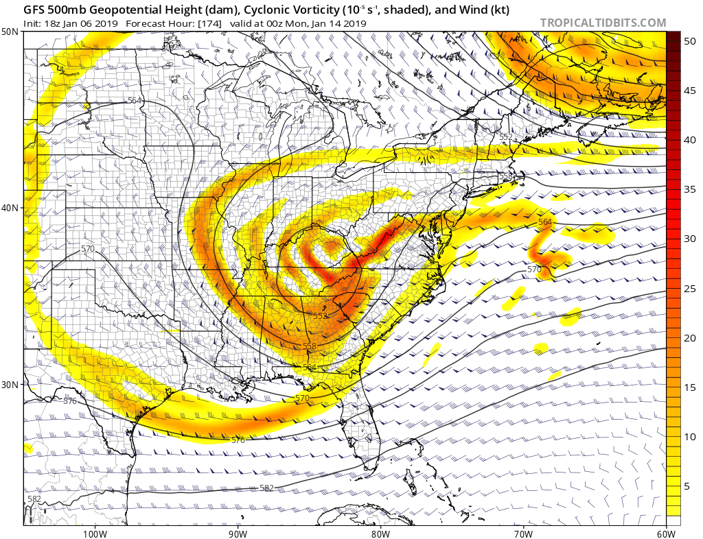
GFS looks to cut through Apps again...
-
12z ICON is Miller A-like. Taken verbatim, would be a moderate-major snow for central and southern VA, Northern NC
-
3 minutes ago, CAD_Wedge_NC said:
Yep, the pattern looks a lot more favorable now that the GL low is no longer in play. Looks like a true miller A type storm incoming. I am still a little concerned with surface/850 temps, but as has been mentioned in previous posts, the confluence in the northeast is stout and should allow surface and 850 temps to trend colder as we approach the event. Now we wait to see how the trends develop over the next few days. Once we get inside the NAM's wheelhouse, we will get a better idea on thermal profiles. Until then, let's enjoy the tracking.
Yep! Time to start losing sleep awaiting the 0z Models to look for Clown Maps.
-
 1
1
-
-
Well this probably wont happen but fun to look at... it snows 27" IMBY
-
2
-
-
Taken Verbatim, it snows for 2 days via 18z GFS in some areas.
-
Can you say Negative Tilt and Phase?

-
18z GFS is Miller A-like.... and it definitely should be colder than what the model is depicting... let's hope this is the beginning of a trend.
-
18z GFS coming in... looking good... especially I-40 North...

January 12th-13th event
in Southeastern States
Posted
Maps??