

BornAgain13
-
Posts
2,879 -
Joined
-
Last visited
Content Type
Profiles
Blogs
Forums
American Weather
Media Demo
Store
Gallery
Posts posted by BornAgain13
-
-
2 minutes ago, griteater said:
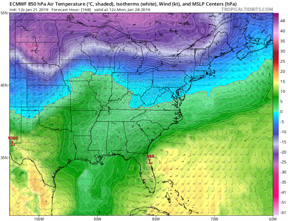
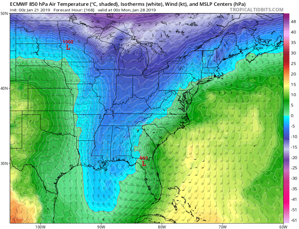
Here's the 12z EPS Mean for Sunday/Monday. I think the move toward suppressing this thru the gulf is perfectly fine. I think the area of "greater concern" is the warming tendency. If the wave detaches from the northern stream, you lose some of the cold air that is necessary to keep the column cold enough east of the mtns and on the NW side of the low.

Other than the cold air, does the EPS have similar results as far as snow from 0z?
-
2 minutes ago, Queencitywx said:
The euro, by far, was the coldest model here and is currently verifying.
Are you DT in disguise? lol
-
 1
1
-
-
5 minutes ago, SnowGoose69 said:
System at 120 over OK/TX doing exactly what you want at this range. Getting buried and squashed. Fully believe that wouldn’t happen and that system would continuee moving E along the gulf coast
So when will the models start getting a better handle on the weekend system? Maybe by Wednesday?
-
Still snowing very hard at the end of the Euro run... taken verbatim, that would be a widespread 10-20" storm.
-
1 minute ago, Queencitywx said:
You're looking at roughly 216-240 here. Probably still coming down hard along and east of the 70% line.


With a max of 20.5" in there
-
1 minute ago, Queencitywx said:
I know it's a LONG way out but the entirety of North and South Carolina is snowing at 240 outside of roughly Edisto Island in SC and Ocracoke.
Yeah, back to looking at a storm 9-10 days out again.... unfortunately
-
 1
1
-
-
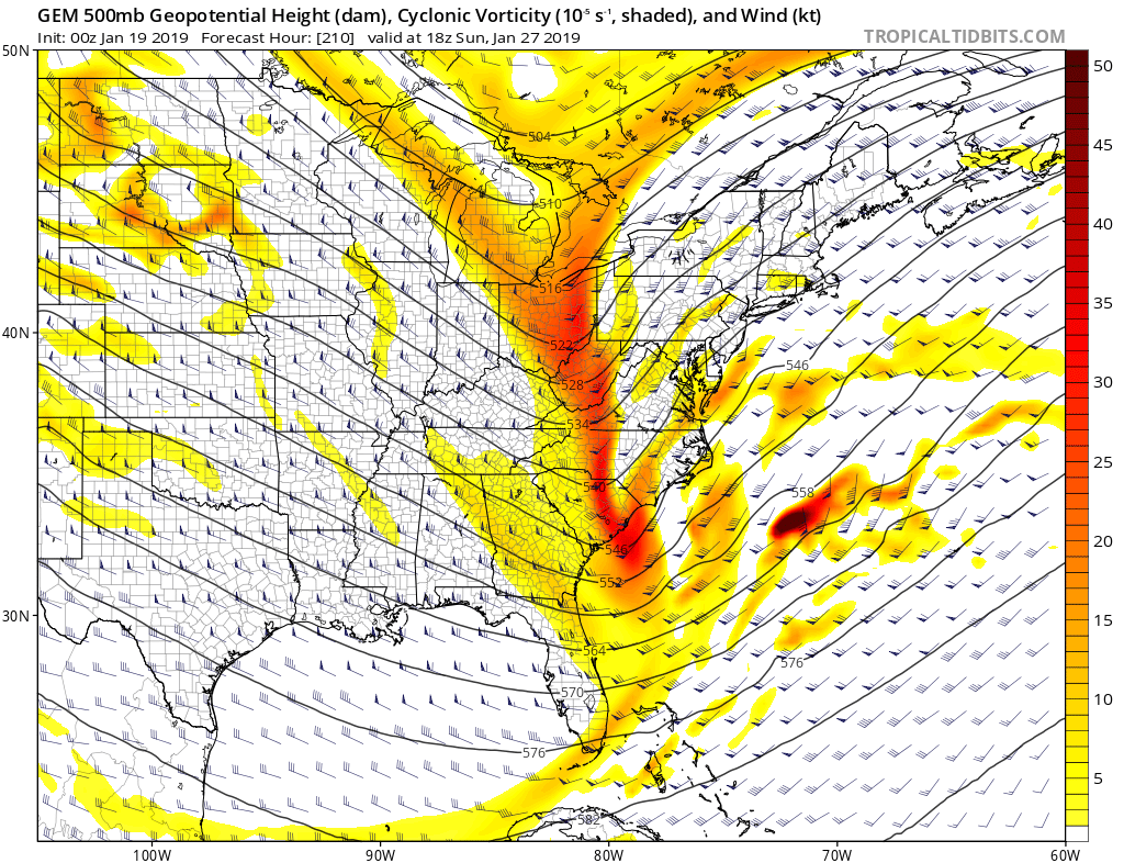
12z Euro has the storm but keeps it to far off shore...
-
1 minute ago, Queencitywx said:
...you sure about that?
Yep...
-
12z EURO not much further south from 0z, not a bad look...
-
8 minutes ago, Queencitywx said:
FV3 has basically nothing
Pretty bad runs for us from 12z so far.... wonder what the Euro will do...
-
Kind of weird that the CMC precip panels dont show much with a run like that.
-
-
-
LOL... CMC comes in and Drops the Bomb!
-
6 minutes ago, Bob Chill said:
What's the nearest bigger city?
Danville VA. I'm in the middle between the Mid Atlantic and Southeast lol
-
27 minutes ago, Bob Chill said:
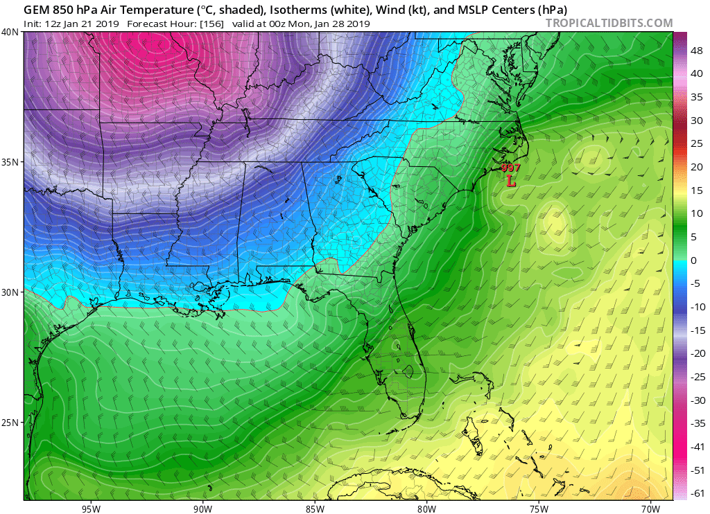
I don't care what any troll or Deb says, this panel says it all. We can't snow without normal to below normal temps are around. Rain can happen in any pattern but snow cannot. By the end of this week I expect a discrete threat to be on the table at a reasonable lead time.

@Bob Chill can I see this same temperature map for Dry Fork, VA?
-
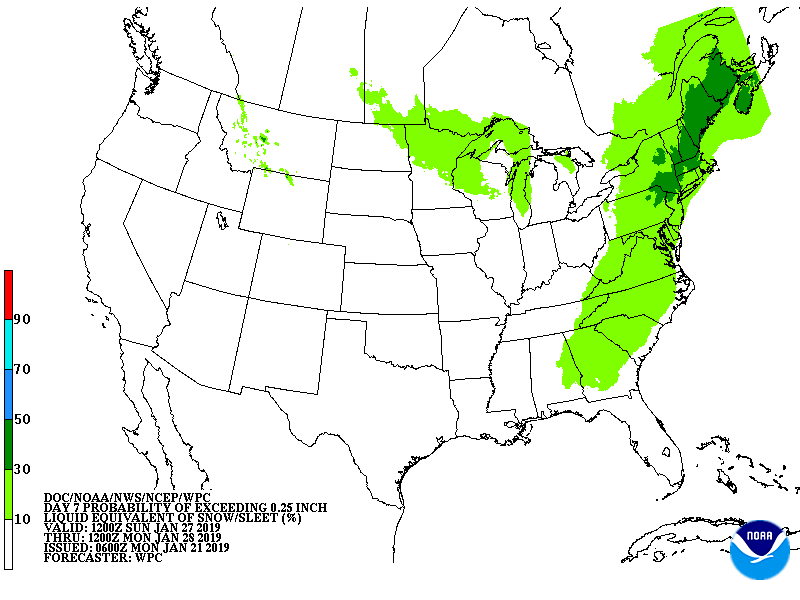
Pretty cool to see WPC jumping on the chance of this a week out.
-
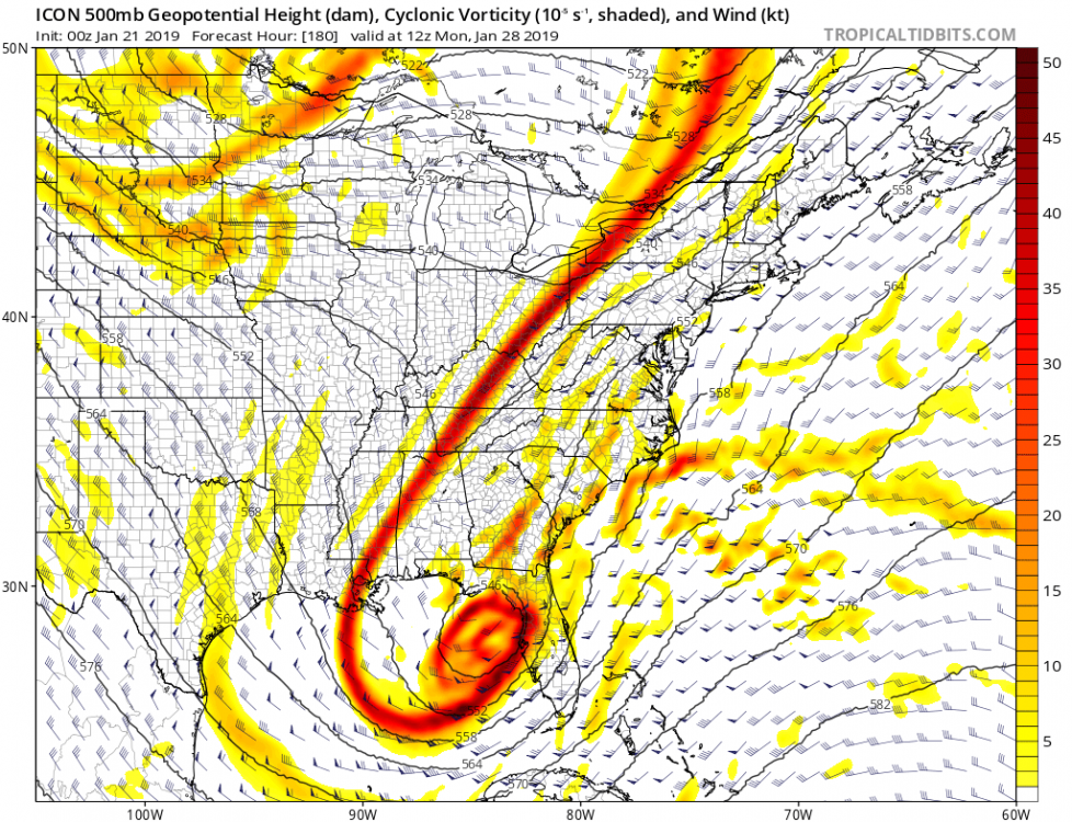
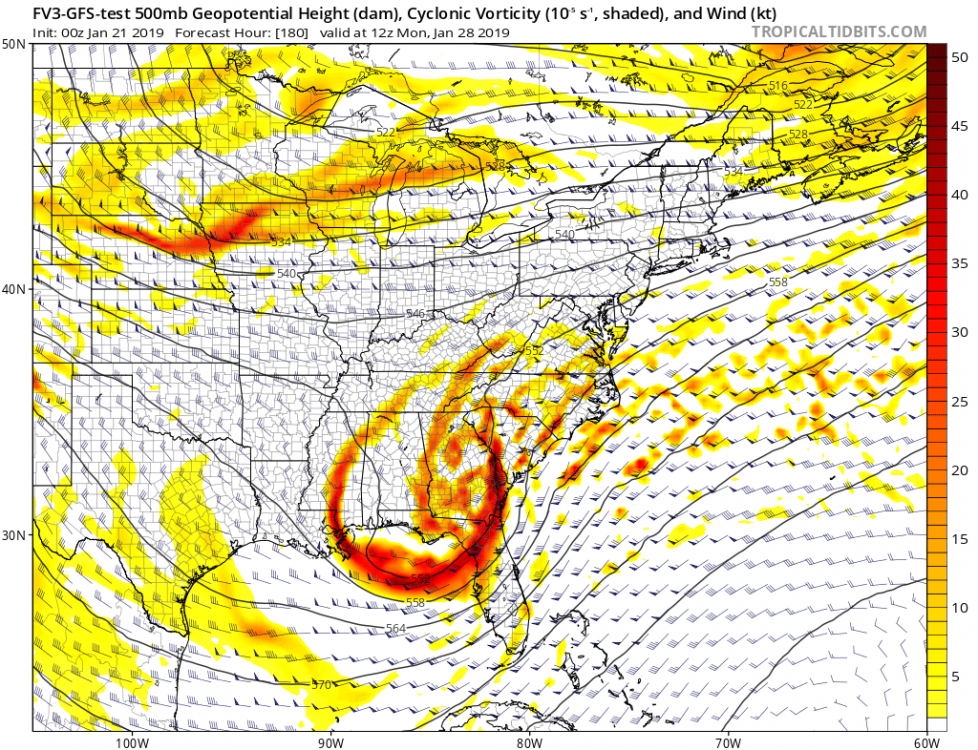
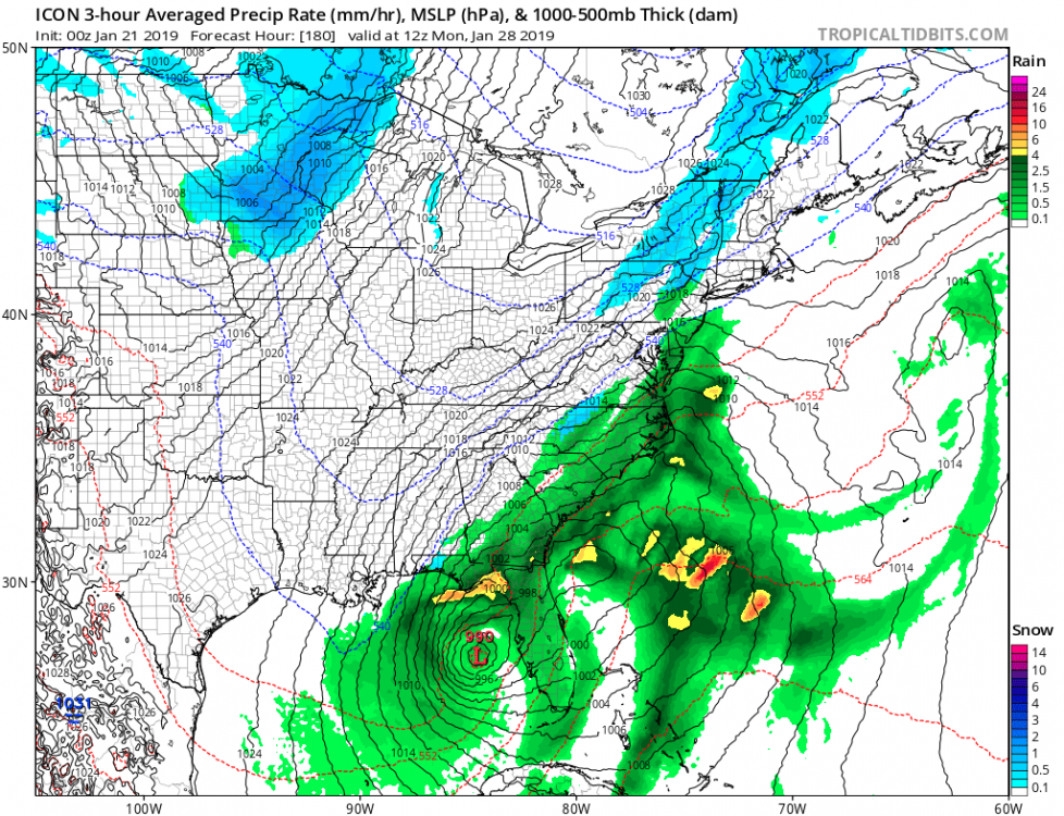
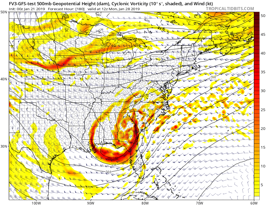
ICON & FV3-GFS For Next Weekend...
-
0z GEFS much wetter for next weekend compared to 18z
-
1 minute ago, CAD_Wedge_NC said:
Like a hurricane in the gulf...
No joke...
-
1
-
-
Just now, NCSNOW said:
Gefs snow map is a beaut. Eps is way up since last night as well.
Image?
-
27 minutes ago, wncsnow said:
As I have said before, it does not look promising at all for a SE winter storm with the upcoming pattern. It will either be clipper city or a conus wide trough and cutters. Historic winter!
Its already been a historic winter for our as area, even if it doesn't snow another inch...
-
CMC goes negative tilt for next weekends storm...

-
Well, The Cold Almost Looks Certain, Winter Weather, Well, That's The Uncertain Part...


Mid to Long Term Discussion 2019
in Southeastern States
Posted
We couldn't ask for a better run from the 18z FV3 right now...