BornAgain13
-
Posts
4,468 -
Joined
-
Last visited
Content Type
Profiles
Blogs
Forums
American Weather
Media Demo
Store
Gallery
Everything posted by BornAgain13
-
GEFS is a solid hit!
-
Dont look at the UK. Its ICE and Rain. To warm this run.
-
Yes the UK was on its way to being a big one at 12z. Hopefully 0z is a big hit to.
-
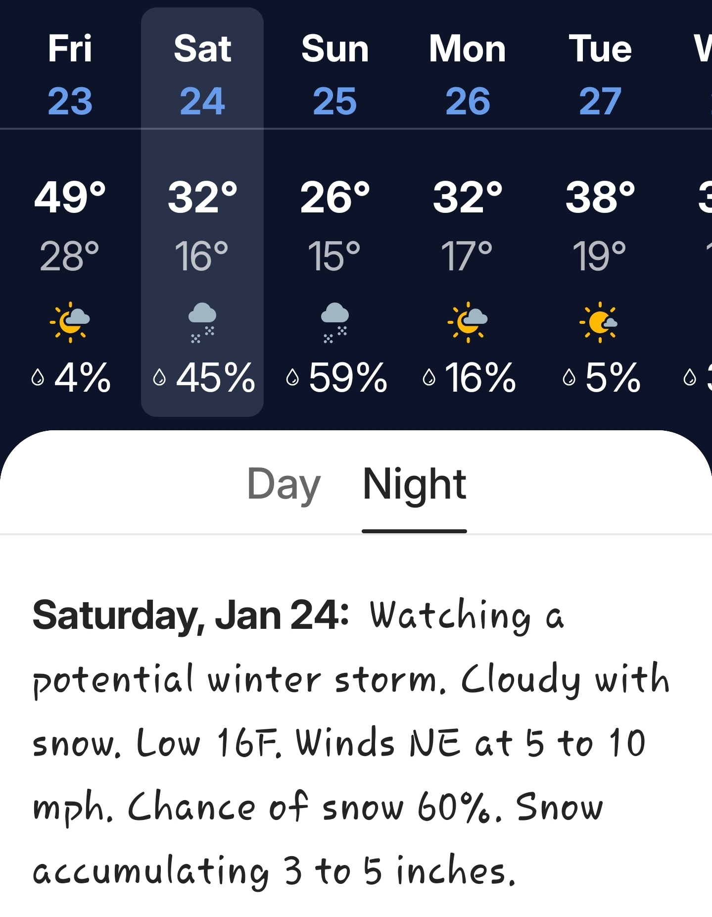
Snowing hard on the GFS/Canadian with temperatures around 15 degrees here taken verbatim.
-
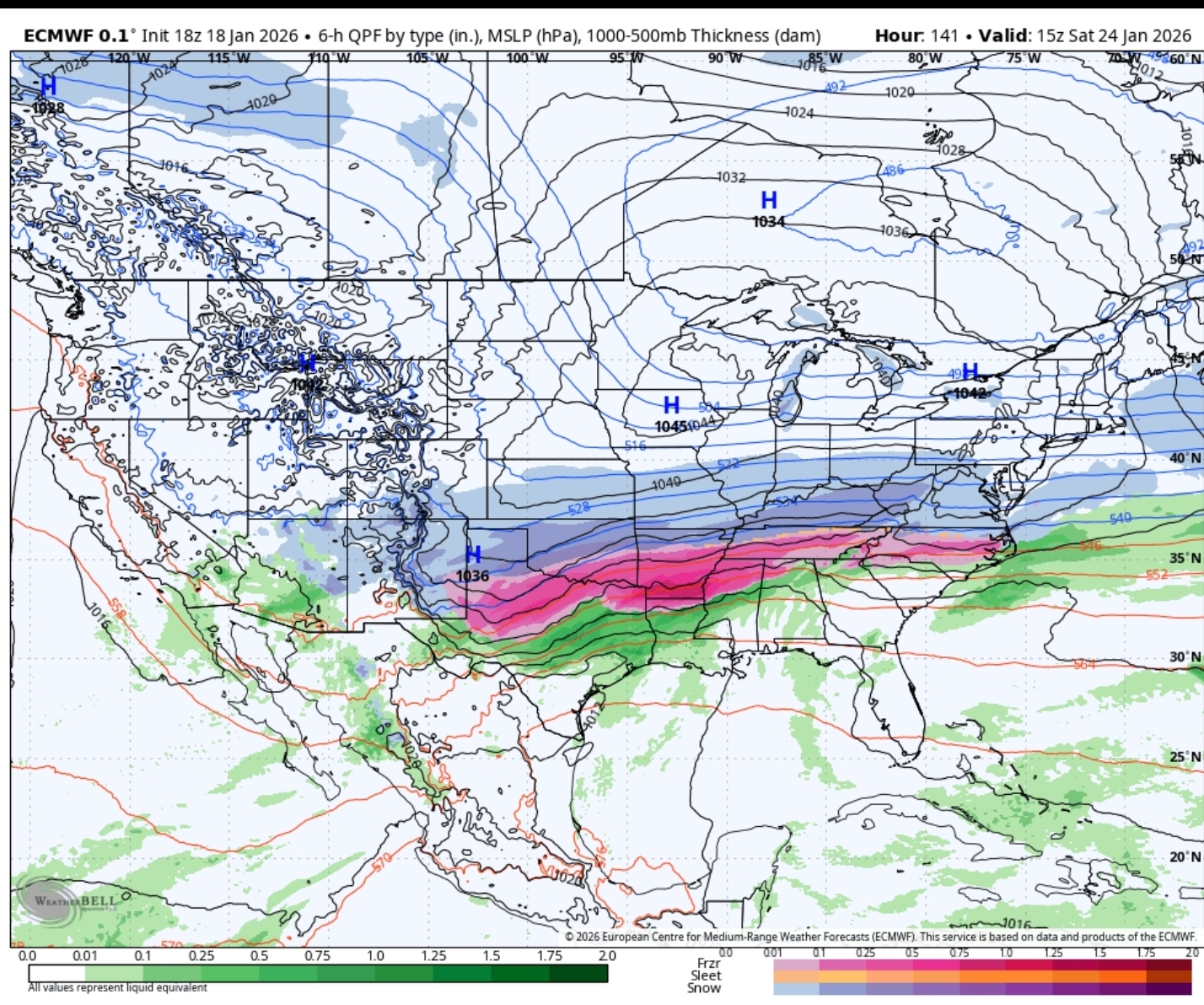
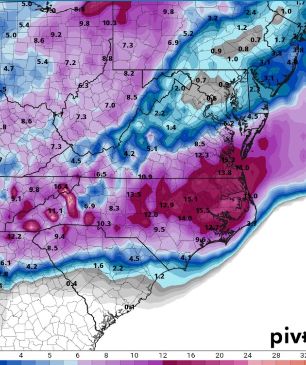
0z Canadian. Big Winter Storm
-
0z GFS is a Big Winter Storm with more Snow and Less ICE
-
0z ICON with a Winter Storm for mainly North Carolina on this run.
-
This is a great way to go about it!
-
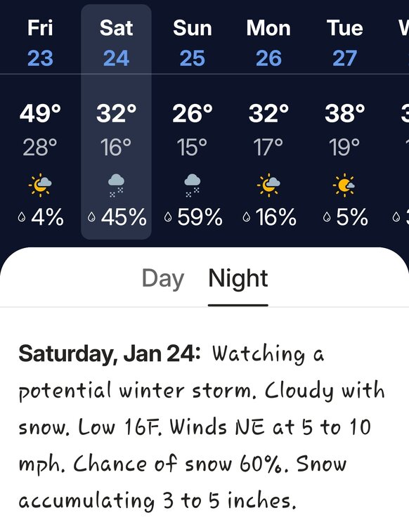
Weather channel app already saying watching a potential winter storm lol
-
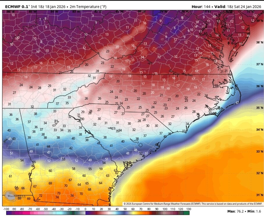
18z Euro temps at the beginning of the storm
-
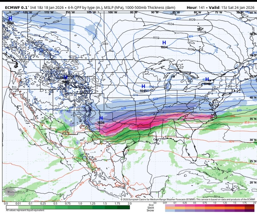
18z Euro ... wow yall
-
18z Euro AI is a Virginia SnowStorm
-
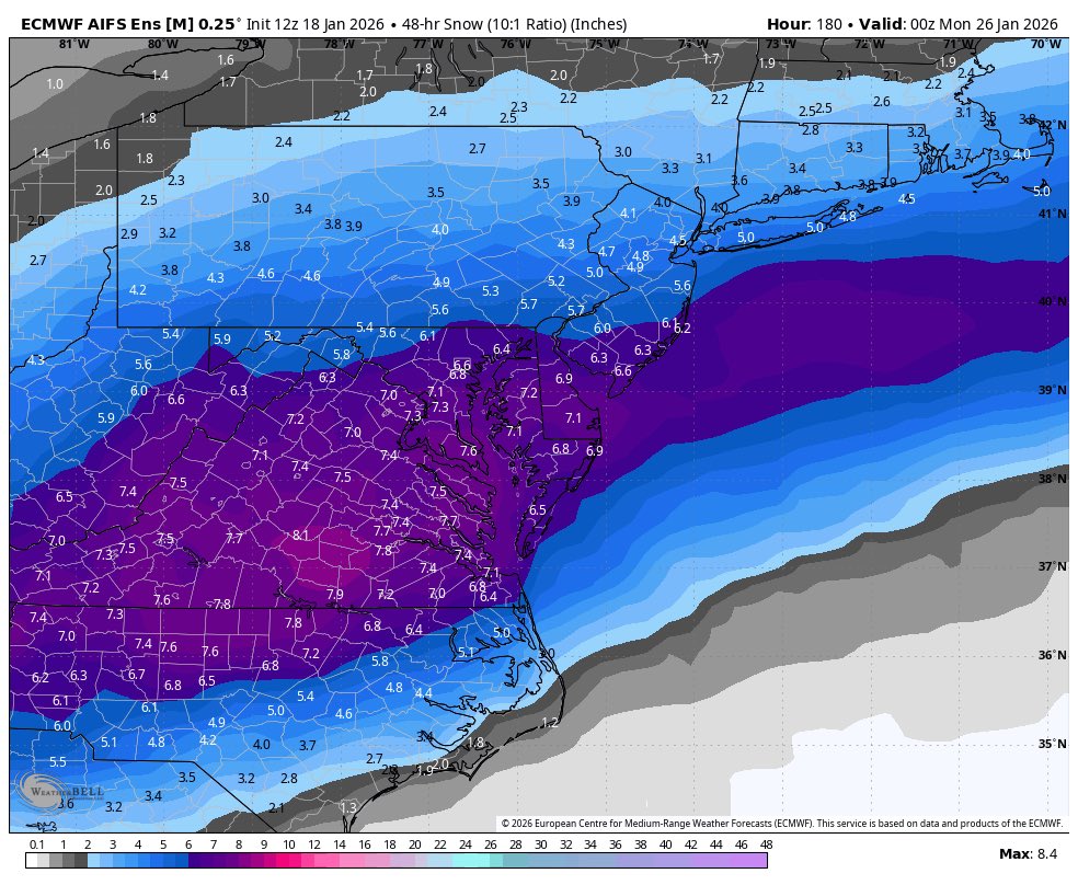
18z GEFS for next Sunday. Strong signal folks!
-
18z GFS solid Winter Storm for NC but a sharp cut off to the north and then it suppresses south.
-
Yes December 2018 had a big signal at Day 6 or 7 and continued from there.
-
End of the 18z ICON, which only goes out to Friday, was setting up for the weekend event it seems.
-
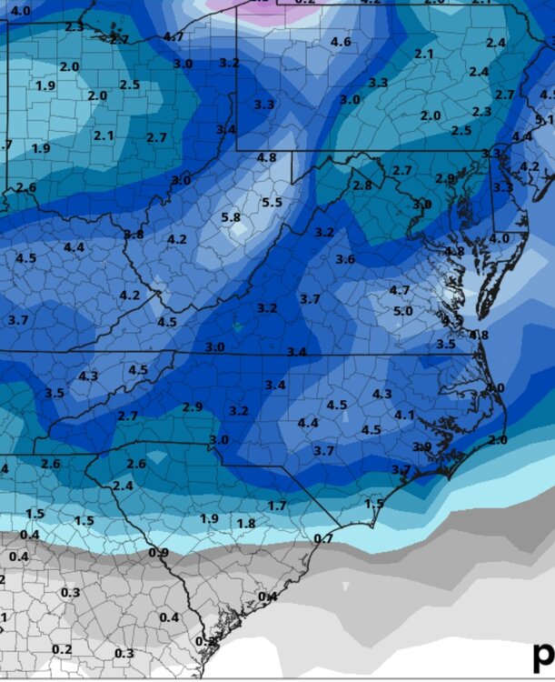
Thru Next Sunday at 7 PM

-
Pouring Snow here
-
Snowing here in Dry Fork,VA! Officially another trace for the season lol
-
Check out the Euro AI for next Sunday lol

-
Wow just wow. Look at 12z showing off lol
-
6z GFS brings back the storm for next Sunday for NC/VA
-
I am really excited about this period because most of your top models are showing a Winter Storm or a couple of them. Huge signal.
-
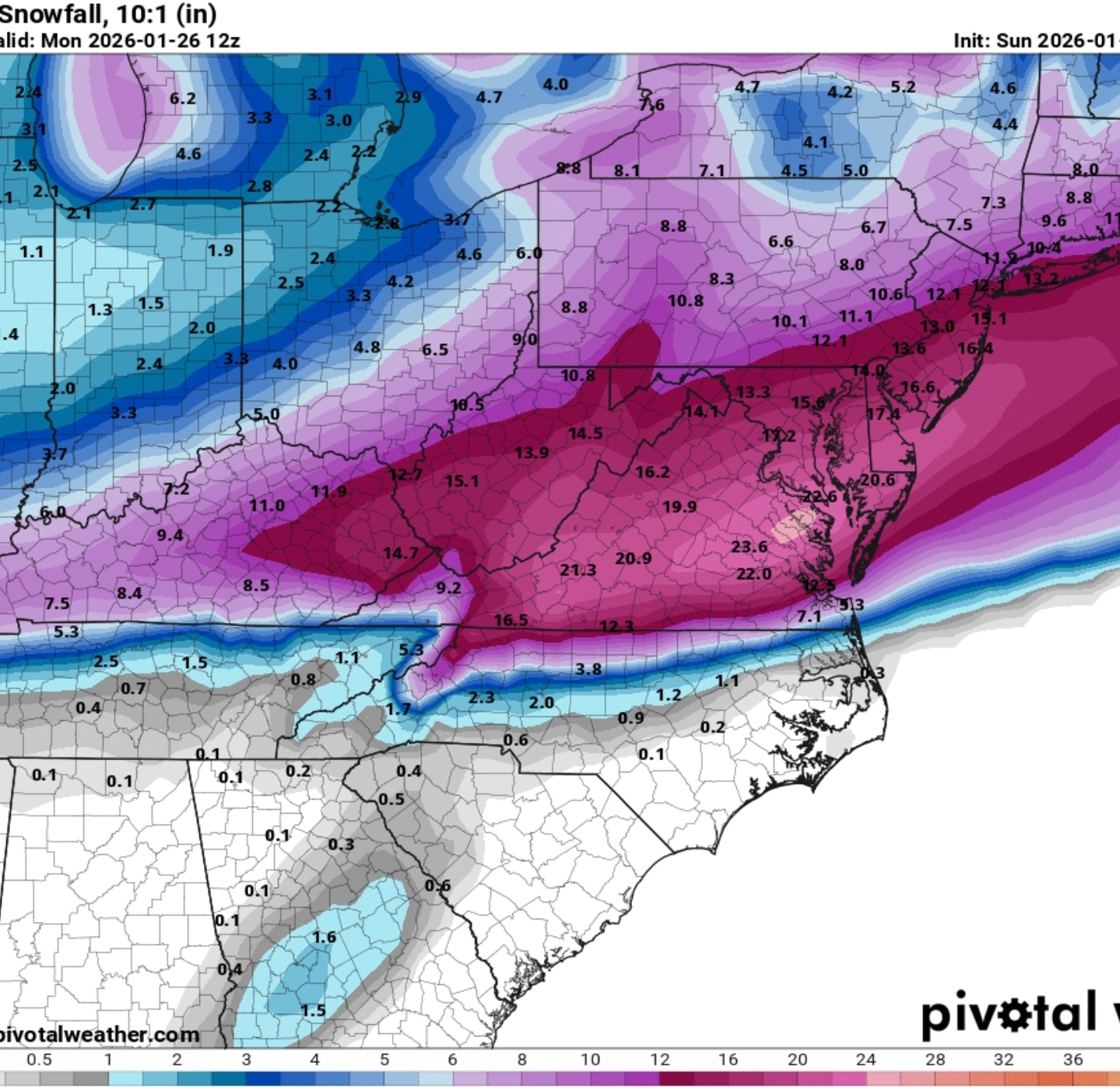
That is 1 strong signal around the 27thish
-
12z NAM is a hit just NW of Raleigh. Narrow stripe. 3k NAM is further NW with light to moderate snow for a good area.