BornAgain13
-
Posts
4,468 -
Joined
-
Last visited
Content Type
Profiles
Blogs
Forums
American Weather
Media Demo
Store
Gallery
Everything posted by BornAgain13
-
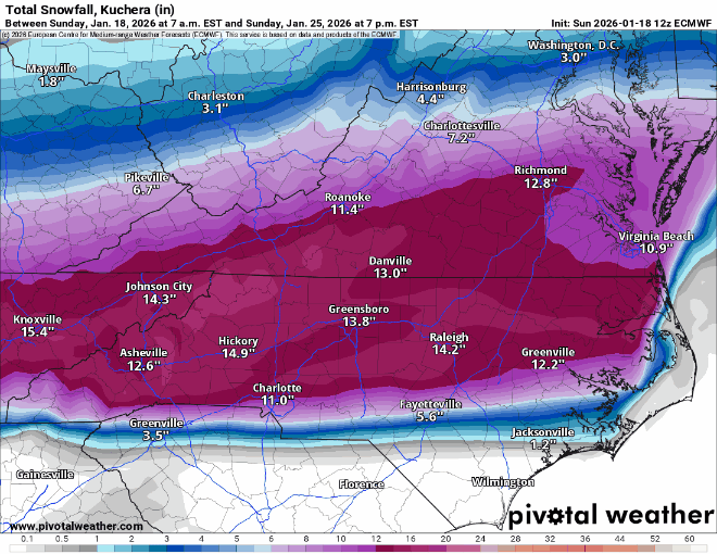
This is a Classic Winter Storm for the SE/Mid-Atlantic
-
-
Monster Run on the Euro especially central NC and north... 18"+
-
Should be a Big Euro Run....
-
-
Lol Euro AI has 3 hits... over 30" total here for all 3 lol
-
Euro AI definitely a shift south
-
Lol the Euro doesnt want to run or the AI Euro. May have a trick up its sleeve lol
-
This may should go in the mid term discussion but the Canadian had a Miller A at the end of its Run
-
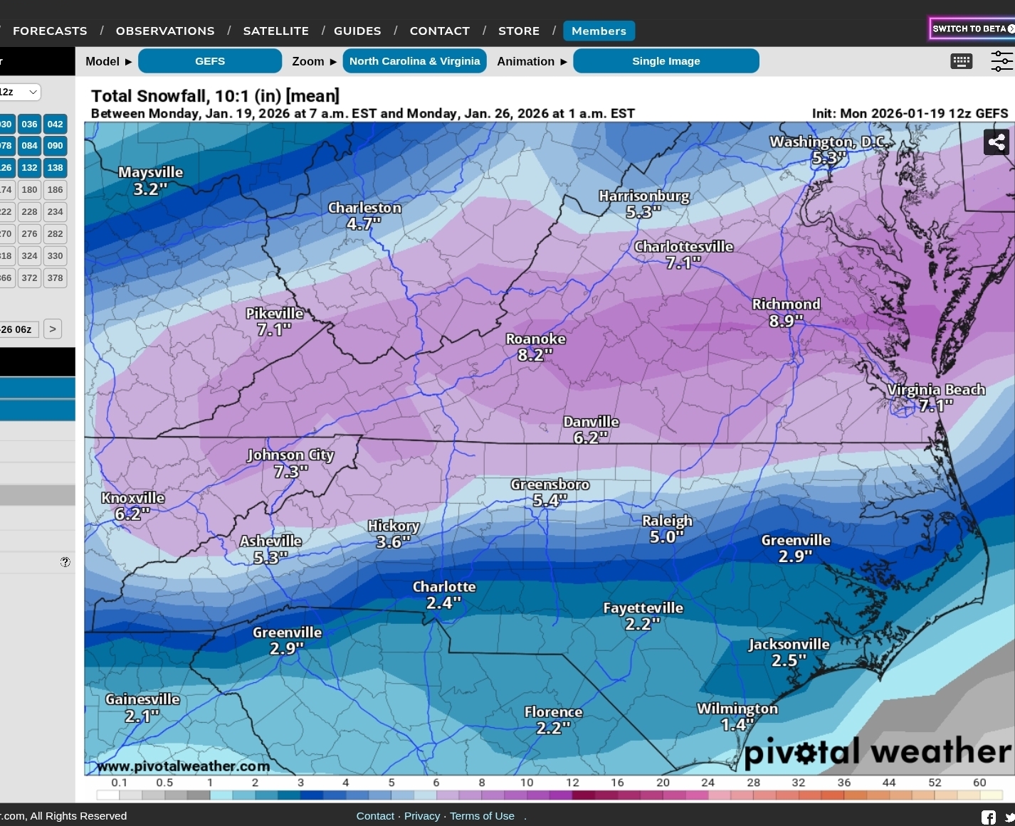
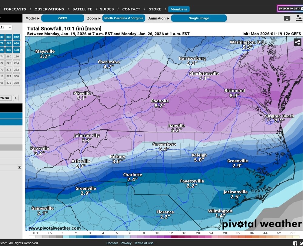
12z GEFS
-
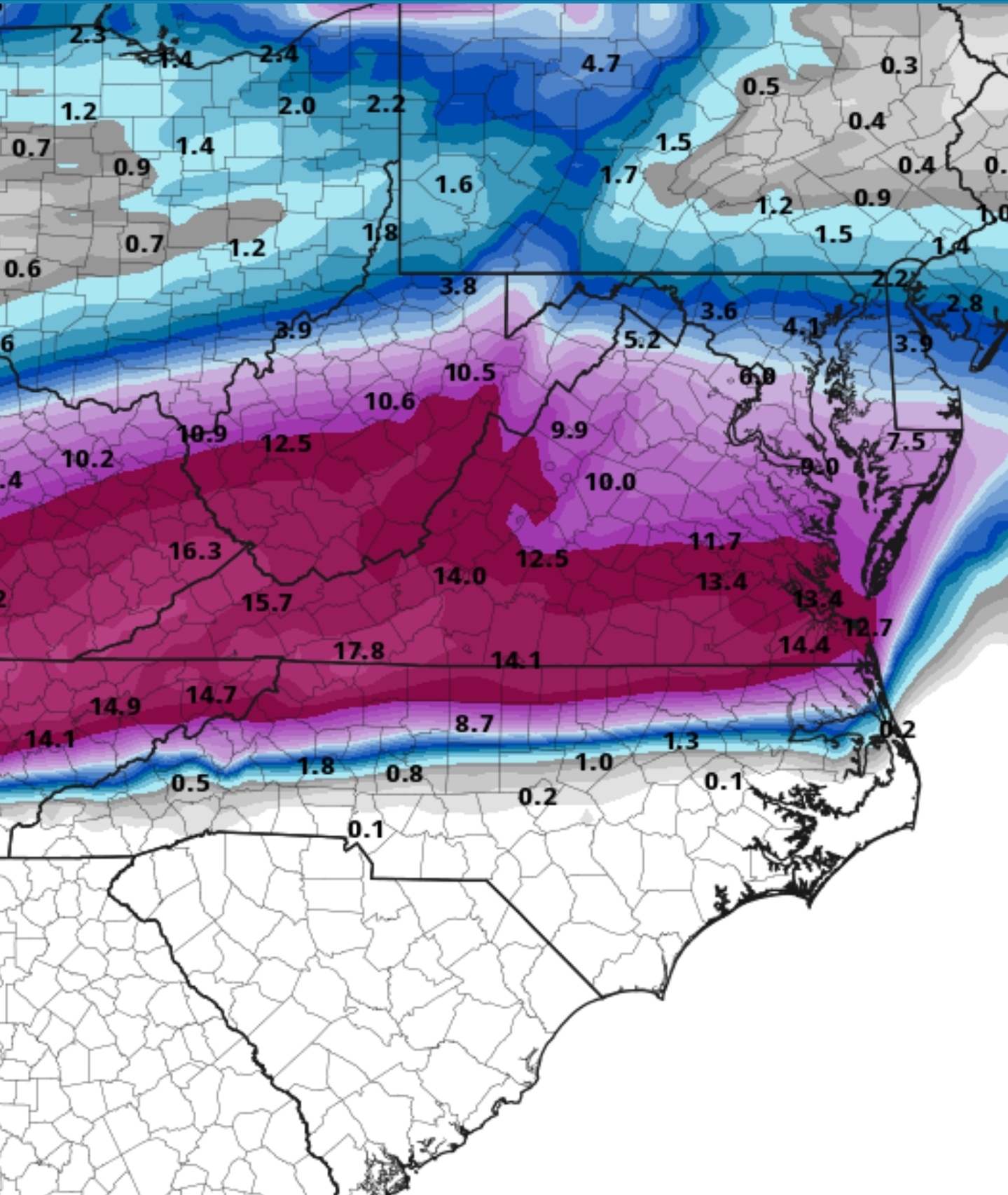
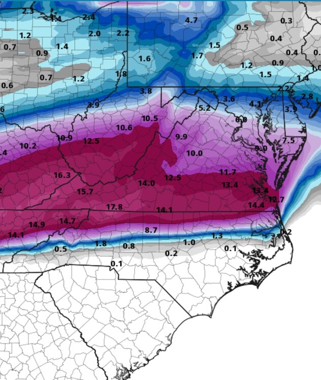
UK with a monster hit. Around 15" up this way . Over 2 feet northern VA
-
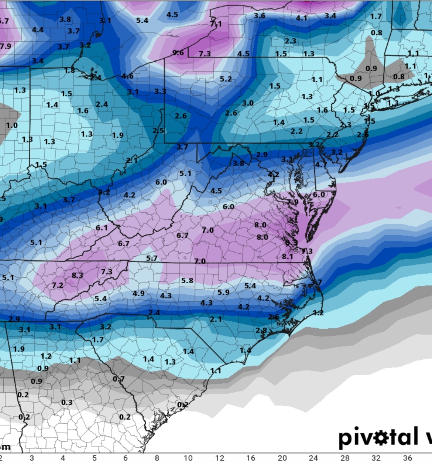
CMC is north with the Snow
-
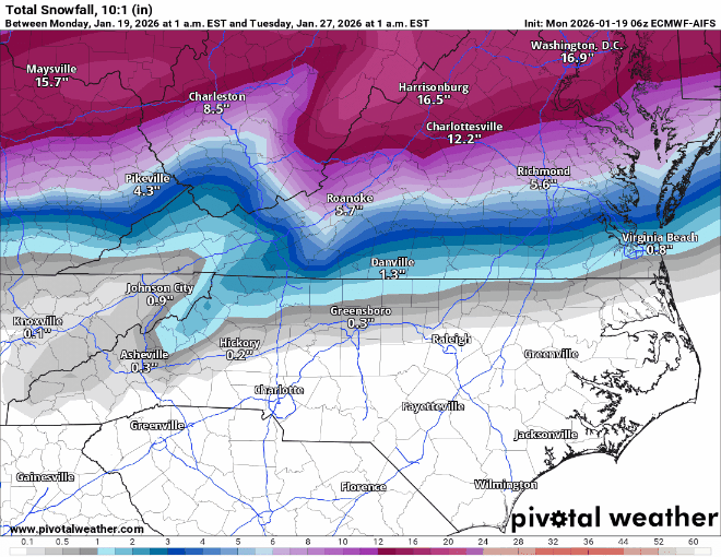
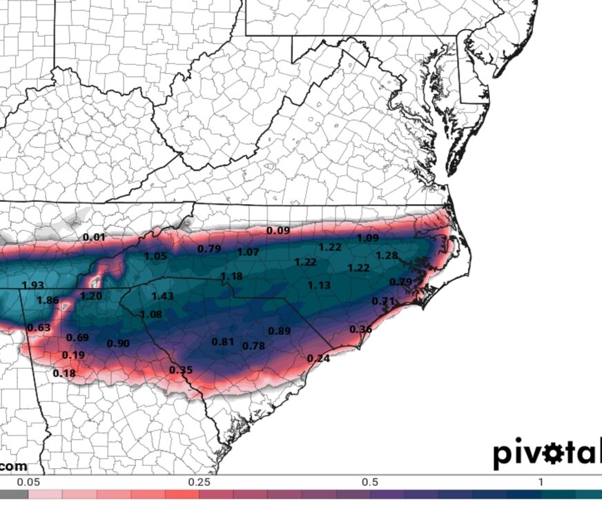
12z GFS = Carolina Crusher
-
Awesome jump south on the AI GFS
-
Mid Atlantic crew are hoping the AI models are right... obviously they are further north. Will be interesting to see which way things go the next couple of days.
-
Just unreal if it happens like that
-
What's crazy is after this storm, there is a lot of cold air sticking around for a while. Whatever falls aint going anywhere. The ground temps will be cold when it starts falling.. I need sleep gonna be a long week tracking lol
-
6z EPS at the end of its run was gonna be a huge run, especially NC/VA
-
6z EURO Snow/ICE Maps. Still going at the end of the run
-
Euro AI brings in another Winter Storm mid next week.
-
6z Euro AI is just to far north for snow on most of this board. Plenty of ice though taken literally
-
Still a ways to go this week but 1 thing i dont like is the Euro AI and GFS AI cutting west of the apps and bringing more sleet/ZR than snow. Plenty cold at the surface but aloft that would make for more ice.
-
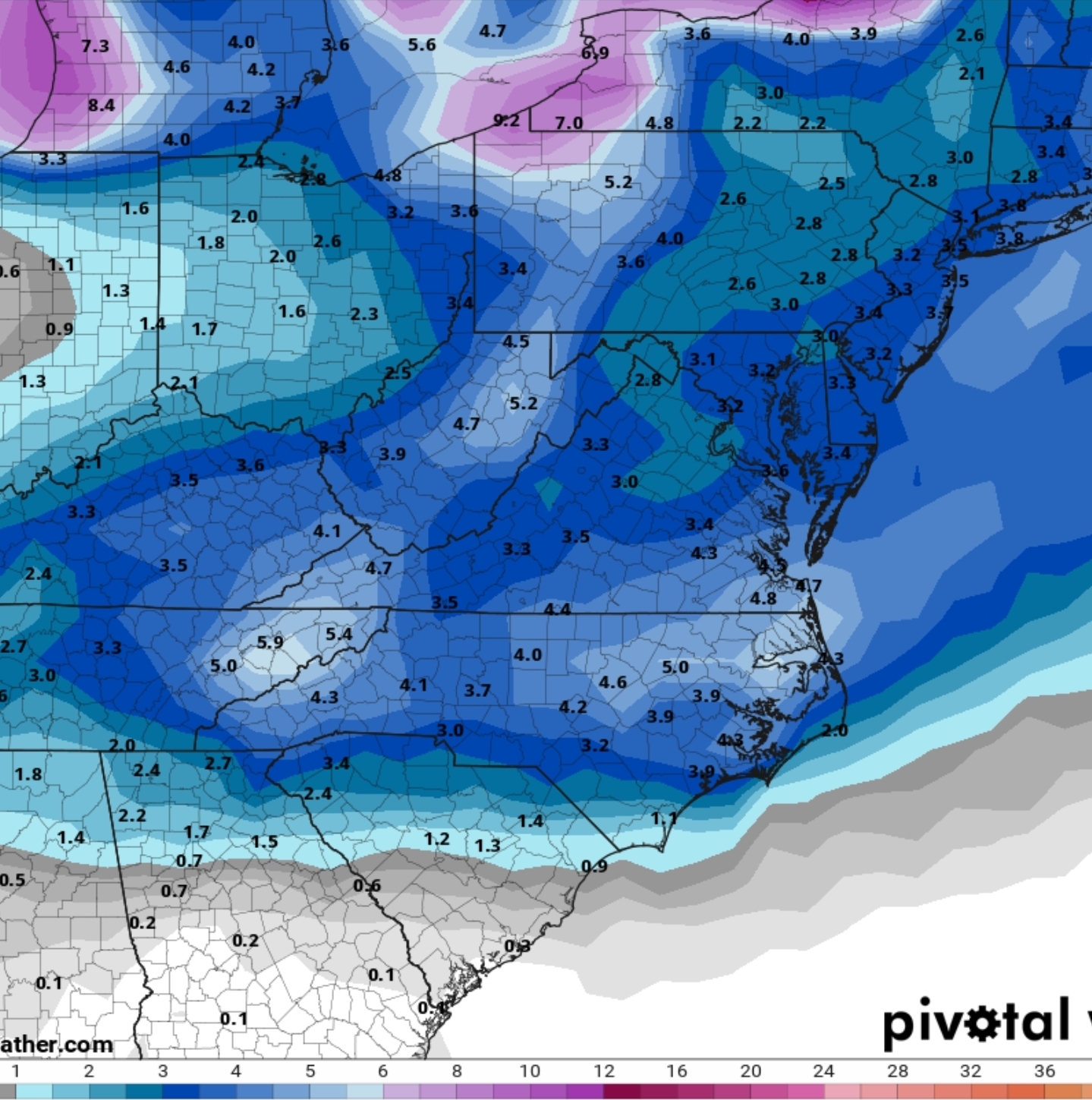
6z GEFS

-
6z GEFS is a Big One. Especially just north from where the ICE line is.
-
0z GEFS