BornAgain13
-
Posts
4,468 -
Joined
-
Last visited
Content Type
Profiles
Blogs
Forums
American Weather
Media Demo
Store
Gallery
Everything posted by BornAgain13
-
Euro AI and most guidance continues to like that period between the 24th-29th
-
New SREF
-
0z GFS with a massive Carolina Crusher around the 29th
-
Would think that western edge of precip from the GFS will look better than modeled.
-
Pulling me back in lol
-
Most of short range guidance has trended NW ... even the HRW-WRF models
-
Oh NAM why are u doing this to me lol
-
Wow!!
-
Snow and Cold is a coming!!
-
18z GFS continues to show potential after the 24th.
-
The SREF continues to be rock steady

-
Does this thing continue NW or does it stop now?
-
This thing may not be dead yet lol
-
Pattern looks great coming up y'all! Let's reel something in.
-
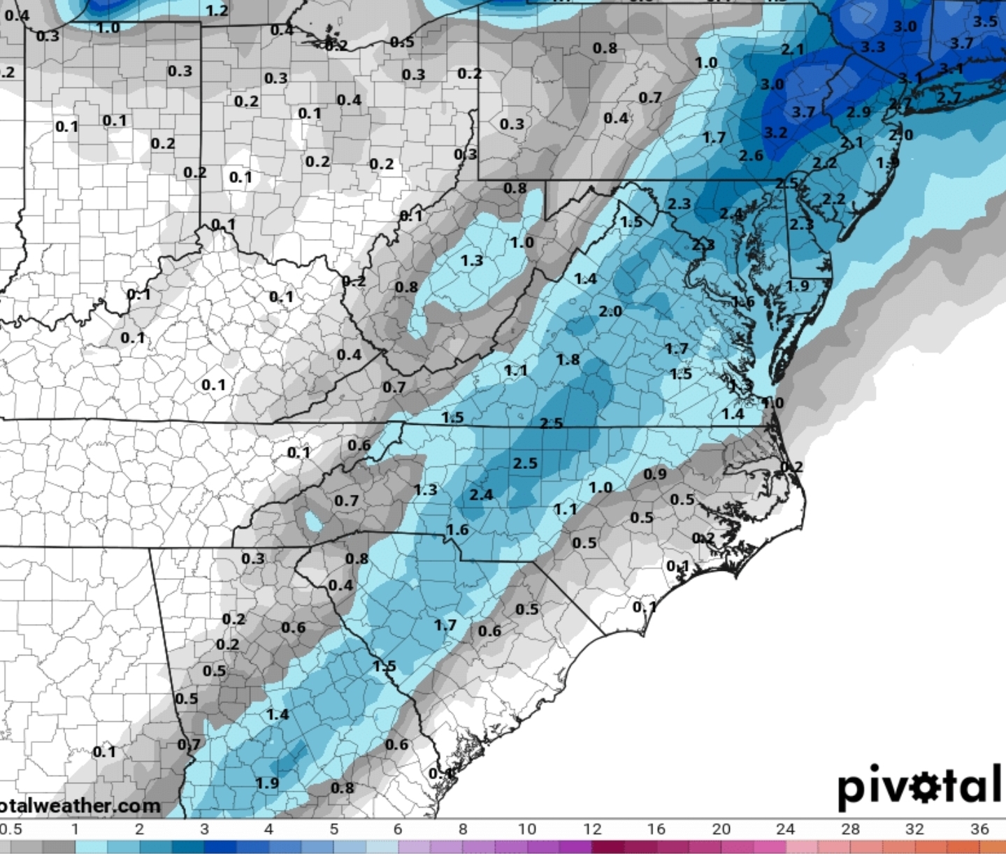
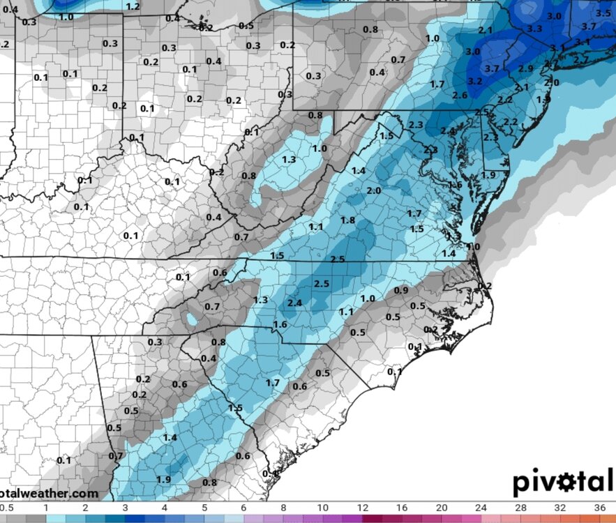
North Carolina and Virginia get pasted per 12z GFS.
-
Several runs in a row from the GFS around the 27th-28th time frame of a possible Winter Storm.
-
Icon and Canadian actually bring some accumulations up this way. I aint getting my hopes up. Edit: Not the Icon just the Canadian lol
-
I know this is kicking the can so to say... but it looks like the best period for snow or wintry weather is between the period of the 25th-29th. Multiple runs of the euro/gfs/cmc ensemble show a decent cold and moisture during that time. Something possibly more significant to track.
-
GFS folding like a towel. Horrible model. The Euro aint perfect but it is Superior. Like @BooneWXsaid, hopefully short range models start picking up on something and lead the way
-
GRAF Model is offshore
-
Would love to see the NAM and RRFS A be correct. This is a storm thats final solution is far from captured yet.
-
The model thats gonna replace the NAM the RRFS A.

-
SREF

-
The EPS actually went west at 12z compared to 6z I think lol
-
Winter Storm showing for VA at Day 10/11 on the Euro.