SouthBuffaloSteve
-
Posts
2,617 -
Joined
-
Last visited
Content Type
Profiles
Blogs
Forums
American Weather
Media Demo
Store
Gallery
Everything posted by SouthBuffaloSteve
-
 If the ice made it out of the Buffalo River last night then it’s on its way over today. Tomorrow morning will also be interesting as we look at have a short window of WSW winds gusting over 50mph which will very likely cause the lake level to rise above the height of the boom and we could see a violent ice flow exit the lake into the upper Niagara River for a few hours.
 -
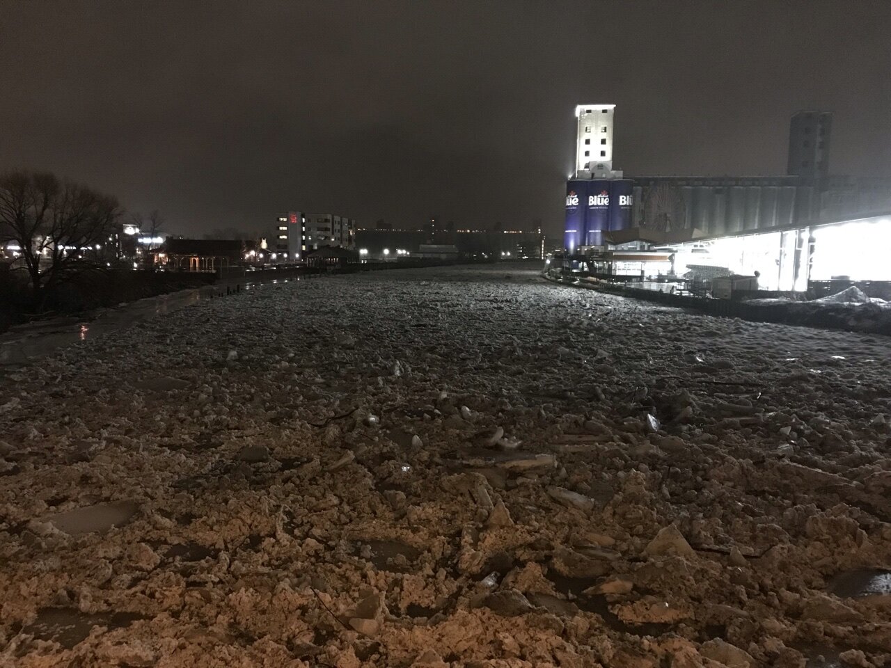
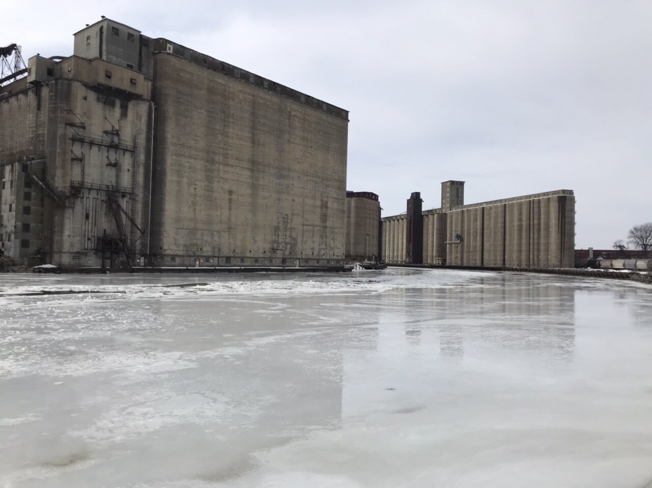
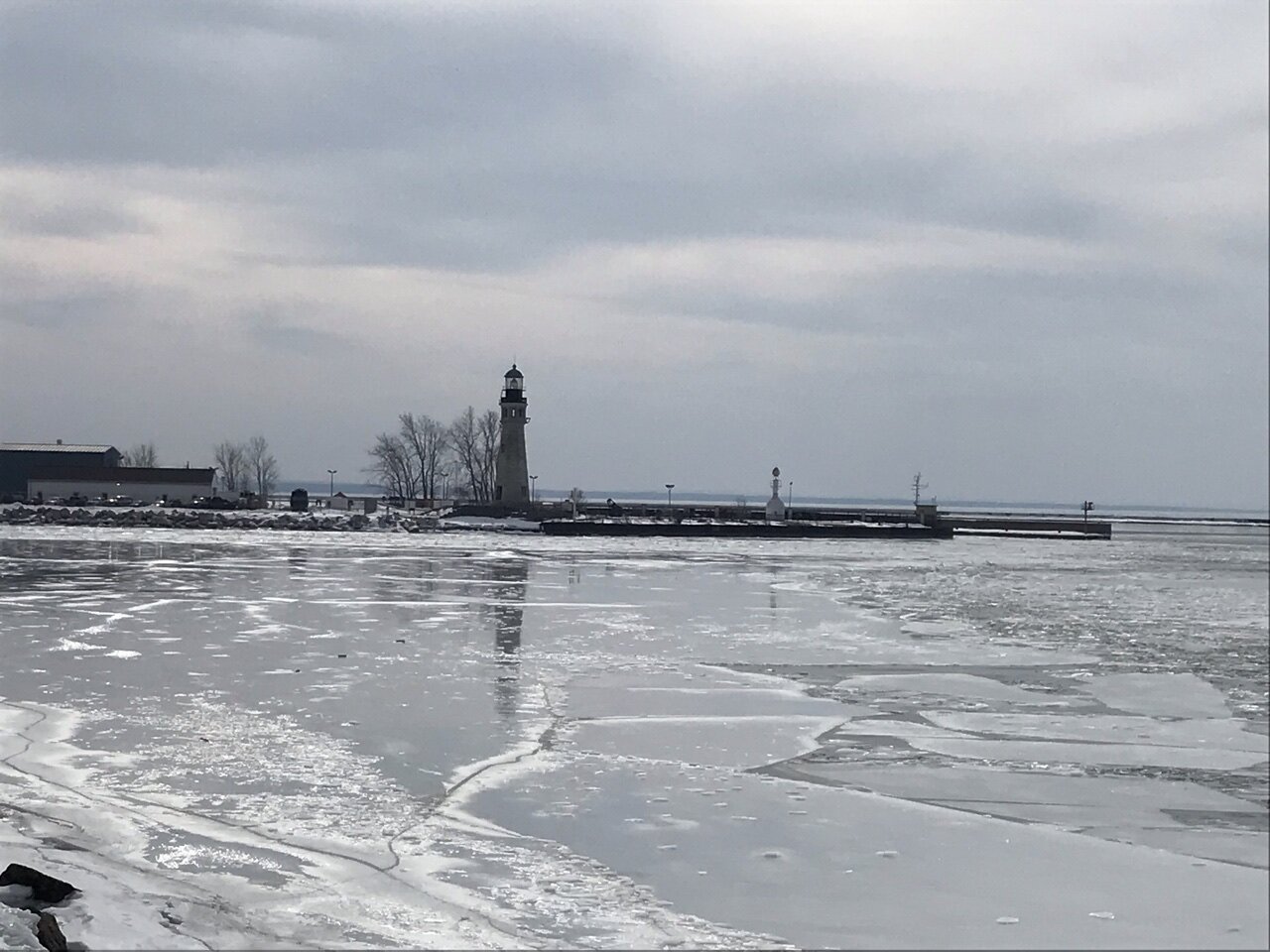
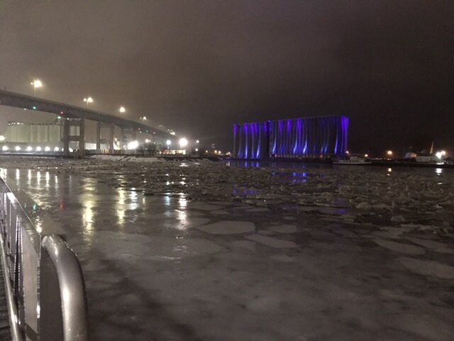
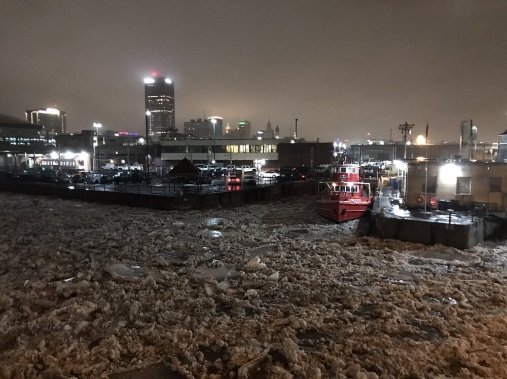
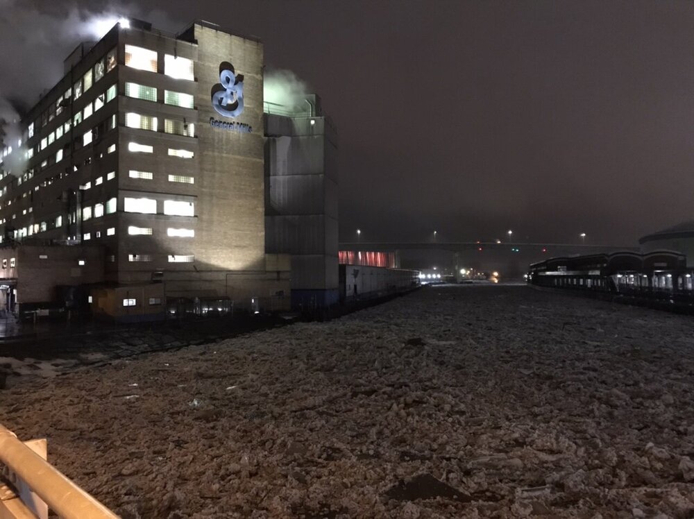
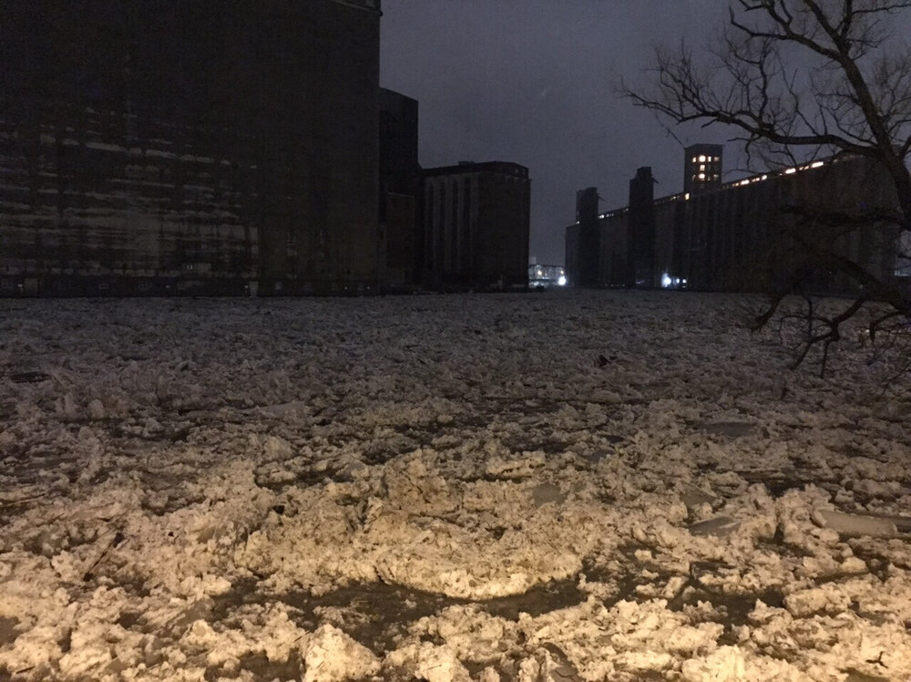
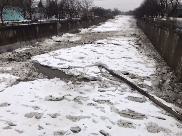
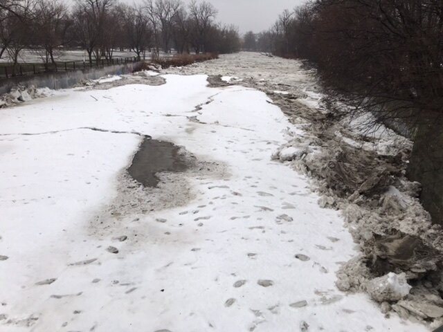
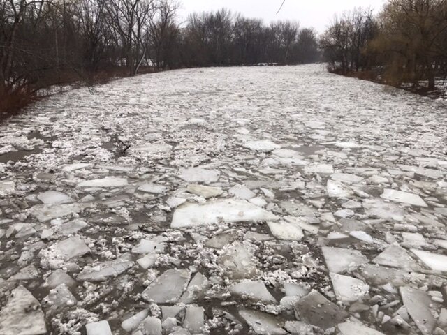
Just got super lucky with my timing today on several occasions. Flows were very strong so while we did see small pockets of flooding the ice kept moving for the most part. Was trying to setup a time lapse up at Silo City and RiverWorks but was just to dark. Filled up so fast once the ice started piling in. Had better lighting at canal side but I was out of energy at that point and just packed it in. This would have been an awesome view of the entire flow rushing out into the Lake. There’s a low foggy haze over the skyline and above the ice just adds to the feel of it!
-
Very Heavy Sleet! Finally called it for the night. Made it all the way down to canalside and now it’s just sitting there with no sign of flowing into the lake for a while yet. The dark really cuts down on the viewing but was still an awesome night chasing that ice flow all the way to downtown.

-
Crazy out here tonight. Surprised they are still flooding in West Seneca. The flow that came down Buffalo River was insane! Down at RiverWorks now watching it head to the lake!
-
Let the time lapse run for 5 hours today and it only used 60% of the battery. Drone shots would have been epic!
-
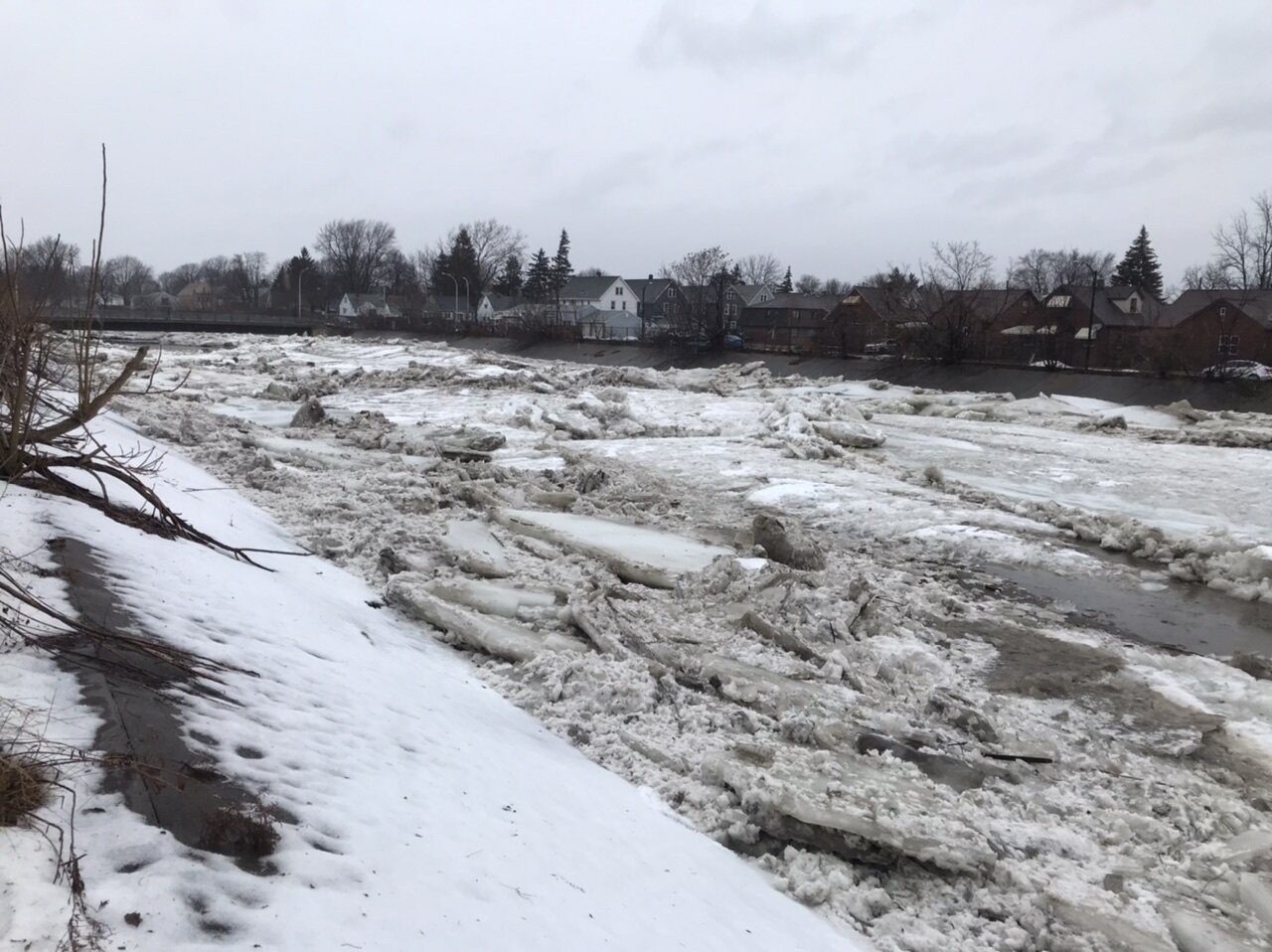
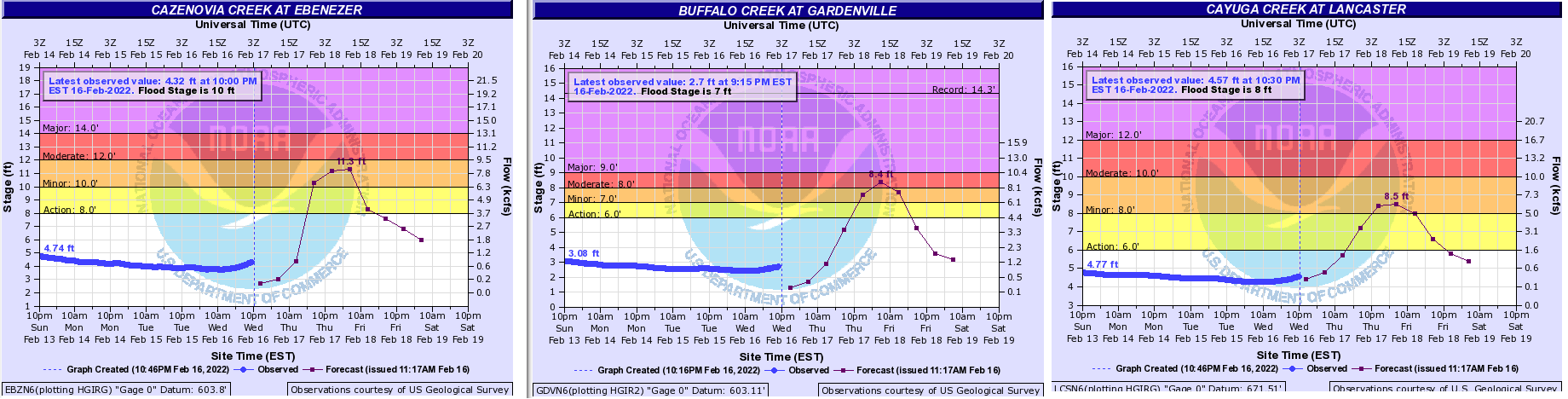
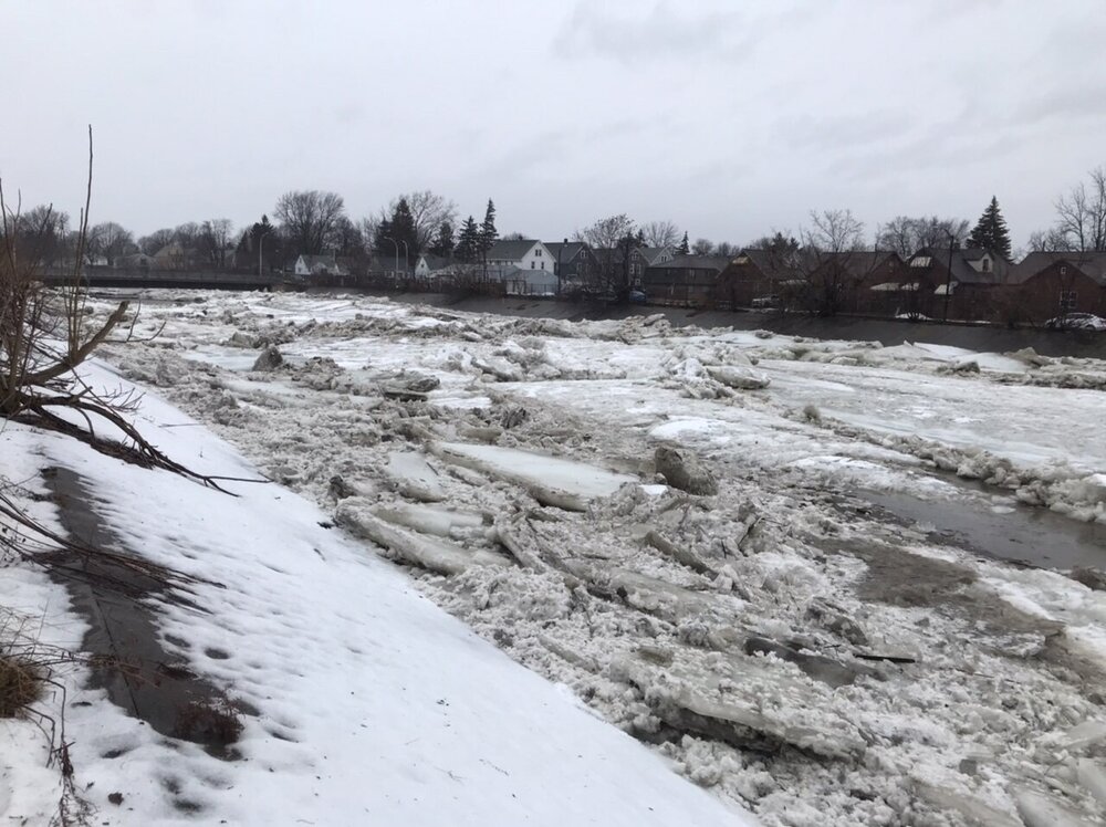
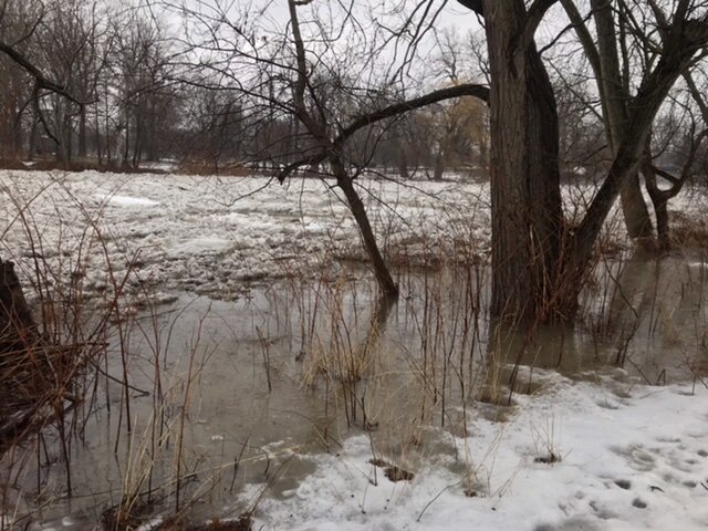
Caz looks like it has been fully blown out now. Buffalo River on the other hand has a major jam in place from Smith Street back to the area behind Tesla. Two additional jams are lurking just upstream into Kaiser Town area. Could be some flooding problems down in the First Ward tonight if these start shifting.
-
Maybe… There is another flow slowly coming downstream from West Seneca now so possible it could jam up again. One other neat video to share. This is when the jam first let go.
-
Got more video to sift through later but this one was probably the best with the trees smashing into the bridge deck.
-
I set it to time lapse once before and just left it alone overnight recorded like 6 hours before it died but it was on a super cold day as well. Just happened to roll down for a check and times it perfect the first jam broke while I was on the bridge, was a pretty intense ice flow for about 15 minutes and now it’s flowing free. There is still another jam in place from Southgate Plaza in West Seneca back to Lydecker Road bridge so we may see another one setup later today.
-
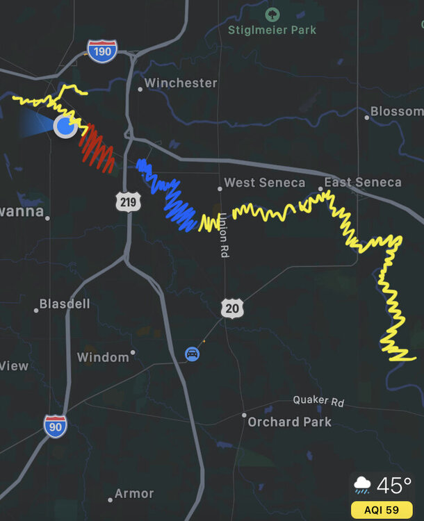
Bigger jam looks to be locking in just before the Stevenson Street bridge. Have this massive tree on top of the flow I’m using to judge travel distance and only seeing the flow moving about 100 yards so far. Level is rising at a good clip right now.
-
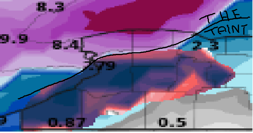
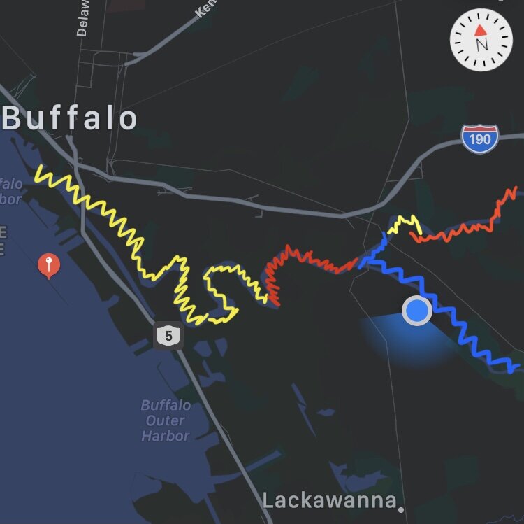
Still A LOT of ice to come through. Red is current jam. Blue is ice free. Yellow has yet to start moving. Wait till it starts letting go upstream next 2-4 hours…
-
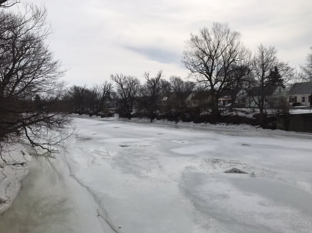
Currently one jam in place in Caz park. Is starting to flood over into the park. Ice under Stevenson still has not moved yet. Up stream in West Seneca is ice free from 90 overpass to SouthGate plaza but then looks to be a solid sheet again from there.
-
Well every city’s gotta have its king right? Also nothing wrong with bragging when you are in fact #1 in the snow department… you just Salty… lol

-
@lakeeffectkid383
-
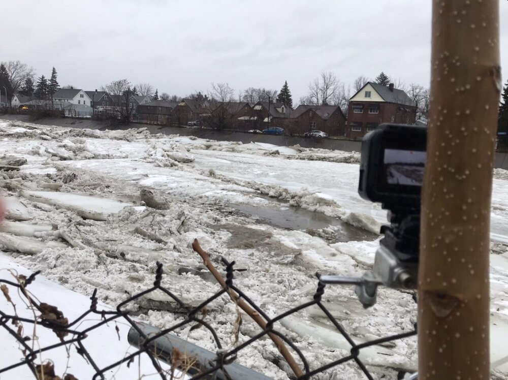
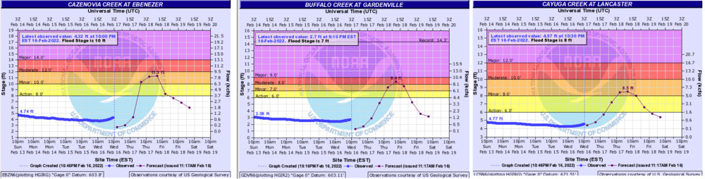
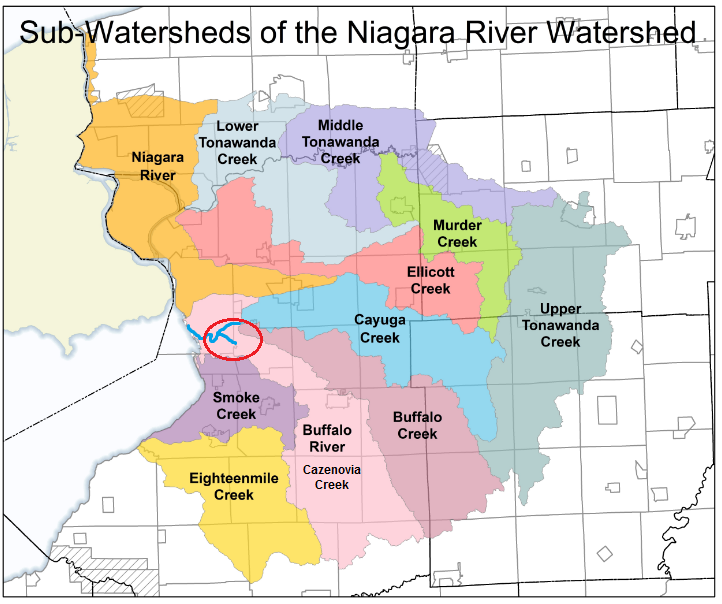
I live two streets over from Stevenson Street Bridge so that's my usual post. Planning to zip tie my go pro to the fence 50 yards up stream and time lapse the jam form under the bridge. Took a drive an hour ago and not seeing any rise yet just a low flow on top of the ice sheet but nothings moving. Charts showing a very slow flow increase but this is largely remaining below the current ice sheet without issue. My fear is a lot of the water content from the snow melt is not reaching the ground layer water table yet. Caz rises fast, responding withing 4-6 hours of precip and runoff, but saw almost no flinch all day despite peak melt conditions. Thinking is current pack continues to maintain an extremely dense water content that is not working into the ground. Just went to Target in OP and the fields along Milestrip were lakes! Possible ground layer is still frozen over and water is just stuck and not reaching the watersheds yet? Add a rapid melt of that bottom layer tomorrow with 2" of rain and were talking a flash flood situation. This could lead to a very violent ice flow if the entire content is all released at the same time. I'll be chasing the ice flow down stream throughout the day. Will have to do some recon in the morning but looking to start in West Seneca at Lydecker and move from there. Gotta shuttle the kids here and there through out the day but no work until Monday so planning to chase the jam until it reaches the lake on Firday. Buffalo Creek in West Seneca could also see some action as well. Until the ice starts moving can't really tell. I found a nice map that shows the areas covered by the creek system in WNY. The other factor in jamming is the race on which creek can hit the Buffalo River main branch first. If Buffalo and Cayuga Creek can dump into the River first and clog it up Caz has a major issue draining as it makes a perpendicular entry into the main branch. If Caz can hit the River first it doesn't seem to jam as bad.
-
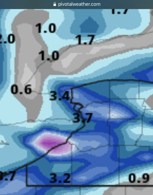
Flood threat tomorrow evening through Friday morning looking pretty decent. Along with the Cotter ice breaking on the Buffalo River the Underwater Team was out cutting the triangles into Caz Creek. The slants are packed with ice already so once things start flowing upstream expect to see issues in the normal problem areas. Snowpack is extremely ripe with a high water content still in the 2-4” range. 1-2” of rain possible with a rapid melt of the remaining snow pack and things should get rather interesting.
-
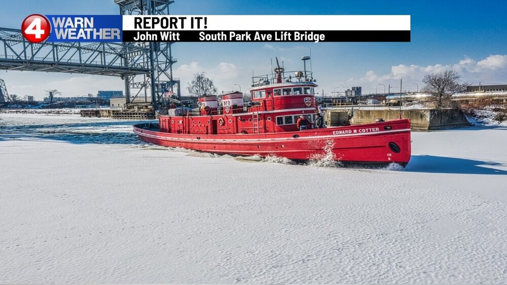
What a great afternoon outside! Was out along the River hunting for the Cotter but couldn’t find it. People jogging down on the waterfront in shorts… Officially a THAW now!

-
As much as I love my winter, I also want my January Thaw even if it’s in mid February now. Love ice jam chasing on the local creeks when we finally torch after a long cold and snowy stretch.
-
The videos save as to big of a file, and i always have issue posting video directly here regardless of file size. You need to save it as a gif and post it like an image. No idea how it calculates the file size as a few times a 6 frame loop was over the 2MB limit but then other times I can do 12-14 frame loops no problem.
-
Neat…
-
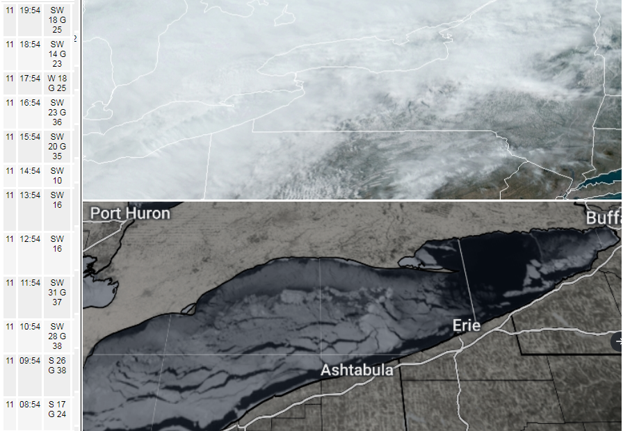
Next Lake Erie Satellite should be interesting. Saw strong south westerlies gust over 35 most of the afternoon. Ice sheet in central basin is mobile and could be pushing up in eastern basin this evening. Clouds did not allow for any good views of the ice today.
-
Pack took a pretty hard hit today. Its getting really compacted now absorbing this rain tonight. I still don't think it's losing that much water content overall, haven't noticed any increases on area creeks. We hit the deep freeze again for a few days so should turn the leftover slop into a block of ice. Then still up in the air a bit for back half of next week.
-
Yup lol. Either way looks like we add .5” rain into the pack then a fluffy 2-4” on the backside. Interested to see runs for that storm next week.
-
RGEM back on this lake band idea Saturday. Really depends where the open water will be then as we might have some winds before that shifting the ice around.