MUWX
-
Posts
1,173 -
Joined
-
Last visited
Content Type
Profiles
Blogs
Forums
American Weather
Media Demo
Store
Gallery
Posts posted by MUWX
-
-
2 minutes ago, MattPetrulli said:
Crescent cell is gonna be choked by WF soon.
Childress cell has potential but is struggling and is continuing to struggle producing.
KFDR’s VAD is not great with 0-1 km being kinda meh. Lapse rates may also be preventing development in open warm sector. Wellington cell has improved the past few scans so we’ll see with that. Unless we’re discrete later on when dynamics improve some, I don’t see 45 verifying
Yeah, definitely doesn't look like it is going to verify at this point. We shall see what the next few hours bring.
-
Have 60% tornado odds ever been issued? Could we see them with the 3:00 update?
-
Not even 9 yet, and the thread is already derailing. Not shocking.
-
Broyles?
-
 2
2
-
-
2 minutes ago, jojo762 said:
Honestly aside from the HRRR, what would give SPC enough confidence in storm mode to pull the trigger at 06Z?
I don’t see it either. I think they should wait until at lease the morning update
-
Definitely some people acting like they have inside info that a high risk is coming with the new update. Not sure how legit that is, obviously.
-
-
5 minutes ago, 1900hurricane said:
It's just one solution from guidance, but to have open warm sector, warm front, and dry line supercells like the 00Z HRRR depicts would really be something else. Not sure when the last plains system had a ceiling this high.
There isn’t much spacing. That could be a real issue. From a chasing perspective, Texas looks like the play
-
I doubt they go high, but it will be interesting to see what kind of day 2 tornado probabilities they put up.
-
4 minutes ago, weatherextreme said:
These guys got a large TOG
Looks like it started a grass fire?
-
Gonna need a warning on the dill city cell soon. Also, the cell all alone down by KFDR Should be watched
-
-
13 minutes ago, Wmsptwx said:
Lots of warnings still out, this place is dead though.
Probably because it’s just a slight risk...
-
Thoughts on tomorrows threat?
-
Significant damage in Wheaton Missouri, per law enforcement. Only law enforcement personnel being allowed in.
-
Will be interesting to see if the storm moving into Joplin can get it together. Everything else in that area has been rotating, and while it has a tornado warning, rotation isn't overly intense.
-
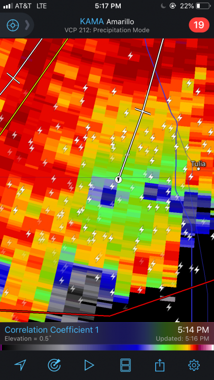
Haven't heard of damage reports yet, but Miller MO was under a PDS warning early as a strong couplet went right through town. Less than two hours later a couplet is about to move over the exact same area. Warning up now. One of those days...
-
Just now, jojo762 said:
...A TORNADO WARNING REMAINS IN EFFECT UNTIL 515 PM CDT FOR
NORTHWESTERN CHRISTIAN...NORTHWESTERN STONE...NORTHEASTERN BARRY AND
SOUTHEASTERN LAWRENCE COUNTIES...
At 436 PM CDT, a confirmed tornado was located near Verona, or near
Aurora, moving northeast at 30 mph.HAZARD...Damaging tornado and golf ball size hail.
SOURCE...Radar confirmed tornado.
IMPACT...Flying debris will be dangerous to those caught without
shelter. Mobile homes will be damaged or destroyed. Damage
to roofs, windows, and vehicles will occur. Tree damage is
likely.Locations impacted include...
Aurora... Marionville...
Clever... Crane...
Billings... Verona...
Hurley... Pleasant Ridge...
Looks weaker now, but it almost certainly produced south of Verona. Could have been on the ground for quite a while.
-
Just now, Araqiel said:
Looks like they just upgraded to Moderate risk.
Yep. Large 15% hatched tor along 44
-
4 minutes ago, Calderon said:
Side note, these comms issues with the NWS pages are really bad timing right now.
Seems to be getting worse too, SGF map is completely blank right now. Unbelievable timing.
-
Just now, pbrussell said:
Velocity must not be telling the whole store there. The reflectivity scans sure have been nasty though
Velocity looked really good over Miller. Small town, but if it was on the ground, they took a direct hit.
-
Just now, Indystorm said:
And I never saw a tor polygon on SGF radar for the tor warned storm just se Joplin area....only a severe warning for areas sw of it.
Seems to me that the NWS in general is having issues with polygons on their maps and radars. Radarscope had it. Fairly strong couplet for a couple minutes but it weakened quickly.
-
3 minutes ago, JMT417 said:
Looks like it is trying to get going again
It has some junk south of it, which may impede in flow but it looks much better than it did 20 minutes ago.
-
 1
1
-
-
Just now, JMT417 said:
Yep I've been watching it for about 30 minutes as well
Doesn't look impressive at all now.


MAY 20, 2019 High Risk
in Central/Western States
Posted
Wow. A decent chunk of the 45% tor has temps under 60...