eyewall
-
Posts
13,328 -
Joined
-
Last visited
Content Type
Profiles
Blogs
Forums
American Weather
Media Demo
Store
Gallery
Everything posted by eyewall
-
Just thought I would mention that we could be back in La Nina next winter so we better cash in on one of these long shots.
-
18z is ice which is probably more realistic lol.
-
On this run it is a complete miss.
-
Congrats VA anyway:
-
I can't buy in at 300 hours.
-
That about sums it up!
-
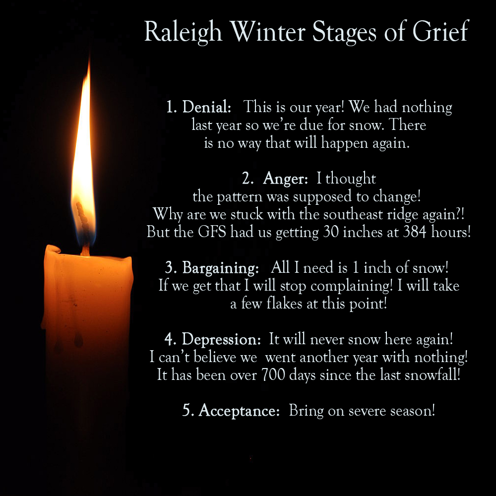
Southeast Sanitarium - Winter 23/24 Edition
eyewall replied to eyewall's topic in Southeastern States
You have successfully completed the 5 stages!
-
The writing is on the wall at this point. A 2nd failed year in a row. We will go into record territory if we do end up with no measurable this winter.
-
Happy hour GFS in the right direction from 12z:
-
well if we don't get any measurable this winter it will likely be a record number of days by the time the next winter rolls around.
-
12z GFS: Book a hotel room in Elizabeth City or Virginia Beach for a few flakes.
-
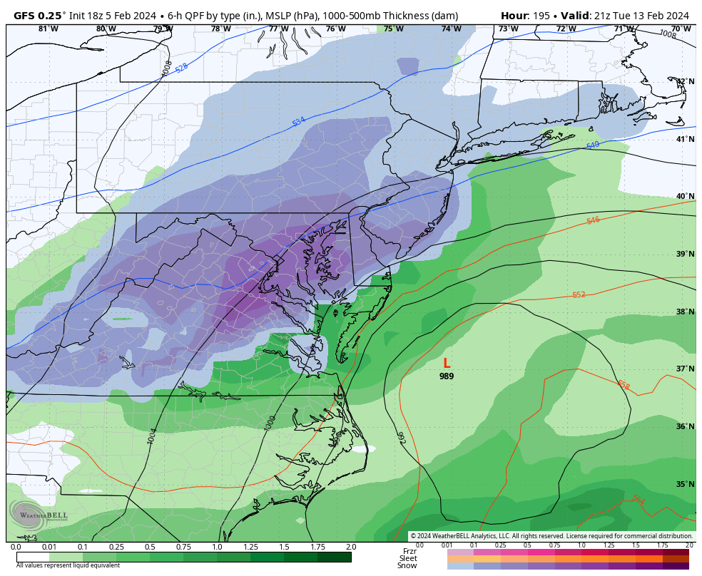
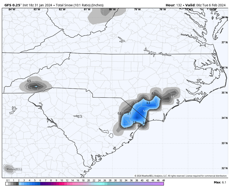
Liquid snow in Raleigh.
-
2023-2024 Fall/Winter Mountain Thread
eyewall replied to The Alchemist's topic in Southeastern States
Nice! What a different world up there! -
So you're telling me there's a chance. Yes!
-
a move to New England.
-
If that run is on to something I better book a room in western NC.
-
2023-2024 Fall/Winter Mountain Thread
eyewall replied to The Alchemist's topic in Southeastern States
I didn't get up there for this one but enjoy! Wet snow always yields the best photos when it pastes everything. -
At some point you just have to laugh. A solid storm track and just not quite cold enough.
-
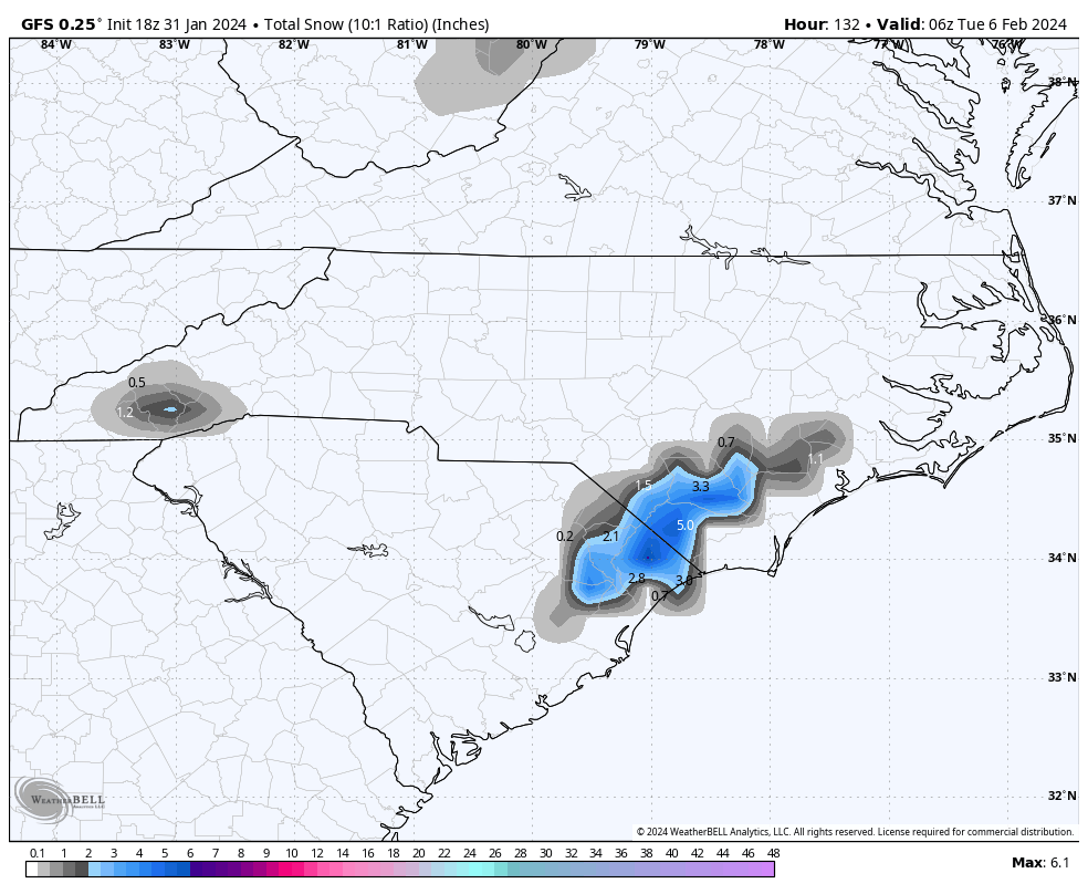
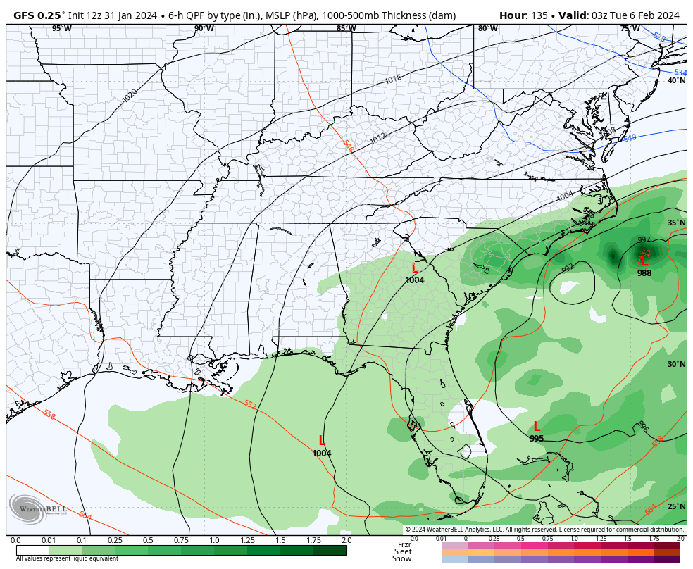
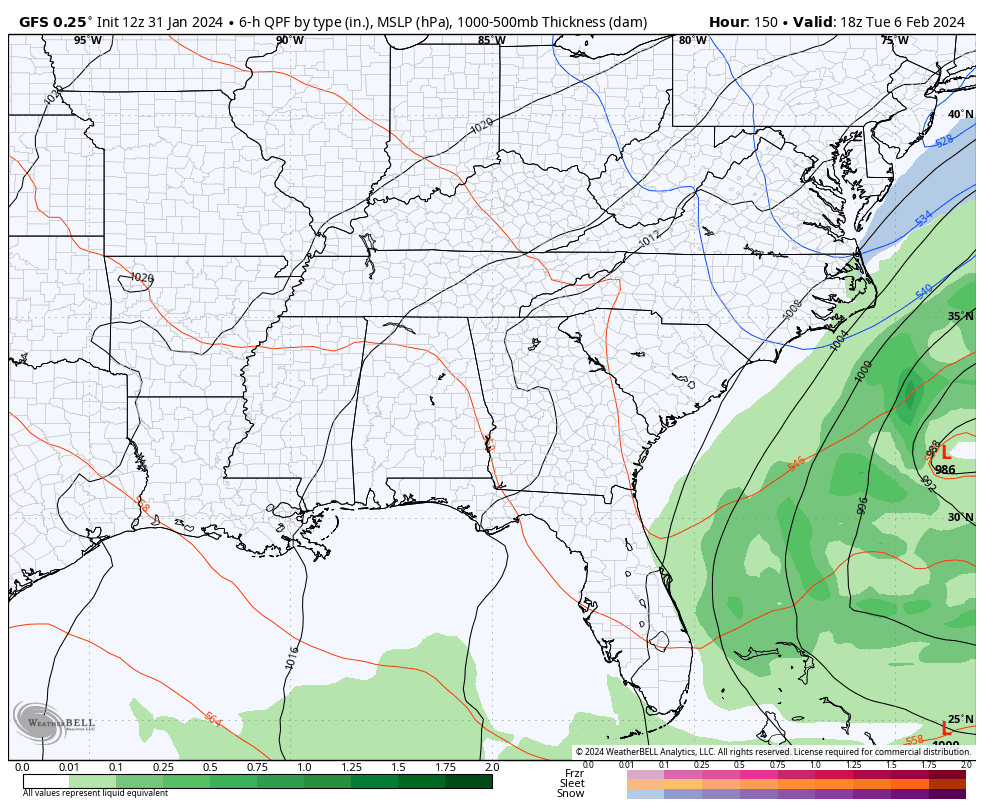
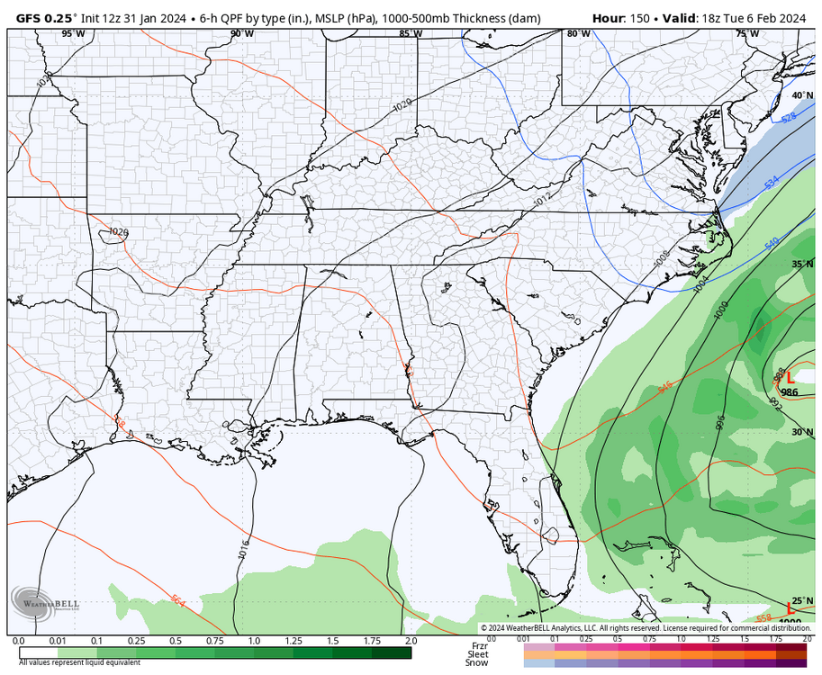
Some good news on the 12z GFS. The little disturbance dropping down from the lakes right at the start of Feb tries spark off a coastal low. The disturbance has been consistently modeled but the coastal re-development hasn't been as much. This run brings some precip into the Piedmont. As far as snow, it is borderline but not impossible.
-
Yeah that is nuts for sure. It has to be a record.
-
As expected what the 6z giveth the 12z taketh away.
-
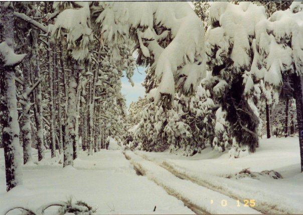
Happy anniversary to the Carolina Crusher! I took this shot in Southern Pines NC on Midland Road on 1/25/2000
-
LOL back to back events on that run at 240+ hours.
-
Exactly once an opportunity is blown it is hard to get it back in the southeast.
-
And it's gone.