eyewall
-
Posts
13,328 -
Joined
-
Last visited
Content Type
Profiles
Blogs
Forums
American Weather
Media Demo
Store
Gallery
Everything posted by eyewall
-
Historic Weather Discussion and Memories
eyewall replied to WinstonSalemArlington's topic in Southeastern States
Southern Pines, NC on Christmas morning 1999 (a month before the big one):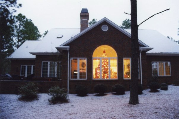
-
Awesome! They were visible at least as far south as VA but here in NC we had clouds.
-
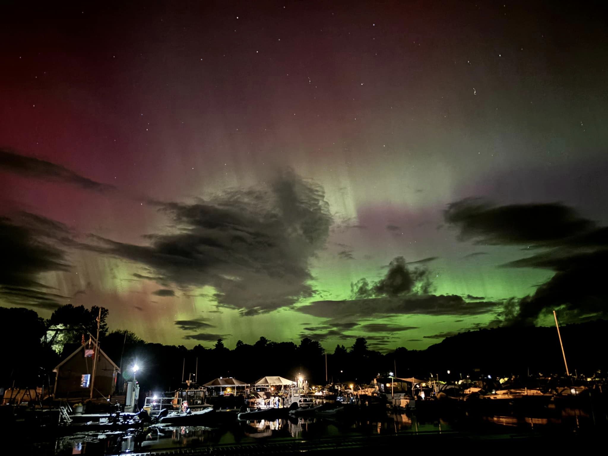
Not my photo but Mallet's Bay VT last night:

-
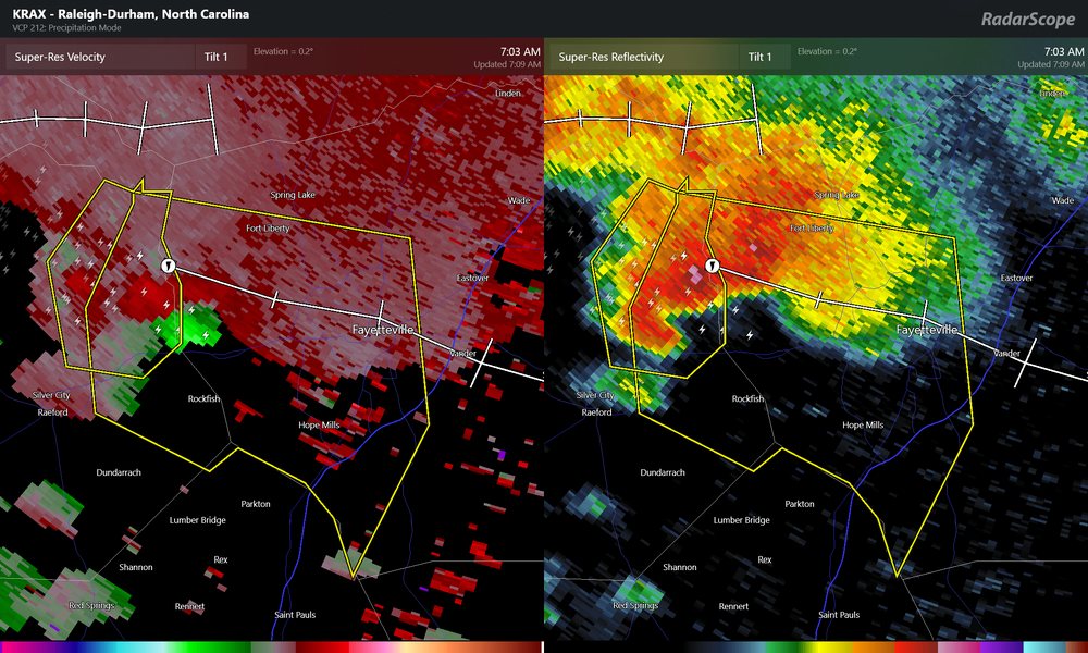
It gave a false TDS due to radar contamination according to NWS but it was spinning for sure!
-
NWS wake up!
-
Anyone catch the overnight show with a G3?
-
Yep once last season was blown we were guaranteed the 1000 day threshold. With another La Nina we could be closing in on 1400 lol.
-
One thing we have seen is tropical systems are carrying more moisture farther north than they used to.
-
I am just looking for a stretch where the dewpoint isn't 75F plus lol.
-
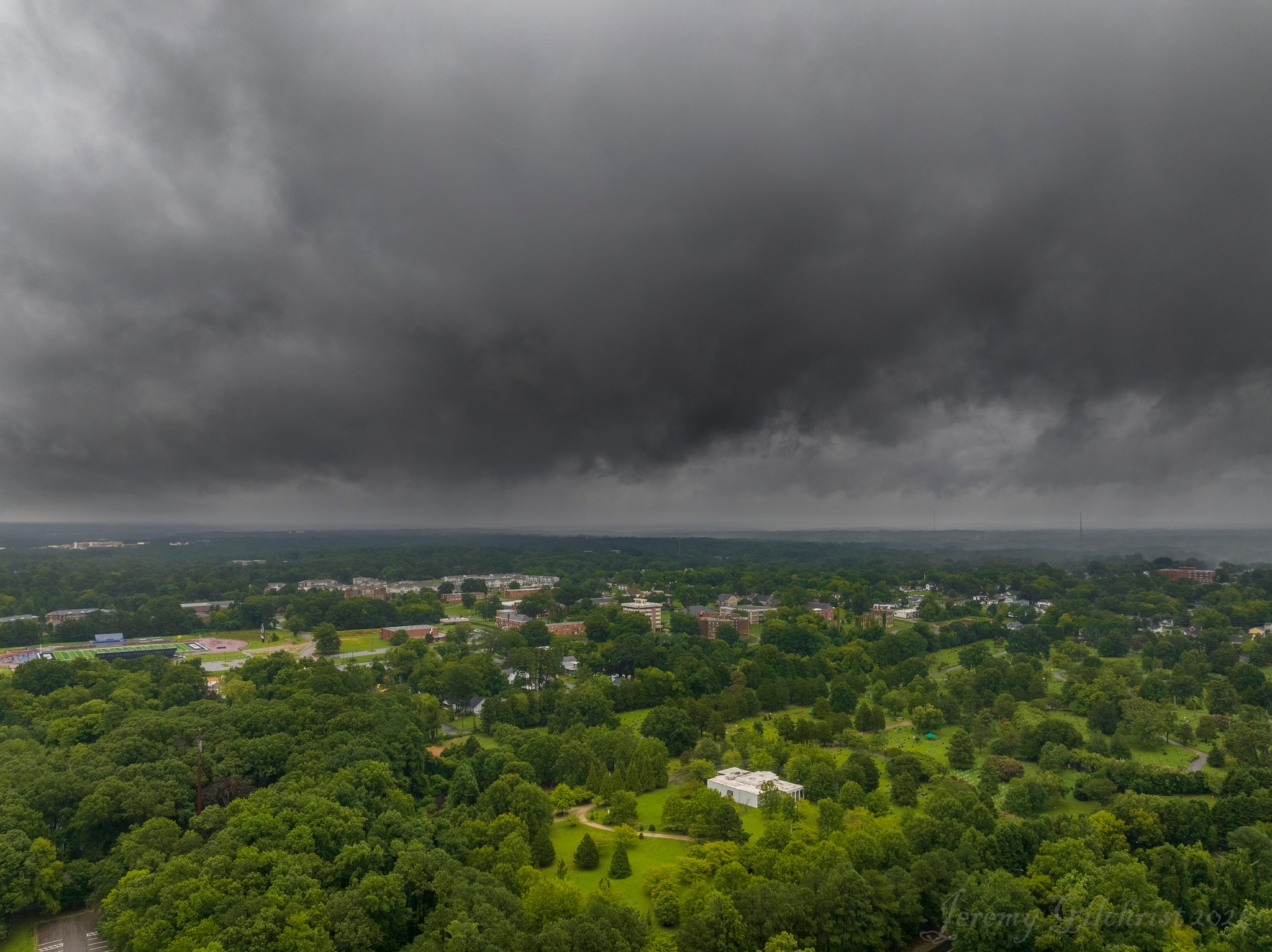
And finally this one was interesting as you can see a clear notch wrapping in from the left and a bit of a point just left of the distant buildings. Can't say for sure if that was an attempt at a funnel but it made a solid attempt to organize over north Raleigh on the afternoon of 8/8.
-
Hurricane Debby - flooding rain threat region wide
eyewall replied to olafminesaw's topic in Southeastern States
And finally this one was interesting as you can see a clear notch wrapping in from the left and a bit of a point just left of the distant buildings. Can't say for sure if that was an attempt at a funnel but it made a solid attempt to organize over north Raleigh on the afternoon of 8/8. -
Hurricane Debby - flooding rain threat region wide
eyewall replied to olafminesaw's topic in Southeastern States
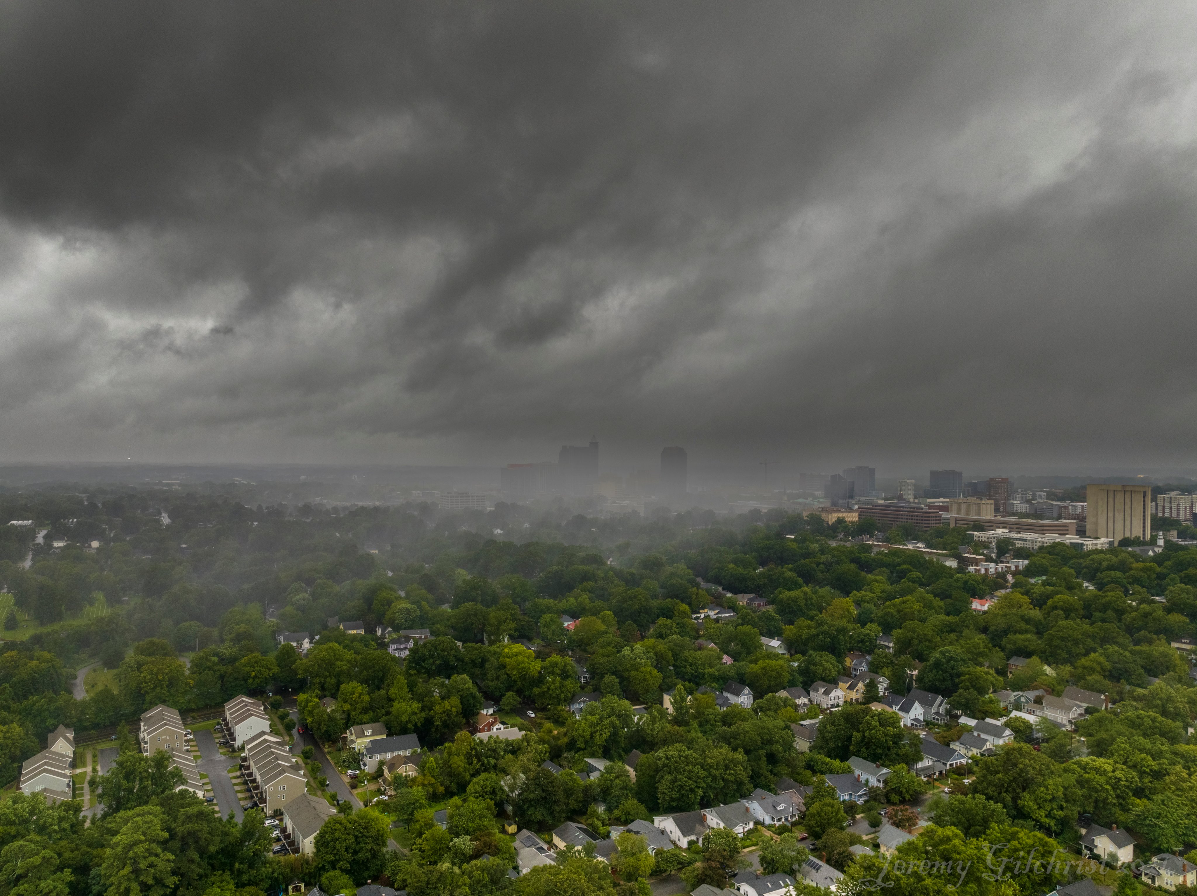
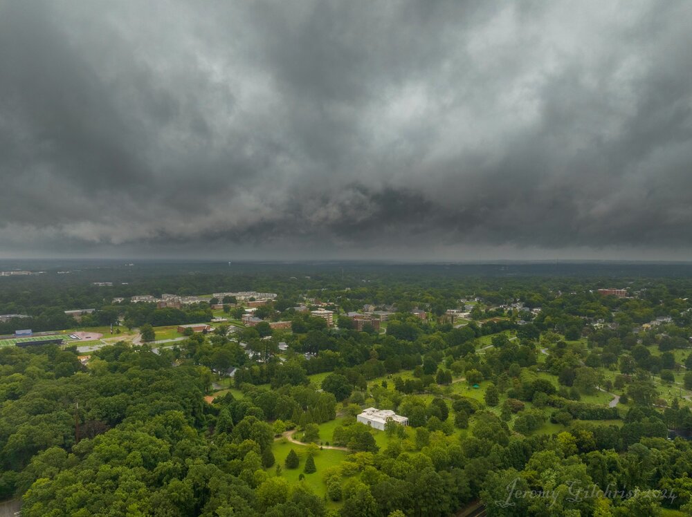
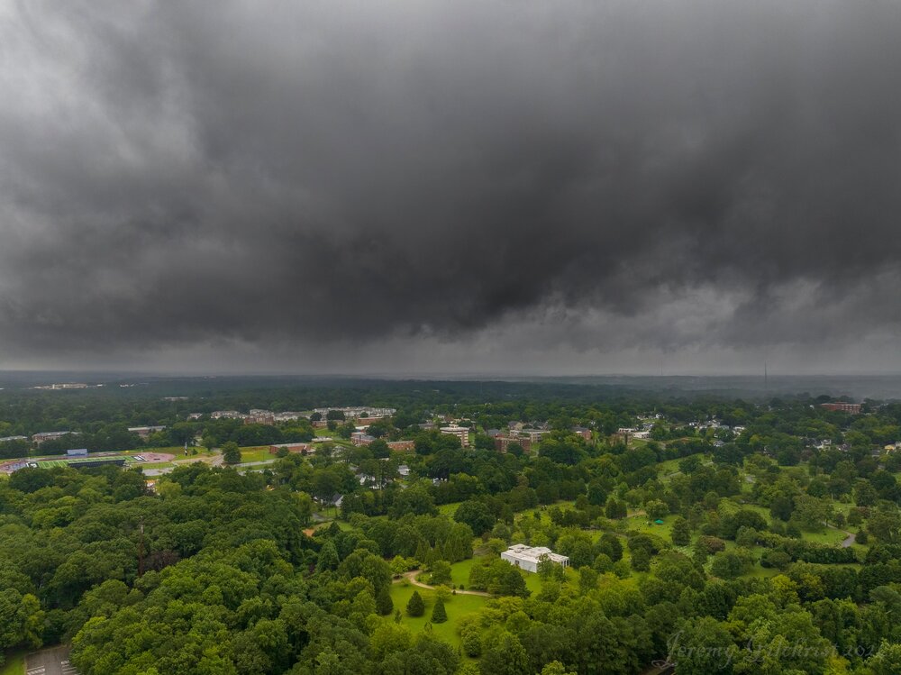
One more super pano showing two mini supercell bases next to each other in Raleigh yesterday: -
One of the more interesting scenes here was two mini supercell bases so close together during the afternoon convective bands with Debby yesterday:
-
Hurricane Debby - flooding rain threat region wide
eyewall replied to olafminesaw's topic in Southeastern States
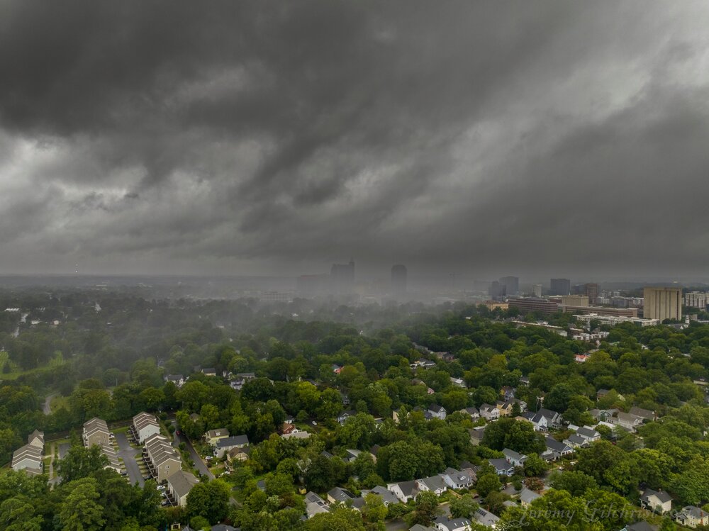
I didn't succeed in getting a tor but I did come out with these shots: -
Hurricane Debby - flooding rain threat region wide
eyewall replied to olafminesaw's topic in Southeastern States
Pics from trying to find a tor today https://x.com/JeremyGilchris6/status/1821612342175826110?t=Rml1khlltcNtMeemWPYhNA&s=19 https://x.com/JeremyGilchris6/status/1821626785739788367?t=nHmBsaU1a8DKhCmacK3BkQ&s=19 -
2 more shots as the band with embedded rotation pulled away from Raleigh:
-
The last bands before the sun broke out got real interesting for sure! Raleigh and Clayton NC between noon and 1pm or so.
- 909 replies
-
- 16
-

-
Hurricane Debby - flooding rain threat region wide
eyewall replied to olafminesaw's topic in Southeastern States
Crabtree Creek didn't really get that bad as I guess the rates were not high enough with this one. -
Some curious lowerings in Raleigh as a couple of bands rolled in. One had some visible spin.
-
Hurricane Debby - flooding rain threat region wide
eyewall replied to olafminesaw's topic in Southeastern States
Crabtree Creek is in Minor Flood this morning at Wake Forest Road and in Morrsiville but not at the mall yet in Raleigh. -
Hurricane Debby - flooding rain threat region wide
eyewall replied to olafminesaw's topic in Southeastern States
So far I am not impressed with what I see regarding the rainbands for our region. I am wondering if there will be additional cutbacks in forecast totals. -
I am so far not impressed with what I am seeing in terms of rain bands out there. I am guessing they will reduce rain totals as the day goes on.
-
Hurricane Debby - flooding rain threat region wide
eyewall replied to olafminesaw's topic in Southeastern States
That is definitely a cutback from yesterday but still a decent amount of rain to be sure. -
I am on a flight back to RDU from Atlanta as of this post and it is quite bumpy. Came out of the seat twice.
-
This thing really rotted out. Not sure how any of these totals verify in NC.
- 909 replies
-
- 10
-
-