eyewall
-
Posts
13,237 -
Joined
-
Last visited
Content Type
Profiles
Blogs
Forums
American Weather
Media Demo
Store
Gallery
Everything posted by eyewall
-
The eye of Katrina passed east of NOLA. They initially looked ok until the levee breaks.
-
It was probably a bit boring for Josh being a minimal hurricane.
-
Hanging Rock is closing in on peak. I was there today and I suspect it is within 4 days or so at most.
-
Hahaha the winds were pretty gusty up there for the drone as it was. I am sure that would have been an adventure to say the least
-
I re-edited this clip from the 12th with better color grading. The other version was too much and left a bit of a purple hue in the sky:
-
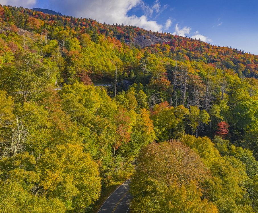
Leaf season appears to be over between Boone and Grandfather at this point. It was all browned out past peak with a lot of bare trees. Any color that was still present was dull. Glad I caught it on the 12th. None the less I enjoyed the fall air. Time to see how it turns at Hanging Rock next.
-
I know it can never compare to my time in VT but this has been a good year in our high country so far (Watch in HD):
-
Sorry if it this a touch late but here is some video of what I saw on the 12th (watch in HD):
-
I am making my last fall trip up there on Sunday for this year. Not sure what will be left but I am sure there will still be color to be found. After that, it is following it to Hanging Rock/Pilot Mountain and out this way.
-
A couple of more (Click for full color and resolution):
-
A pair of ground shots from Linn Cove (Again click for the full quality and color):
-
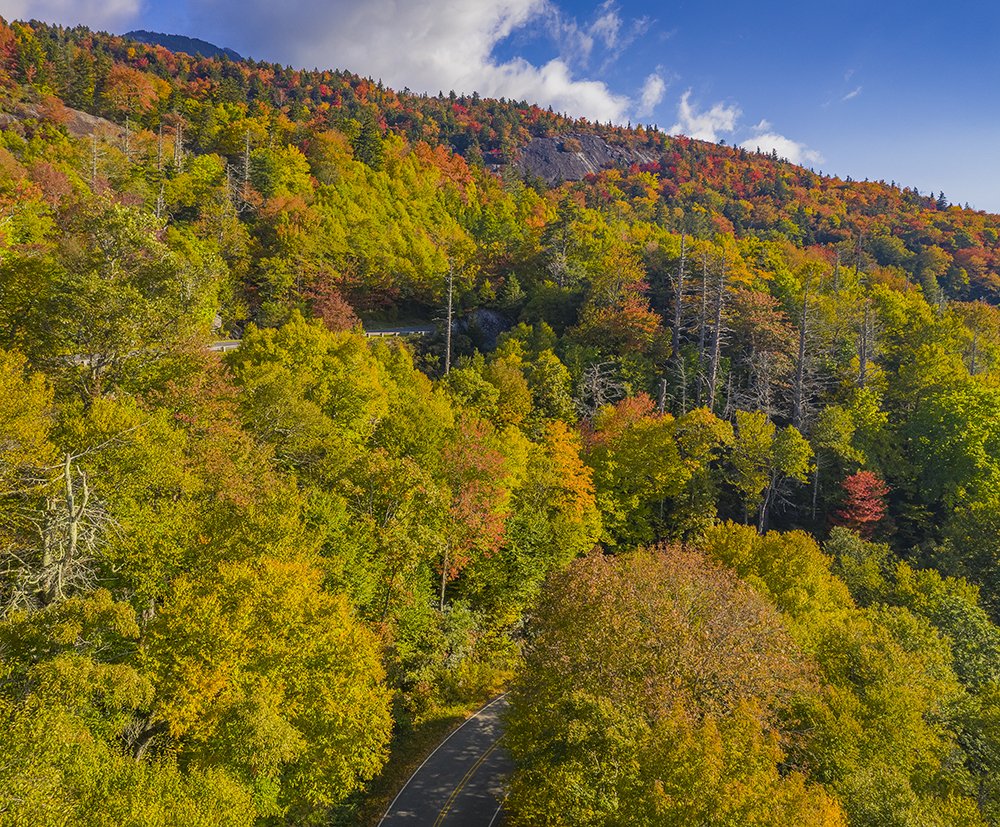
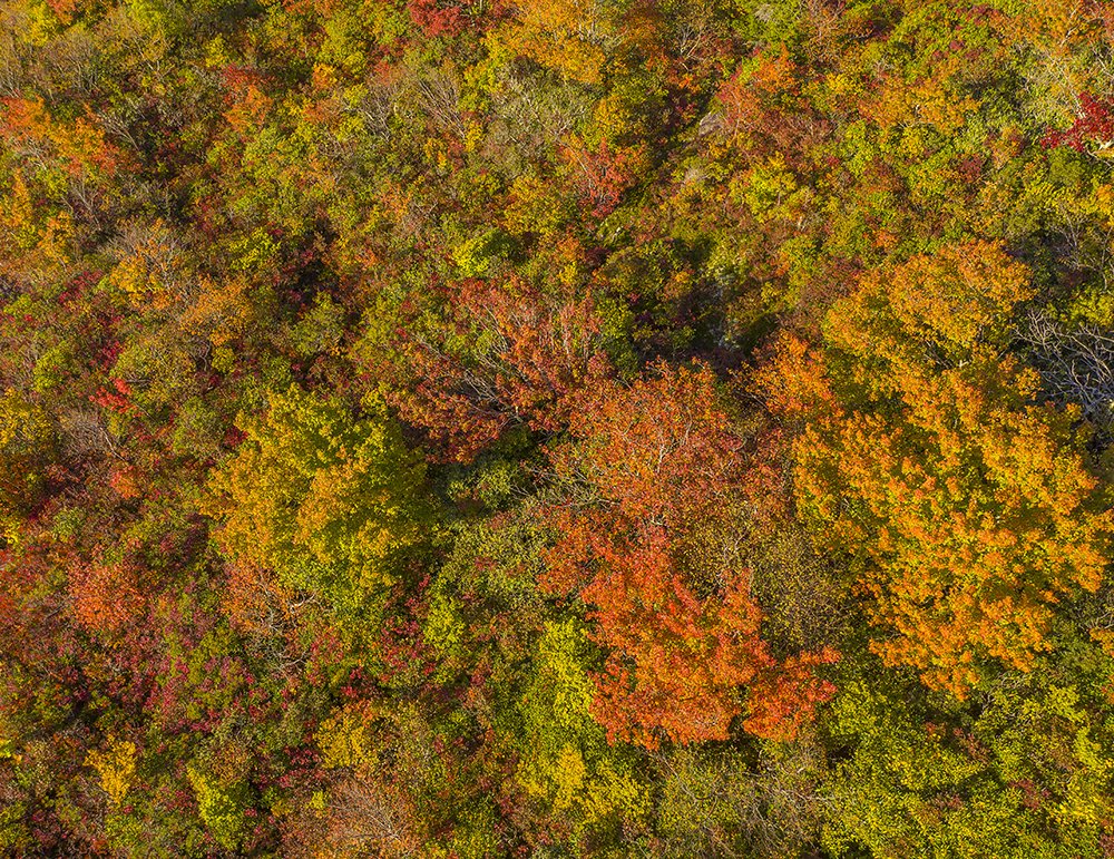
October 12th (click for the full color image as this site dulls them):
-
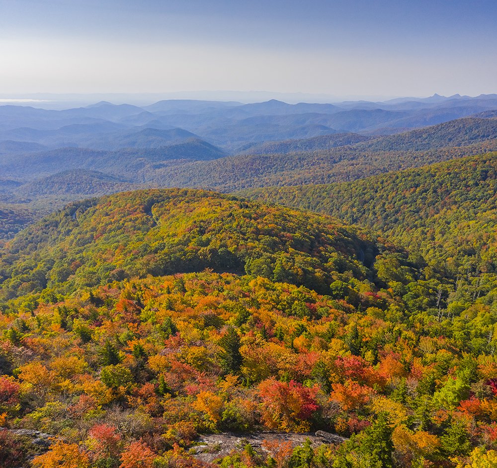
I decided to hit the Linn cove area today because of the fog and everything and it is amazing! Definitely peaking here
-
Very nice! I plan on going back Wednesday and I hope that isn't too late there for the absolute peak.
-
My favorite shot from the other day (click to see the full color version as this site dulls images):
-
Thank you! I just hope this weekend doesn't cause too much leaf drop in that area. I was planning on returning on Wed.
-
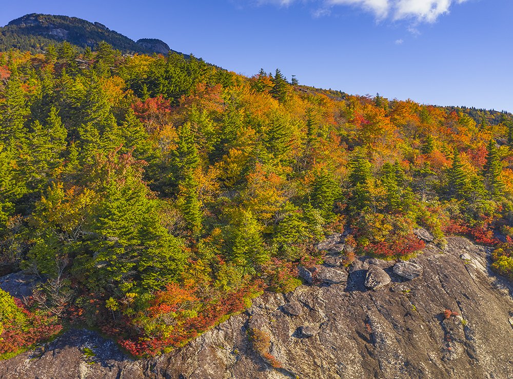
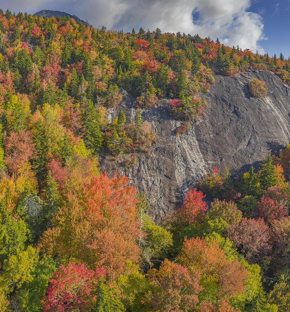
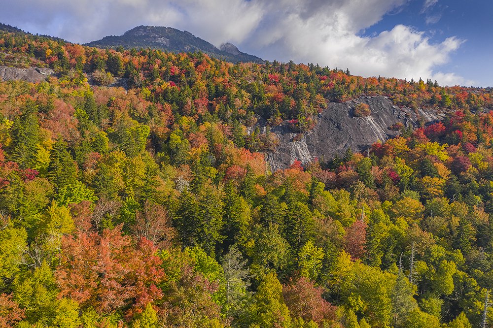
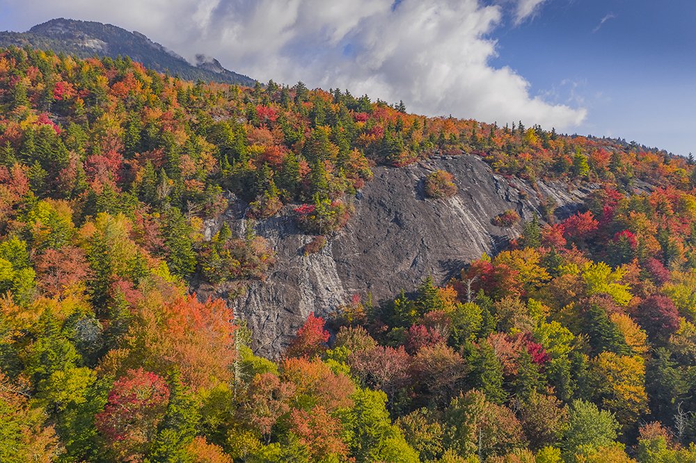
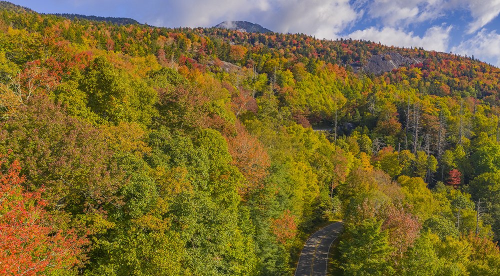
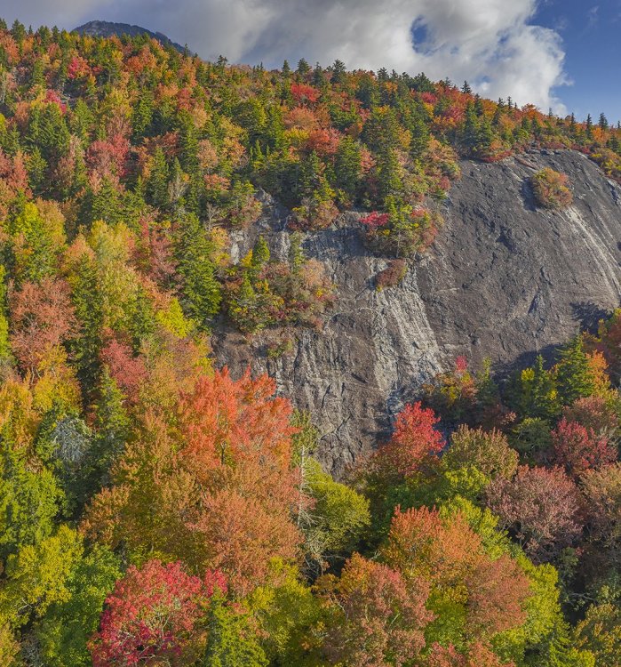
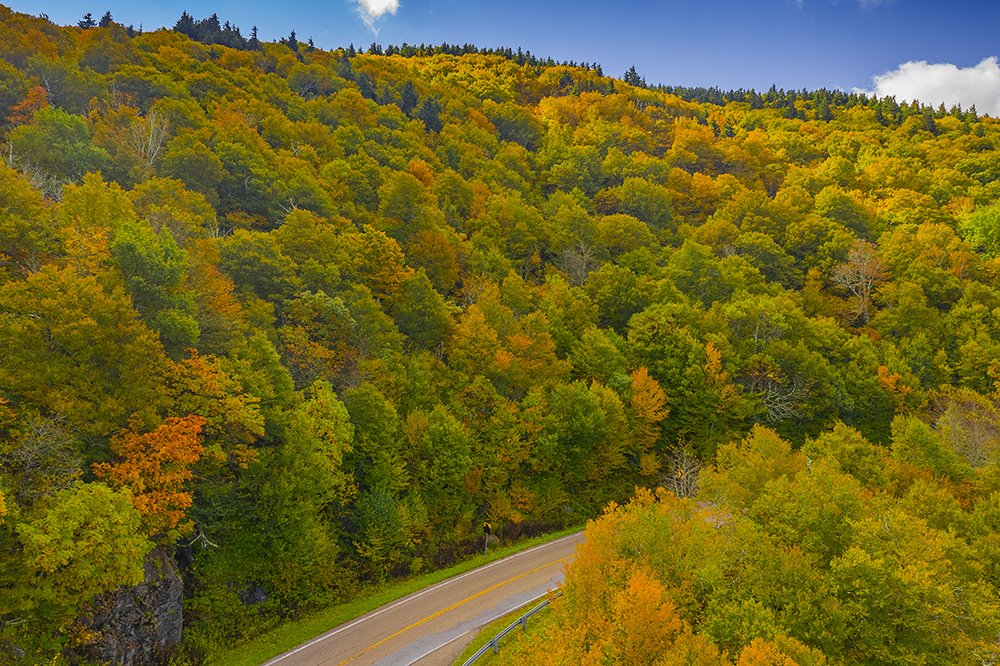
It is looking good down here in NC! Some vibrant colors are starting to pop near the Blue Ridge Parkway in the 4000-5000ft elevation range. I shot this below the summit area of Grandfather Mountain (summit elevation there is 5,900ft). It is getting to fruity pebble phase in spots and peak is probably within a week there. I will go back one more time to try and catch that then follow it out of the mountains into the Piedmont over the next few weeks. Unlike the last two years, the weather has been great for it. I do miss VT foliage but I am glad we have this:
-
Here is the video. I did make some minor adjustments to match real world conditions (cameras naturally dull images/vids a bit).
-
Thank you and yeah it is really popping there in spots. It is amazing how much it varies in short distances. Here are the flickr versions (If you click them they will appear as they should)
-
I am busy today with Delta so I will post some stills first. Again these were taken on October 7th, 2020 near Grandfather Mountain (note: I am not sure why this site dulls the color in my images):

-
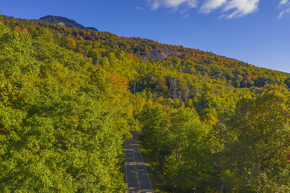
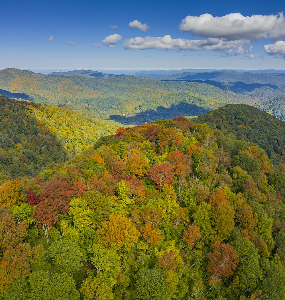
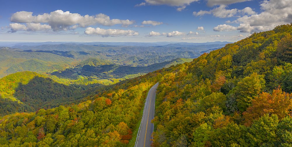
I returned to my favorite spot near Grandfather Mountain yesterday and very vibrant colors are starting to appear in places just above the parkway. It is amazing how variable it is over short distances, but it is coming along very nicely. I took some drone shots which are coming soon and video this time which I am uploading now (without any color enhancement). I think peak will occur within a week around Linn Cove. The Banner Elk area was starting to turn nicely as well.
-
A couple of more from Roan Mountain
-
Thank you all and yeah Delta could present a real problem. Just our luck that it is finally a good year and that would happen.
-
One more for now (still a few to go through):
-
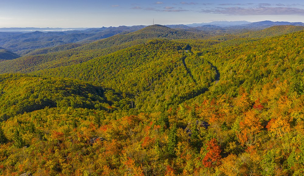
The first shot is the Roan Mountain area and the other 3 are from Grandfather Mountain on 10/3: