sbnwx85
-
Posts
1,785 -
Joined
-
Last visited
Content Type
Profiles
Blogs
Forums
American Weather
Media Demo
Store
Gallery
Everything posted by sbnwx85
-
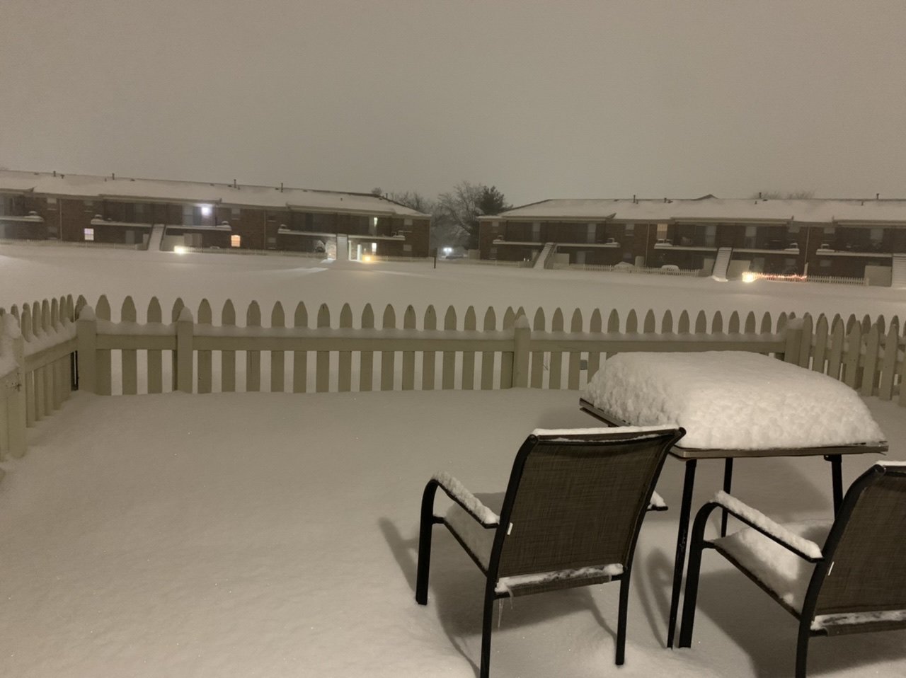
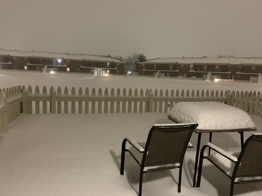
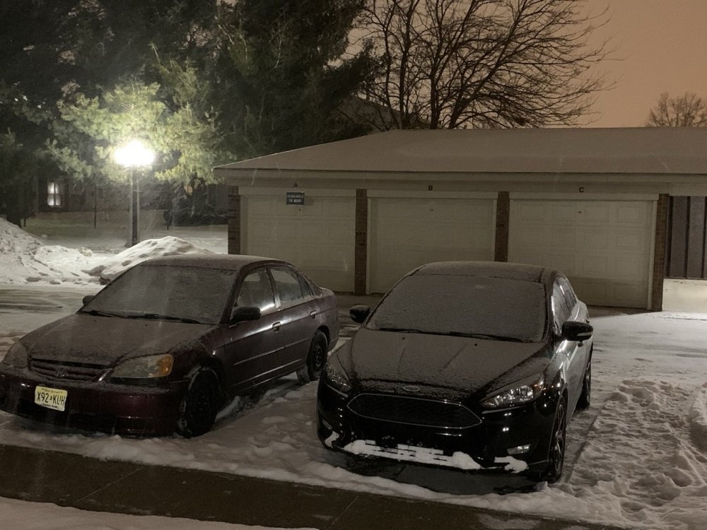
Going to guess we got about 8 inches here. Total snow depth is 14”. Most I’ve seen on the ground at once in years. Northern Indiana finally delivered some childhood memories.
-
Hard to measure considering I don’t have a real snow board, the wind and the previous snowpack but I’d say we’ve gotten around 4.5” of fresh powder today. Snowpack around 10”.
-
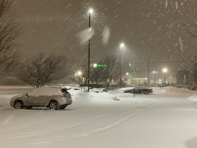
Best rates and flake size yet. Gotta be two inches per hour.
-
I was in Northern IN for GHDI. We only got about 8 inches before getting dryslotted. This has the feel of that storm but it doesn't look like we'll get the dryslot this time. It's just puking snow.
-
This is my video from outside my TV station. This isn't even under the best radar returns. Absolutely fantastic.
-
Just a quick update for everyone: It's snowing.
-
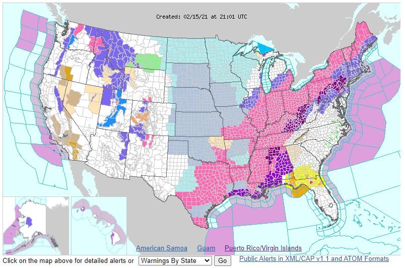
Posting for posterity's sake. All of Indiana in a Winter Storm Warning. That just doesn't happen often.
-
IWX finally expands warning to include its entire CWA.
-
Very impressive.
-
At some point IWX has to put the rest of their CWA in a WSW. Otherwise this will be the most impressive advisory I’ve been in.
-
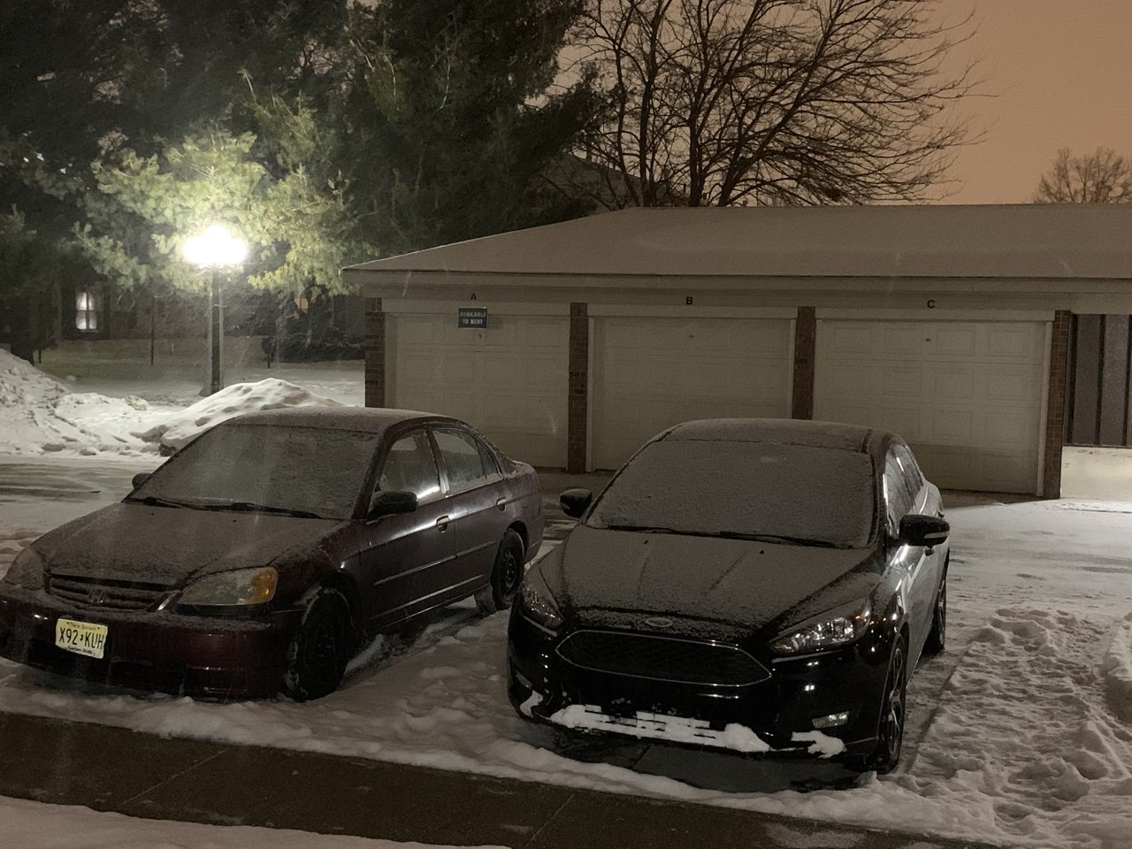
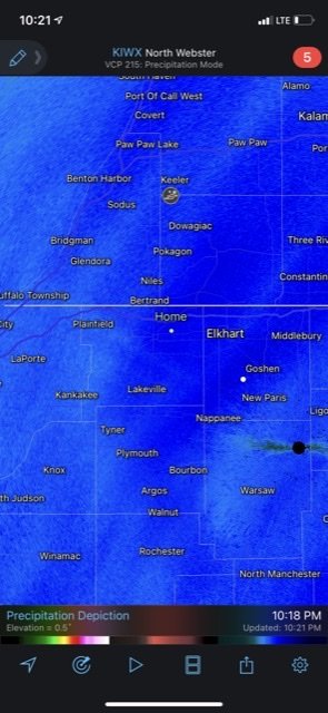
Currently snowing at a decent clip. Already have a light coating down on the cars. I was reluctant to believe the first wave would produce much but the radar looks good.
-
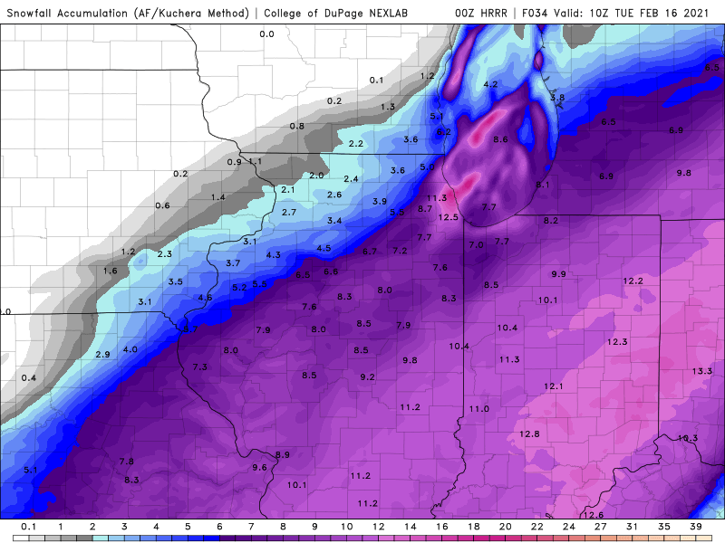
The first wave on the NAM drops like 2-3” before the main wave. HRRR and RAP only put down an inch. Something to keep in mind when looking at total snow maps. Edit: this is particularly true for the South Bend area. Didn’t look at the entire subforum.
-
Latest HRRR. Still snowing lightly across northern parts of the subforum at this point.
-
Lol it is silly being in one of only two Indiana counties not in a WSW.
-
I’ll start by saying IWX does a good job overall. I think they could have just issued WSW for their entire CWA, but it’s not a bad decision to go with a WWA for its northwest counties. The maps looks a little weird since LOT went with warnings, but it’s less of a shock to the public if South Bend starts as a WWA and upgraded later to a warning. Also, gives them wiggle room if amounts trend lower.
-
Talk about a spread the wealth system!
-
Just woke up after catching up on some much needed sleep and looked at the models. Wow. No question we’ll need at least an advisory here and if trends continue to increase snow amounts a WSW will be needed. SREF plumes up to 6 inches at SBN. My call of 3” looks like it’s going to bust and I’m good with that.
-
Final call 3” here. I managed about an inch from the system today and there’s light lake effect falling now. Hoping the grand finale will be the Thursday system.
-

Feb 12-14th V-Day Weekend Potential Stuff
sbnwx85 replied to Chicago Storm's topic in Lakes/Ohio Valley
Snow falling here. Although looking at radar it appears to be more lake-effect than system snow. -
Weeks ago I scheduled errands to run for myself and mom on the 16th so this is definitely going to be a big dawg. You're welcome, guys.
-
Feb 12-14th V-Day Weekend Potential Stuff
sbnwx85 replied to Chicago Storm's topic in Lakes/Ohio Valley
I trust this guy more. -
Feb 12-14th V-Day Weekend Potential Stuff
sbnwx85 replied to Chicago Storm's topic in Lakes/Ohio Valley
Gonna need to change your name to "Happysummons" soon. -
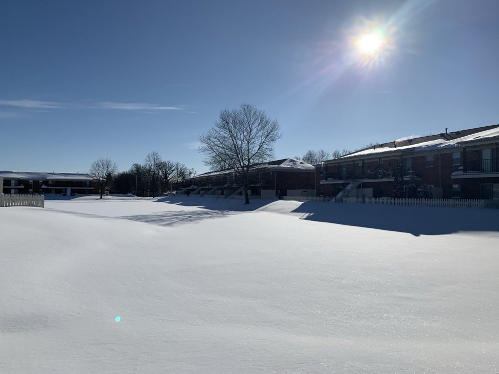
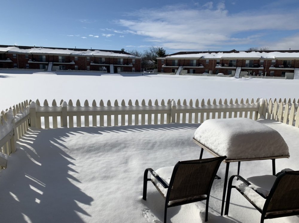
I was going to post this in the Valentine's Day thread but figured it fit better here. Maybe I'm in the minority but anything else I get at this point in the year is just gravy. I've got 6 to 8 inches on the ground with no signs of melting anytime soon. March is less than three weeks away. I'll embrace whatever more snow we get but can't get mad at any misses the rest of the way. In about four weeks I'll be ready for Spring and thunderstorms.
-
That last band that pushed through put me at about 2.8” on the day. Highest drift on the snowpack in my little backyard is up to 8”.
-
I thought we were getting a surprise lake effect band before looking at radar. Hard to tell how much has fallen with what was already on the ground but I can tell the ratios are phenomenal. Might be closing in on an inch? The best banding looks like it was just to my south.