

AlexD1990
-
Posts
655 -
Joined
-
Last visited
Content Type
Profiles
Blogs
Forums
American Weather
Media Demo
Store
Gallery
Posts posted by AlexD1990
-
-
That band over western Sussex has to be ripping right now.
-
3 minutes ago, CAPE said:
That sucks but it will go over to snow.
I know it. Thinking maybe that little mesolow that @Bob Chillpointed out in the main thread that popped off Ocean City might have yanked in some warmer air aloft for a bit. already mixing back, and CC shows it moving back offshore.
-
 1
1
-
-
Getting some rain in Rehoboth. Hoping for a change back soon
-
 3
3
-
-
fucking rain in Rehoboth. madder than a red hen...
-
2 minutes ago, CAPE said:
Radar is beginning to fill in nicely now. Maybe we can overcome this 3 hour lull of occasional pixie dust that all the guidance seemed to miss.
It really is starting to expand and increase. hoping for a good pivot!
-
4 minutes ago, CAPE said:
It's trying to blossom a bit. Might be moderate snow at my place now. Wish I would have charged the damn battery on the security cam.
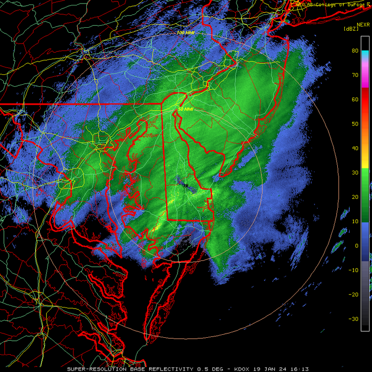
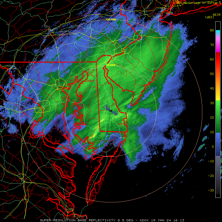
Nice band forming on DOX radar from a Dover- Easton-Cambridge arc.
-
1
-
-
Here's hoping we all get a good MECS in February with cold smoke and no mixing!
-
Definitely a lil worried about the dead zone, but still hoping for some coastal/norlun lovin this afternoon...
-
1
-
-
Loving these last minute trends. Reeled in another one!
-
So, is it the crabs themselves that don't care? As in indifferent crabs?

Sent from my SM-F711U using Tapatalk
-
4 minutes ago, NorthArlington101 said:
looks better for DC... and should make the delmarva folks happier
oh do tell..
-
6 minutes ago, MillvilleWx said:
No problem! It’s definitely possible, but narrowing exactly where that band could setup is tough and a nowcast situation. I think it’s plausible somewhere between south-central Jersey coast down to about OCMD extending to the western shore of the Bay. A lot of area and still a question mark. If I HAD to pick a spot, I like northern DE through northern MD along the M/D as the primary spot for something like that just based on trends and positioning of the upper jet. Will be watching intently along with the NWS because that’s the kind of stuff that can trigger a Hazard upgrade (WWA -> WSW).
Thanks for coming in and answering! I am excited by the latest modeling trends! I would love to steal an extra inch or two out of this!
-
3
-
-
@MillvilleWx didn't want to clutter main thread with a IMBY question, but what are your thoughts on some coastal/norlun enhancement on this side of the bay? I feel like some of the increase shown on modeling over this way may be due to that.
-
20 minutes ago, H2O said:

Hall of fame material right here.
-
2
-
 3
3
-
-
1 minute ago, H2O said:
I'm not in the blue. Fuck this storm. Its like it knows where I live
Georgetown?
-
3
-
-
6 minutes ago, stormtracker said:
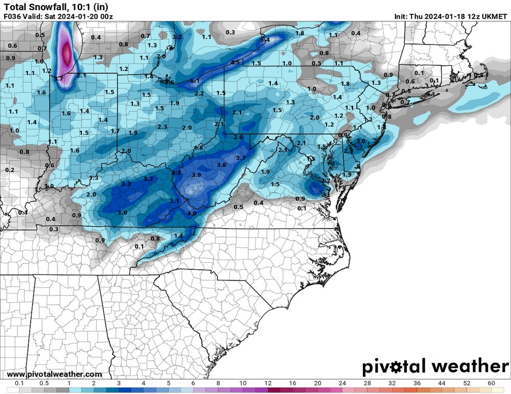
Now watch we have some clown ass wonky maps. Here's SV
The little spit of blue right over my house in Delaware is just.. *chefs kiss*
-
5 minutes ago, StormyClearweather said:
UKIE is slightly improved as well.

I'm wondering if some of the uptick East of the Bay might be due to coastal enhancement, or a better pass from the inverted trough?
-
DT on FB talking about upping his numbers on his next snowfall map

-
2
-
2
-
-
Seems to me like we have at least an outside chance of inverted trough/coastal love if things go right... we've done it before.
Sent from my SM-F711U using Tapatalk -
Such optimism

Sent from my SM-F711U using Tapatalk -
Let's reel in another nice event Friday. Maybe temps won't be as much of an issue
Sent from my SM-F711U using Tapatalk-
1
-
-
1 minute ago, stormtracker said:
How the hell do i black my name out on the screen and it's fucking right there at the bottom of the pic.
in the corner of the monitor AND on the desk..
"Supreme Commander"....sounds sexy.
-
JFC I am deceasedOh shit! Sterling updated again!!District of Columbia[EXCEPT GEORGETOWN]Prince Georges-Anne Arundel-Northwest Montgomery-Central and Southeast Montgomery-Northwest Howard-Central and Southeast Howard-Rappahannock-Fairfax-Arlington/Falls Church/Alexandria-Northern Fauquier-Western Loudoun-Eastern Loudoun-Northern Virginia Blue Ridge-Northwest Prince William-1028 PM EST Mon Jan 15 2024...WINTER STORM WARNING IN EFFECT [EXCEPT GEORGETOWN] UNTIL 10 AM EST TUESDAY...* WHAT...Heavy snow, possibly changing to light freezing rain or freezing drizzle along the Interstate 95 corridor toward morning, except in Georgetown, where rain will turn to light rain. Total snow accumulation of 4 to 6 inches and ice accumulations of a light glaze. In Georgetown, rain will be up to .40 inch.* WHERE...Portions of central Maryland, The District of Columbia [Except fucking Georgetown] and northern Virginia.* WHEN...Until 10 AM EST Tuesday.
Sent from my SM-F711U using Tapatalk
-
1
-

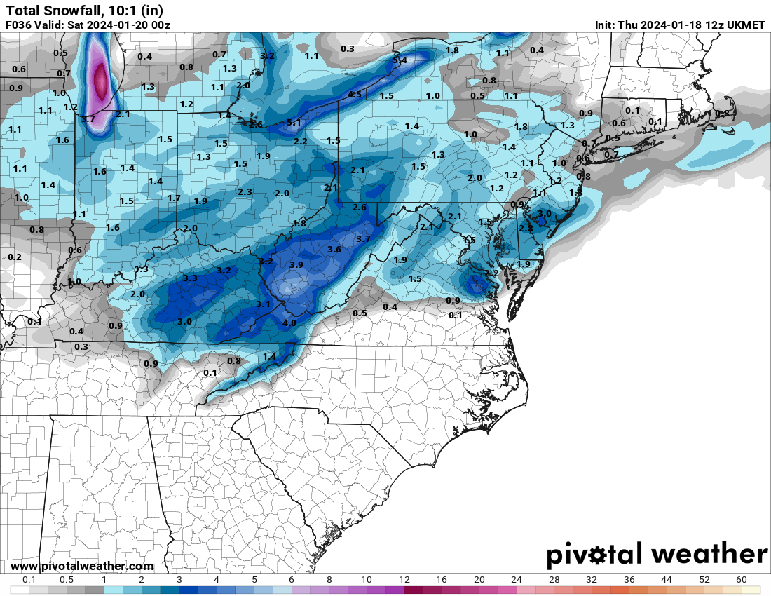
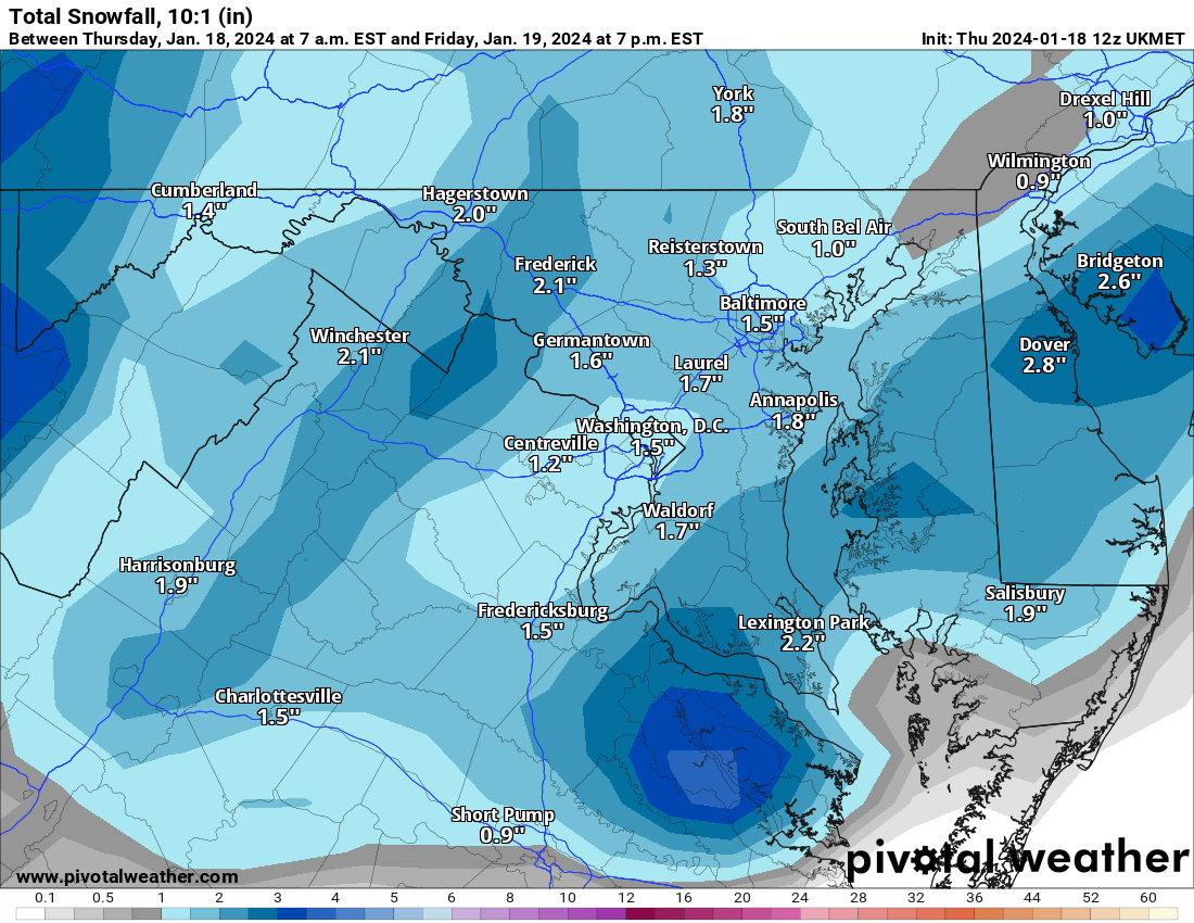
Jan 19th Storm OBS Thread
in Mid Atlantic
Posted
If only...