

qg_omega
-
Posts
3,044 -
Joined
-
Last visited
Content Type
Profiles
Blogs
Forums
American Weather
Media Demo
Store
Gallery
Posts posted by qg_omega
-
-
44 minutes ago, CoastalWx said:
Maybe some light snows in Southeast mass early next week?
Congrats
-
 1
1
-
-
6 minutes ago, dendrite said:
At least the useless cold shot is trending warmer. Maybe I can have my first winter without a below 0F temp.
From this
To this and we aren’t done trending, LOL, horrific. Just end this “winter”
-
 3
3
-
-
Not shocking, we lost the direct shot of artic air this weekend. Now it’s glancing at best, whole setup shifted east.
-
2
-
-
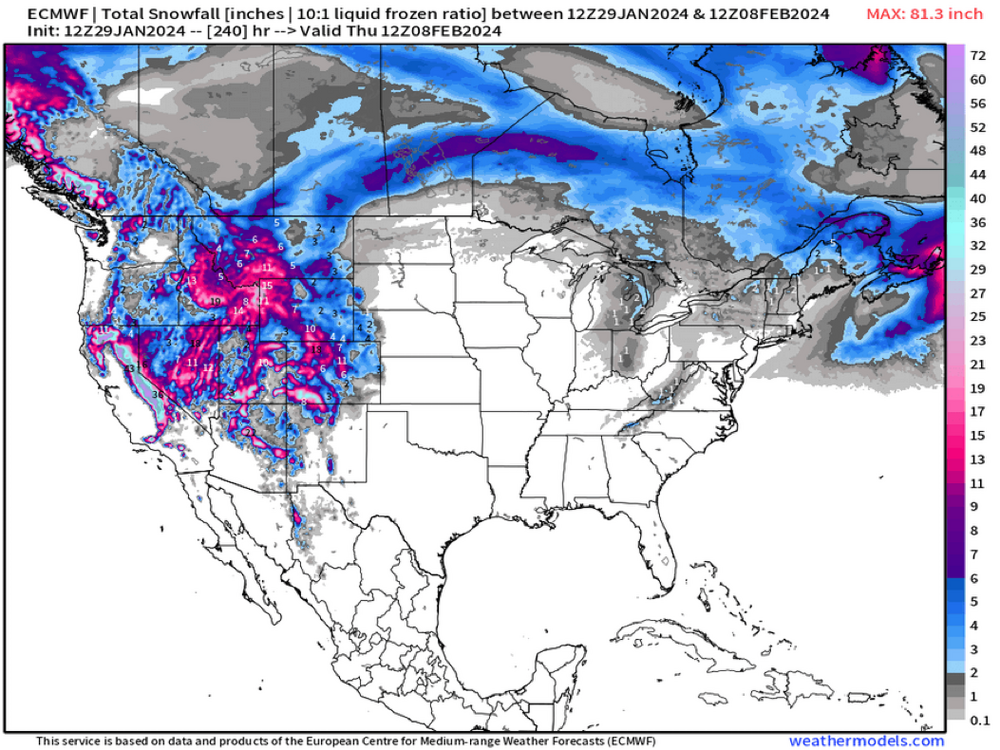
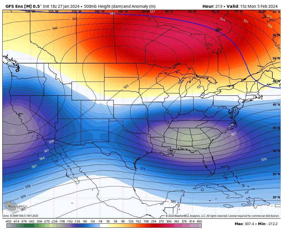
Omega block looks to roll east 2nd week of February while the weekend cold shot trends milder. One of the quietest first two weeks of February I’ve seen modeled. Makes sense we would regress a bit from the epic wet pattern of the past many months
-
2
-
-
7 hours ago, qg_omega said:

Not boring…..Not
-
1
-
-
-
19 minutes ago, Sey-Mour Snow said:
Ok so you say no threats at all Feb 1-14? Let’s exchange Venmo’s for a friendly wager? I can use that for a valentines gift for the wife.
Done, PM me
-
3
-
 1
1
-
-
16 minutes ago, Sey-Mour Snow said:
I’m with you, it’s hard to write off Feb 1-14 that’s peak climo. The pattern doesn’t look like an all out torch so I’d lean that there will be something to at least track whether it’s a hit/miss or light/moderate event I’m sure something will creep up. Then the weenie set up we’ve all been waiting for is now Feb 12th ish to early March. Let’s see I’m not sold on any great pattern setting up since one hasn’t set up in over 2 years.
lol nothing changes in two weeks, how can you constantly be wrong and continue doing the same thing
-
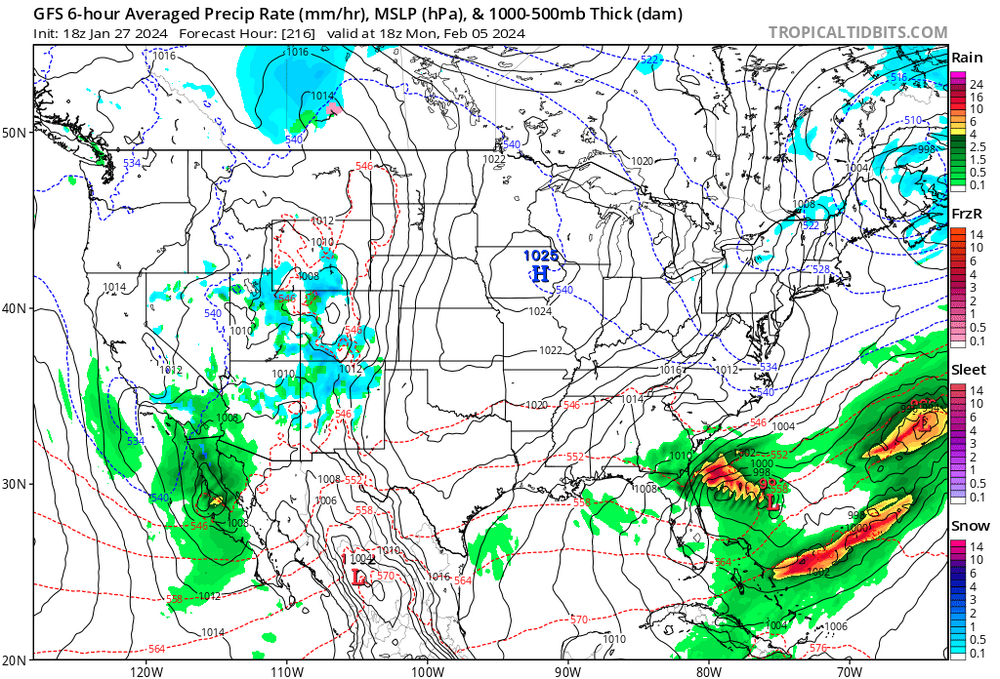
1 hour ago, Wxoutlooksblog said:
It's back. And right now with CMC indicating snow over the mid Atlantic States the likely track would keep this too far to our south and east and we'd stay high and dry. But the HP position is perfect on this run. It would only take some subtle changes to cause this system to track a little further north or turn up the east coast (less likely but still not impossible). So we watch and wait but it's still NOT boring.
WX/PT
It’s actually very boring, looks dry with nothing of interest for the next two weeks at least
-
1
-
 3
3
-
-
Few saw this coming

-
 1
1
-
-
Nothing of interest from now to Valentine’s Day at the earliest
-
2
-
1
-
-
This will likely verify from 300 hours out, as they do
-
2
-
-
56 minutes ago, brooklynwx99 said:
big Nino stuff here

could be good for NC and VA or could be rain, not a good pattern for the NE tho
-
1
-
1
-
1
-
3
-
-
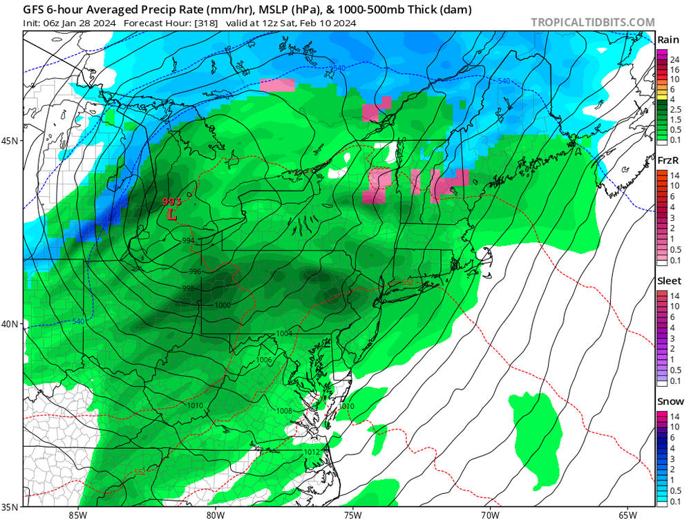
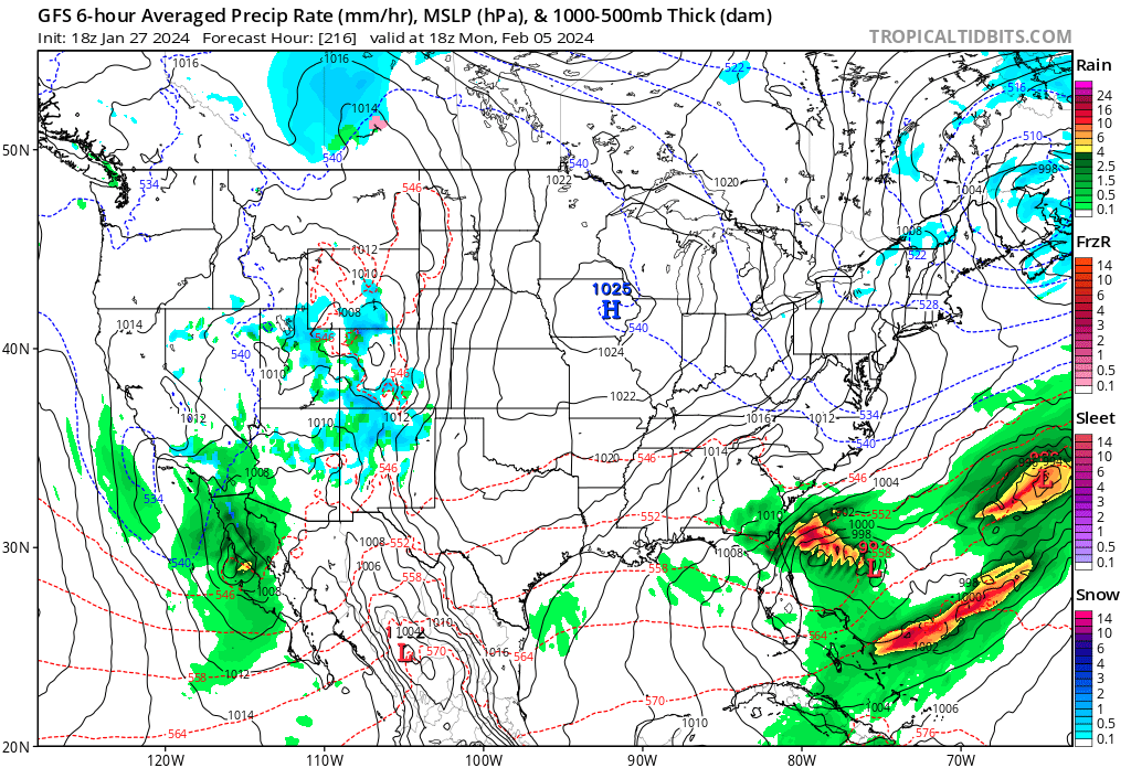
4 hours ago, Wxoutlooksblog said:
Two runs in a row pointing to a major storm of some kind somewhere on the east coast on February 5th. Yes, temperatures are marginal but this kind of storm can make its own cold air and its centered around February 5th, a rather historic time-frame. Not only that comparing last night's run to this one, changes are not subtle from run to run, last night's run being colder. I think it's worth watching this.
WX/PT
-
6 minutes ago, Wxoutlooksblog said:
Boom! It's not boring.
WX/PT

Nice El Niño rainstorm but that is pure fantasy, pattern does not support
-
1
-
-
1 hour ago, the_other_guy said:
I am so sick of this weather… It’s like Nova Scotia on a bad day in July. Terrible.
Beauty of a spring day today
-
1
-
-
4 hours ago, Wxoutlooksblog said:
This might or might get this far north but not boring.
WX/PT

Zzzz, pattern supports upper level lows diving into the SE and then crushed out to sea. It’s a spring time pattern
-
4
-
-
14 minutes ago, 40/70 Benchmark said:
I have news for you...models do not print out physically implausible solutions. Don't waste any more of your 5 disputing this fact, dude.
If you actually took any meteorology courses you would know that statement is incorrect
-
2
-
2
-
-
32 minutes ago, brooklynwx99 said:
i don’t think that the GFS solution is likely by any means, but it certainly is a possibility
No, it’s not. Zero
-
12 minutes ago, brooklynwx99 said:
are we even punting at this point for storm potential? let alone a torch
lol its fake, a country wide torch is much more likely then the GFS shown pattern
-
1
-
1
-
-
Two weeks of zero on the Euro after the rain on Sunday
-
47 minutes ago, AstronomyEnjoyer said:
In more exciting news, my snow depth actually increased to 17" today! Had to measure on a hill as it was the only untouched spot I could find. I found this unedited snippet from JPL that could explain the increase. It was likely due to the warm weather and water expansion.

By far of the biggest


 posts ever, wow
-
2
-
3
-
-
This looks like zero for NYC and the coast
-
1
-
-
1 minute ago, MJO812 said:
Cmc is further north. Congrats guys.

-
1
-
2
-


It was a Flop... February 2024 Disco. Thread
in New England
Posted
It’s been a historically warm DJF, snowfall aside