

NEOH
-
Posts
3,366 -
Joined
-
Last visited
Content Type
Profiles
Blogs
Forums
American Weather
Media Demo
Store
Gallery
Everything posted by NEOH
-
Are there any recent studies that take into account home schooling kids, having significant others at home, etc? I'd be surprised if they still showed increased productivity.
-
I own the business -- these are people I pay. Can't imagine what your %'s would be - 90% internet trolling?
-
40 somethings - porn, sports and news websites - 32% of day spent on those sites 30 somethings - apparel, sports, social networks - 40% of day spent on those sites 20 somethings - social networks, apparel - 44% of day spent on those sites
-
You watch too many sitcoms. What type of environment do you work in?! So instead of wasting time IN the office (see examples above), many employees are now losing productivity OUT of the office with the many distractions at home. As a business owner I will say that employees are more productive in the office. This may be somewhat unique to my industry but we have software to track employee productivity -- and it has fallen off of a cliff since people started working from home. There's just no disputing the reporting I receive.
-
Terrible story. But I wonder if hospitals are attributing/classifying more deaths to COVID since receive $13k per person from the government. Healthcare is big business... Cleveland Clinic was running a $44 million dollar deficit -- now they are encouraging patients to come back for routine health visits.
-
We are probably near or at peak. The rain and wind yesterday took a lot of leaves down in my yard. I'd say we are week or so ahead of schedule with the foliage. I could do without the frigid temps in November -- cools the lake too quickly. I wouldn't complain about swimming in October -- sad to see the warm temps go.
-
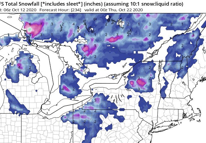
Nice to see this on the models again...
-
That's a bunch of malarkey.
-
Honestly, you lost me. Is this LeBron on a weather forum? Its things like bailing out the airlines that give cause for concern... along with the additional $600 per week in unemployment. There are lots of jobs available right now. But why work when you get paid more to do nothing -- but that is a whole different discussion. Do you object to using a billion from the 2+ trillion toward funding the drug cocktail that Hoosier referenced?
-
Not that hot actually as they have been negotiating for months. Remove the non-COVID crap from the bill and its gets passed. The stimulus isn't meant to be a looting spree.
-
Oof. That's expensive. Perhaps some of the stimulus money could have gone in to funding this... or get another stimulus passed that includes it? Surprised that none of the politicians have discussed that -- or maybe big pharma' $$$ is to important.
-
Hopefully they can start mass producing whatever drug cocktail they gave him. Sounds promising.
-
Where did you read that? Sounds like something from an entertainment website :). Its posts like that which derail the thread and stoke the Trump fire. Everyone wants to blame someone -- at what point do people start shifting their eyes to where the virus originated?
-
Lol... Is this some type of reverse psychology? I didn't see one post in here blaming 'leftists", all fingers point right in the blame game. Like Alek said, we're all gonna die so eat, drink and be merry. Our time is limited.
-
Lol. Take a closer look at this thread... It is a giant echo chamber for the left. Who isn't wearing a mask anywhere that requires them? The "right" hasn't caused more sick and dead Americans. The sad fact (not counting the elderly) is that a lot of the deaths are self-inflicted by poor lifestyle choices that have lead to pre-existing conditions. People have been warned for years about the health dangers of obesity, hypertension, diabetes etc. In most cases, it comes down to the ability to control what goes from your hand to your mouth. Too bad more Americans didn't listen or possess self control. Time for people to take some personal responsibility for their health. Or maybe people should just wait for the President to tweet that its important to lead a healthy lifestyle?
-
State Governor's (not Trump) made all COVID related decisions which hasn't changed I believe -- so there is your starting point for expressing disappointment. For some reason I don't hear or see anything in the news about state Governors... except New York given what happened there early on. Some states handled it well such as Ohio, and others did not.
-
Hoosier I'll agree to disagree. People are going out of their way to find faults/problems with everything he does or doesn't do. Its all political non-sense at this point. Perhaps low intelligence should be added to the list of pre-existing conditions that contribute to COVID deaths.
-
HA! I'm usually cursing you folks when its partly cloudy in Ohio while WNY gets buried for days on a WSW wind direction. I'll definitely be around this winter. Hopefully its a decent one. Let's keep the lakes warm until November.
-
How much of the US population follows his Twitter account? I don't feel its the President's responsibility to remind me via social media to wear a mask or follow basic hygiene. Masks have been pushed hard at least locally in Ohio. If someone refuses to wear a mask at this point its probably unlikely that a tweet is going to make a difference. Wasn't there a lot of complaining about Federal government involvement early in COVID? Now everyone blames the Federal government for not doing enough. You can't have it both ways. Hopefully a vaccine comes out in the Nov/Dec time frame so that can get to those with the highest risk levels. Until then the finger pointing at one individual is getting old because the election is getting close.
-
It was incredible and an experience I will never forget. Pretty remarkable to get those kind of totals in northeast ohio with the limited fetch we have to deal with. We were without power for 5 days due to the tree damage. I will probably never see that amount of thundersnow again in my lifetime. Every night the sky would be illuminated with a greenish tint from the lightning. The snow would diminish in intensity during the day as it became more cellular... then get heavy again every night. Once in a lifetime for sure.
-
That's what some media outlets would like you to believe at least. There are definitely things that could have been done differently of course... hindsight is always 20/20. What countries do you think did the best in dealing with COVID? Many of the countries that had lower death numbers also have healthier populations.
-
300k seems like a big stretch. If it happened, COVID would beat obesity for the number of deaths in the US by end of year... Around 300k die in the US each year from obesity, and 2.8 million globally - https://www.who.int/features/factfiles/obesity/en/
-
One of the best and earliest I can remember off of Erie in Ohio - http://ww2010.atmos.uiuc.edu/(Gh)/arch/cases/961109/home.rxml
-
https://www.ncbi.nlm.nih.gov/pmc/articles/PMC5343795/
-
That's interesting... or maybe it isn't. Not sure if you have kids but every Fall when they return to school they always get sick with something. The vast majority of the population will likely be "infected" at some point. Schools around here are 1/2 day virtual, and 1/2 day in the classroom. They are now looking at going to the classroom full time starting in November as there have been no reported cases in the schools since re-opening.


