NEOH
-
Posts
3,366 -
Joined
-
Last visited
Content Type
Profiles
Blogs
Forums
American Weather
Media Demo
Store
Gallery
Everything posted by NEOH
-
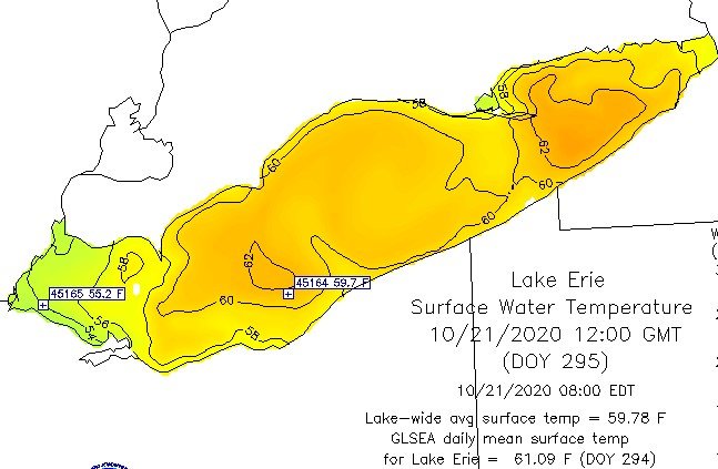
Definitely impressive. But Lake Erie is so shallow it just takes a couple of cold shots and the temp plummets. I have no problem with torching from now to 12/1. The warm weather has been great.
-
What an incredible stretch of weather. The western basin of lake erie has actually warmed a bit -- wonder how often that happens in November. Let's hold on to the warmth as long as possible for the first legit lake effect event.
-
We're all going to get it. Just a matter of time.
-
Its nice to see the ground white again. Yep, it was mostly graupel. Temps hovered around freezing throughout. Good call by OHWeather!
-
Yep. Sunday night should be the first LES event of the season. It will be a welcome change... Feels like it has been in the 40's with rain for days now. CLE is in the top 10 wettest years.
-
Smoking keeps the weight off
-
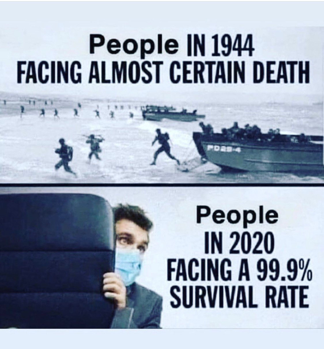
I think its like 96% of the people that have died from COVID had 2 or more chronic conditions. Definitely not a generalization. https://www.cdc.gov/coronavirus/2019-ncov/need-extra-precautions/evidence-table.html
-
Do you think that China is being honest with their numbers ? Just speculation on my part... but the American population as a whole is very unhealthy, and considering chronic conditions play a significant role in deaths I'm guessing that's why the USA is at the top the list.
-
After the rain yesterday CLE is 5" above normal since September 1st, and 14" above normal for the year. Pretty amazing considering the negative precip departures of nearby areas.
-
Glad that we missed the heavier rains last night... once my yard gets wet in the fall it won't dry until Spring. I'd like to hold off on the cold air until November... keep the lake as warm as possible. Temps are still a little above normal.
-
Soaker at CLE last night/this morning with 2.37". There was almost constant thunder from 3am - 6am -- definitely unusual for October.
-
That dude has completely lost it. Lunatic!
-
Fully agree on that point. People are talking about lockdown's again though. Sure wish I could record some of the conversations I have with the Cleveland Clinic docs. Their perspectives on this are very enlightening. So my thoughts/perspectives on COVID are not shaped by what I read on the internet.
-
Please show me where I said that? You are putting words in my mouth. I'm cautious like everyone else -- I wear a mask, etc. You are so far down the rabbit hole of fear. Perhaps you have health problems I don't know.
-
Spreading what if they are healthy? People coughed and hacked long before COVID. Man you are paranoid and negative. And that's true, people do care more about themselves as they should.
-
Stebo there is no stopping the virus -- as several doctors have told me it will infect mostly everyone. Not sure how you consider people traveling to be selfish. If they are healthy they are doing what they should be doing -- living life normally (assuming they are taking the necessary safety precautions). Looking at it from a different perspective -- is it selfish for those that have (controllable) chronic conditions who are at a higher risk for complications to expect the healthy population to lockdown?
-
Some pretty good analogs out there for the upcoming Winter -- 1995/1996 - 101.1" at CLE 2003/2004 - https://www.weather.gov/cle/Climate_Snowfall_2003-04 2007/2008 - https://www.weather.gov/cle/Climate_Snowfall_2007-08 2012/2013 - https://www.weather.gov/cle/Climate_Snowfall_2012-13
-
The percentage may be slightly off (97% - 99%) but you get the point.

-
Yep... and there's the rub.
-
Question for you Stebo (and Hoosier) -- curious as to why you don't comment when someone posts "go big or go home" or "500k here we come"?
-
Wtf. Get off on what you fool? You are the one all lathered up.
-
My post was tongue in cheek. There's so much fear mongering in this thread my post should be the least of your concerns.
-
That's good to hear. Now that the virus has weeded out the weak from the herd we can get back to traveling . I haven't traveled at all since February... most of my travel was business related any way. Since its Friday its probably a lot of leisure travel which is surprising.
-
But I'm woke, Bruh. ... kids these days. Personally, I don't care if someone works in a tree house as long as they get the job done. I don't there are many companies requiring anyone to come to an office. A balanced approach as you mentioned is ideal. The only issue is when someone tells me they are scared to come to the office because of COVID -- like its chasing them around when the leave their home. Unless you have a very valid (health) reason to be scared that is a non-starter.
-
Yep. Pre-COVID data really doesn't hold up. The point I was trying to make is that it is even harder for employees to work/focus from home with kids, spouses, etc. around -- now throw in all of the other time they waste on the items I posted and its not a recipe for success.