

Blizzard of 93
-
Posts
12,865 -
Joined
-
Last visited
Content Type
Profiles
Blogs
Forums
American Weather
Media Demo
Store
Gallery
Everything posted by Blizzard of 93
-
Central PA - Winter 2021/2022
Blizzard of 93 replied to Bubbler86's topic in Upstate New York/Pennsylvania
Yes, the 12z GFS showed some Winter storm chances. -
Central PA - Winter 2021/2022
Blizzard of 93 replied to Bubbler86's topic in Upstate New York/Pennsylvania
This is the storm that @paweather has been waiting for this March! -
Central PA - Winter 2021/2022
Blizzard of 93 replied to Bubbler86's topic in Upstate New York/Pennsylvania
Yes, it is looking more & more likely that we have at least 1 more Wintry period coming up during the last week of March. -
Central PA - Winter 2021/2022
Blizzard of 93 replied to Bubbler86's topic in Upstate New York/Pennsylvania
Just for @paweather, Here is the 0z GFS snow map… Maybe we have 1 more chance before the locked in Early April snow storm? -
Central PA - Winter 2021/2022
Blizzard of 93 replied to Bubbler86's topic in Upstate New York/Pennsylvania
The 0z GFS has a Couple of chances on the 27th & 28th this run. -
Central PA - Winter 2021/2022
Blizzard of 93 replied to Bubbler86's topic in Upstate New York/Pennsylvania
More Winter weather chances are showing on the 0z Canadian & GFS starting later next week. -
Central PA - Winter 2021/2022
Blizzard of 93 replied to Bubbler86's topic in Upstate New York/Pennsylvania
Any more snow is a bonus at this point. There were still a few lonely snow piles around my neighborhood as of about 1 hour ago. -
Central PA - Winter 2021/2022
Blizzard of 93 replied to Bubbler86's topic in Upstate New York/Pennsylvania
@Mount Joy Snowman Any luck with getting CTP to change the weekend snow total at MDT thanks to your stellar research skills? -
Central PA - Winter 2021/2022
Blizzard of 93 replied to Bubbler86's topic in Upstate New York/Pennsylvania
The 18z GEFS gives us a couple of chances of snow before the end of the month. -
Central PA - Winter 2021/2022
Blizzard of 93 replied to Bubbler86's topic in Upstate New York/Pennsylvania
Lol…It will make it easier to decide not to stay up for the Euro! -
Central PA - Winter 2021/2022
Blizzard of 93 replied to Bubbler86's topic in Upstate New York/Pennsylvania
Great post from the New England thread… Maybe 1 more chance? -
Central PA - Winter 2021/2022
Blizzard of 93 replied to Bubbler86's topic in Upstate New York/Pennsylvania
Thanks for researching this info! I thought that something was off with their measurements and final tally. There is no way that 0 precip and additional snow was not recorded between those 2 hours of early afternoon heavy snow. It would be great if you or @Cashtown_Coop or someone with a contact at CTP could reach out to them to have them look into this and possibly make a revision if they find an error. We only have 2 official recording locations for CTP snow-Harrisburg & Williamsport. It would be great if they made an effort to get it right for the sake of history. -
Central PA - Winter 2021/2022
Blizzard of 93 replied to Bubbler86's topic in Upstate New York/Pennsylvania
10 minutes after I posted this it stopped & the radar fell apart! The mountains won again against a Clipper… -
Central PA - Winter 2021/2022
Blizzard of 93 replied to Bubbler86's topic in Upstate New York/Pennsylvania
CTP now has this for the Harrisburg area. This Afternoon A chance of snow before 5pm. Mostly cloudy, with a high near 37. Southwest wind around 11 mph. Chance of precipitation is 50%. Total daytime snow accumulation of less than a half inch possible. -
Central PA - Winter 2021/2022
Blizzard of 93 replied to Bubbler86's topic in Upstate New York/Pennsylvania
Same here, it kind of took me be surprise. This is now the 3rd day this week that we are getting snow! -
Central PA - Winter 2021/2022
Blizzard of 93 replied to Bubbler86's topic in Upstate New York/Pennsylvania
This Clipper looks to be tracking well to the south of where it was modeled even on this morning’s model runs. The radar looks solid & decent precip looks to be staying together over the mountains. -
Central PA - Winter 2021/2022
Blizzard of 93 replied to Bubbler86's topic in Upstate New York/Pennsylvania
Yes, this is remarkable in March with full sun as well. -
Central PA - Winter 2021/2022
Blizzard of 93 replied to Bubbler86's topic in Upstate New York/Pennsylvania
I agree…I’ve never had a problem with the time change either. More daylight after work in the evening is great for time in the yard with my kids or more time to take a family walk with our dog. -
Central PA - Winter 2021/2022
Blizzard of 93 replied to Bubbler86's topic in Upstate New York/Pennsylvania
The ensembles yesterday all showed a good looking pattern for late season winter weather chances during the last week of March. -
Central PA - Winter 2021/2022
Blizzard of 93 replied to Bubbler86's topic in Upstate New York/Pennsylvania
Yes, all of the ensembles today now show the trough back in the east in 12 to 14 days. Maybe we have 1 more chance before March is done? -
Central PA - Winter 2021/2022
Blizzard of 93 replied to Bubbler86's topic in Upstate New York/Pennsylvania
Marysville snow photo from today before a little sledding with my daughters.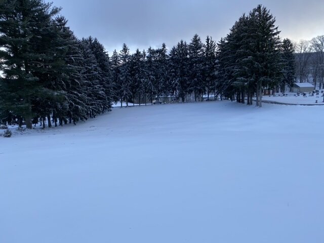
-
Central PA - Winter 2021/2022
Blizzard of 93 replied to Bubbler86's topic in Upstate New York/Pennsylvania
MDT as of the 5 pm climate summary recorded 3.0 inches today. I didn’t realize that MDT also recorded 0.8 inches of snow for the Wednesday event. The March total snow right now stands at 3.8 inches. -
Central PA - Winter 2021/2022
Blizzard of 93 replied to Bubbler86's topic in Upstate New York/Pennsylvania
My final tally in Marysville after several backyard measurements in protected areas was 5.3 inches of snow. Great Warning level event here! Still occasional light snow here now. -
Central PA - Winter 2021/2022
Blizzard of 93 replied to Bubbler86's topic in Upstate New York/Pennsylvania
Snow had picked back up again here in one of these streamer bands that made it down here. -
Central PA - Winter 2021/2022
Blizzard of 93 replied to Bubbler86's topic in Upstate New York/Pennsylvania
I’m getting worried about the MDT measurement. They reported .5 mile visibility at 1pm & 2pm but recorded no precip in the last hour…. Let’s just call that very unlikely…lol!
