

shaggy
-
Posts
7,429 -
Joined
-
Last visited
Content Type
Profiles
Blogs
Forums
American Weather
Media Demo
Store
Gallery
Posts posted by shaggy
-
-
Big flare up over the eastern core as it moves inland
-
Most models keep me dry with really strong 925mb winds over central and eastern NC. If we get some sun and breaks in the clouds to aid mixing then we arent out of the woods here either.
-
 1
1
-
-
13 minutes ago, Windspeed said:
Look for an area along the coast to increase in surge height if Delta really gets going by this evening. I think the 7-11 ft could be increased to 12-16 right of the forecasted point of landfall. The 7-11 may be extended further east of that increase as well.
With the decent rate of forward speed hopefully we dont see surges as high as 12 to 16 feet. If this was a slower moving storm that had time to pile the water in then that 12 to 16 feet of surge would be easy.
-
1 minute ago, Windspeed said:
This quite noticeable on visible after daybreak. This looks like core convection is consolidating an eyeband. Perhaps Delta finally gives us a clear eye by this evening.

Has there ever been a clear eye on IR? Dont remember too many storms that got this strong and ever presented an eye on sat loops.
-
20 minutes ago, LongBeachSurfFreak said:
Over the years some big offshore CV hurricanes have killed more people on the east coast then many would believe. Rip currents caused by the resultant swell are real killers. Some classics like Gabrielle in 89 had double digit deaths.
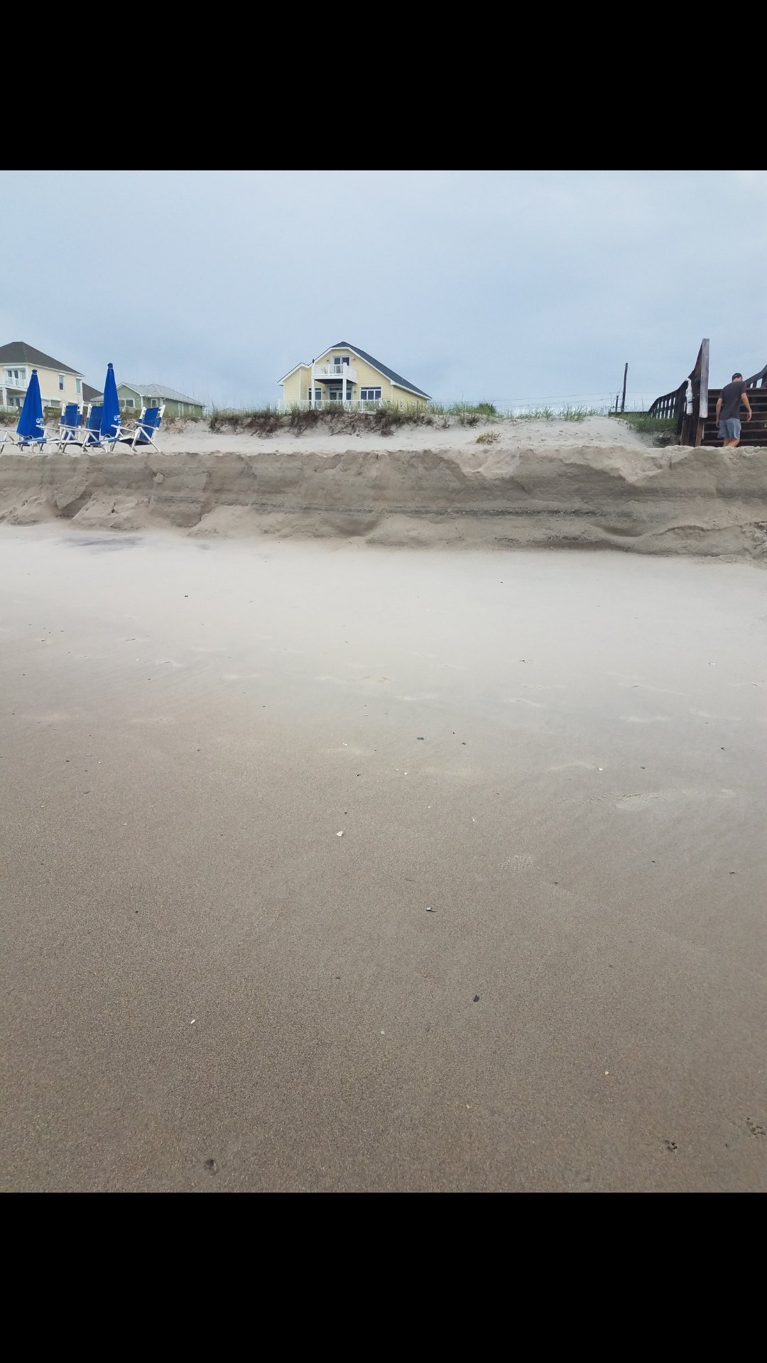
Large battering waves can also cause erosion and beach washovers. Bill in 08 caused a ton of damage at Jones Beach NY where I have been a life guard for 22 years. The East Coast with it’s sandy beaches is very prone to erosion caused by high energy long period swells. I have watched the beach washed clean (all snow fencing destroyed) under sunny sky’s on numerous occasions.
Moral of the story, I find the term fish storm annoying.We were at Carolina beach near Wilmington back in June. It was a wet week with a ULL to our southwest and we had a long onshore flow. It chewed that beach to pieces and I knew it was gonna be bad of we got a cane. Luckily Iseias wasnt too bad of a storm.

-
1 hour ago, notlikethis said:
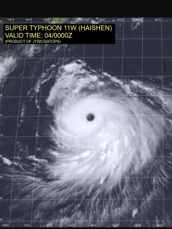
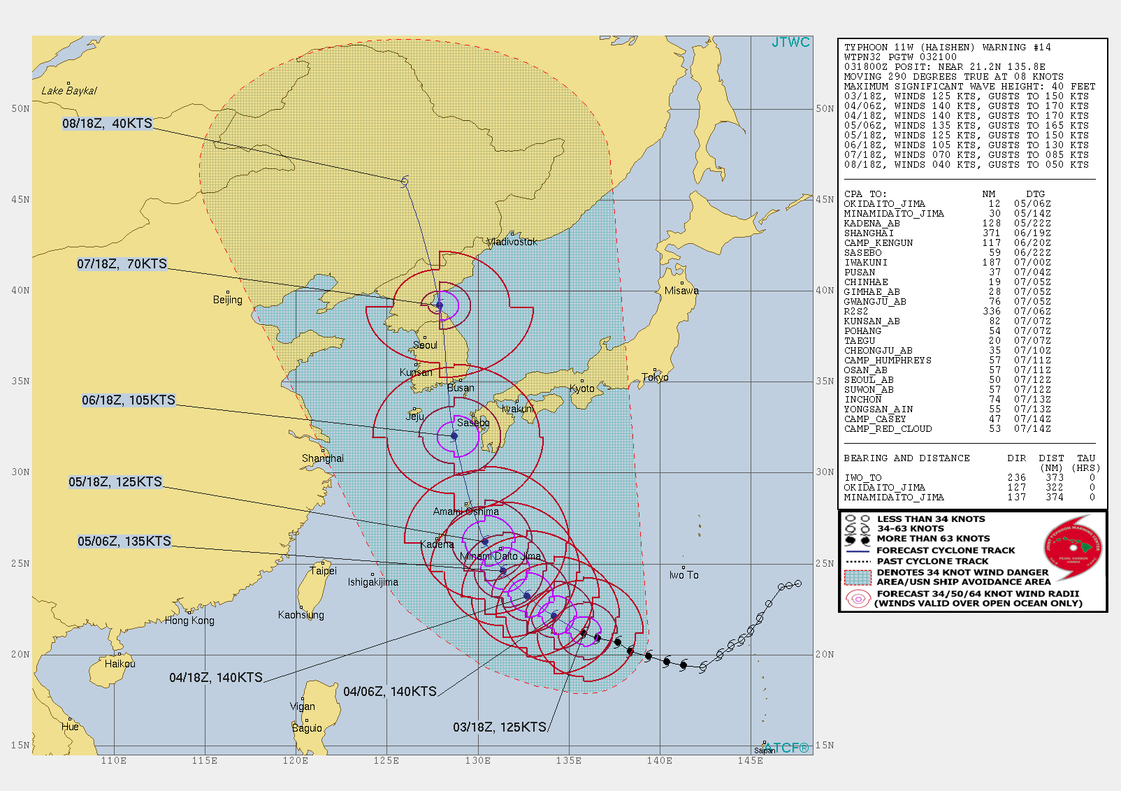
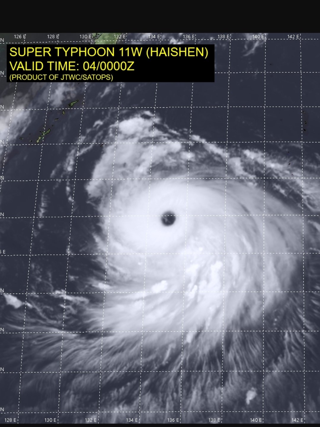
Classic satellite representation and will achieve super typhoon status later today, as shaggy noted:
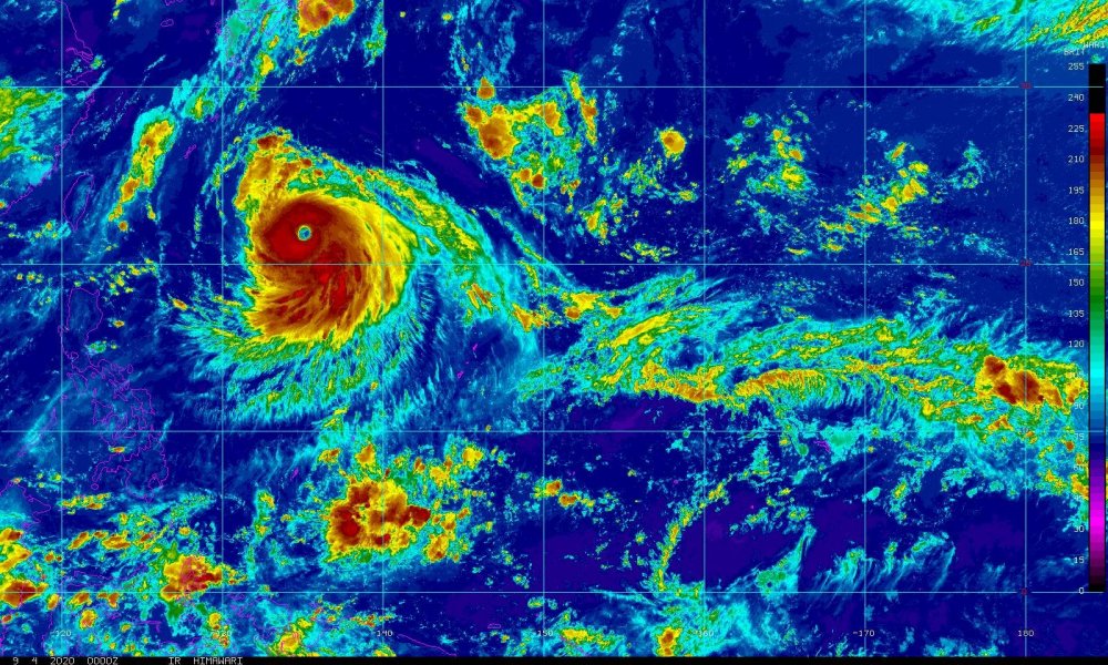
Already upgraded to STY. Took awhile but the wpac has put out 2 monsters this week.
-
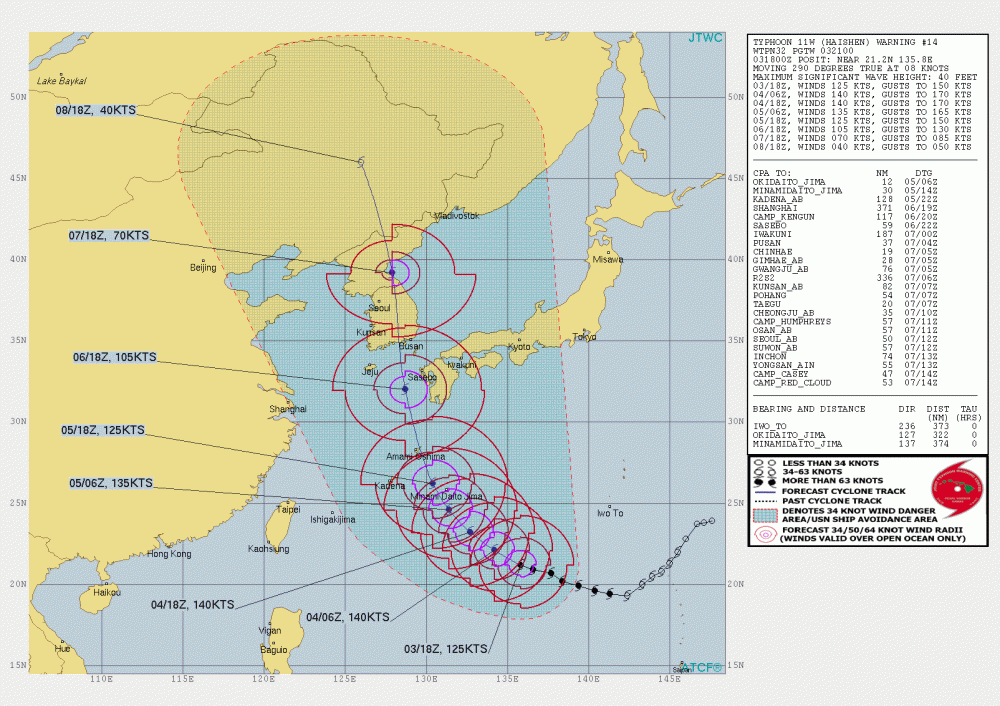
Typhoon Haishan now forecast to peak at 140kts
-
5 hours ago, goldsborosnow said:
It gets more interesting the more you think about it. Unfortunately, we have to wait until next year to add to the sample size.
Yeah it's pretty neat to track and follow.
-
On 8/30/2011 at 1:45 PM, Brick Tamland said:
So where do earthquakes fit in the picture?
Hmmm brick on to something?
-
On 8/5/2020 at 6:20 PM, goldsborosnow said:
So there were at least 15 tornadoes between the February and April severe weather events plus there were likely a few more scattered throughout the year and we've already had a hurricane make landfall in Eastern NC.
The numbers over the course of 9 years are holding up. Also had Bertha into SC so this is 2 strikes on the carolinas.
-
3 hours ago, Solak said:
93/61 today with one brief passing cloud.
Yeah it was a hot one but humidity was tolerable.
-
So i found 3 storm reports updated on the SPC storm reports late for Feb 6th. They were EF-1 for both gates and Stanley counties and an ef-0 for Randolph county. There were still 4 other reports from Feb 6th that I havent found a survey for and those were Gaston, Mecklenburg, Cabarrus, and Gaston counties.
This makes 15 confirmed tornados and 4 others reports I havent found surveys on yet.
-
 1
1
-
-
Still looking for total tornado counts from NC from the Feb outbreak but we had 12 on Monday.
-
Tomorrow still looking quite worrisome for the piedmont/coastal plains areas.
-
1
-
-
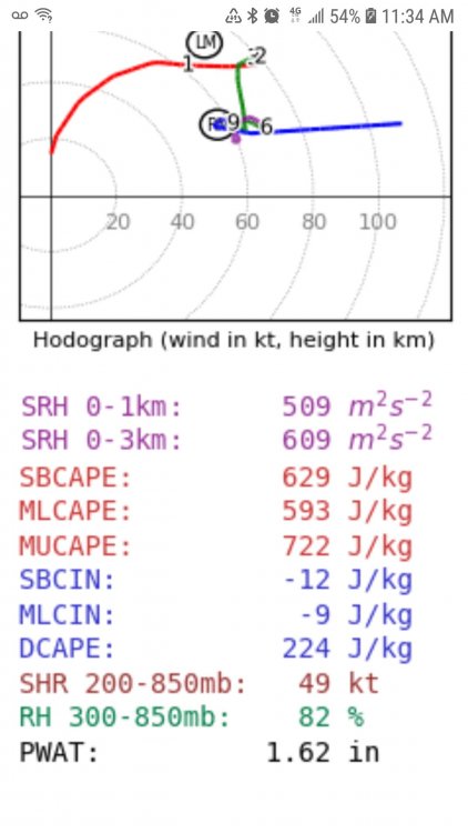
1 minute ago, Quincy said:
It has some utility, but not always. It gives you a good idea of where the background environment would favor tornadoes, but it doesn’t really distinguish between storm mode (supercell vs. QLCS for example).
Usually it exaggerates the threat between 06-12z due to the LCL and 0-1km terms skewing during that time frame, however I think this situation is a outlier, where nighttime and morning tornadoes could be fairly widespread.
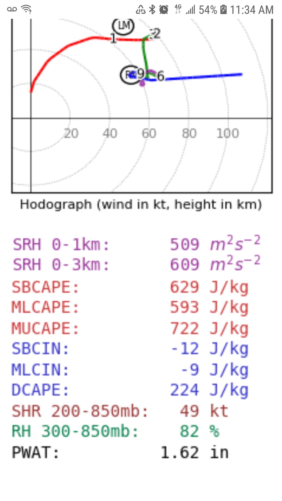
I'm in greenville NC and pulled this sounding just as the storms hit here. Ot sure I've ever seen SRH levels above 500 m2 s2 here.
-
1 hour ago, eyewall said:
Yeah I don't think we will see a high today. During the April, 16 2011 outbreak in NC the high wasn't issued until the morning of the event.
I'm off on Monday and with us having a slightly later in the morning event I may chase near home If it's safe and my home isn't threatened. Not sure we see enough discrete cells here for any major tornado outbreak but it might not take much to get a few out of this setup.
-
Looks ominous for the deep south again. A little less concerned here in the coastal plains due to timing. Hope people are paying attention.
-
6 hours ago, NorthHillsWx said:
Can you post links? Thanks. Wish Josh had been able to chase this one. Looked high end at both landfalls
I'm assuming it's real.
-
16 hours ago, NorthHillsWx said:
That's a monster impact for whoever was in Harold's eyewall. Sounds like limited population but the initial hit then recovery then even stronger hit on the second island will be devastating for whoever was in that storm's path.
Couple videos have surfaced just waiting to see if they are legit or not.
-
15 minutes ago, BullCityWx said:
It is really struggling to warm up today
Havent broke 32 yet with the snow cover. Overnight low was 20 but our forecast high was 40. Will be intrested in what we crash to tonight.
-
1
-
-
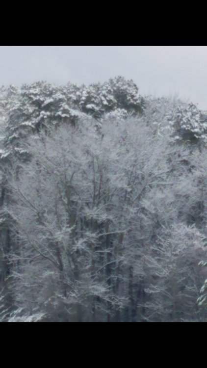
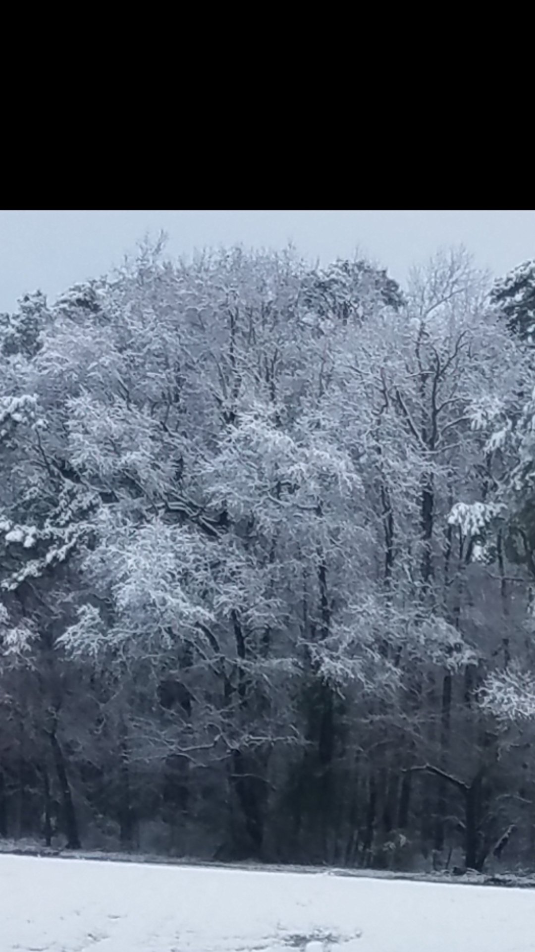
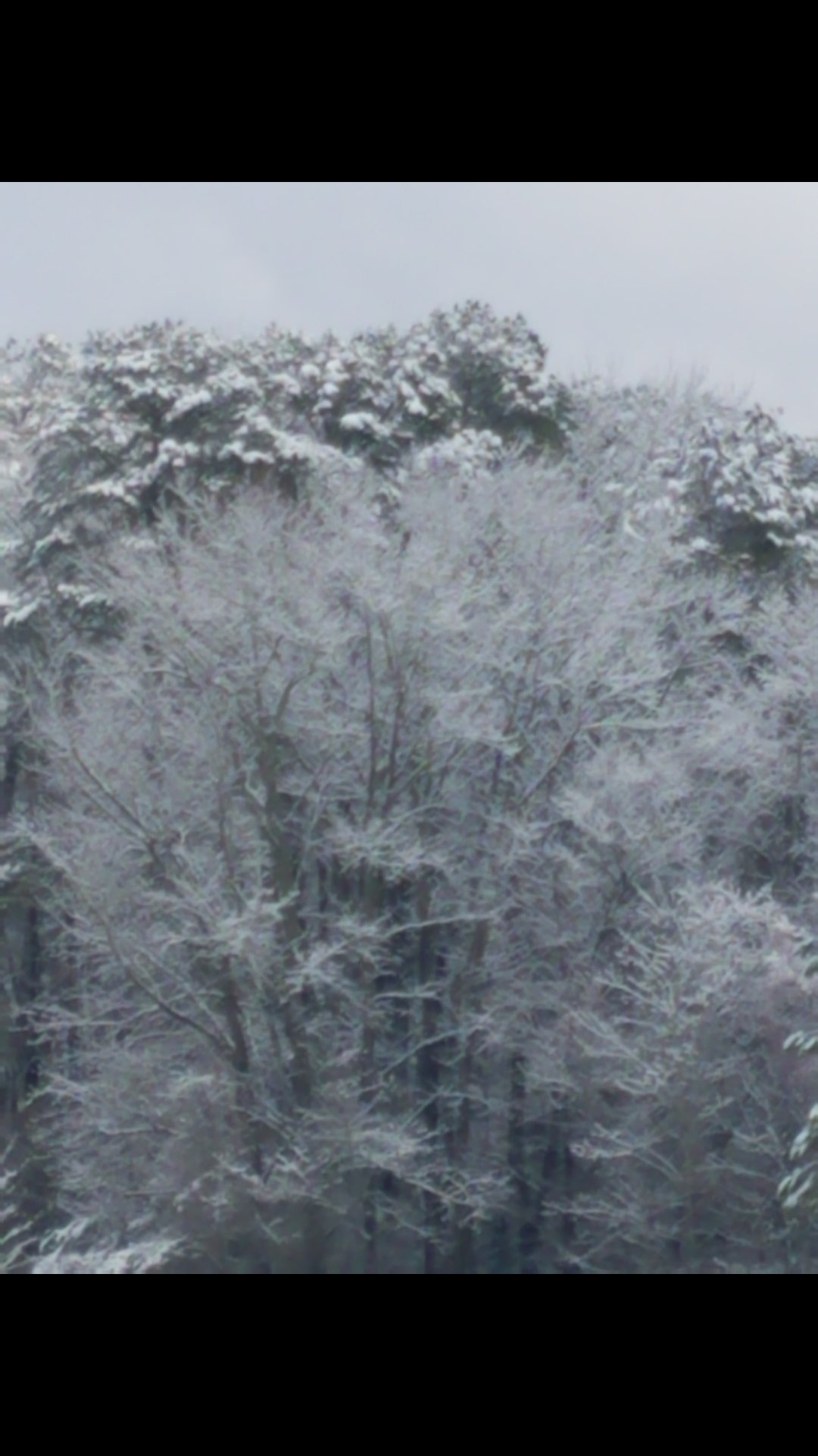
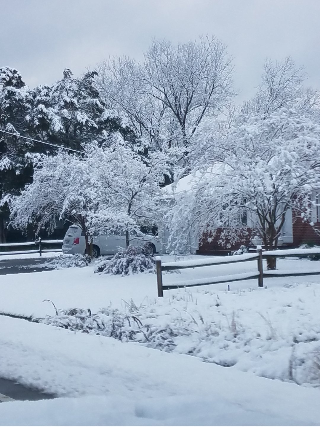
Very photogenic. Classic paste bomb that stuck to trees and encased them in snow.

-
2
-
-
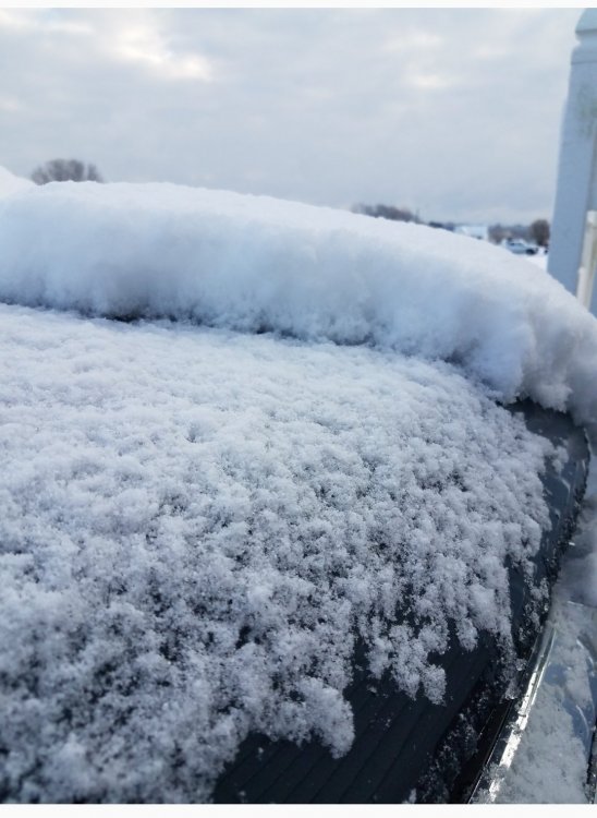
Did ok here.

-
13
-
-
19 minutes ago, Dunkman said:
Interestingly the UK has the jackpot set up in the Kinston area much like the GFS did.
Yea sitting here at PGV with individual model maximums all around me. Some south some north some west......who knows.
-
1
-
-
Mhx is saying all rain all day tomorrow for their NW counties. Either they are way off or the tools they use are showing then what we cant see.
As of 250 PM Wednesday...The calm before the storm on Thursday.
Low pressure develops off the northeast Florida coast and moves
offshore well to our SE while strengthening Thursday. NAM3km/HRRR
shows light rain returning to the CWA by mid-morning Thursday
with steady light rain continuing through the daylight hours.
Top- down ensemble precipitation type tool indicates that ptype
should remain liquid through 00z and surface temperatures remain
at 36 degrees or higher over the northwestern corner of the CWA
and closer to 40 degrees elsewhere. Highs will likely occur
around midday with slowly falling afternoon temperatures. N/NE
winds will remain gusty on Thursday.


Hurricane Zeta
in Tropical Headquarters
Posted
Not too shabby 5 hours post landfall