

shaggy
-
Posts
7,429 -
Joined
-
Last visited
Content Type
Profiles
Blogs
Forums
American Weather
Media Demo
Store
Gallery
Posts posted by shaggy
-
-
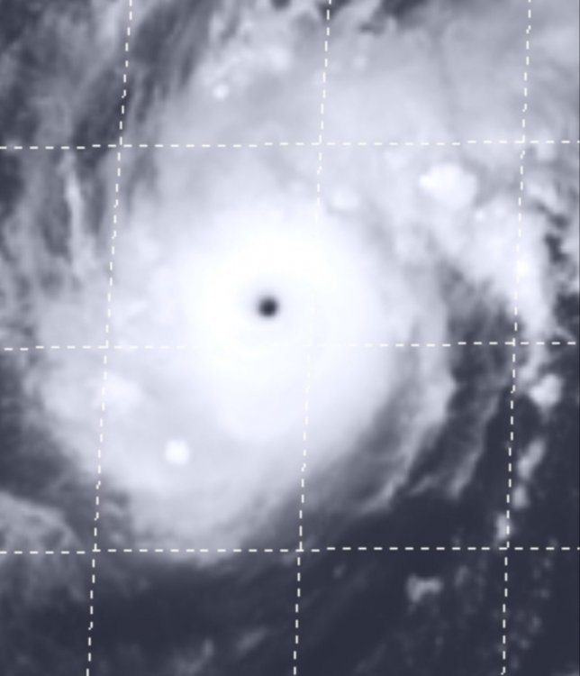
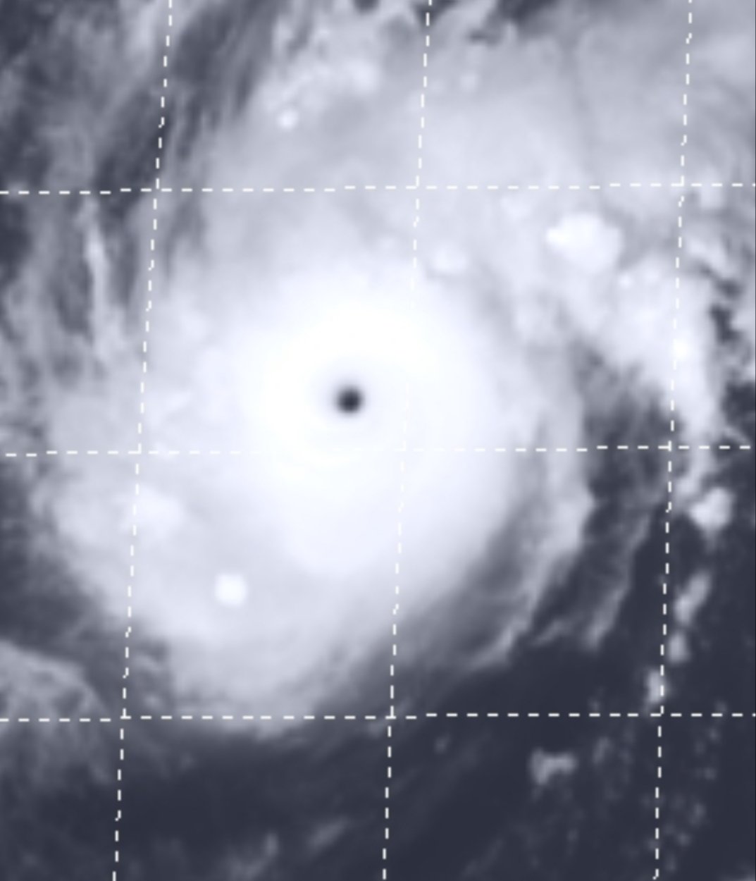
Surprised this is only at 140kts. Hard for me to believe such an incredible sat presentation along with a cleared out 5 mile wide pinhole eye is only producing 140kts.
Anyone know the pressure on this thing?
-
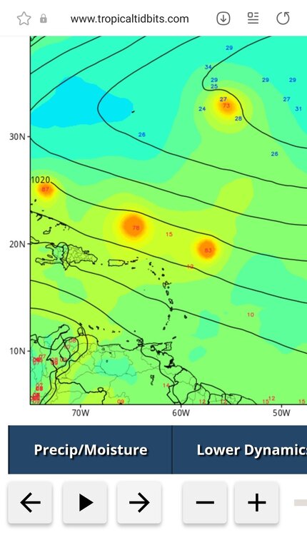
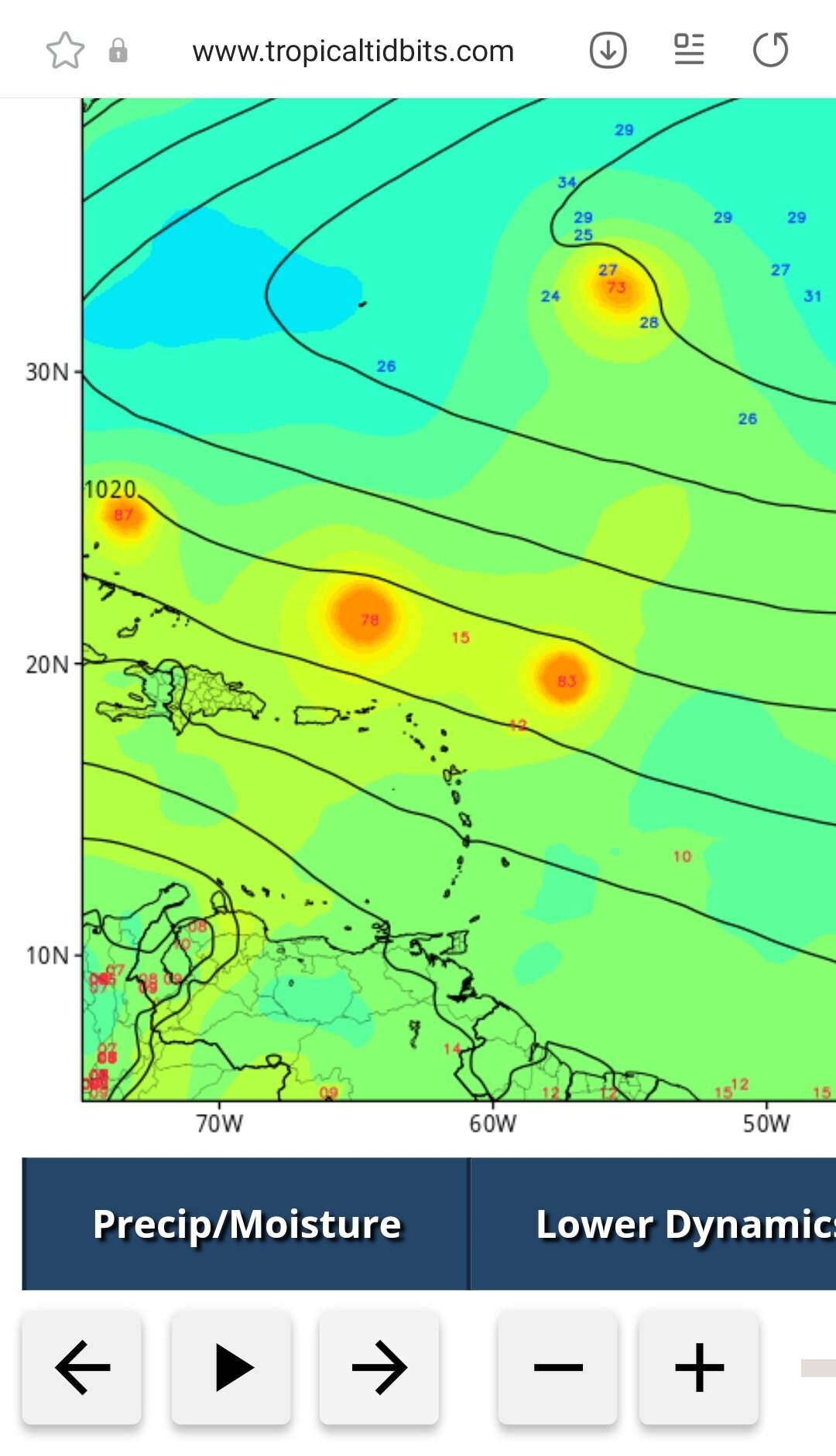
I know it's the nam and it's not a tropical model but the 3k is a noticable SW shift so far versus 18z
-
Shear becoming apparent on the northern edge
-
26 minutes ago, MattPetrulli said:
West trend continues on 00z and we got a LF

The stop and recurve occuree roughly 75 miles SW of where it did at 18z. While not huge that's not insignificant and a few more of those and the OBX can come back into play.
-
 3
3
-
-
2 hours ago, GaWx said:
The 18Z GEFS started off with all weak members but suddenly became much more active near the SE coast.
Yeah most make landfall so this still has legs and needs to be watched.
-
Icon looking Frances/Jeanne like so far just weaker than those storms.
-
Take away for me right now is that there's a strong signal for a TC in the danger zone of the southwest Atlantic. Details beyond that are pointless at this time frame.
-
2
-
-
I'm running a +17 inch surplus for the year in Eastern NC and wo far its the wettest year on record to date. While most of the heavy rains modeled would be north of me that's the head waters of the river systems and would cause major flooding.
On the other hand with the ground so saturated a real deal inland wind storm would cause major tree loss.
-
1 hour ago, MJO812 said:
Dude stop
It's insufferable.
Gfs cranks out a big recurver but the ens so far has a few members keep west into the SW Atlantic. We will see what the rest of the ens shows
-
1
-
-
1 hour ago, jconsor said:
I am skeptical of the EPS idea of rapidly developing the tropical wave currently just off the African coast. Next wave likely has a better chance to develop.
I'm definitely sitting on the slightly concerned side here in Eastern NC as the season cranks up. We are way above normal (a surplus of 13.34 officially) on rainfall with 4-8 inches more coming this week. Wet ground and a hurricane would be bad for downed trees and flooding concerns. Of course we could just as easily see no local hurricane traffic with everything going OTS or into the GOM.
I'll be paying far more attention over the next week as we start to see the models spit out different scenarios.
-
2
-
-
Still a weak signal.for something in the super long range gefs.
-
Decent typhoon looks to miss most landmass before weakening. Gfs did well with it.
-
Missed on a hot April as it was quite normal around these parts.
-
Coming up on the 10th anniversary of this thread starting and the numbers still support the correlation.. The more tornados the higher the hurricane threat.
That being said the ncdc severe reports site I use hasnt updated in a while. What's my best source for looking for confirmed tornadoes in 2021?
-
Wpac about to crank out a big one that will luckily miss land.
-
1
-
-
Luckily it won't hit anything but theres a 140kt beast in the Indian ocean.
-
4 hours ago, goldsborosnow said:
How about a day three slight risk for Eastern North Carolina on Christmas Eve?

Yeah the 12k nam 63 hour sounding over our neck of the woods is just bad. Hope its wrong.
-
1
-
-
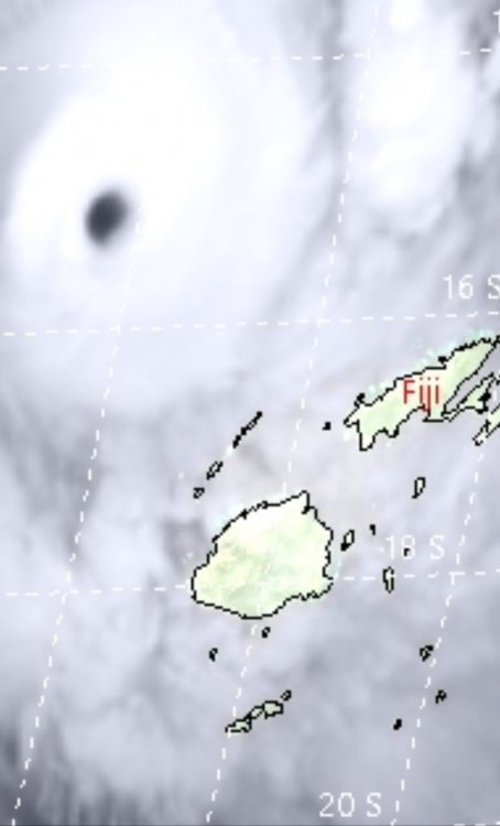
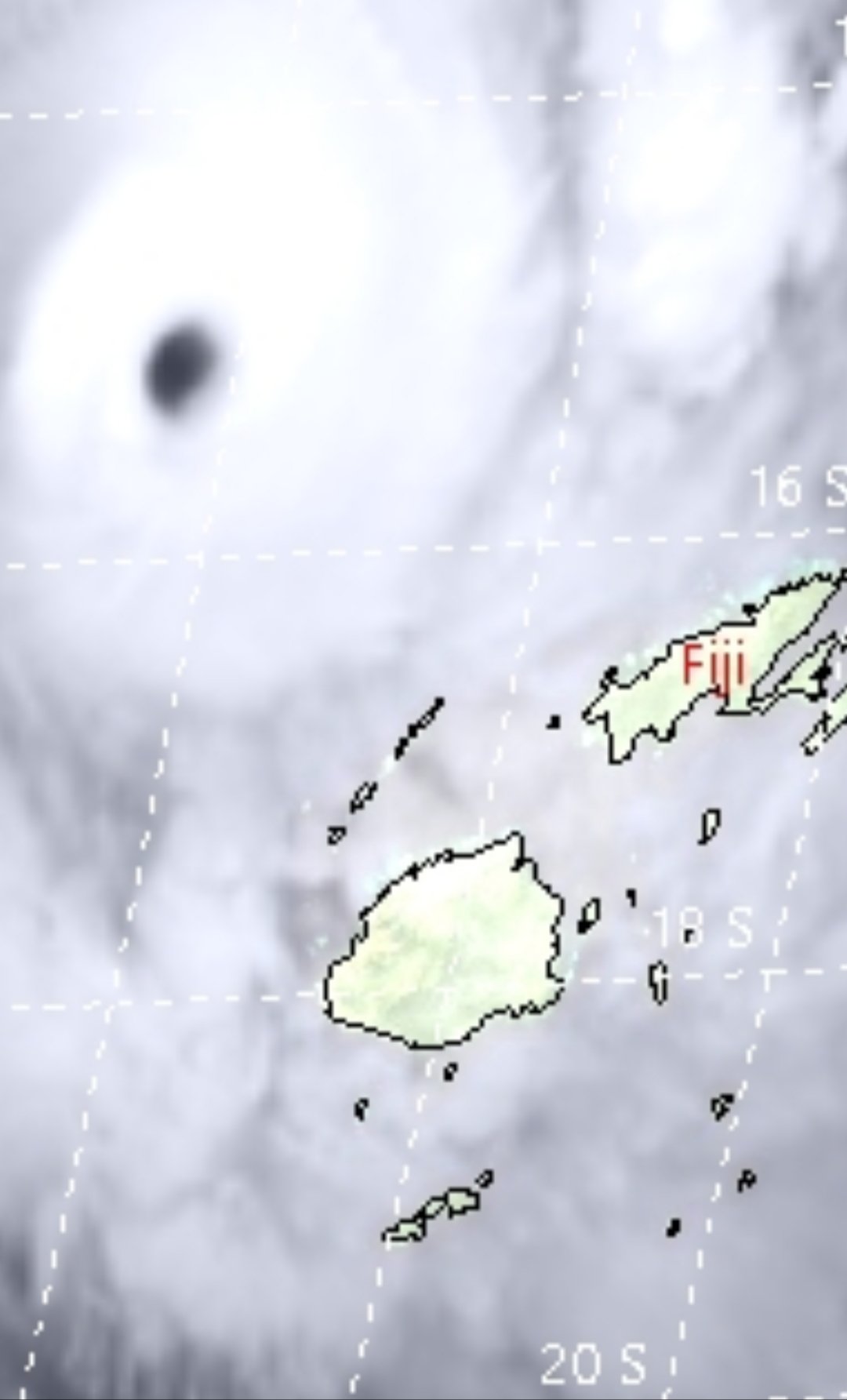
Landfall at 130kt
-
Yeah gonna be a big hit for Fiji. Hopefully the eye passes between the islands but either way it looks like someone takes the eyewall of a 130+kt cyclone.
-
1 hour ago, Windspeed said:
Make that a Cat 5 on the Aussie scale.

JTWC presently has it at 110 kts and expectss further intensification. Should reach a high end Category 4(Saffir-Simpson) prior to land interaction.
Yeah forecast to peak at 140kts and landfall at around 120kts. Gonna be a bad hit for Fiji.
-
Fiji looks to be on the receiving end of a cat 3 landfall in a couple of days if the track forecast holds.
-
Up to 150kts this morning.
-
Been a relatively quiet season over there but newly formed typhoon looks to approach the Philippines as a strong cat 4 in a few days.
-
6 minutes ago, SnowGoose69 said:
The 20Z HRRR got that 02-03Z MOB forecast very close. Had 90kts at 925mb with 76kts mixing to the surface
Hrrr has shifted highest winds eastward in NC and now gets me right at 60mph gusts when earlier today it had me low to mid 40s.
-
 1
1
-
WPAC, Indian Ocean, and Southern Hemisphere Tropical Cyclones
in Tropical Headquarters
Posted
Now up to 155kts. Pure beast mode