

shaggy
-
Posts
7,429 -
Joined
-
Last visited
Content Type
Profiles
Blogs
Forums
American Weather
Media Demo
Store
Gallery
Posts posted by shaggy
-
-
7 minutes ago, GaWx said:
.NEW TROPICAL DEPRESSION FORMS IN THE CENTRAL TROPICAL ATLANTIC... ...FORECAST TO BECOME A POWERFUL HURRICANE BY THE END OF THE WEEK... 11:00 AM AST Tue Sep 5
Location: 12.5°N 40.2°W
Moving: WNW at 15 mph
Min pressure: 1008 mb
Max sustained: 35 mph
0Z UKMET initialized 190 miles due east of thisCorrect me if I'm wrong but the ukmet tends to have a W bias with tropical systems correct? I remember when the ukmet was the only model showing Irma reaching the north coast of Cuba.
Winder where the other 12z suites will initialize their centers.
-
It's actually much more like an Irene impact over lookout and into the sounds.
Doesnt matter it was one op run from 200+ hours out
-
31 minutes ago, GaWx said:
After two runs without TCG being noted on the UKMET, the new run (0Z) has TCG. So, together with a much stronger CMC vs 12Z, there is some reversal of recent runs' weakening trends despite the 0Z GFS being similar to its recent weaker runs.
0Z UKMET: moving WNW at 15 just N of Leewards at 168:
NEW TROPICAL CYCLONE FORECAST TO DEVELOP AFTER 84 HOURS
FORECAST POSITION AT T+ 84 : 14.8N 44.0WLEAD CENTRAL MAXIMUM WIND
VERIFYING TIME TIME POSITION PRESSURE (MB) SPEED (KNOTS)
-------------- ---- -------- ------------- -------------
1200UTC 06.09.2023 84 14.8N 44.0W 1010 24
0000UTC 07.09.2023 96 15.7N 45.9W 1009 27
1200UTC 07.09.2023 108 16.4N 47.8W 1008 29
0000UTC 08.09.2023 120 17.2N 50.6W 1008 26
1200UTC 08.09.2023 132 17.8N 53.7W 1008 29
0000UTC 09.09.2023 144 18.3N 56.3W 1007 27
1200UTC 09.09.2023 156 18.6N 59.6W 1007 31
0000UTC 10.09.2023 168 19.5N 62.1W 1005 32Gfs op run doesn't seem to match its ensembles which are coming in with a strong signal for a storm to be threatening the northern islands so far. We will see what the rest of the run shows.
-
Icon and cmc at 0z are stronger(albeit not tbat strong) and more threatening to the islands
-
 1
1
-
-
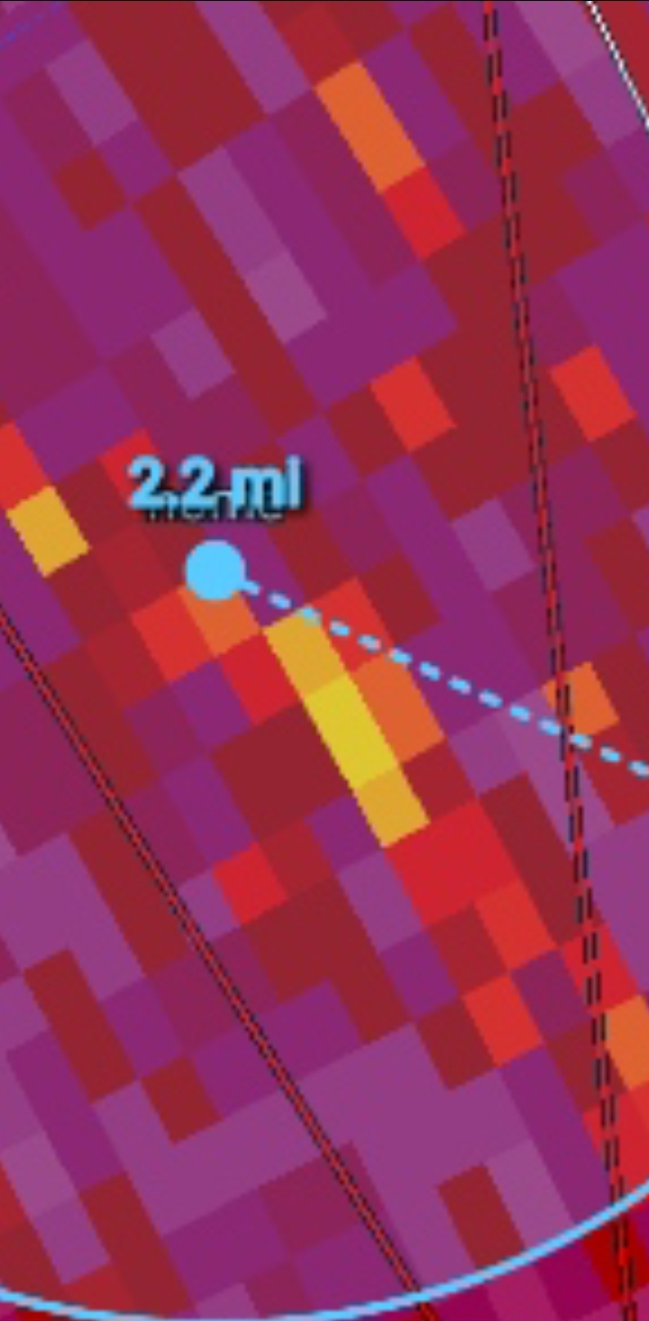
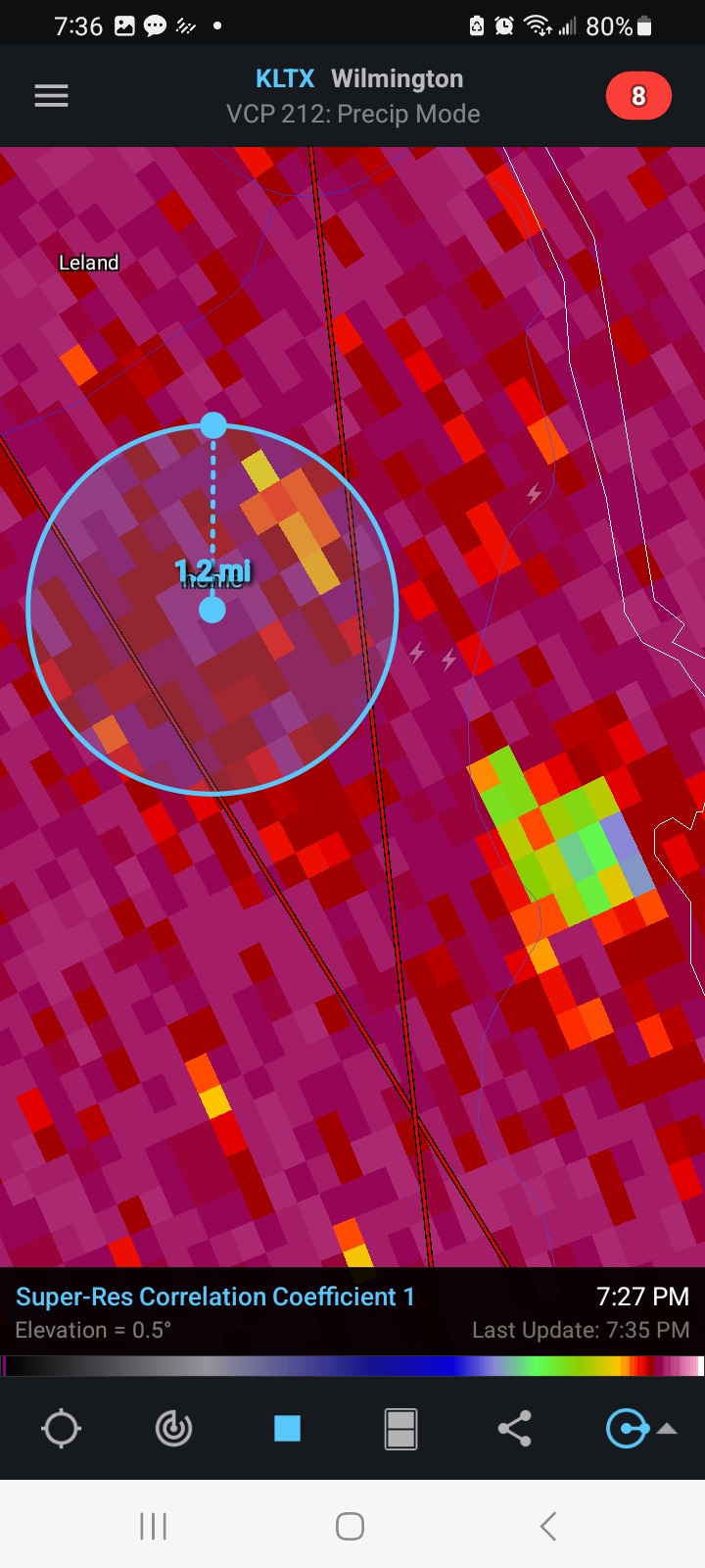
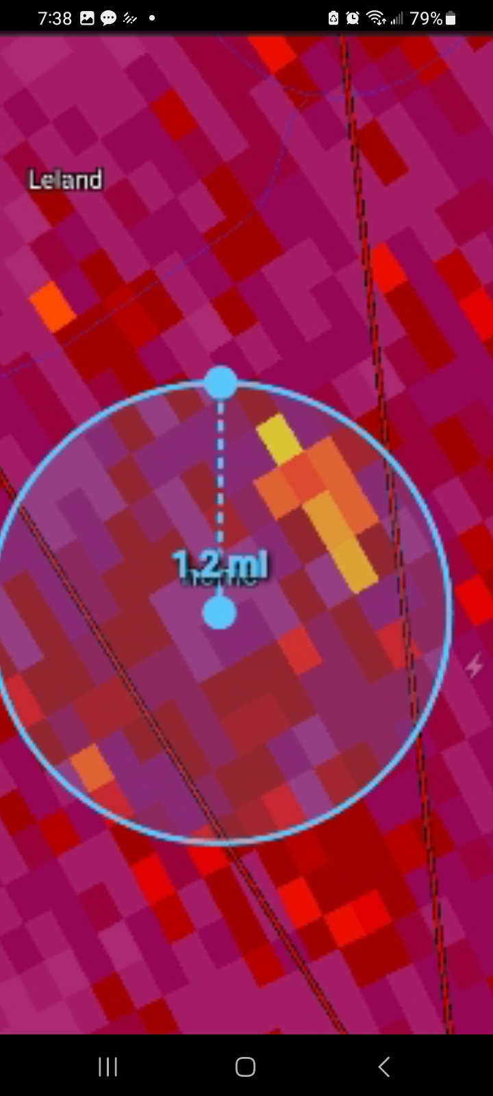
Going back throught my images I saved as I was focused on the larger CC drop and missed the one right at the house. Wasn't a clear circulation there as the bigger couplet was SE of.me. wonder if it was a satellite tornado on the edge of the bigger meso

-
 1
1
-
 1
1
-
-
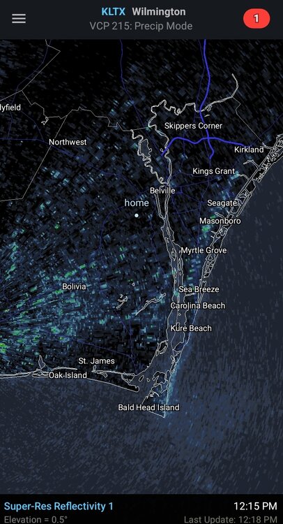
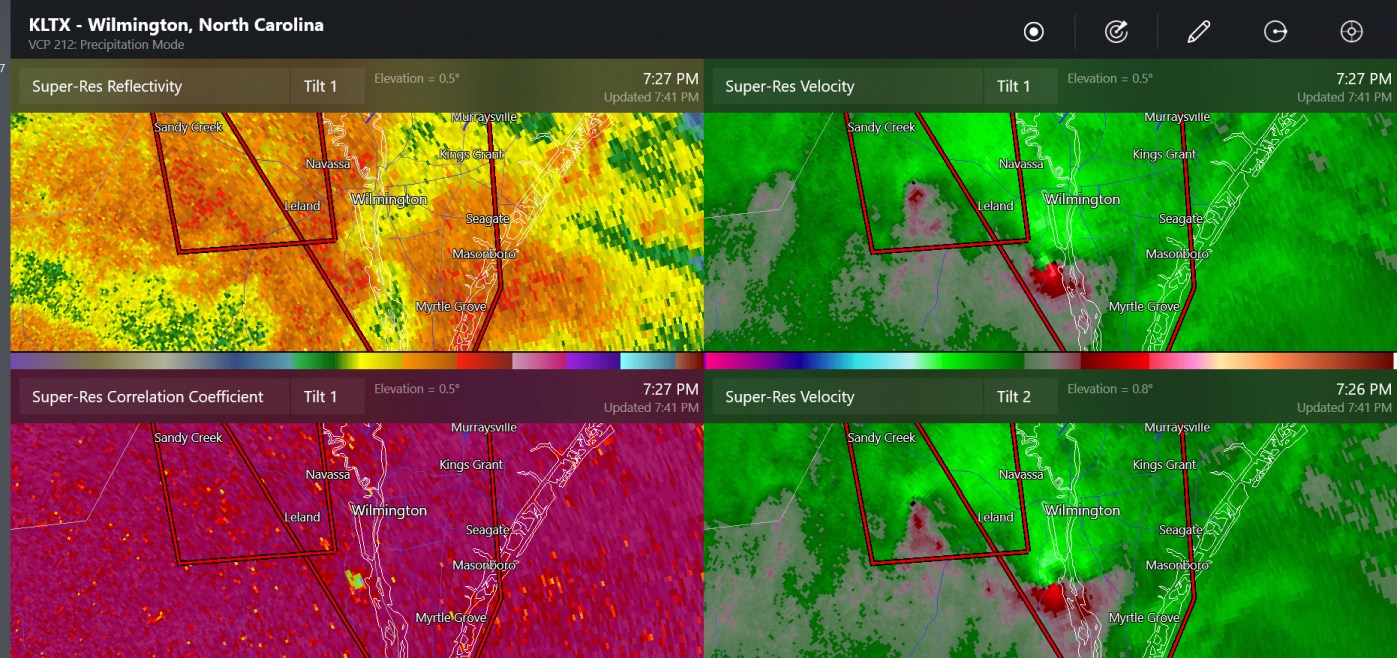
17 minutes ago, Chinook said:
confirmed tornado near Wilmington NC

Bout crapped my pants. Was out on the porch watching and listening for the larger vortex to my southeast when another circulation formed and dropped less than a mile from me. Confirmed both by radar and law enforcement down the road from me.


-
1
-
-
10 minutes ago, GaWx said:
12Z Euro little later landfall vs 0Z and quite a bit stronger
Still has it at 983 off cape fear so. Ot too far from my backyard although I don't expect much wind impact with that track
-
1
-
-
2 minutes ago, PackGrad05 said:
With so many consistent moves to the east, a move back west wouldn't be surprising at this point. It's really going to depend on the speed and the trough strength to the north.
With her reluctance to move north in wonder if we get into a scenario where the trough leaves her behind a little as the models are hinting at just offshore.
For practical impacts along the east coast inwonder if a slight miss by the trough equals less east turn and we see a closer to the coast track say Charleston to lookout or so?
-
1
-
-
Been moving more west short term
-
29 minutes ago, dan11295 said:
I know Idalia is forecast to speed up, but how fast of a forward speed are we looking at for landfall?
Gfs goes from landfall in the big bend to being over cape fear in 18 hours. That's pretty quick
-
3 minutes ago, eyewall said:
Yeah I am hoping for some outer bands like I saw in Isiais in 2020.
I'm about 10 miles west off the beach at Wrightsville and about 15 miles north of Caswell beach now. Just moved down here a month ago.
-
1
-
-
6 minutes ago, PackGrad05 said:
6Z EPS model consensus is tight around a big bend landfall and then riding the GA/SC/NC coast up to Cape Fear. ECMWF, UKMET, and ICON largely agree.
6Z GEFS model consensus slightly west of this.
I've recently relocated to the cape fear region and am curious as to what intensity it can bring up this way. It's steady forward motion and coast riding gives me hope for at least a few TS force gusts Thursday
-
He could have been a big hit if he was 500 miles west. The board would have been nuts of we had been looking at a Franklin east coast landfall followed by a gom landfall
-
So far dmax hasn't helped with new storm development yet. Was sort of thinking it had potential to really get going tonight but so far it's simmered down
-
1 hour ago, GaWx said:
Although I'm not saying they can't end up with a dangerous situation then, I'd say that the worry regarding the 12Z GFS would be the case for folks not realizing that the exact 10 day position on the GFS or really on any operational for that matter is of very limited forecasting value since they jump around a lot that far out from run to run. Regarding GFS runs over the last 5 days, only the 0Z 8/16 run has anything similar.
Especially since there was little support from the gefs
-
2
-
-
A lot more noise on 06z gfs op and the gefs so far this morning
-
1
-
-
35 minutes ago, ldub23 said:
06 gfs has nothing except a weak low thats going to recurve. Im amazed NOAA was so high and no one is reducing numbers by alot.
It's early August. In pre- 2000s we would be lucky to have 1 named storm by this point in the season.
-
2
-
-
4 hours ago, LongBeachSurfFreak said:
While this is true, like CC forecasts any storm that finds a hole in the shear will have a higher ceiling for intensification.
Agreed
-
59 minutes ago, GaWx said:
My money's on uncertainty! This is a tough year to forecast. In the contest I'm going with the less active side vs 1995+, but with low confidence.
Agreed. I'd go lower as well. Doesn't really matter if the warm water helps big storms that subsequently have the roof blown off them.
-
21 minutes ago, GaWx said:
The 12Z Euro has what appears to be a TD on 6/21 that moves WNW to just NE of the Leewards on 6/23.
Battle royal this year. El Nino versus bathwater SSTs. Who you got your money on?
-
30 minutes ago, Hotair said:
The cone on this one seems rather unusual to me. Do we get many storms in the gulf that transit North to South ?
Definitely not typical in June
-
1
-
-
On 5/5/2023 at 5:32 PM, Windspeed said:
I'd disagree with this on principle. Suee the Atlantic is above average and there will be plenty of warm water for storms to feed off of. That however doesn't IMO mitigate shear because if the shear due to strong El Nino is strong it will simply blow those strong storms apart.
-
24 minutes ago, andyhb said:
New estimate of 160 kts and 897 mb from ATCF. Dvorak technique maxed out at 8.0.
This thing is an animal.
Gfs called it way in advance as well
-

Category Five Hurricane Lee
in Tropical Headquarters
Posted
Trough looks less amped in the great lakes when he makes the turn