cincy.wx
-
Posts
107 -
Joined
-
Last visited
About cincy.wx

- Birthday 12/28/1998
-
 cincy.wx changed their profile photo
 -
4/1-4/2 severe threat (southern portion of subforum)
cincy.wx replied to largetornado's topic in Lakes/Ohio Valley
been a long time since this verbiage was used in the IN/KY/OH neck of the woods: "THE GREATEST RISK, WHICH WILL INCLUDE POTENTIAL FOR A COUPLE OF INTENSE/LONG-TRACK TORNADOES, SHOULD BEGIN ACROSS INDIANA, AND THEN SPREAD ACROSS OHIO THROUGH THE AFTERNOON AND EVENING, POTENTIALLY REACHING AS FAR EAST AS WESTERN PORTIONS OF WEST VIRGINIA AND FAR WESTERN PENNSYLVANIA INTO THE EVENING. EASTWARD ADVANCE OF THE RISK INTO CENTRAL PENNSYLVANIA WILL LIKELY REMAIN LIMITED, BUT OTHERWISE THREAT MAY SPREAD INTO WESTERN PORTIONS OF VIRGINIA AND THE CAROLINAS LATE." -
2024 Short/Medium Range Severe Weather Discussion
cincy.wx replied to Chicago Storm's topic in Lakes/Ohio Valley
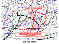
Mesoscale Discussion 0244 NWS Storm Prediction Center Norman OK 0656 PM CDT Thu Mar 14 2024 Areas affected...Southeastern Indiana into portions of southwest/south-central Ohio Concerning...Tornado Watch 44... Valid 142356Z - 150100Z The severe weather threat for Tornado Watch 44 continues. SUMMARY...An area of greater tornado potential is evident from southeast Indiana into southwestern Ohio over the next 1-3 hours. DISCUSSION...Three supercells from just east of Indianapolis to northwest of Columbus, OH have shown a rightward turn to the southeast. Surface flow remains backed in southwestern portions of Ohio. Considering the observed storm motion and regional VAD profiles, an area of greater tornado threat is evident from southeastern Indiana into southwestern Ohio. 850 mb winds are expected to increase this evening as well. Should storms remain discrete and surface wind backed, the environment would become more favorable in the next 1-3 hours. -
2024 Short/Medium Range Severe Weather Discussion
cincy.wx replied to Chicago Storm's topic in Lakes/Ohio Valley
-
2024 Short/Medium Range Severe Weather Discussion
cincy.wx replied to Chicago Storm's topic in Lakes/Ohio Valley
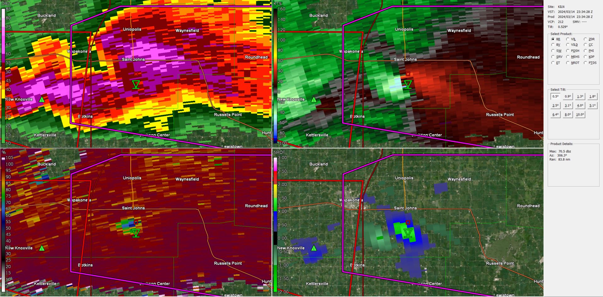
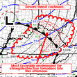
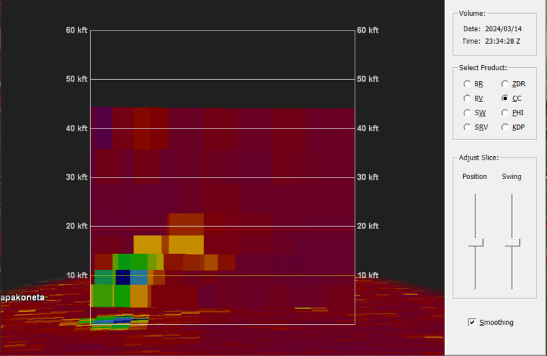
strong tornado ongoing south of Saint Johns, OH
-
2024 Short/Medium Range Severe Weather Discussion
cincy.wx replied to Chicago Storm's topic in Lakes/Ohio Valley
not ideal
-
2024 Short/Medium Range Severe Weather Discussion
cincy.wx replied to Chicago Storm's topic in Lakes/Ohio Valley
LEO confirmed tor now. -
2024 Short/Medium Range Severe Weather Discussion
cincy.wx replied to Chicago Storm's topic in Lakes/Ohio Valley
already got some spinners north of indy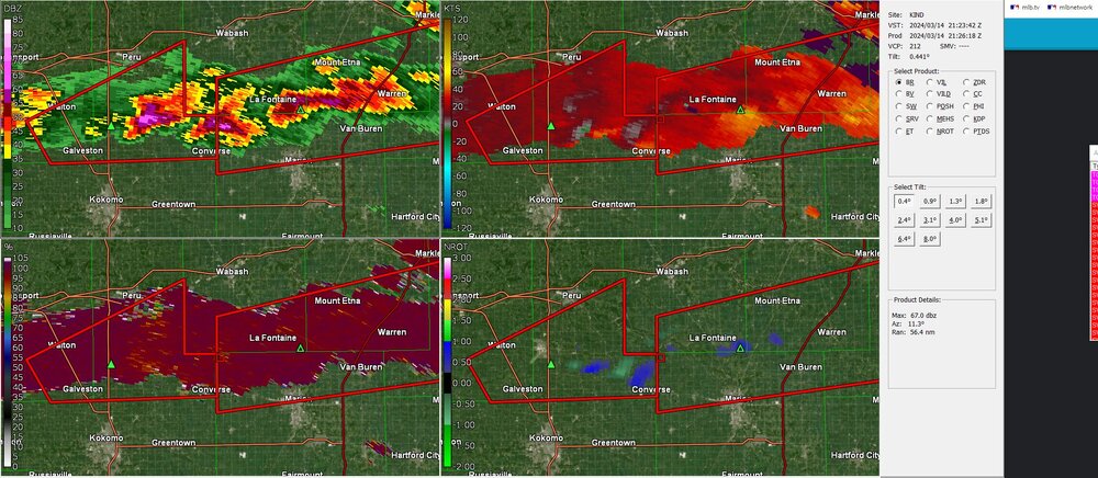
-
-
short term guidance has been consistent with the idea of a few discrete cells firing off in S/SE IN after dark. concerning look, given the projected environment at the time and the fact it would be after dark. sun is trying to break thru here and its already 65 degrees, but some possible pop up showers may ultimately temper the threat down here.
-
Did Someone Say Clipper(Hybrid)!?! 1/18-1/19
cincy.wx replied to Frog Town's topic in Lakes/Ohio Valley
eyeing the potential for overperformance here along the ohio river in cincy -
lots of squalls passing thru the cincy metro this morning. even had thundersnow reported down in northern ky. hopefully gonna get that here with a big squall passing thru shortly
-
cautiously optimistic at the premise of the northern end swiping thru cincy this evening
-
-