

TSG
-
Posts
472 -
Joined
-
Last visited
Content Type
Profiles
Blogs
Forums
American Weather
Media Demo
Store
Gallery
Posts posted by TSG
-
-
The big heat the GFS is throwing out for the Midwest next week is downright scary. I can't ever remember such a wide swathe being forecast that far over 100 degrees, for 12+ hours in a single day. Lows in KC Tuesday night would be in the upper 90s...

-
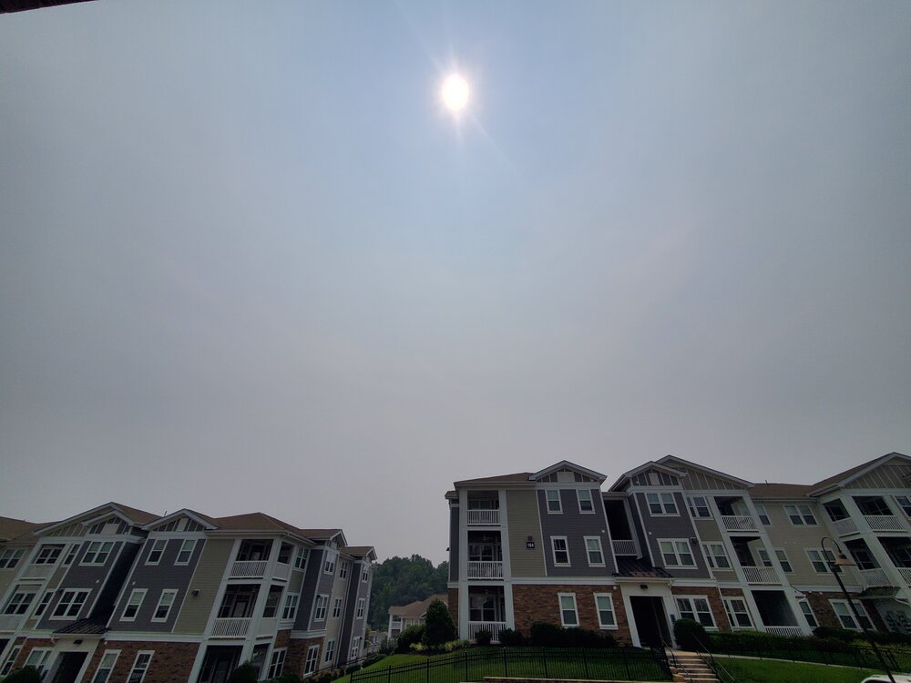
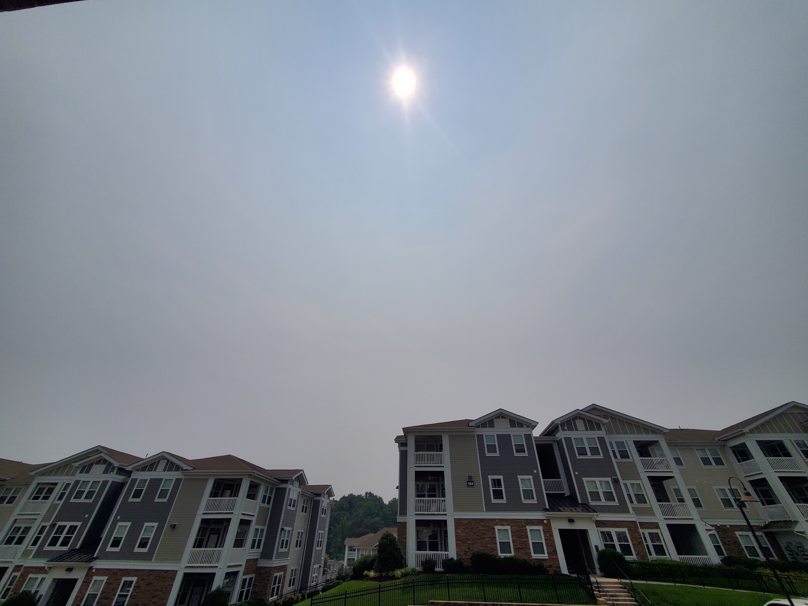
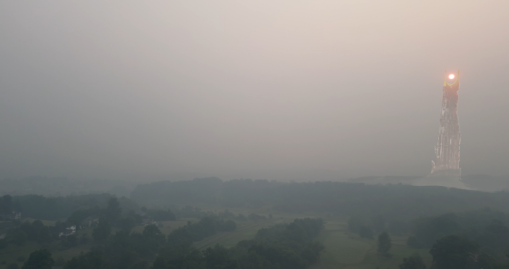
Milky-gray skies with a noticeable burnt wood smell in Cville. Slightly irritating to the eyes/sinuses. Worse than I thought we were going to get it today
-
@Roger Smith can we get a mid-season update?
yes I'm aware I didn't put an entry in this year..
-
 1
1
-
-
2 hours ago, CAPE said:
Not seeing a signal on the means over the next 2 weeks for 'big heat' in our region. Mostly upper 80s- low 90s.
Latest CFS looks like this at h5 for August-

2m temps are average.
Seems like we're going to have a hard time hitting 100 anywhere in the mid-atlantic this summer. High temp so far in Charlottesville is 94 for July, 91 for June and 88 for May. Fine by me!!
-
2
-
-
The December 2009 blizzard is seared into my memory. That winter as a whole is really. It was my senior year of HS, living in Falls Church at that point. I had faint memories of the '96 blizzard and clear ones of 02/03 and the Feb 2006 save, but that was just something I had never really witnessed. I think that storm is the one responsible for setting me on the path to weather weenie. I started checking out weather forums around then. And that was all before the onslaught that was to come in Feb lol
-
1
-
-
Slightly larger than pea-sized hail with the cell that just cross Charlottesville. Best storm of the year so far!
-
Just now, Kmlwx said:
I might be misremembering - but I think the last time LWX was down for either part of SLEP or a major failure - we all thought it was going to be like a 10 day outage and it was back up on like the 6th day or something.
Makes sense that they would put some extra time into the schedule in case something doesn't go as smoothly as planned. Under promise, over deliver
-
Today's haze is a lot like what I remember growing up with all summer in the 90s/early 00s in NoVA. Bittersweet in a way
-
1
-
-
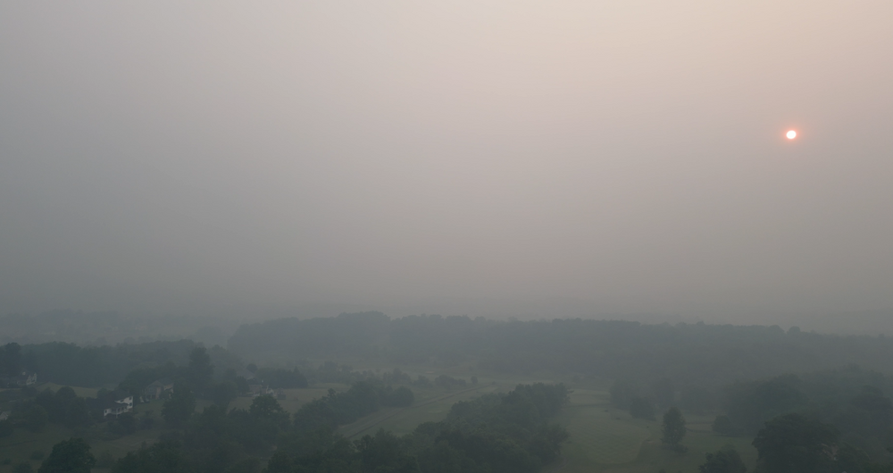
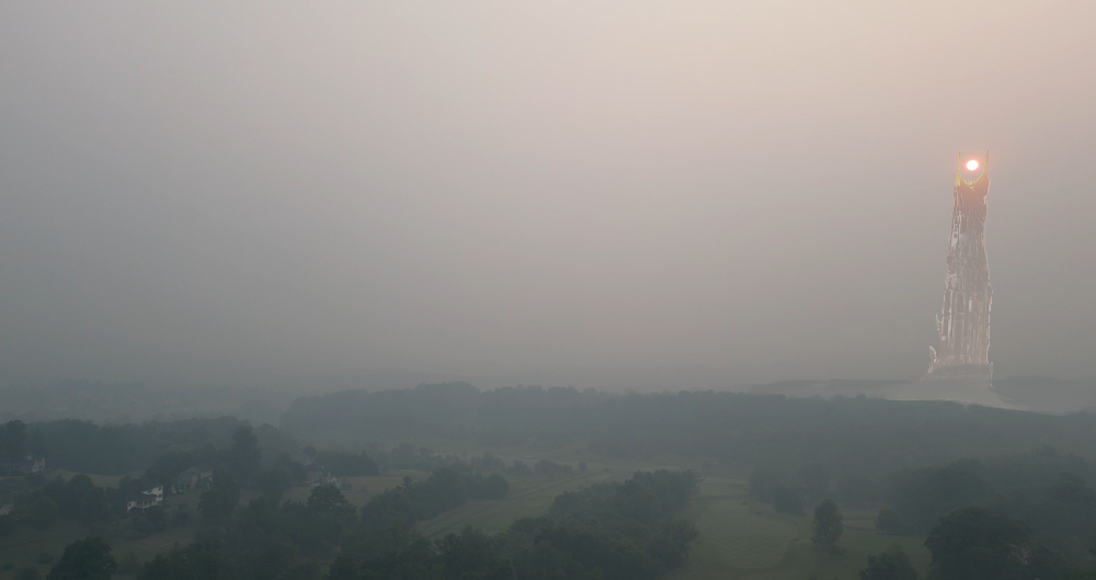
Smoke seems to be getting a little lighter at ground level in Albemarle, but it looks as thick as it has all day overhead. Maybe a product of the sun angle at noon?
219 reading to our East at Zion Crossroads (Louisa). The Hollymead sensor on PurpleAir north of town has been reading low the past few days, seems like it's somewhat protected, maybe indoors.
-
5 hours ago, ge0 said:
breathe in that fresh air
Round Hill or Mordor?
-
2
-
 9
9
-
-
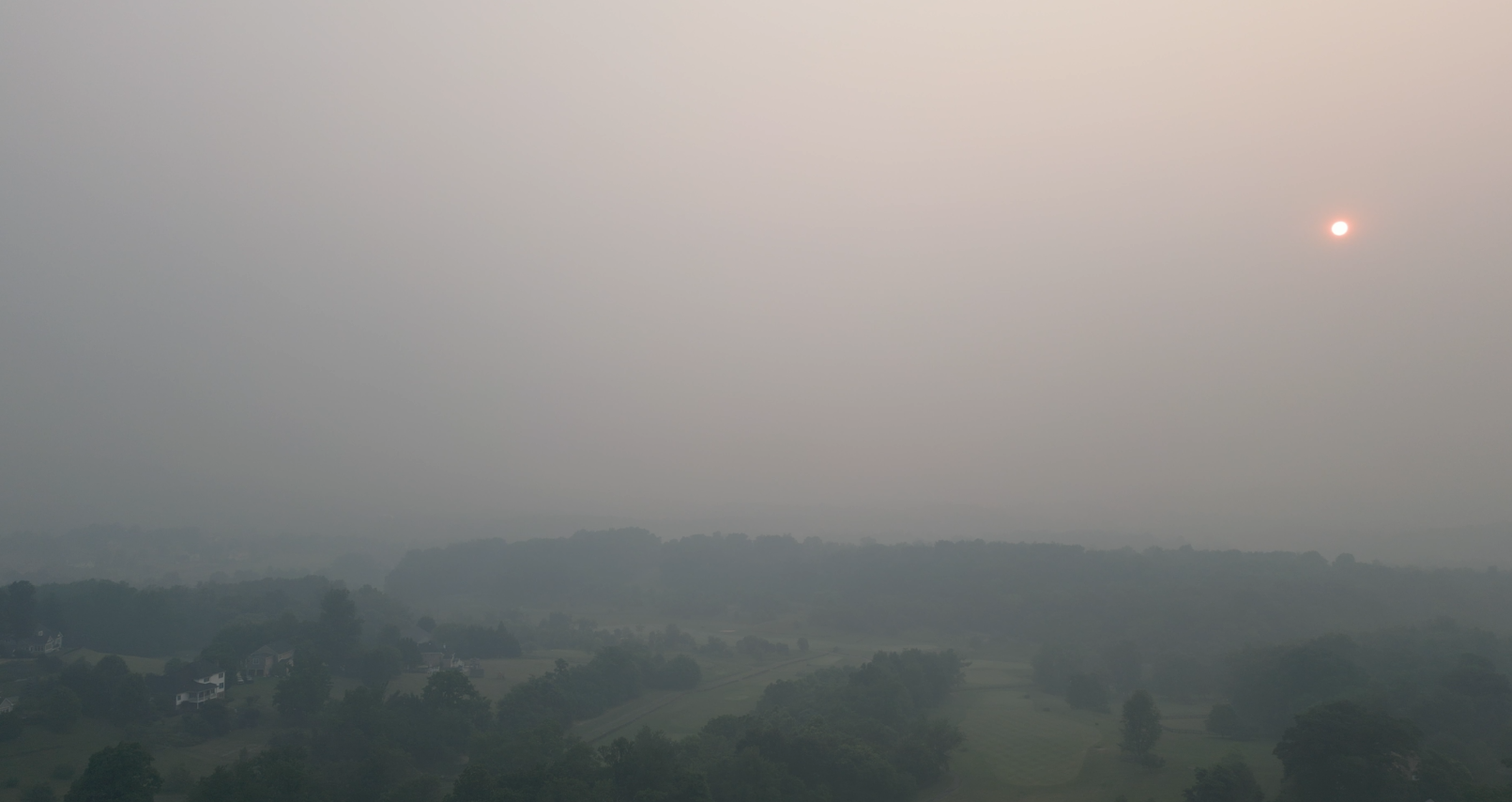
10 minutes ago, mattie g said:
Picture I took from on top of a building at 10th and F, NW at about 8:00am. The Capitol should be visible on the middle left, but no dice.
Edit: It's interesting that the smoke is much more noticeable in the picture around where the sun is shining, but in person it all looks pretty much the same (and definitely not blue like on the right/west).
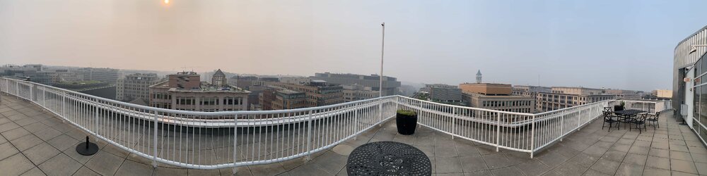
A large part of that is the phone is adjusting it's exposure/white balance settings as it takes each successive photo that then gets stitched into a single image. Your brain does the same but it's subconscious and not frozen in time for easy comparison.
-
1
-
-
Picked up 0.65" with that line that came across Albemarle between 1-2pm. It really blew up just to our SE. 45k ft echo tops on that cell near Powhatan.
-
1 hour ago, TSG said:
comma head forming over Albemarle?
up to 1.62" on the UVA Weatherbug station
1hr later: up to 1.99" with the heavy stuff now tapering off
-
1
-
-
comma head forming over Albemarle?
up to 1.62" on the UVA Weatherbug station
-
1 hour ago, Eskimo Joe said:
This is my shocked face.

-
1
-
1
-
-
Where's the guy with the big green hornworms?
Need to see those things hatched to truly get some closure on the disaster winter we had
-
1
-
-
CHO hit 88 twice this afternoon. At or above 85 from basically 3-5pm. Almost felt like summer today

-
1
-
-
2 minutes ago, psuhoffman said:
Huge improvement
Mind posting the previous?
-
13 minutes ago, Dendrimer77 said:
Despite solid radar, still no snow making it to the ground down here in Charlottesville. Virga virga-ing it
Nice little band coming over the mountain now that should produce, it dropped snow in Staunton 20 mins ago
-
1
-
 1
1
-
-
33 minutes ago, WxUSAF said:
Not for below the fall line in March
yeah but I moved from DCA to CHO 3 years ago. My allegiances have changed!!
-
2
-
 2
2
-
-
This is the stuff dreams are made of
-
5
-
3
-
1
-
-
Cherry trees are blooming in Cville
We hit 70 around 1pm today and stayed there through ~4:30. Beautiful afternoon.
-
1 hour ago, Its a Breeze said:
Was just looking at this earlier today. DCA has had one 100+ degree day in the past 9 summers. The longest "cool" stretch like that since the late 60s-early 70s. Only the second such stretch.
This has been brought up and discussed before. I believe the consensus is that the increasing humidity has been keeping our temps down in some of our recent torchy summer stretches.
-
1.07" at CHO and certainly felt like it, yesterday was one of the wall-to-wall rainiest days in recent memory.

July Discobs 2023
in Mid Atlantic
Posted
I thought that looked a little odd but wasn't sure why, appreciate the details