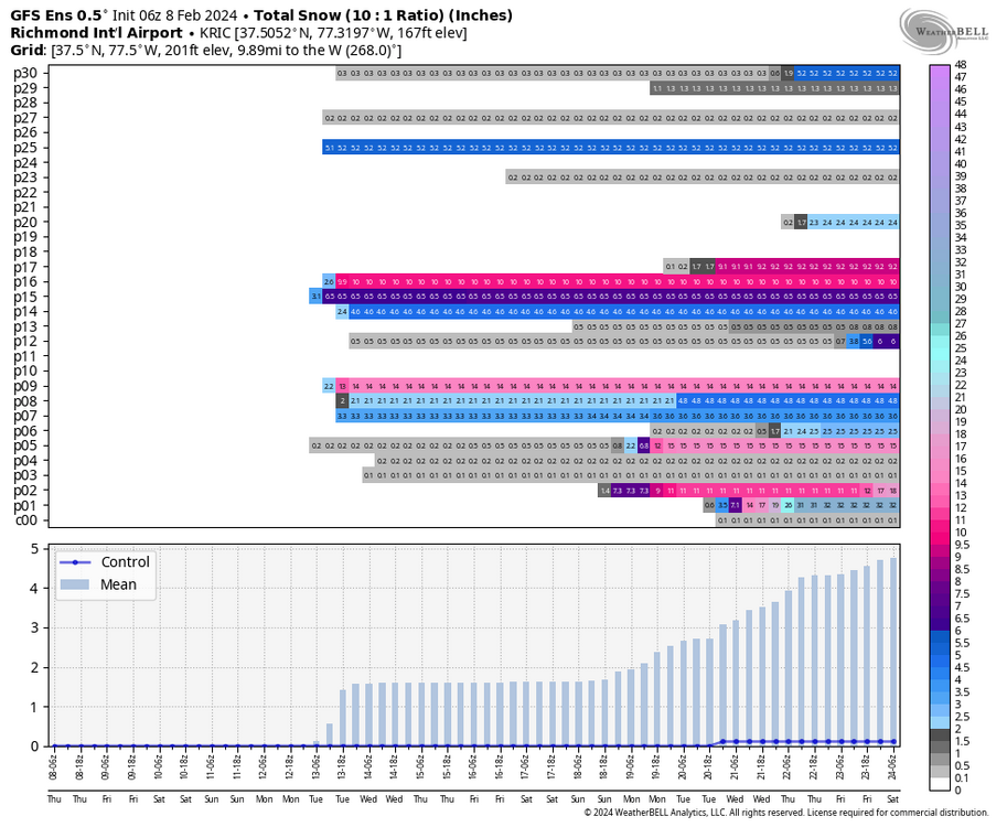
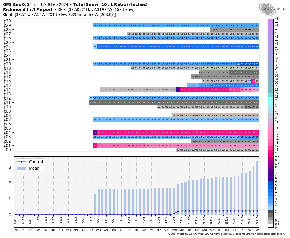
RIC Airport
-
Posts
2,586 -
Joined
-
Last visited
Content Type
Profiles
Blogs
Forums
American Weather
Media Demo
Store
Gallery
Everything posted by RIC Airport
-
Richmond Metro/Hampton Roads Area Discussion
RIC Airport replied to RIC Airport's topic in Mid Atlantic
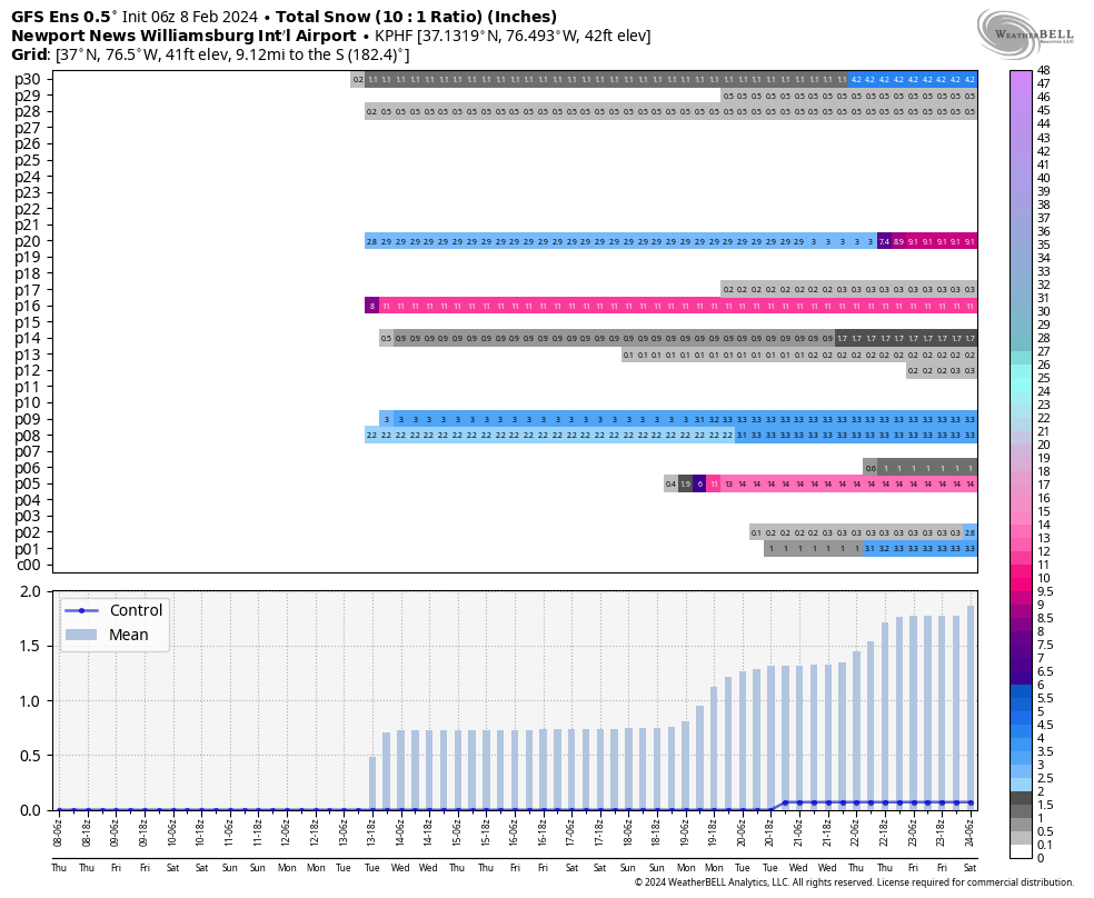
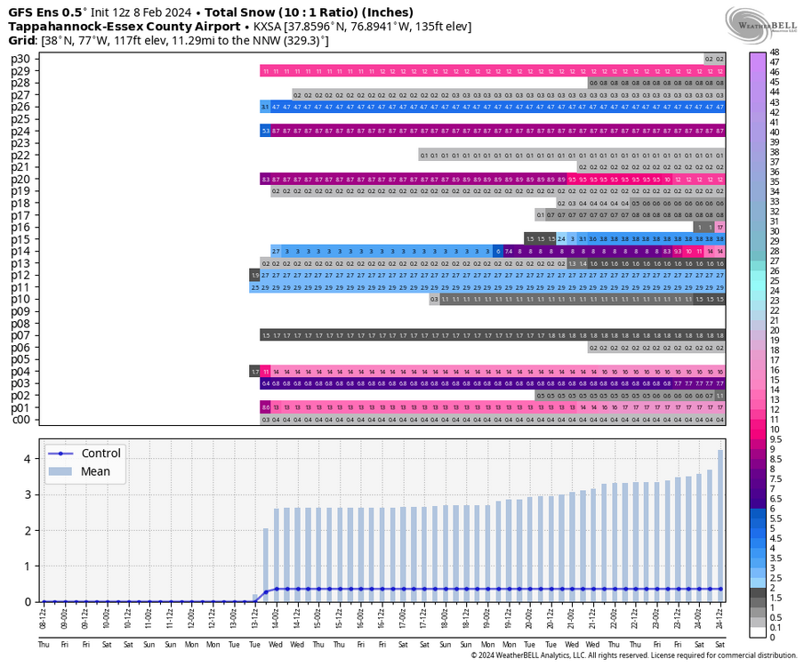
00z GEFS thru 00z 2/20, only 3-4hits.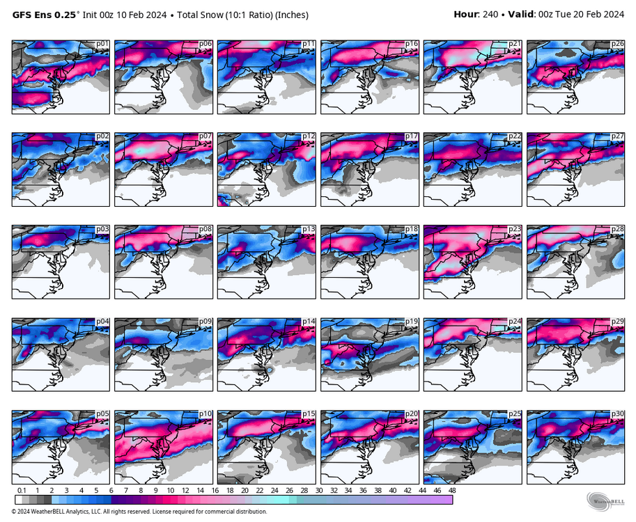
-
Richmond Metro/Hampton Roads Area Discussion
RIC Airport replied to RIC Airport's topic in Mid Atlantic
CMC jumped 1K miles from its 12z. -
Richmond Metro/Hampton Roads Area Discussion
RIC Airport replied to RIC Airport's topic in Mid Atlantic
The CMC is the closest to what the Euro showed at 12z.
-
Richmond Metro/Hampton Roads Area Discussion
RIC Airport replied to RIC Airport's topic in Mid Atlantic
Maybe this will be one of the rare times it leads. -
Richmond Metro/Hampton Roads Area Discussion
RIC Airport replied to RIC Airport's topic in Mid Atlantic
I don't normally look at the Canadian, but fwiw.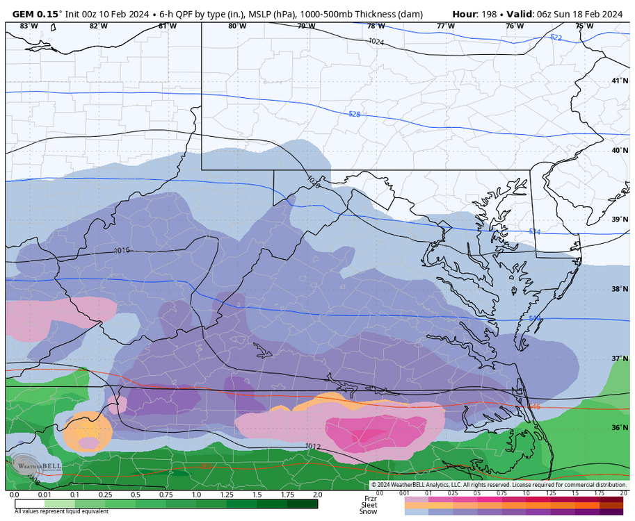

-
Richmond Metro/Hampton Roads Area Discussion
RIC Airport replied to RIC Airport's topic in Mid Atlantic
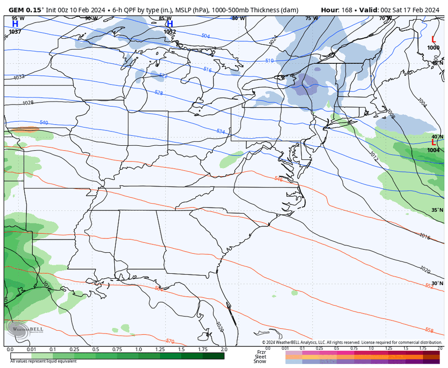
00z GFS didn't deliver, it says drive to Binghamton if you want snow. Maybe the Euro will deliver hope again. -
Richmond Metro/Hampton Roads Area Discussion
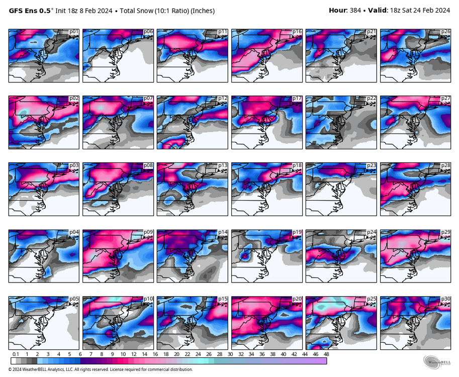
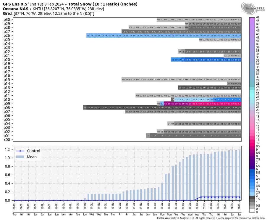
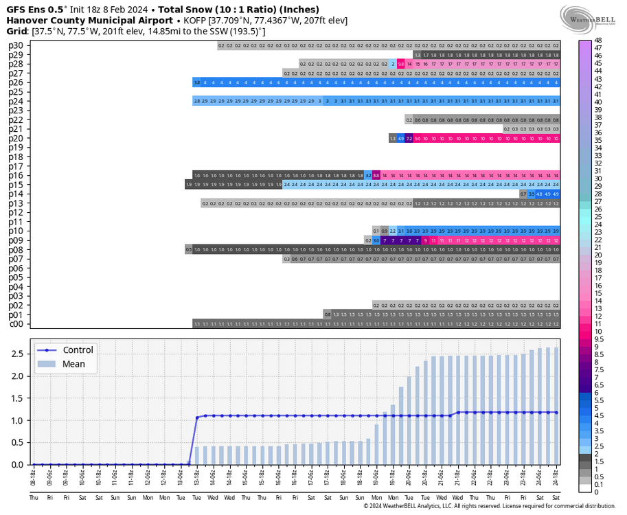
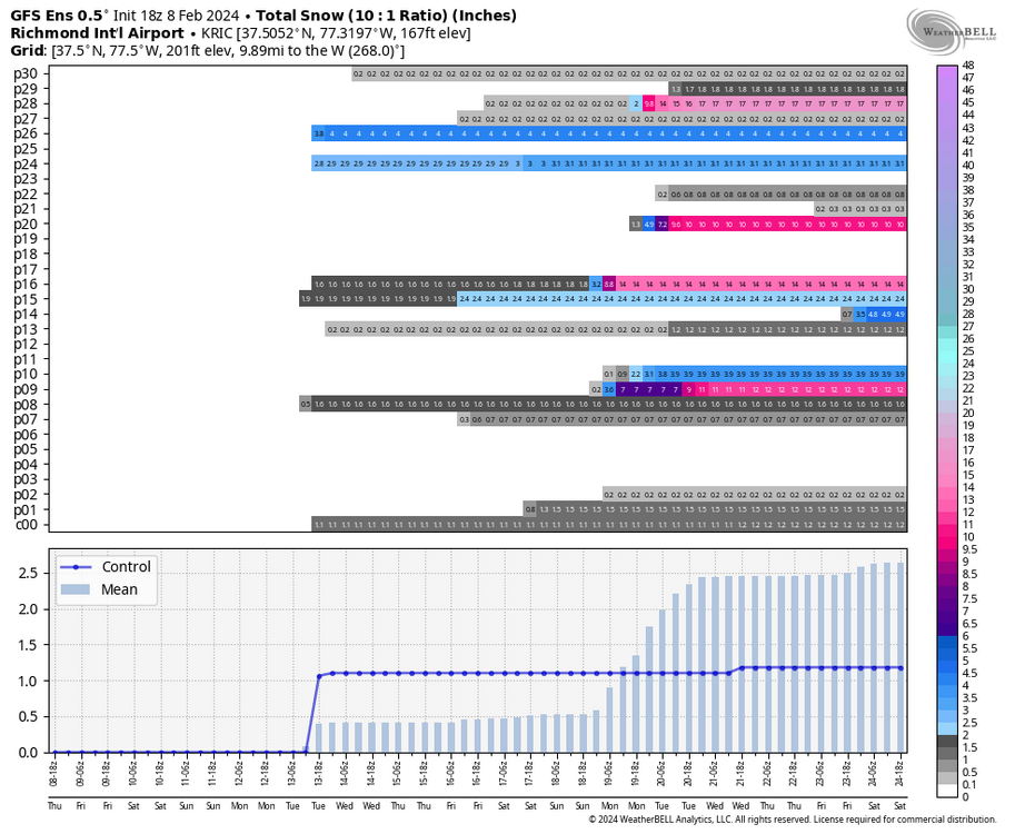
RIC Airport replied to RIC Airport's topic in Mid Atlantic
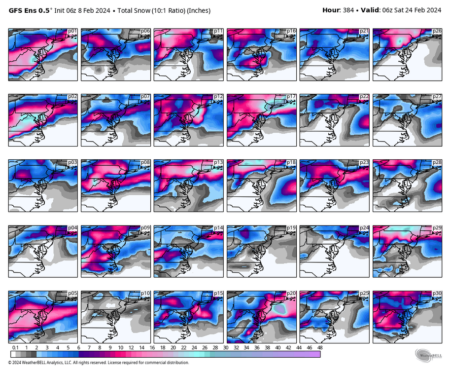
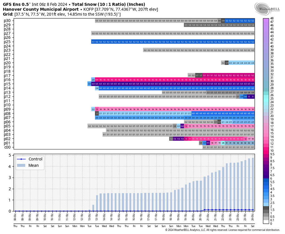
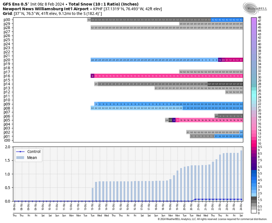
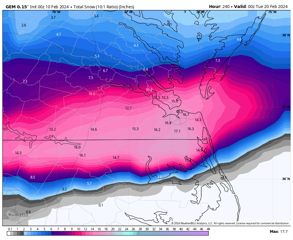
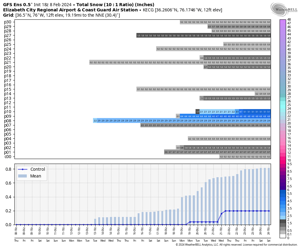
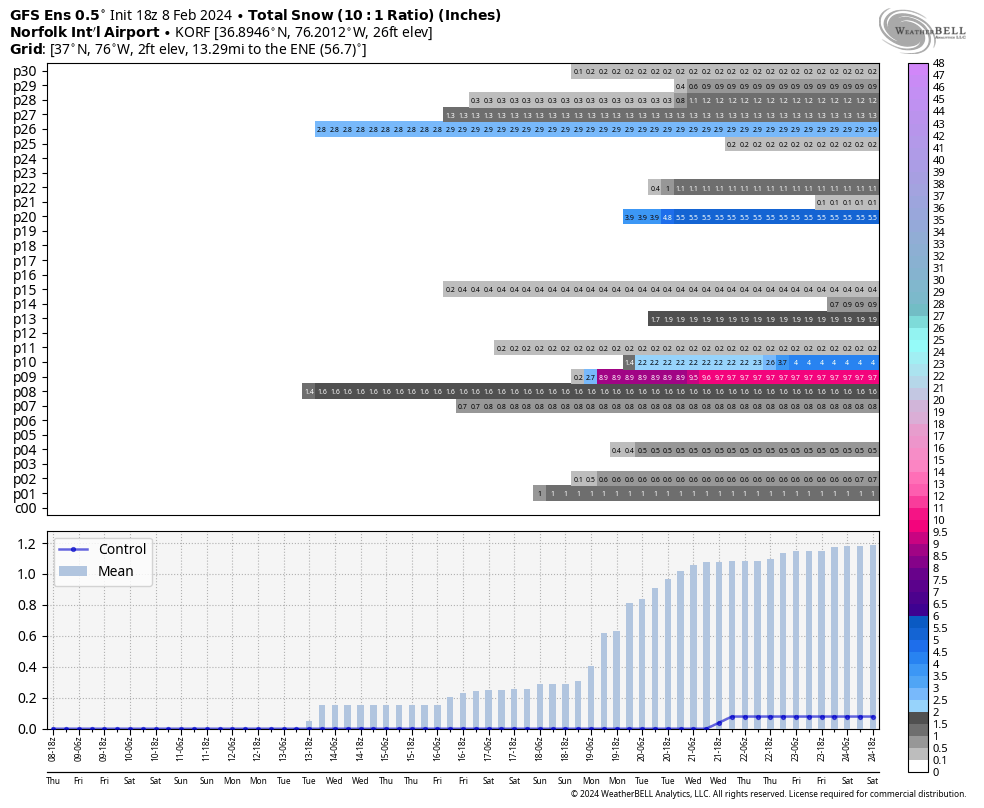
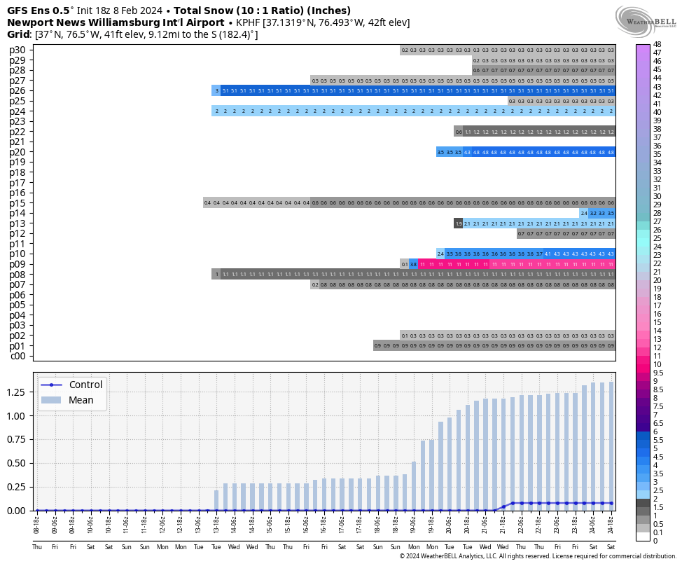
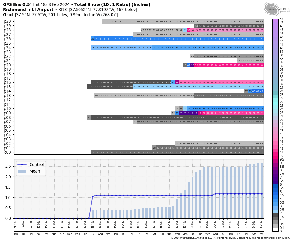
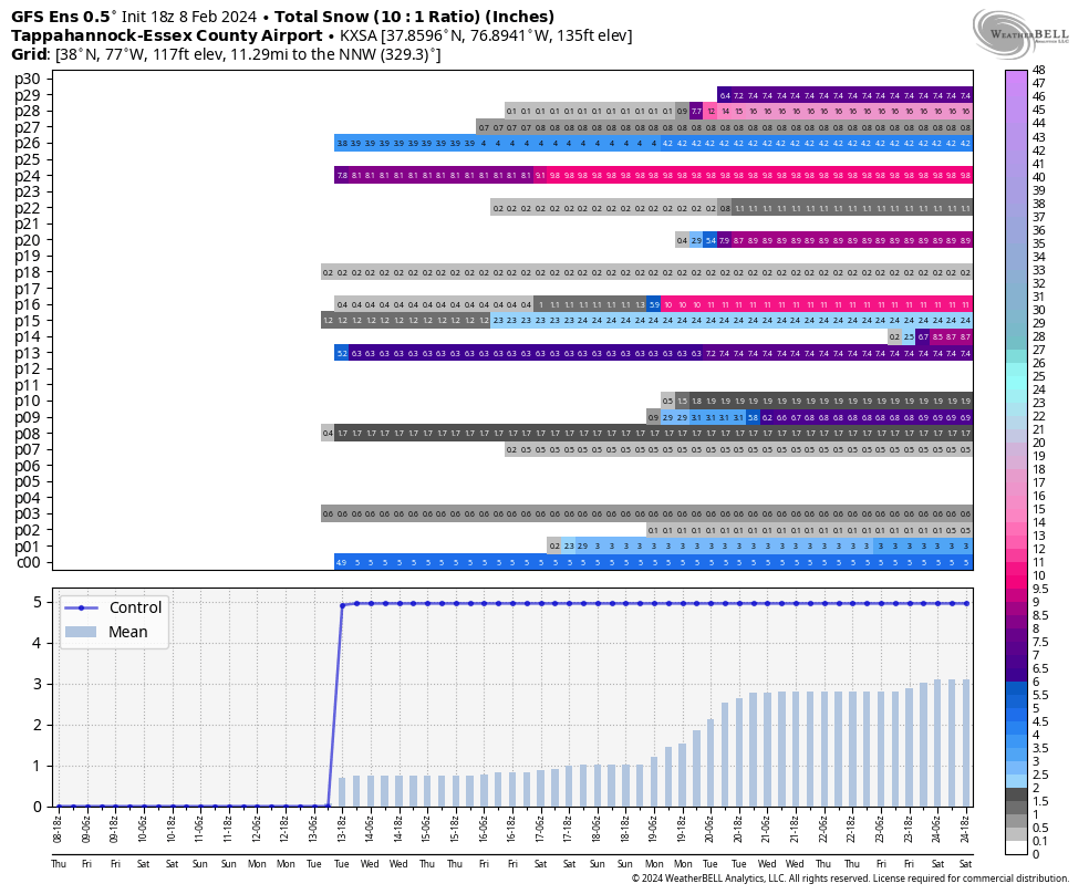
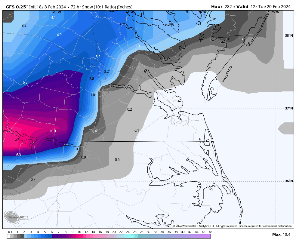
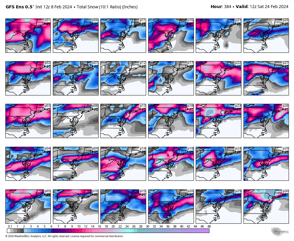
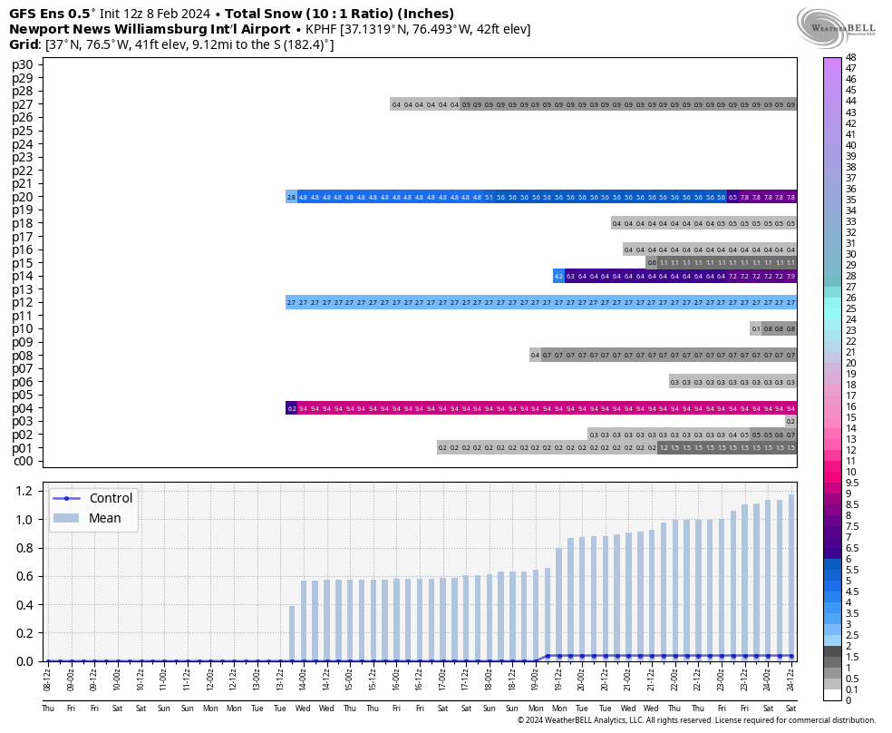
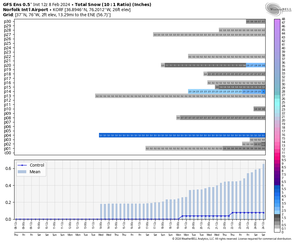
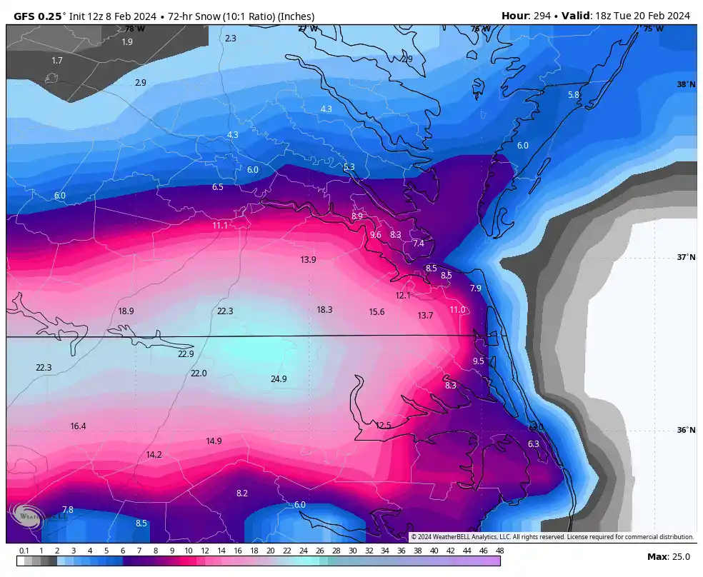
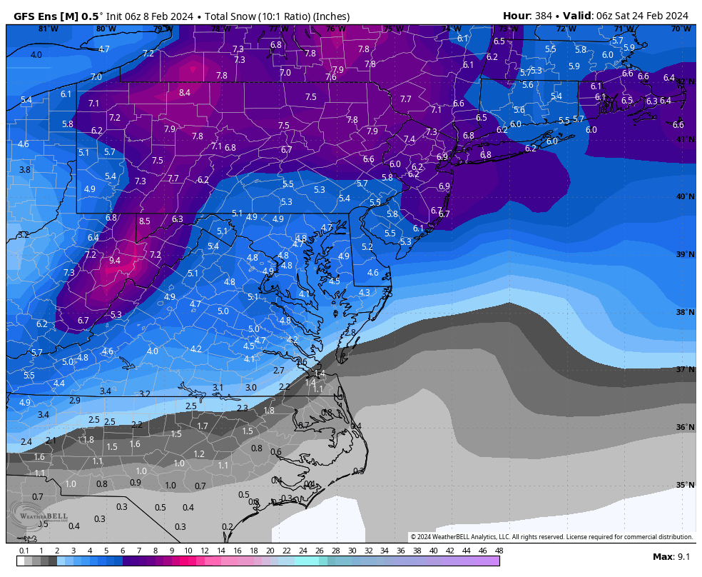
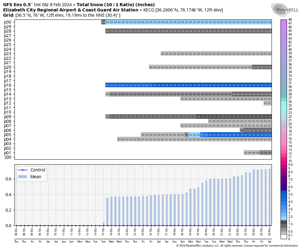
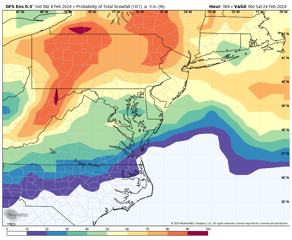
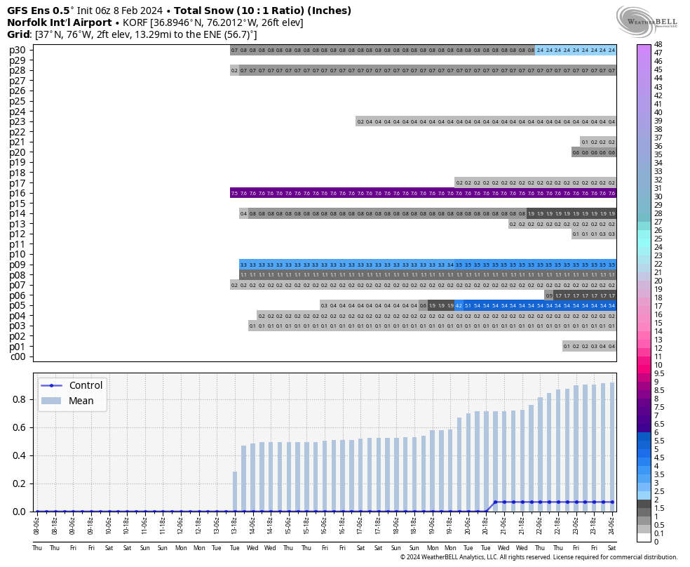
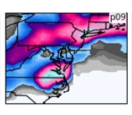
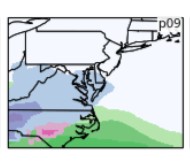
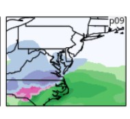
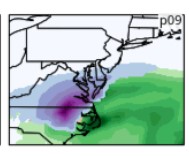
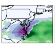
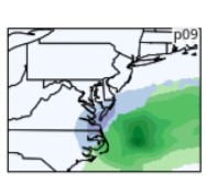
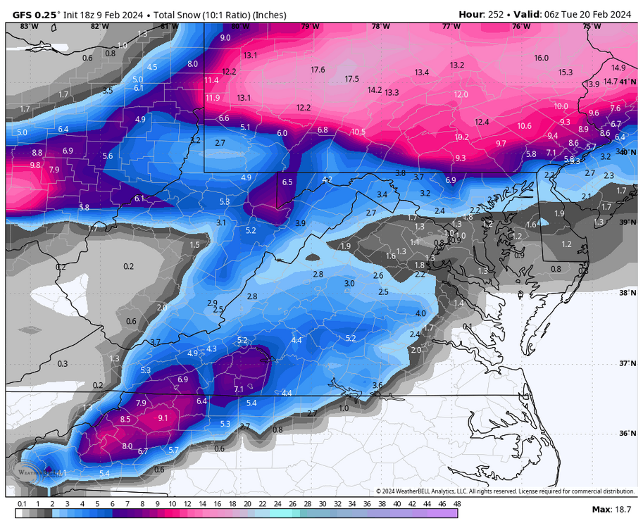
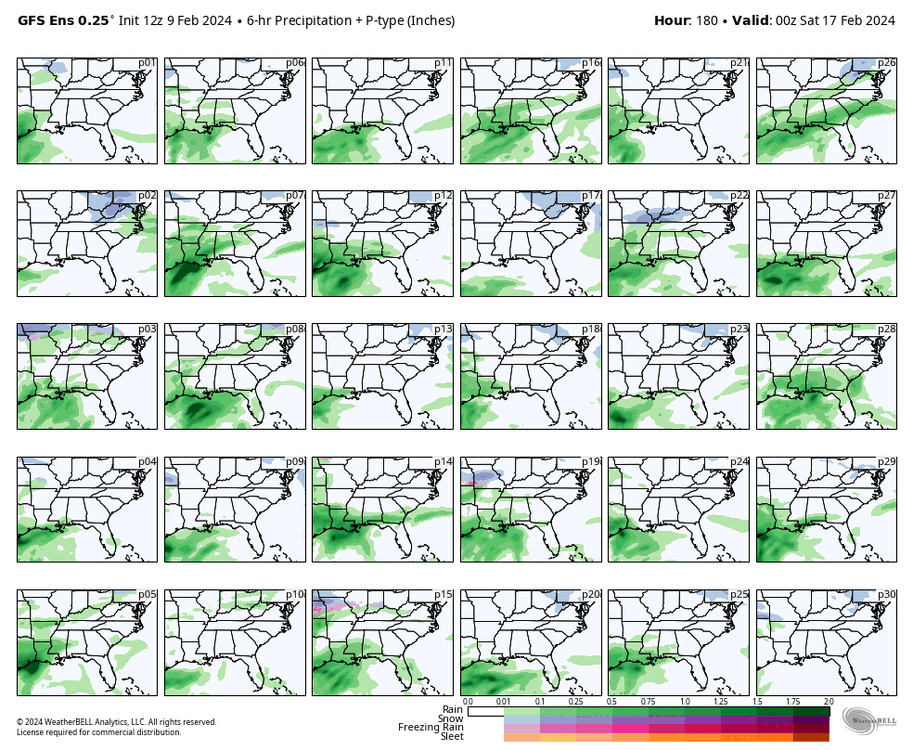
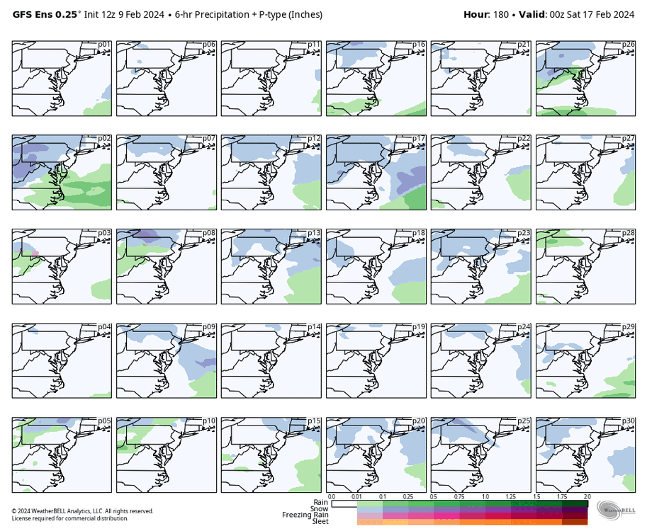
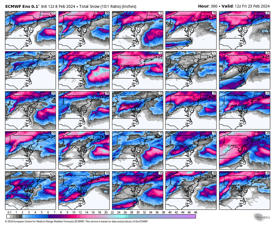
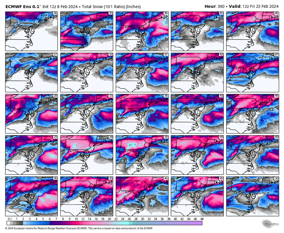
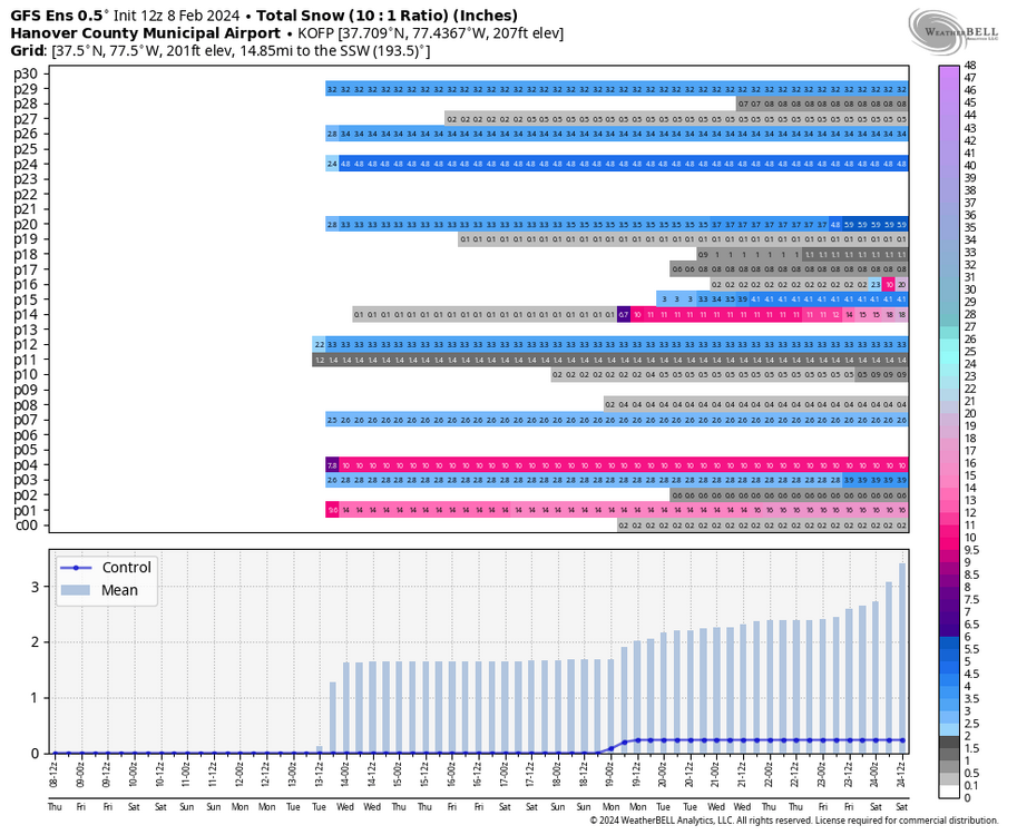
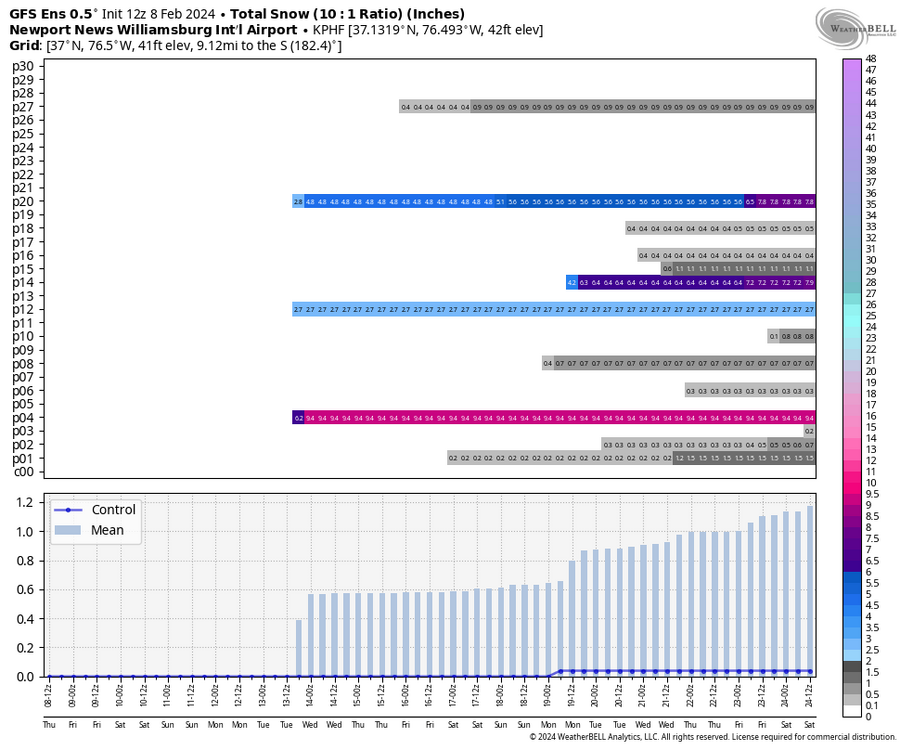
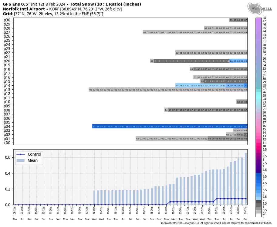
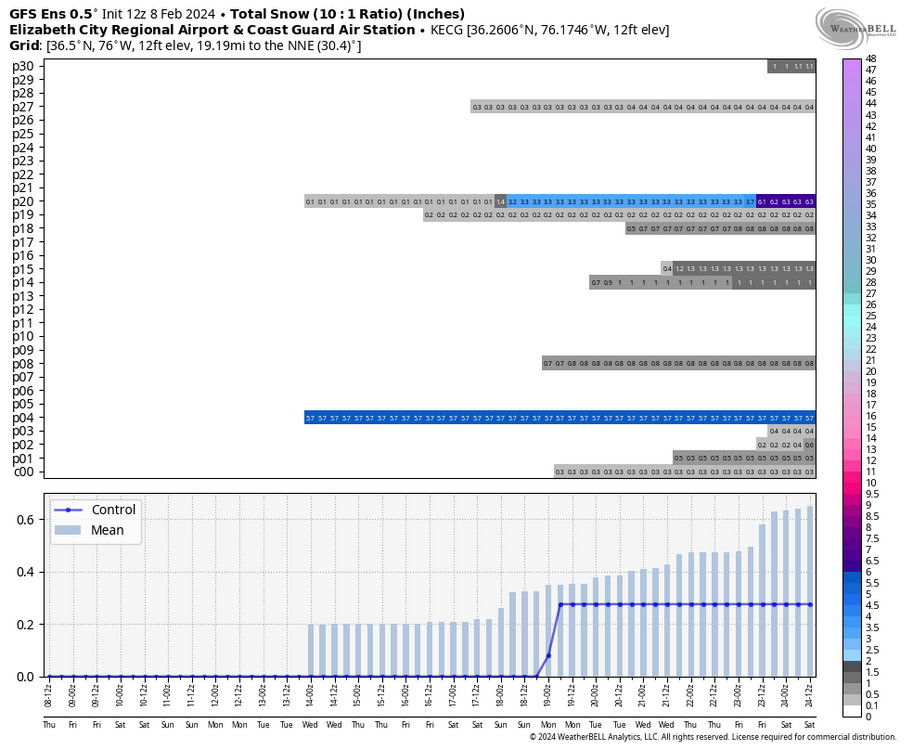
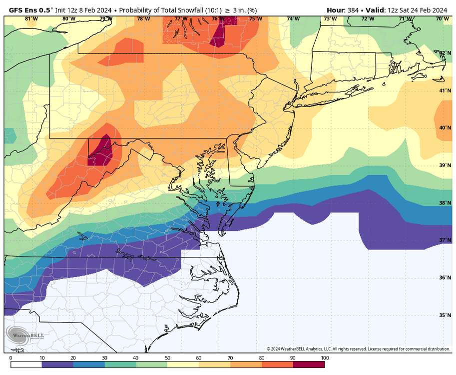
The snowfall mean on the 18z GEFS was lower than 12z because of fewer hits. But, interestingly, there was one ensemble member (p09 below) that obliterated SE VA and NE NC. It looks like March 1-2, 1980. I cropped it below for a closer look, if only something like this could actually happen. I also looked at the charts for places in the bullseye area and these were the snowfall outputs from p09, @ldub23, @Stormpc. Richmond: 11" Ashland/Hanover: 11" Chesterfield: 11" West Point: 13" Accomack: 18" Norfolk: 19" Virginia Beach (Oceana): 19" Chesapeake: 22" Petersburg: 23" Chesapeake (Fentress) 24" Wakefield: 24" Currituck, NC: 24" Elizabeth City, NC: 26" Franklin: 27" Williamsburg: 28" Norfolk (NAVSTA): 28" Suffolk: 28" Langley AFB: 28" Newport News: 28" Emporia: 32"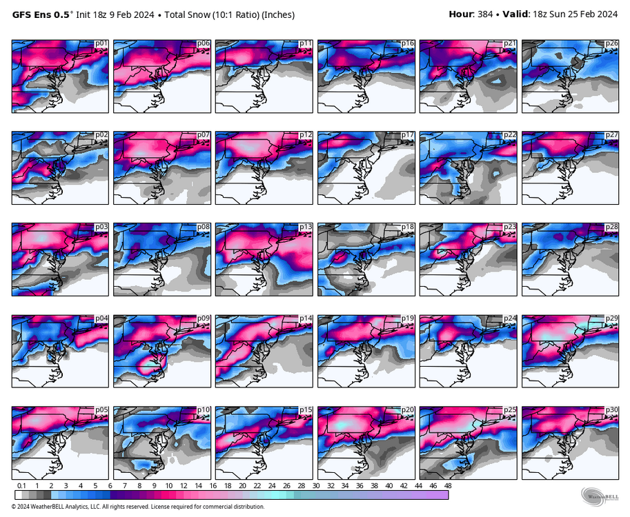
-
Richmond Metro/Hampton Roads Area Discussion
RIC Airport replied to RIC Airport's topic in Mid Atlantic
-
Richmond Metro/Hampton Roads Area Discussion
RIC Airport replied to RIC Airport's topic in Mid Atlantic
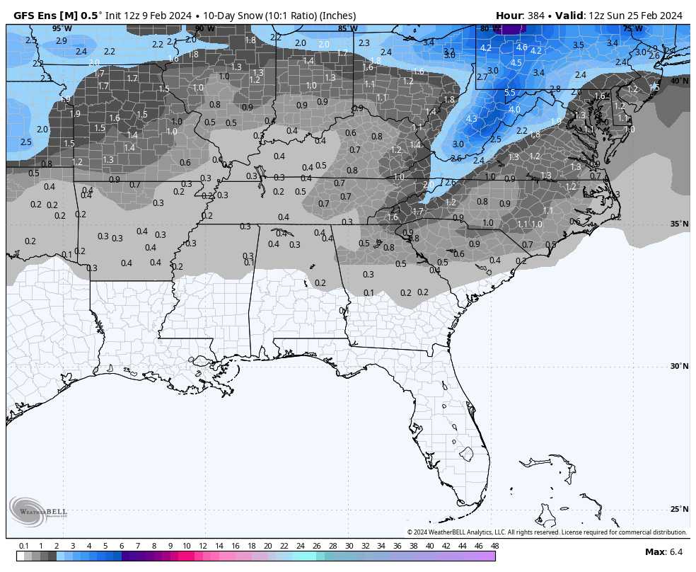
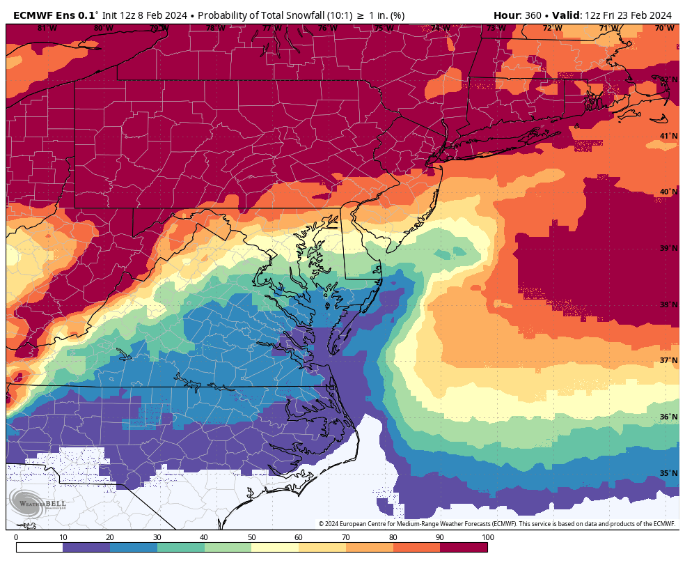
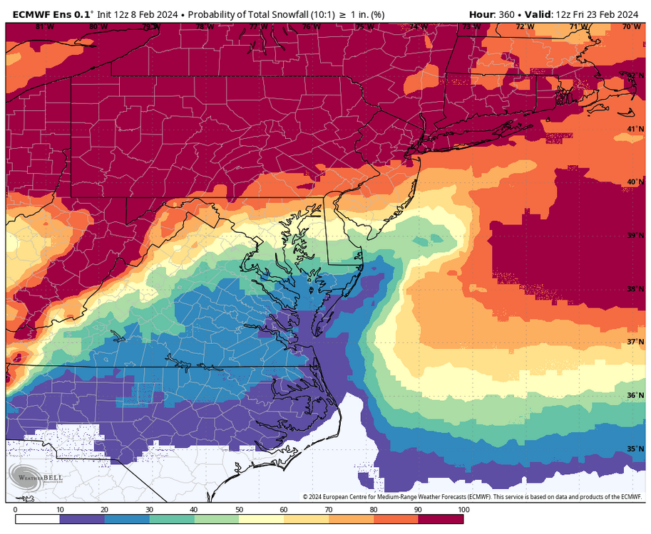
So, looking at the EPS, I can identify the 18th-20th and the 23rd to 25th as the second threat. There are not many good snow hits for our region, and there are quite a few rainy members. I looked at places like PHL and NYC during this time frame, and some of the ensemble members have them performing very well, so there is still an outcome too far north on the table. My confidence at this time still needs to improve on whether or not this pattern will produce a satisfactory result. But it can still change in the coming days. -
Richmond Metro/Hampton Roads Area Discussion
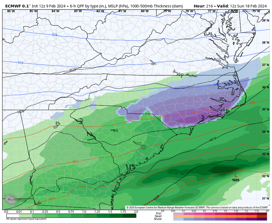
RIC Airport replied to RIC Airport's topic in Mid Atlantic
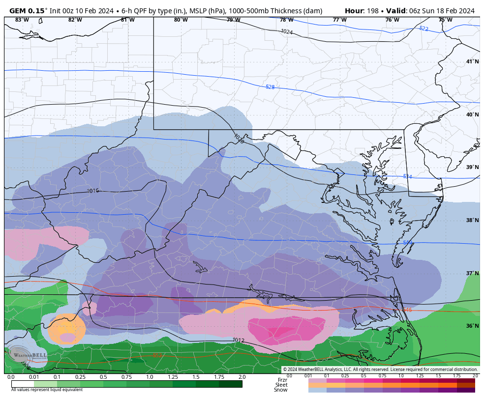
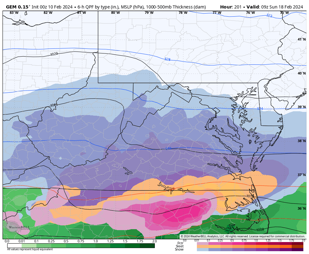
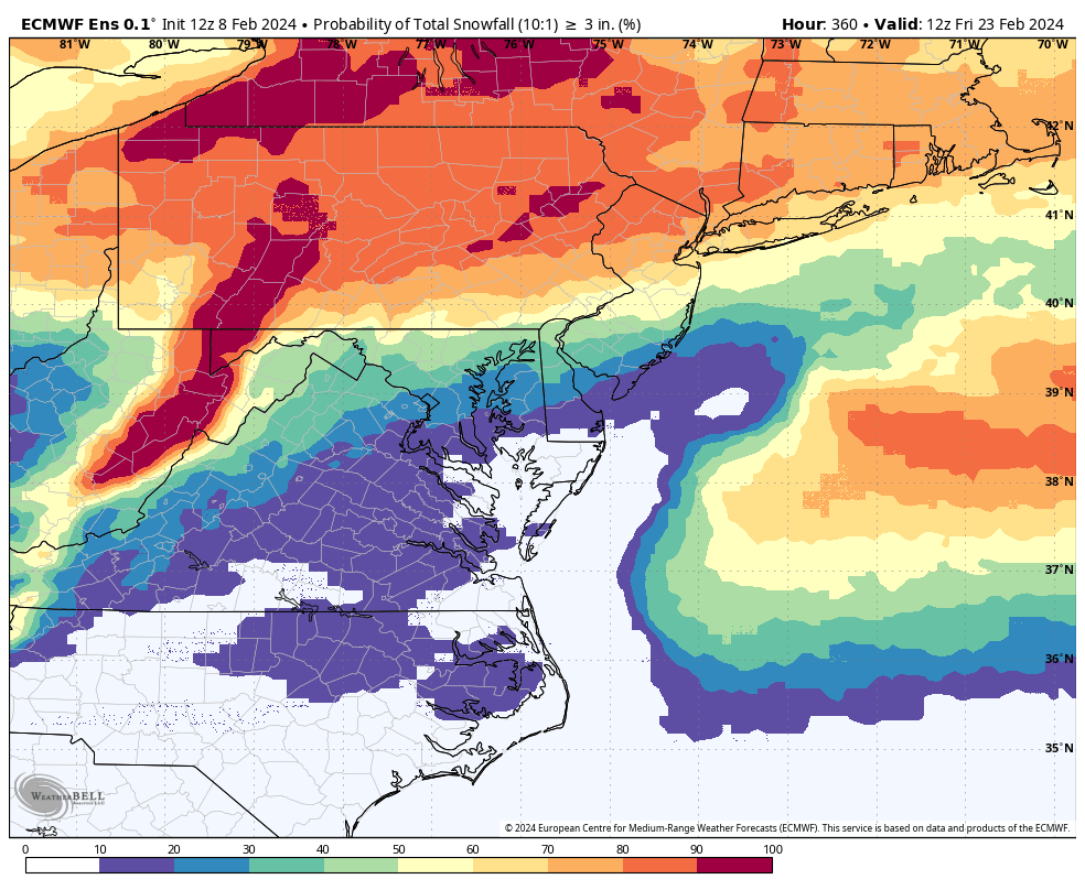
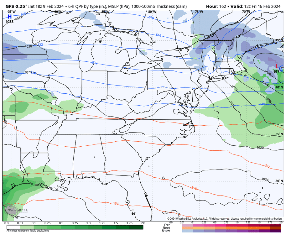
The 12z Euro is also very close, and we still have PLENTY of time. Verbatim it brings snow up to central and eastern NC and far SE VA. We really don't want to be in the bullseye this far out, I'd prefer the storm stay south on the models then trend north over time.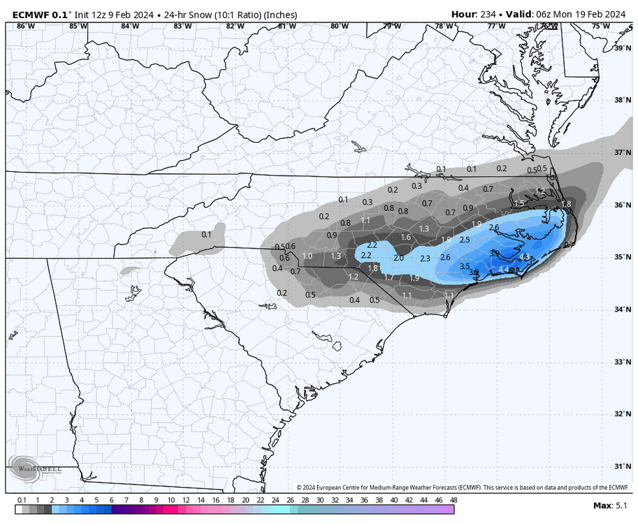
-
Richmond Metro/Hampton Roads Area Discussion
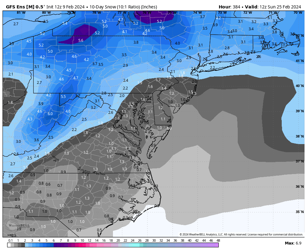
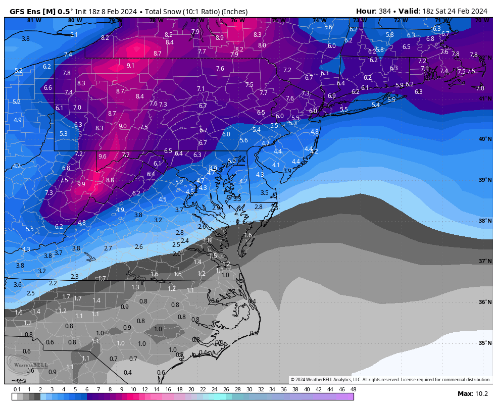
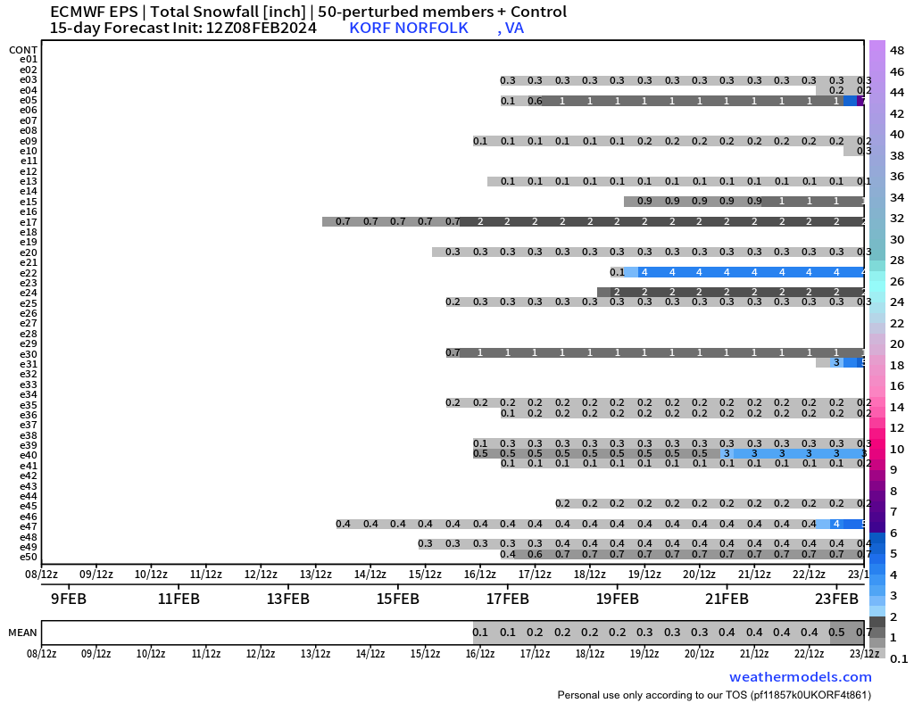
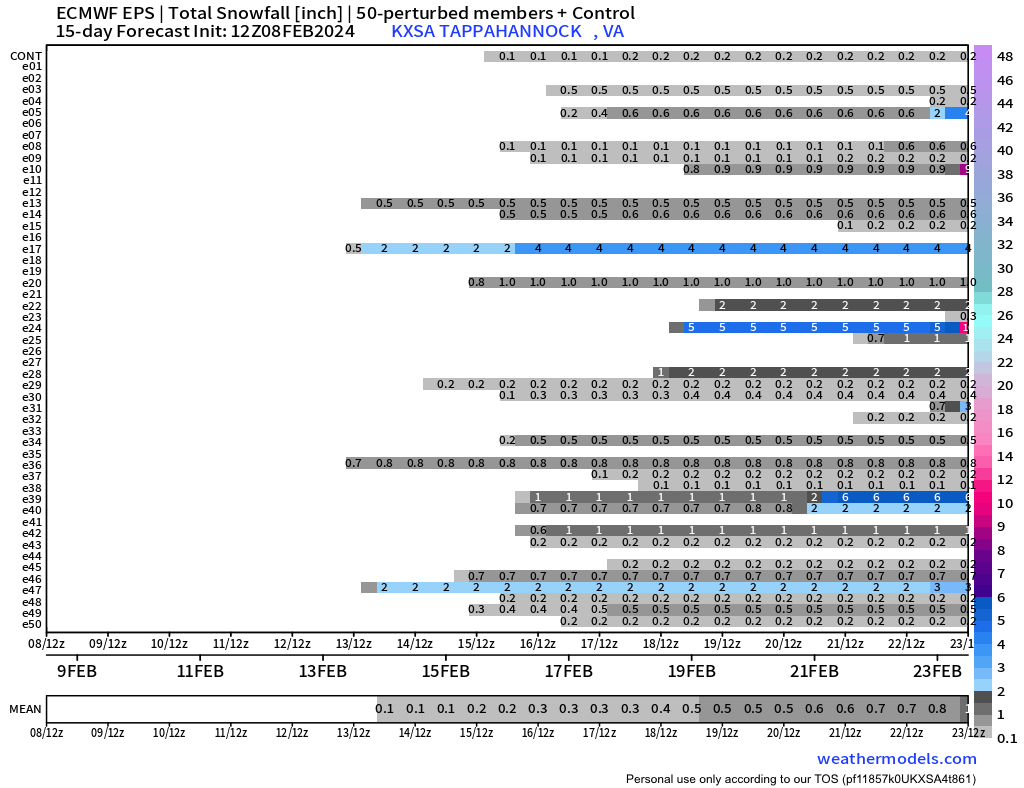
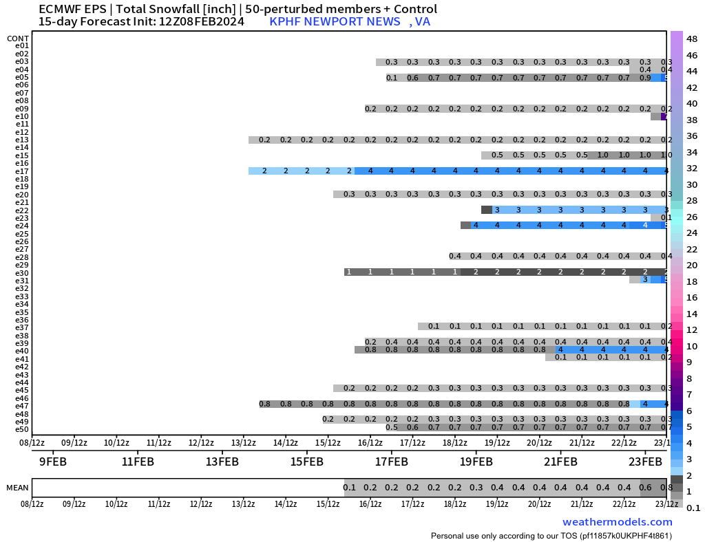
RIC Airport replied to RIC Airport's topic in Mid Atlantic
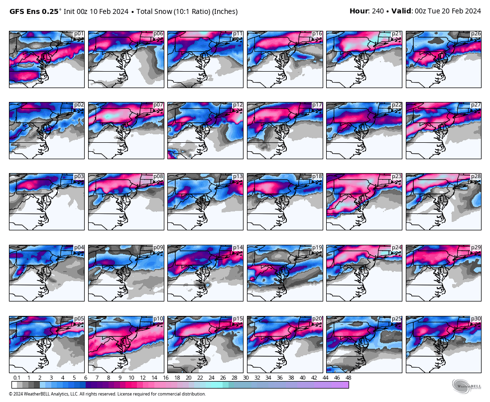
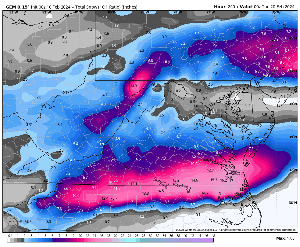
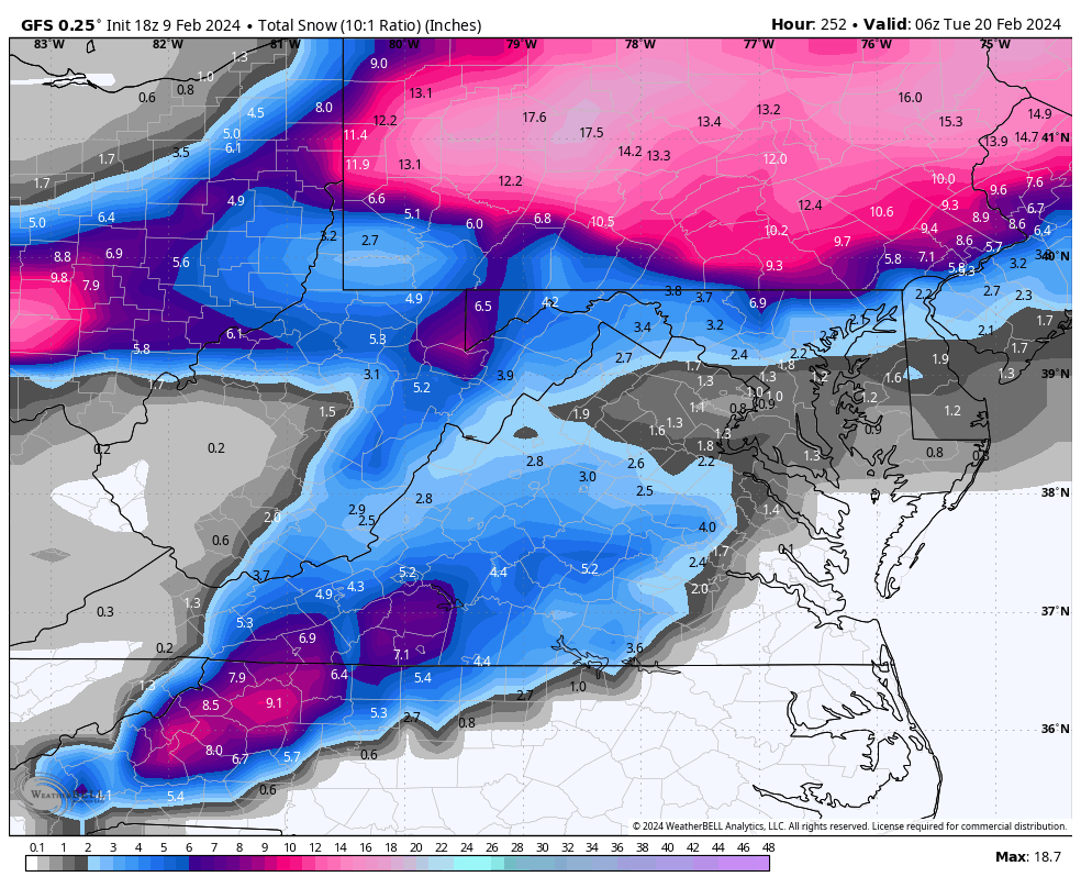
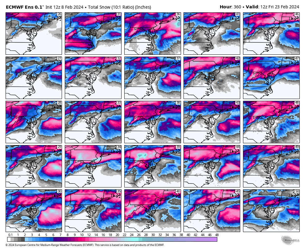
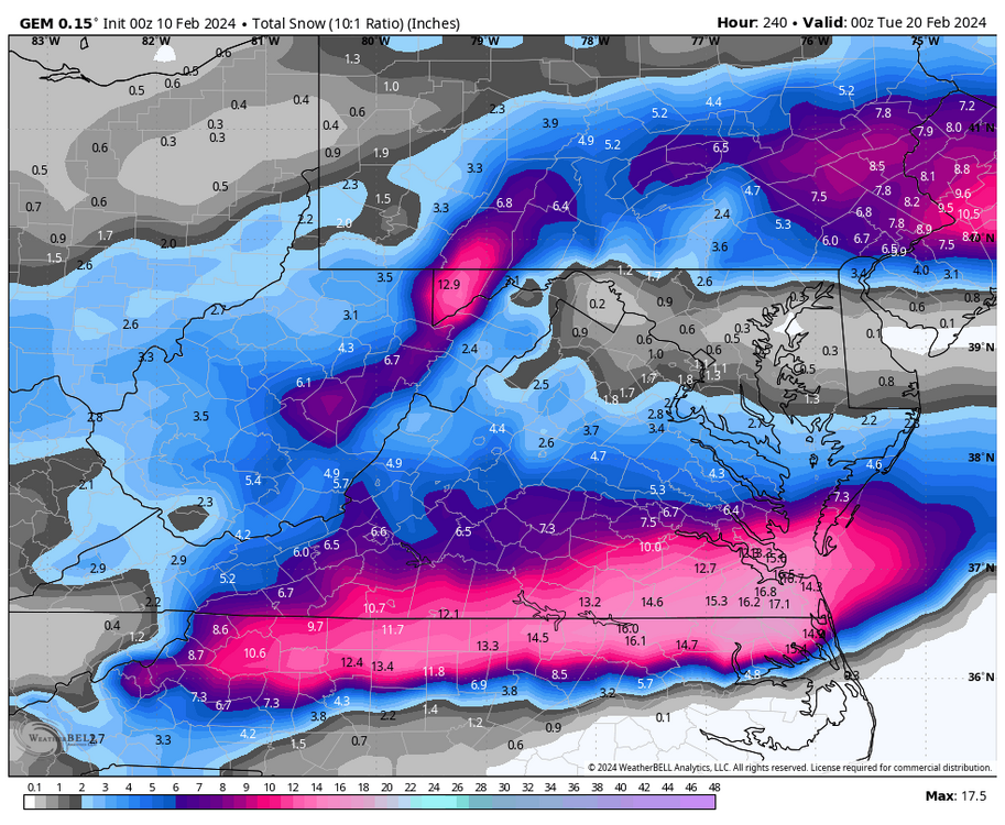
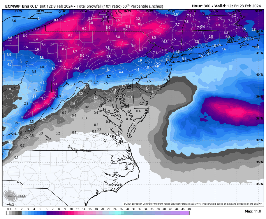
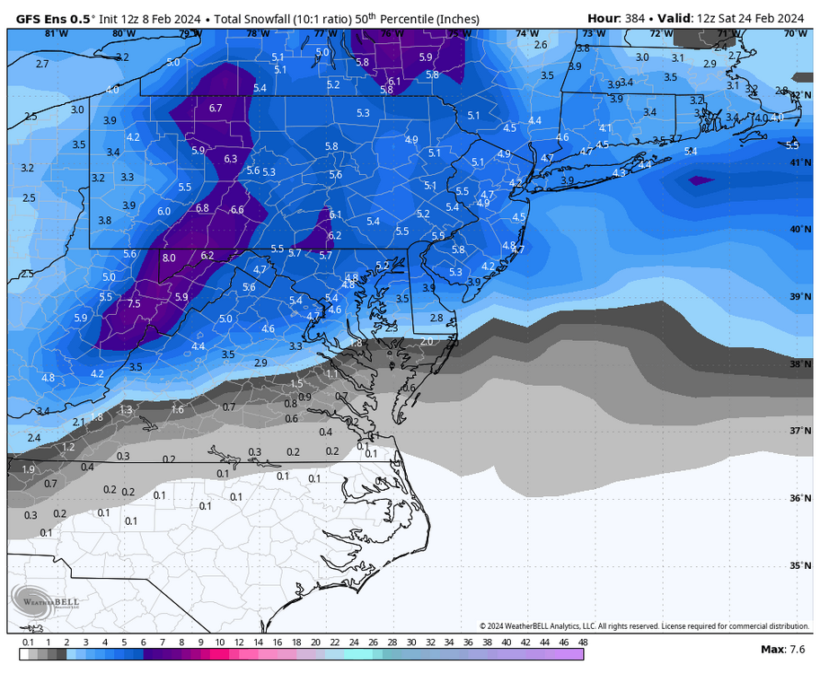
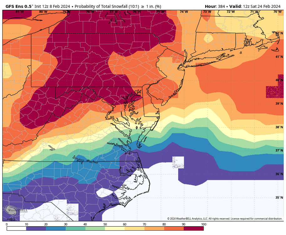
The 12z GEFS 10 day snowfall mean ending 12z 2/25 shows that a farther north solution with accumulations around CLT up toward RIC and interior SE VA is still possible. If you watch the below animation closely, which starts at 00z 2/17 and ends at 12z 2/24, a few members have some snowfall hits. You may also notice some of them have us getting snowfall from more than one system between those dates. However, there are also many rainy members, but just trying to point out something positive, at least from a surface depiction, that I see.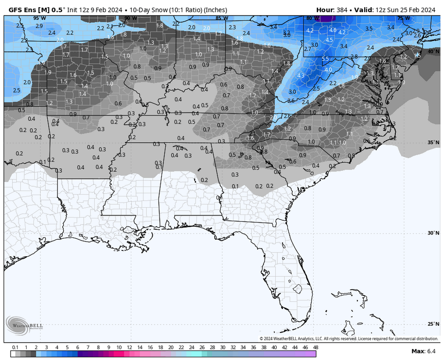

-
Richmond Metro/Hampton Roads Area Discussion
RIC Airport replied to RIC Airport's topic in Mid Atlantic
I decided to take a break until we see consistency. It's way too early to give up. As @Conway7305 alluded to, the ingredients are there, and every model will handle the features differently regarding strength and timing since we are still talking about 9-10 days away. Now that the operational Euro is within range let's focus on it and see how it handles everything. I understand the GFS runs before the Euro, but we tend to only focus on the GFS since it runs 4 times a day through 384 hours. The VD day storm is not even set in stone for places like NYC and BOS, and it's only a few days away. The GFS is still wobbling with that track, while the Euro has been more consistent. -
Richmond Metro/Hampton Roads Area Discussion
RIC Airport replied to RIC Airport's topic in Mid Atlantic
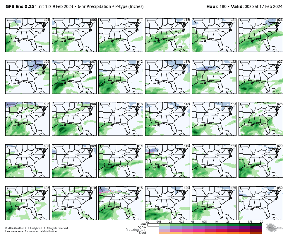
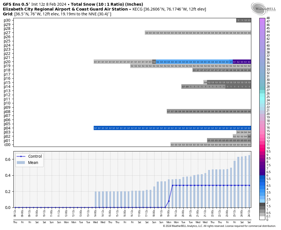
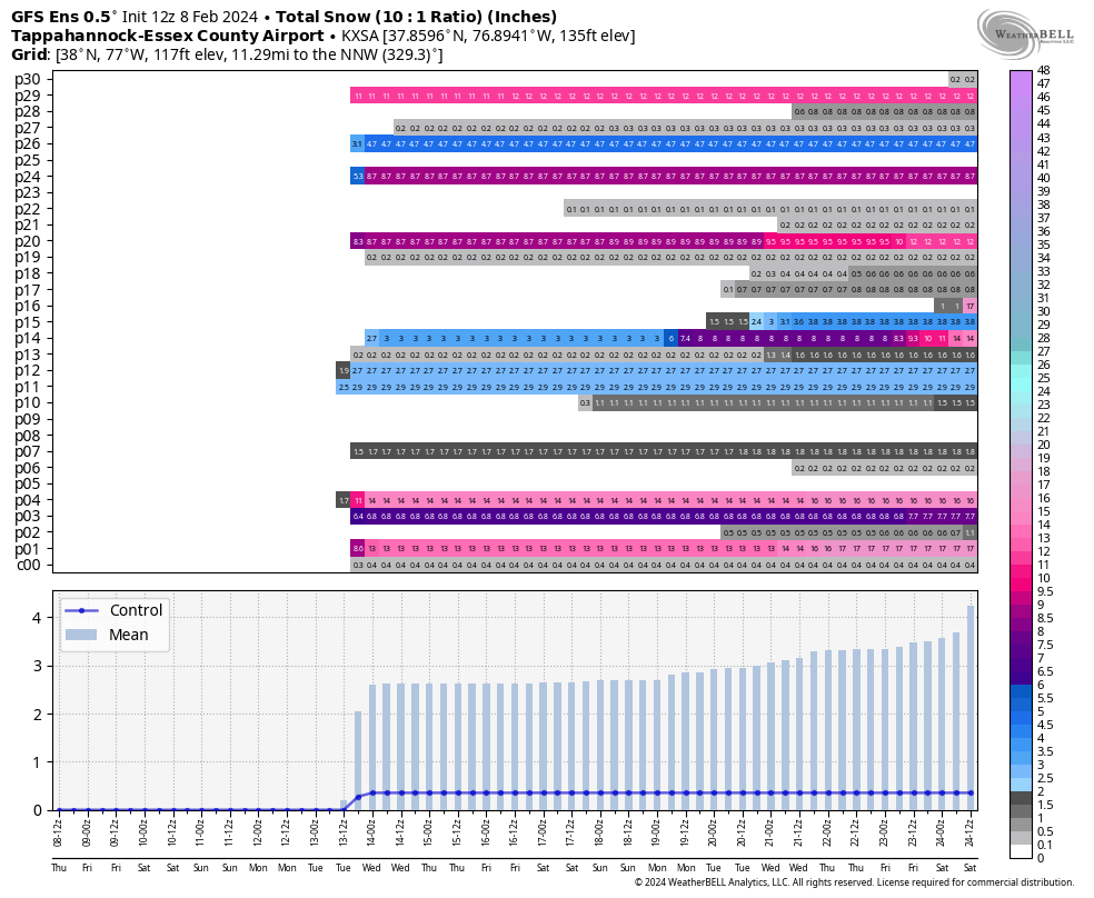
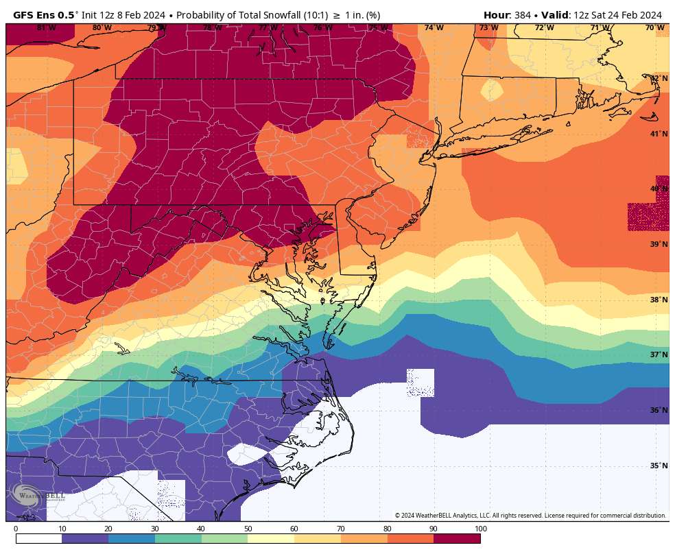
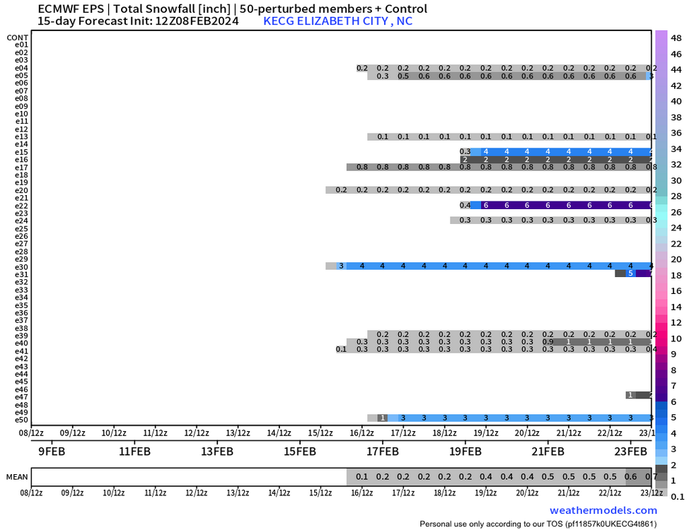
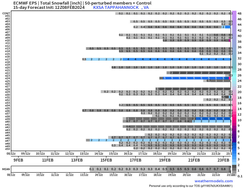
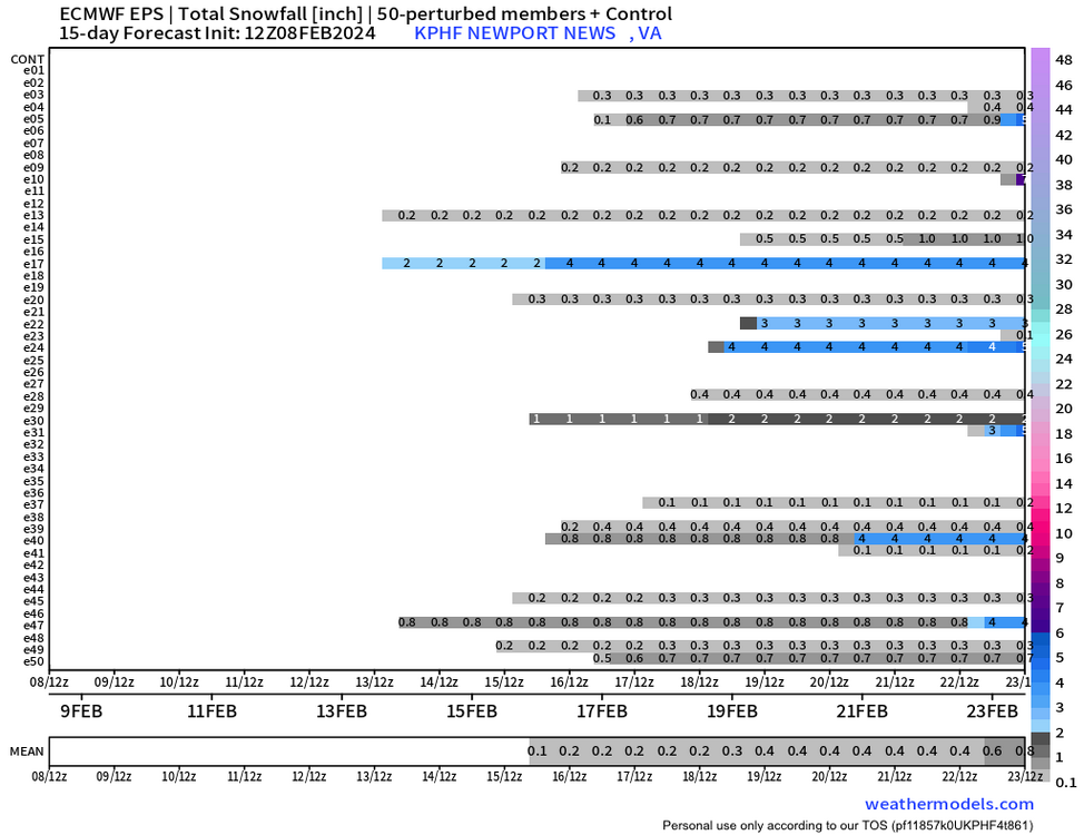
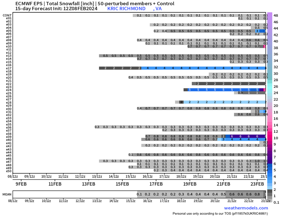
18z ens snow maps and charts, fwiw.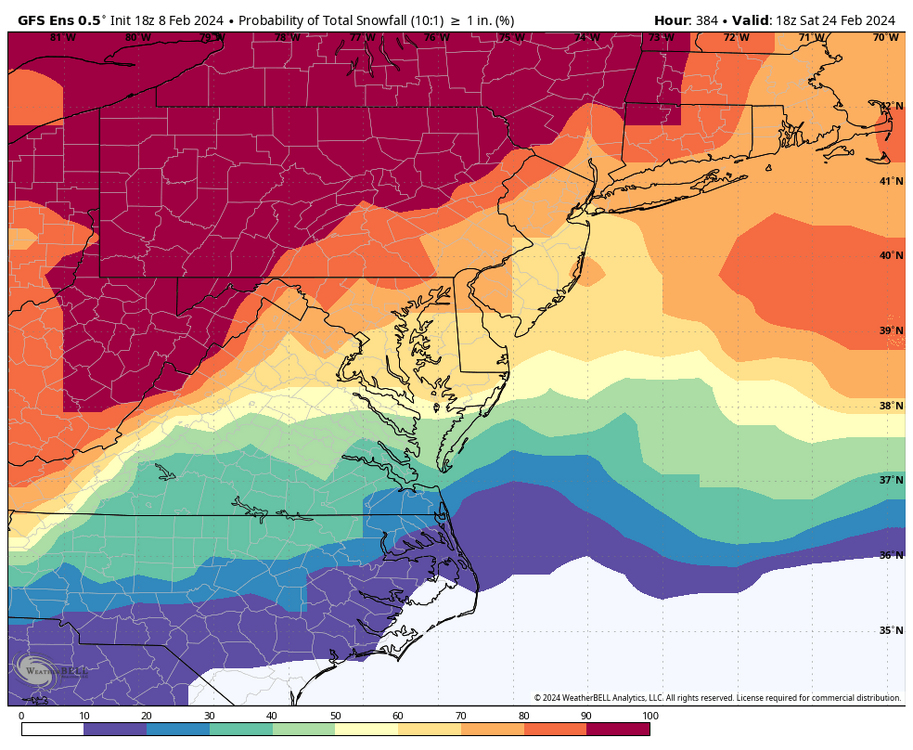
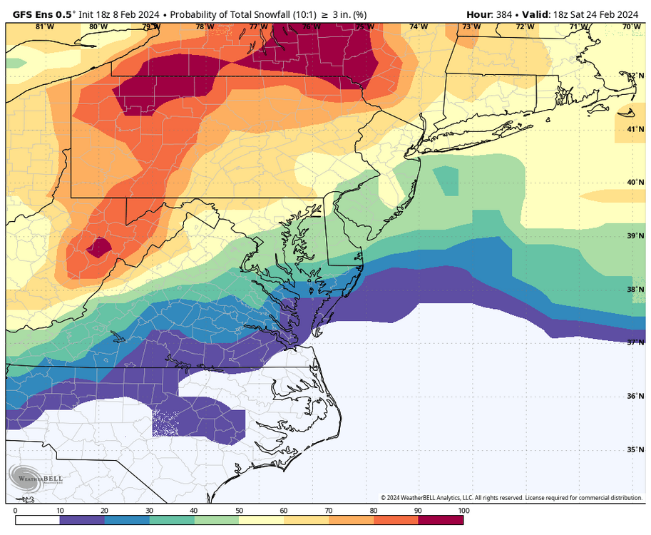

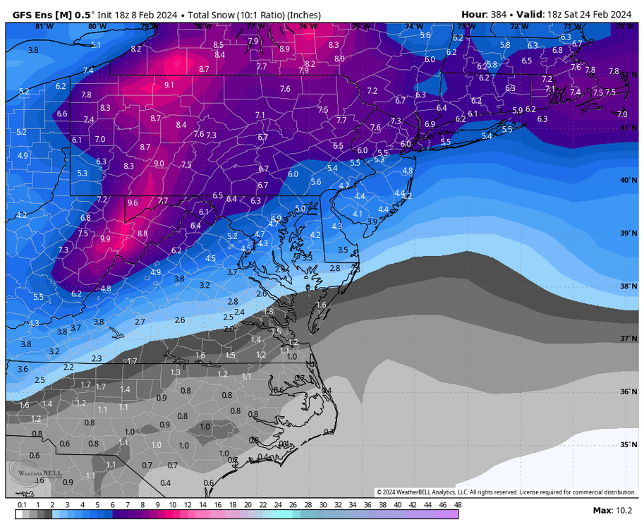
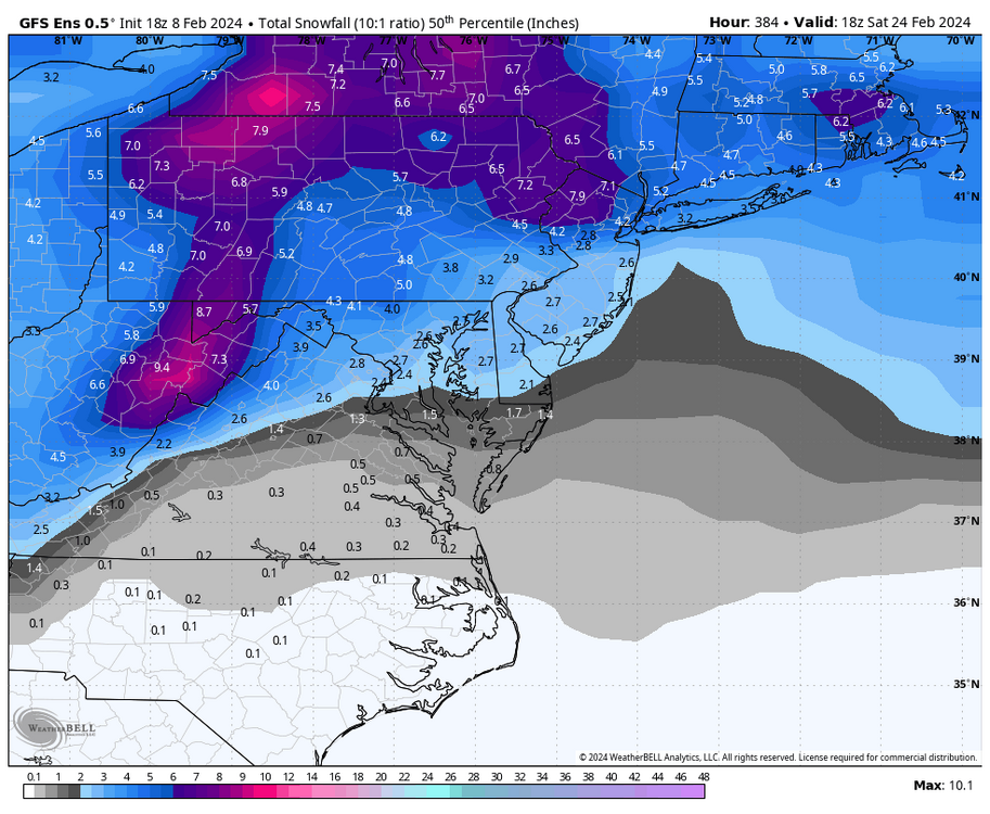


-
Richmond Metro/Hampton Roads Area Discussion
RIC Airport replied to RIC Airport's topic in Mid Atlantic
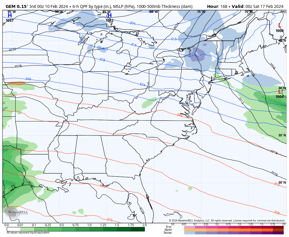
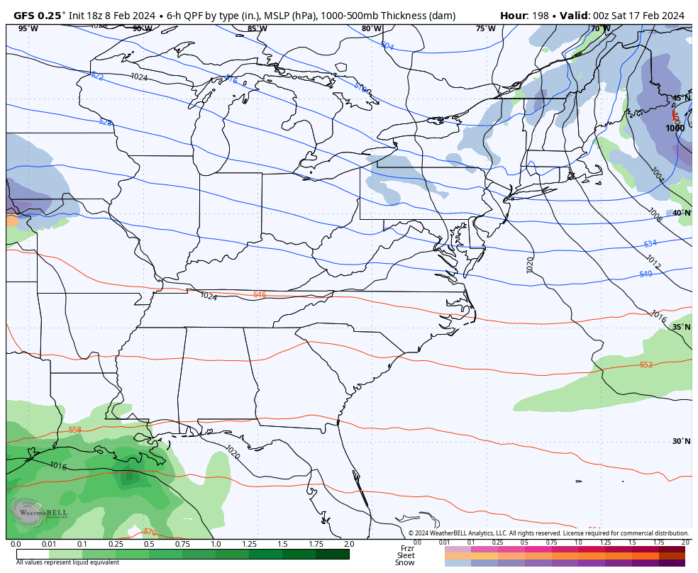
It's not like 12z, but at least we didnt lose the storm. -
Richmond Metro/Hampton Roads Area Discussion
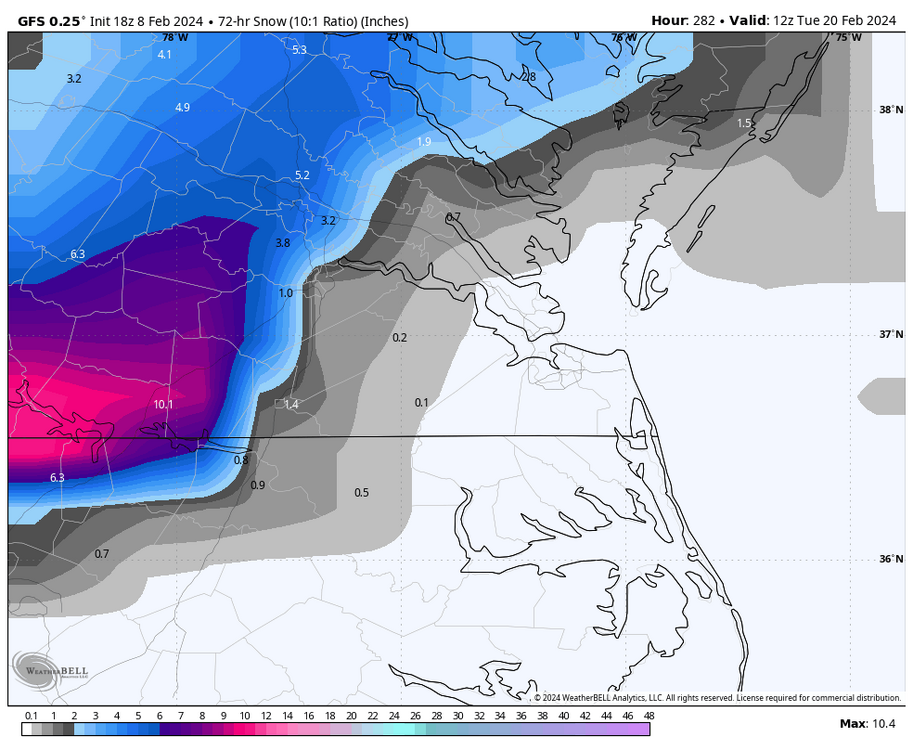
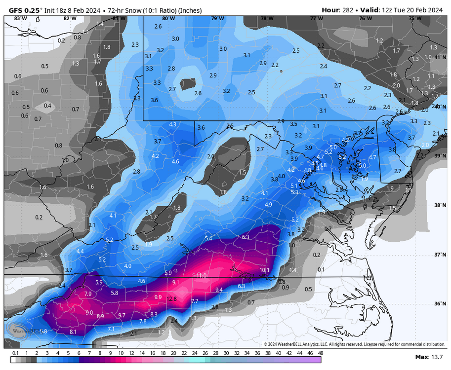
RIC Airport replied to RIC Airport's topic in Mid Atlantic
18Z GFS coming in good for Richmond and west for the PD storm.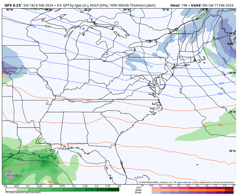
-
Richmond Metro/Hampton Roads Area Discussion
RIC Airport replied to RIC Airport's topic in Mid Atlantic
Yup, usually around Montana is the golden spot. Also, and this is just for everyone's SA, the EPS only goes out to 360hrs while the GEFS goes out to 384. So, the EPS may catch up as we get closer within range. The window still seems to be the 18th-25th, and there could be just one or two different lows, something to keep in mind. Now that the operational Euro is within range, I'll start looking at more details at 500mb and comparing GFS/Euro. I prefer to avoid getting into the weeds beyond day 10 and look at the larger picture. i.e. teleconnections. -
Richmond Metro/Hampton Roads Area Discussion
RIC Airport replied to RIC Airport's topic in Mid Atlantic
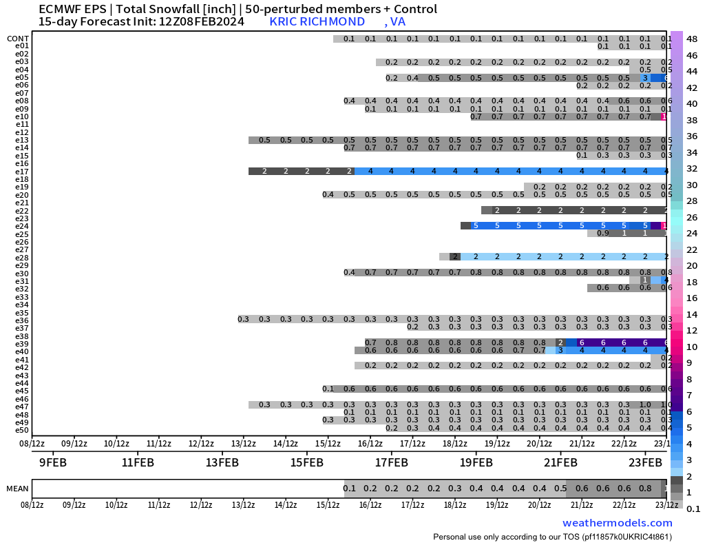
EPS is still very meh.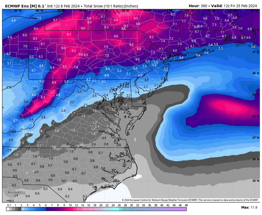


-
Richmond Metro/Hampton Roads Area Discussion
RIC Airport replied to RIC Airport's topic in Mid Atlantic


-
Richmond Metro/Hampton Roads Area Discussion
RIC Airport replied to RIC Airport's topic in Mid Atlantic
Sorry, out and about today. Still a lot of support for next week’s storm, but I’m not believing it since the Euro is not in board.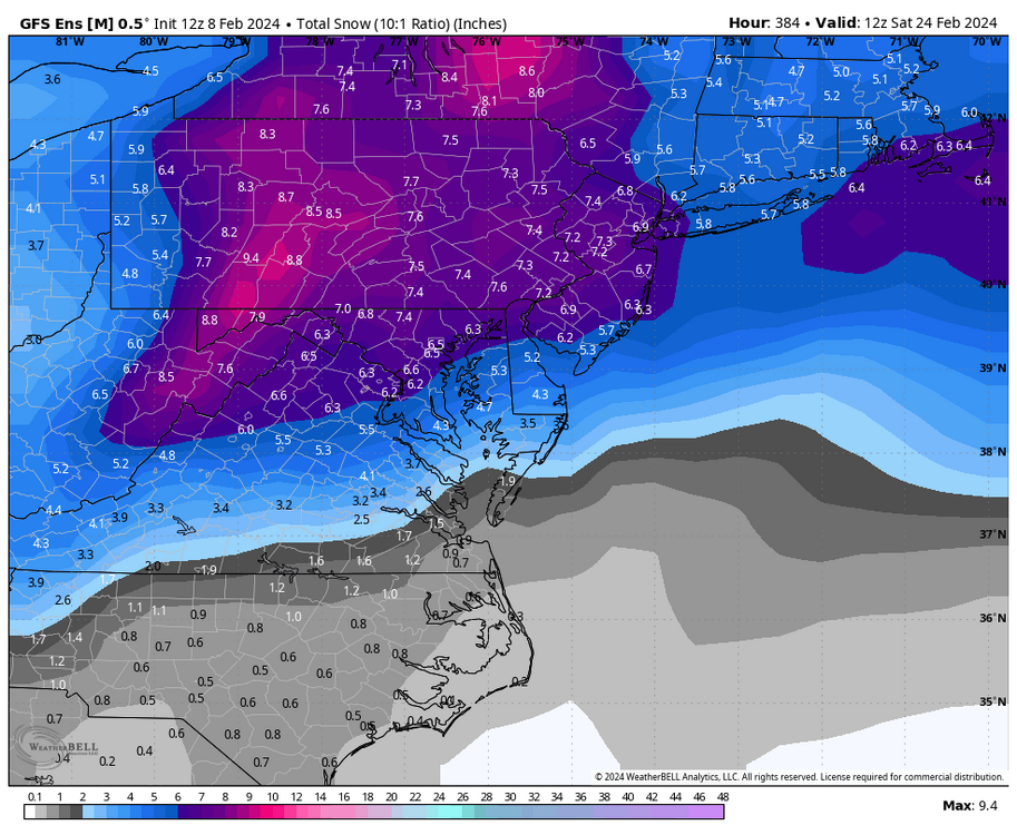
-
Richmond Metro/Hampton Roads Area Discussion
RIC Airport replied to RIC Airport's topic in Mid Atlantic
I just added the full loop and removed the snow the GFS showed for the storm next week to my earlier post. This is a great sign for our area. Too bad it's still so far away. -
Richmond Metro/Hampton Roads Area Discussion
RIC Airport replied to RIC Airport's topic in Mid Atlantic

-
Richmond Metro/Hampton Roads Area Discussion
RIC Airport replied to RIC Airport's topic in Mid Atlantic
Yup, waiting on the next couple panels before I post the maps. -
Richmond Metro/Hampton Roads Area Discussion
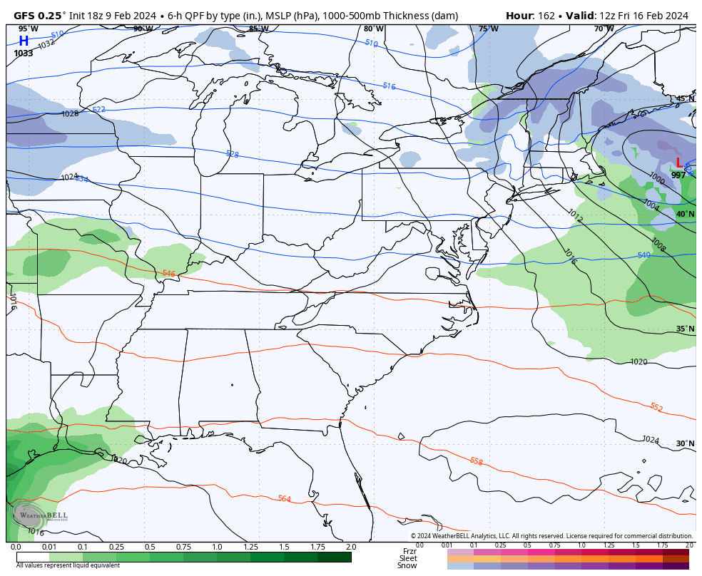
RIC Airport replied to RIC Airport's topic in Mid Atlantic
GFS crushes us for PD -
Richmond Metro/Hampton Roads Area Discussion
RIC Airport replied to RIC Airport's topic in Mid Atlantic
I am not believing the 12z GFS for next week until the Euro is on board. Just saying.

-
Richmond Metro/Hampton Roads Area Discussion
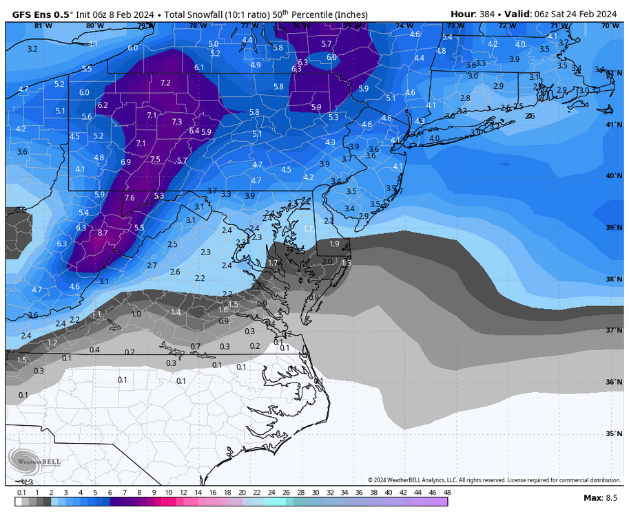
RIC Airport replied to RIC Airport's topic in Mid Atlantic
The 6z GEFS snowfall mean was high. Hopefully the 12z EPS continues to catch up. We are headed in the right direction.