RIC Airport
-
Posts
2,586 -
Joined
-
Last visited
Content Type
Profiles
Blogs
Forums
American Weather
Media Demo
Store
Gallery
Everything posted by RIC Airport
-
Richmond Metro/Hampton Roads Area Discussion
RIC Airport replied to RIC Airport's topic in Mid Atlantic
Also, @JB Fins Duncan started a YT channel. I know he had freelanced at some stations since his retirement from NBC12. https://www.youtube.com/@weatherspin -
Richmond Metro/Hampton Roads Area Discussion
RIC Airport replied to RIC Airport's topic in Mid Atlantic
My honor. I went all in because of the El Nino. Yes, we got the moisture but couldn't get good cold. And when we finally got a decent cold airmass, it was centered a bit too far west, and that 1/15 storm tracked just west and north of us along the boundary giving places like Chattanooga and Nashville 6+" of snow. I am not active during the summer and not a severe weather fan since thunderstorms are so routine around here that it's hard to get excited about them. I track hurricanes, though, so I'll chime in if there is a legitimate threat. But, it's been a while even for that, maybe in 2018 when Florence hit NC and spawned some tornadoes nearby. Hopefully, next winter delivers. Whether I will live here for the entire time remains to be seen. I might be moving away again, but not certain where yet. I will probably know at the end of the year. -
Richmond Metro/Hampton Roads Area Discussion
RIC Airport replied to RIC Airport's topic in Mid Atlantic
Euro was also lower for DC proper. Looks like the best places to be are MoCo and toward BWI, parts of the Delmarva. -
Richmond Metro/Hampton Roads Area Discussion
RIC Airport replied to RIC Airport's topic in Mid Atlantic
Yeah, I'm monitoring. I won't be leaving until 6pm or 7pm if I even leave at all. I have a ton of things to do this weekend so going up will set me back so it's also something I'm weighing. -
Richmond Metro/Hampton Roads Area Discussion
RIC Airport replied to RIC Airport's topic in Mid Atlantic
I am having second thoughts. I might drive up to Arlington later today. Will make a decision soon. I can't help myself. -
Richmond Metro/Hampton Roads Area Discussion
RIC Airport replied to RIC Airport's topic in Mid Atlantic
Yeah, that's the most frustrating part, along with the fact they are so close to us. And that they display the worst level of entitlement on the east coast. I see a lot of people canceling winter, but we've seen sneaky events in the past into March. There was more support for tonight's threat on the EPS. I only saw 4 of 51 members with anything from the 23rd to the 24th. The next threat looked like 29th to 1st. -
Richmond Metro/Hampton Roads Area Discussion
RIC Airport replied to RIC Airport's topic in Mid Atlantic
Agree wholeheartedly. And the lack of extreme cold and how that doesn't bode well for the rest of the winter. I showed that one member, but the 12z EPS overall did not have much of a wintry look, just seasonal to slightly above average temps. There was still a weak signal around the 24th and around the 1st. I considered driving up to Arlington tomorrow to see snow. I usually stay in Ballston when I do. But I will probably pass on that idea. Maybe I'd think twice if they were getting a widespread 6"+ event. Also, must've been amazing to experience the March 1993 storm, hopefully we see something like that again in our lifetimes. -
Richmond Metro/Hampton Roads Area Discussion
RIC Airport replied to RIC Airport's topic in Mid Atlantic
I'm not yet ready to give up since it's only 2/15. I am optimistic each winter until about the 2nd week in March, and then, if I see no concrete signals one to two weeks from there, it's time to accept defeat. It's a shame the winter turned out this way, and equally as frustrating that the DC area, which is not that far from us, may end up being the I-95 jackpot region because they successfully nickeled and dimed their way to average. Models even trended better within 48 hours for each event, which is different from how it usually works. Nonetheless, hopefully, there will be better luck next year, but with the return of a possible La Nina it's hard to be too excited. -
Richmond Metro/Hampton Roads Area Discussion
RIC Airport replied to RIC Airport's topic in Mid Atlantic
Just piggybacking off of @Conway7305's post on the weeklies for mid March. Just adding some hope, that's all. Of course, it's just ONE member out of 51 that I cherry picked since we are all pretty depressed, as @Stormpc's post clarifies the situation we're all in. I know we're tired of looking at these maps and charts. Trust me, I understand. -
Richmond Metro/Hampton Roads Area Discussion
RIC Airport replied to RIC Airport's topic in Mid Atlantic
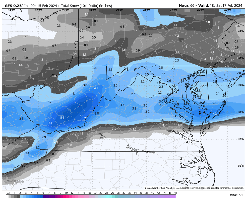
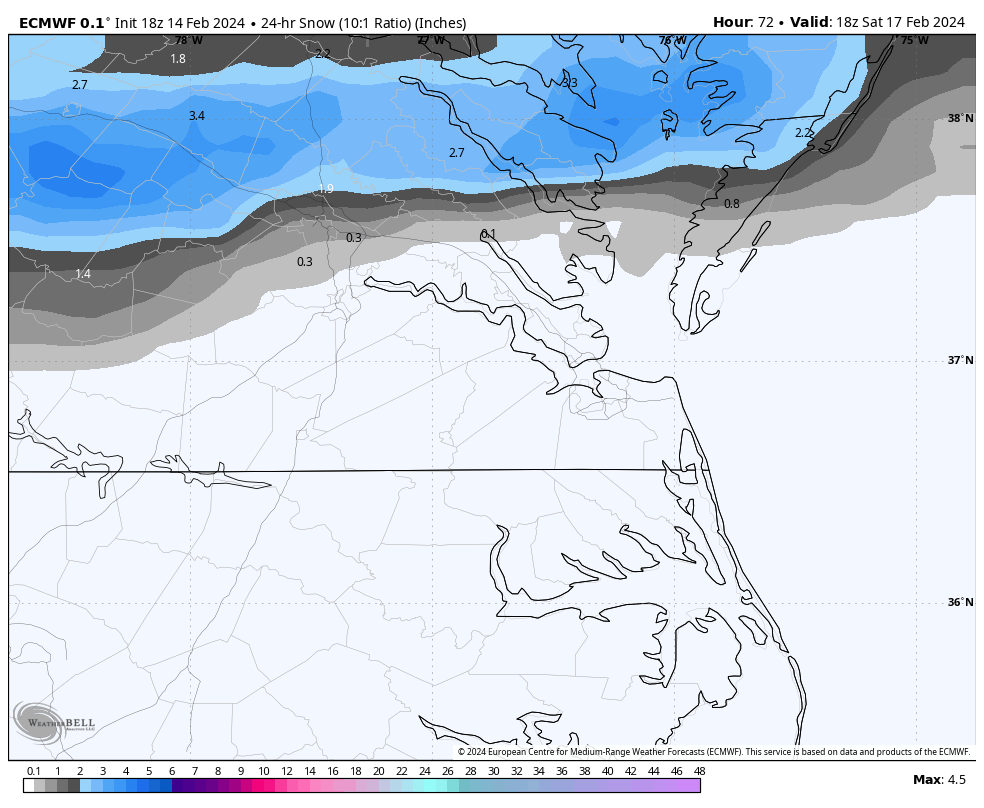
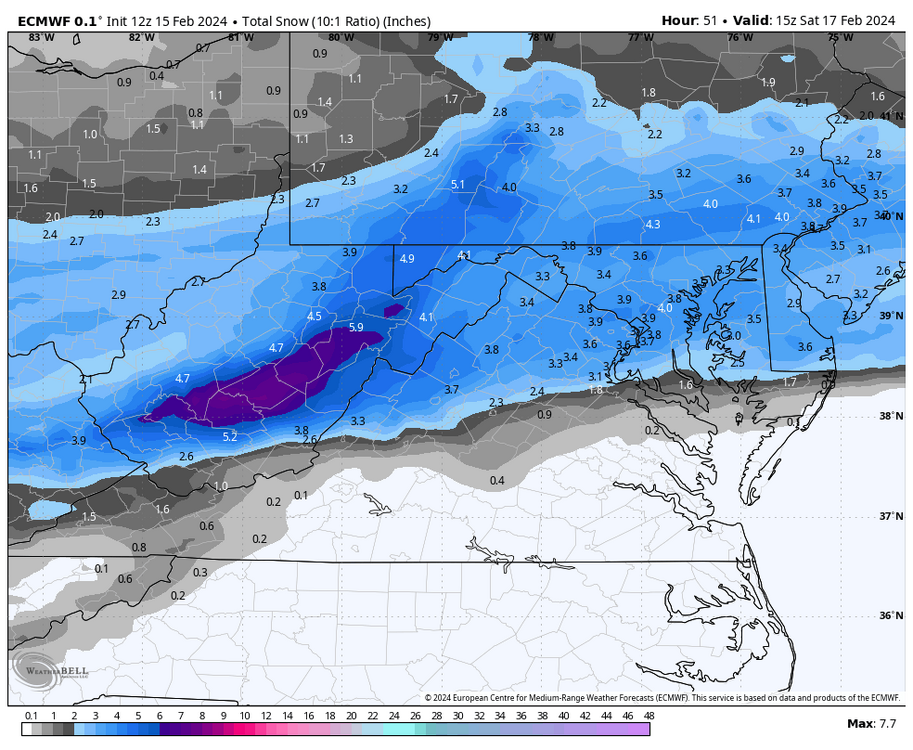
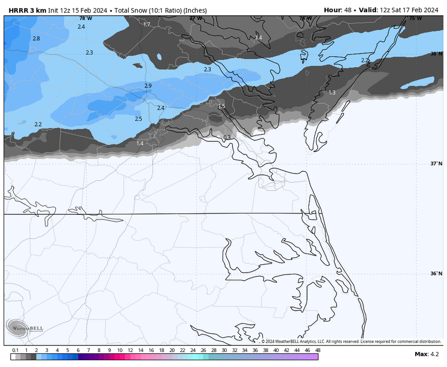
If you want more hope, one EPS member had a Miller A HECS from 29 Feb to 1 Mar. Here are some airport snowfall totals from it. Areas closest to the coast get its snow on the back side of the low. Fredericksburg: 18" Ashland: 17" Louisa: 15" Tappahannock: 15" Richmond: 14" New Kent: 12" Chesterfield: 11" Petersburg: 10" West Point: 9" Williamsburg: 6" Newport News: 5" Hampton: 4" Ahoskie, NC: 4" Norfolk: 2" Currituck, NC: 2"
-
Richmond Metro/Hampton Roads Area Discussion
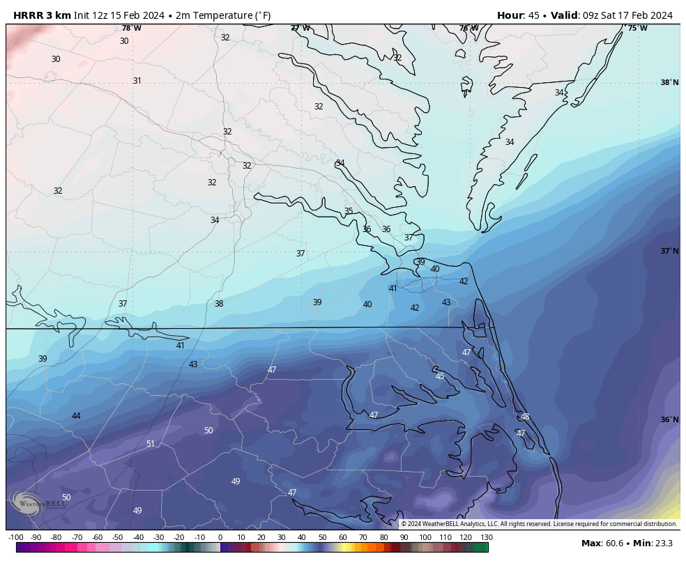
RIC Airport replied to RIC Airport's topic in Mid Atlantic
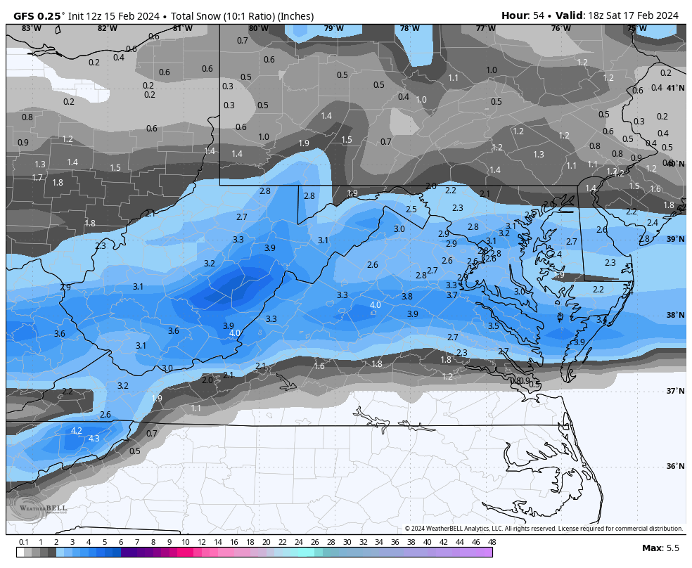
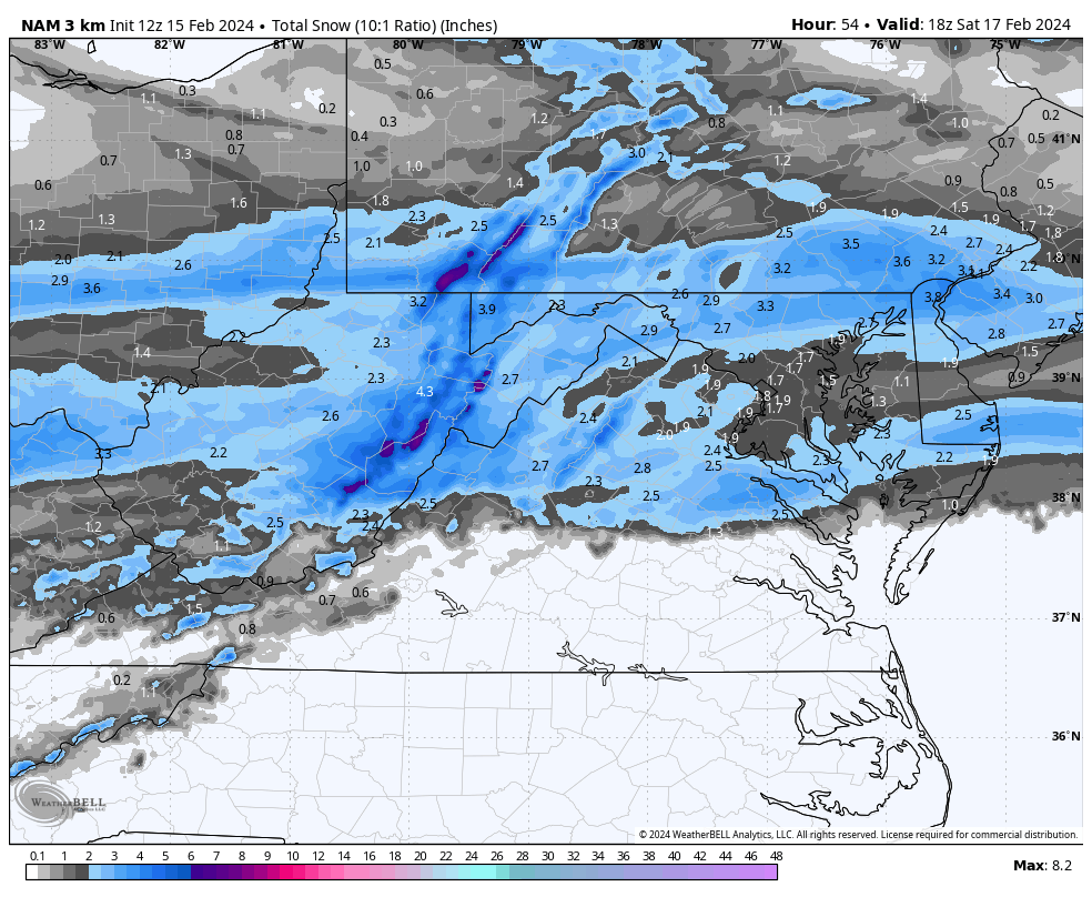
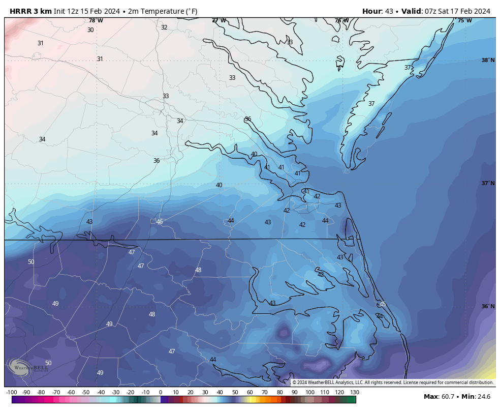
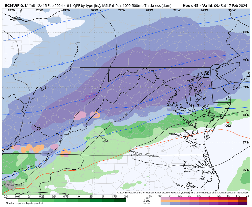
The Euro has the low tracking along the KY/TN border and then once it gets to VA, it takes an abrupt jump north from about Bristol to Roanoke to Wallops Island by 4am Saturday morning. Not understanding what is making the low take that last minute jump north instead of following the same trajectory. The GFS keeps the low along the VA/NC border, really northern NC, which makes more sense to me.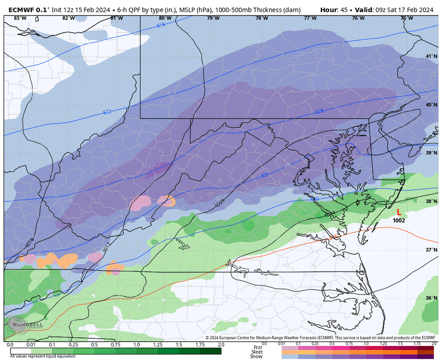
-
Richmond Metro/Hampton Roads Area Discussion
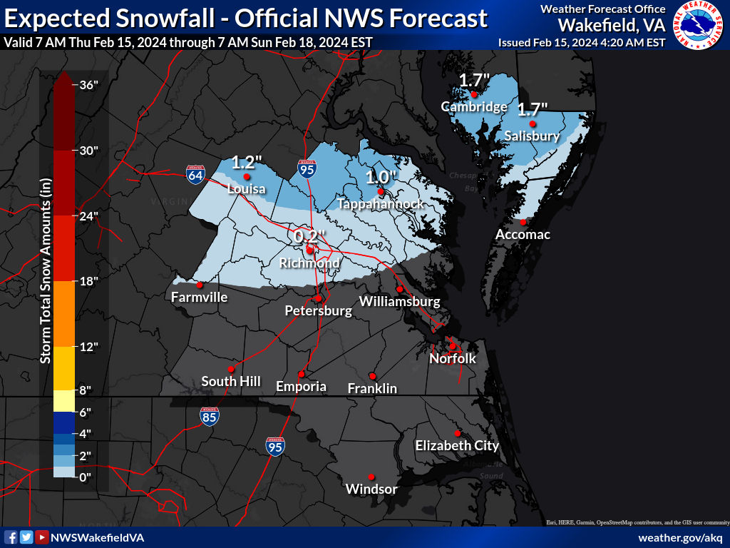
RIC Airport replied to RIC Airport's topic in Mid Atlantic
This is the map AKQ put out this morning. Best chance of 1" or more is north of about Ruther Glen..thumb.jpg.ff04264d99664fd4494a9a968f6a81de.jpg)

-
Richmond Metro/Hampton Roads Area Discussion
RIC Airport replied to RIC Airport's topic in Mid Atlantic
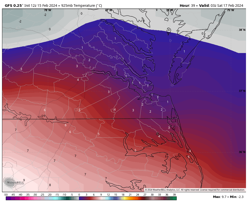
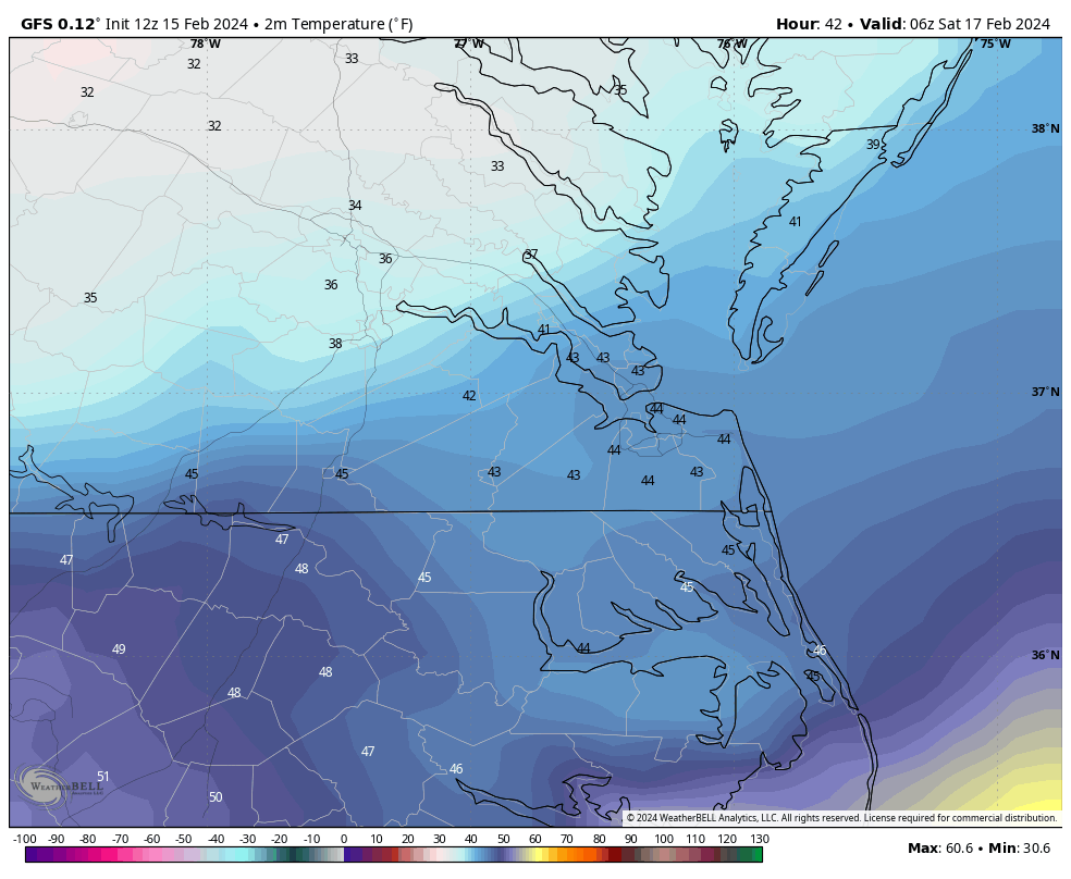
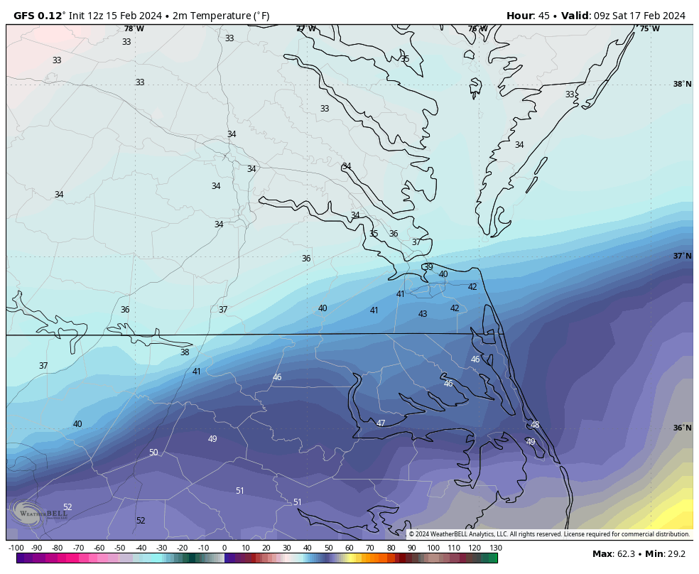
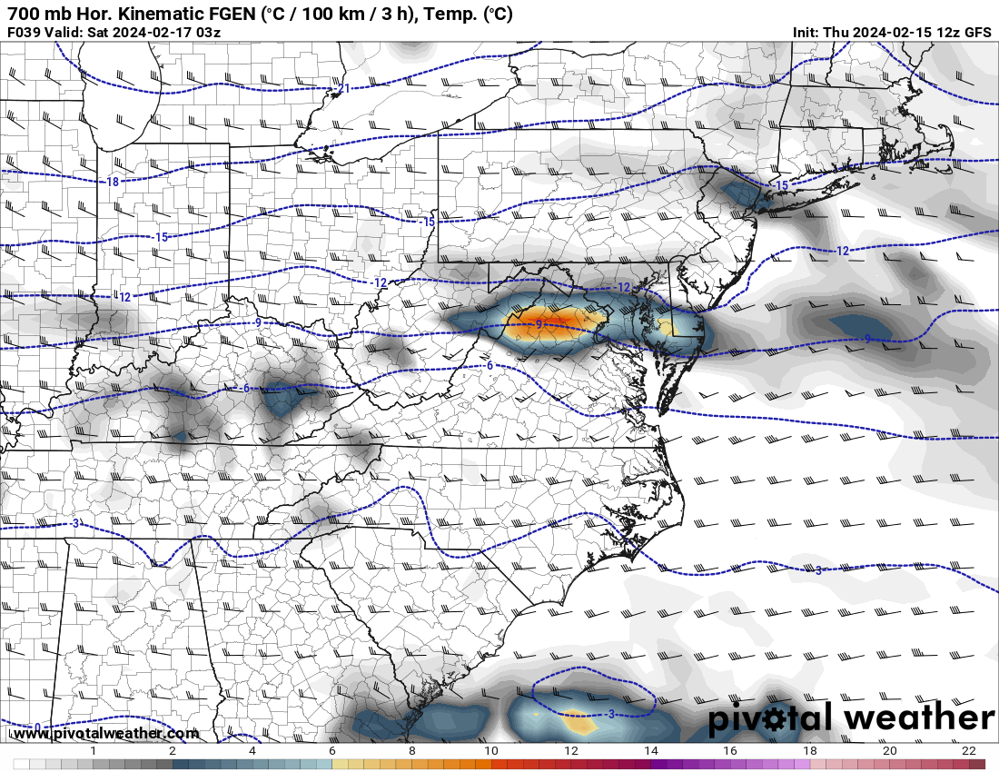
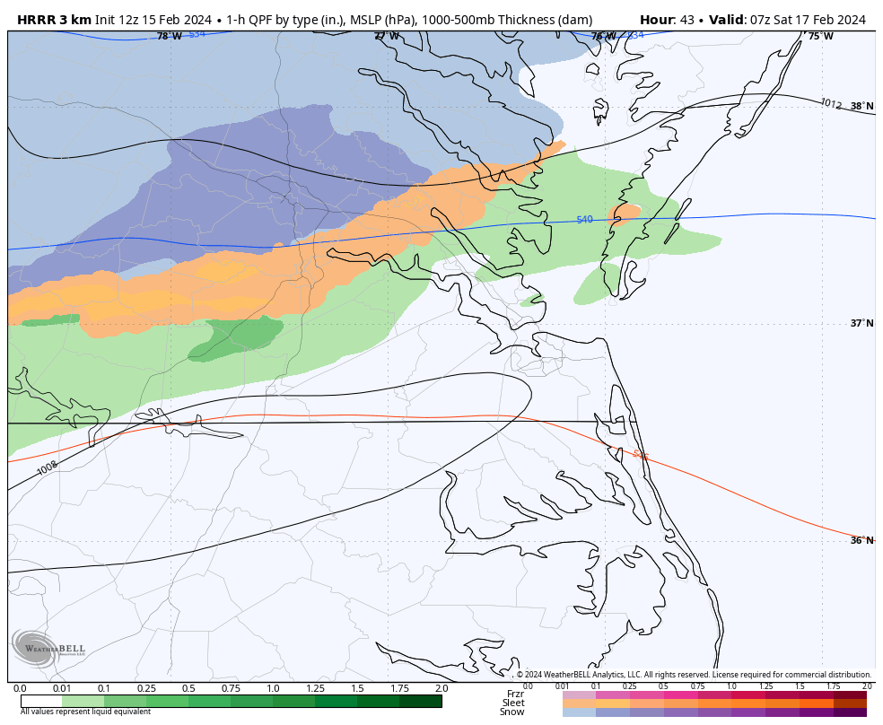
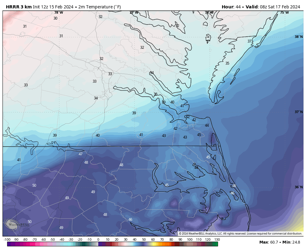
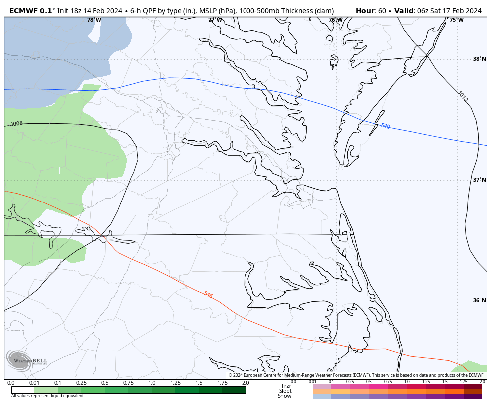
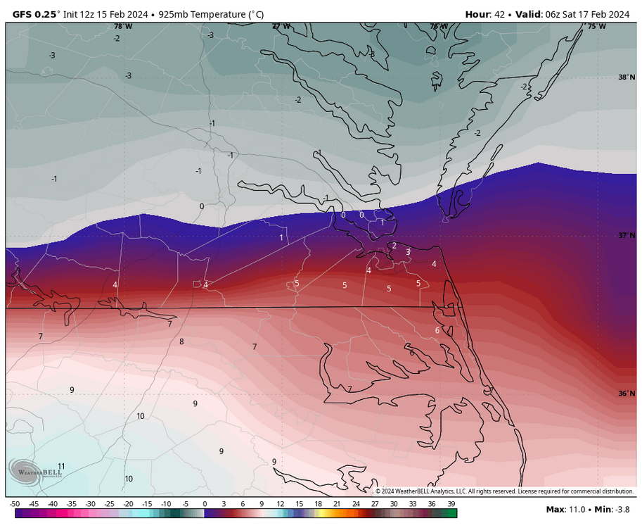
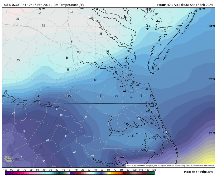
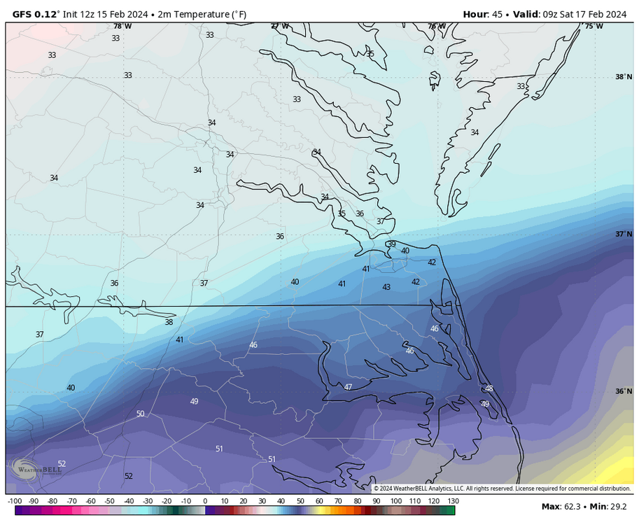
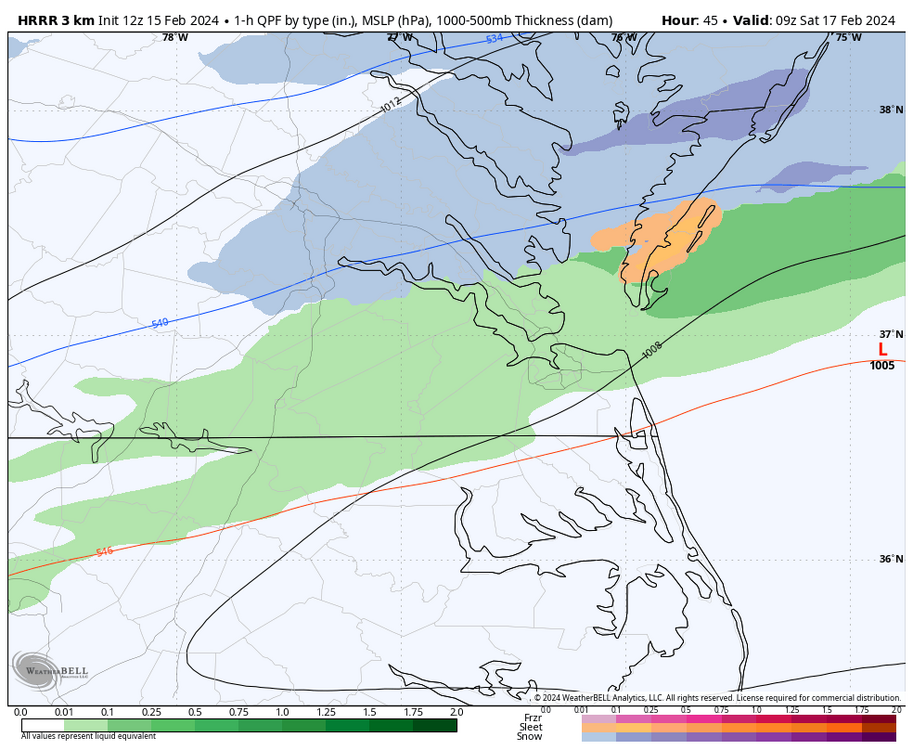
@RVAman,The colder air aloft is not as deep before 1am, but that's before the best precip comes in, so it won't matter as much. But, this suggests that there is a higher likelihood that any precipitation will be rain before the heavier rates arrive around 1am. 10pm 925mb temps 1am 925mb temps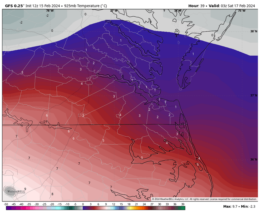
-
Richmond Metro/Hampton Roads Area Discussion
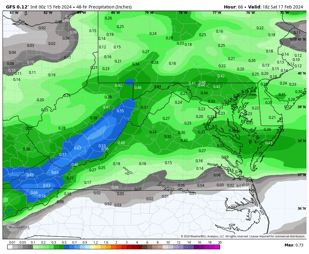
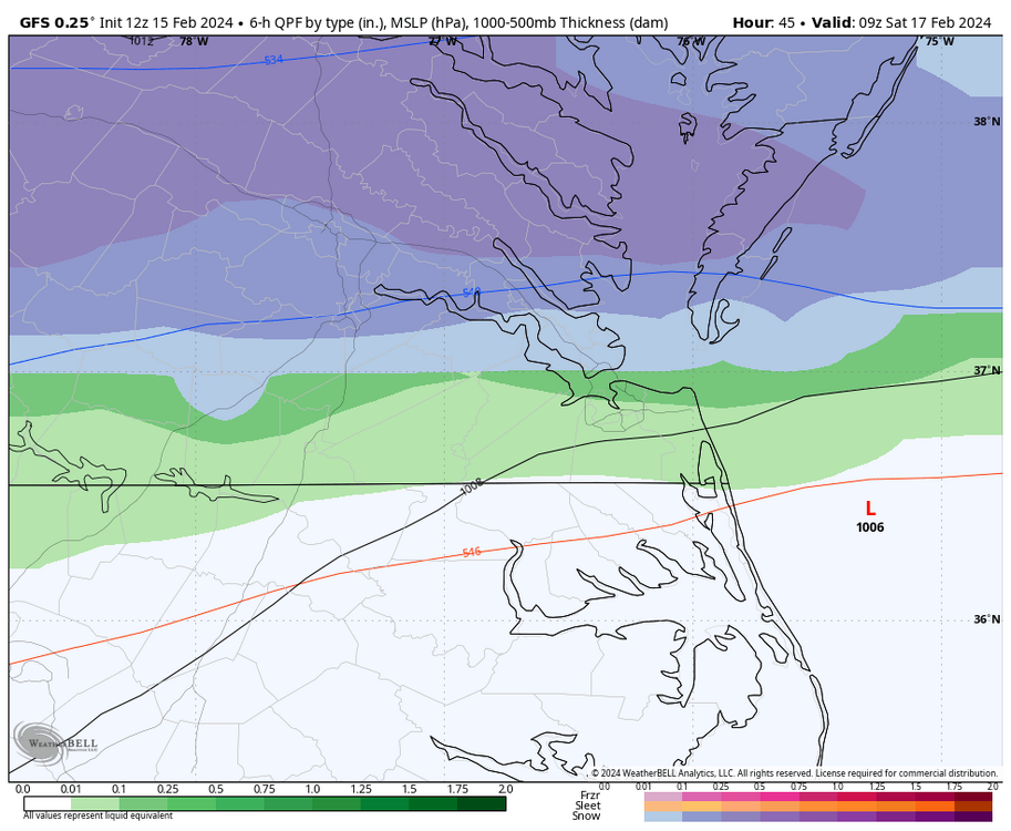
RIC Airport replied to RIC Airport's topic in Mid Atlantic
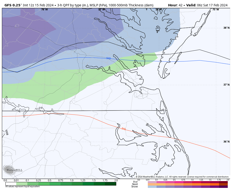
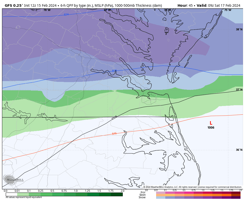
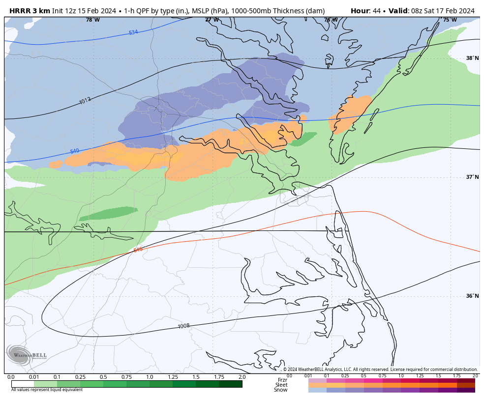
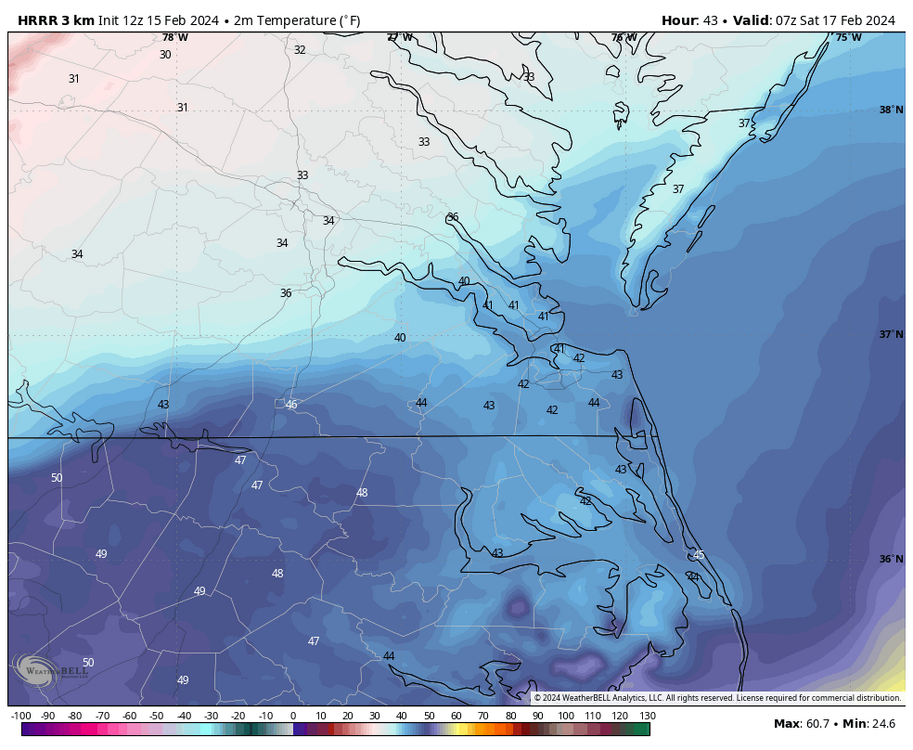
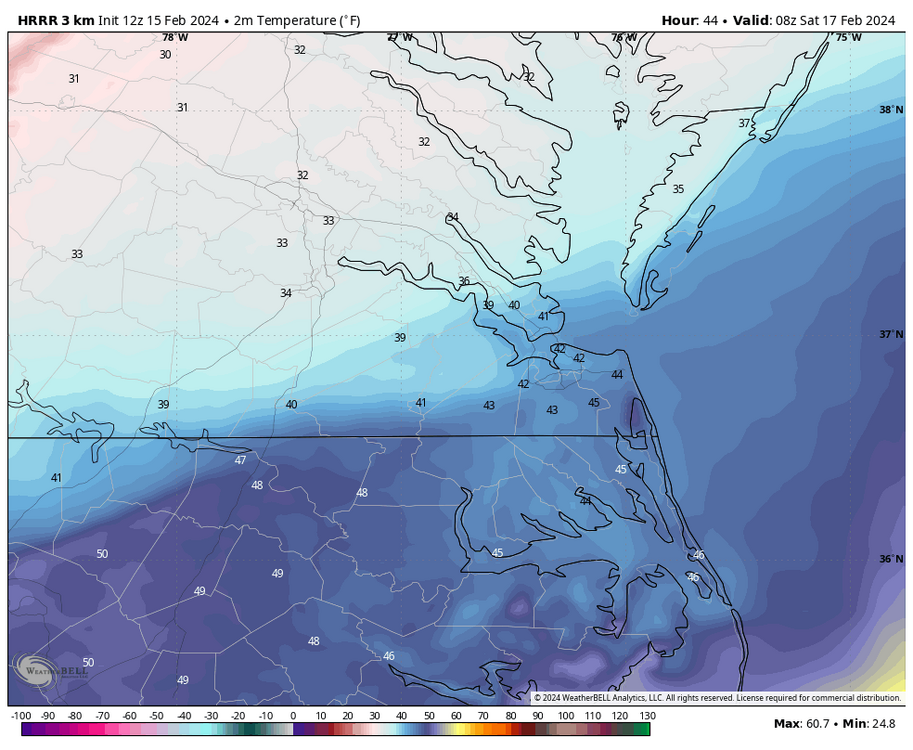
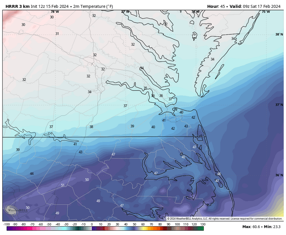
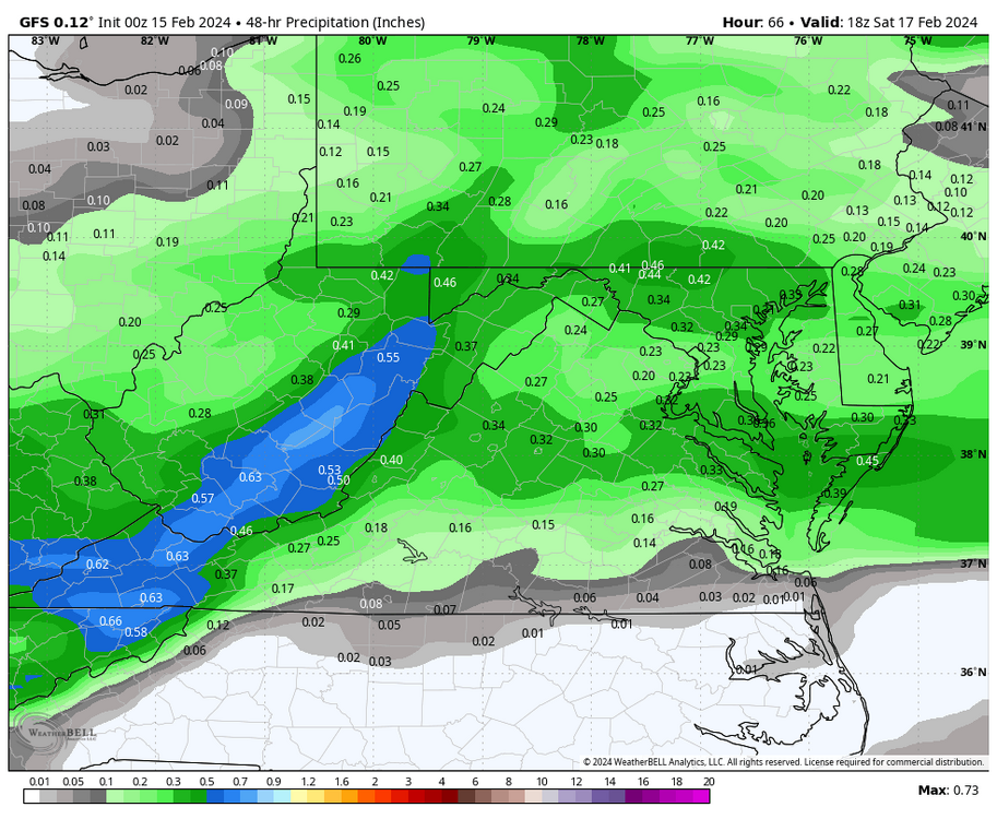
GFS has precip arriving Friday night between 10pm and 11pm. It has the heaviest QPF between 1am and 4am. Between 1am and 4am, surface temperatures go from around 36 to 33 degrees in the Richmond metro area. However, temperatures are below freezing at the 925mb and 850mb levels. To overcome air temperatures above freezing at the surface and for the snow to accumulate, we will need heavy precip rates to bring down the colder air aloft. Otherwise, the snow would just melt on contact. It could even fall as rain the whole time if it's too light. That's because it may not be heavy enough to bring down the below-freezing air at 925mb and higher. Will need to watch the trends.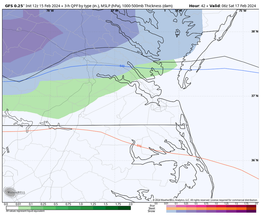
-
Richmond Metro/Hampton Roads Area Discussion
RIC Airport replied to RIC Airport's topic in Mid Atlantic
The best lift is still north around the i-66 corridor. I am not sure if the rates farther south, mainly south of Ashland will be able to overcome the marginal surface temperatures accumulate. QPF is very limited so anything wasted makes it even more difficult south of Caroline County.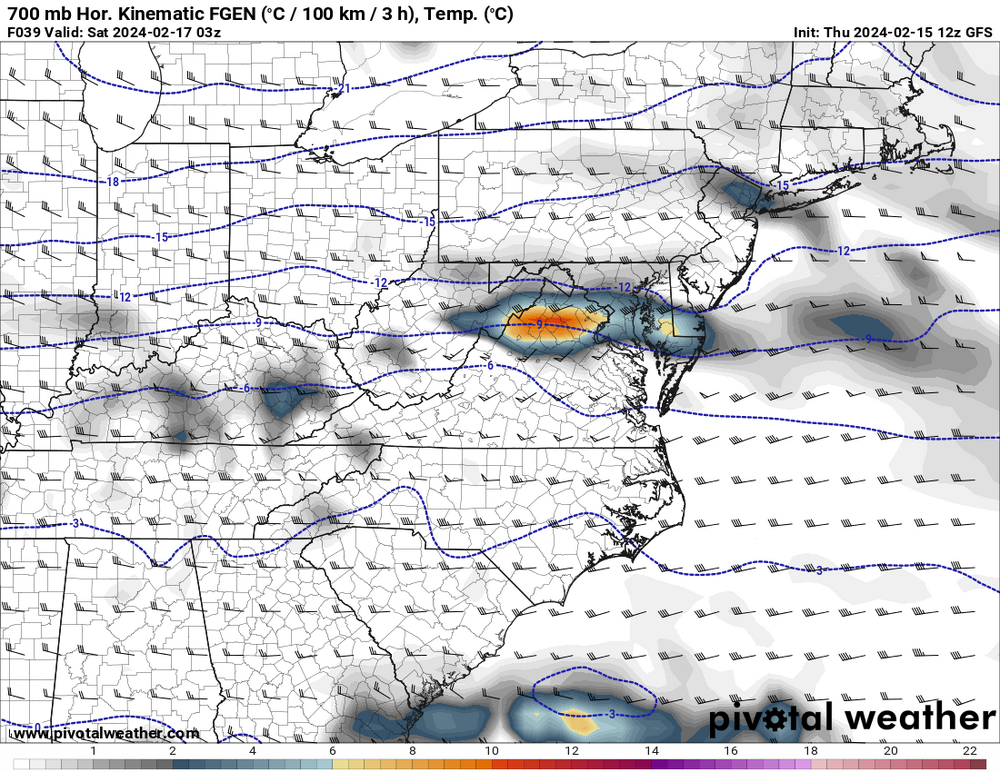

-
Richmond Metro/Hampton Roads Area Discussion
RIC Airport replied to RIC Airport's topic in Mid Atlantic
It's never over until it's actually over. -
Richmond Metro/Hampton Roads Area Discussion
RIC Airport replied to RIC Airport's topic in Mid Atlantic
I like it.

-
Richmond Metro/Hampton Roads Area Discussion
RIC Airport replied to RIC Airport's topic in Mid Atlantic
@JFLETCHER, you're definitely in a good spot.
-
Richmond Metro/Hampton Roads Area Discussion
RIC Airport replied to RIC Airport's topic in Mid Atlantic
Yes, and we've been through plenty of marginal events and busts. Just saying it's not over until it's over. But I agree. I wish things were better, but I'm just trying to be positive, as the HRRR, which changes every hour, is only one model. The end goal is for all of us to get a decent snowfall, so we're all here with curiosity and still tracking this threat. -
Richmond Metro/Hampton Roads Area Discussion
RIC Airport replied to RIC Airport's topic in Mid Atlantic
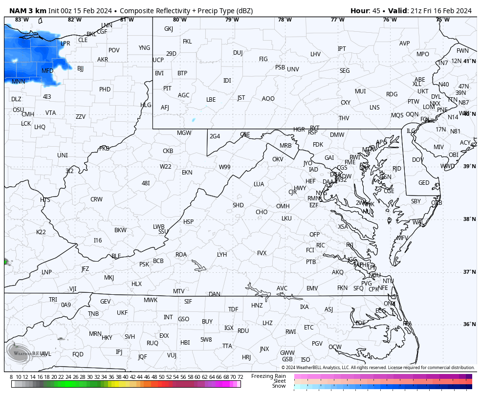
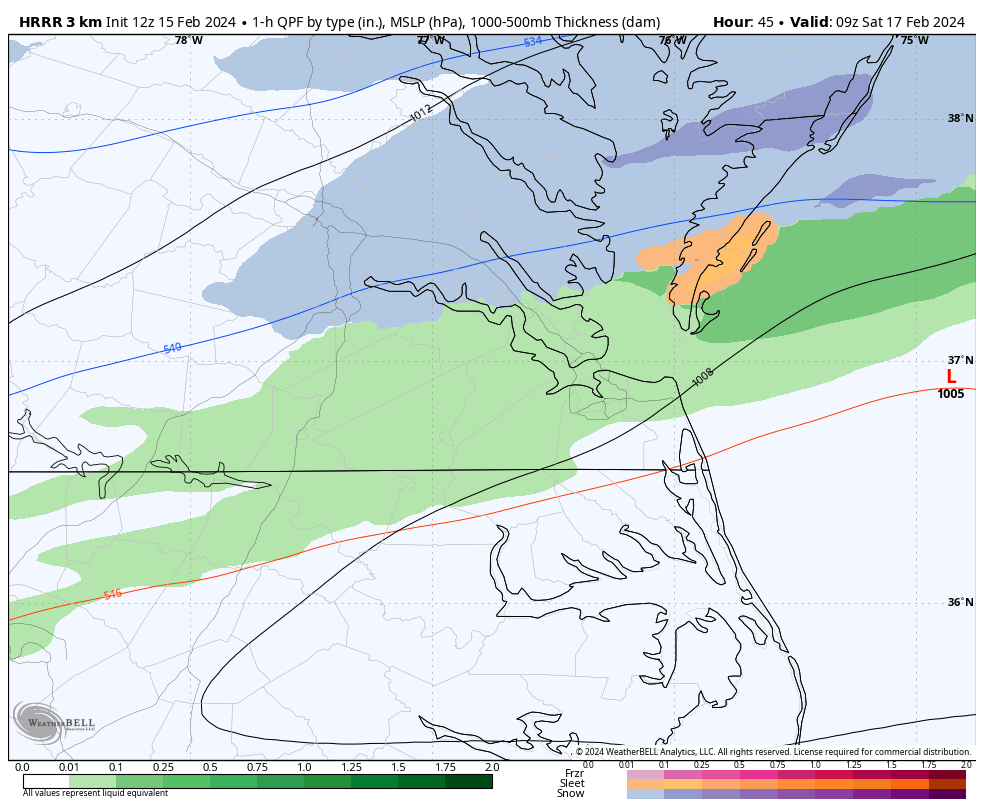
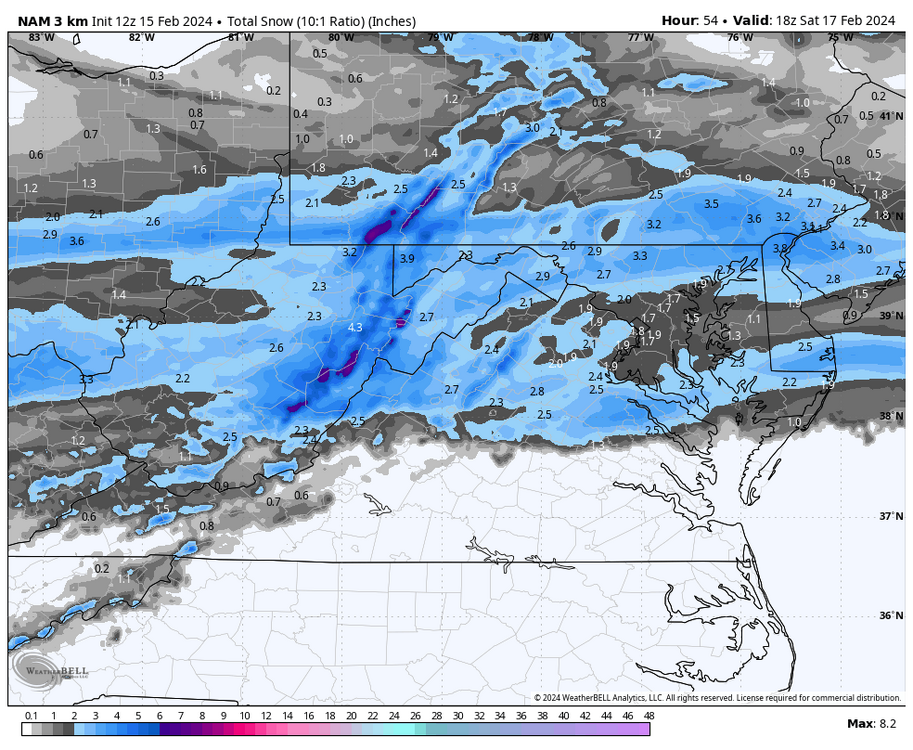
Sketics and anyone else worried and concerned, well that's why the panic thread exists. Meanwhile, thee 12Z HRRR, has a nice bad of snow between 2am and 4am Saturday morning across the Richmond metro area.

-
Richmond Metro/Hampton Roads Area Discussion
RIC Airport replied to RIC Airport's topic in Mid Atlantic
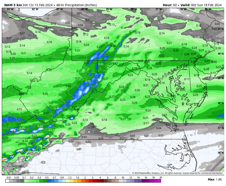
00z GFS came in the best yet. But it is still a nail-biter situation around RIC due to marginal surface temps. Will need good rates to bring the cold down. Otherwise, we will waste the limited QPF we have. Verbatim, most of the precip stays north of RIC, at least this run of the GFS.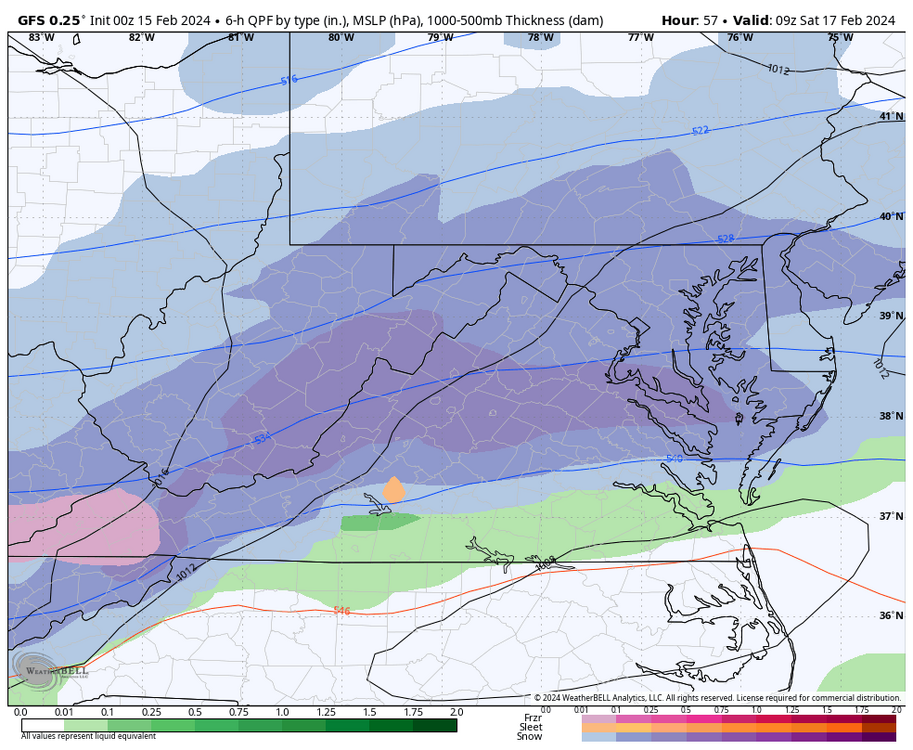

-
Richmond Metro/Hampton Roads Area Discussion
RIC Airport replied to RIC Airport's topic in Mid Atlantic
The latest GRAF model looks legit. Just look at what the model does vs what he tweeted since he is a DC TV Met. But it's the model that the TV stations use. I like it. -
Richmond Metro/Hampton Roads Area Discussion
RIC Airport replied to RIC Airport's topic in Mid Atlantic
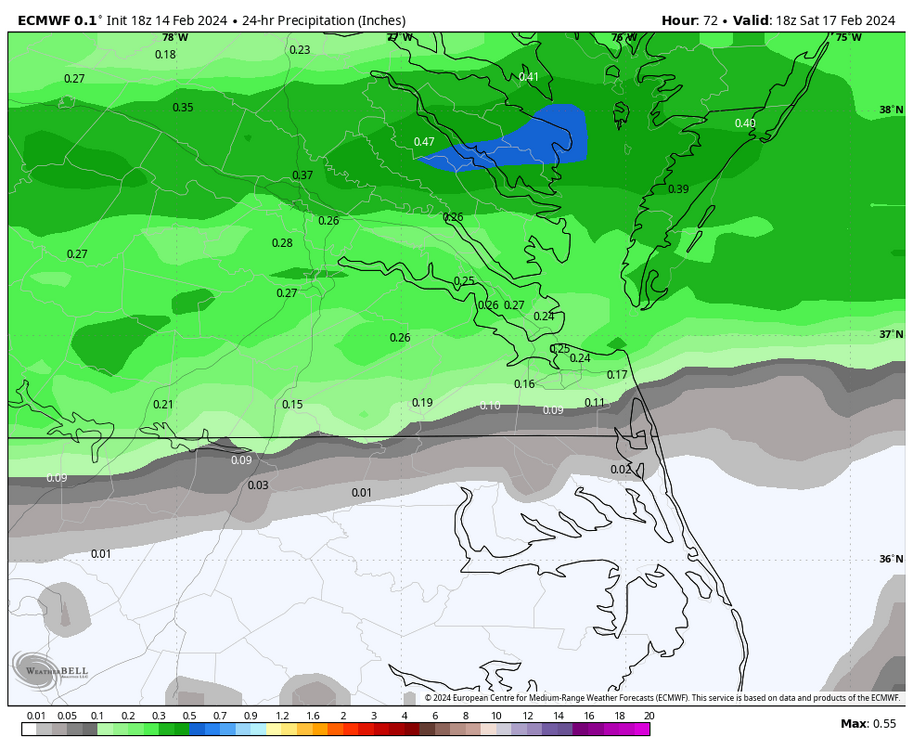
18Z Euro was a step back for us. Limited QPF and marginal temps persist.


-
Richmond Metro/Hampton Roads Area Discussion
RIC Airport replied to RIC Airport's topic in Mid Atlantic
The models seem to behave differently yearly, but they've not been good this year. I can't trust the weeklies next year. I don't know if we've seen a pattern go poof so fast, especially when almost everyone harped it up, even the usual skeptics. It's disappointing that Richmond has had over 18" of rain since the Tuesday before Thanksgiving and only 0.7" of snow out of it. -
Richmond Metro/Hampton Roads Area Discussion
RIC Airport replied to RIC Airport's topic in Mid Atlantic
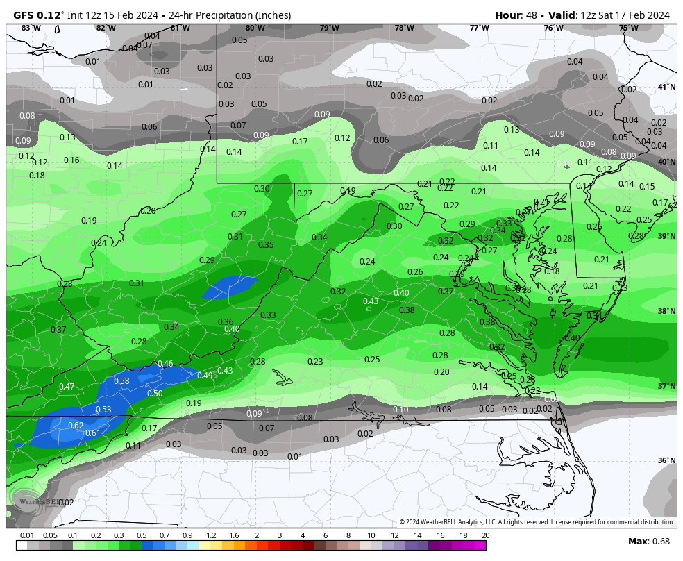
This is from AKQ's afternoon disccussion. .SHORT TERM /7 AM THURSDAY MORNING THROUGH SATURDAY/... As of 300 PM EST Wednesday... Key Messages: -The potential for accumulating snow early Saturday morning has increased across northern portions of the area (roughly from Louisa to Salisbury), where 1-2" of snow is in the forecast. -There is the potential for a light accumulating snow as far south as the Richmond Metro, but confidence in this is lower. -There is still some uncertainty regarding the track and strength of the system, so expect changes in the forecast in the coming days. The surface high becomes suppressed to our SE on Thursday while a fast moving clipper system tracks well to our north. This system will drag a cold front through the area Thursday night. Return southerly flow will allow temps to rise into the upper 50s-lower 60s in most areas west of the Ches Bay...although it will struggle to get out of the upper 40s-lower 50s on the ern shore. While there will be an increase in clouds on Thu in advance of the front, no precipitation is expected. Clearing Thu night with winds becoming W then NW behind the front. Lows will fall into the mid 30s-mid 40s. The main focus of the period is the increasing potential for accumulating snow across the northern half of the area Friday night into Saturday morning...as a fast moving shortwave in zonal flow aloft tracks over the area. No wx concerns ahead of the system on Fri with increasing clouds and highs in the 50s in most areas (mid- upper 40s on the ern shore). The GFS/ECMWF and GEFS/EPS ensembles are in much better agreement than they were yesterday with respect to the track of the system. At this time, model consensus shows the system tracking across southern VA, with the most likely timing for precip between 10 PM-6 AM (before ending by sunrise as the system moves offshore). While the system will be fast moving...there will likely be a 3-6 hour period of light to moderate snow north of the low track, with light rain (with amounts under 0.10") in SE VA and NE NC. Despite temperatures falling to 32-33F, the snow will likely come down at a decent enough rate (thanks to fairly strong 850-700mb frontogenesis to the N of the low track). Also, the fact that this event will occur at night will help a bit with accums despite the marginal temps. Right now, the forecast calls for 1-2" of snow in areas from roughly Louisa-Salisbury...to less than 1" in the RIC Metro...with no snow at all south of a Farmville-Hopewell line. There is the potential for localized amounts greater than 2" in the most persistent bands...but too early to reflect this in the forecast. Of course, there will be changes in the forecast track and strength of the system during the next couple of days. Any travel issues Sat AM will be short-lived as the snow will quickly melt on Saturday with highs rising well into the 40s.


.jpg.04dc24ff17e80c19b0ffdd62b5165200.jpg)