RIC Airport
-
Posts
2,586 -
Joined
-
Last visited
Content Type
Profiles
Blogs
Forums
American Weather
Media Demo
Store
Gallery
Everything posted by RIC Airport
-
Richmond Metro/Hampton Roads Area Discussion
RIC Airport replied to RIC Airport's topic in Mid Atlantic


-
Richmond Metro/Hampton Roads Area Discussion
RIC Airport replied to RIC Airport's topic in Mid Atlantic
Yes, but mostly the 1st from looking at the dates. -
Richmond Metro/Hampton Roads Area Discussion
RIC Airport replied to RIC Airport's topic in Mid Atlantic
-
Richmond Metro/Hampton Roads Area Discussion
RIC Airport replied to RIC Airport's topic in Mid Atlantic
Also, @eaglesin2011 confluence is no substitute for a bona fide high to our north, so that makes warm air advection easier in this setup. The Euro could be too cold at the upper levels. -
Richmond Metro/Hampton Roads Area Discussion
RIC Airport replied to RIC Airport's topic in Mid Atlantic
Right. And the key is how much to take away from the clown maps because of it. -
Richmond Metro/Hampton Roads Area Discussion
RIC Airport replied to RIC Airport's topic in Mid Atlantic
-
Richmond Metro/Hampton Roads Area Discussion
RIC Airport replied to RIC Airport's topic in Mid Atlantic
I am worried about mixing. -
Richmond Metro/Hampton Roads Area Discussion
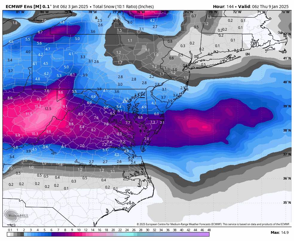
RIC Airport replied to RIC Airport's topic in Mid Atlantic
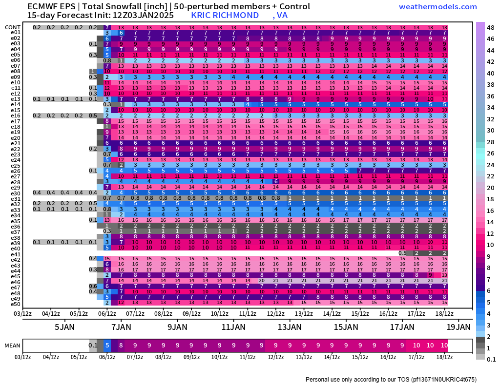
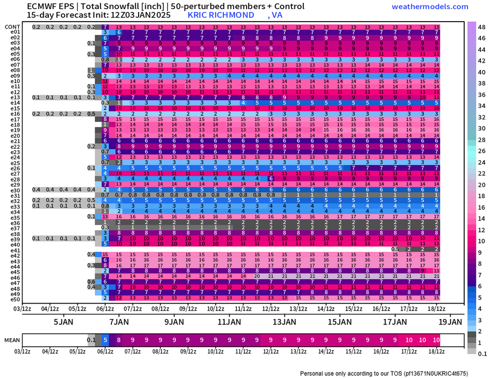
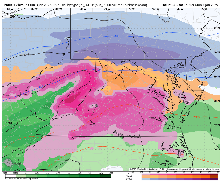
EPS for 1/6 event, backs up the Op.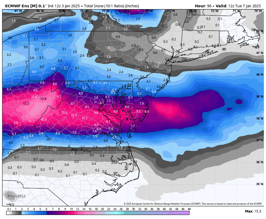
-
Richmond Metro/Hampton Roads Area Discussion
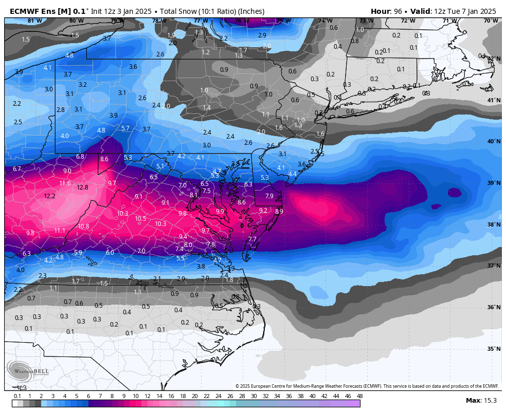
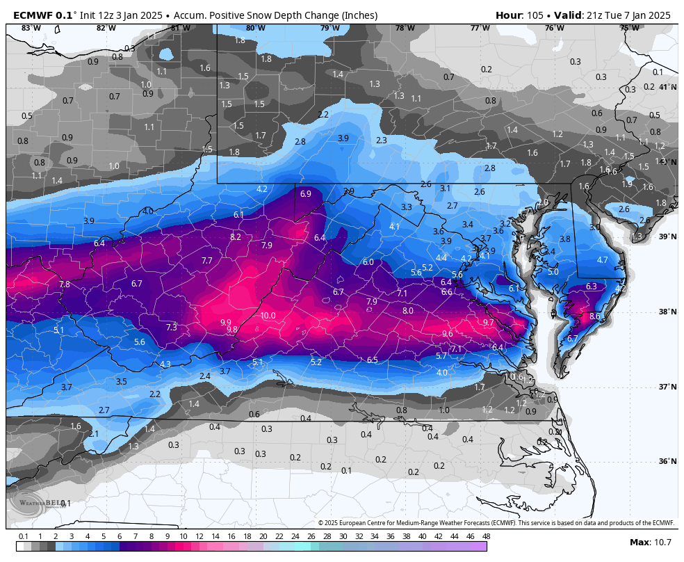
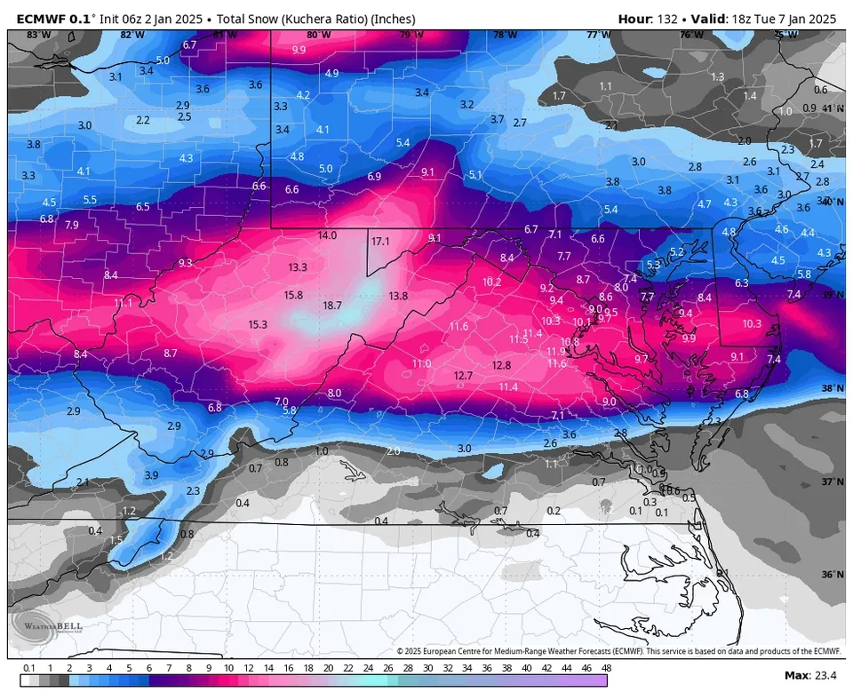
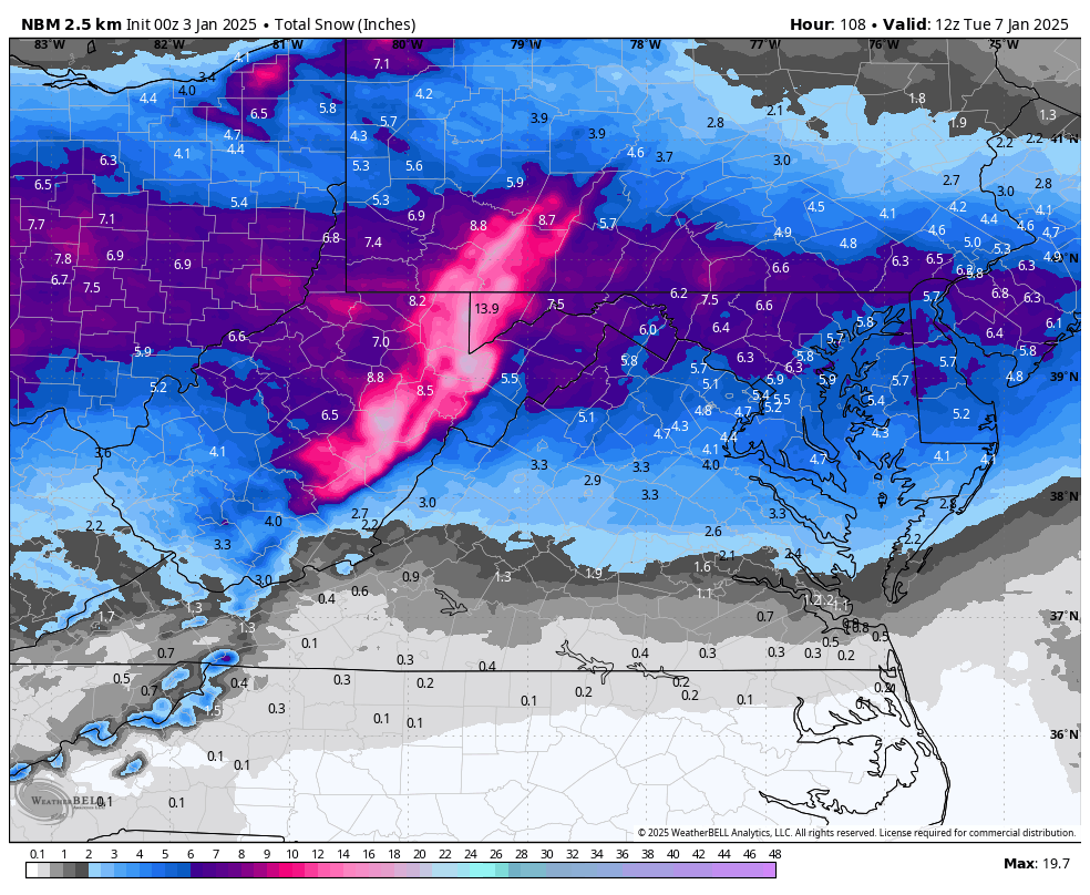
RIC Airport replied to RIC Airport's topic in Mid Atlantic
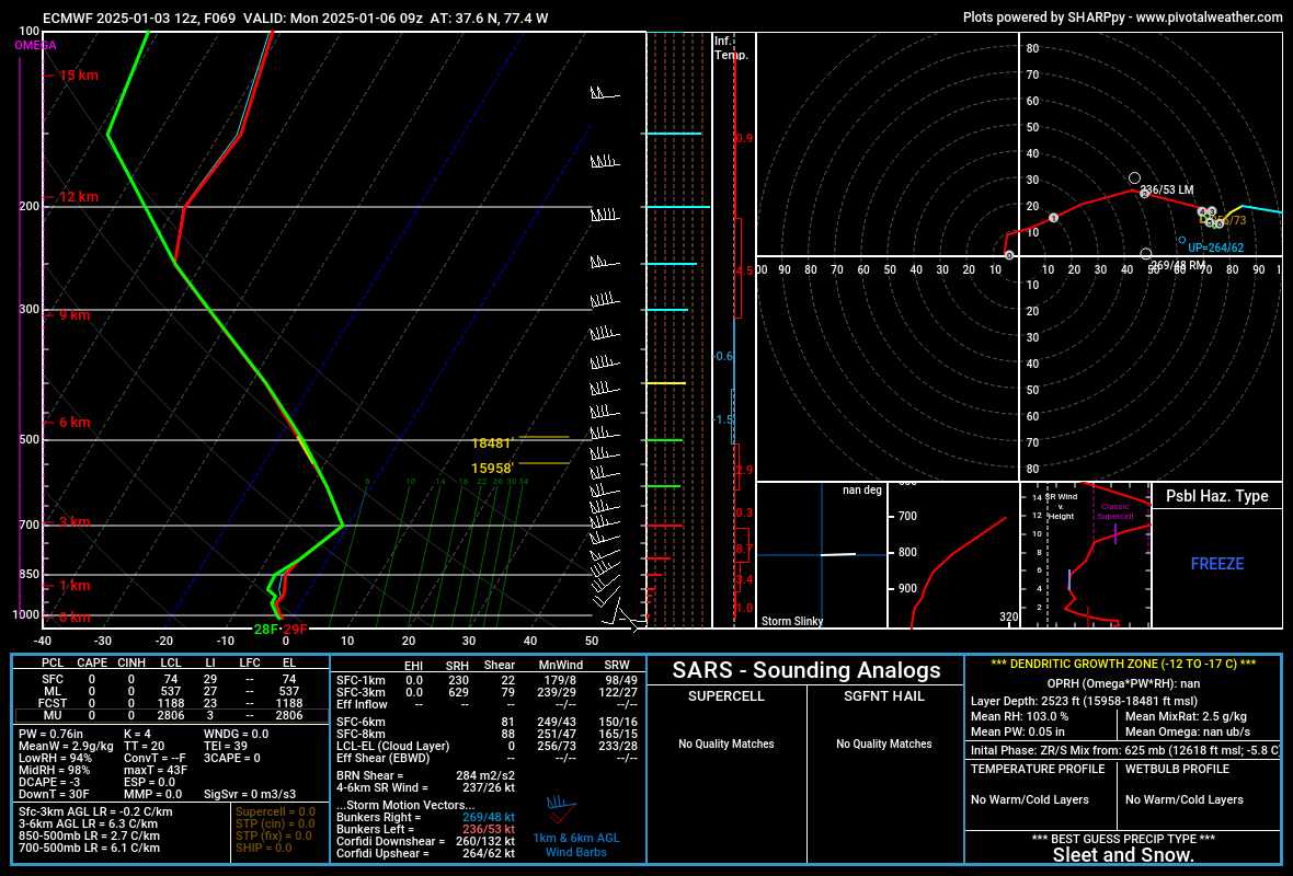
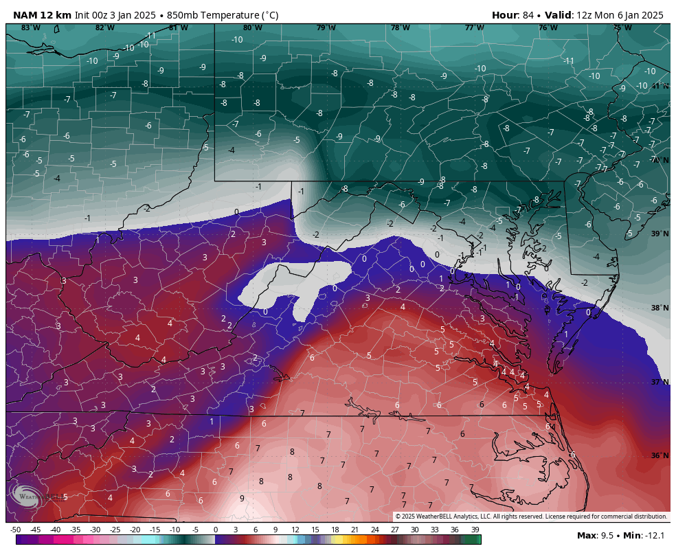
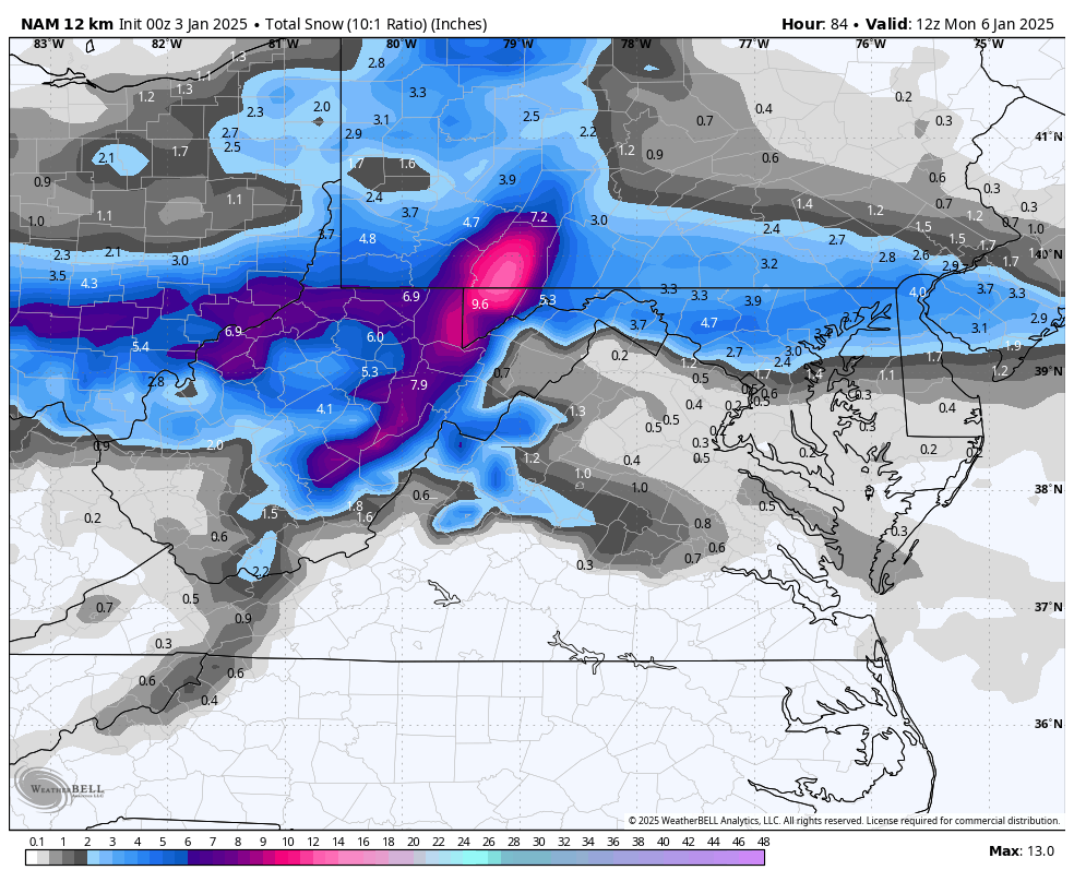
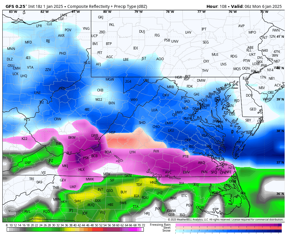
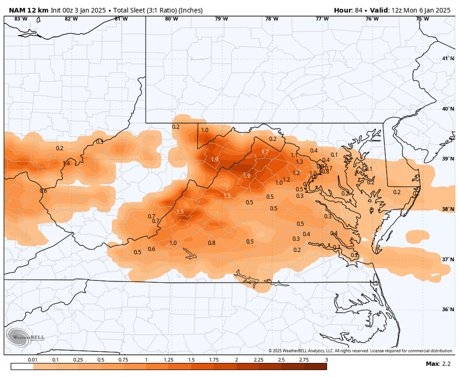
Snow depth map, fwiw Also, Euro doesn't get RIC above freezing for the entire event. There was a much smaller window above freezing at 925mb and 850mb between hour 74 and 78.
-
Richmond Metro/Hampton Roads Area Discussion
RIC Airport replied to RIC Airport's topic in Mid Atlantic
-
Richmond Metro/Hampton Roads Area Discussion
RIC Airport replied to RIC Airport's topic in Mid Atlantic
Euro coming in STRONG!!! -
Richmond Metro/Hampton Roads Area Discussion
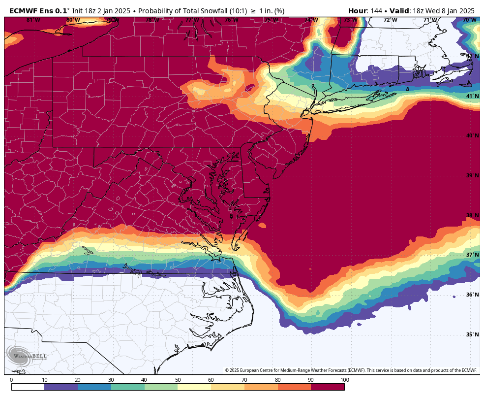
RIC Airport replied to RIC Airport's topic in Mid Atlantic
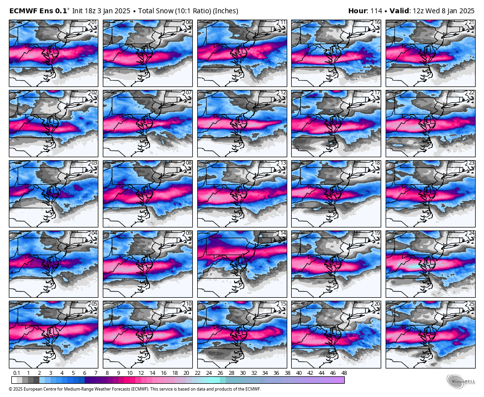
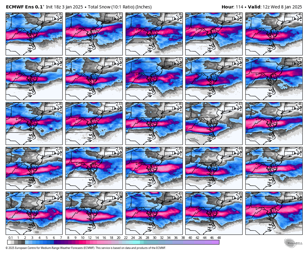
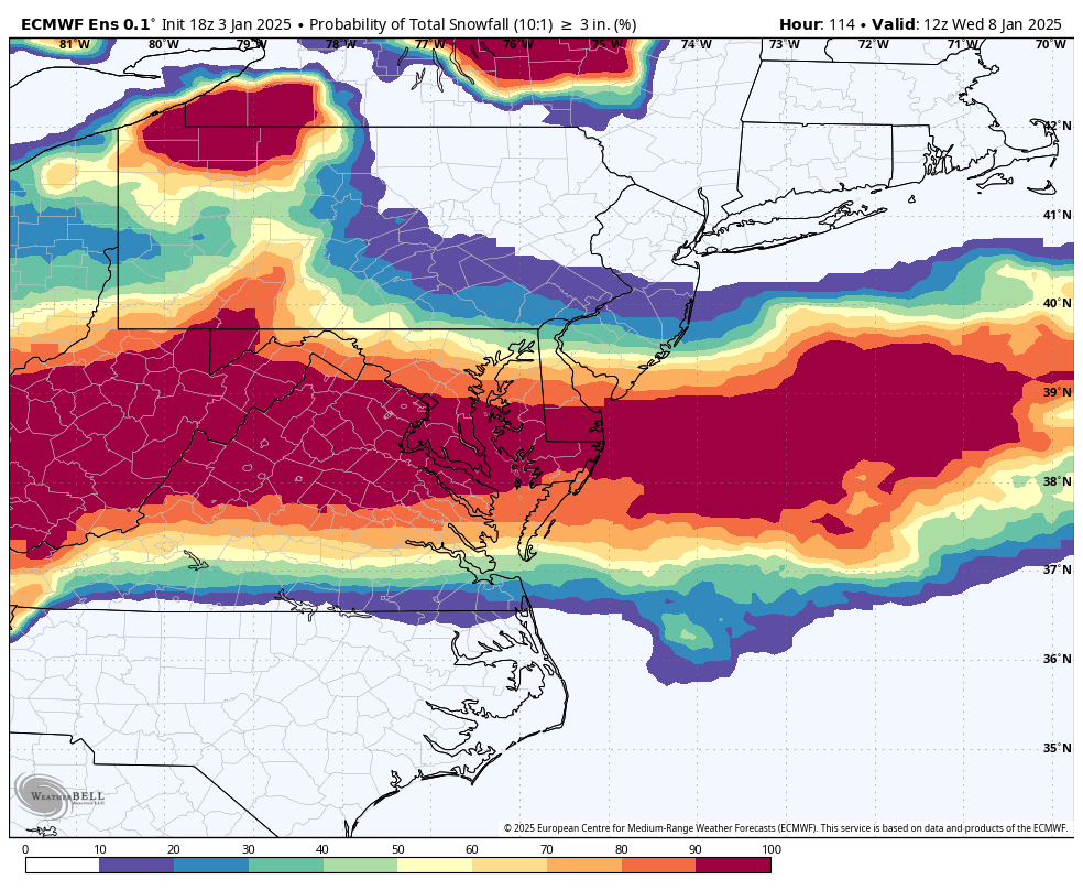
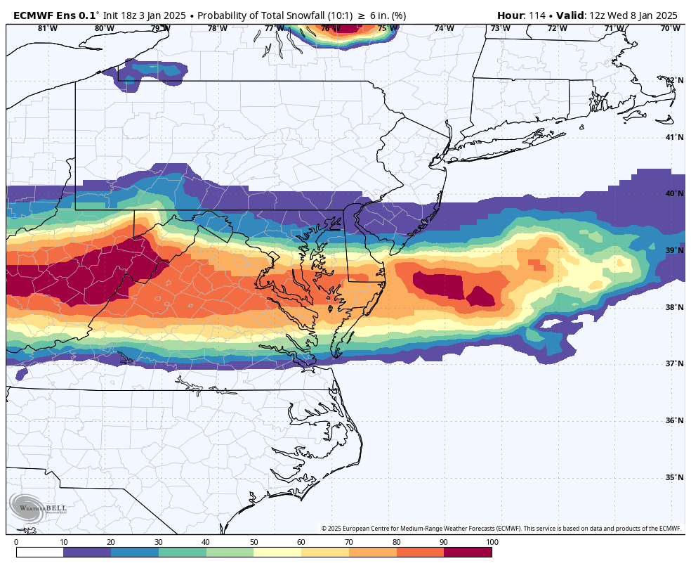
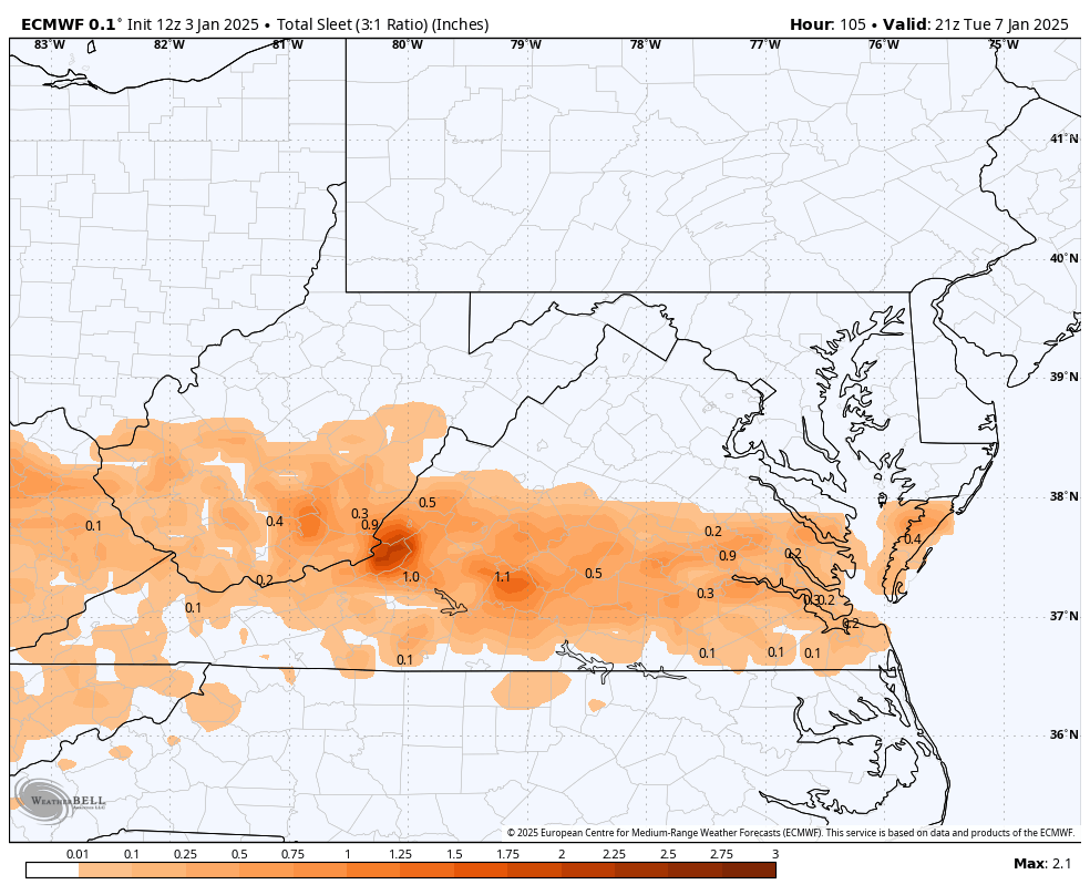
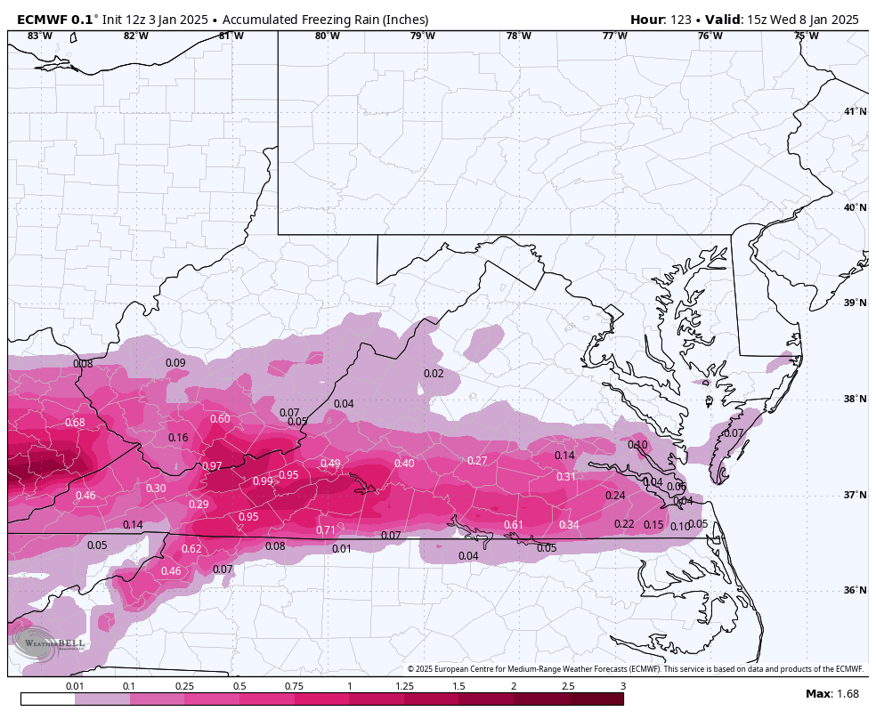
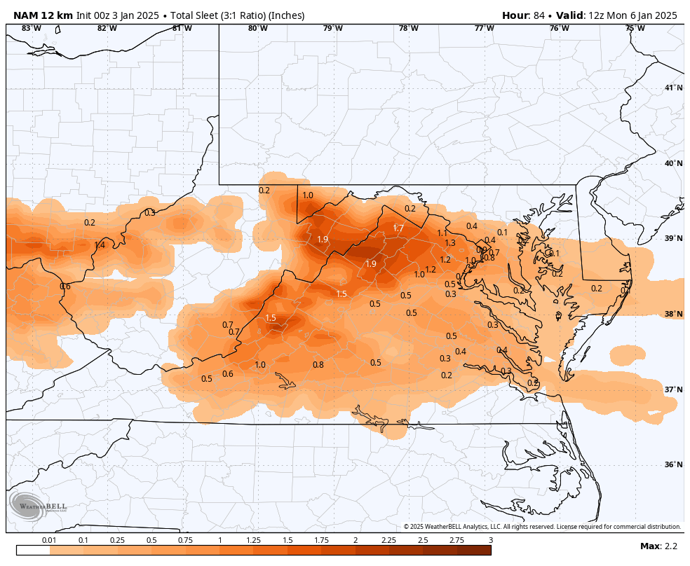
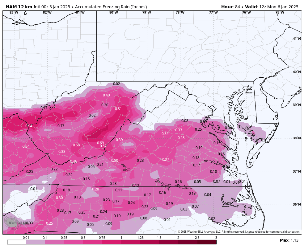
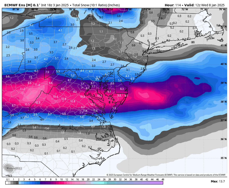
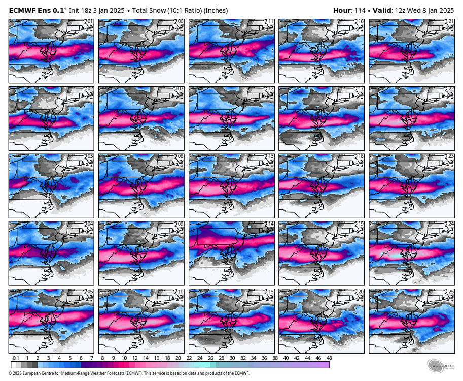
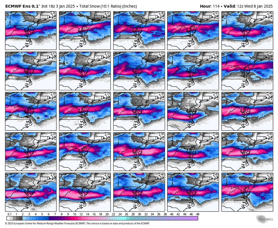
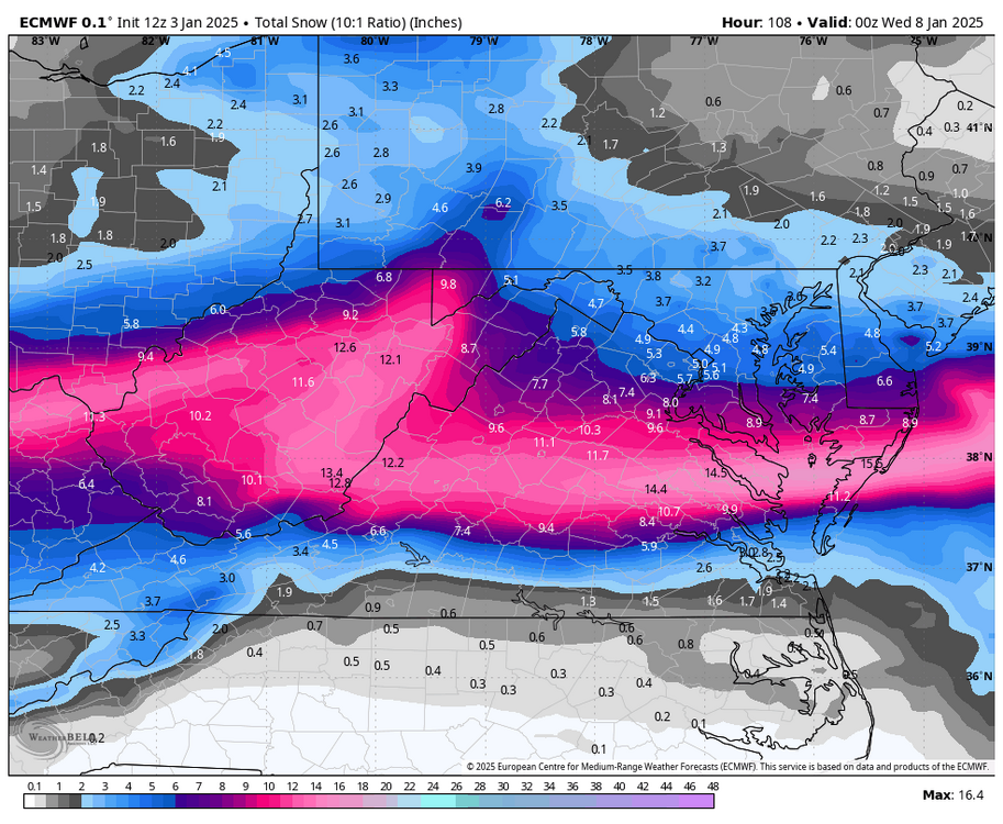
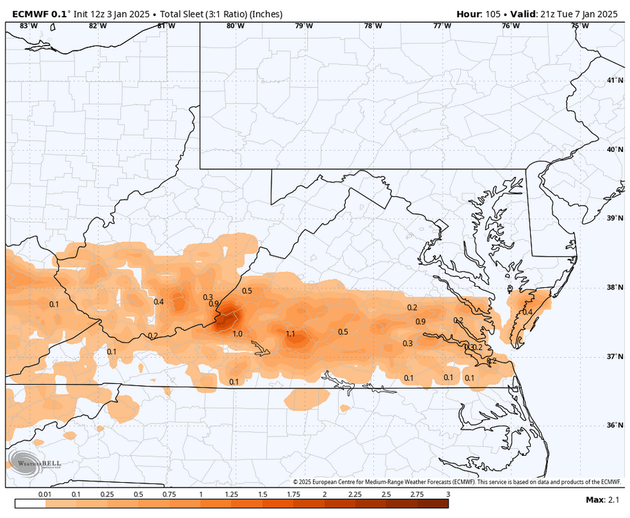
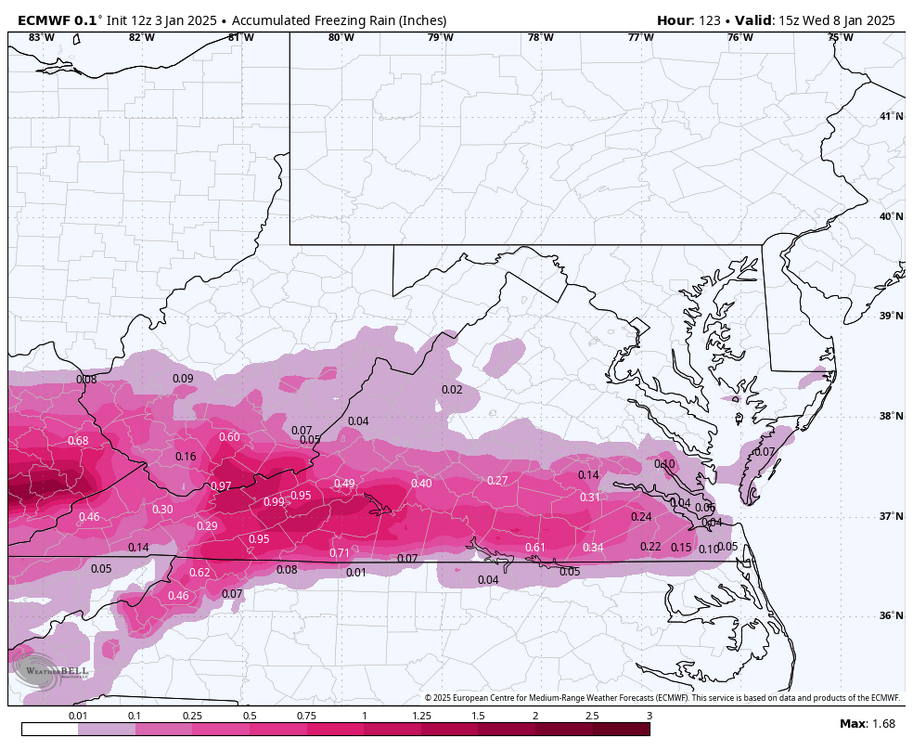
This is good to see and could preview what the 12z Euro has. I'd urge caution with the 10:1 ratio maps though. It could be picking up a large amount of IP/ZR. -
Richmond Metro/Hampton Roads Area Discussion
RIC Airport replied to RIC Airport's topic in Mid Atlantic
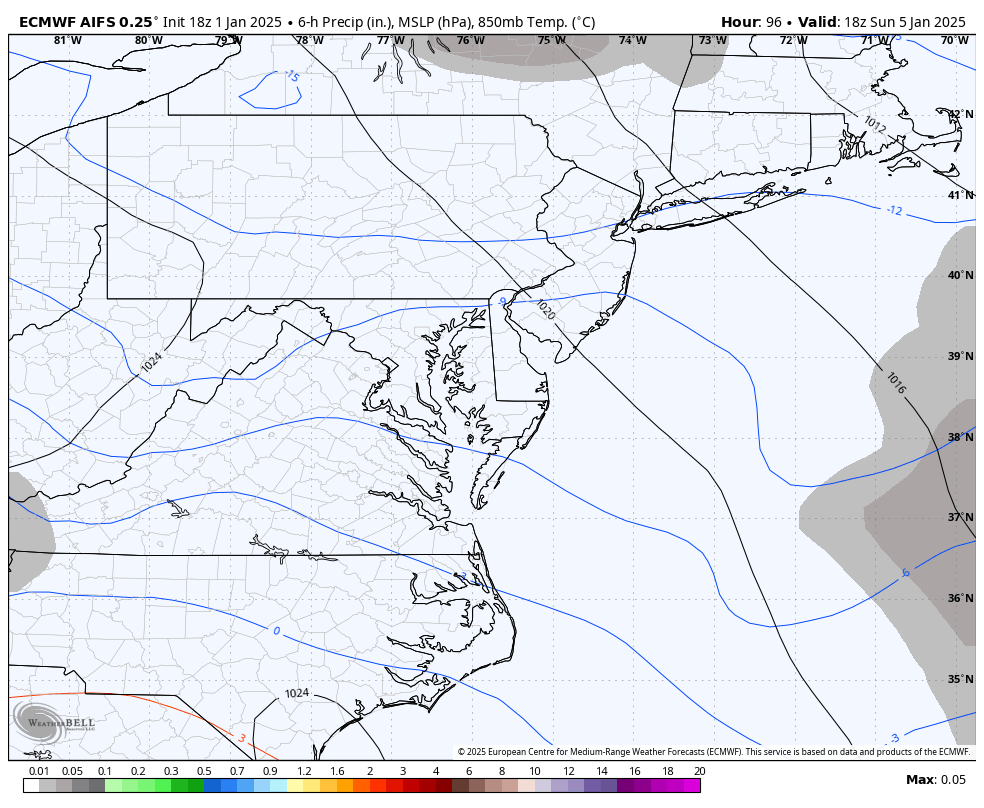
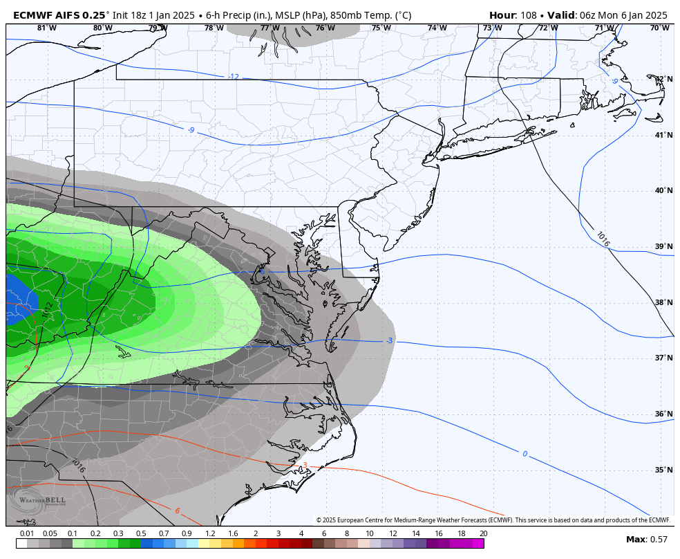
Slower storm seems to make a difference. 6z euro looks slower and slightly weaker low. Less warm air advection and coming in overnight instead of the afternoon. GFS has stuff in by 21z and the low is stronger. -
Richmond Metro/Hampton Roads Area Discussion
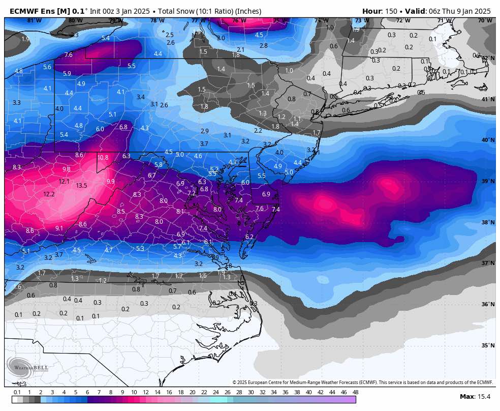
RIC Airport replied to RIC Airport's topic in Mid Atlantic
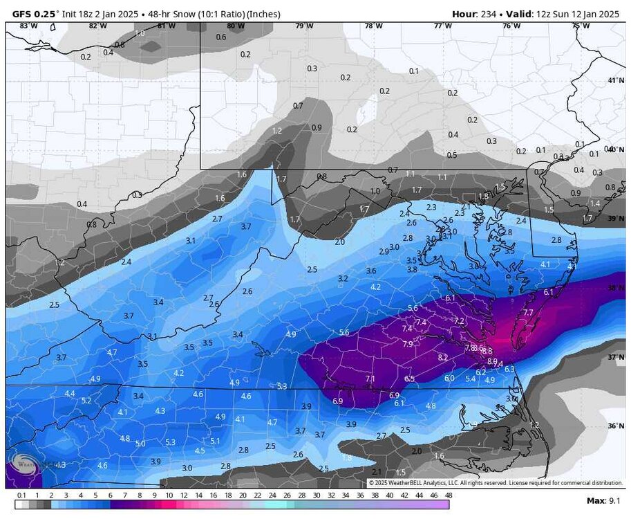
Definitely a south trend on the Euro and the EPS. 6z EPS 00z EPS


-
Richmond Metro/Hampton Roads Area Discussion
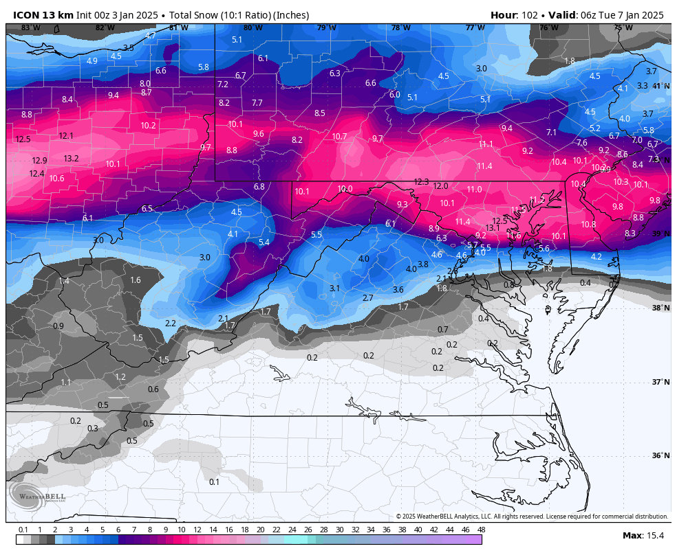
RIC Airport replied to RIC Airport's topic in Mid Atlantic
00z ICON, fwiw was worse for NoVa.
-
Richmond Metro/Hampton Roads Area Discussion
RIC Airport replied to RIC Airport's topic in Mid Atlantic
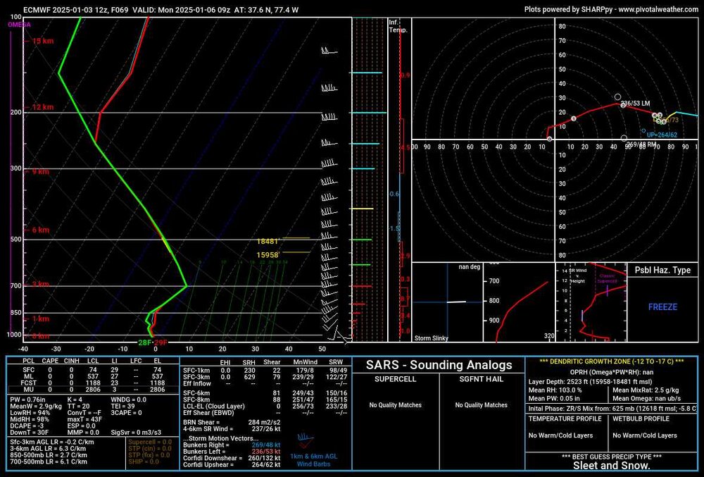
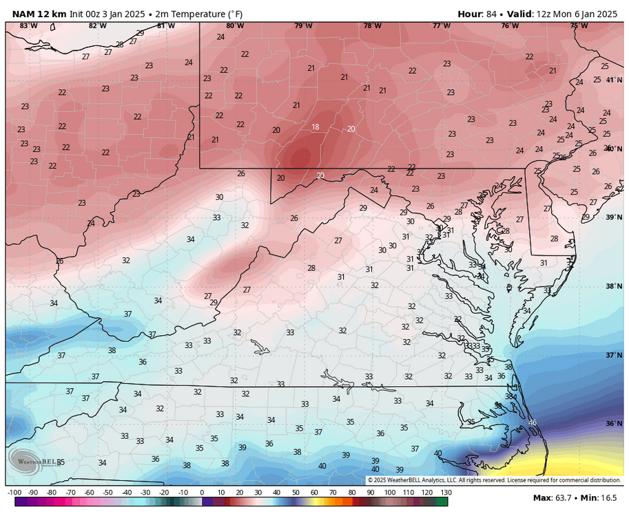
@Conway7305, at hour 84, even at 925mb, it's close to or slightly above freezing. This suggests that in later frames, the cold is continuing to get scoured out closer to the surface, so we will probably eventually flip. But, hard to really say, it's close.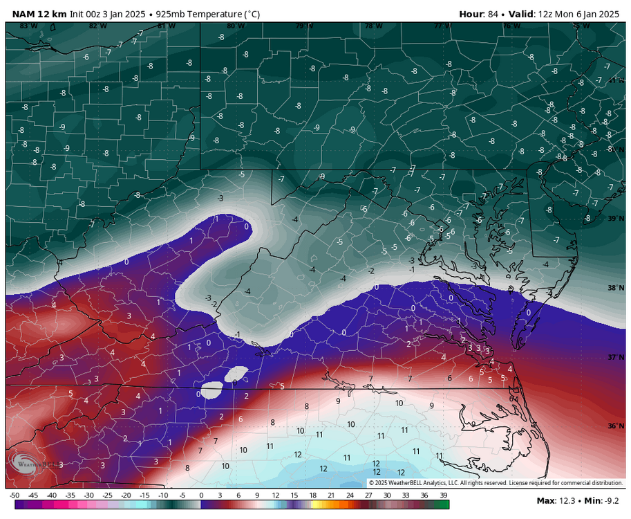

-
Richmond Metro/Hampton Roads Area Discussion
RIC Airport replied to RIC Airport's topic in Mid Atlantic
I think it's possible, but CAD may not be enough to help us at the 850mb level. If anything, CAD could cause us to never rise above freezing at the surface preventing us from turning to rain. -
Richmond Metro/Hampton Roads Area Discussion
RIC Airport replied to RIC Airport's topic in Mid Atlantic
There is maybe a 2-3 hour window of snow so that warm air intrusion aloft is coming in pretty fast. Also, since it only goes out to hour 84, it is hard to tell if/when we eventually flip to rain. Of course, everything is subject to further fluctuation.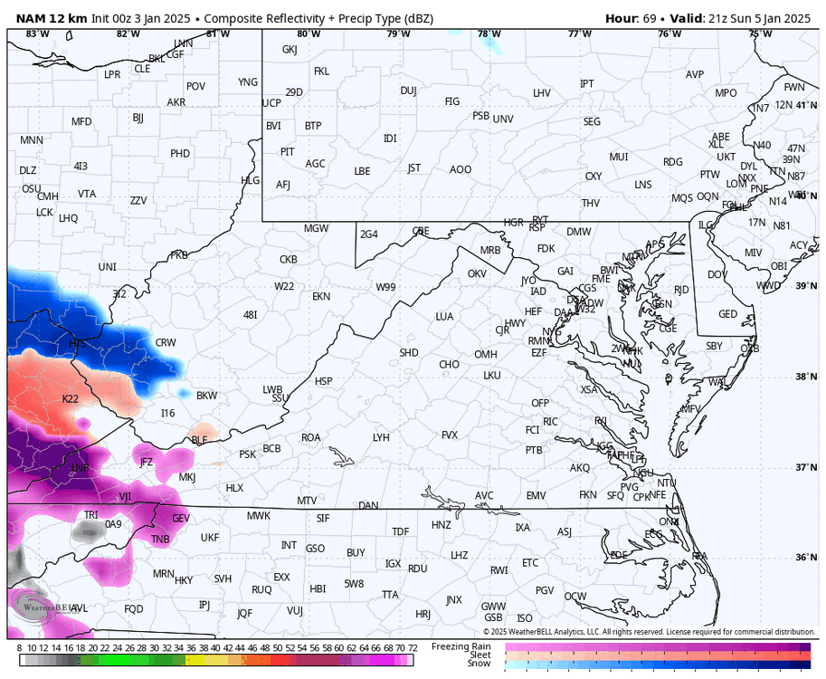
-
Richmond Metro/Hampton Roads Area Discussion
RIC Airport replied to RIC Airport's topic in Mid Atlantic
The 00z NAM was pretty far north with the mixing.


-
Richmond Metro/Hampton Roads Area Discussion
RIC Airport replied to RIC Airport's topic in Mid Atlantic
FWIW, the 00z run of the NBM model seems to follow this theme. It was explained to me that it includes models from previous cycles, which may cause it to lag if the deterministic models are changing drastically.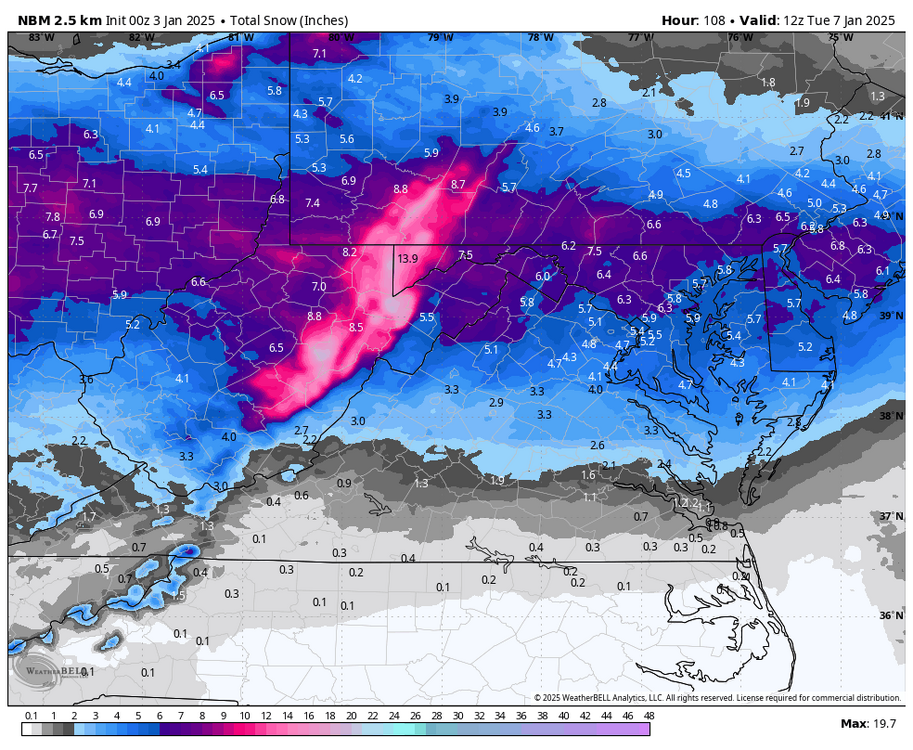
-
Richmond Metro/Hampton Roads Area Discussion
RIC Airport replied to RIC Airport's topic in Mid Atlantic
I don't know why people like camping out in there. All the good mets often have their posts drowned by the nonsense. Not worth it. -
Richmond Metro/Hampton Roads Area Discussion
RIC Airport replied to RIC Airport's topic in Mid Atlantic
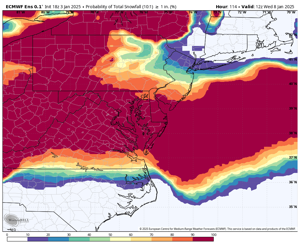
The 18z EPS seems to suggest that an inch is more likely than not across the metro area, especially just north of the city. New NAM is rolling in now. It will be interesting to see what the short-range models do with the mid-level warmth and how far north it gets in the coming runs. There is still time for some fluctuations as @Rhino16alluded to before, the data comes on shore I think tomorrow afternoon so we should be all set with better sampling.
-
Richmond Metro/Hampton Roads Area Discussion
RIC Airport replied to RIC Airport's topic in Mid Atlantic
No, I had to take a step back after seeing the trends. It looks like another NoVa special. It seems like it always happens now. 1/3/2022, 1/16/2024 and now 1/6/2025. I may periodically check, but I am not putting in as much tracking effort on the next threat until we get within 4 to 5 days. The models can't decide whether it's on or off.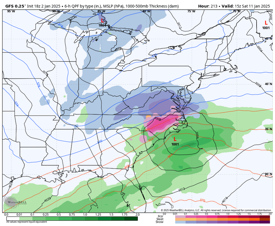
-
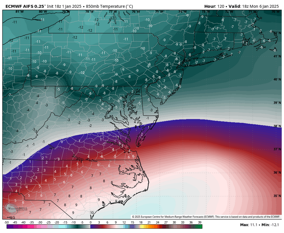
Richmond Metro/Hampton Roads Area Discussion
RIC Airport replied to RIC Airport's topic in Mid Atlantic
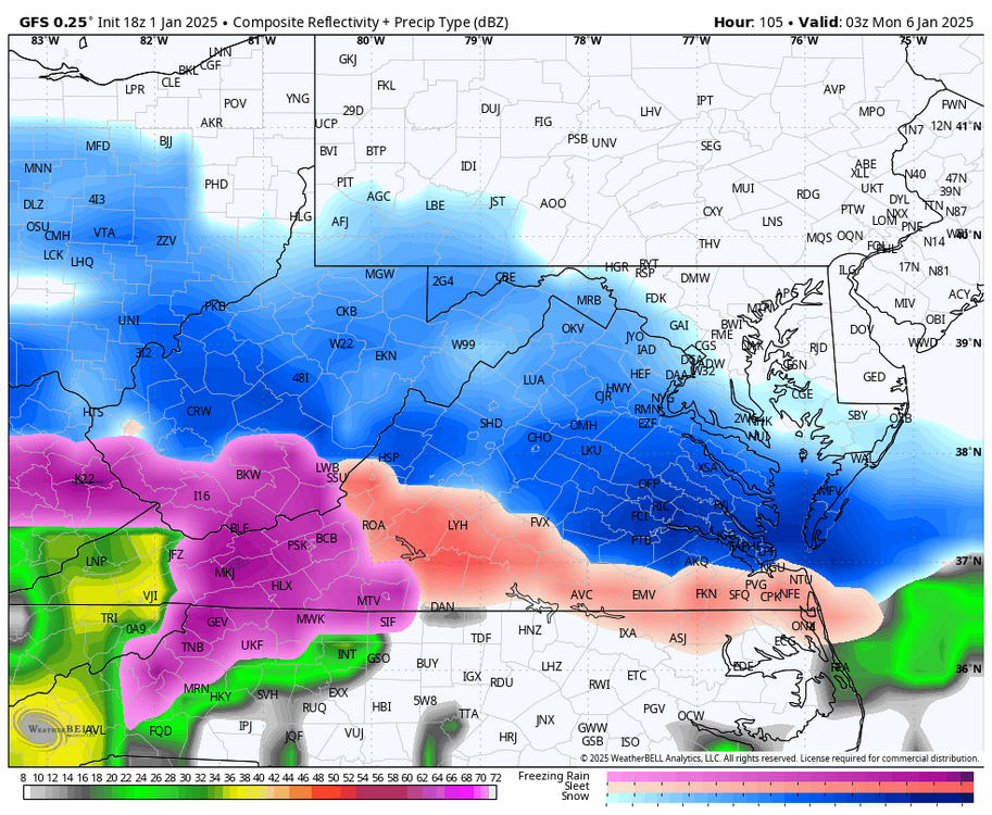
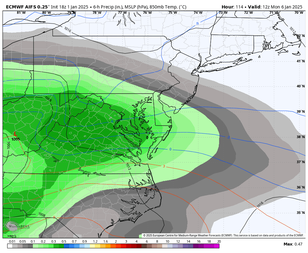
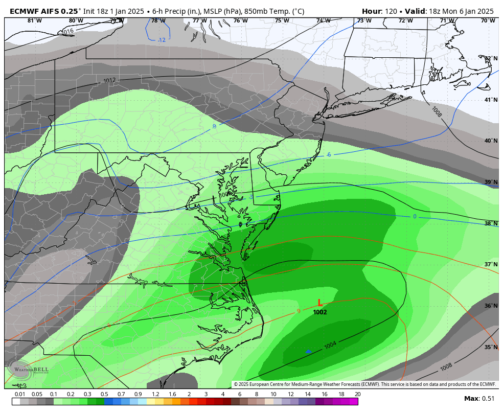
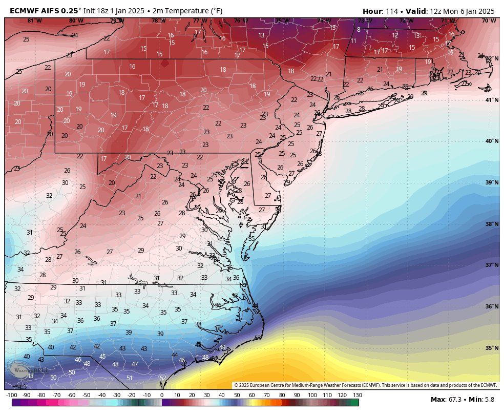
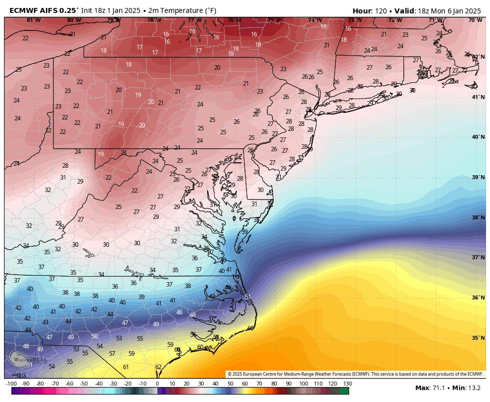
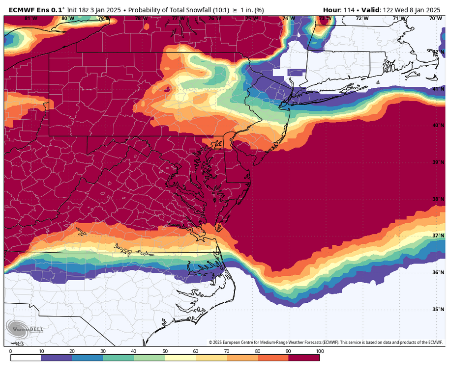
Seems like between hour 114 and 120 is iffy for RIC with the the 0°C line being close by and advancing just north of the city. Surface temps are around freezing, but can't tell whether this run gets RIC above freezing at the surface or not. It's close.

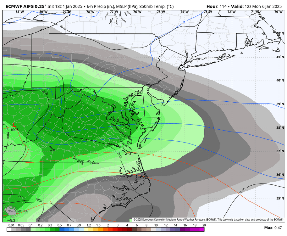


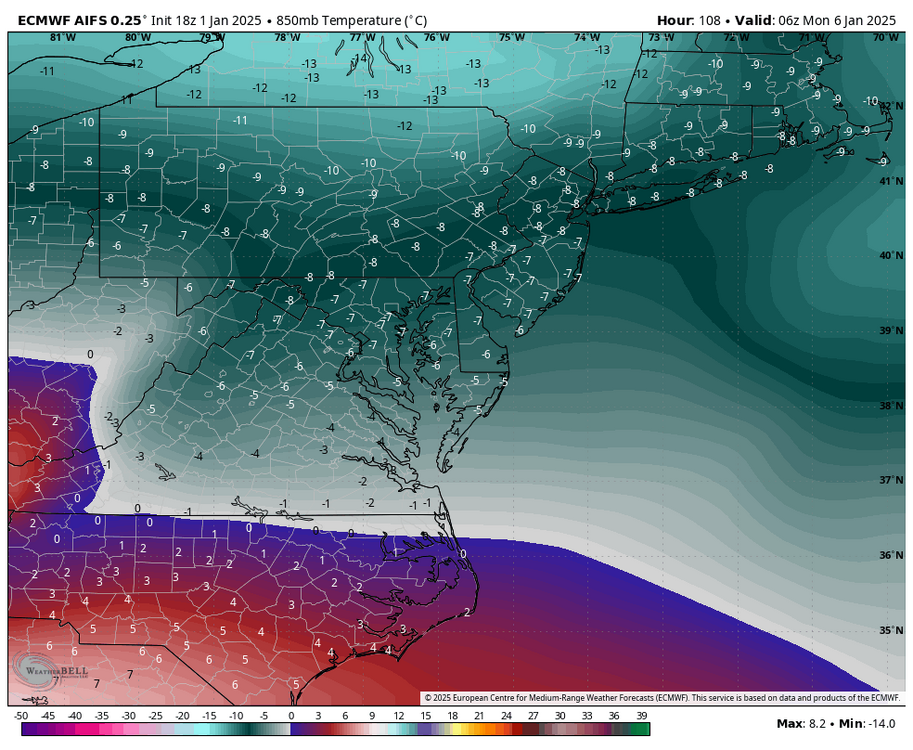
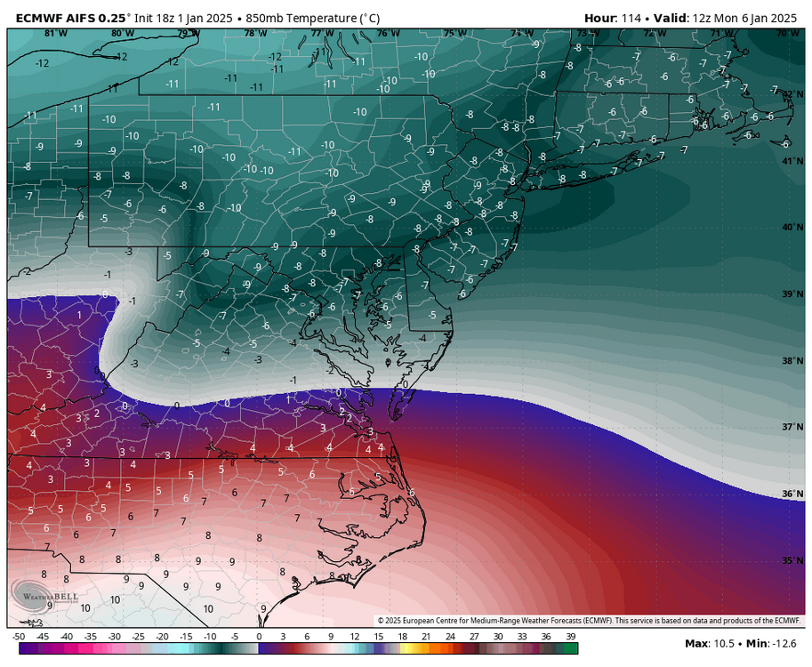


-
Richmond Metro/Hampton Roads Area Discussion
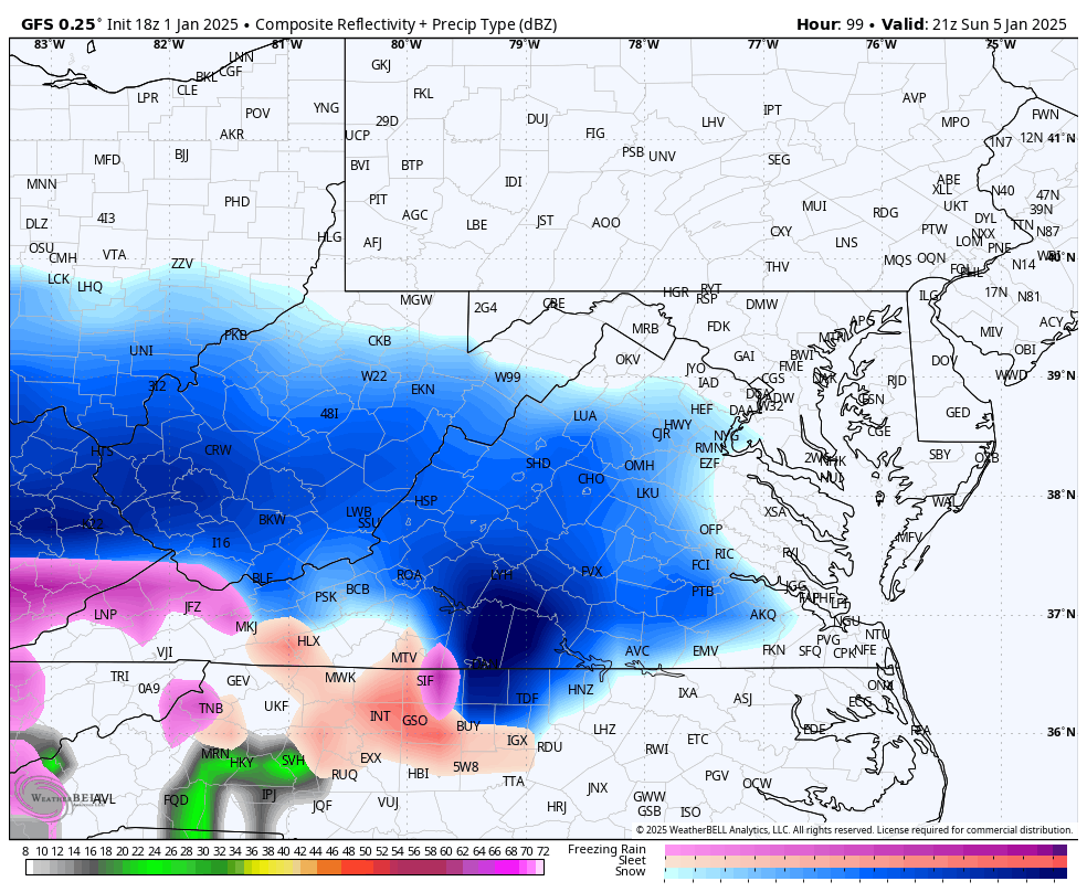
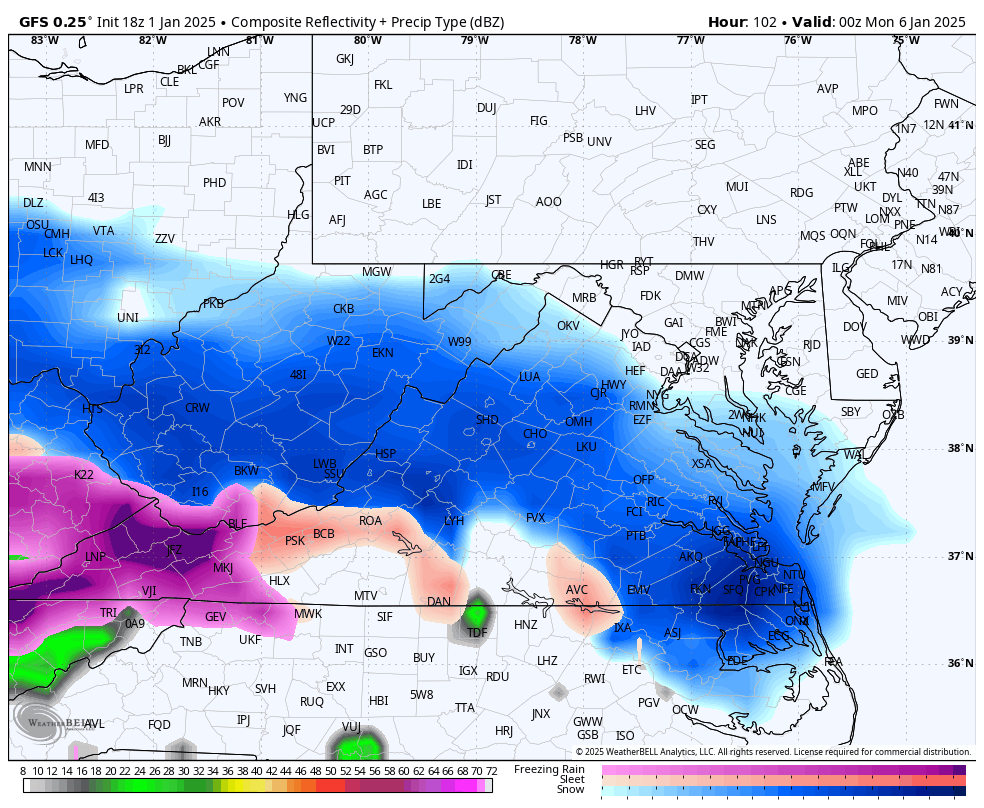
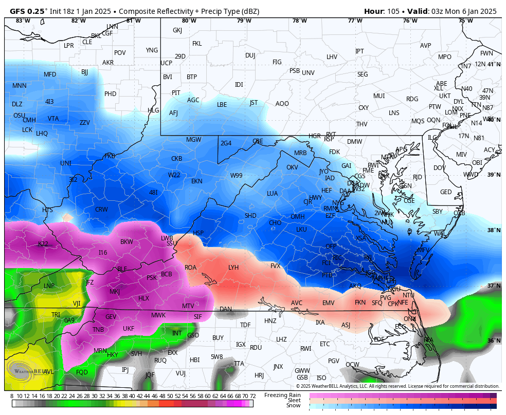
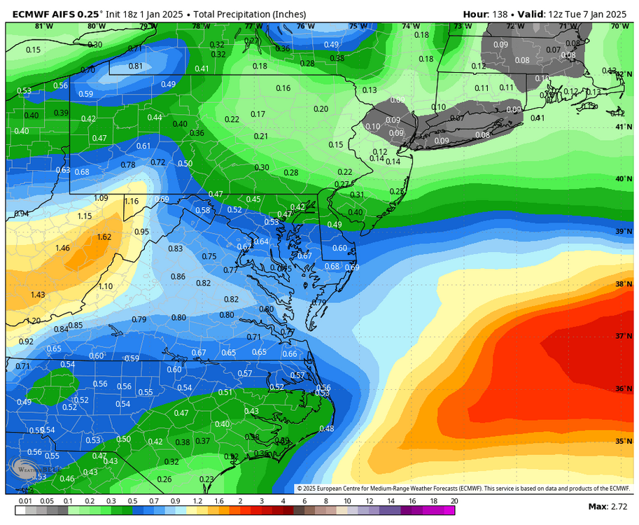
RIC Airport replied to RIC Airport's topic in Mid Atlantic
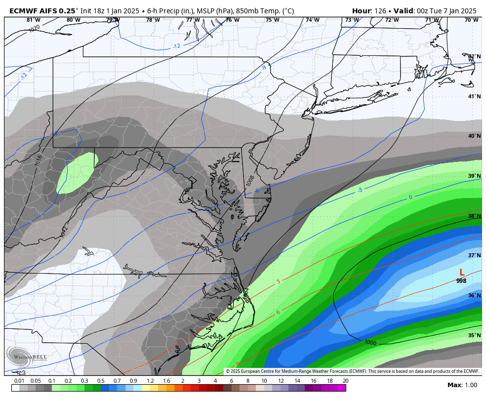
Timing on this run, looks to be mid-late afternoon. 4PM 7PM 10PM 1AM