RIC Airport
-
Posts
2,586 -
Joined
-
Last visited
Content Type
Profiles
Blogs
Forums
American Weather
Media Demo
Store
Gallery
Everything posted by RIC Airport
-
Richmond Metro/Hampton Roads Area Discussion
RIC Airport replied to RIC Airport's topic in Mid Atlantic

-
Richmond Metro/Hampton Roads Area Discussion
RIC Airport replied to RIC Airport's topic in Mid Atlantic
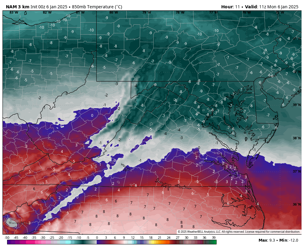
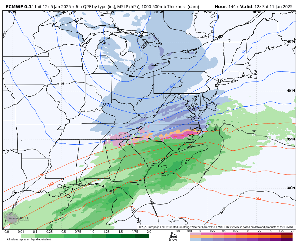
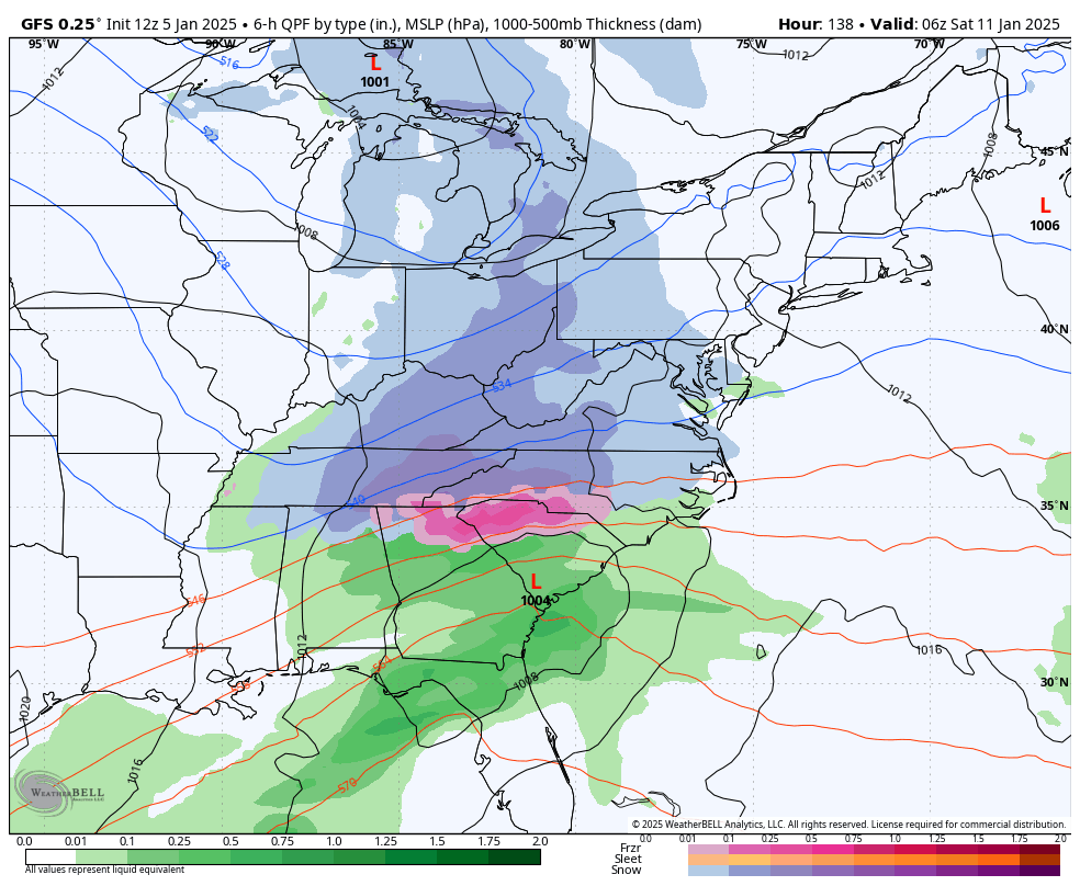
Sorry, I overlooked your first question. I believe the model tries to account for what has already fallen. But it's not precise; it's only an estimate, so it's very possible it could be on the low end for your particular location. There will still be a transition to IP, maybe ZR before there is a period of a lull and rain before the back-end snows arrive late afternoon and evening. All of this is location dependent; the farther north you are, the more likely you remain frozen through and through. -
Richmond Metro/Hampton Roads Area Discussion
RIC Airport replied to RIC Airport's topic in Mid Atlantic
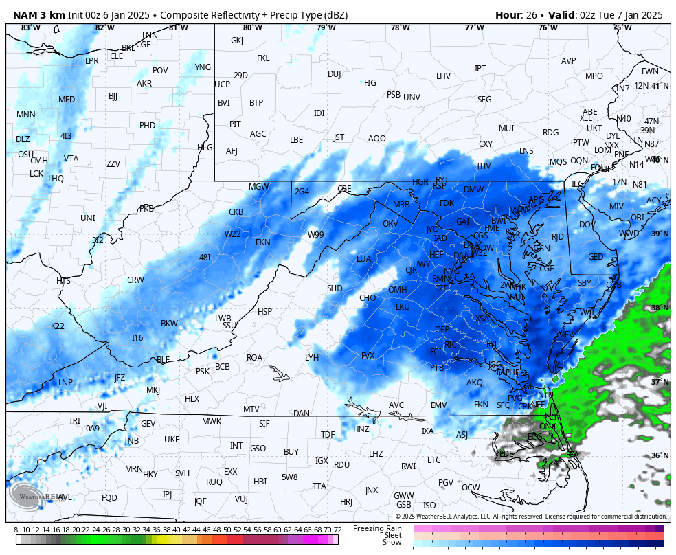
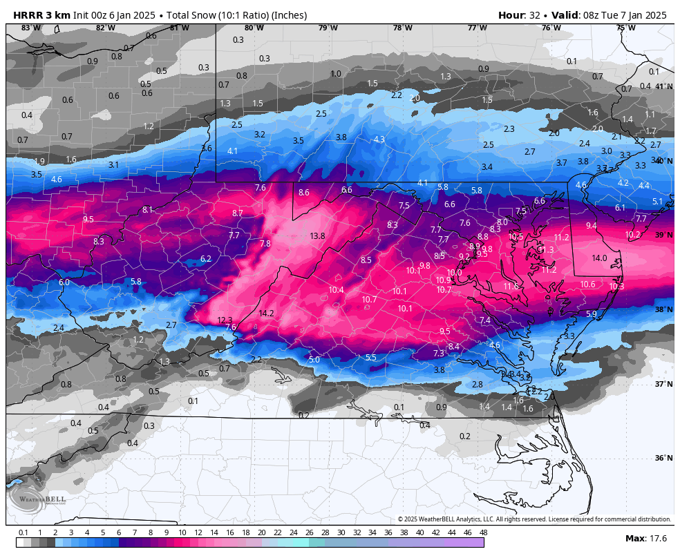
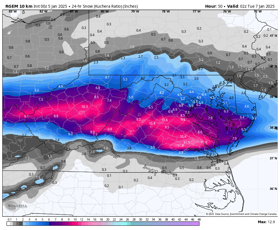
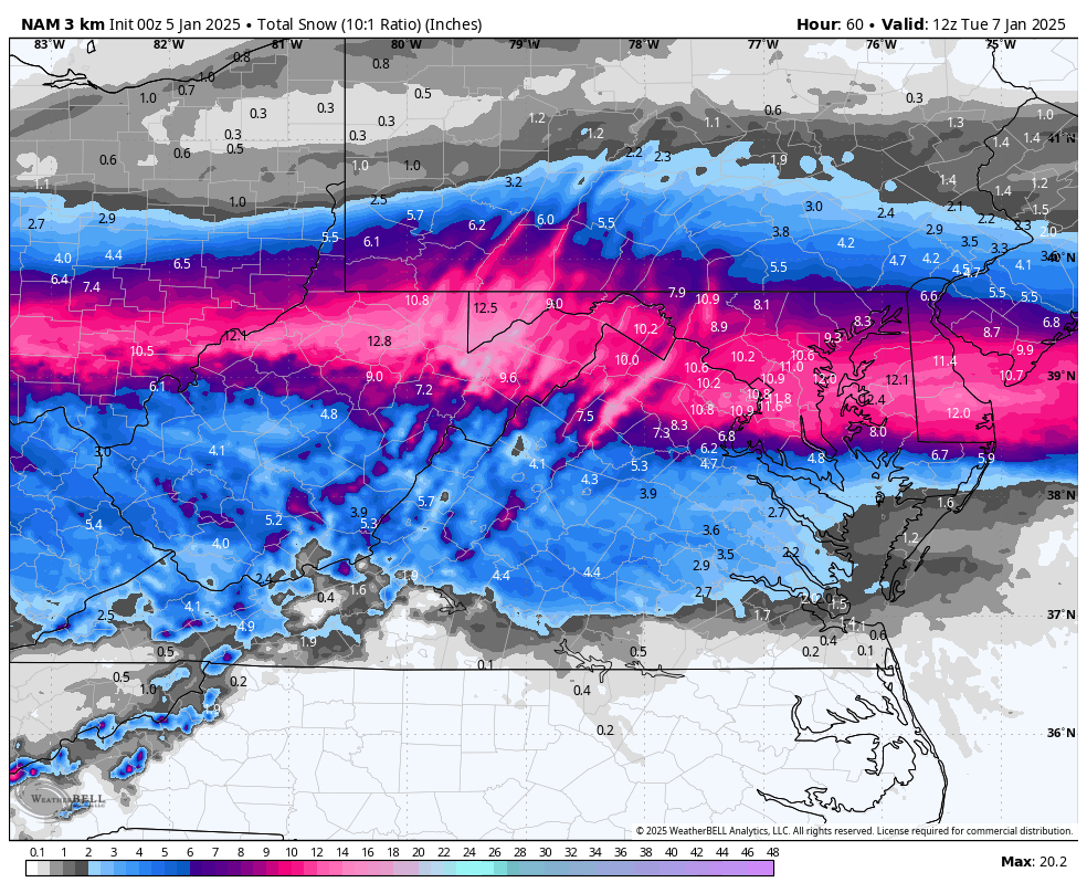
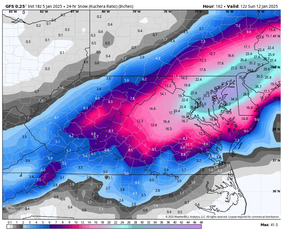
NAM showed the backend very well.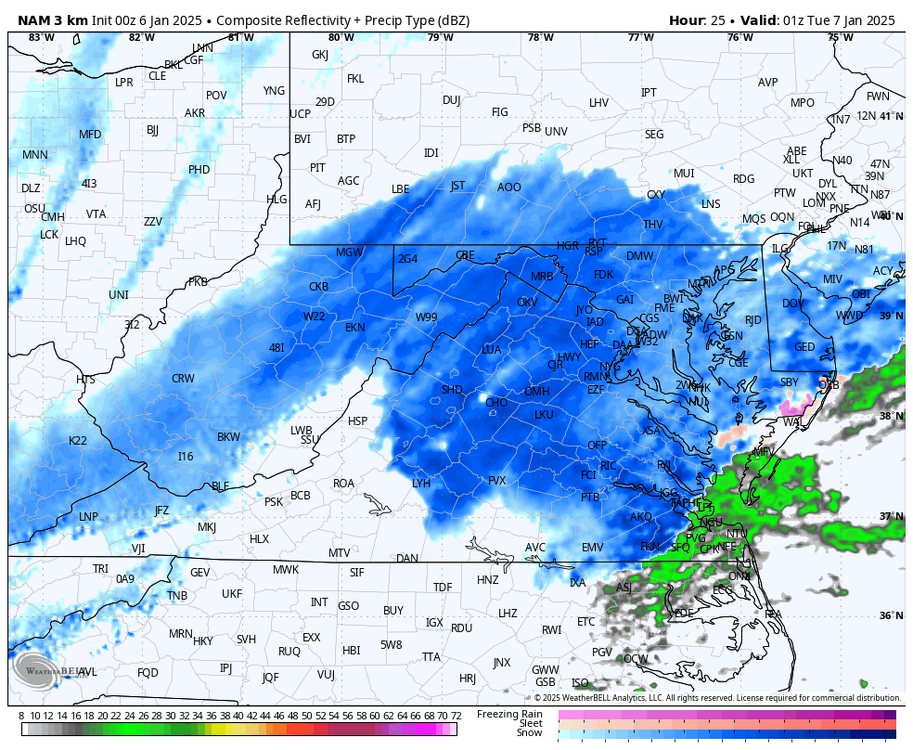

-
Richmond Metro/Hampton Roads Area Discussion
RIC Airport replied to RIC Airport's topic in Mid Atlantic
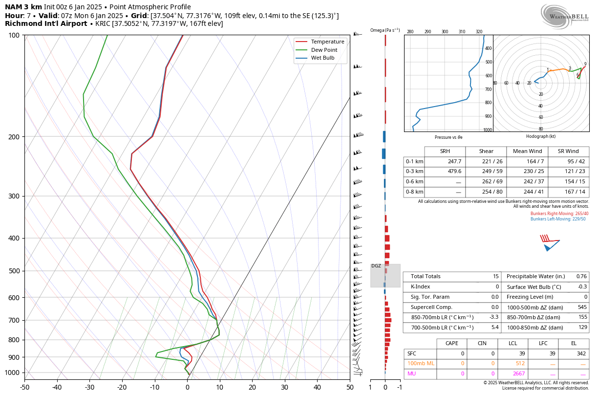
Just checked a sounding, might be in trouble as early as 1am or 2am.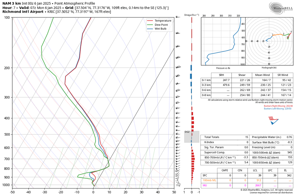
-
Richmond Metro/Hampton Roads Area Discussion
RIC Airport replied to RIC Airport's topic in Mid Atlantic
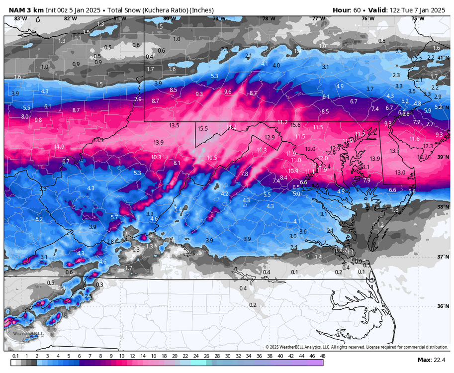
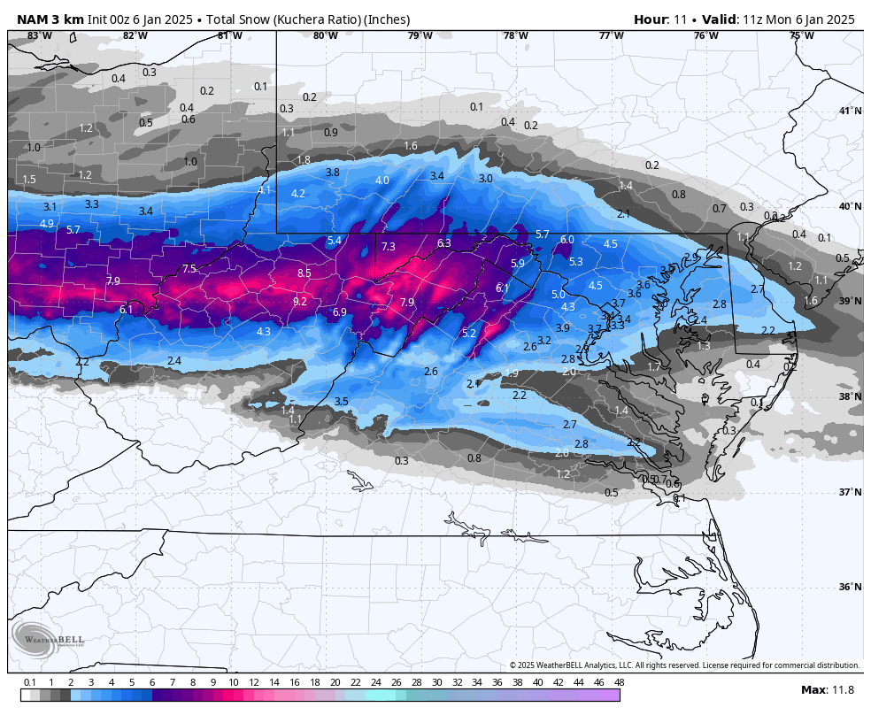
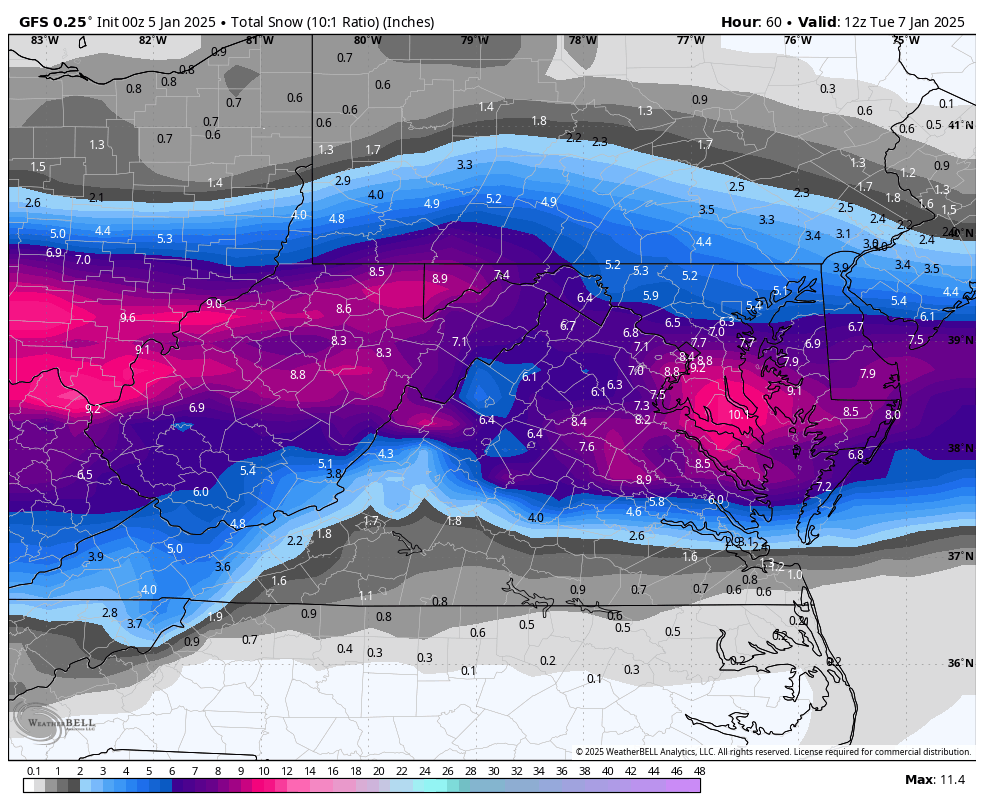
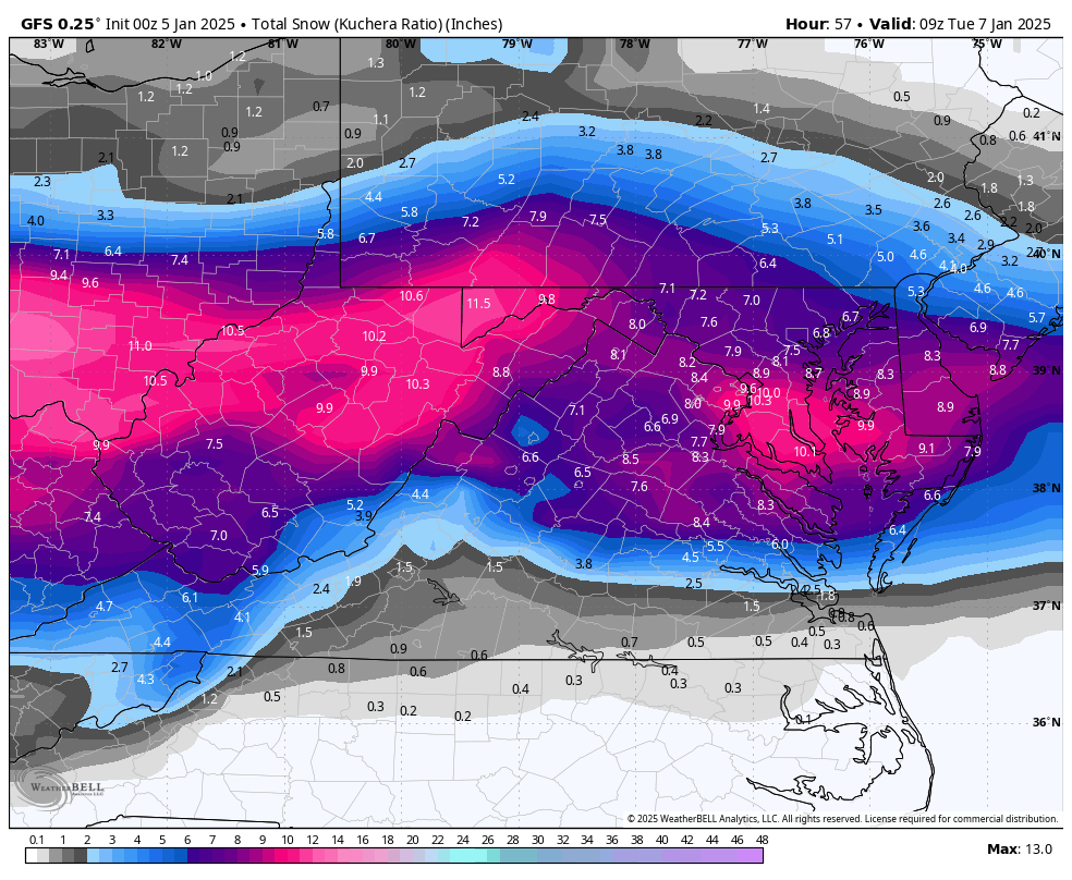
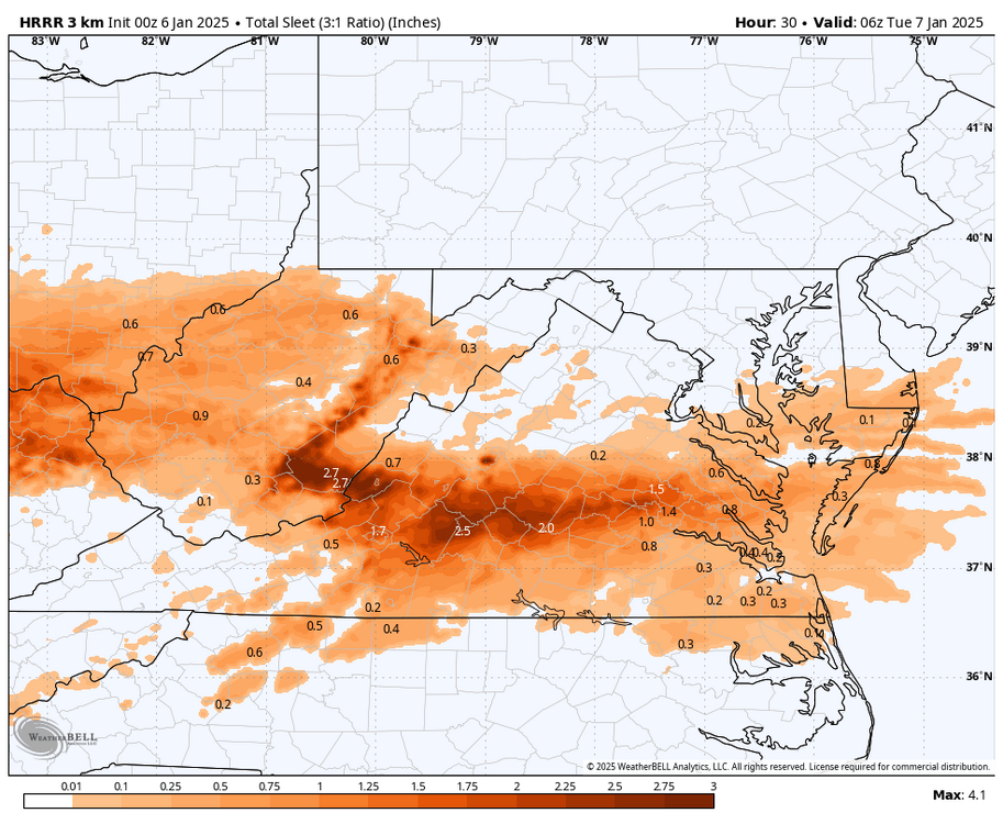
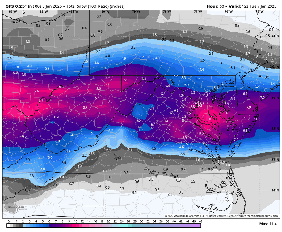
00z 3K NAM has RIC at 2.8" at 6am when 850s start to rise above 0.

-
Richmond Metro/Hampton Roads Area Discussion
RIC Airport replied to RIC Airport's topic in Mid Atlantic

-
Richmond Metro/Hampton Roads Area Discussion
RIC Airport replied to RIC Airport's topic in Mid Atlantic
Agreed, that's what we typically see. A coastal bomb, if it phases far enough south, could still deliver, but more rare. -
Richmond Metro/Hampton Roads Area Discussion
RIC Airport replied to RIC Airport's topic in Mid Atlantic
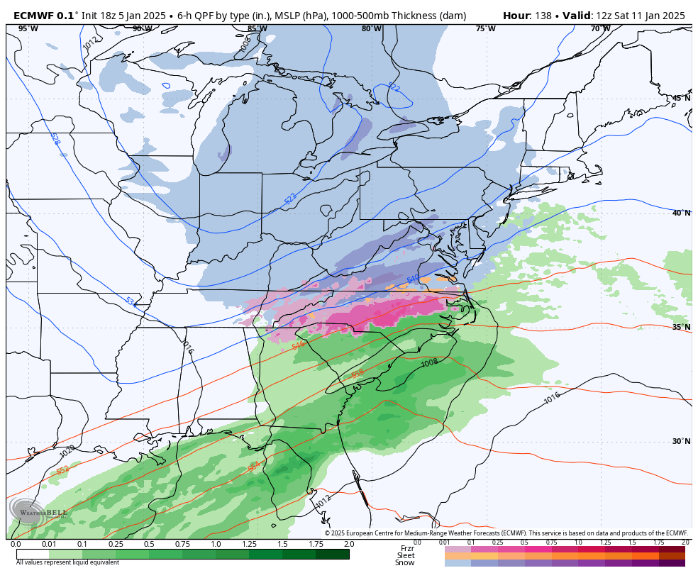
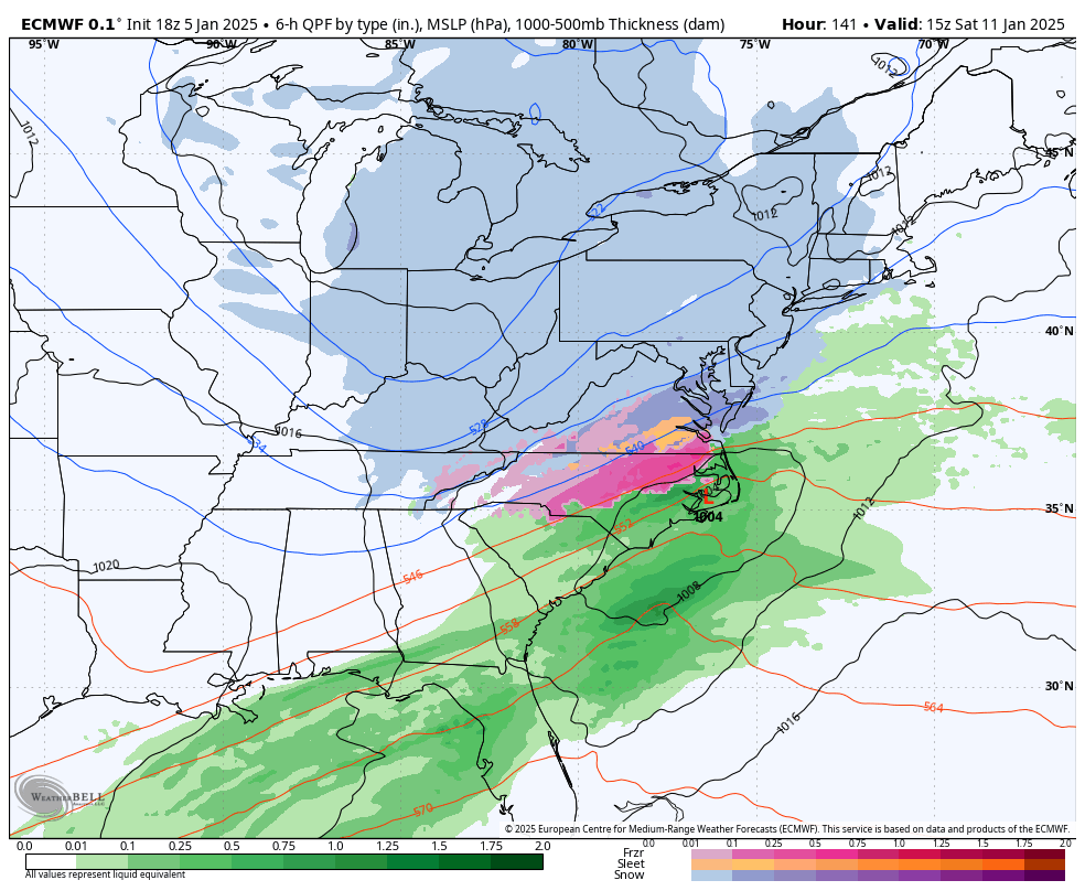
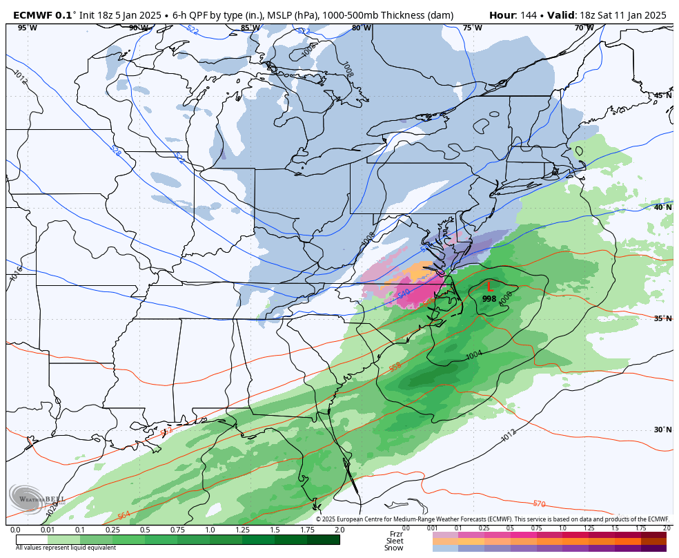
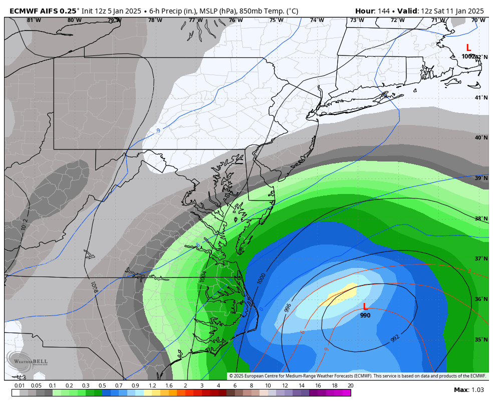
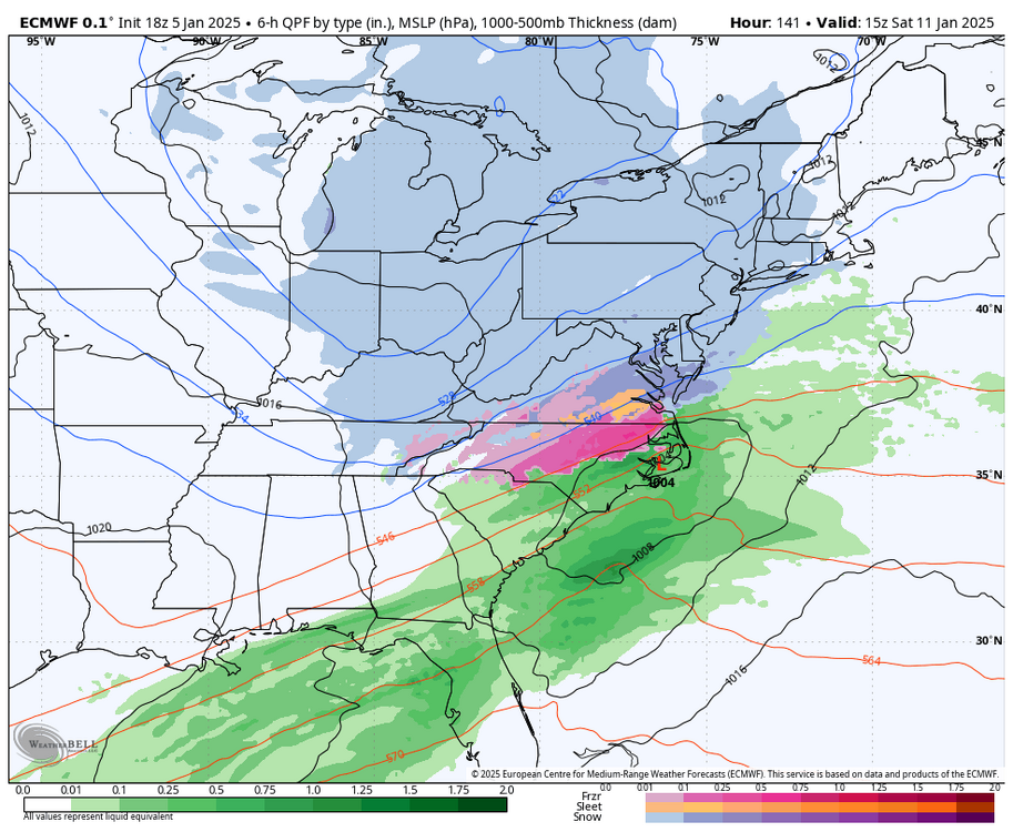
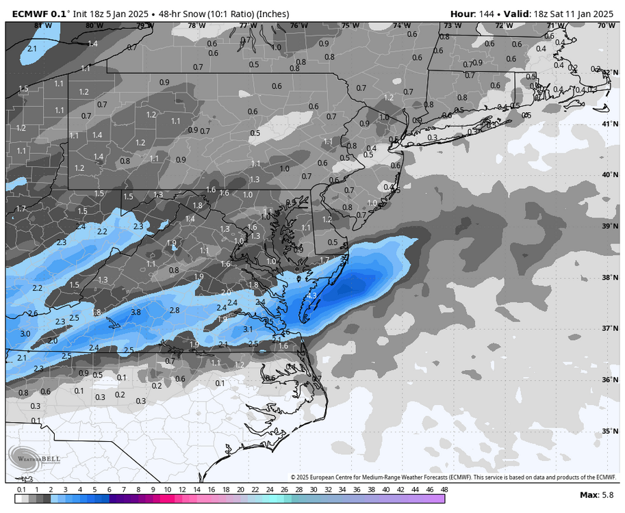
@Conway730518z Euro for this weekend. Only goes out to hour 144, so the storm is still going here, not final snow amounts. But, still encouraging to see this threat.

-
Richmond Metro/Hampton Roads Area Discussion
RIC Airport replied to RIC Airport's topic in Mid Atlantic
Dews rising rapidly, it's coming. Btw, RIC reached 15°F, no model it it getting that cold.
-
Richmond Metro/Hampton Roads Area Discussion
RIC Airport replied to RIC Airport's topic in Mid Atlantic
It's hard to separate the current event from next weekend, but I tried to slow this down this period and you can see the hits. Seems to me, the ENS are south of the op.
-
Richmond Metro/Hampton Roads Area Discussion
RIC Airport replied to RIC Airport's topic in Mid Atlantic
Yes, I will. They are still running, not quit through next weekend yet, maybe another 10 minutes. 12z Euro AI was south.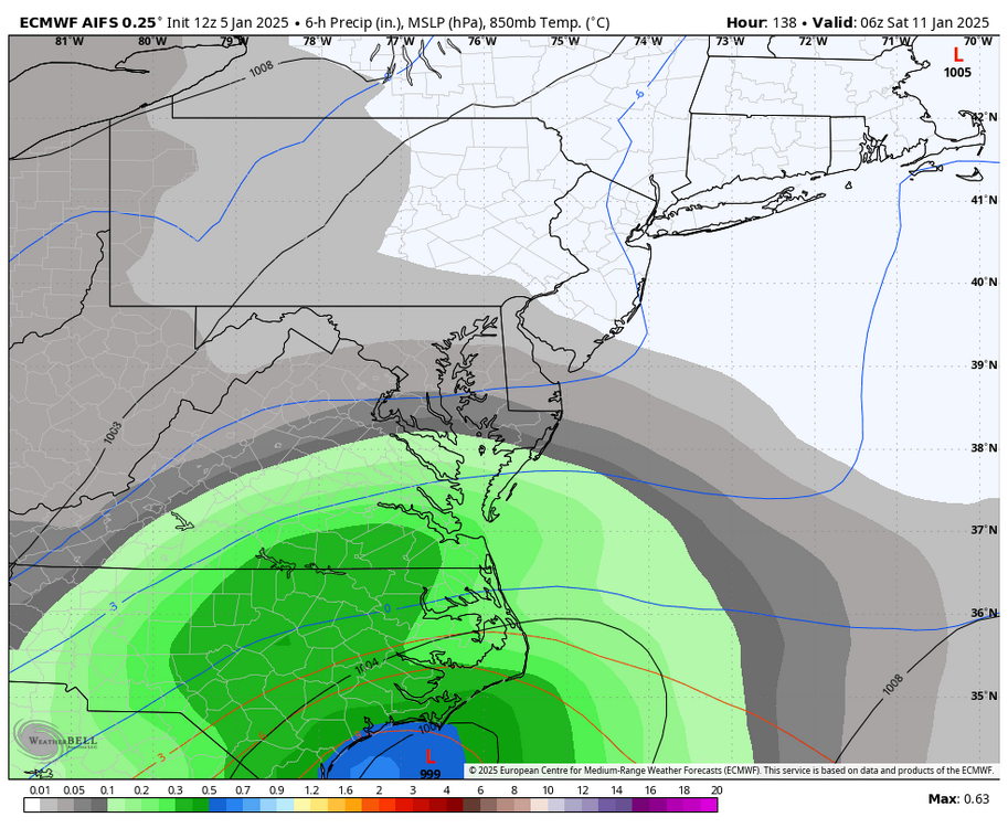

-
Richmond Metro/Hampton Roads Area Discussion
RIC Airport replied to RIC Airport's topic in Mid Atlantic
Right, next weekend is still on the table.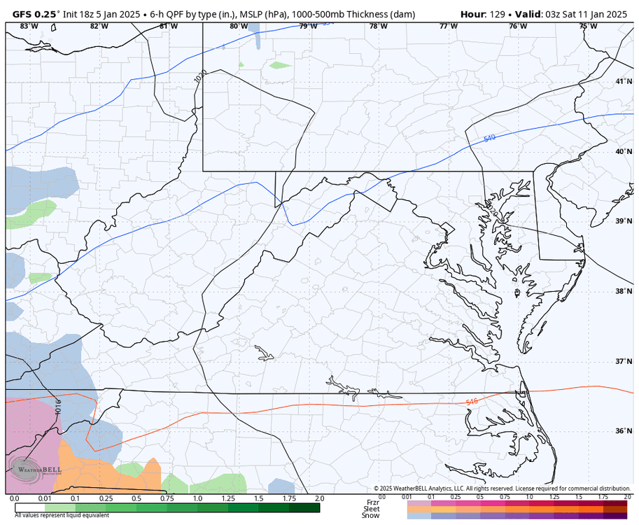

-
Richmond Metro/Hampton Roads Area Discussion
RIC Airport replied to RIC Airport's topic in Mid Atlantic
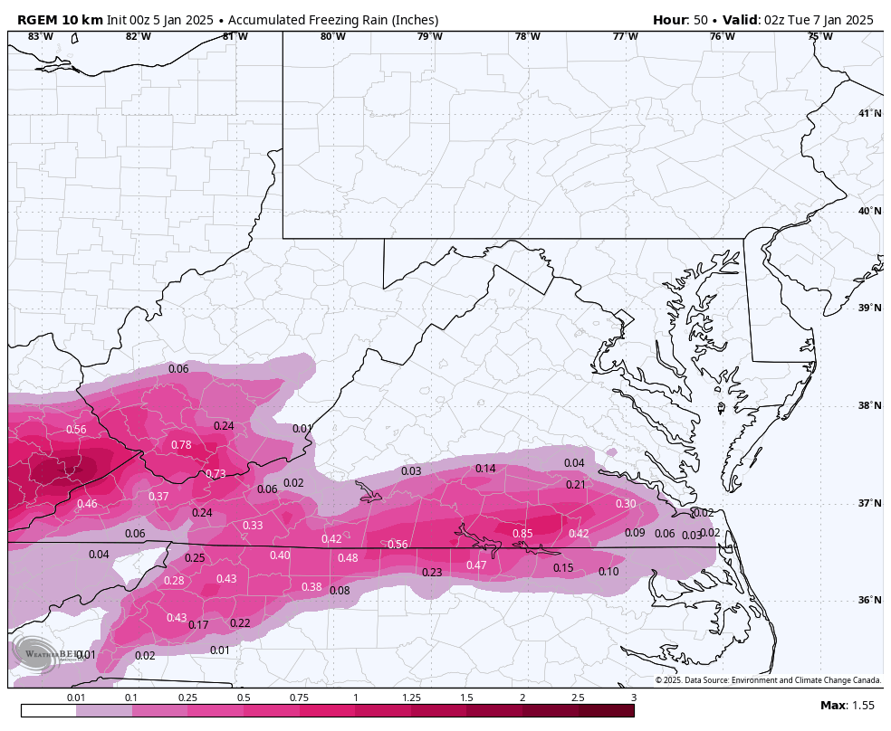
Dewpoints are in the low single digits. Any precip will cause temperatures to fall below freezing quickly with evaporative cooling. I'm just pointing out that sleet is pretty far east and practically on our doorstep this early, essentially right at the onset, is not a good sign. We want a solid 6-8+ hours of snowfall before any sleet arrives if we want to maximize accumulations. It's early, but obviously sleet doesn't take up as much room as snow, so it won't accumulate as much. -
Richmond Metro/Hampton Roads Area Discussion
RIC Airport replied to RIC Airport's topic in Mid Atlantic
Sleet is already being reported in Amelia and SW Chesterfield. Not a good sign. -
Richmond Metro/Hampton Roads Area Discussion
RIC Airport replied to RIC Airport's topic in Mid Atlantic
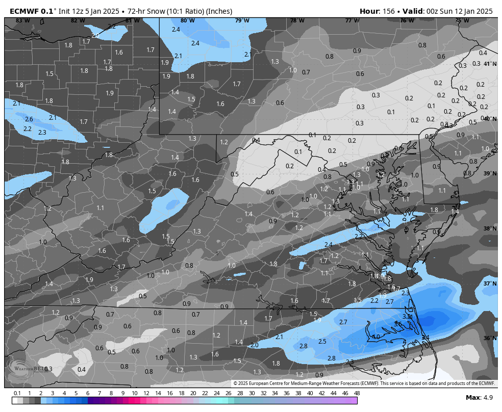
AKQ made some slight adjustments to the numbers, just clarifying the higher amounts north of I-64. If anything snow cover makes it through tomorrow, where there is about a 6 hour window when the surface temps could be above freezing, it'll stick around for a bit.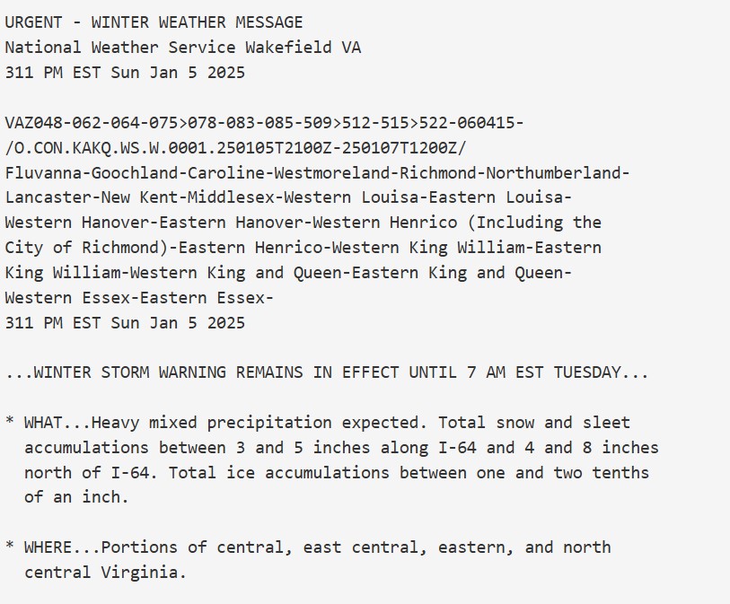
-
Richmond Metro/Hampton Roads Area Discussion
RIC Airport replied to RIC Airport's topic in Mid Atlantic
Hopefully it's a sign for possibly maximizing the front end thump. -
Richmond Metro/Hampton Roads Area Discussion
RIC Airport replied to RIC Airport's topic in Mid Atlantic
Good luck, think of us down here, share a few pics. -
Richmond Metro/Hampton Roads Area Discussion
RIC Airport replied to RIC Airport's topic in Mid Atlantic
Euro still has the weekend storm. Hopefully we can adjust some things at 500mb to produce a better outcome. Plenty of time.

-
Richmond Metro/Hampton Roads Area Discussion
RIC Airport replied to RIC Airport's topic in Mid Atlantic
I like where we stand here.

-
Richmond Metro/Hampton Roads Area Discussion
RIC Airport replied to RIC Airport's topic in Mid Atlantic
Time to look ahead to next weekend.
-
Richmond Metro/Hampton Roads Area Discussion
RIC Airport replied to RIC Airport's topic in Mid Atlantic

-
Richmond Metro/Hampton Roads Area Discussion
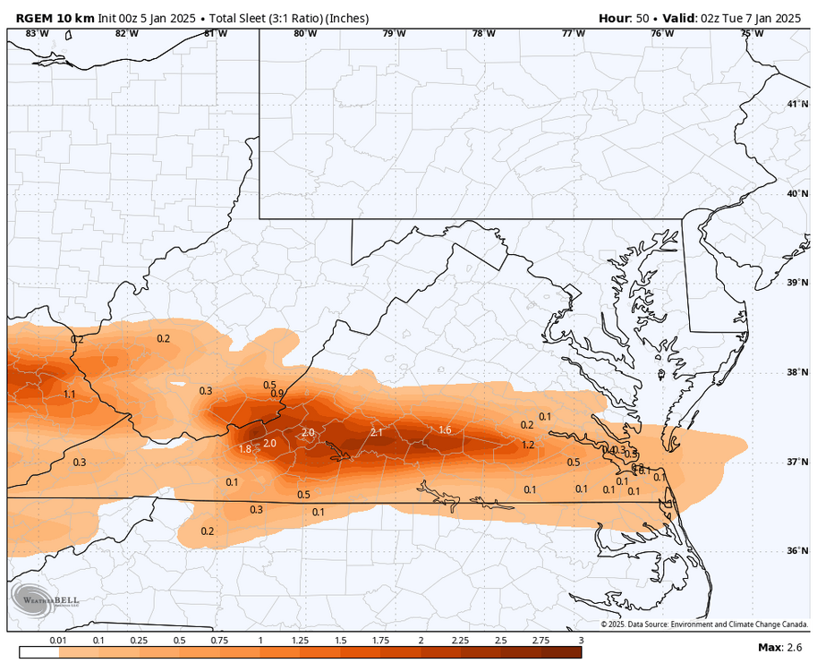
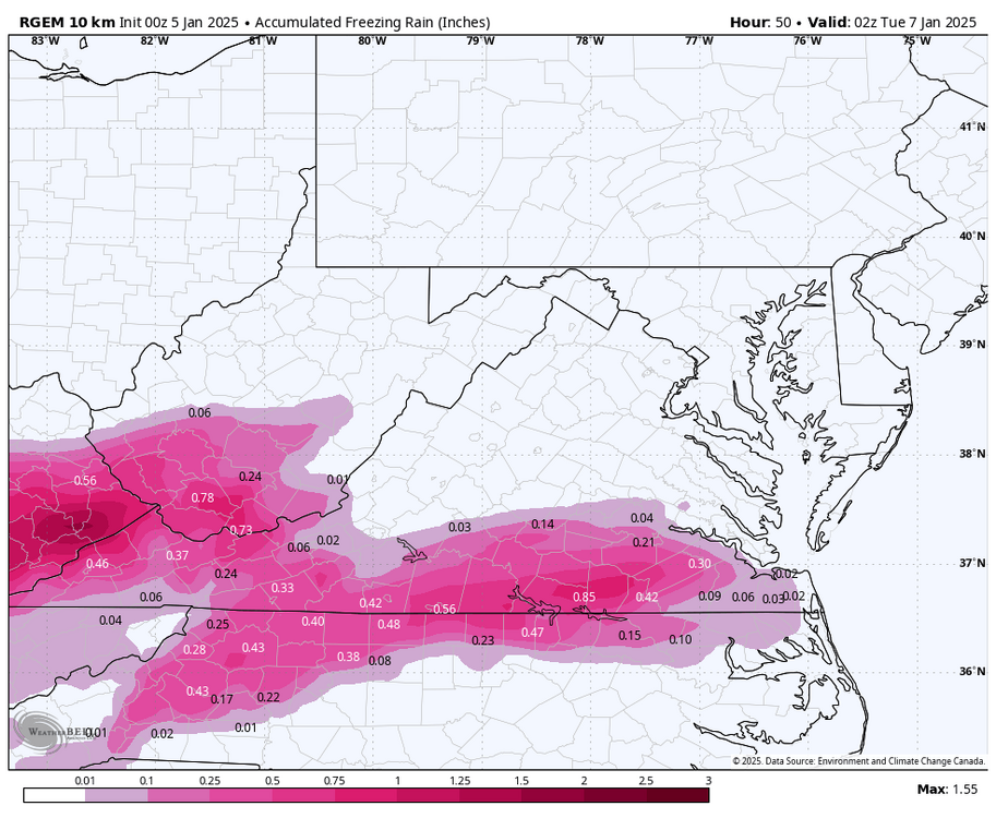
RIC Airport replied to RIC Airport's topic in Mid Atlantic
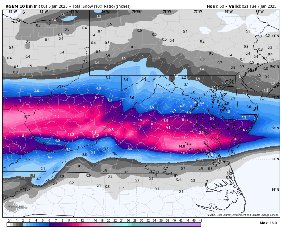
We DO have the RGEM.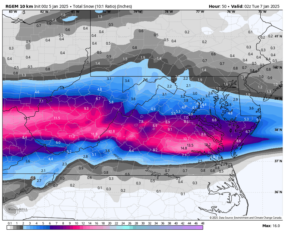

-
Richmond Metro/Hampton Roads Area Discussion
RIC Airport replied to RIC Airport's topic in Mid Atlantic
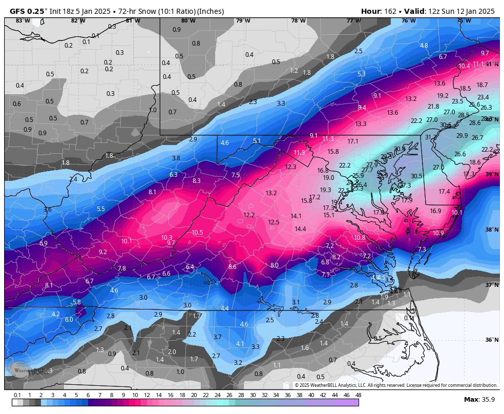
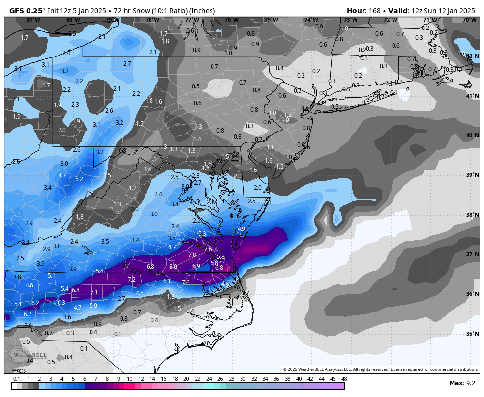
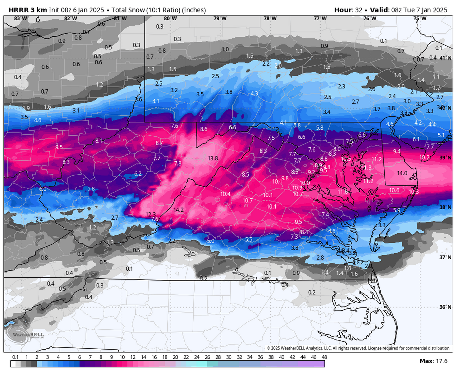
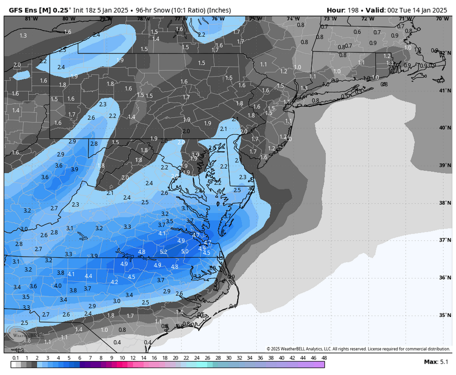
Meanwhile DCA is looking at an 8-12" event, while we are southern fringed. Happened on 1/3/2022, 1/16/2024.....1/6/2025?? -
Richmond Metro/Hampton Roads Area Discussion
RIC Airport replied to RIC Airport's topic in Mid Atlantic
I like your optimism, but I'm just reading the room. Every model has the axis of snow well north of us. Every model has us flipping to IP/ZR and rain for a short while. So we get possibly 1-2" of snow, followed by slop that turns into slush, and then we'll be begging for the back end snow to fall in the right places to provide another 1-2"? -
Richmond Metro/Hampton Roads Area Discussion
RIC Airport replied to RIC Airport's topic in Mid Atlantic
Been a while since we've been screwed this bad.