RIC Airport
-
Posts
2,586 -
Joined
-
Last visited
Content Type
Profiles
Blogs
Forums
American Weather
Media Demo
Store
Gallery
Everything posted by RIC Airport
-
Richmond Metro/Hampton Roads Area Discussion
RIC Airport replied to RIC Airport's topic in Mid Atlantic
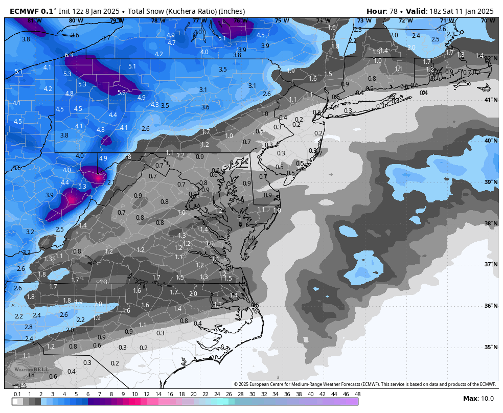
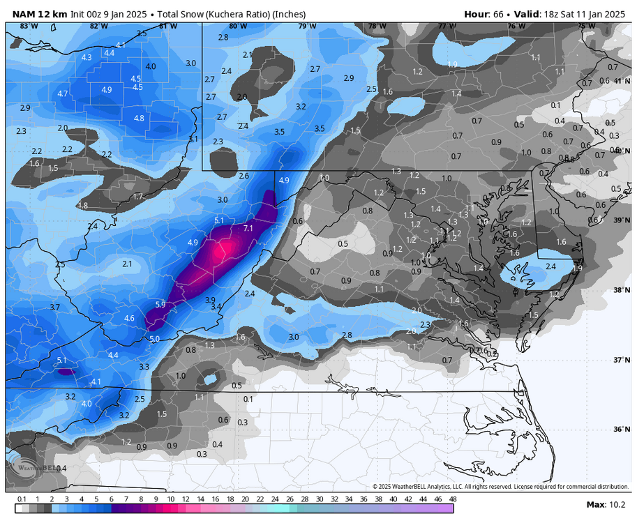
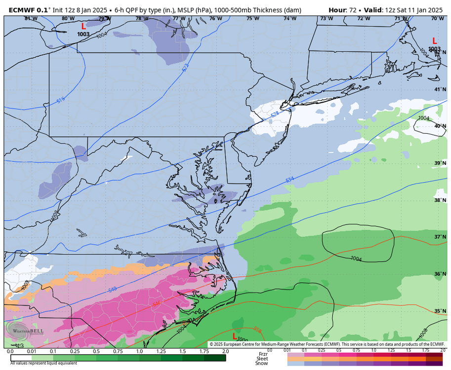
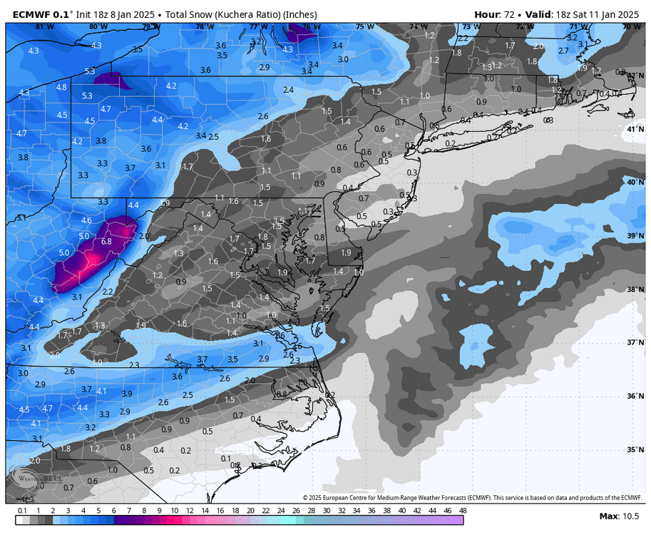
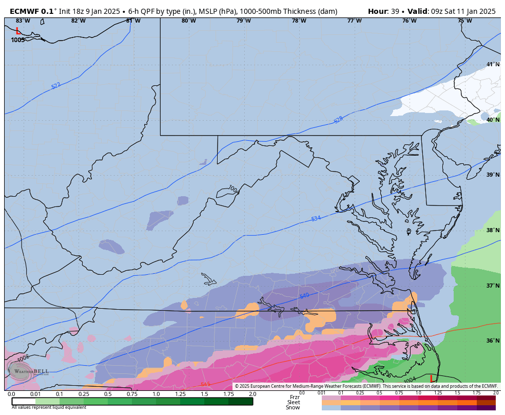
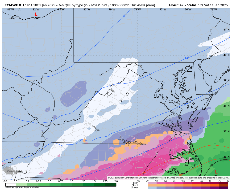
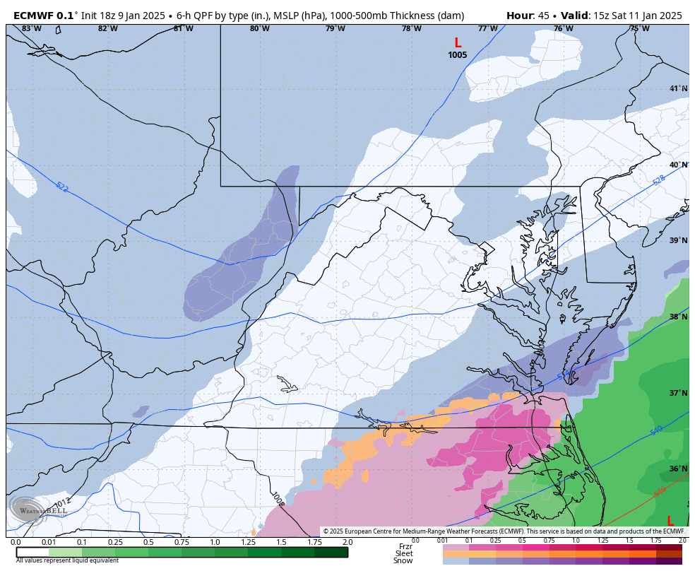
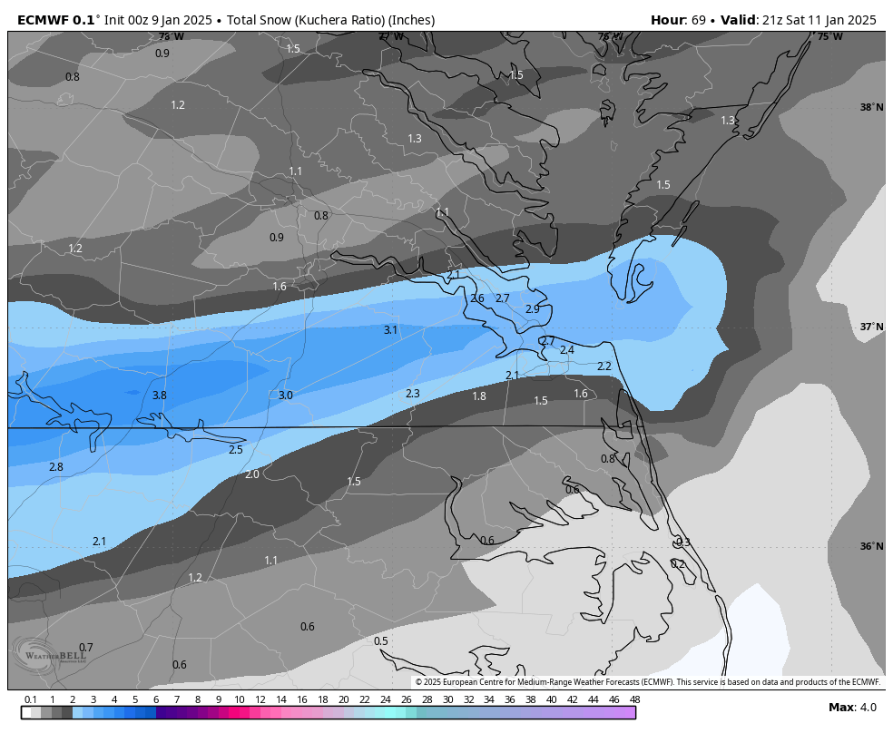
This storm reminds me of 12/9/2018, in a way. As the system moved from west to east, the models underestimated the expected precipitation (QPF) as it approached I-95 and points between Richmond and Williamsburg. This led to an inaccurate forecast since the actual numbers around Richmond were much higher than predicted when the moisture came in. For now, I believe a forecast of 2" to 4" is a reasonable and conservative estimate. However, I remain open to adjustments based on radar trends in the next 24 hours and how the moisture moves into our region. I don't think 5-6" in a few lucky spots is unreasonable. -
Richmond Metro/Hampton Roads Area Discussion
RIC Airport replied to RIC Airport's topic in Mid Atlantic


-
Richmond Metro/Hampton Roads Area Discussion
RIC Airport replied to RIC Airport's topic in Mid Atlantic
I have to step away soon and won't be timely on posting maps from todays 18z suite. Have quite a few errands to make. -
Richmond Metro/Hampton Roads Area Discussion
RIC Airport replied to RIC Airport's topic in Mid Atlantic
-
Richmond Metro/Hampton Roads Area Discussion
RIC Airport replied to RIC Airport's topic in Mid Atlantic
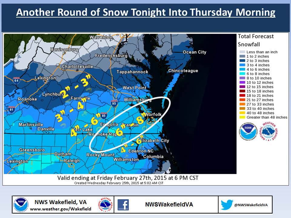
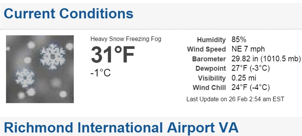
The timing of this event reminds me of the 2/26/2015 storm. It was an overnight event starting around midnight or so and quickly became heavy snow for a few hours. RIC finished with 5 inches and it was all done around sunrise. A few images I saved from that event. February 2015 overall was a really go month, a ton of cold and good snows.
.gif.08f908478458a9686a6c25286e1fda7e.gif)
-
Richmond Metro/Hampton Roads Area Discussion
RIC Airport replied to RIC Airport's topic in Mid Atlantic
Yes, I did. Sorry I couldn't PBP, I had to step away. Hopefully this thing overperforms for our area. -
Richmond Metro/Hampton Roads Area Discussion
RIC Airport replied to RIC Airport's topic in Mid Atlantic
Yup, this month may end up being the coldest January since at least 2014, possibly the 1980s if this keeps up. And two measurable events within seven days quite a treat for us. Btw, saw this WTKR map moments ago. You may be right, I only follow it for certain events of interest. Not sure how it does with storms.
-
Richmond Metro/Hampton Roads Area Discussion
RIC Airport replied to RIC Airport's topic in Mid Atlantic
I agree. It usually does well. The problem is that we don't have access to it. Only the TV stations. But some Mets, like Mike Thomas (Fox 5 DC), post it a lot, so I try to look for his posts when I can. -
Richmond Metro/Hampton Roads Area Discussion
RIC Airport replied to RIC Airport's topic in Mid Atlantic
Here is our local map.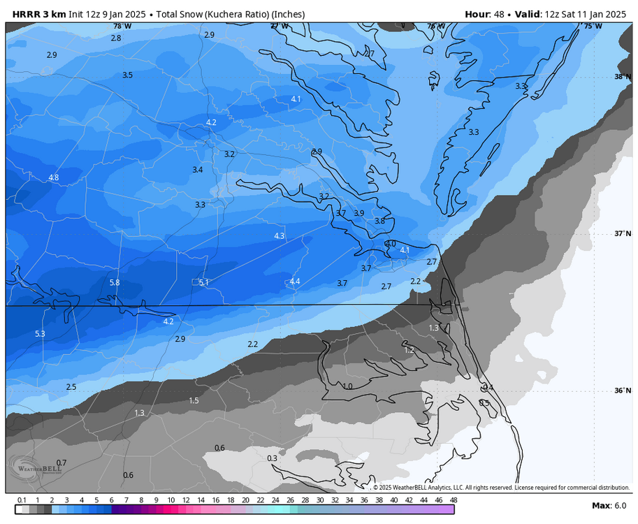
-
Richmond Metro/Hampton Roads Area Discussion
RIC Airport replied to RIC Airport's topic in Mid Atlantic
URGENT - WINTER WEATHER MESSAGE National Weather Service Wakefield VA 327 AM EST Thu Jan 9 2025 VAZ060-065>068-079>083-085-513>516-518-520-091630- /O.NEW.KAKQ.WS.A.0002.250111T0000Z-250111T1800Z/ Prince Edward-Mecklenburg-Lunenburg-Nottoway-Amelia-Brunswick- Dinwiddie-Prince George-Charles City-New Kent-Middlesex-Western Chesterfield-Eastern Chesterfield (Including Col. Heights)- Western Henrico (Including the City of Richmond)-Eastern Henrico- Eastern King William-Eastern King and Queen- 327 AM EST Thu Jan 9 2025 ...WINTER STORM WATCH IN EFFECT FROM FRIDAY EVENING THROUGH SATURDAY AFTERNOON... * WHAT...Snow and mixed precipitation possible. Total snow accumulations between 2 and 4 inches with locally higher amounts and ice accumulations of a light glaze possible. * WHERE...Portions of central, east central, eastern, and south central Virginia. * WHEN...From Friday evening through Saturday afternoon. * IMPACTS...Plan on slippery road conditions. PRECAUTIONARY/PREPAREDNESS ACTIONS... Monitor the latest forecasts for updates on this situation.png.83385a477b92801b5859a821af260e75.png)
-
Richmond Metro/Hampton Roads Area Discussion
RIC Airport replied to RIC Airport's topic in Mid Atlantic

-
Richmond Metro/Hampton Roads Area Discussion
RIC Airport replied to RIC Airport's topic in Mid Atlantic
The 00z GEFS was the best since the 6z run.
-
Richmond Metro/Hampton Roads Area Discussion
RIC Airport replied to RIC Airport's topic in Mid Atlantic
Hope you can break your 1" drought. But will have to be up early Saturday. -
Richmond Metro/Hampton Roads Area Discussion
RIC Airport replied to RIC Airport's topic in Mid Atlantic
Canadian, fwiw
-
Richmond Metro/Hampton Roads Area Discussion
RIC Airport replied to RIC Airport's topic in Mid Atlantic
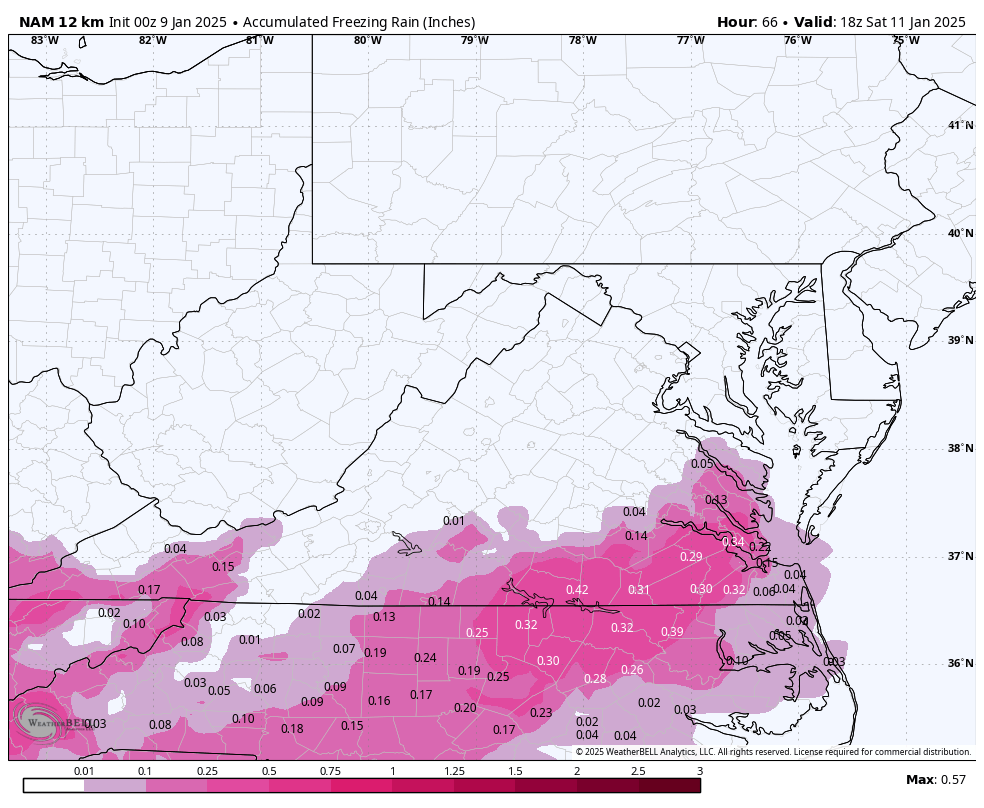
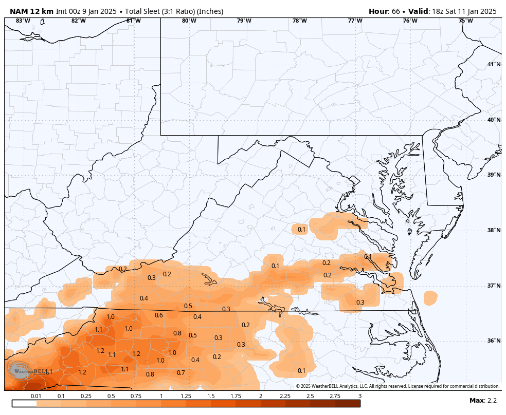
0.56" at RIC during this run, with surface temps of 30-31 during the event. Soundings suggest it tries to get sleety at the end, but by then, the precip is basically over, so it won't matter.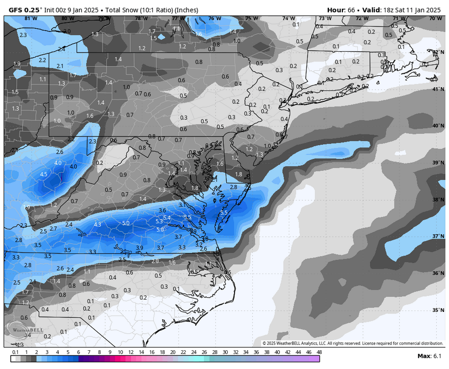
-
Richmond Metro/Hampton Roads Area Discussion
RIC Airport replied to RIC Airport's topic in Mid Atlantic

-
Richmond Metro/Hampton Roads Area Discussion
RIC Airport replied to RIC Airport's topic in Mid Atlantic
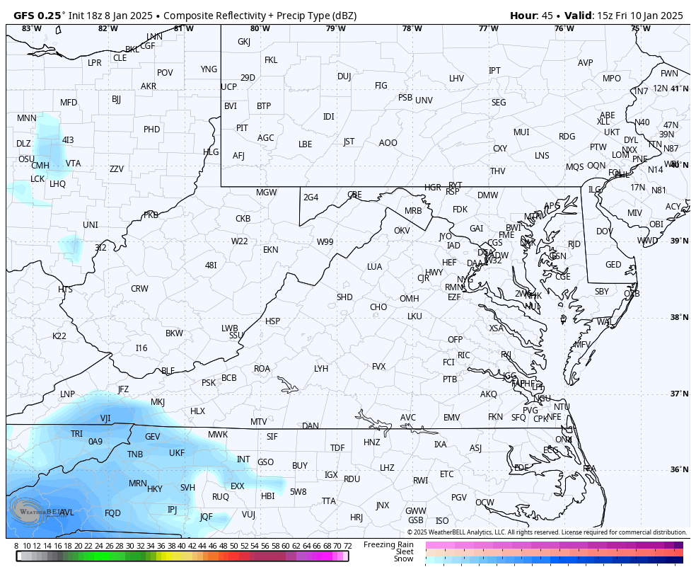
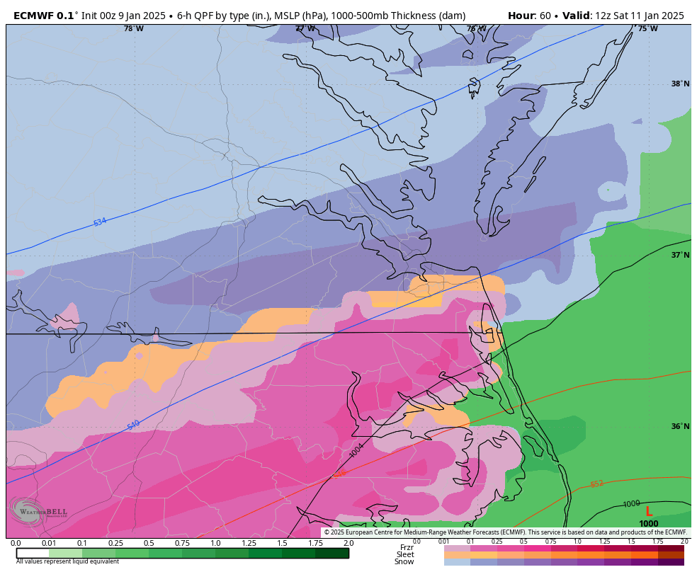
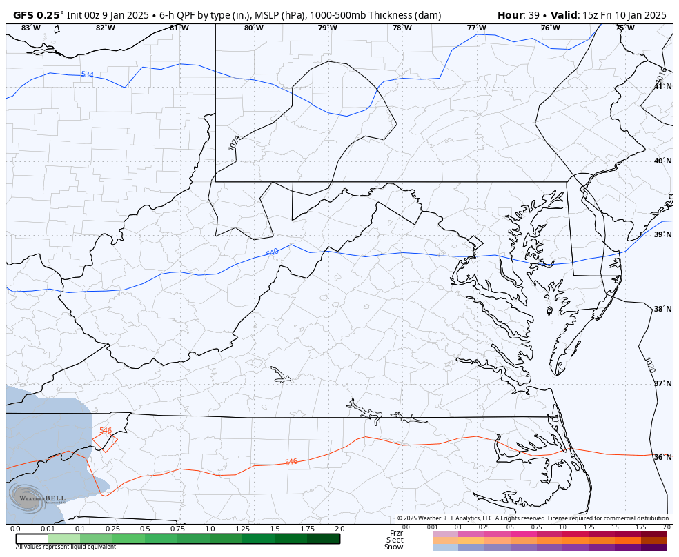
00Z NAM brings a warm nose pretty far north and so we mix. -
Richmond Metro/Hampton Roads Area Discussion
RIC Airport replied to RIC Airport's topic in Mid Atlantic
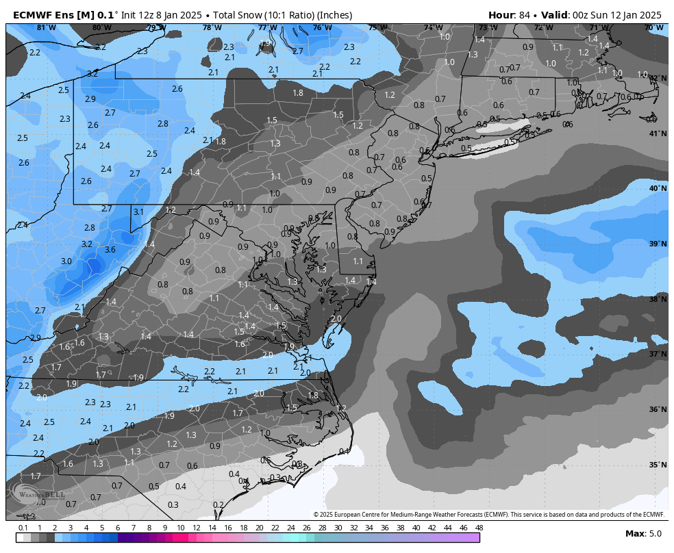
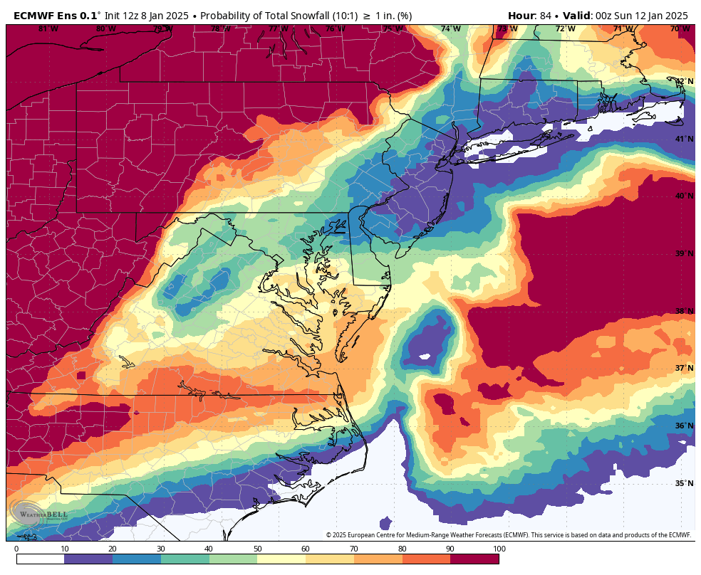
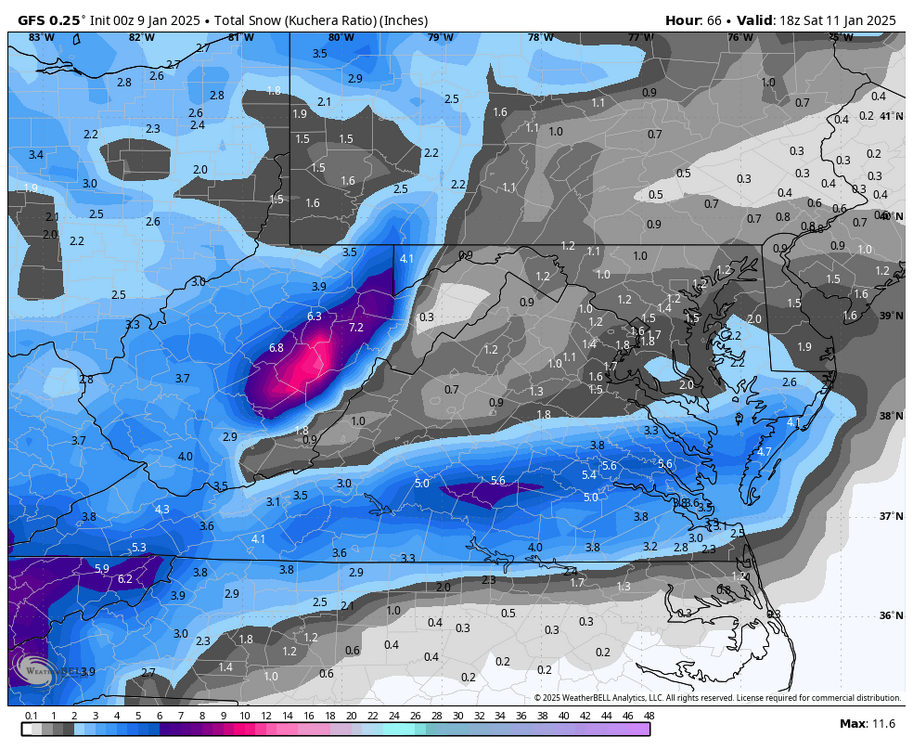
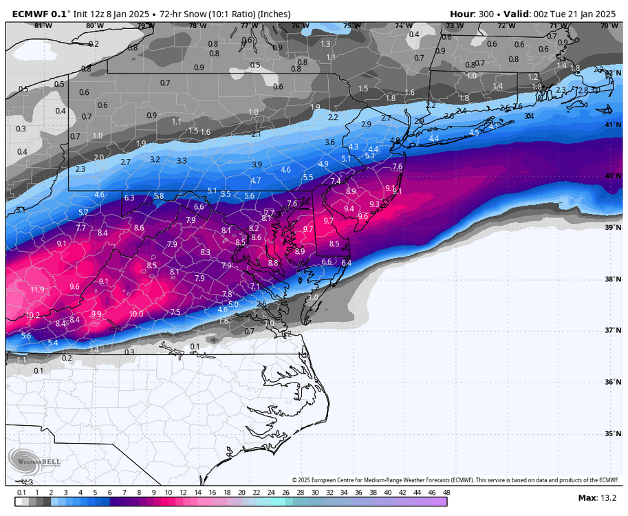
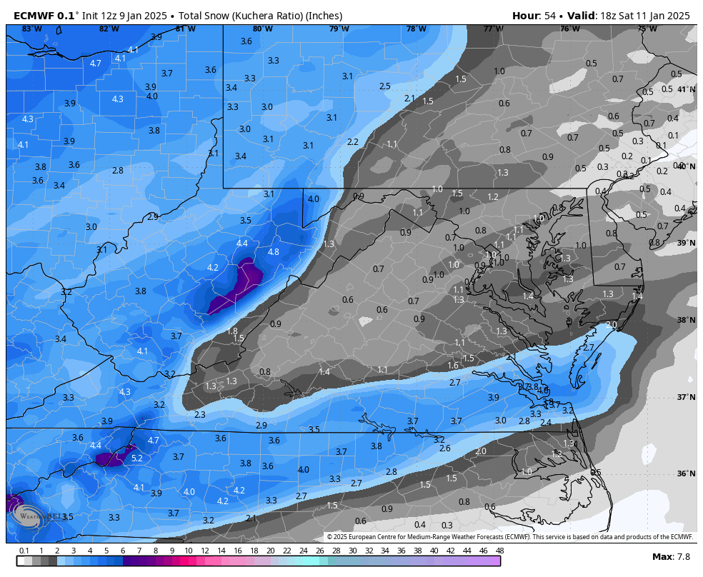
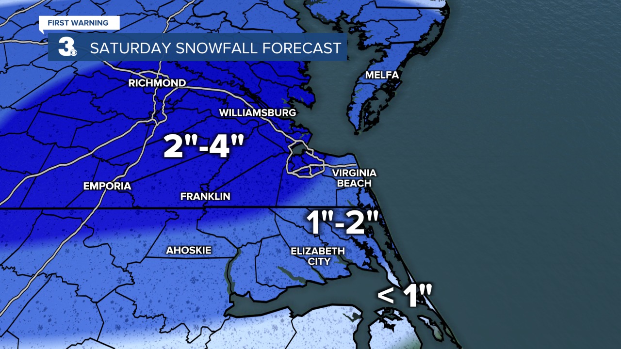
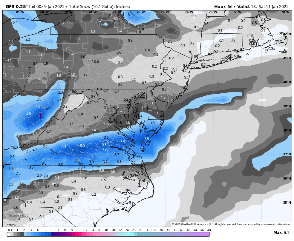
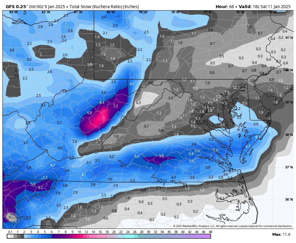
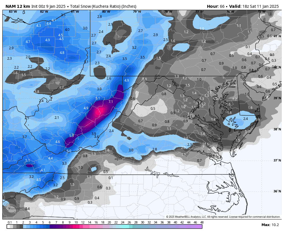
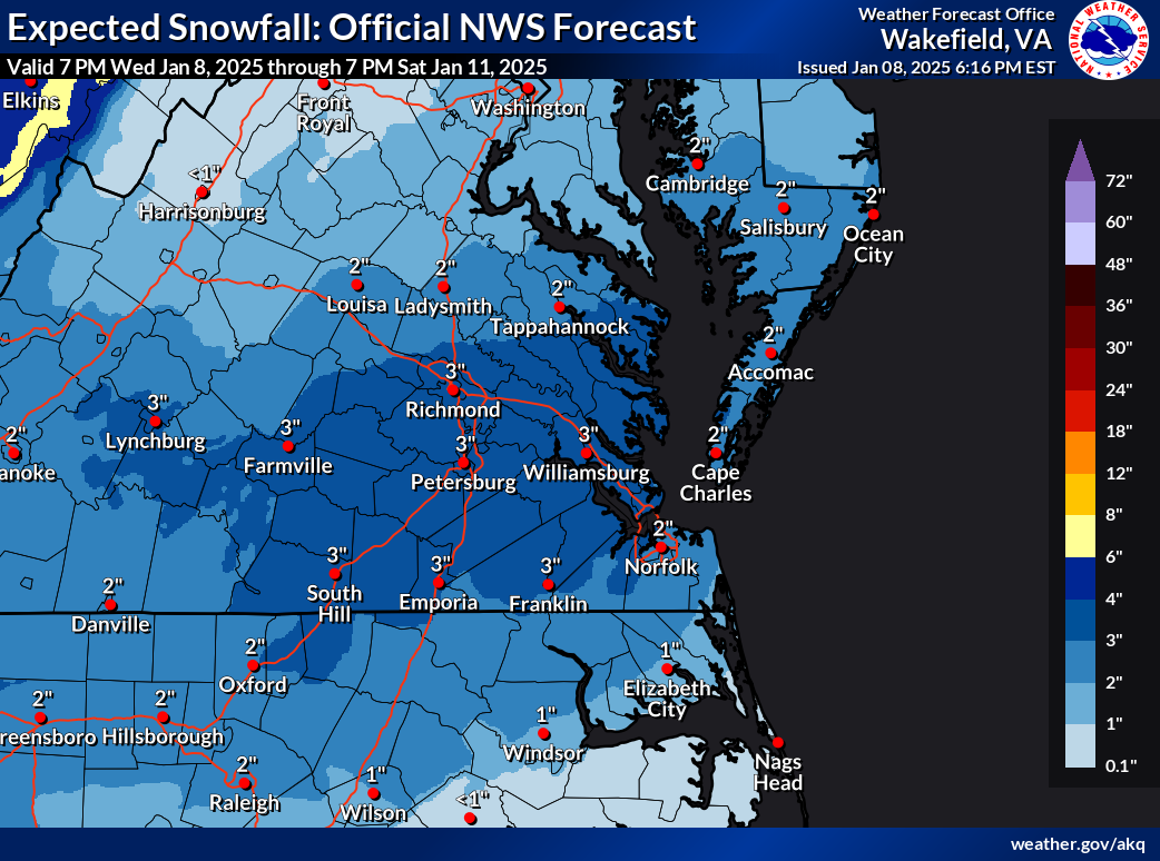
First snow maps from Wakefield are out. Best case scenario is 5".

.thumb.png.b8085e239d6eb077abfde67bb622b945.png)
-
Richmond Metro/Hampton Roads Area Discussion
RIC Airport replied to RIC Airport's topic in Mid Atlantic
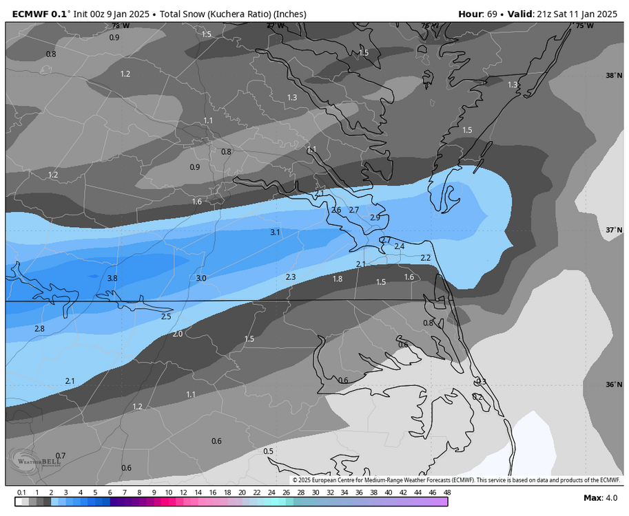
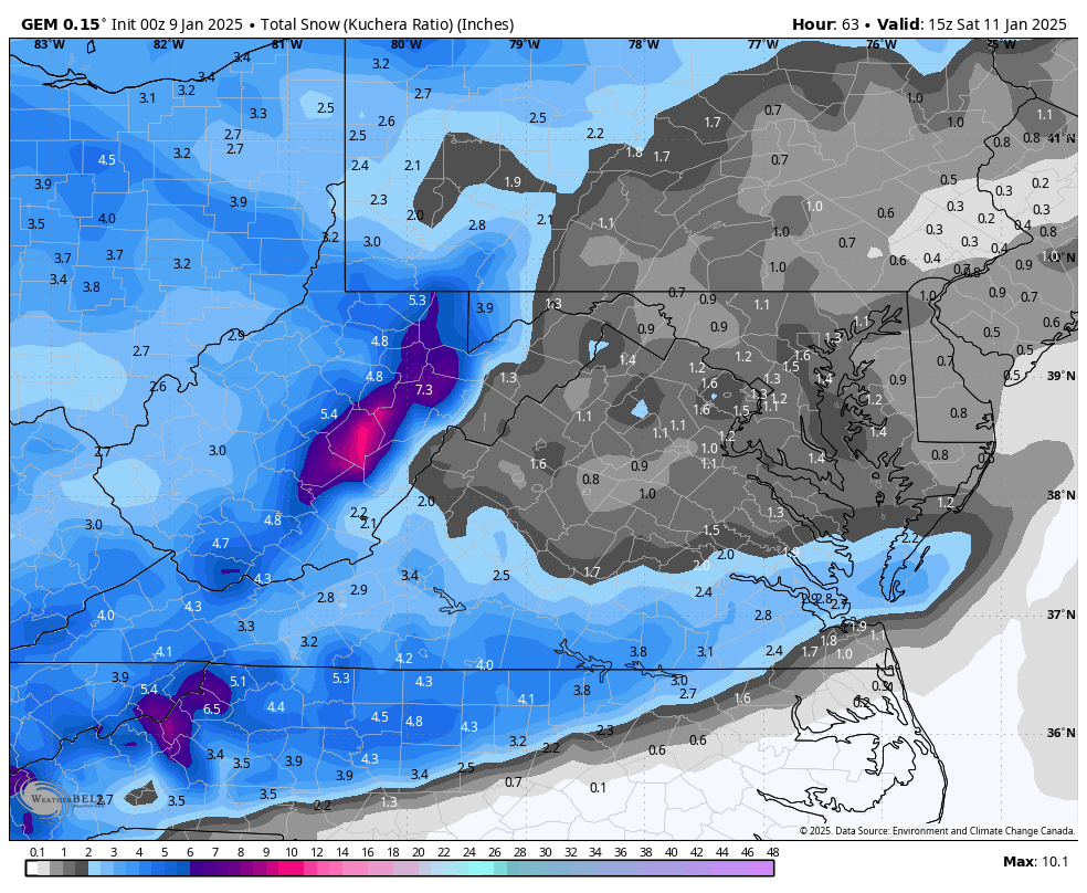
18z Euro, although still south compared to GFS, did creep north from the 12z run. 12z Run

-
Richmond Metro/Hampton Roads Area Discussion
RIC Airport replied to RIC Airport's topic in Mid Atlantic
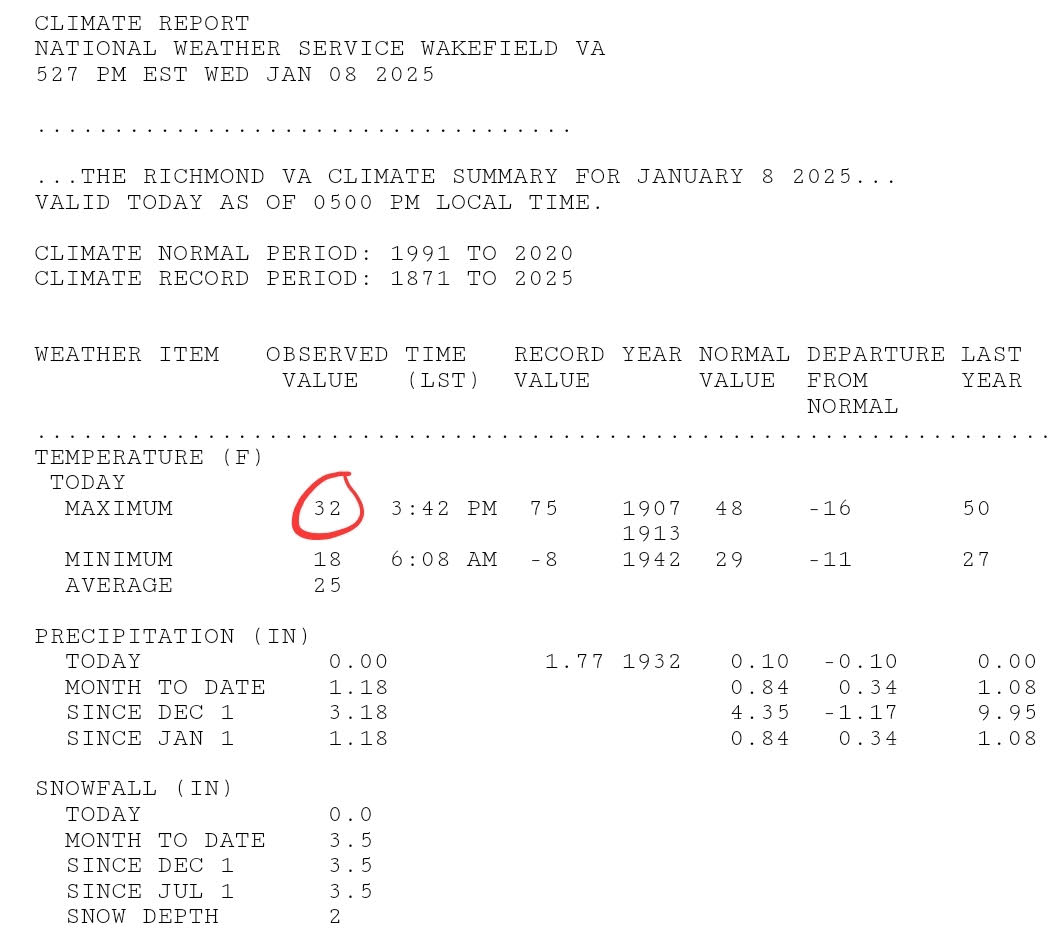
CLI was just sent. Under full sun, Richmond never made it above freezing today.
-
Richmond Metro/Hampton Roads Area Discussion
RIC Airport replied to RIC Airport's topic in Mid Atlantic
Another overnight storm with temps ranging from 29-31°F during the event. Unfortunately, temps will start to rise above freezing almost as soon as the storm is over, could get around 40-41°F later in the day. -
Richmond Metro/Hampton Roads Area Discussion
RIC Airport replied to RIC Airport's topic in Mid Atlantic
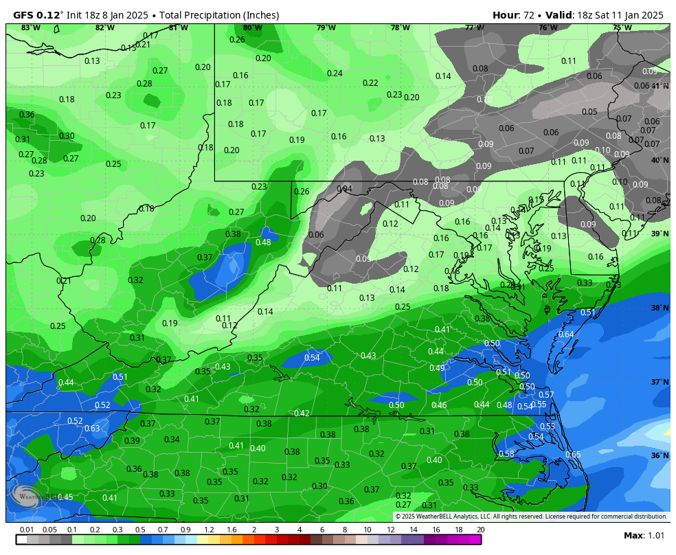
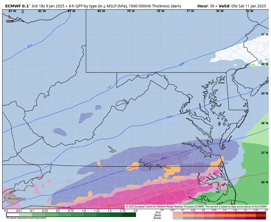
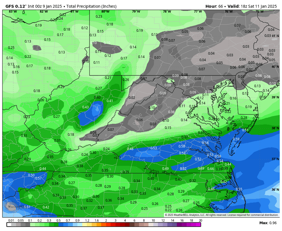
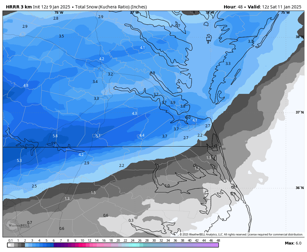
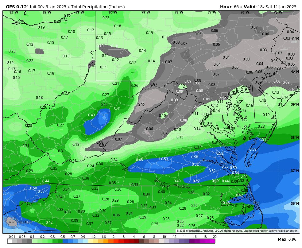
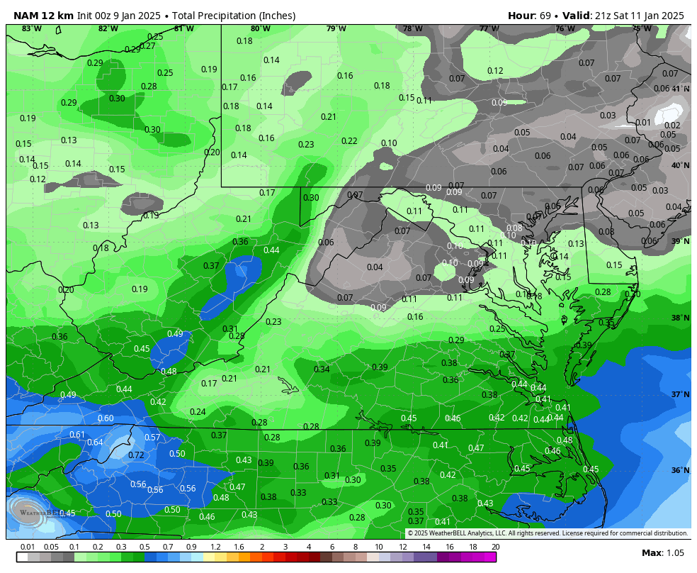
At least the GFS has been pretty consistent with this system. The 18z run brings 0.40 to 0.50" of QPF up past Richmond.

-
Richmond Metro/Hampton Roads Area Discussion
RIC Airport replied to RIC Airport's topic in Mid Atlantic
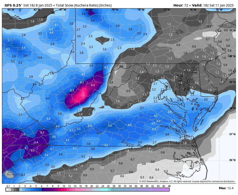
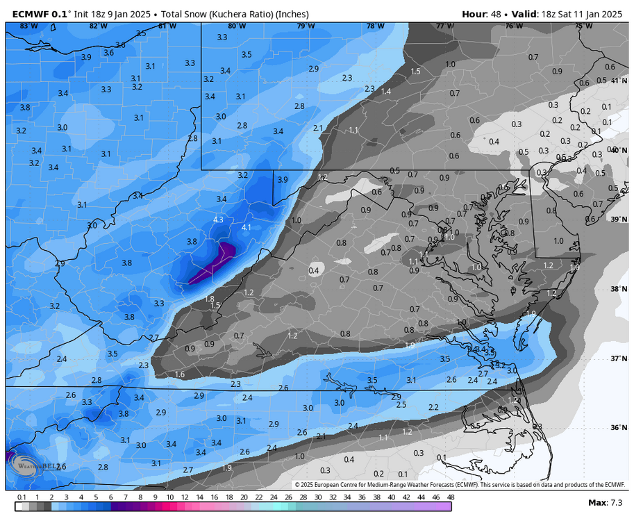
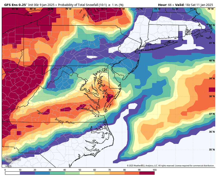
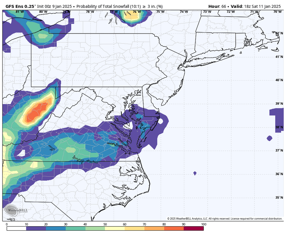
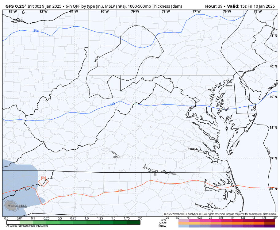
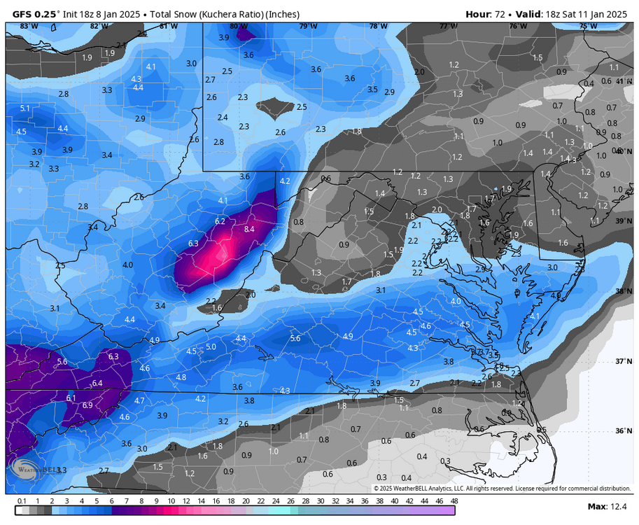
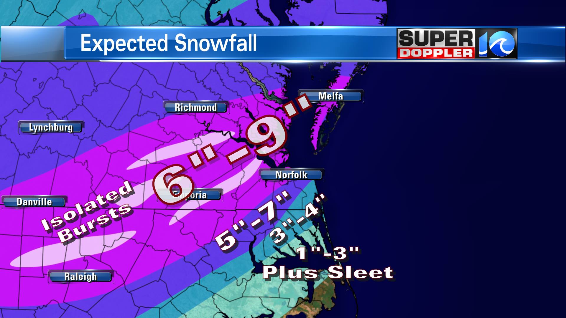
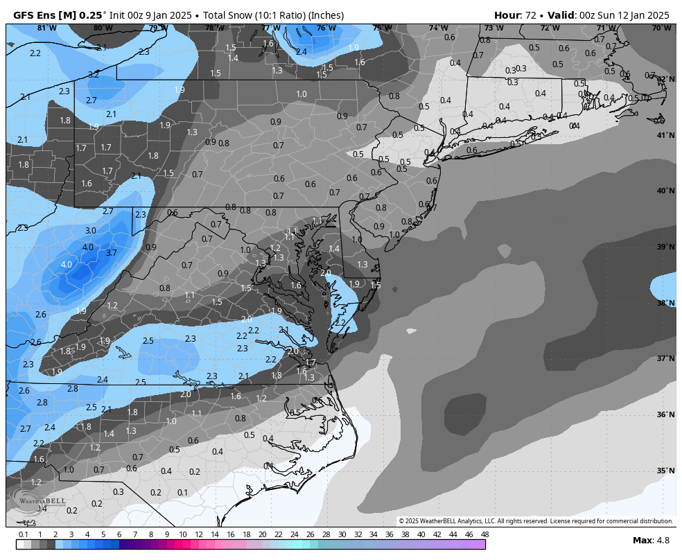
AKQ going with 2-4" across the metro RIC, 1-3" just north. 1-3" for Hampton Roads once you get S and E of Williamsburg. .SHORT TERM /FRIDAY THROUGH SATURDAY/... As of 325 PM EST Wednesday... Key Messages: - Increasing chances for winter precipitation and accumulating snow Friday night into Saturday. Confidence is growing for chances of wintry precip with the next low pressure system late Fri into Sat afternoon. The deep trough that has been over the area this week will move offshore with a low pressure forming near the Gulf Coast. This low will move along the SE coast Fri, and eventually move offshore of the area Sat, taking on a Miller A track. Models have increased confidence in timing, precip types, and amounts during the 12z suites. However, there is still some uncertainty in regards to location of the highest amounts, which will be dependent on the bands of snow north of frontogenesis. The NAM model shows a heavier band of snow over the metro RIC area overnight, while the GFS model depicts a heavier band a few hours after the NAM and more to the NE/Eastern Shore area. With this forecast package, as there is still some uncertainty, have broad-stroked with general amounts of 2-4" across the area. Wherever the heavier bands of snow end up, the snowfall totals are likely to be higher than 4". NE NC/Albemarle Sound will likely have warmer temps as a warm nose tries to push through the coastal area, preventing higher snowfall amounts. Expected totals for this area are around 1". NBM probs have increased for the likelihood of greater than 1" to 60-70% around the metro RVA area. Unfortunately, (or fortunately depending on your opinion of snow) this event isn`t looking like a pure snow event. The event will likely start off as all snow late Fri night. With the warm nose to the southeast of the region, a period of wintry mix is possible before turning into rain, especially for the southern region of the FA. All this being said, there are still details to be ironed out regarding the event which will have large impacts in terms of total accumulations. && -
Richmond Metro/Hampton Roads Area Discussion
RIC Airport replied to RIC Airport's topic in Mid Atlantic
We seem to either be too far south or too far north. But, happy to see another threat, a 3rd threat had been popping up off and on for a while.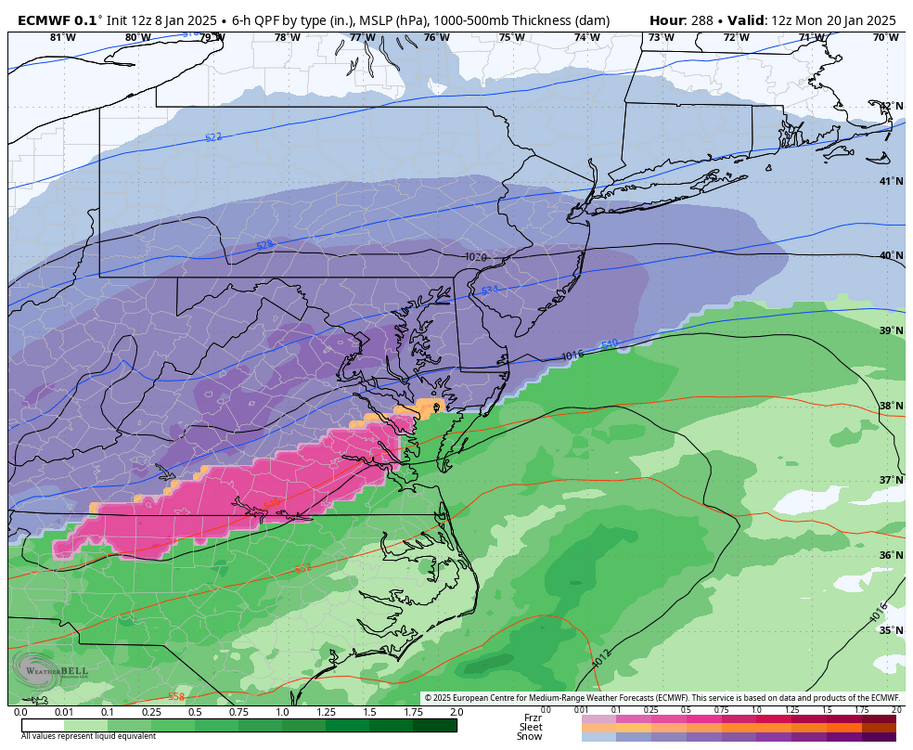
-
Richmond Metro/Hampton Roads Area Discussion
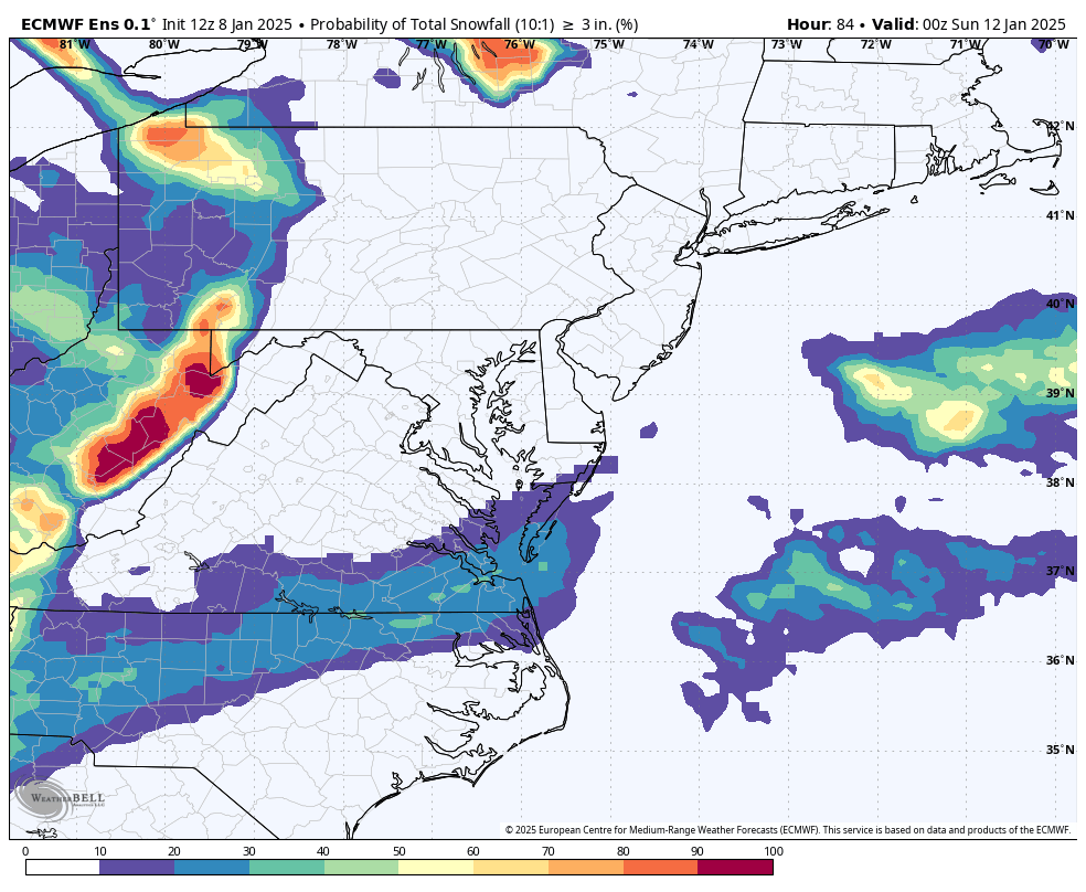
RIC Airport replied to RIC Airport's topic in Mid Atlantic
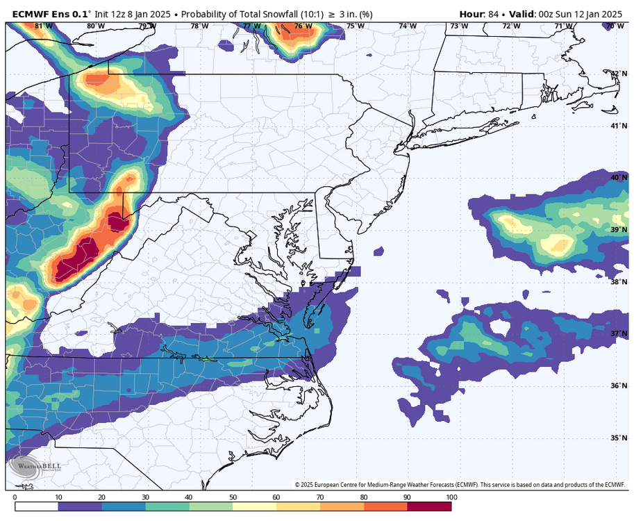
EPS favors S & E of RIC as well.


.png.3d4af21b2bc1e88fea8653649b054216.png)