RIC Airport
Members-
Posts
2,586 -
Joined
-
Last visited
Content Type
Profiles
Blogs
Forums
American Weather
Media Demo
Store
Gallery
Everything posted by RIC Airport
-
Richmond Metro/Hampton Roads Area Discussion
RIC Airport replied to RIC Airport's topic in Mid Atlantic
-
Richmond Metro/Hampton Roads Area Discussion
RIC Airport replied to RIC Airport's topic in Mid Atlantic
-
Richmond Metro/Hampton Roads Area Discussion
RIC Airport replied to RIC Airport's topic in Mid Atlantic
-
Richmond Metro/Hampton Roads Area Discussion
RIC Airport replied to RIC Airport's topic in Mid Atlantic
It was revised down to 3.5" this afternoon. Admittedly the 6" was too high and not representative of area reports. Not the first time this has happened. -
Richmond Metro/Hampton Roads Area Discussion
RIC Airport replied to RIC Airport's topic in Mid Atlantic
-
Richmond Metro/Hampton Roads Area Discussion
RIC Airport replied to RIC Airport's topic in Mid Atlantic
Hanover having issues, too. And I just saw that there was another malfunction at the city treatment site. Hang in there! I hope you have access to water or some friends who are not affected and can provide you a place to shower or something. I'm sure they are working around the clock to resolve the situation -
Richmond Metro/Hampton Roads Area Discussion
RIC Airport replied to RIC Airport's topic in Mid Atlantic
-
Richmond Metro/Hampton Roads Area Discussion
RIC Airport replied to RIC Airport's topic in Mid Atlantic
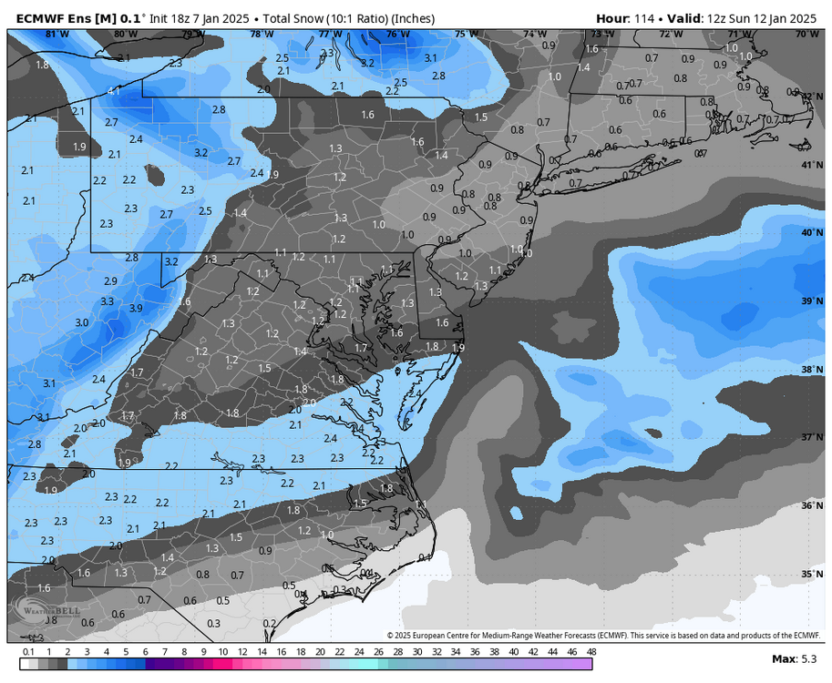
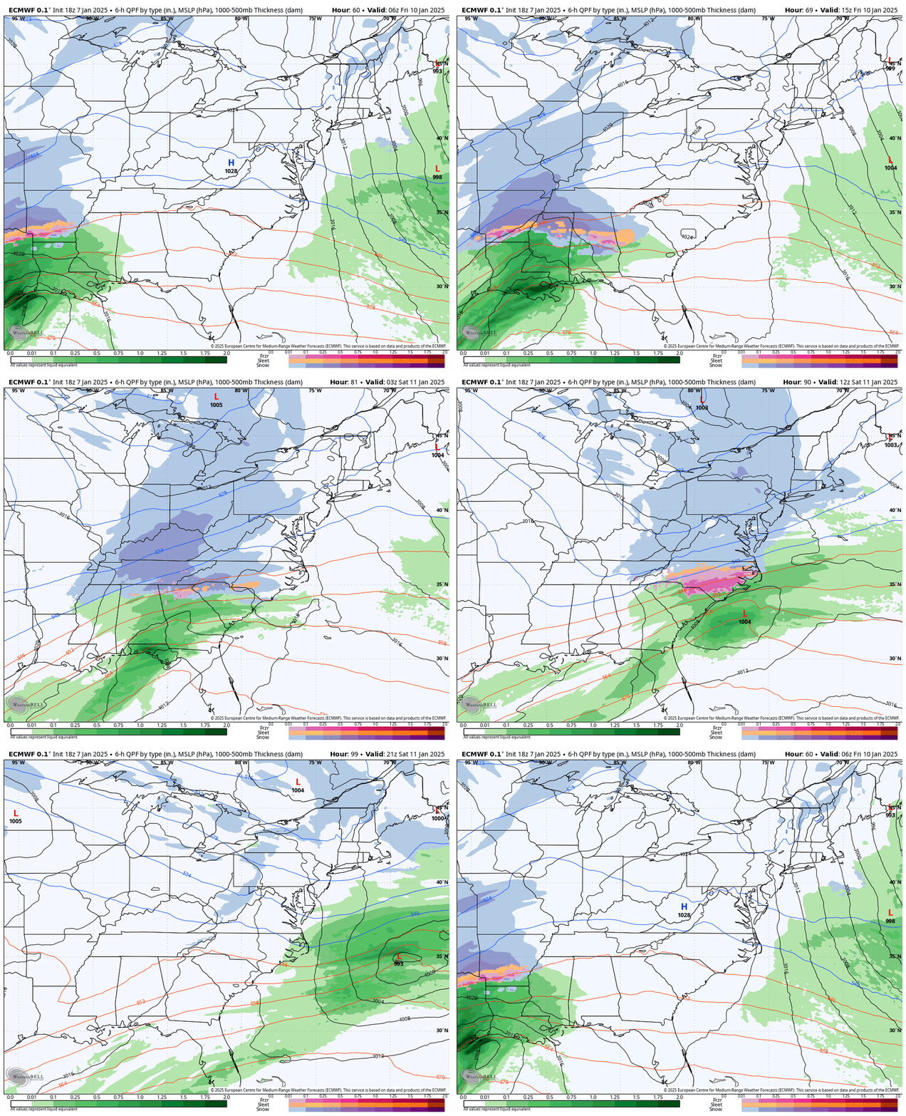
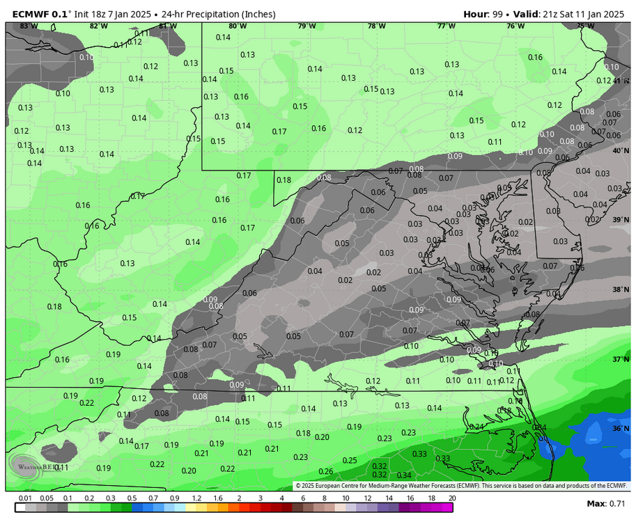
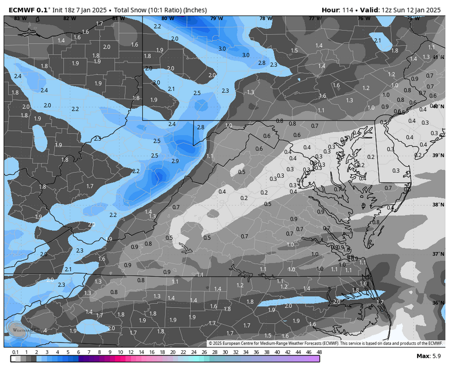
Euro continues its stubbornness at 18z. -
Richmond Metro/Hampton Roads Area Discussion
RIC Airport replied to RIC Airport's topic in Mid Atlantic
-
Richmond Metro/Hampton Roads Area Discussion
RIC Airport replied to RIC Airport's topic in Mid Atlantic
-
Richmond Metro/Hampton Roads Area Discussion
RIC Airport replied to RIC Airport's topic in Mid Atlantic
Interesting, not available on wxbell. Anybody have a map? -
Richmond Metro/Hampton Roads Area Discussion
RIC Airport replied to RIC Airport's topic in Mid Atlantic
-
Richmond Metro/Hampton Roads Area Discussion
RIC Airport replied to RIC Airport's topic in Mid Atlantic
1/29/2022, 1/22/2022, 2/20/2020, 2//26/2015, 1/7/2017, 2/26/2015, 1/29/2014, etc. Plenty of examples. -
Richmond Metro/Hampton Roads Area Discussion
RIC Airport replied to RIC Airport's topic in Mid Atlantic
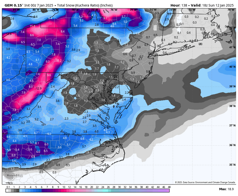
Still wondering the same, maybe better luck Friday night into Saturday for a 3-6" event and no ice or slop in between. -
Richmond Metro/Hampton Roads Area Discussion
RIC Airport replied to RIC Airport's topic in Mid Atlantic
-
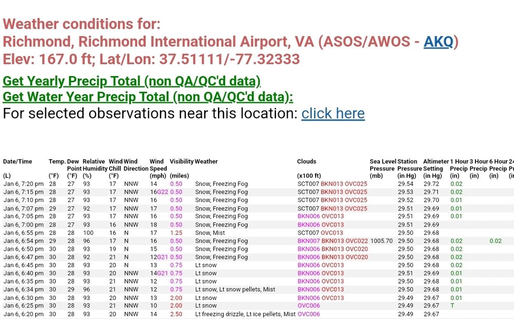
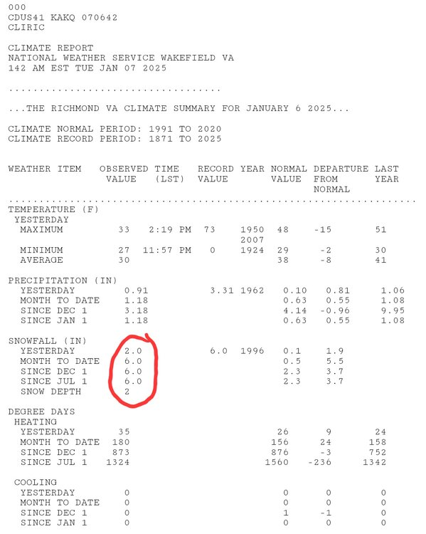
@RodneyS, RIC was revised to 3.5". The CF6 was updated, should reflect on the CLI later today.
-
Richmond Metro/Hampton Roads Area Discussion
RIC Airport replied to RIC Airport's topic in Mid Atlantic
-
Richmond Metro/Hampton Roads Area Discussion
RIC Airport replied to RIC Airport's topic in Mid Atlantic
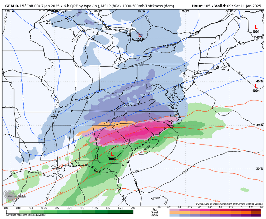
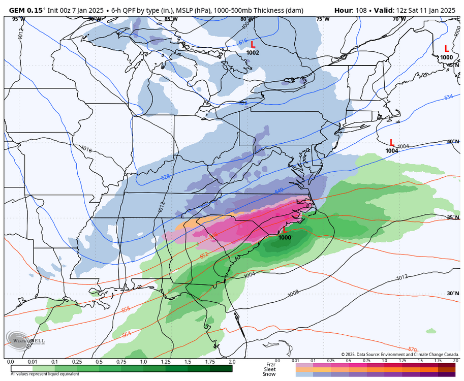
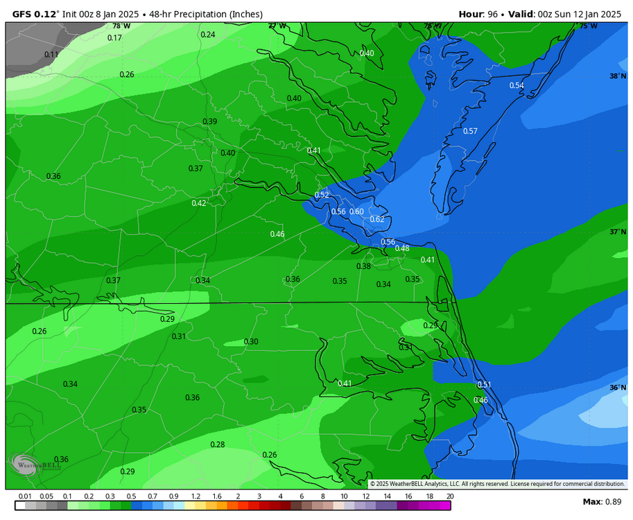
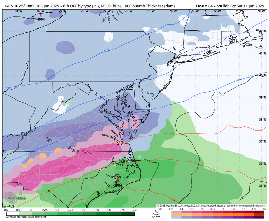
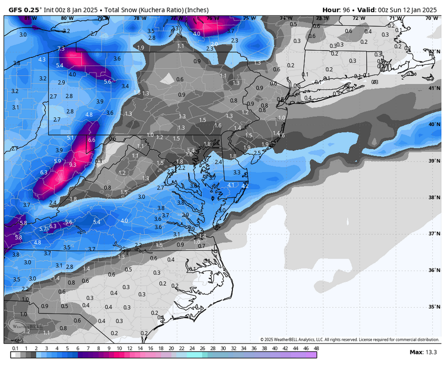
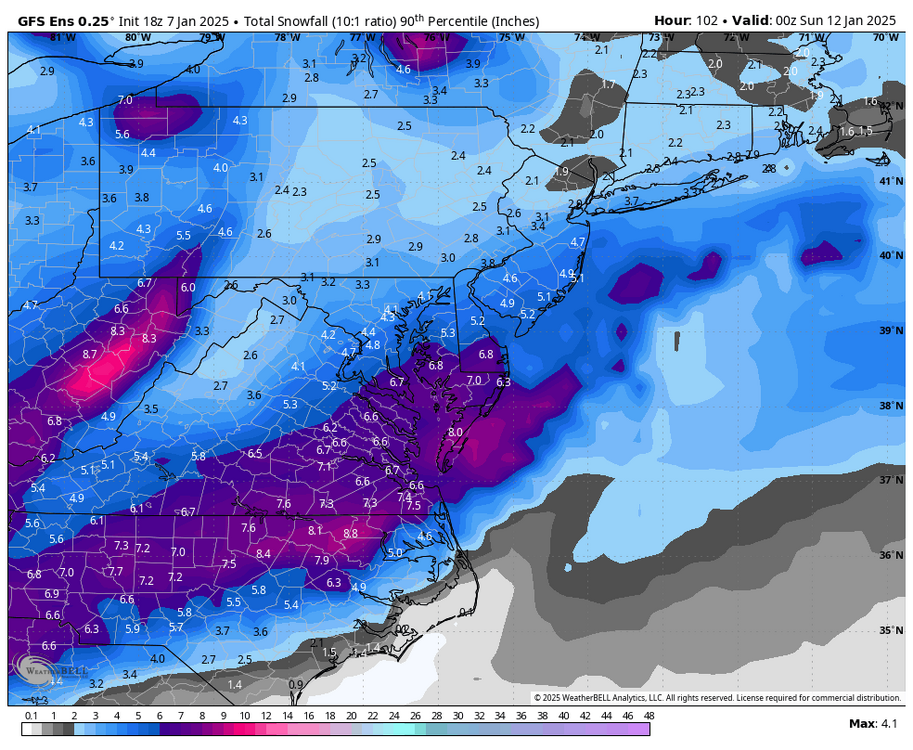
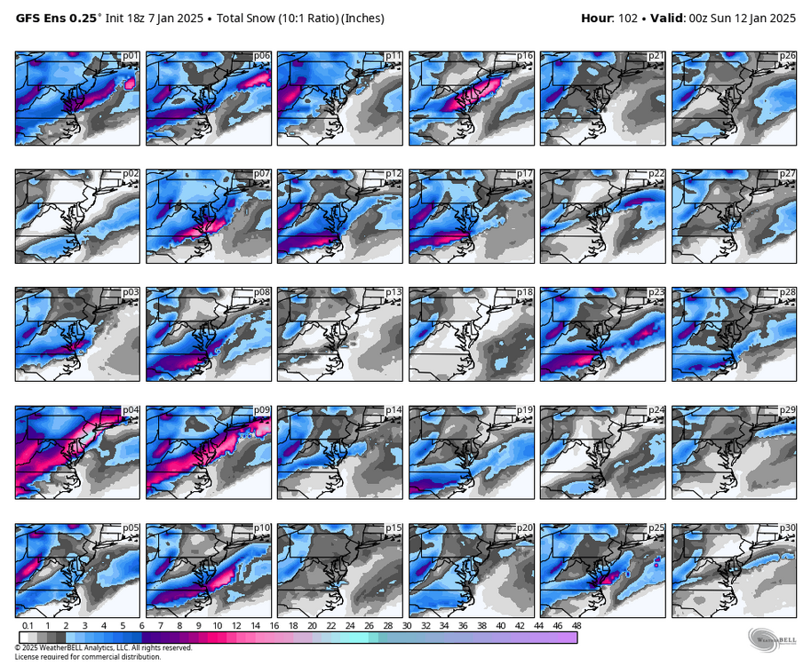
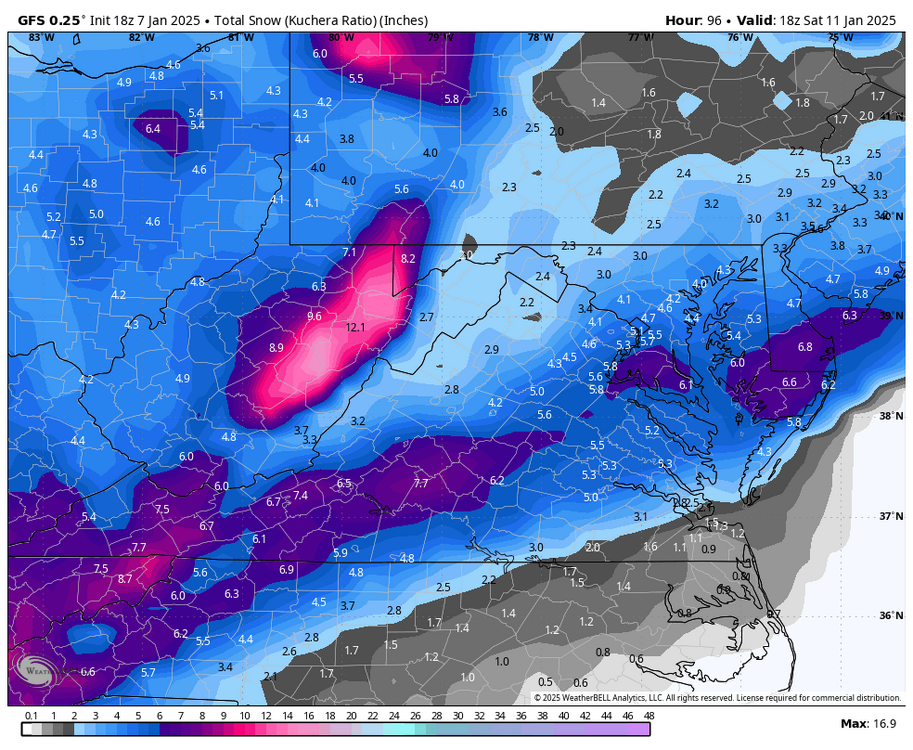
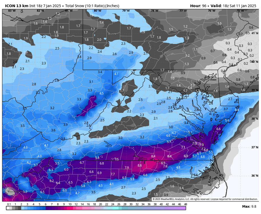
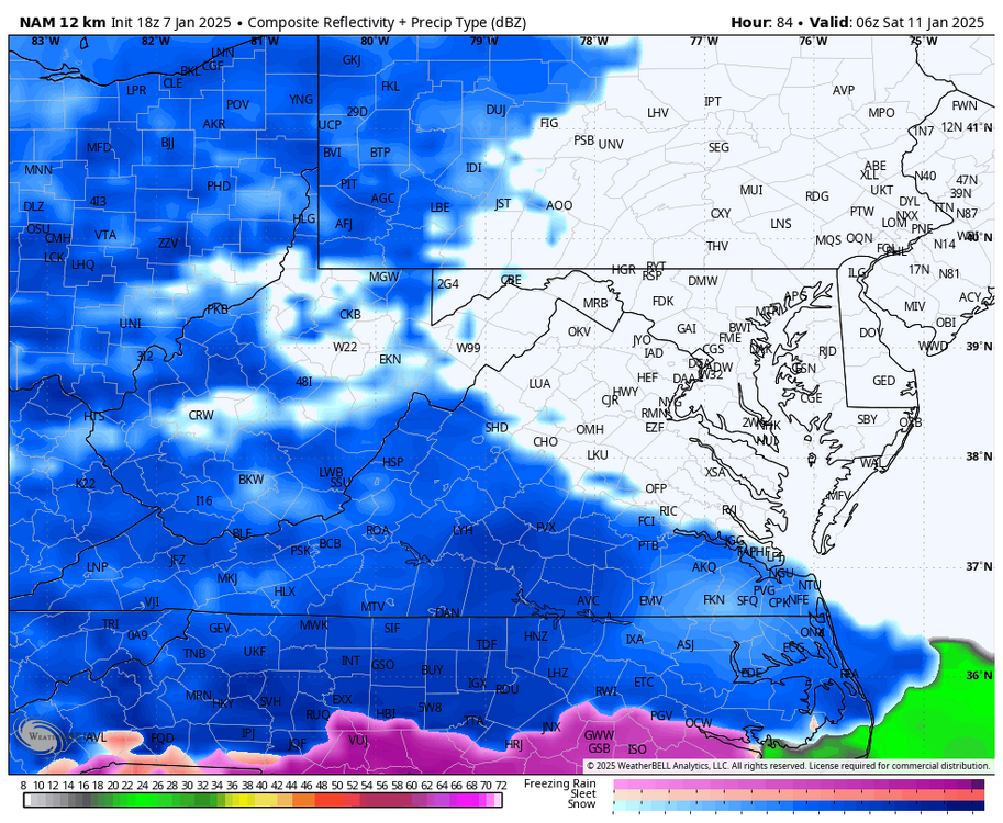
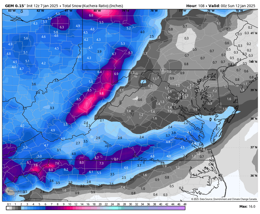
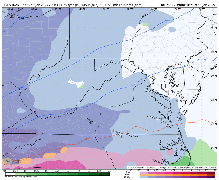
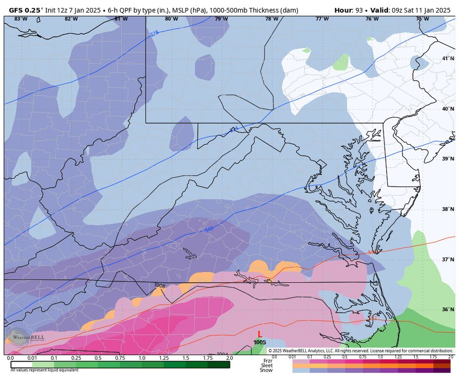
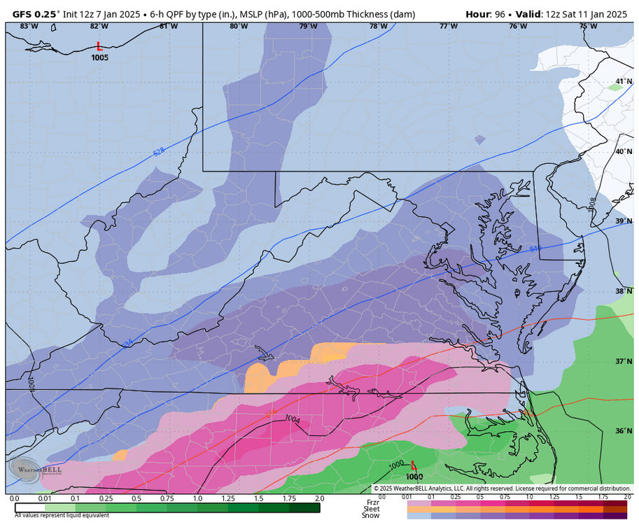
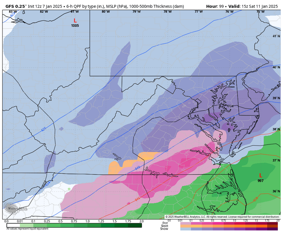
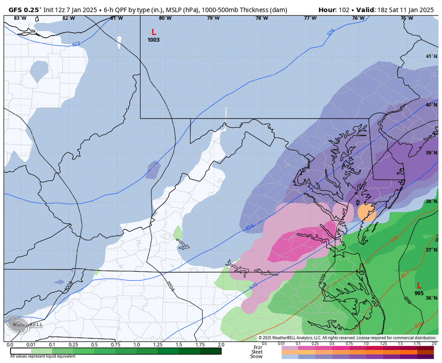
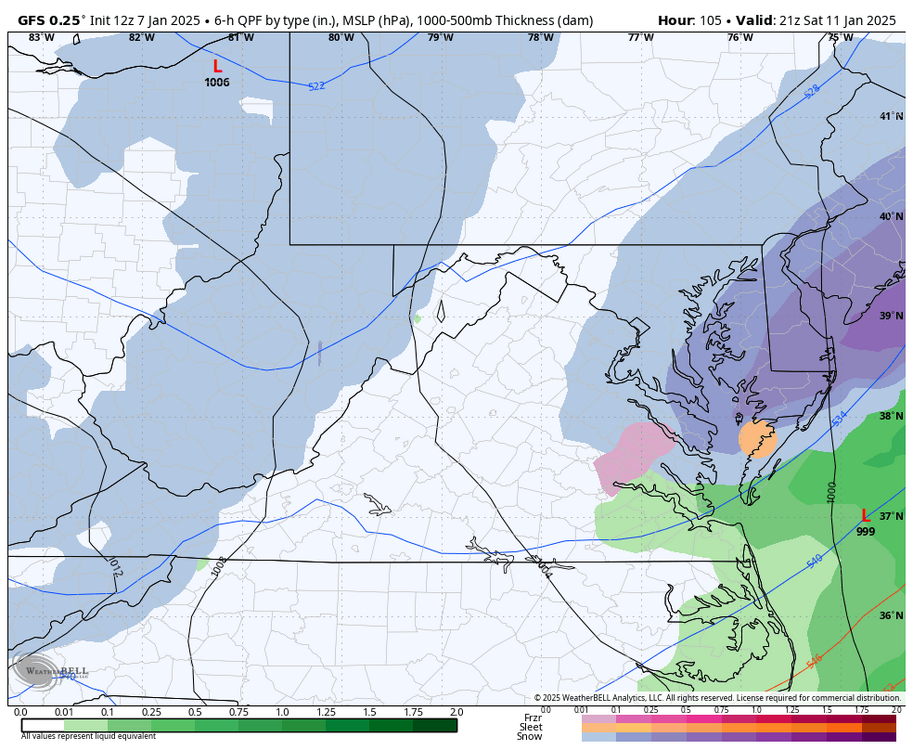
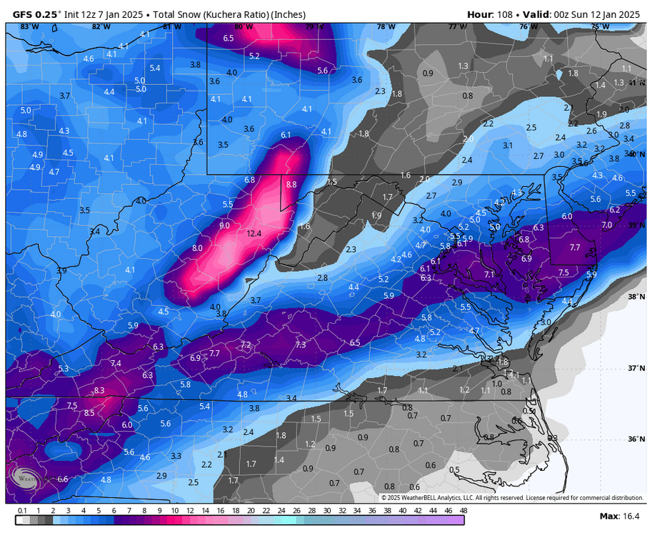
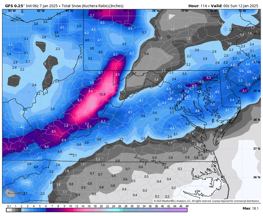
@Conway7305, @wasnow215, @RVAman12z GFS sliding south from earlier runs, max potential seems to be about 6". -
Richmond Metro/Hampton Roads Area Discussion
RIC Airport replied to RIC Airport's topic in Mid Atlantic
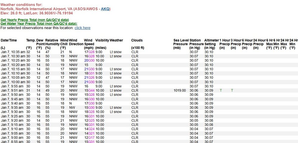
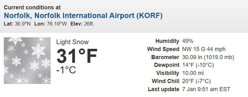
Interestingly, ORF has been reporting Bay Effect snow over the last hour. Not sure when the last time this has happened. -
Richmond Metro/Hampton Roads Area Discussion
RIC Airport replied to RIC Airport's topic in Mid Atlantic
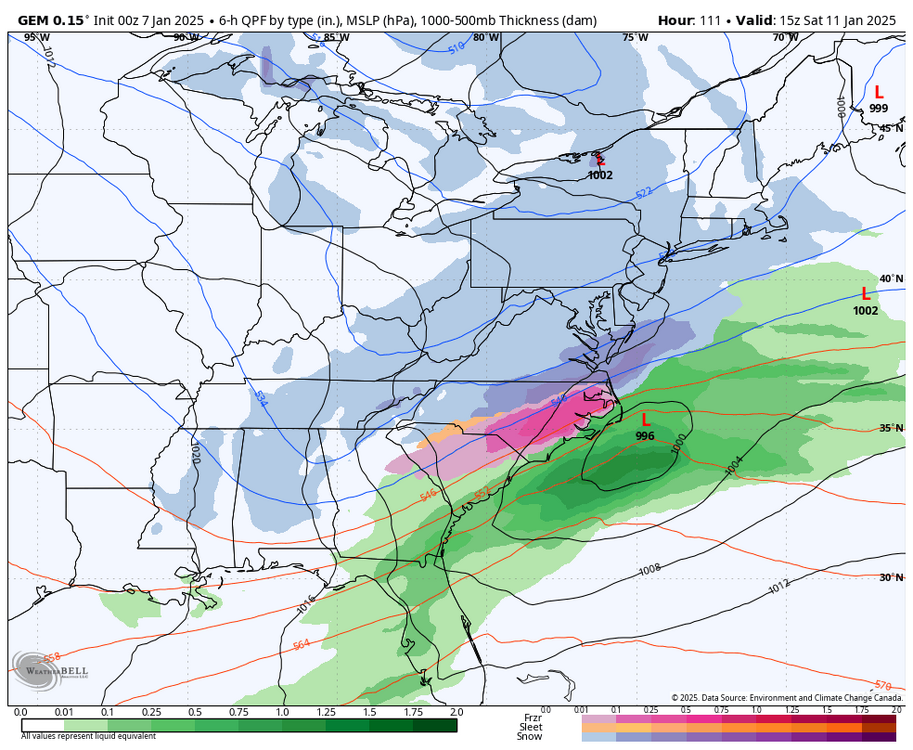
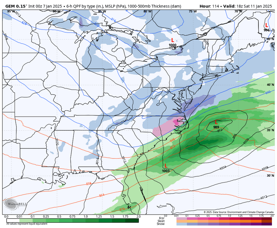
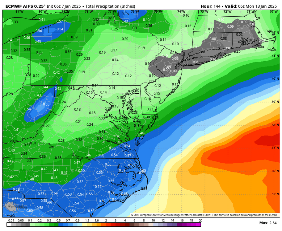
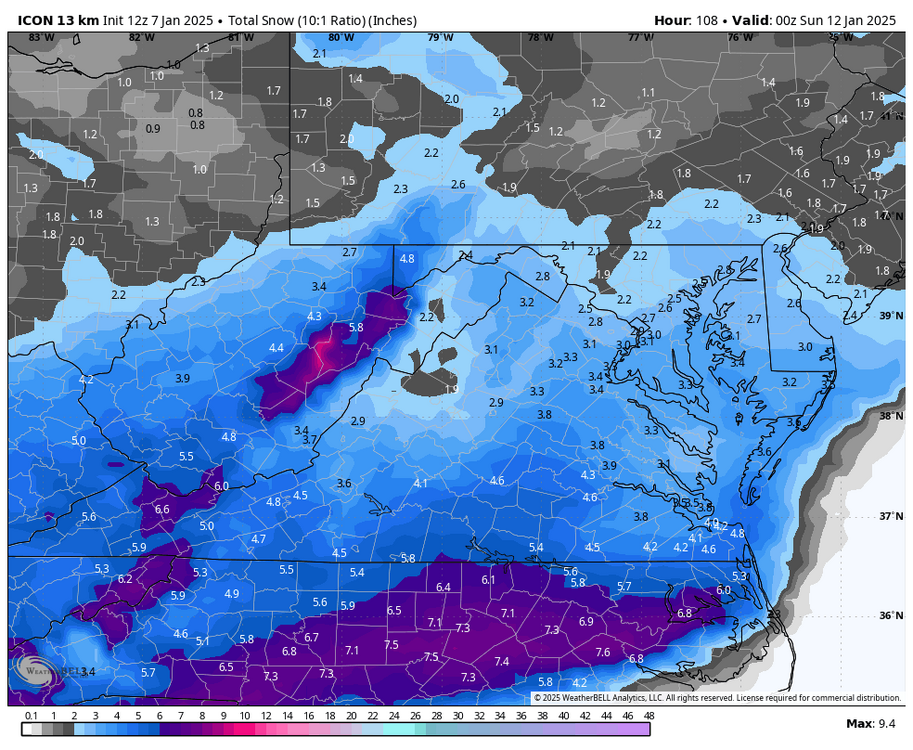
6Z Euro AI model has about .30" as far west as RIC. Surface temps still looks cold, a late Friday evening, mainly overnight event. 12z ICON did inch south with the axis of heaviest accumulations. -
Richmond Metro/Hampton Roads Area Discussion
RIC Airport replied to RIC Airport's topic in Mid Atlantic
-
Richmond Metro/Hampton Roads Area Discussion
RIC Airport replied to RIC Airport's topic in Mid Atlantic
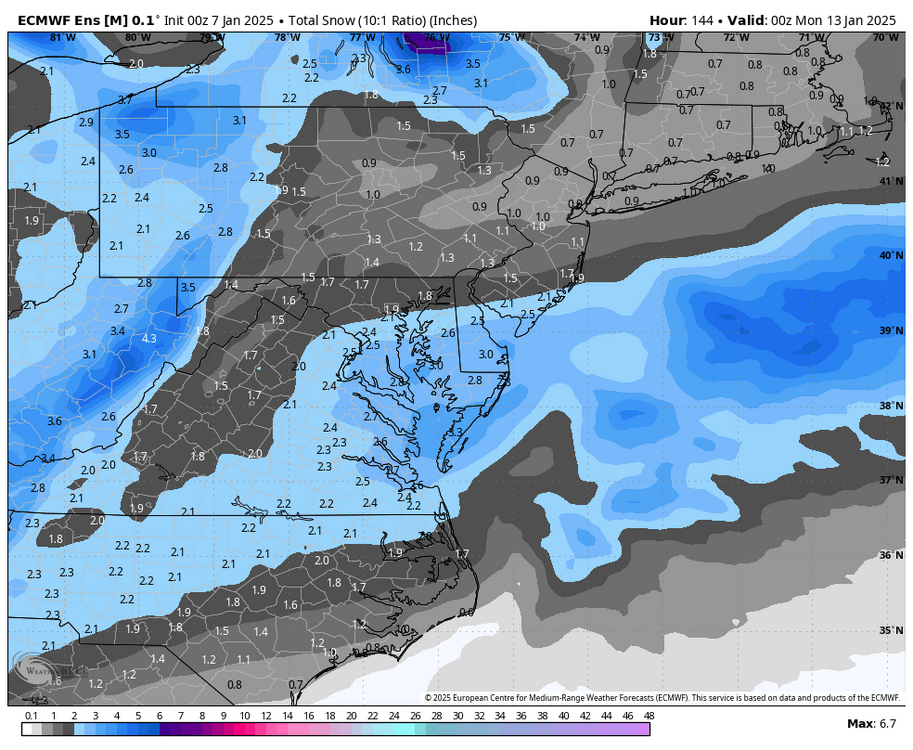
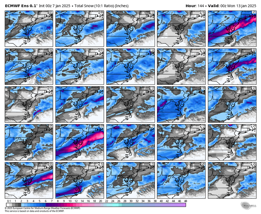
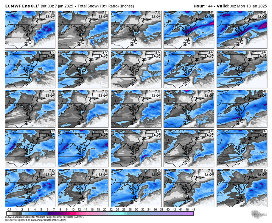
Here was the 00z EPS through hour 144, there is about a 2" mean for this weekend. 3" for Norfolk. The snow charts below go out further and indicate a possible threat threat later in the period. -
Richmond Metro/Hampton Roads Area Discussion
RIC Airport replied to RIC Airport's topic in Mid Atlantic
This is Richmond's first 6 inch snowstorm since 12/9/2018. The biggest since then was on 1/31/2021 when 3.0" fell. -
Richmond Metro/Hampton Roads Area Discussion
RIC Airport replied to RIC Airport's topic in Mid Atlantic
-
Richmond Metro/Hampton Roads Area Discussion
RIC Airport replied to RIC Airport's topic in Mid Atlantic







.thumb.png.6e3ec377b9b92e7b814465f63b4ac17c.png)
.thumb.png.800784e313af3e9f951e9f2dd5edb49f.png)
