RIC Airport
-
Posts
2,586 -
Joined
-
Last visited
Content Type
Profiles
Blogs
Forums
American Weather
Media Demo
Store
Gallery
Everything posted by RIC Airport
-
Richmond Metro/Hampton Roads Area Discussion
RIC Airport replied to RIC Airport's topic in Mid Atlantic
That's some heavy snow coming in around 10pm Sunday night!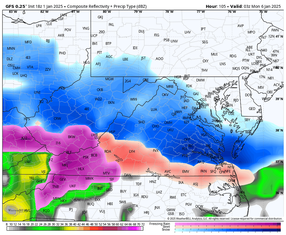
-
Richmond Metro/Hampton Roads Area Discussion
RIC Airport replied to RIC Airport's topic in Mid Atlantic
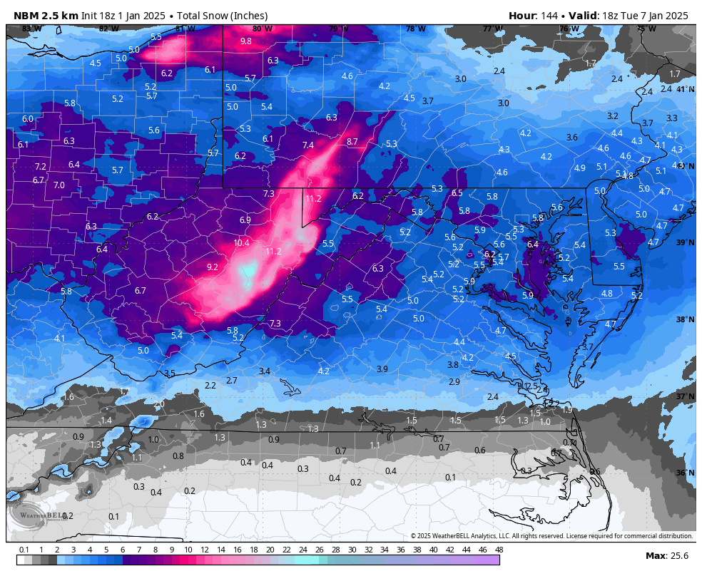
18z NBM model coming with higher snow totals, certainly an uptick from earlier this morning.
-
Richmond Metro/Hampton Roads Area Discussion
RIC Airport replied to RIC Airport's topic in Mid Atlantic
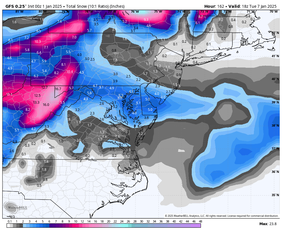
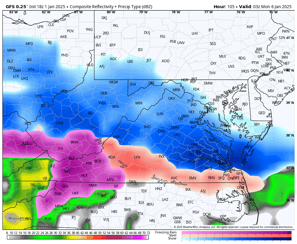
Almost looks like a blizzard for ORF, but good snows all the way to Richmond. Would be a high ratio event, temps are very cold.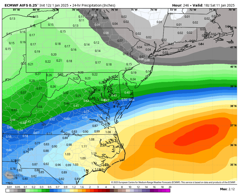
-
Richmond Metro/Hampton Roads Area Discussion
RIC Airport replied to RIC Airport's topic in Mid Atlantic
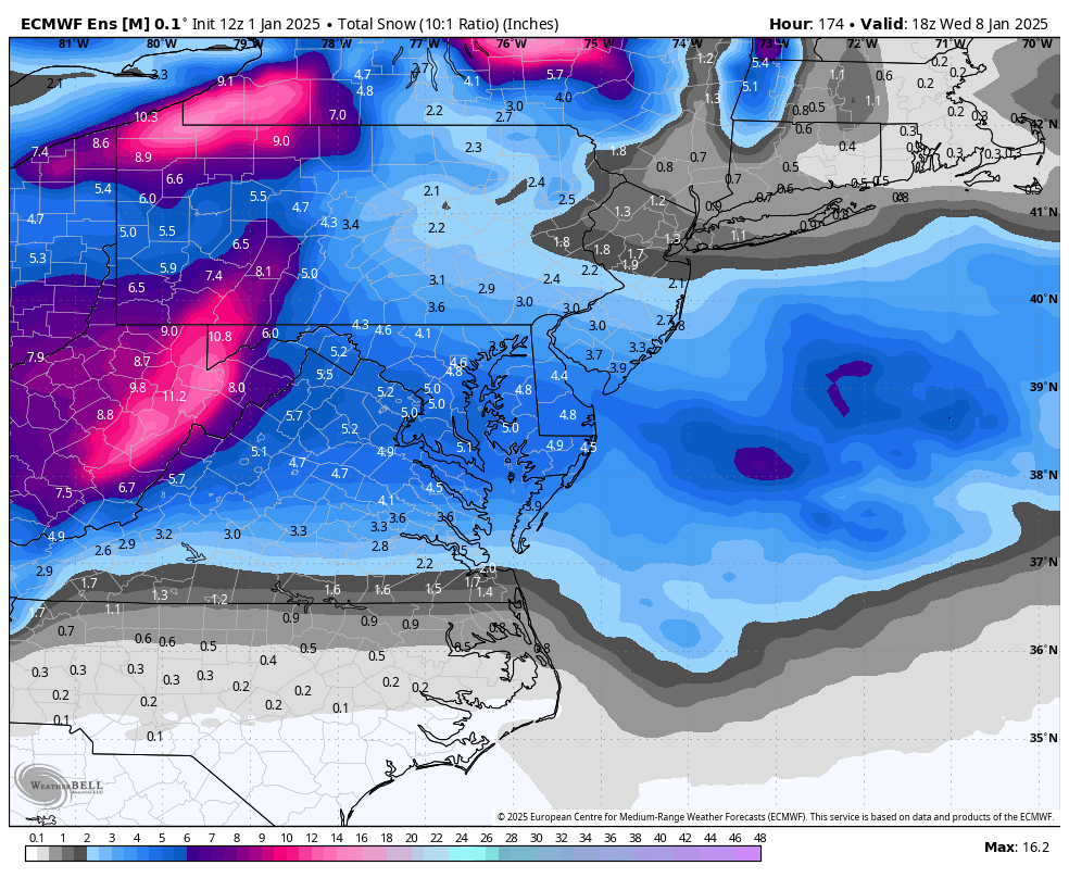
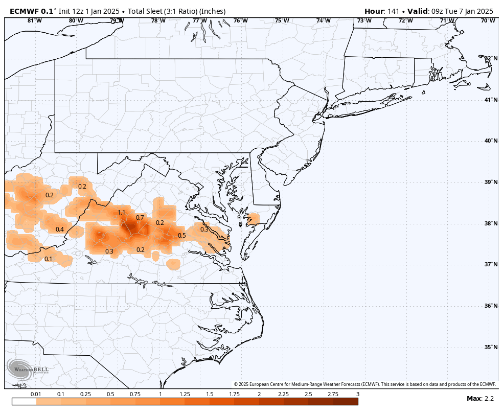
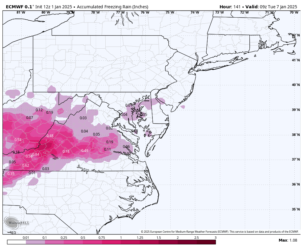
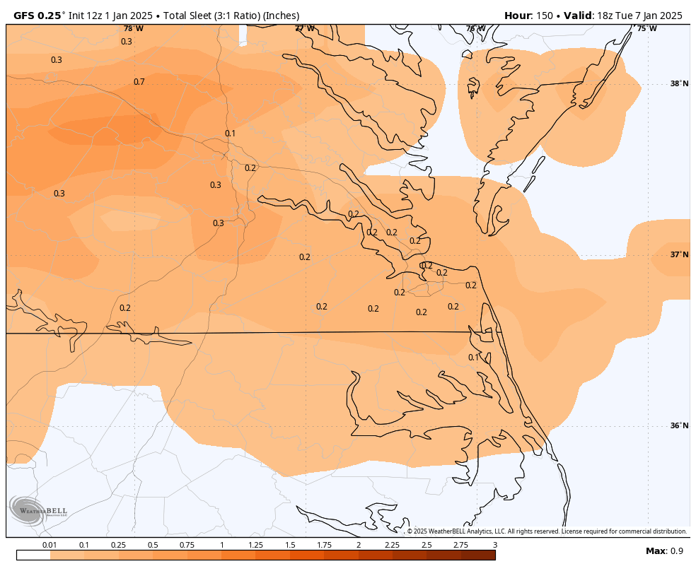
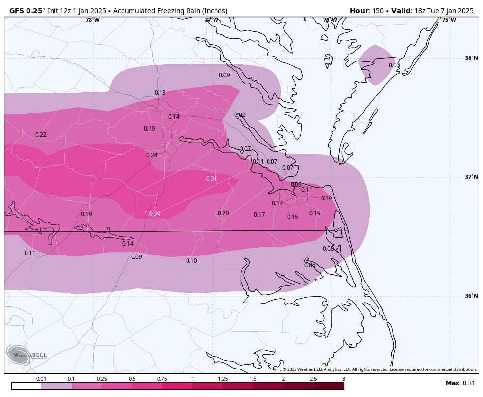
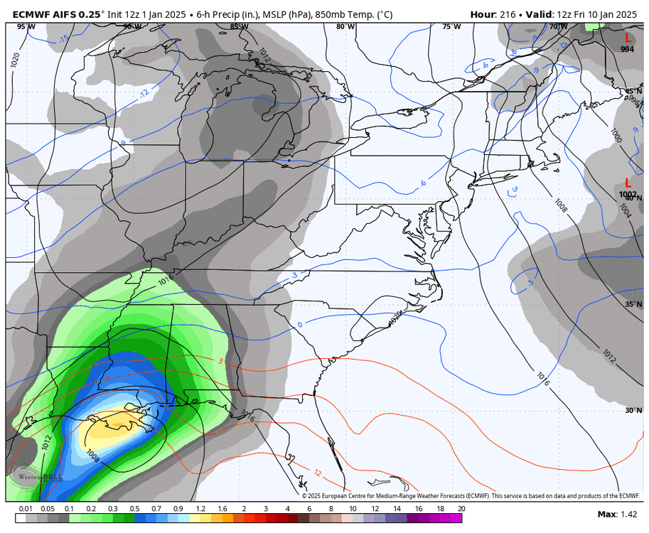
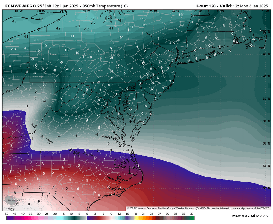
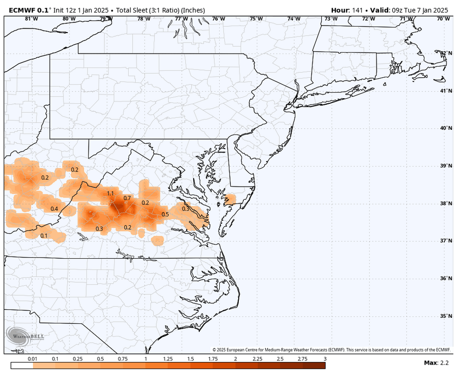
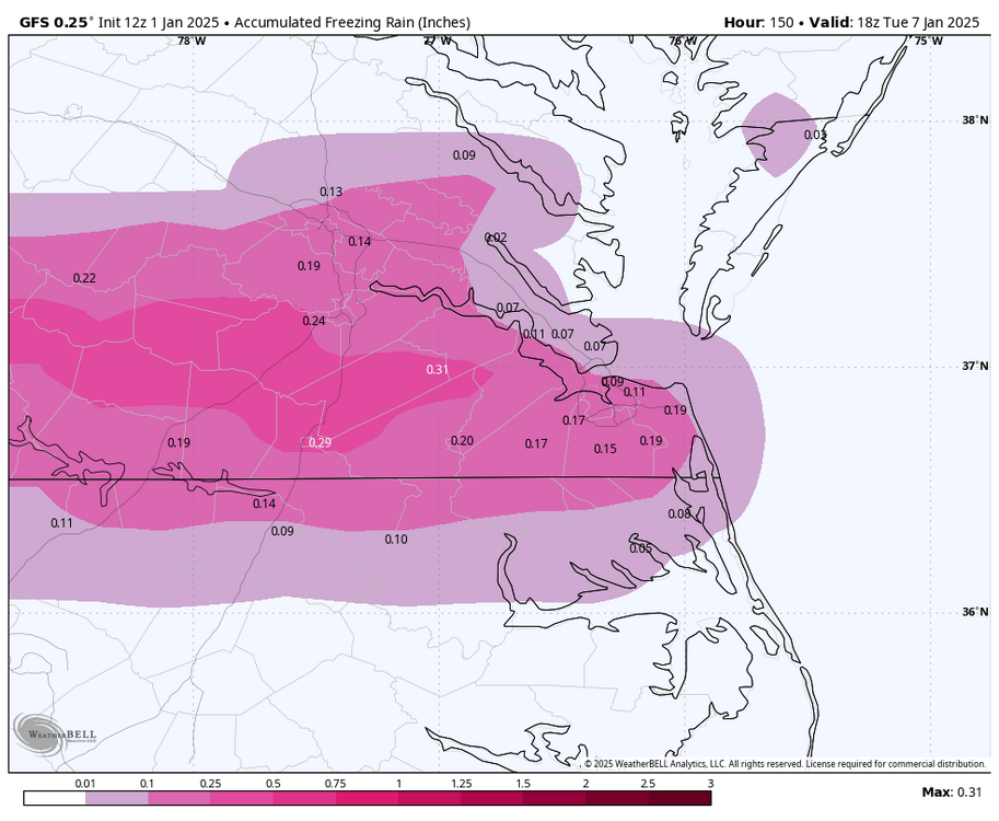
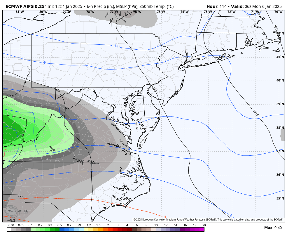
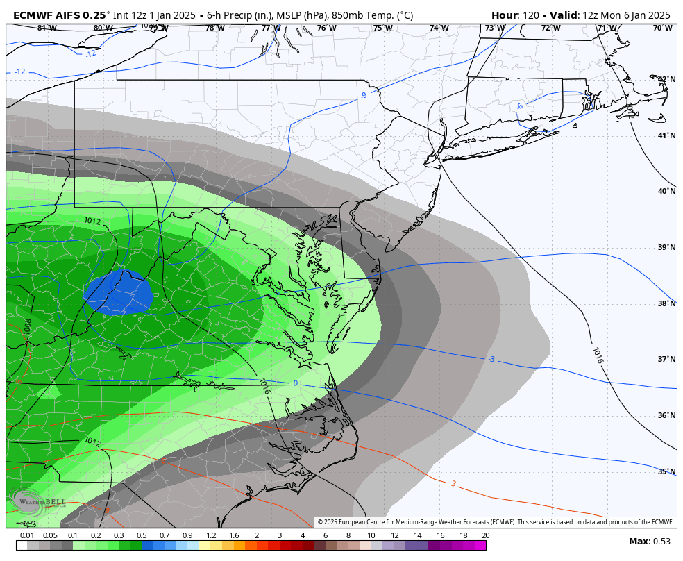
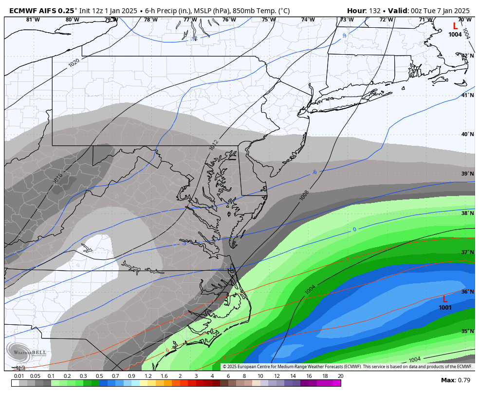
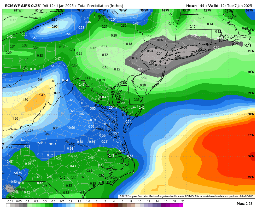
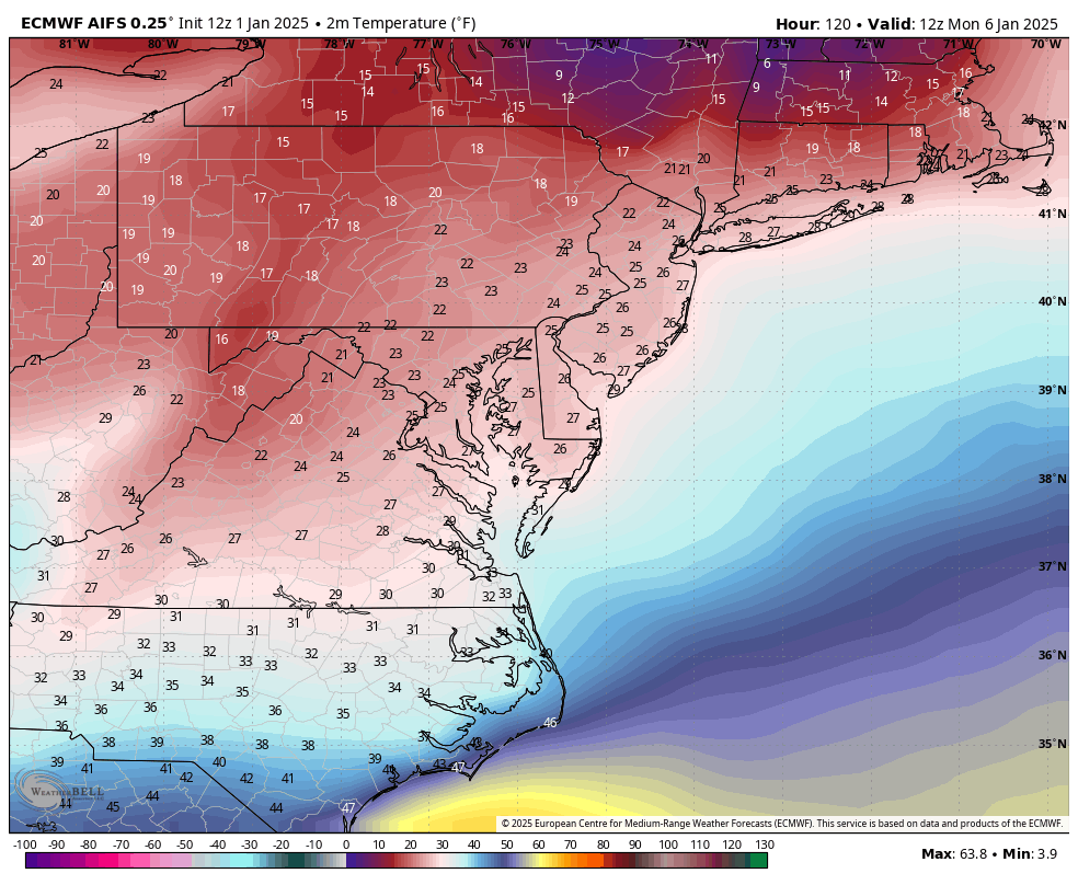
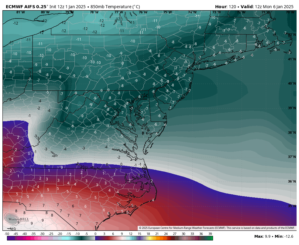
12z Euro AI came in. I'm not sure what to glean from it. It looks like 850mb temps stay below 0°C for most, if not all, of the event. Surface temps also look to remain below freezing. It's hard to tell how much IP/ZR it has, but it's a good run with about 0.60" of QPF.


-
Richmond Metro/Hampton Roads Area Discussion
RIC Airport replied to RIC Airport's topic in Mid Atlantic
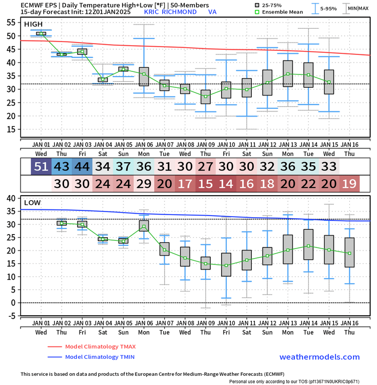
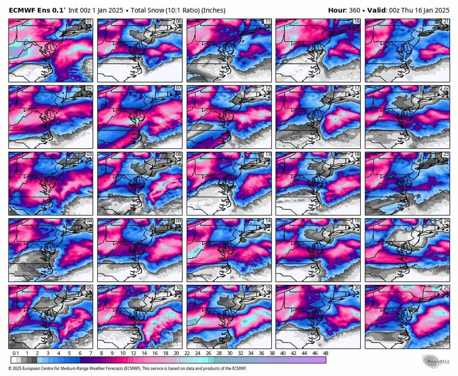
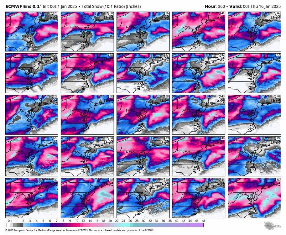
Oh I agree. I'm really hoping to get a solid 3-4" that sticks around for several days with the upcoming cold. There are quite a few EPS members delivering that, including some that seem to think we can approach a foot..thumb.png.fd77f0d9ceac7ae351a4a4cb02c5fb59.png)
-
Richmond Metro/Hampton Roads Area Discussion
RIC Airport replied to RIC Airport's topic in Mid Atlantic
The Euro has been fairly consistent. Here is the latest EPS, a slight uptick from the 6zz run. Just hoping we can squeak out an inch before we flip to ice.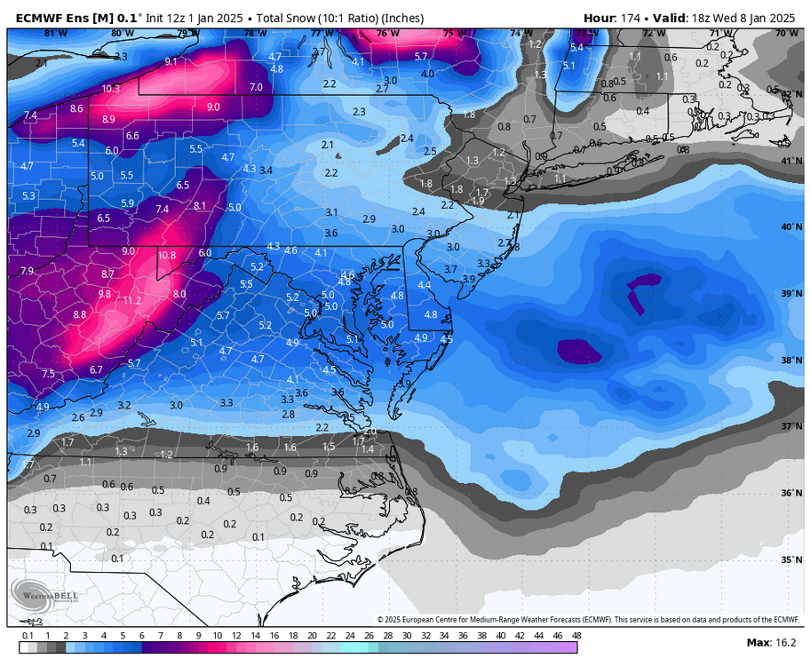
-
Richmond Metro/Hampton Roads Area Discussion
RIC Airport replied to RIC Airport's topic in Mid Atlantic
12z Euro.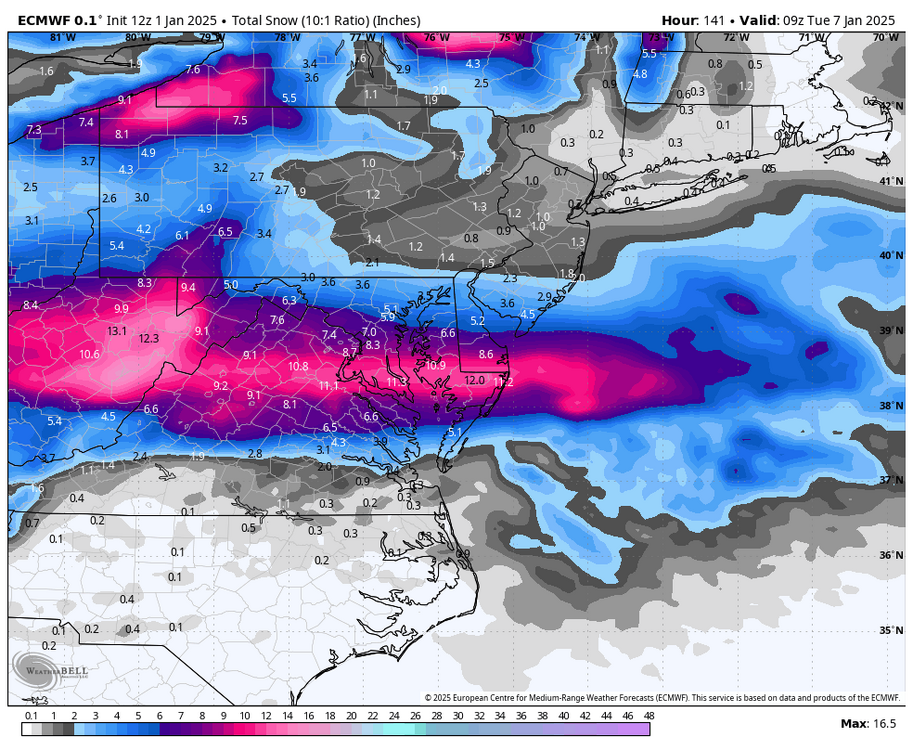

-
Richmond Metro/Hampton Roads Area Discussion
RIC Airport replied to RIC Airport's topic in Mid Atlantic
I'll take it!
-
Richmond Metro/Hampton Roads Area Discussion
RIC Airport replied to RIC Airport's topic in Mid Atlantic
I saw it was the farthest south it's been. But, the ICON hasn't been around long, I don't normally look at it. At least the "big one" is still on the table on the GFS.
-
Richmond Metro/Hampton Roads Area Discussion
RIC Airport replied to RIC Airport's topic in Mid Atlantic
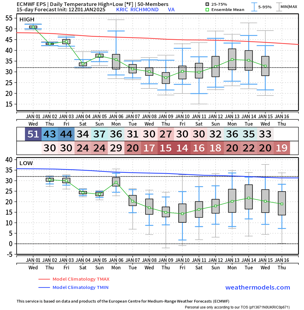
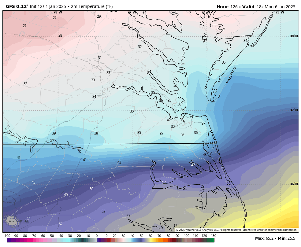
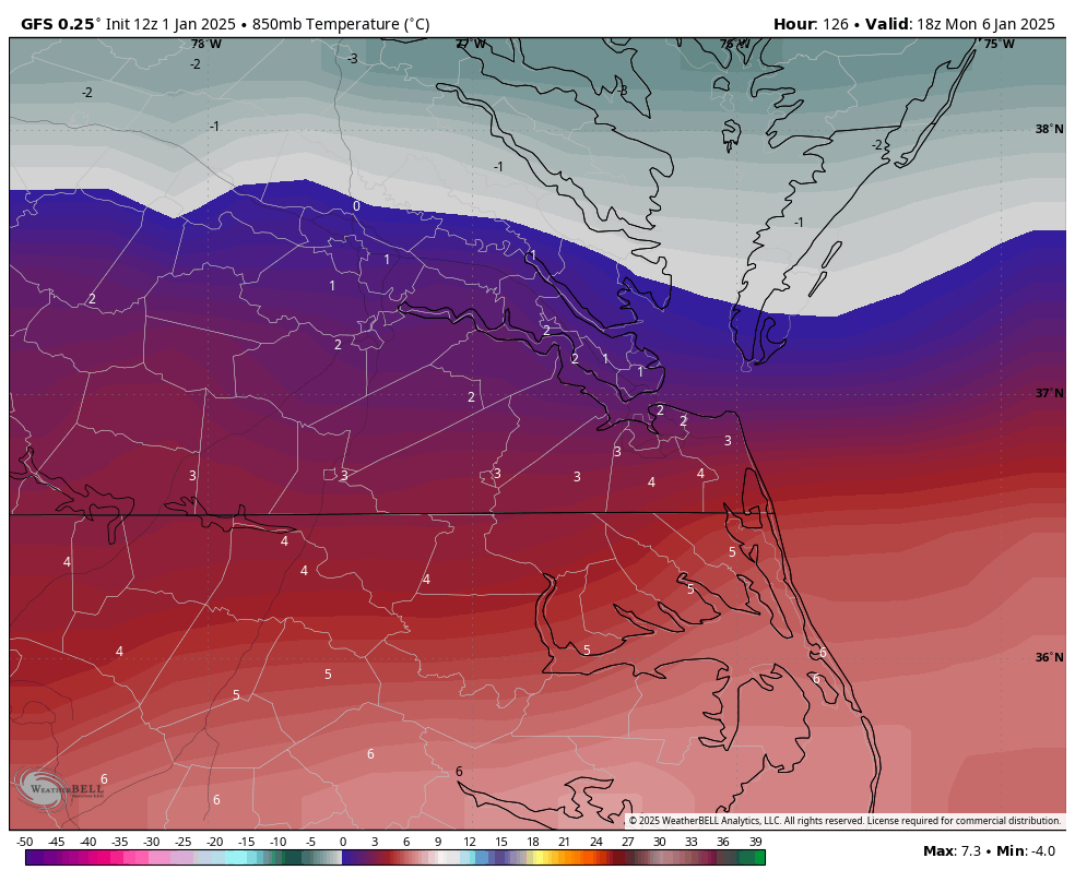
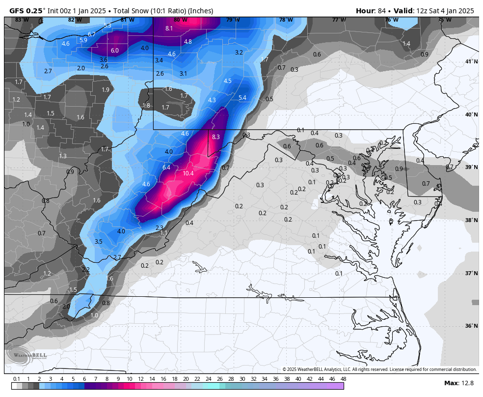
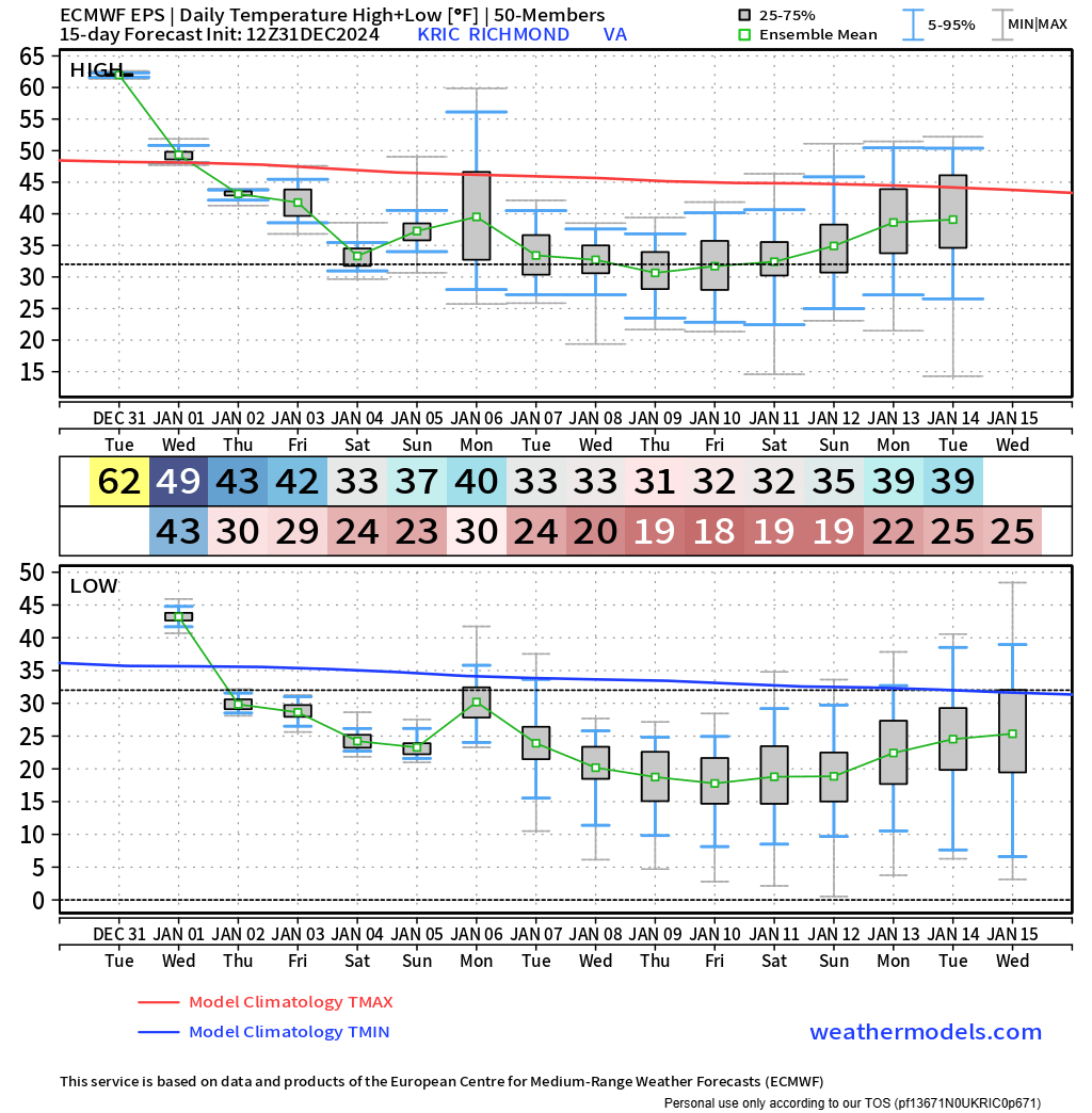
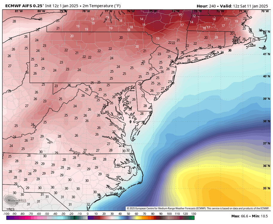
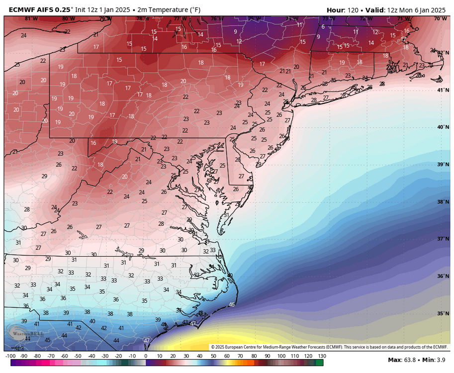
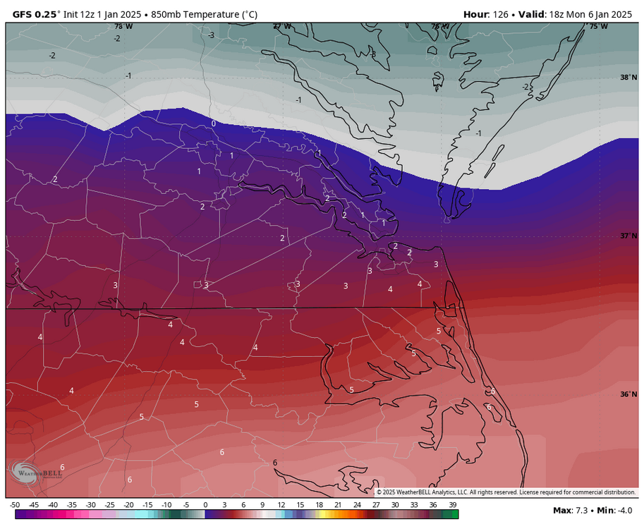
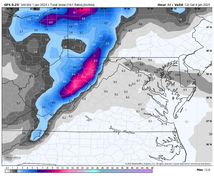
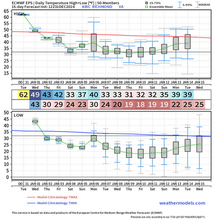
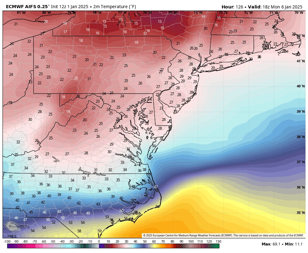
This was the warmest panel I saw during the event, which was at 1pm Monday. GFS does have RIC with a surface temperature up to 33°F before dropping thereafter. Anyone that lives south of I-64 will have 850mb temps above 0°C for a time. Also, Sunday evening surface temps may take a few hours to hit freezing as the precip arrives so we need that to happen quickly to maximize any snow accumulation before the warmer air aloft arrives. Hopefully we don't get too warm Sunday afternoon.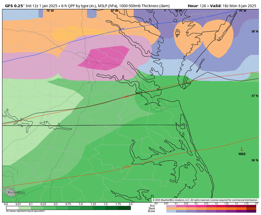

-
Richmond Metro/Hampton Roads Area Discussion
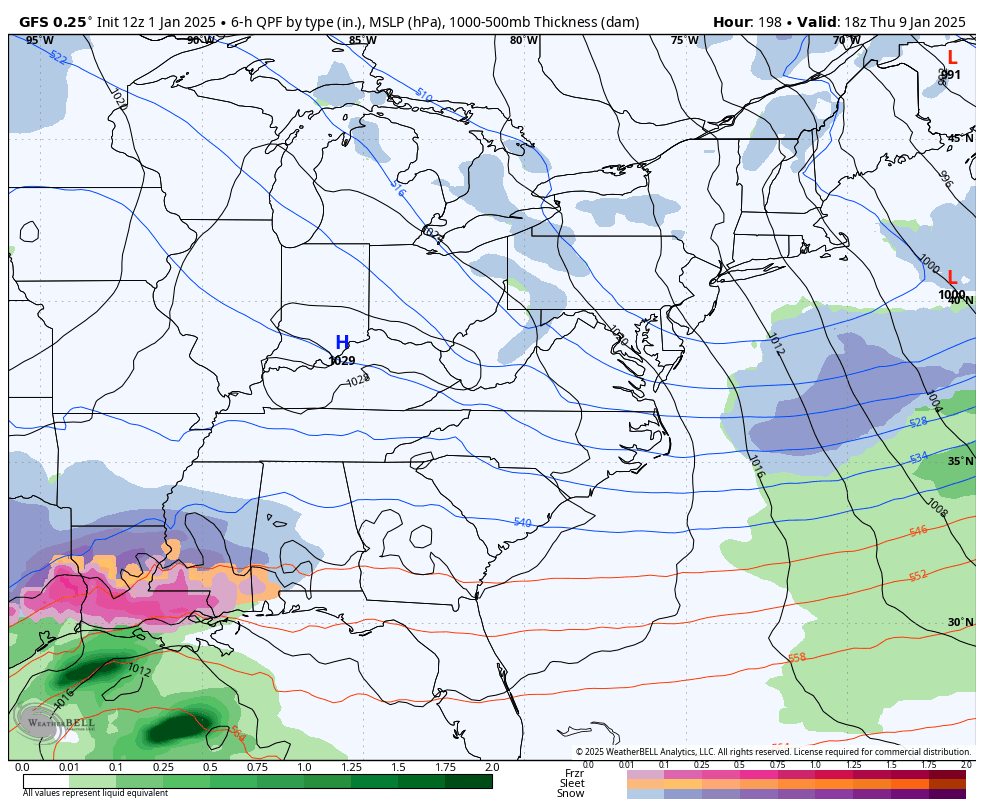
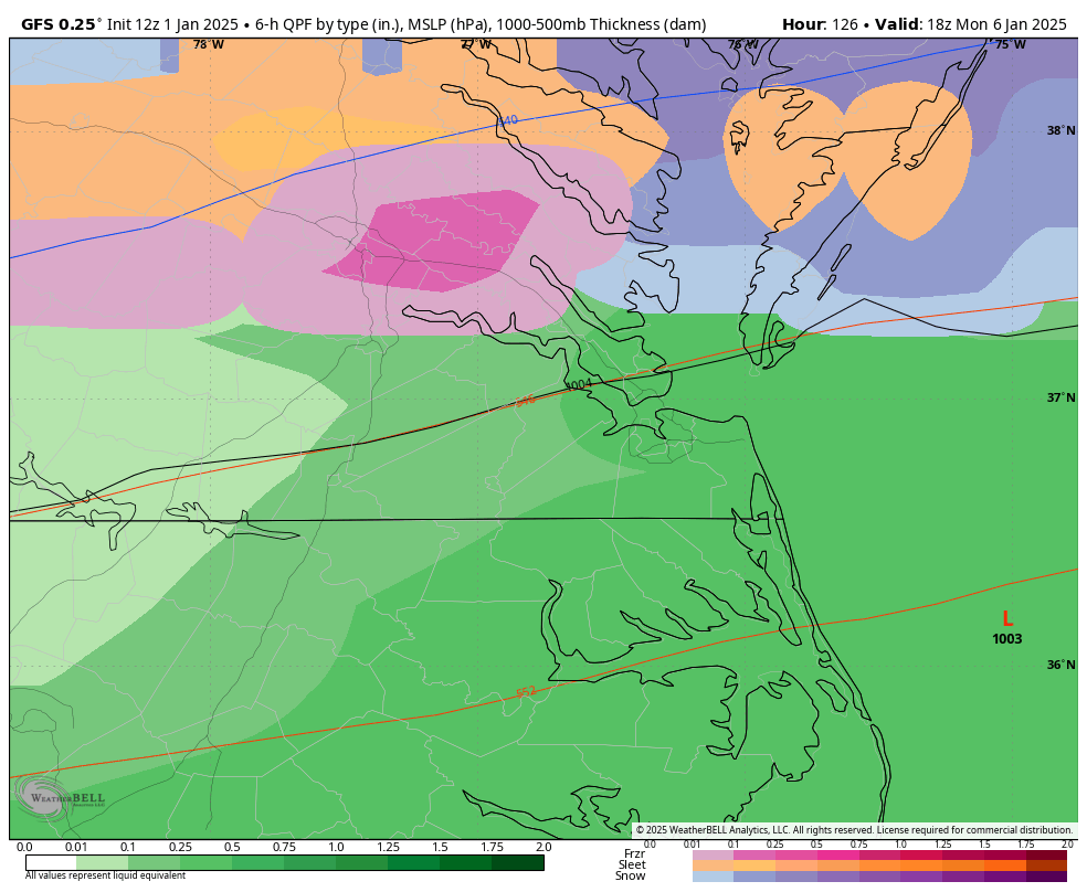
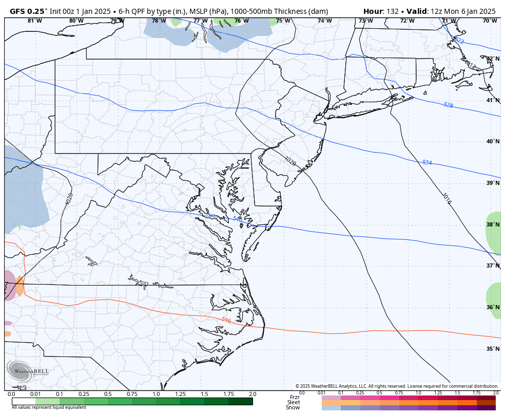
RIC Airport replied to RIC Airport's topic in Mid Atlantic
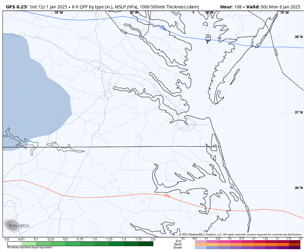
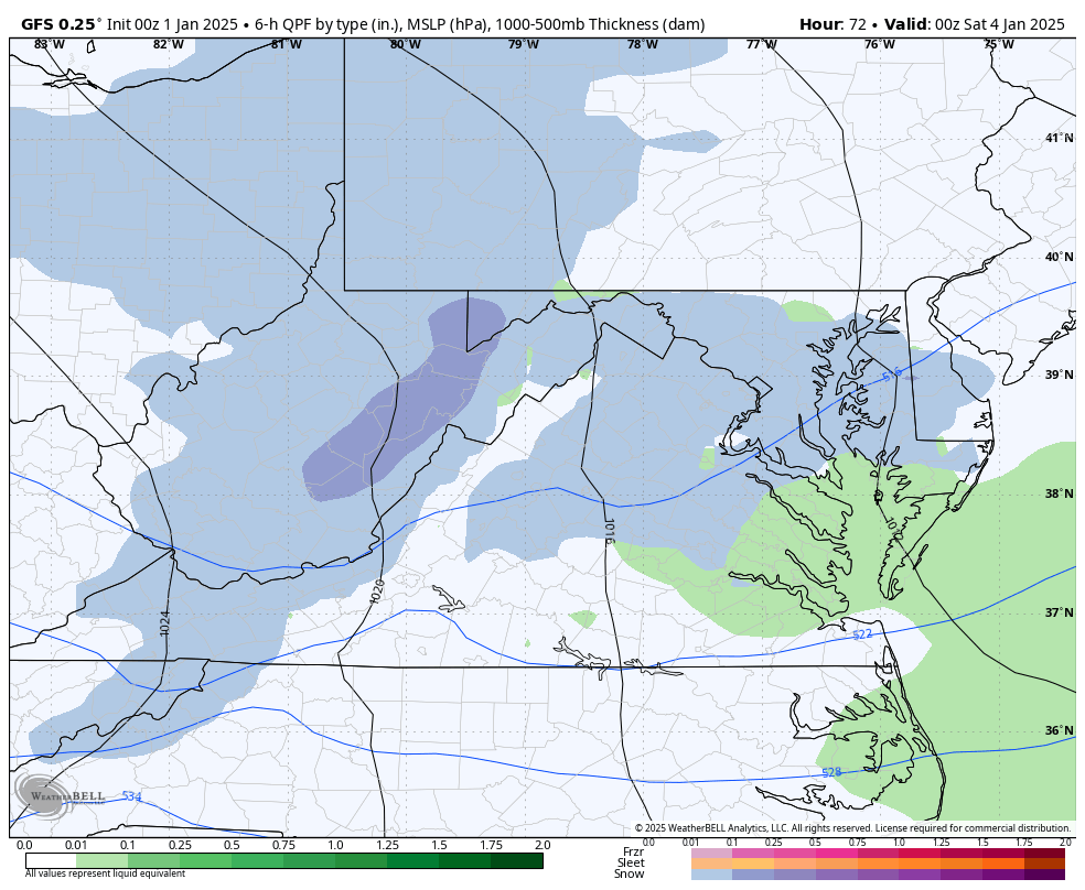
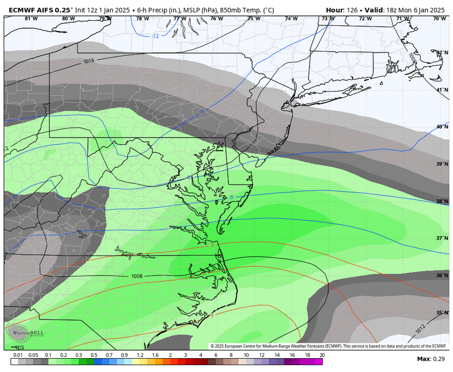
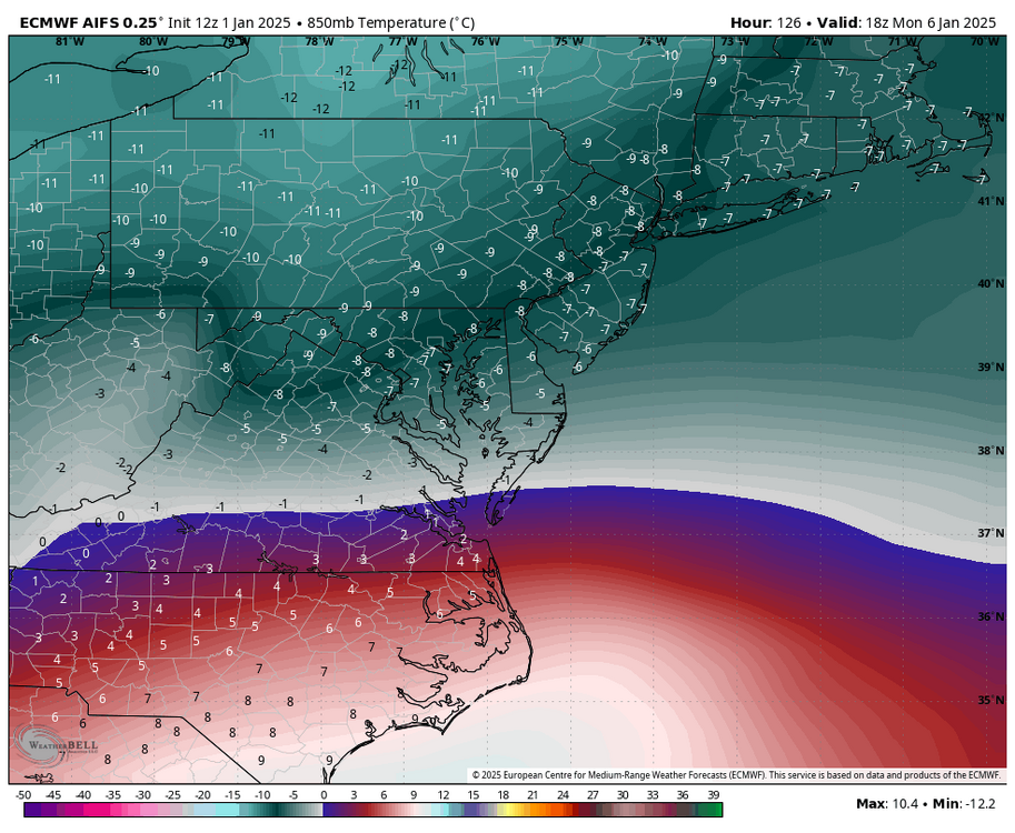
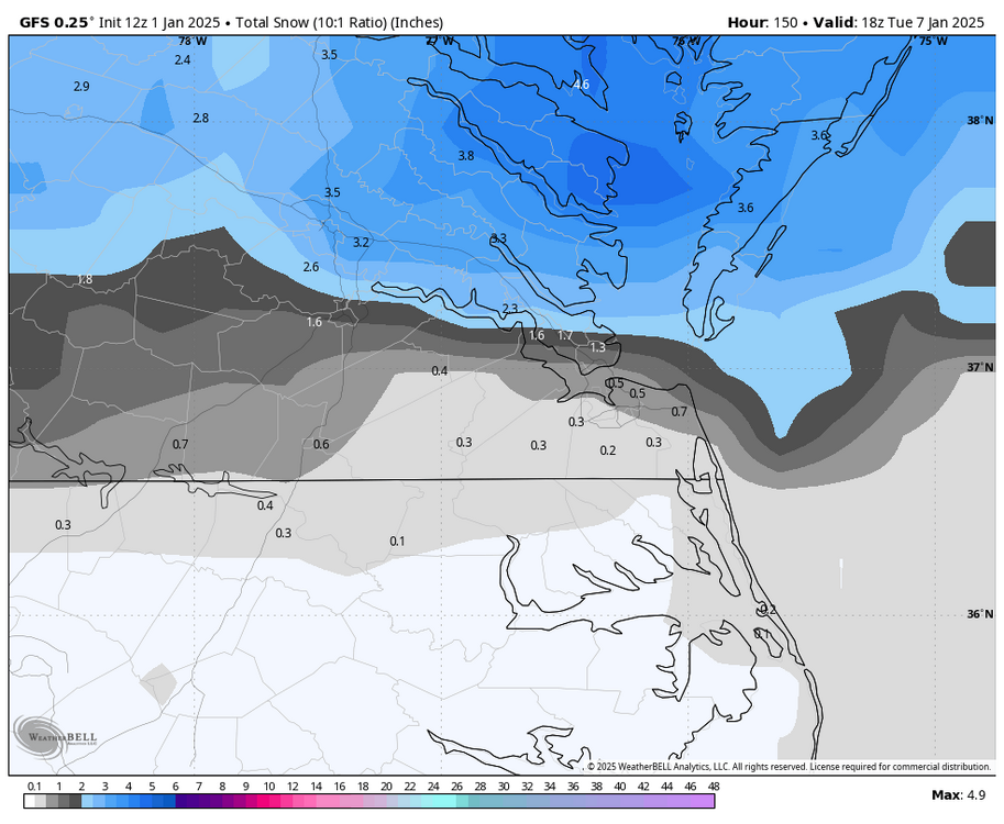
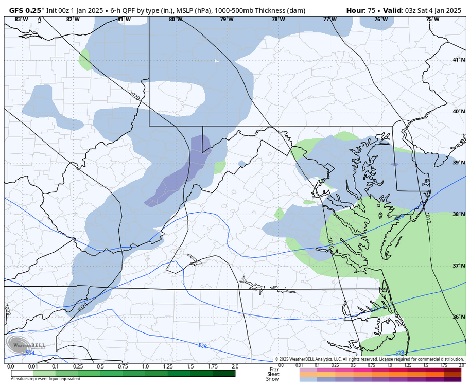
GFS came in with what is a pretty impactful event for the area. However, that changeover to IP/ZR happens quickly. Precip enters the metro area between 7pm and 10pm Sunday night, and by 4am, we are already changing over.

-
Richmond Metro/Hampton Roads Area Discussion
RIC Airport replied to RIC Airport's topic in Mid Atlantic
Hopefully, the airport exceeds an inch within a 24 hour period to break the streak. -
Richmond Metro/Hampton Roads Area Discussion
RIC Airport replied to RIC Airport's topic in Mid Atlantic
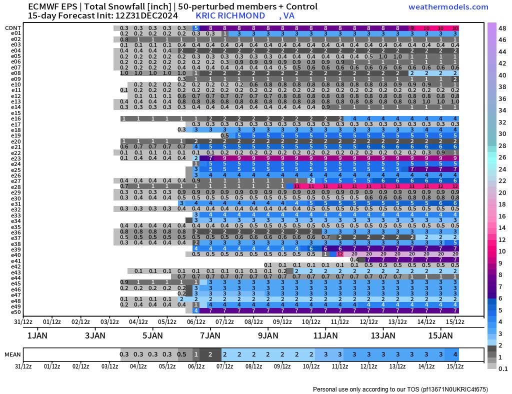
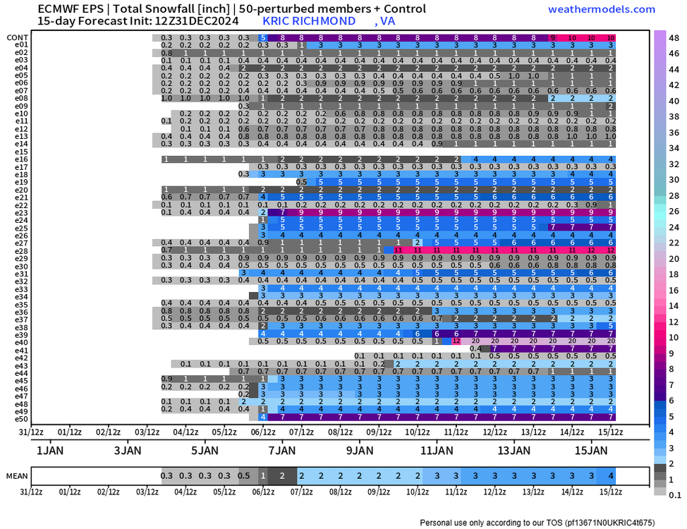
If you look at the dates, some show up around the 6-7th, from the first storm. I'm not sure what you can glean from that, but I was also surprised to see how high some members were. But it could also be picking up some of the IP/ZR numbers since it assumes a 10:1 ratio. Also, the 11-13th period is still showing potential. Old news now, so we'll see what 12z EPS does, and of course, once the short range models get within range, they will be telling too! -
Richmond Metro/Hampton Roads Area Discussion
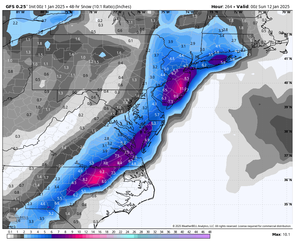
RIC Airport replied to RIC Airport's topic in Mid Atlantic
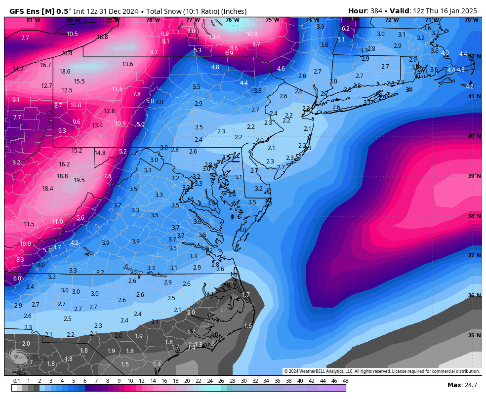
Looking healthy for storm #1. Below is the entire run. Highest mean so far and good hits!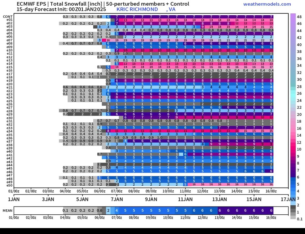

-
Richmond Metro/Hampton Roads Area Discussion
RIC Airport replied to RIC Airport's topic in Mid Atlantic
2nd threat is still there at least. Tries to pull a Miller A.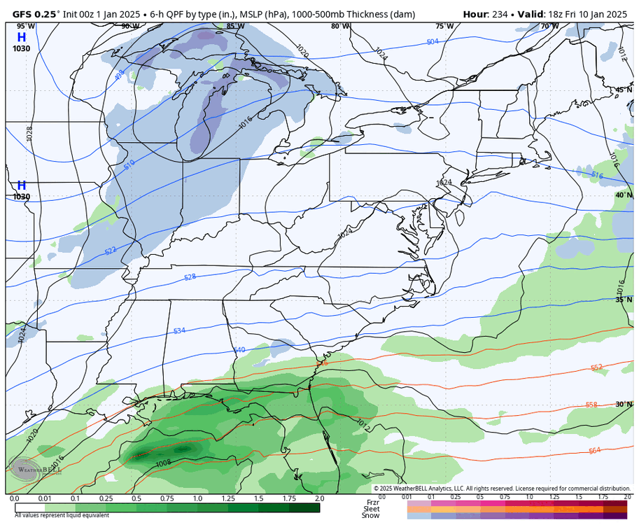

-
Richmond Metro/Hampton Roads Area Discussion
RIC Airport replied to RIC Airport's topic in Mid Atlantic
Wasn't a good run at all.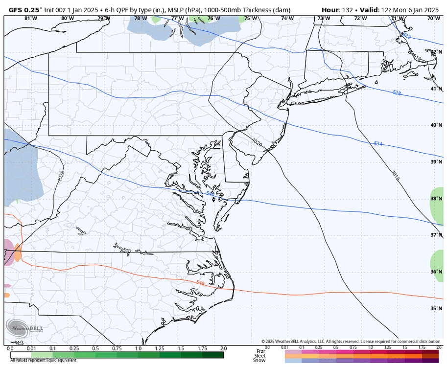
-
Richmond Metro/Hampton Roads Area Discussion
RIC Airport replied to RIC Airport's topic in Mid Atlantic
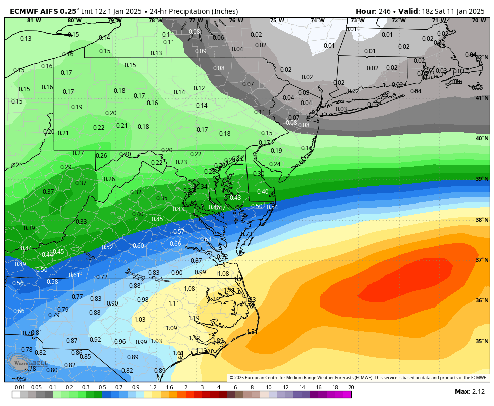
One thing that hasn't been mentioned in this thread is the possibility of snow flurries/showers Friday night into Saturday morning ahead of the 1/6 event. Temps are marginal, and QPF is spotty (<.10"), but both GFS and Euro have had this on several runs. Maybe some conversational snow ahead of the first wave?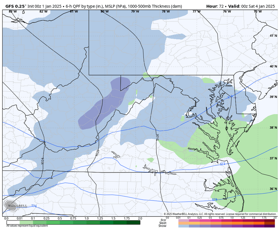
-
Richmond Metro/Hampton Roads Area Discussion
RIC Airport replied to RIC Airport's topic in Mid Atlantic
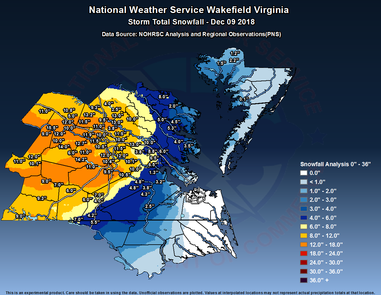
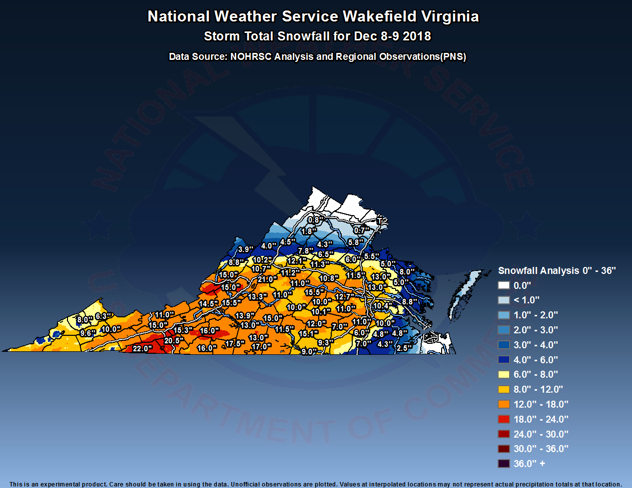
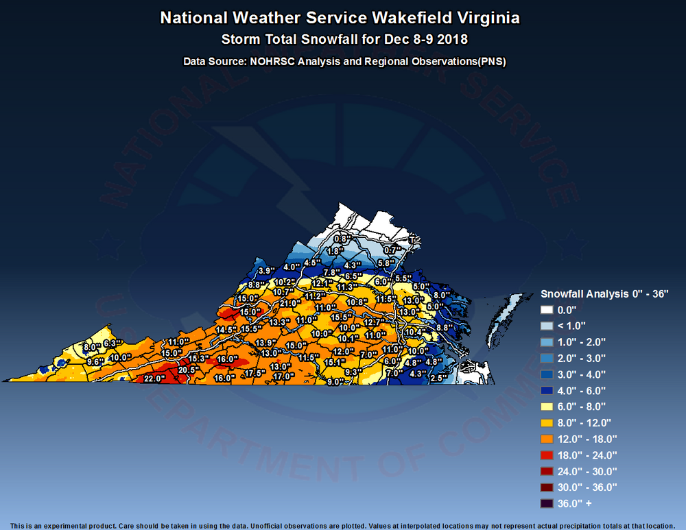
11.5" at RIC officially from this event. The 12/9/2018 storm was one of the rare occurrences where we overperformed the day of. I lived out of Virginia for 14 years and returned the summer before this storm. I haven't seen more than 2-3" since, certainly nothing that has stuck around for more than a day.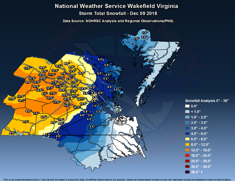
-
Richmond Metro/Hampton Roads Area Discussion
RIC Airport replied to RIC Airport's topic in Mid Atlantic
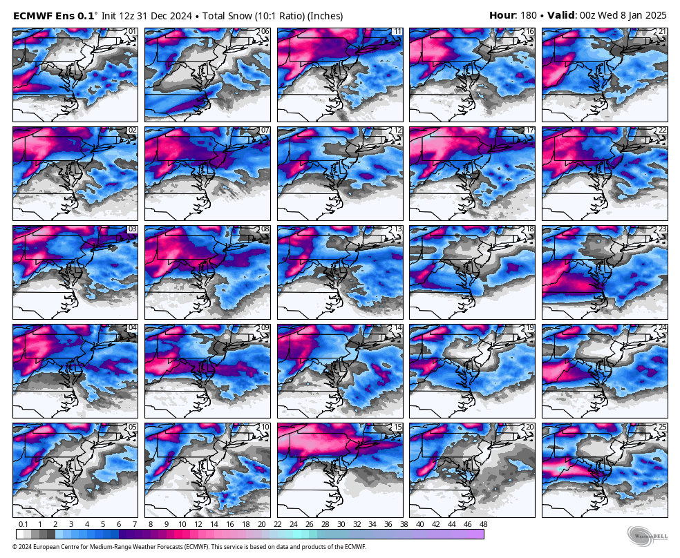
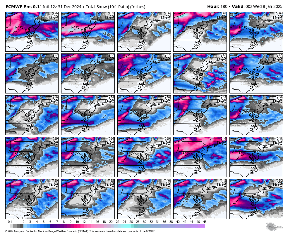
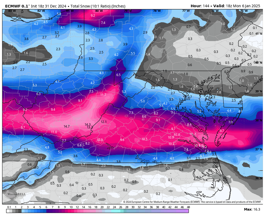
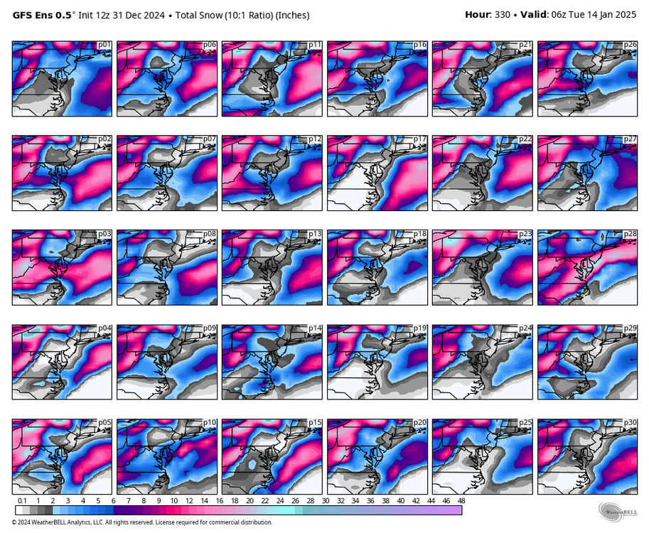
The 18Z GEFS and the 18Z EPS still have a CHO to DCA tendency in the mean. Unfortunately, there is certainly enough time for a shift back north on the op runs. There is still so much time left before we truly know, but my gut feeling, based on what has tended to happen in the modern era, is that there will be a correction back north. I'd be happy to be wrong, of course. -
Richmond Metro/Hampton Roads Area Discussion
RIC Airport replied to RIC Airport's topic in Mid Atlantic
18Z Euro was farther south and colder.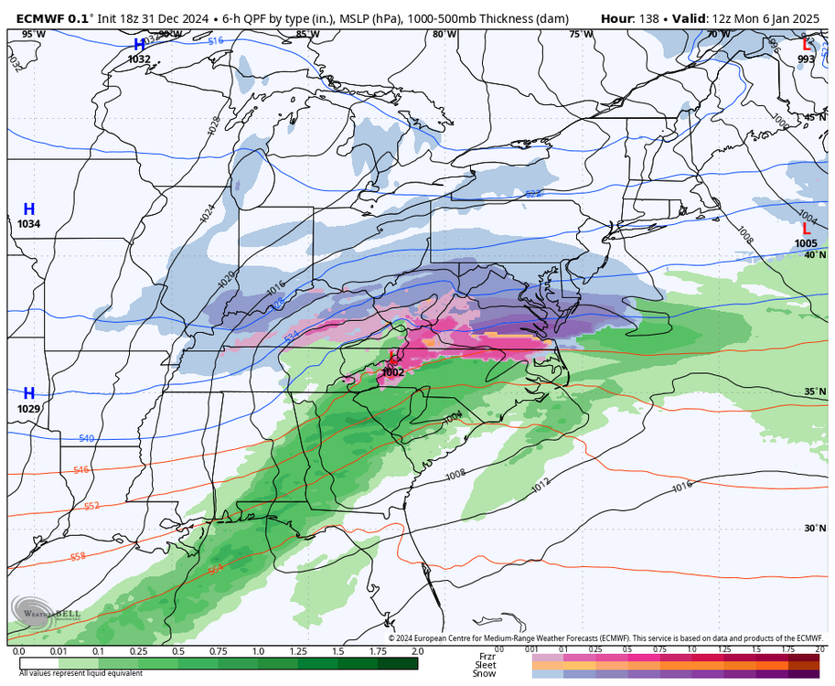
-
Richmond Metro/Hampton Roads Area Discussion
RIC Airport replied to RIC Airport's topic in Mid Atlantic
Hard to believe there is a tornado threat in the state on NYE. -
Richmond Metro/Hampton Roads Area Discussion
RIC Airport replied to RIC Airport's topic in Mid Atlantic
-
Richmond Metro/Hampton Roads Area Discussion
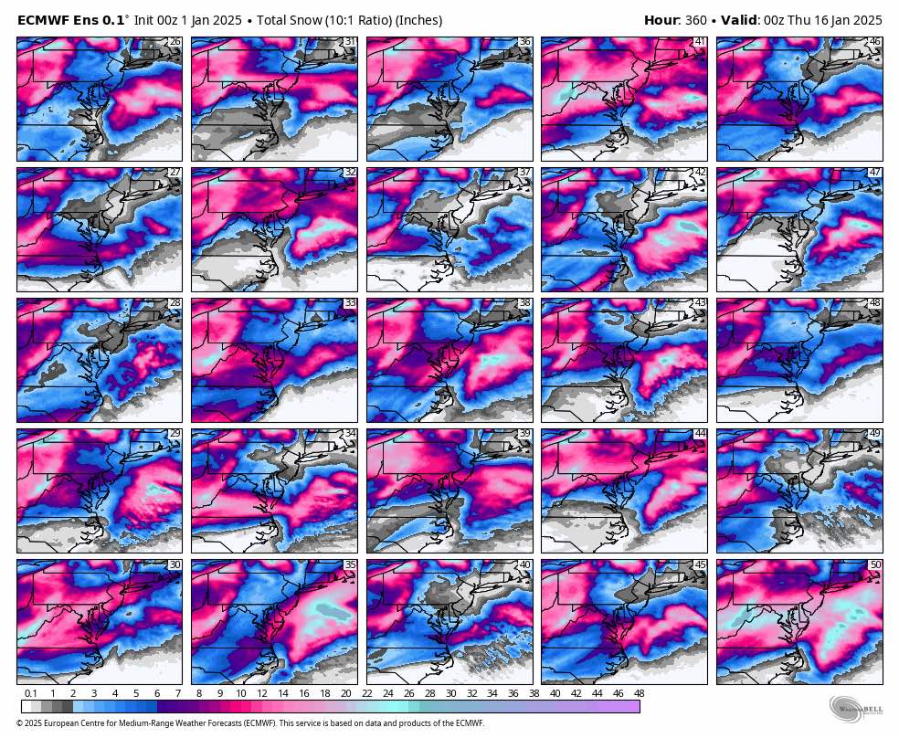
RIC Airport replied to RIC Airport's topic in Mid Atlantic
12Z GEFS final, more than one event, of course. Wintry signal is still there.
-
Richmond Metro/Hampton Roads Area Discussion
RIC Airport replied to RIC Airport's topic in Mid Atlantic
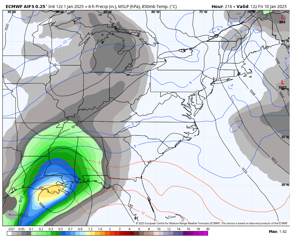
Euro has another storm further out in time, but of course, it's too far out and we know things will change. -
Richmond Metro/Hampton Roads Area Discussion
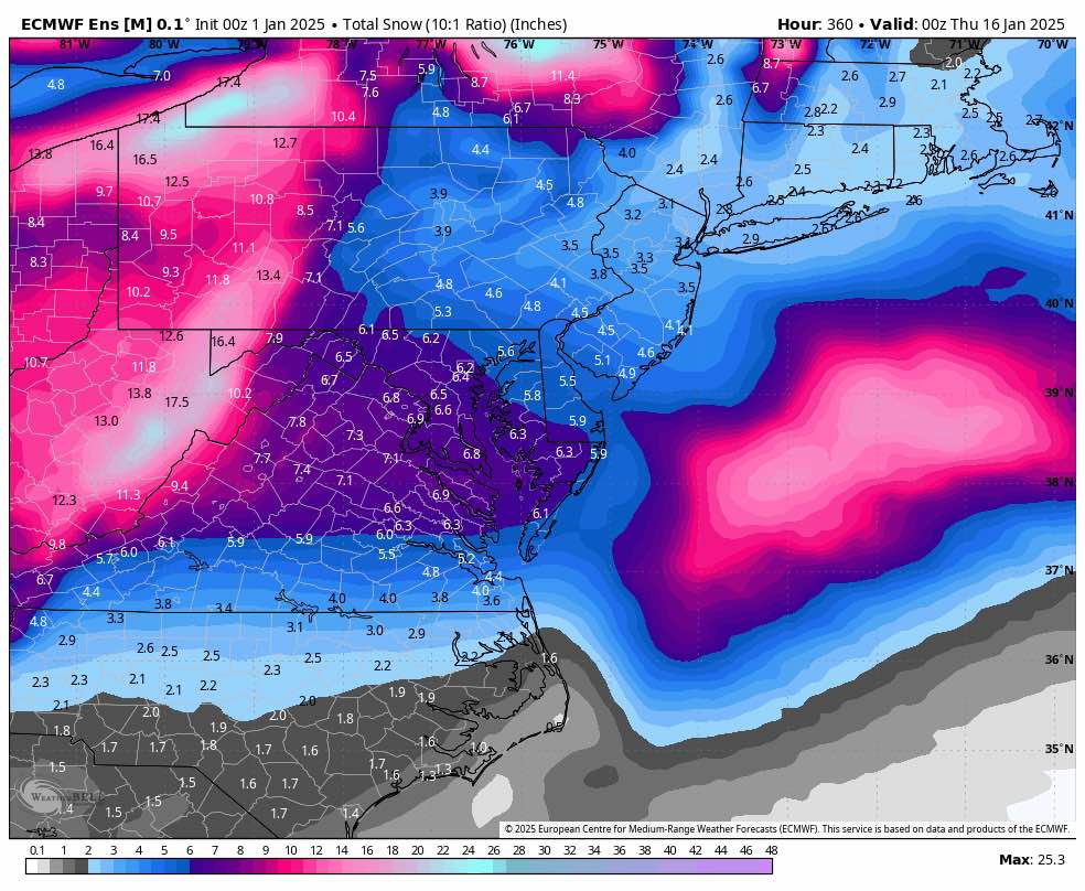
RIC Airport replied to RIC Airport's topic in Mid Atlantic
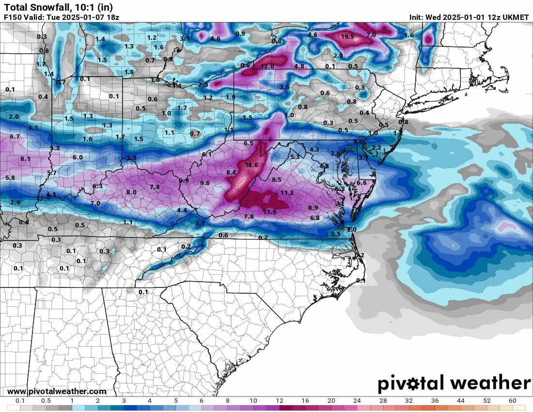
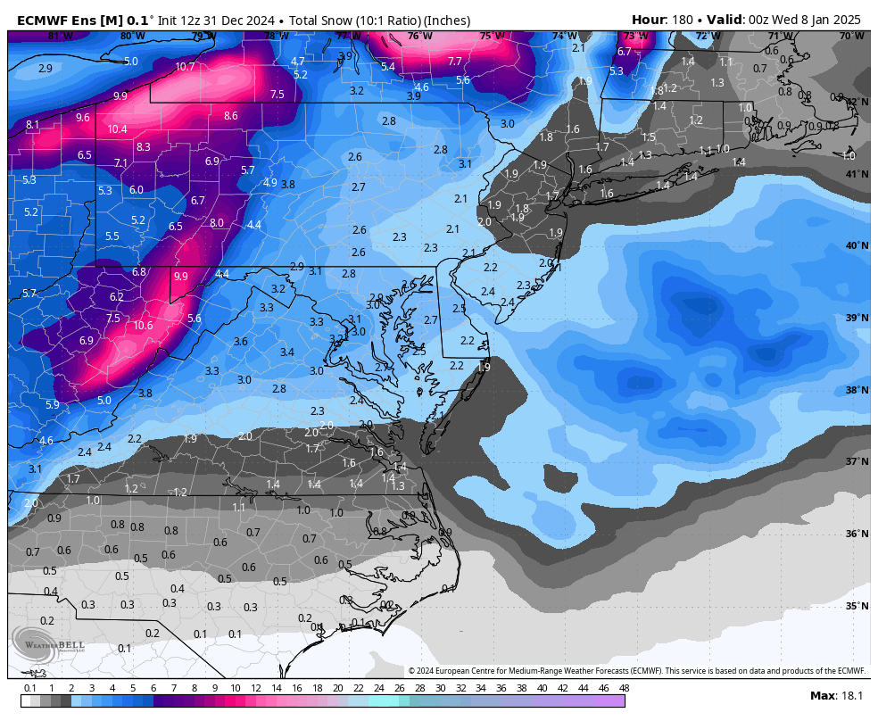
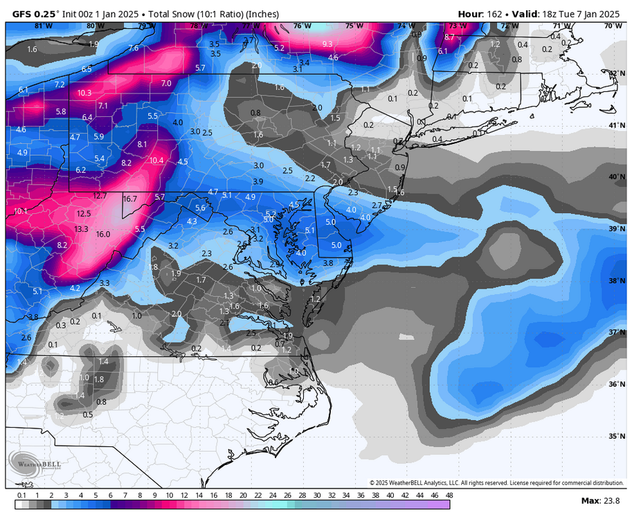
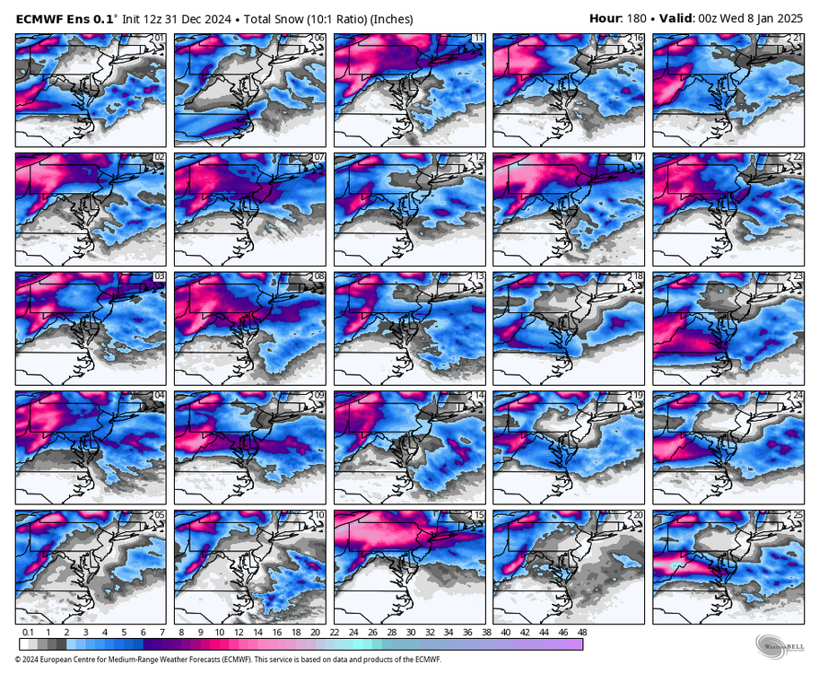
FWIW, EPS for this event. Still an indication the heaviest snows remain north of RIC, from CHO to DCA.


.png.98f68ee91d8c8daf4f85c170f4c4b9db.png)