Buffalo Bumble
-
Posts
1,613 -
Joined
-
Last visited
Content Type
Profiles
Blogs
Forums
American Weather
Media Demo
Store
Gallery
Everything posted by Buffalo Bumble
-
Upstate/Eastern New York
Buffalo Bumble replied to BuffaloWeather's topic in Upstate New York/Pennsylvania
May, the new November in upstate NY. Picking right up where last May left off. -
Upstate/Eastern New York
Buffalo Bumble replied to BuffaloWeather's topic in Upstate New York/Pennsylvania
Hope you’re not headed to the ADK’s! Looks like some heavy snow right now in the Lake Placid area. -
Upstate/Eastern New York
Buffalo Bumble replied to BuffaloWeather's topic in Upstate New York/Pennsylvania
Same here. Full on winter outside with everything plastered in thick snow. -
Upstate/Eastern New York
Buffalo Bumble replied to BuffaloWeather's topic in Upstate New York/Pennsylvania
I would vote Oct 2006. Even though sun angle is much higher on May 7 the boreal north still has gobs of snow and ice cover. I think Hudson Bay is still frozen at that time. Point being there’s serious cold to still pull from when the jet stream buckles. Not the same in early October. Canadians still skinny dipping in the balmy waters of Hudson Bay at that time. -
Upstate/Eastern New York
Buffalo Bumble replied to BuffaloWeather's topic in Upstate New York/Pennsylvania
Whatever rain deficit here should be gone, at least IMBY. Just had an hour-long deluge as a stationary cell popped up overhead. Standing water everywhere. Back to normal spring here, saturated ground, mud, clouds, and cool. -
Upstate/Eastern New York
Buffalo Bumble replied to BuffaloWeather's topic in Upstate New York/Pennsylvania
I’m still traumatized by the weather last April and first half of May when the thermometer was stuck between 33 and 43 degrees, the sun never shined, and it seemed to snow frequently (and stick!) during peak hearing hours. So even after this phenomenal stretch, when I see low 50’s and shower chances in the forecast , I think that’s pretty nice spring weather... -
Upstate/Eastern New York
Buffalo Bumble replied to BuffaloWeather's topic in Upstate New York/Pennsylvania
If you head that far north I think somewhere like Saranac Lake or Lake Placid with good elevation would be a better spot. Malone isn’t exactly a snowy place, downsloping off the Dacks probably limits their totals. -
Upstate/Eastern New York
Buffalo Bumble replied to BuffaloWeather's topic in Upstate New York/Pennsylvania
Wicked squall with that line. About 5 minutes of blinding rain and wind. Looks like another one fired up right behind it. Calm winds here now with frequent lightning. -
Upstate/Eastern New York
Buffalo Bumble replied to BuffaloWeather's topic in Upstate New York/Pennsylvania
Is this lake enhanced?? Didn’t think the air mass change was that cold, plus lake is frigid. Seems to be hung up though, heavy rain here for 30 minutes with lots of lightning. Radar looks like a lake effect rain band. -
Upstate/Eastern New York
Buffalo Bumble replied to BuffaloWeather's topic in Upstate New York/Pennsylvania
Pounding snow here. I haven’t looked at anything all day. What’s this about? -
Upstate/Eastern New York
Buffalo Bumble replied to BuffaloWeather's topic in Upstate New York/Pennsylvania
Same here. Snow storming out right now. -
Upstate/Eastern New York
Buffalo Bumble replied to BuffaloWeather's topic in Upstate New York/Pennsylvania
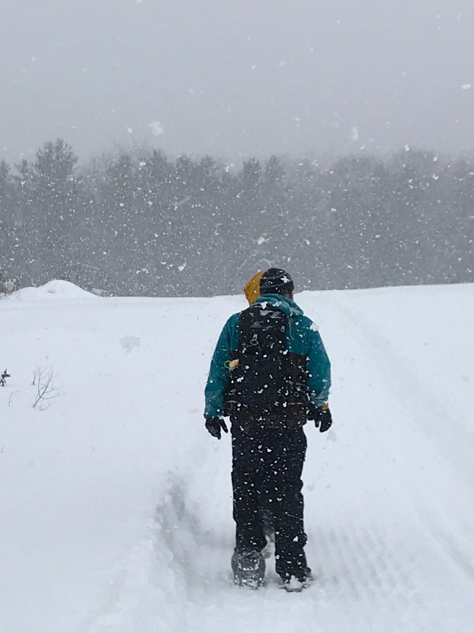
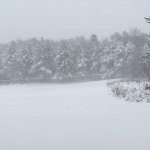
Had some fun in the Lake Erie band today. Drove down Center Road from East Aurora to Sprague Brook between 1:30 and 2:30. For those not familiar with the area Center Road runs from central Erie County to near the southern boundary of the county. Snow was dumping most of the way, heaviest around Colden and Glenwood. Easy 3-4”/ hour, just huge flakes. Lightened up a bit at Sprague Brook during a 2-hour snowshoe, then cranked up big time as we were leaving around 4. Average 3 foot depths throughout the park. Pic below is from the hike. Just epic winter conditions.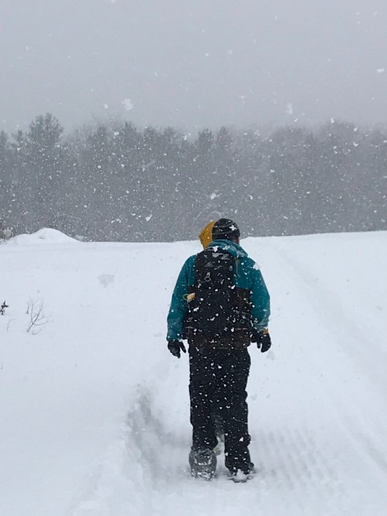
-
Upstate/Eastern New York
Buffalo Bumble replied to BuffaloWeather's topic in Upstate New York/Pennsylvania
Chase off to a great start...Maple Rd, East Aurora, 2”/. Nice white plastering here. -
Upstate/Eastern New York
Buffalo Bumble replied to BuffaloWeather's topic in Upstate New York/Pennsylvania
Incredible. What was the forecast for those areas? I know they had a LE warning, thought forecast totals were only 8-12” though. Not many places in the country can bust so spectacularly awesome where 8-12” turns into 30”+. -
Upstate/Eastern New York
Buffalo Bumble replied to BuffaloWeather's topic in Upstate New York/Pennsylvania
Yeah I get that but how much did ice cover limit this particular event? Sounds like rates were 3-4”/hour. How much higher would you realistically get? Maybe ice cover helped this in some ways with convergence or something? Just spitballing here...Thinking we would have had 5-7”/hour rates with no ice cover seems unrealistic. -
Upstate/Eastern New York
Buffalo Bumble replied to BuffaloWeather's topic in Upstate New York/Pennsylvania
With the northeast end of the lake wide open and the fetch primarily running right over the open water, does it matter that the rest of the lake is frozen? Not like the rest of the lake was “contributing” much to the lake effect. Either that or the ice is thin enough where fetch is passing over to allow for uplift which then gets supercharged when it hits the open water. Anyway, fascinating stuff! I’m heading south soon to chase. -
Upstate/Eastern New York
Buffalo Bumble replied to BuffaloWeather's topic in Upstate New York/Pennsylvania
Certainly looks like it on radar. Interesting looking wide band too, guessing lots of synoptic juice in there getting enhanced by the upslope. -
Back to Back Major Synoptic Snowstorms!
Buffalo Bumble replied to BuffaloWeather's topic in Upstate New York/Pennsylvania
The title of this thread gets more ironic every time I look at it... -
Back to Back Major Synoptic Snowstorms!
Buffalo Bumble replied to BuffaloWeather's topic in Upstate New York/Pennsylvania
Light snow has started here in the BUF area. Some nice appetizer flakes in advance of the main course tonight. Topping a foot of snow from synoptic systems in BUF is no easy thing, let's see how this sucker plays out over the next 18 hours! -
Back to Back Major Synoptic Snowstorms!
Buffalo Bumble replied to BuffaloWeather's topic in Upstate New York/Pennsylvania
Catching up on this thread after 4 hours away while driving is darkly hilarious. “20 inches for everyone”! “I’m done”! “It’s over”! Oh the drama. -
Back to Back Major Synoptic Snowstorms!
Buffalo Bumble replied to BuffaloWeather's topic in Upstate New York/Pennsylvania
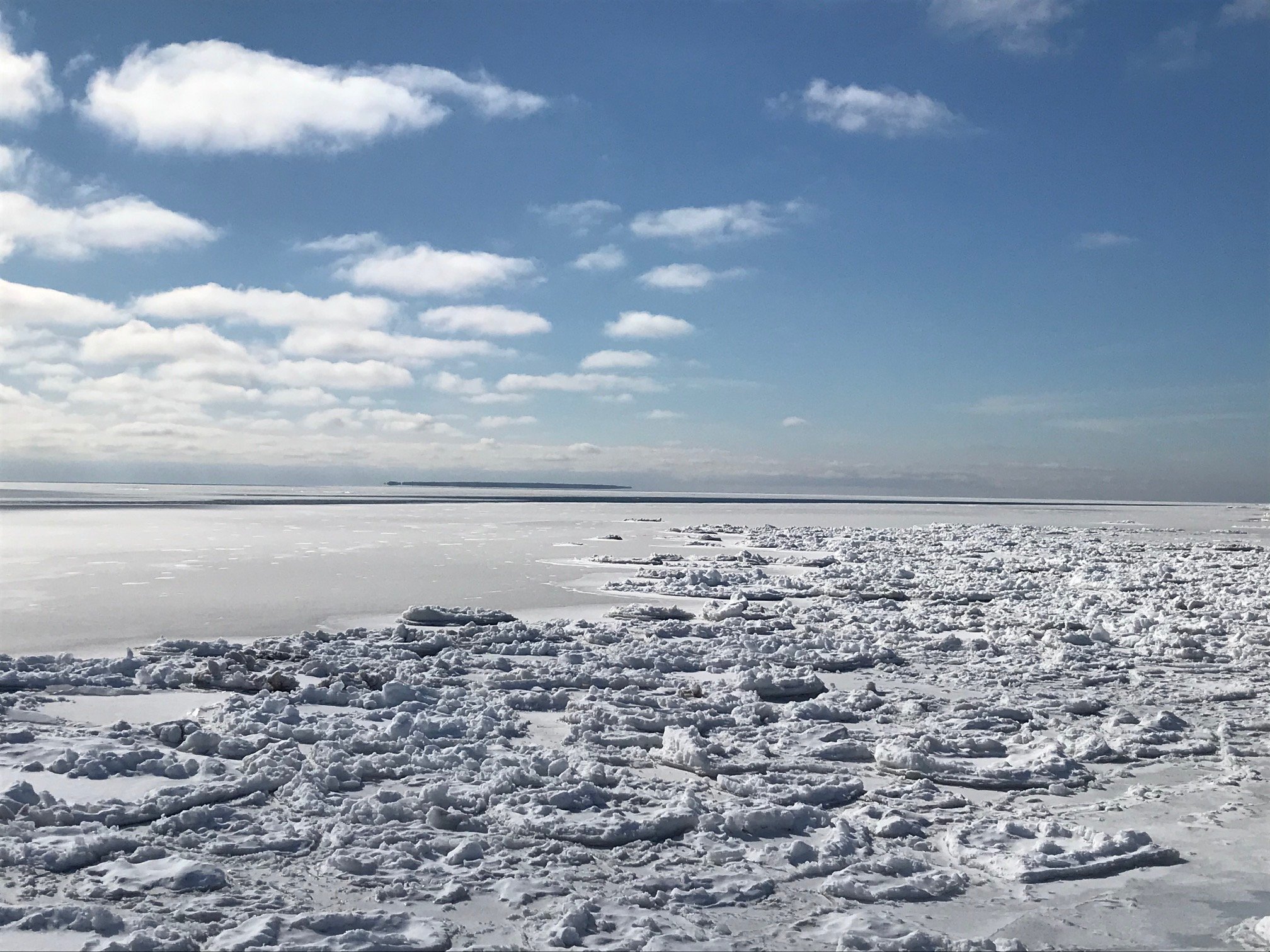
Sorry team CNY, looks like Lake Ontario is completely iced over... This shot taken today is from the “Isthmus”, a narrow spit of land separating Chaumont Bay from Lake Ontario. You can see Galloo Island in the distance. Ice as far as the eye can see, except for a narrow opening about 500 yards offshore. Impressive ice extent, obviously just a tiny dent on the overall lake. Side note...super cool listening to the ice pitch and yawn standing on the shore.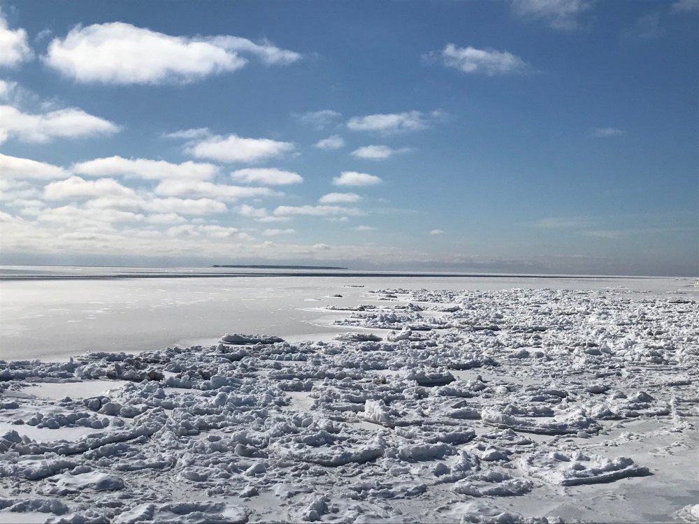
-
Upstate/Eastern New York
Buffalo Bumble replied to BuffaloWeather's topic in Upstate New York/Pennsylvania
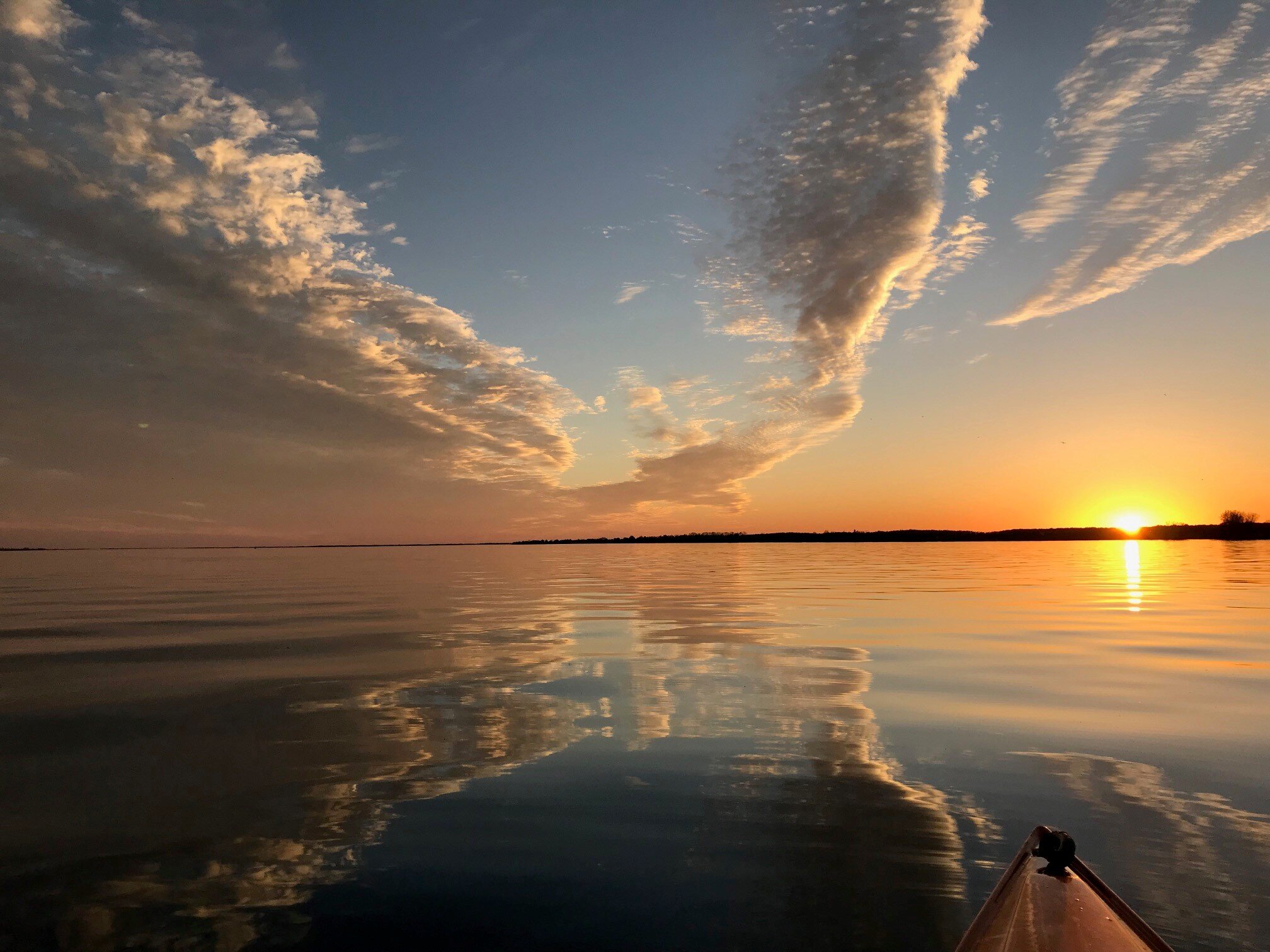
Splash of color on the frozen St Lawrence River landscape. Channel markers in Clayton...Beautiful sunny day up here today.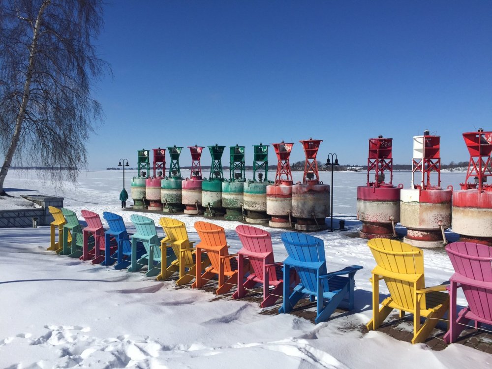
-
Major LES Events- Feb 5-?
Buffalo Bumble replied to BuffaloWeather's topic in Upstate New York/Pennsylvania
Not IMBY. BUF might have had tech issues but my thermometer was working fine. It was legit. -
Upstate/Eastern New York
Buffalo Bumble replied to BuffaloWeather's topic in Upstate New York/Pennsylvania
Yeah this is turning into a good old fashioned winter, Generation X style. Not like the old timers would claim, wall to wall snow from Labor Day to Easter. More like those where you get a great 2-4 week stretch and the rest is spent watching the Weather Channel hoping to see the jet stream get off the Canadian border and nosedive down the Rockies. -
Major LES Events- Feb 5-?
Buffalo Bumble replied to BuffaloWeather's topic in Upstate New York/Pennsylvania
Congrats over there in Ontario. If the border wasn’t closed I might have chased this just for the novelty of it. I’ll count this as 2 hugely anomalous “E/NE” events in our region in the last year. Both on complete opposite ends of the spectrum. First was just your garden variety E/NE flow dropping like 5 straight days of 96 deg+ temps on BUF in July. Desert southwest like Sonoran heat release from...the St Lawrence Valley. Now this Arctic chill E/NE flow standing on its own legs apart from a low pressure dumping lake effect snow on Ontario. Pretty wild.